We have a rich and awe-inspiring history of geological processes and life here on Earth, and in this section of Earth@Home you can explore the Earth science of different regions.
Earth Science of the United States
The place where you are right now has a rich geological history that is recorded by the rocks beneath you and the fossils that they may contain. The rocks and fossils reveal the movements of continents and the evolution of new forms of life. This history helps to explain why the Earth looks like it does today. It also explains things like the distributions of natural resources, from rare minerals to rich soils for agriculture. Studying Earth's ancient climate also helps us to make sense of how the climate is changing today and how it will affect us where we live.
The goal of this part of the Earth@Home project is to explain the Earth science of every region of the United States and provide necessary background information. Each region is divided into physiographic provinces: regions that are naturally defined by their modern topography and geologic history. The map below shows the major physiographic regions of the contiguous United States that we are recognizing in Earth@Home.
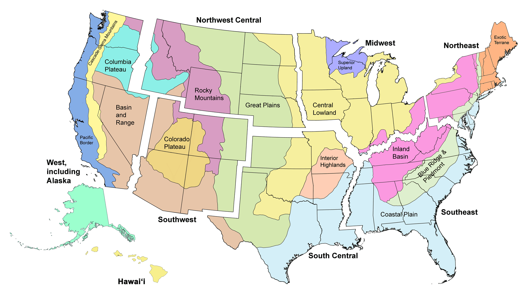
Major physiographic provinces of the contiguous United States. Click on a region to go to the corresponding section. Note that the provinces each span multiple states and, in some cases, multiple regions. Map by Jonathan R. Hendricks.
Regions now online:
Development of the Here on Earth part of Earth@Home is supported by a grant from the Institute of Museum and Library Services (ARPML-250637-OMLS-22). The views, findings, conclusions or recommendations expressed in this website do not necessarily represent those of the Institute of Museum and Library Services.
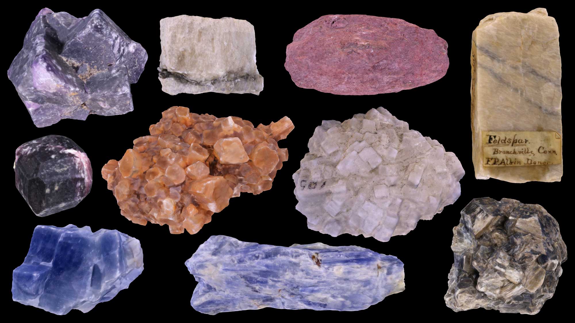
Introductions to Earth Science Topics
Quick introductions to Earth science topics, including minerals, rocks, fossils, climate, energy, Earth hazards, and more.
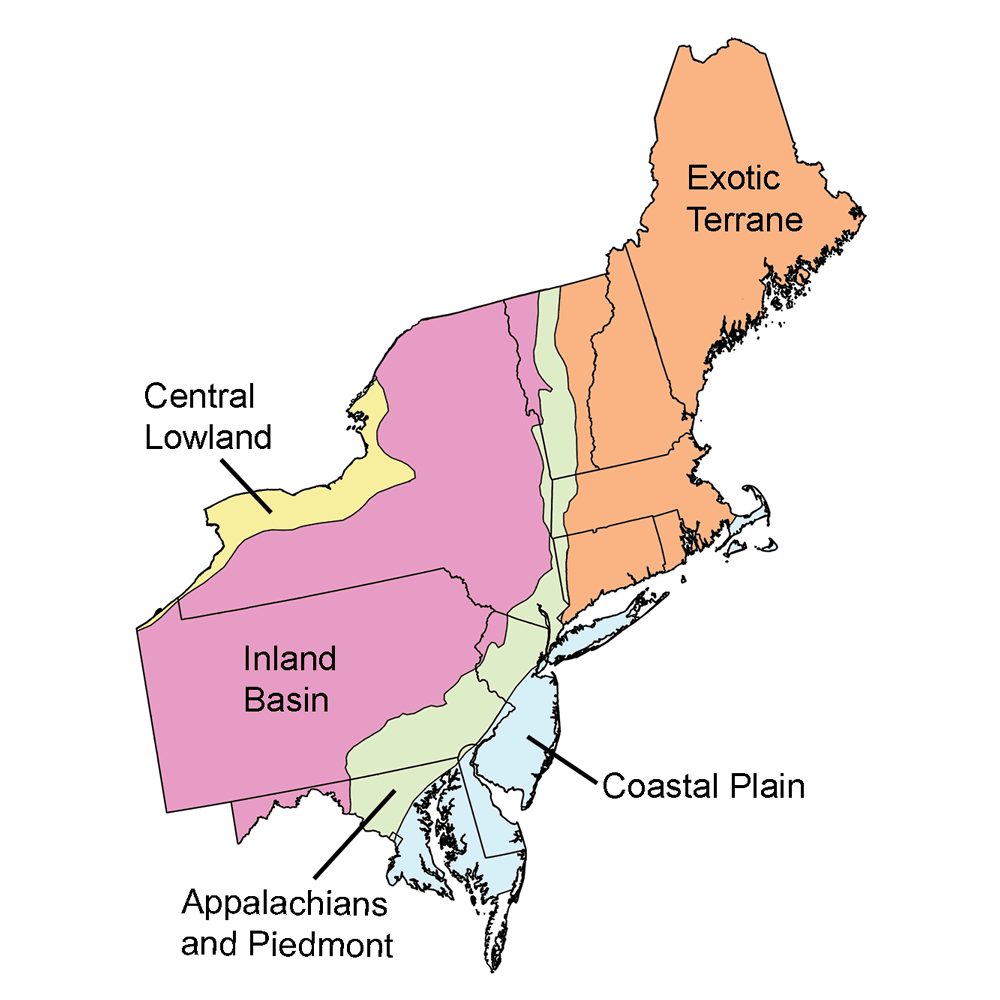
Northeastern United States
The northeastern United States include Maine, New Hampshire, Vermont, Massachusetts, Rhode Island, Connecticut, New York, New Jersey, Pennsylvania, Delaware, and Maryland.
Pages online now describe the geologic history of the northeastern United States, as well as the rocks of the Inland Basin region.
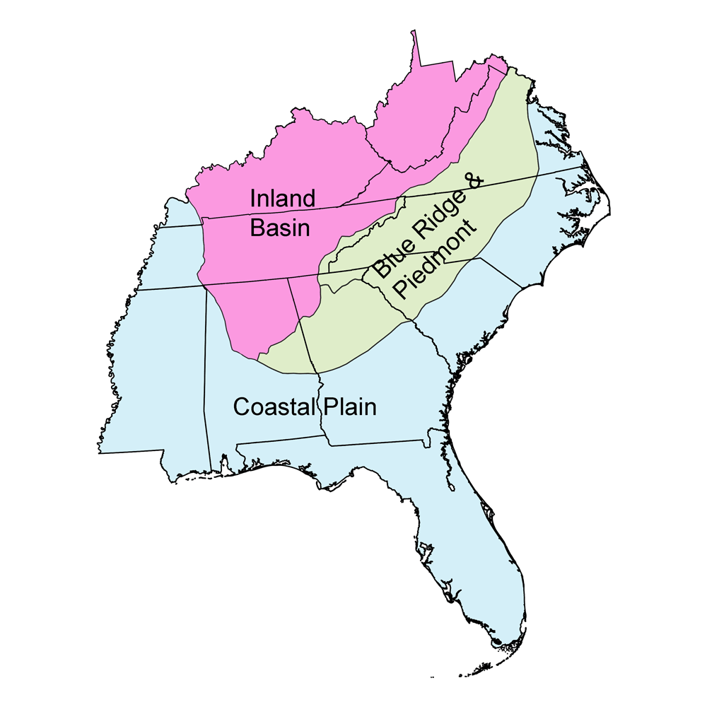
Southeastern United States
The southeastern United States includes West Virginia, Kentucky, Virginia, Tennessee, North Carolina, Mississippi, Alabama, Georgia, and Florida. Major regions include the Inland Basin, Blue Ridge and Piedmont, and Coastal Plain.
Topics covered include generalized overviews of the geologic history of the Southeast, as well as its climate and Earth hazards. Detailed information about the rocks, fossils, topography, energy resources, and mineral resources of each subregion is also included.
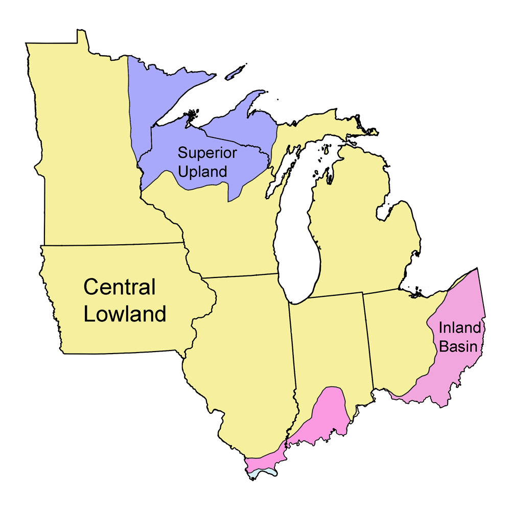
Midwest United States
The midwestern United States includes Illinois, Indiana, Iowa, Michigan, Minnesota, Ohio, and Wisconsin.
Topics covered include the geologic history, climate, Earth hazards, rocks, fossils, topography, energy, and mineral resources of the region.
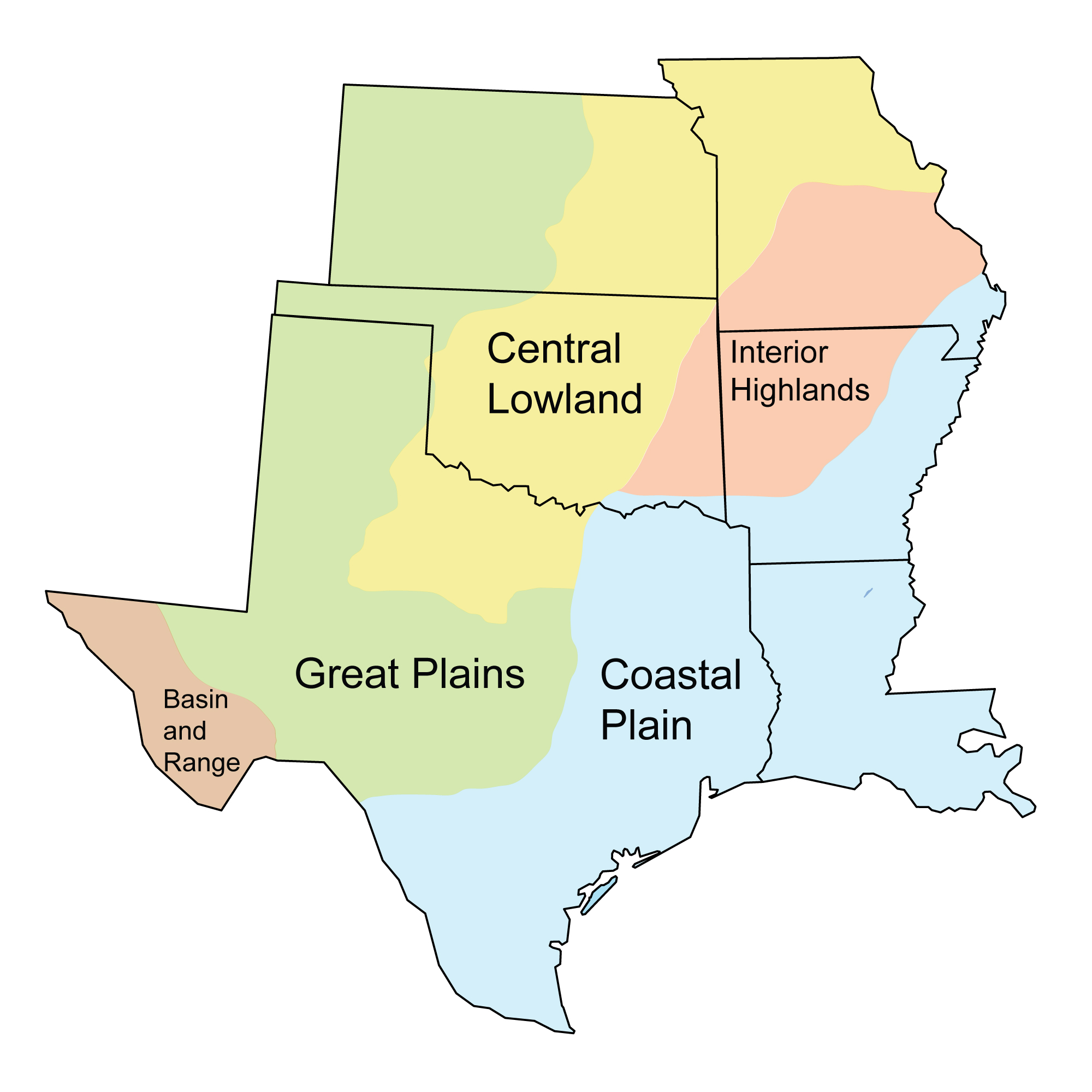
South-Central United States
The South-Central United States includes Louisiana, Texas, Arkansas, Oklahoma, Missouri, and Kansas. Major regions include the Coastal Plain, Interior Highlands, Central Lowland, Great Plains, and Basin and Range.
Topics covered include generalized overviews of the geologic history of the South-Central U.S., as well as its climate and Earth hazards. Detailed information about the rocks, fossils, topography, energy resources, and mineral resources of each subregion is also included.
Northwest-Central United States
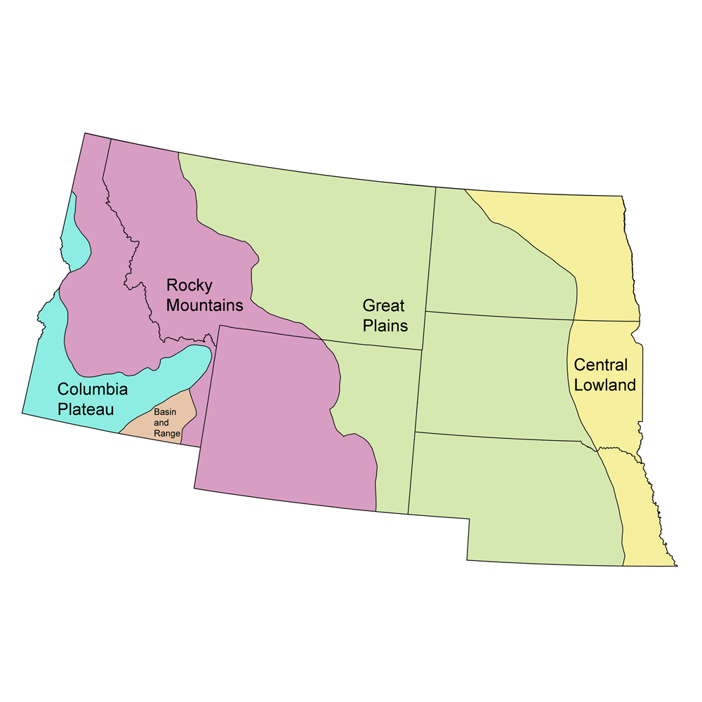
The northwest-central United States includes Idaho, Montana, Wyoming, North Dakota, South Dakota, and Nebraska.
Topics covered include the geologic history, climate, Earth hazards, rocks, fossils, topography, energy, and mineral resources of the region.
Southwestern United States
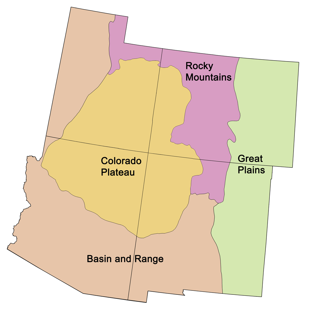
The southwestern United States includes Colorado, New Mexico, Arizona, and Utah. Major regions include the Great Plains, Rocky Mountains, Colorado Plateau, and Basin and Range.
Topics covered include generalized overviews of the geologic history of the Southwest U.S., as well as its climate and Earth hazards. Detailed information about the rocks, fossils, topography, energy resources, and mineral resources of each subregion is also included.
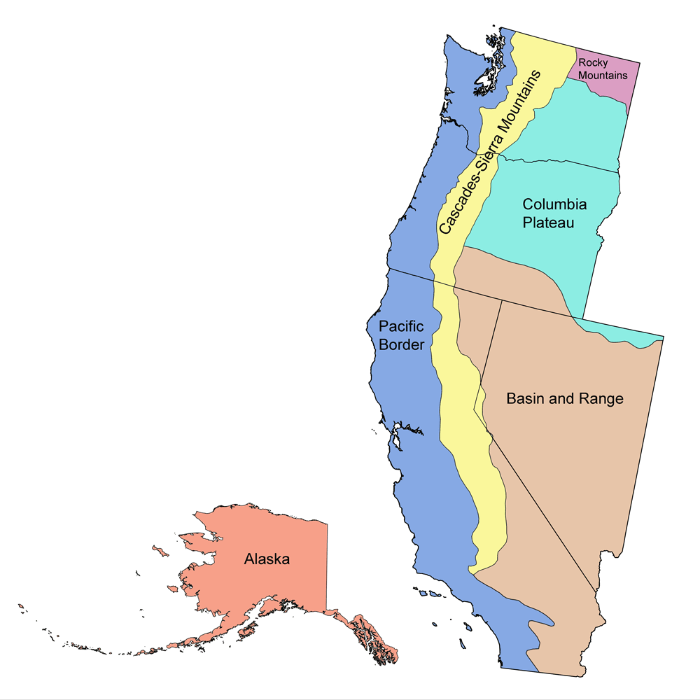
Western United States
The southwestern United States includes Colorado, New Mexico, Arizona, and Utah. Major regions include the Great Plains, Rocky Mountains, Colorado Plateau, and Basin and Range.
Topics covered include generalized overviews of the geologic history of the Southwest U.S., as well as its climate and Earth hazards. Detailed information about the rocks, fossils, topography, energy resources, and mineral resources of each subregion is also included.
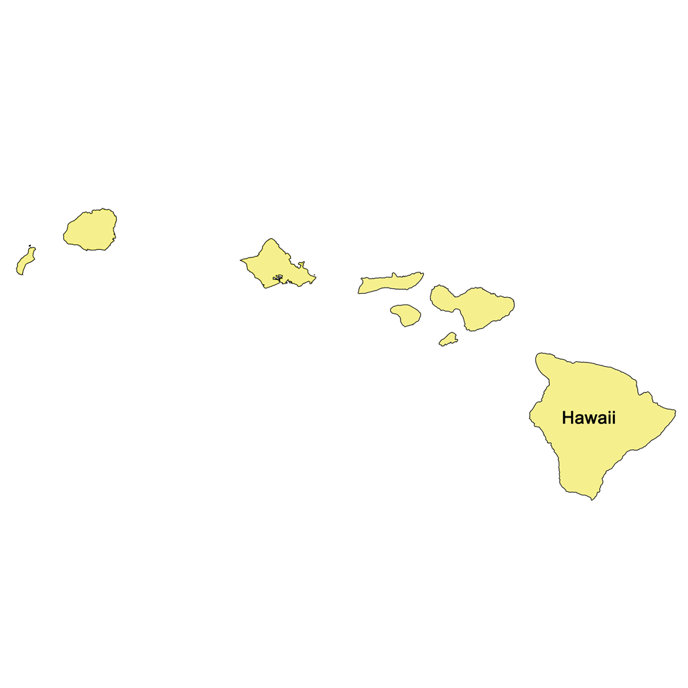
Hawaiʻi
Topics covered include the geologic history, climate, Earth hazards, rocks, fossils, topography, energy, and mineral resources of Hawaiʻi.
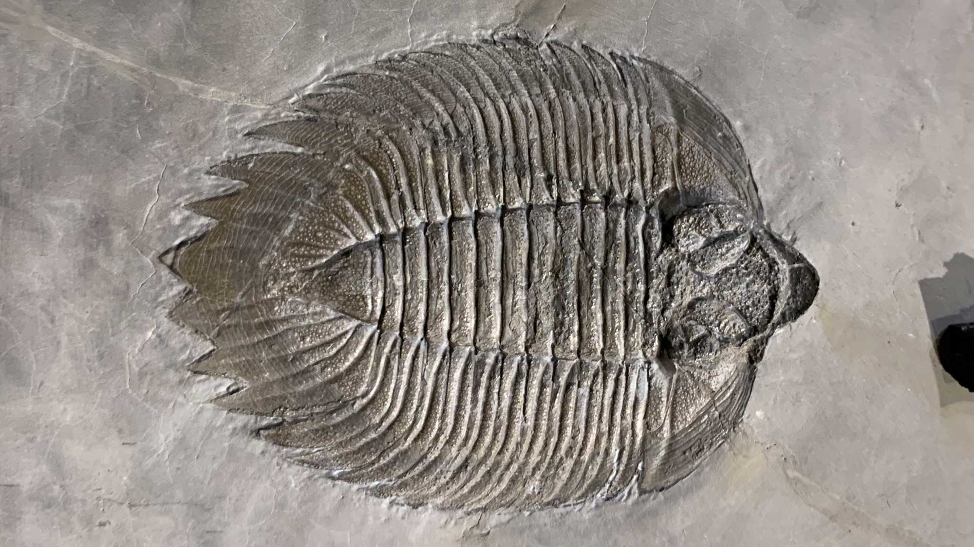
Fossils of the United States
From trilobites to dinosaurs, the United States has an incredibly rich fossil record that tells the story of how ancient animals and plants evolved, lived, and went extinct.
Find out more about the ancient life that once lived near your home.
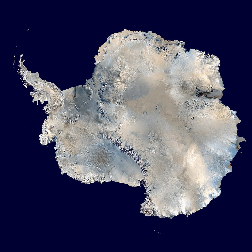
Antarctica
Learn about the ice-covered continent of Antarctica and the history of life on the continent as shown in the fossil record, including PRI's Zinsmeister collection, possibly the world's largest and most comprehensive collection of Antarctic fossil molluscs.