

The place where you are right now has a rich geological history that is recorded by the rocks beneath you and the fossils that they may contain. The rocks and fossils reveal the movements of continents and the evolution of new forms of life. This history helps to explain why the Earth looks like it does today. It also explains things like the distributions of natural resources, from rare minerals to rich soils for agriculture. Studying Earth's ancient climate also helps us to make sense of how the climate is changing today and how it will affect us where we live.
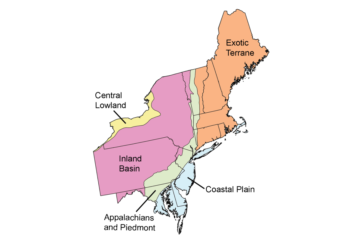
The goal of this part of the Earth@Home project is to explain the Earth science of the northeastern United States, which is defined here to include Maine, New Hampshire, Vermont, New York, Massachusetts, Rhode Island, Connecticut, New Jersey, Pennsylvania, Delaware, and Maryland. Major regions include the the Central Lowland, Inland Basin, Blue Ridge and Piedmont, Coastal Plain, and Exotic Terrane.
Contents
Overviews of Northeastern U.S. Earth Science

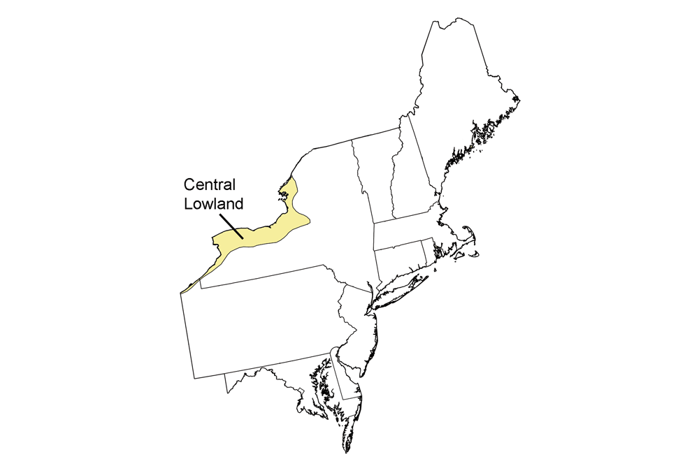
Central Lowland Region
Northern New York bordering Lake Ontario.
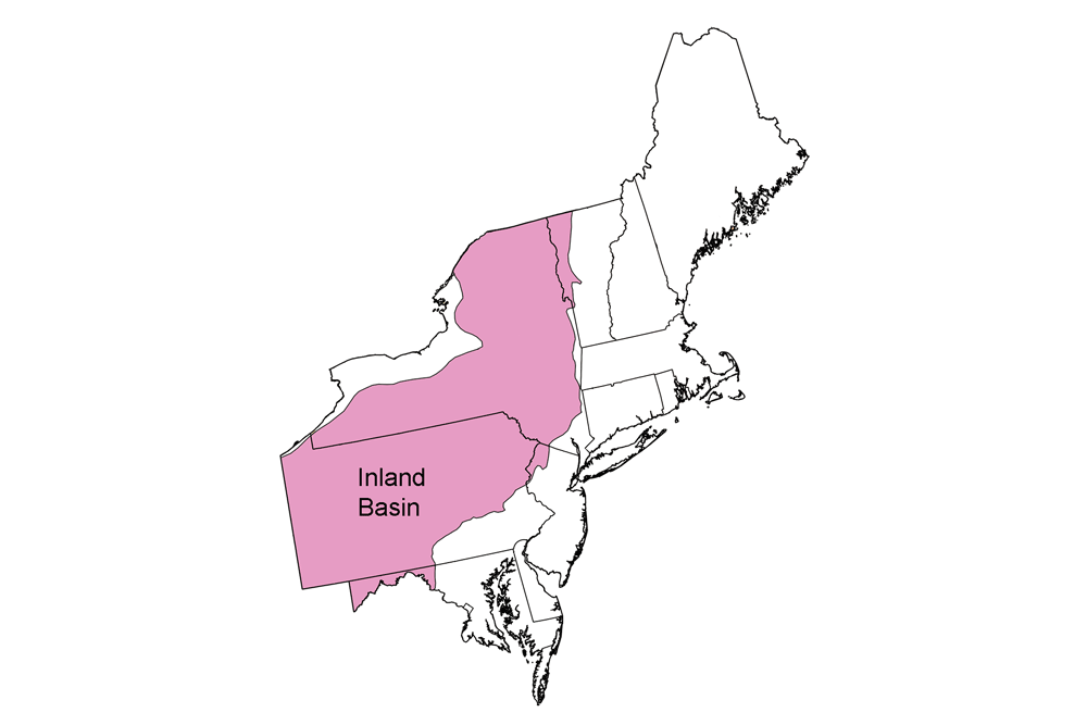
Inland Basin Region
New York, western Vermont, much of Pennsylvania, northwestern New Jersey, and western Maryland.
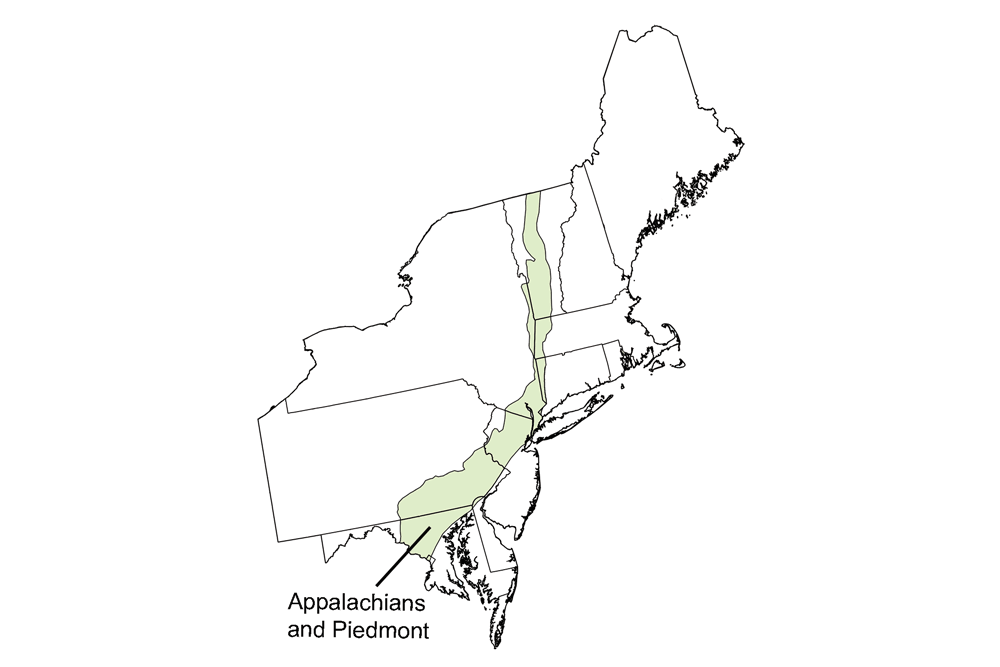
Appalachians and Piedmont
Central Maryland, southeastern Pennsylvania, a small part of central to northeastern New Jersey, and a tiny part of northern Delaware.
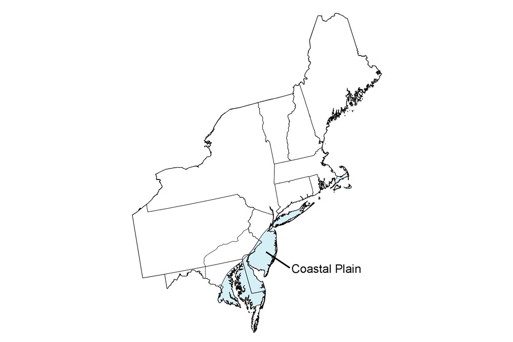
Coastal Plain
Eastern Maryland, Delaware, southern New Jersey, Long Island, other islands off the southern New England coast, and Cape Cod (Massachusetts).
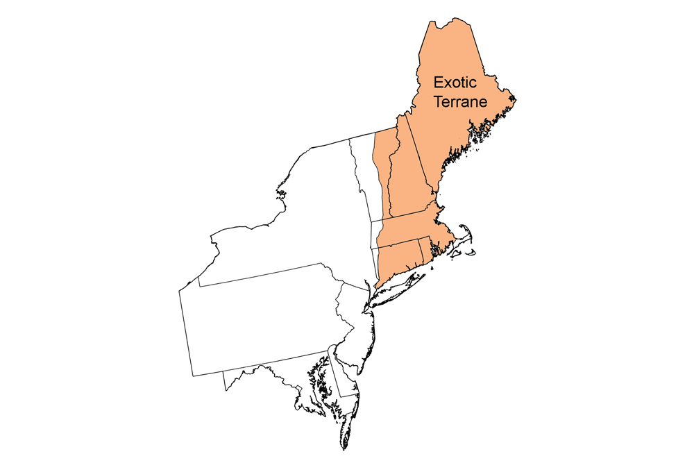
Exotic Terrane
Maine, New Hampshire, most of Vermont, Connecticut, Massachusetts, Rhode Island, and small parts of New York, New Jersey, and Pennsylvania.
Geologic Maps, Topographic Maps, and Earth Science Quick Facts
Simple geologic and topographic maps of each state in the northeastern United States, along with quick facts about official state fossils, rocks, minerals, gems, points of highest and lowest elevation, and lists of places to visit.
Resources
Lists of supplemental and teaching resources for the Earth science of the northeastern U.S., sorted by topic.
Earth Science Careers
Information about Earth science career paths.
Credits
Most of the Earth@Home content in the Here on Earth: Earth Science of the Northeastern United States section comes from The Teacher-Friendly Guide to the Geology of the Northeastern U.S., published in 2000 and reprinted 2016 by the Paleontological Research Institution. The citation for the original book is:
- Ansley, J. E. 2000, reprinted 2016. The Teacher-Friendly Guide to the Geology of the Northeastern U.S. Paleontological Research Institution, Ithaca, New York, 205 pp.
The book was adapted for the web by Elizabeth J. Hermsen and Jonathan R. Hendricks in 2022. Changes include formatting and revisions to the text and images.
The original chapters adapted for the Northeastern U.S. section of Here on Earth are as follows. Some of the content has been spread over multiple pages on this website, so links are not provided below:
- Chapter 1. Geologic history of the Northeastern US.
- Chapter 2. Rocks of the Northeastern US.
- Chapter 3. Glaciers of the Northeastern US.
- Chapter 4. Fossils of the Northeastern US.
- Chapter 5. Topography of the Northeastern US.
- Chapter 6. Mineral Resources of the Northeastern US.
- Chapter 7. Non-mineral Resources of the Northeastern US.
- Chapter 8. Environmental Issues of the Northeastern US.