

Page snapshot: Maryland State Geologic Map; Fossils; 3D models; Rock; Mineral; Gem; Highest and Lowest Elevations; Places to Visit; and Additional Resources.
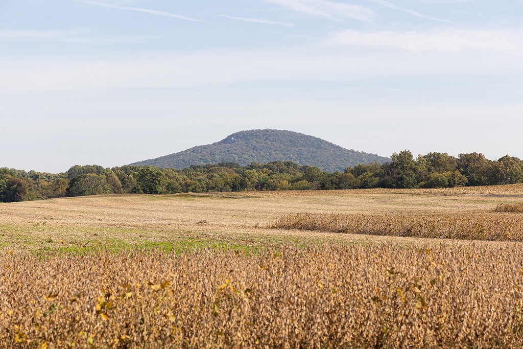
Image above: View of Sugarloaf Mountain, located near Frederick, Maryland. It is an example of a "monadnock," or an erosion-resistant, high elevation spot which remains after the erosion of surrounding land. Photo by Billy Wilson (Flickr; Creative Commons Attribution-NonCommercial 2.0 Generic license; image resized).
Geologic Map of Maryland
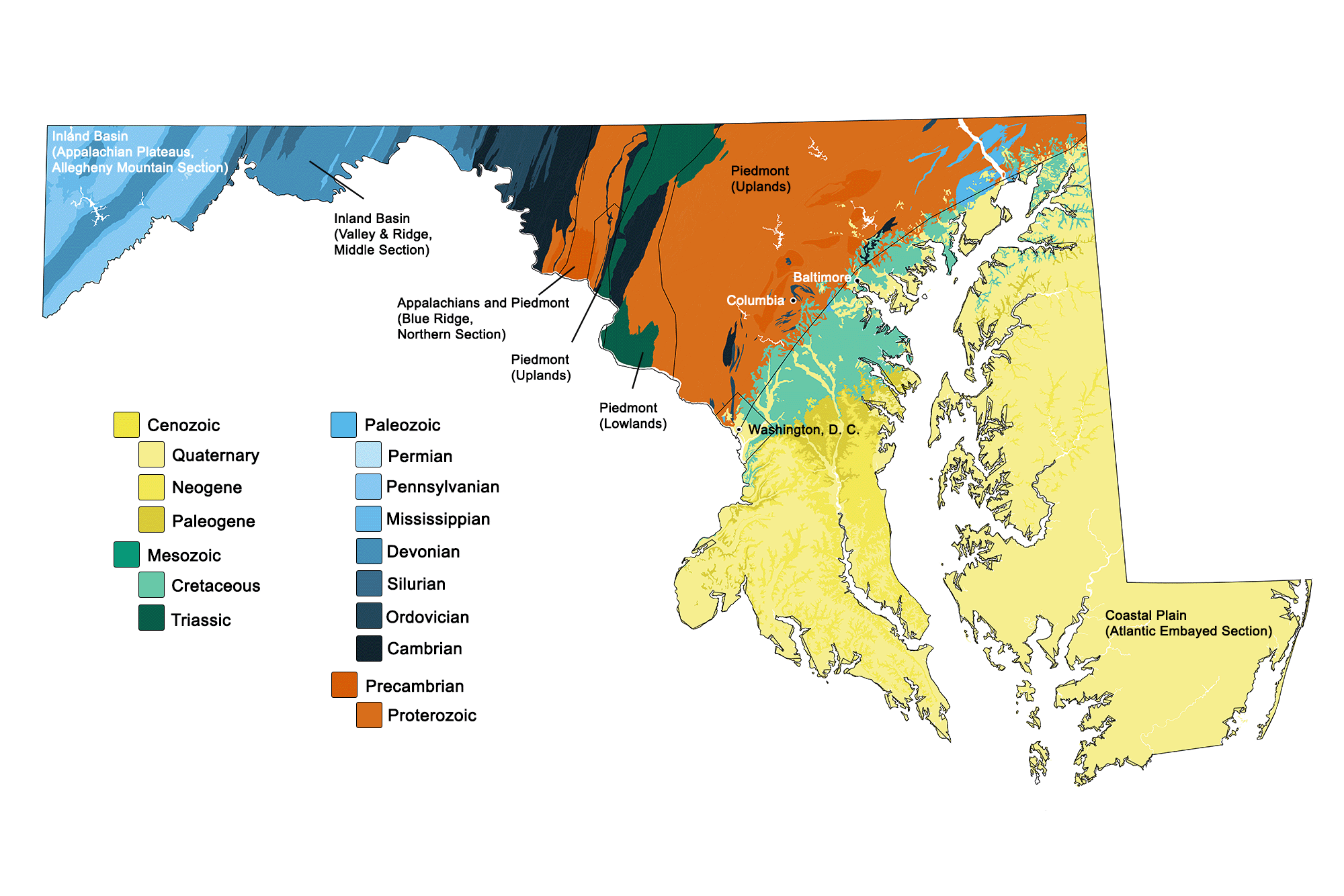
Geologic map of Maryland showing maximum ages of mappable units. Image by Kiera D. Crowley for the Earth@Home project developed using QGIS and USGS data (public domain) from Fenneman and Johnson (1946) and Horton et al. (2017).
Maryland State Fossils: Snail & Dinosaur
The state fossil shell of Maryland is Ecphora gardnerae gardnerae, named for paleontologist Julia Gardner. Julia Gardner was the first woman to formally enroll in the geology program at Johns Hopkins University in Baltimore, where she earned her Ph.D. She was one of the few women working at the United States Geological Survey in the 1920s, and she specialized in fossil mollusks. Ecphora gardnerae gardnerae and other species of Ecphora are marine snails that are found in the Miocene of Maryland.
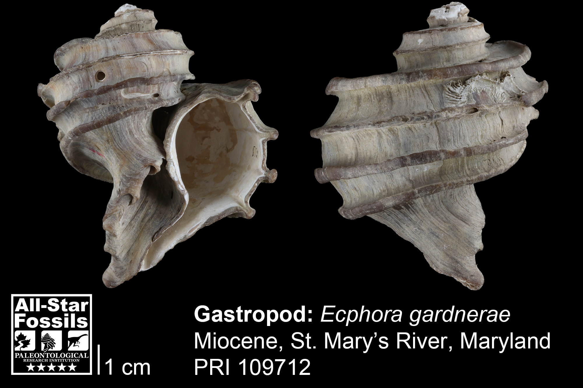
Ecphora gardnerae from the Miocene of St. Mary's River, Maryland (PRI 109712). Does this shell look familiar? Look at our logo at the top of the page! Gilbert Harris used Ecphora as the symbol of PRI when he founded the organization in 1932.
The state dinosaur of Maryland is Astrodon johnstoni, which is known from the Lower Cretaceous Potomac group. This dinosaur was a sauropod, a type of herbivorous dinosaur that was large, walked on four legs, and had a long neck and relatively small head. The remains of this dinosaur consist mostly of teeth, individual bones, and fragments, so it has been reconstructed on the basis of more complete sauropods from elsewhere.
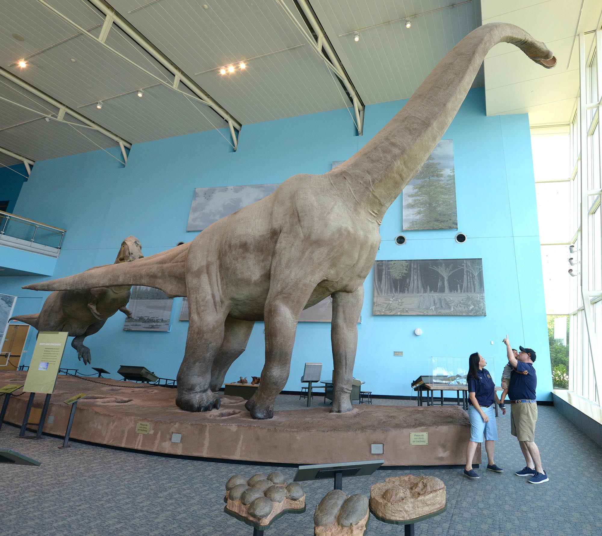
Reconstruction of Maryland's state dinosaur, Astrodon johnstoni, on display at the Maryland Science Center. Photo by "Maryland GovPics" (Flickr; Creative Commons Attribution 2.0 Generic license; image cropped and resized).
3D Models of fossils from Maryland
Fossil specimen of the bivalve Mercenaria mercenaria from the Quaternary of St. Mary’s County, Maryland (PRI 76728). Specimen is from the collections of the Paleontological Research Institution, Ithaca, New York. Width of specimen is approximately 10 cm. Model by Emily Hauf. Click here for a view showing both valves together.
Fossil specimen of the echinoid Echinocardium orthonotum from the Miocene of Maryland (PRI 503). Specimen is from the collections of the Paleontological Research Institution, Ithaca, New York. Length of specimen is approximately 5 cm. Model by Emily Hauf.
Maryland State Rock: None
Maryland does not yet have an official state rock.
Maryland State Mineral: None
Maryland does not yet have an official state mineral.
Maryland State Gem: Patuxent River Stone
Patuxent River Stone is a form of quartzite unique to Maryland, and it is found in a range of red to yellow hues dependent on the quantity of iron and other trace elements it contains. These red and yellow shades mimic the colors in the state's flag.
Maryland's Highest and Lowest Elevations

Topographic map of Maryland with physiographic regions and point of highest elevation identified. Topographic data are derived from the Shuttle Radar Topography Mission (SRTM GL3) Global 90m (SRTM_GL3) (Farr, T. G., and M. Kobrick, 2000, Shuttle Radar Topography Mission produces a wealth of data. Eos Trans. AGU, 81:583-583). Image by Kiera D. Crowley for the Earth@Home project.
Highest Elevation: Backbone Mountain
Maryland's highest point, located south of the town of Frederick in the Allegheny Mountains, is Backbone Mountain at 1,024 meters (3,360 feet). The ridge it lies on is part of the Eastern Continental Divide.
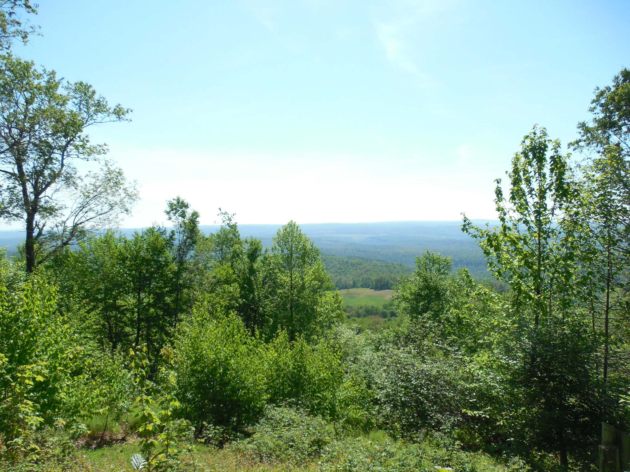
View looking out from the trails up Backbone Mountain, Maryland. Photo by Jimmy Emerson (Flickr; Creative Commons Attribution-NonCommercial-NoDerivs 2.0 Generic license).
Lowest Elevation: Atlantic Coast
Maryland's lowest points are along its coastline, where the shore is at sea level.
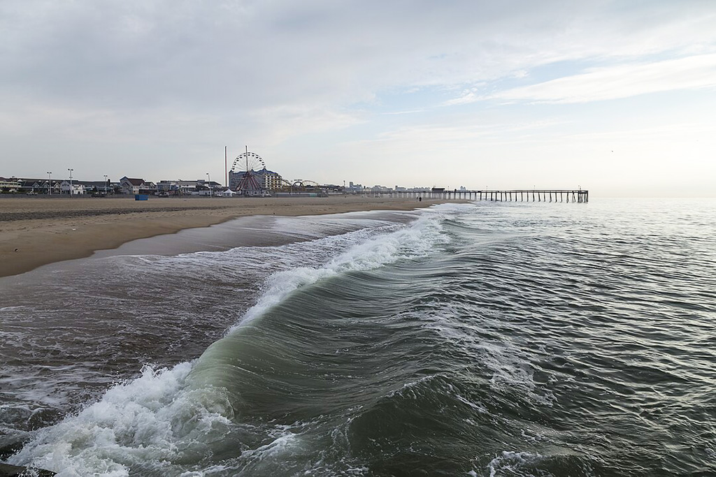
The beach and pier in Ocean City, Maryland. Photo by Acroterion (Wikimedia Commons; Creative Commons Attribution-Share Alike 3.0 Unported license; image resized).
Places to Visit
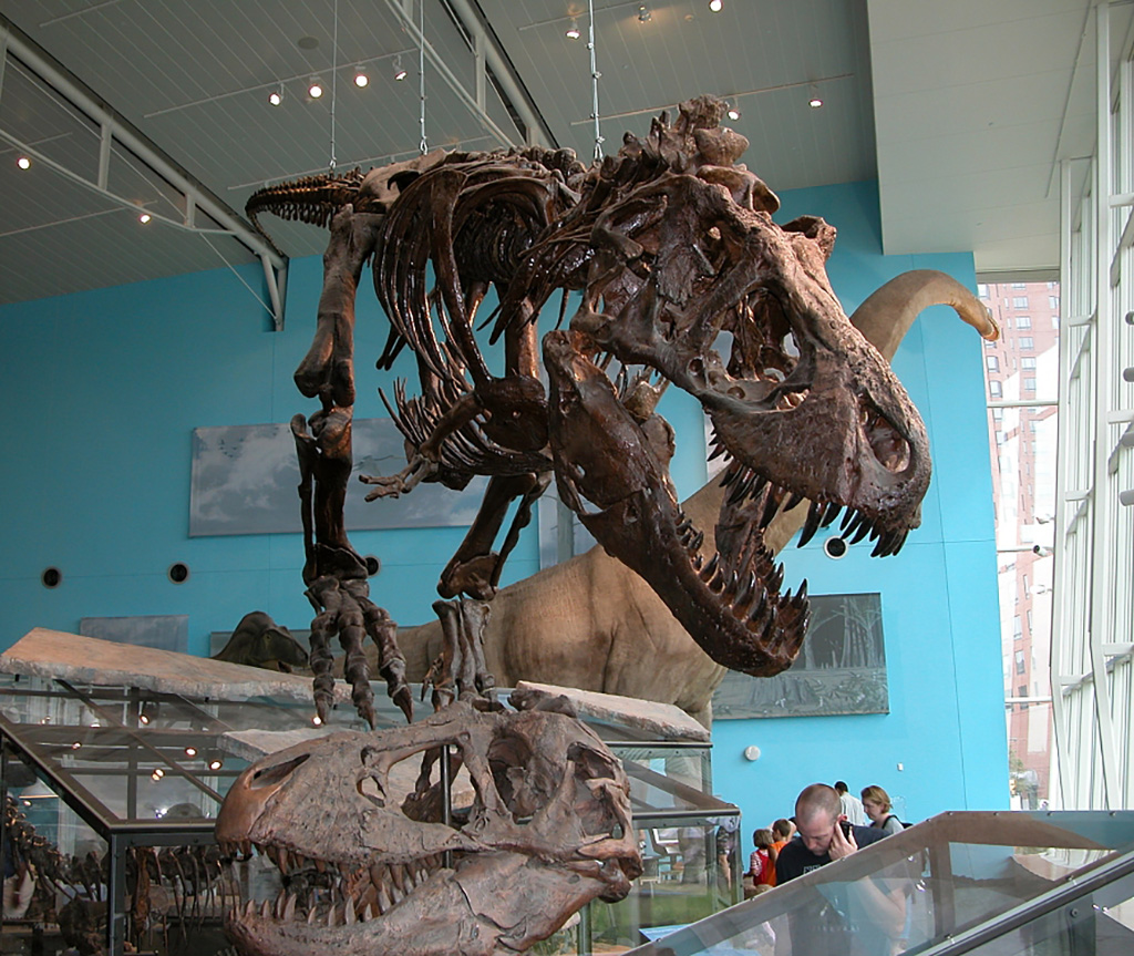
Dinosaur exhibit at the Maryland Science Center. Photo by Fritz Geller-Grimm (Wikimedia Commons; Creative Commons Attribution-Share Alike 2.5 Generic license; image cropped and resized).
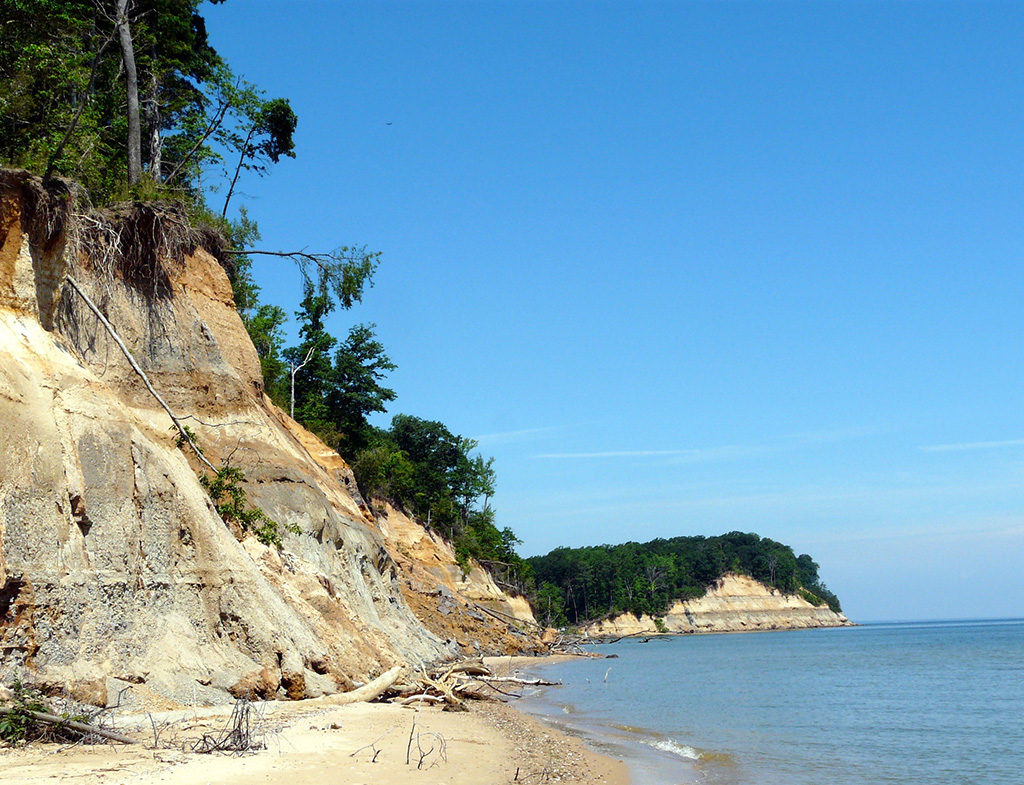
Miocene-aged sediments make up the fossiliferous cliffs at Calvert Cliffs State Park in Maryland. Photo by David Heise (Flickr; Creative Commons Attribution-NonCommercial 2.0 Generic license; image cropped and resized).
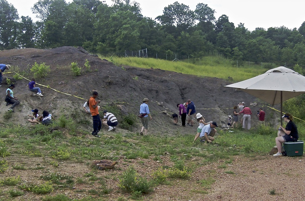
Visitors hunt for fossils in Dinosaur Park, Maryland. Photo by Paul (Flickr; Creative Commons Attribution-ShareAlike 2.0 Generic license; image cropped and resized).
Additional resources

Earth@Home resources about Maryland and nearby states:
- Rocks: Central Lowland, Inland Basin, Appalachians and Piedmont, Coastal Plain, and Exotic Terrane.
- Fossils: Central Lowland, Inland Basin, Appalachians and Piedmont, Coastal Plain, and Exotic Terrane.
- Topography: Central Lowland, Inland Basin, Appalachians and Piedmont, Coastal Plain, and Exotic Terrane.
- Mineral Resources: Central Lowland, Inland Basin, Appalachians and Piedmont, Coastal Plain, and Exotic Terrane.
Earth@Home resources about the northeastern region of the United States: