

The place where you are right now has a rich geological history that is recorded by the rocks beneath you and the fossils that they may contain. The rocks and fossils reveal the movements of continents and the evolution of new forms of life. This history helps to explain why the Earth looks like it does today. It also explains things like the distributions of natural resources, from rare minerals to rich soils for agriculture. Studying Earth's ancient climate also helps us to make sense of how the climate is changing today and how it will affect us where we live.
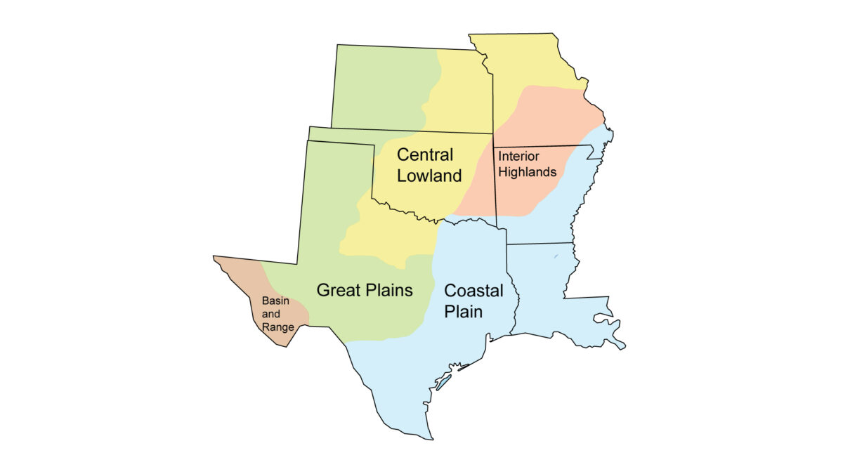
The goal of this part of the Earth@Home project is to explain the Earth science of the south-central United States, which is defined here to include Arkansas, Kansas, Louisiana, Missouri, Oklahoma, and Texas. Major regions include the Central Lowland, Interior Highlands, Coastal Plain, Great Plains, and Basin and Range.
Contents
Overviews of South-Central U.S. Earth Science
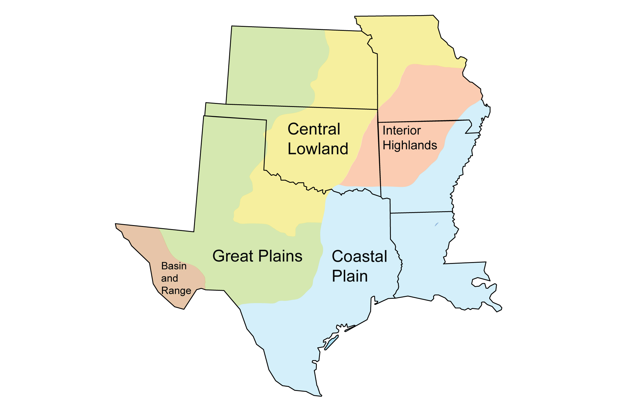
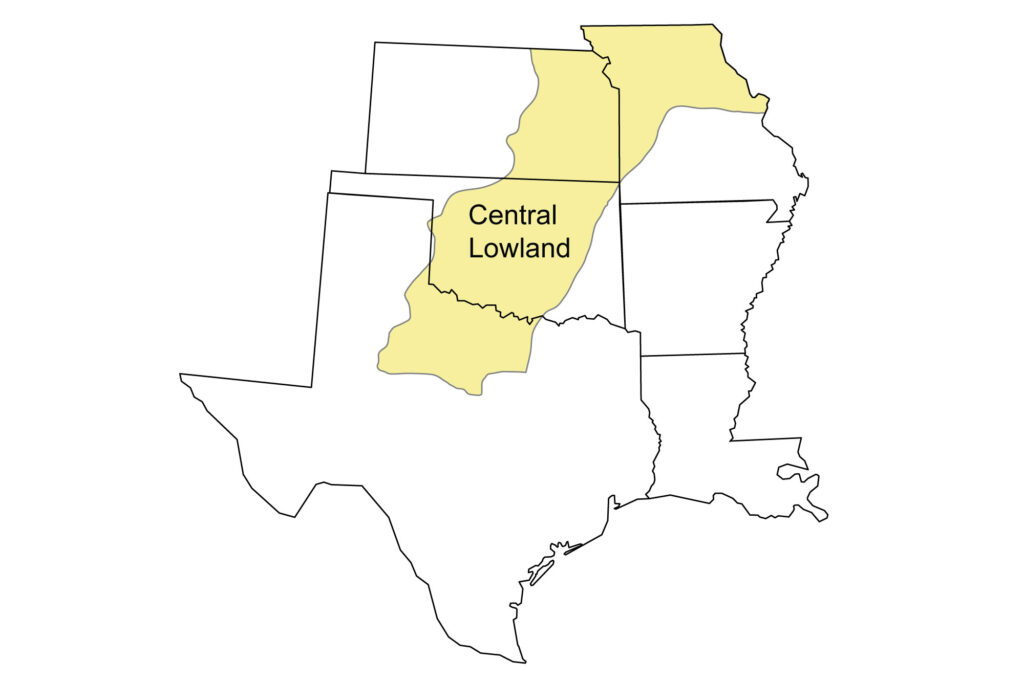
Central Lowland Region
Northern Missouri, eastern Kansas, central Oklahoma, and part of northern Texas.
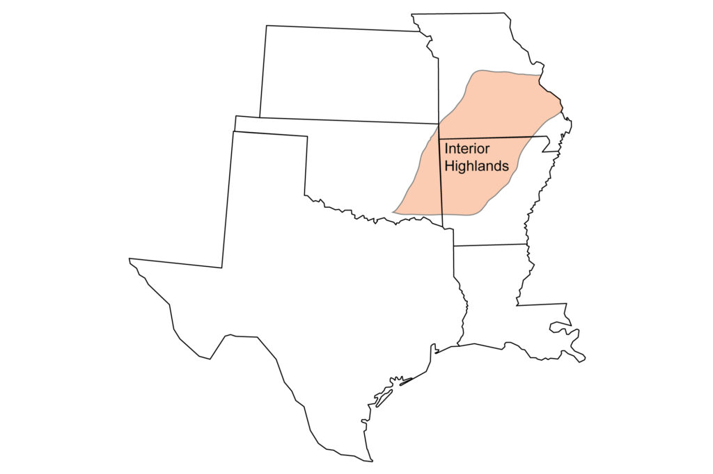
Interior Highlands Region
Southern Missouri, eastern Oklahoma, and northwestern Arkansas.
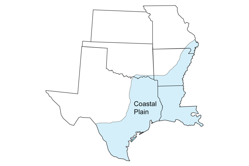
Coastal Plain Region
The Gulf Coast and Mississippi Embayment, including a small part of southeastern Missouri, eastern and southern Arkansas, Louisiana, a small part of southeastern Oklahoma, and eastern to southern Texas.
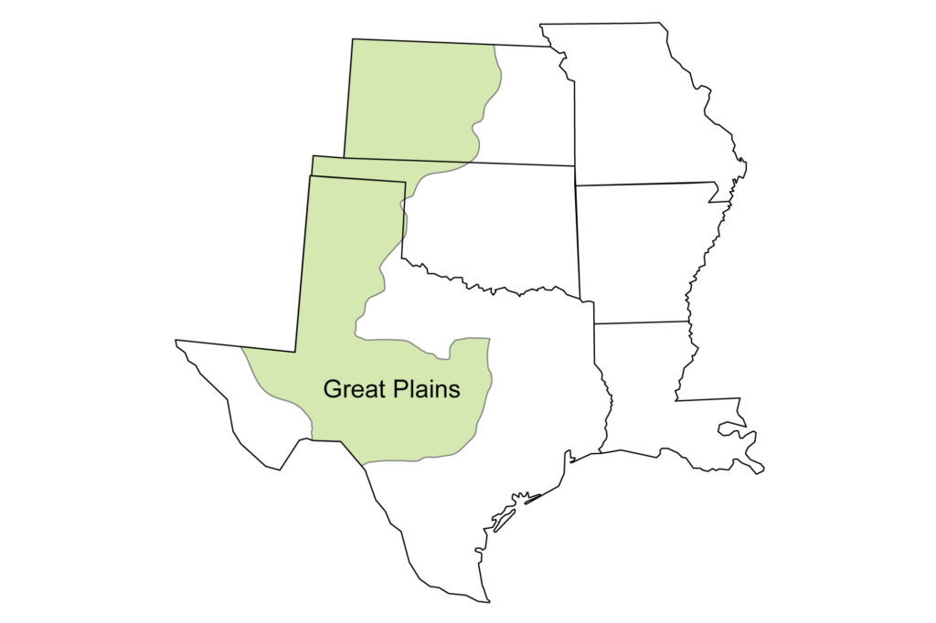
Great Plains Region
Central and western Kansas, the Oklahoma panhandle (western Oklahoma), and the Texas panhandle (northern Texas), central Texas, and part of West Texas.
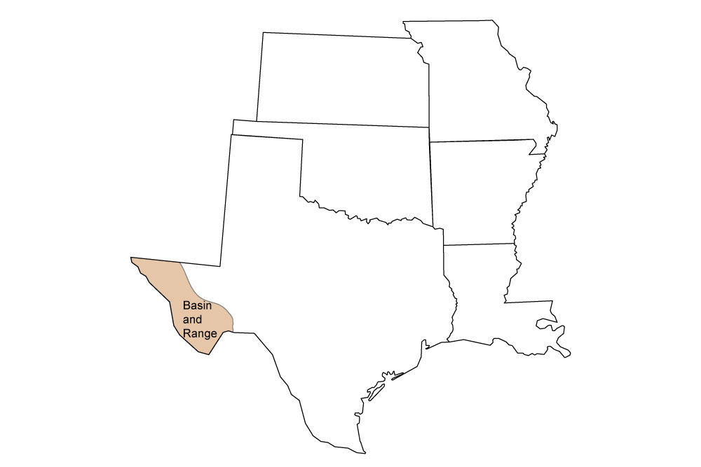
Basin and Range Region
Far western Texas (El Paso, Hudspeth, Jeff Davis, Presidio, and Brewster counties; also includes about half of Culberson county and a little of Pecos and Terrell counties.)
Geologic Maps, Topographic Maps, and Earth Science Quick Facts
Simple geologic and topographic maps of each state in the South-Central United States, along with quick facts about official state fossils, rocks, minerals, gems, points of highest and lowest elevation, and lists of places to visit.
Resources
Lists of supplemental and teaching resources for the Earth science of the south-central U.S., sorted by topic.
Earth Science Careers
Information about Earth science career paths.
Credits
Most of the Earth@Home content in the Here on Earth: South-central United States section is derived from The Teacher-Friendly Guide to the Earth Science of the South Central US, edited by Mark D. Lucas, Robert M. Ross, and Andrielle N. Swaby (published in 2015 by the Paleontological Research Institution; currently out of print). The citation for the original book is:
- Lucas, M. D., R. M. Ross, and A. N. Swaby (eds.). 2015. The Teacher-Friendly Guide to the Earth Science of the South Central US. Paleontological Research Institution, Ithaca, New York, 428 pp.
The book was adapted for the web by Elizabeth J. Hermsen and Jonathan R. Hendricks in 2022. Changes include formatting and revisions to the text and images.
Authors for the original chapters adapted for the south-central U.S. section of Here on Earth are as follows. Some of the content has been spread over multiple pages on this website, so links are not provided below:
- Chapter 1. Geologic history of the South Central US: Richard A. Kissel and Alex F. Wall.
- Chapter 2. Rocks of the South Central US: Richard A. Kissel, Alex F. Wall, and Andrielle N. Swaby.
- Chapter 3. Fossils of the South Central US: Warren D. Allmon and Alex F. Wall.
- Chapter 4. Topography of the South Central US: Richard A. Kissel and Alex F. Wall.
- Chapter 5. Mineral Resources of the South Central US: Allen Macfarlane.
- Chapter 6. Glaciers in the South Central US: Alex F. Wall and Robert M. Ross.
- Chapter 7. Energy in the South Central US: Carlyn S. Buckler and Robert M. Ross.
- Chapter 8. Soils of the South Central US: Richard A. Kissel and Judith T. Parrish.
- Chapter 9. Climate of the South Central US: Richard A. Kissel and Judith T. Parrish.
- Chapter 10. Earth Hazards of the South Central US: Sue Ellen Lyons and Robert M. Ross.