

Snapshot: Overview of the topography of the Coastal Plain region of the South-Central United States, including Louisiana and portions of Texas, Arkansas, Oklahoma, and Missouri.
Topics covered on this page: Overview; Louisiana and Texas; Resources.
Credits: Most of the text of this page is derived from "Topography of the South Central US" by Richard A. Kissel and Alex F. Wall, chapter 4 in The Teacher-Friendly Guide to the Earth Science of the South Central US, edited by Mark D. Lucas, Robert M. Ross, and Andrielle N. Swaby (published in 2015 by the Paleontological Research Institution). The book was adapted for the web by Elizabeth J. Hermsen and Jonathan R. Hendricks in 2021–2022. Changes include formatting and revisions to the text and images. Credits for individual images are given in figure captions.
Updates: Page last updated February 11, 2022.
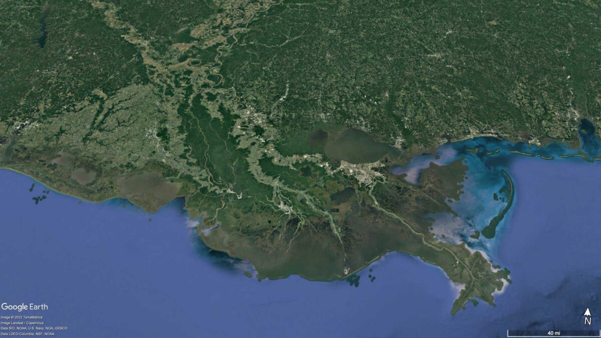
Image above: Google Earth image of the Mississippi River Delta (Image Landsat / Copernicus; Data SIO, NOAA, U.S. Navy, NGA, GEBCO, Data LDEO-Columbia, NSF, NOAA).
Overview
In terms of its geology, the Coastal Plain is the least complicated region of the United States. Following the breakup of Pangaea, as the North American plate began drifting away from the Mid-Atlantic Ridge, mountain building along the eastern margin of North America ceased. A long period of erosion continued from the Cretaceous through the Quaternary, as sediment that eroded from the mountains was gradually deposited along North America’s passive continental margin to build the Atlantic and Gulf Coastal plains. Sediment was transported from the mountains by rivers and streams to the coast, building up successive layers of sediment that fanned out onto the continental shelf.
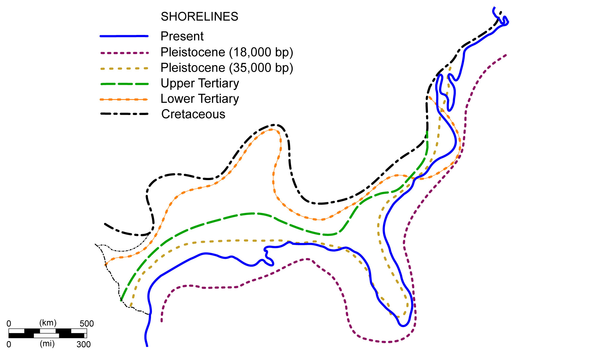
Shoreline positions along the Coastal Plain during the past 70 million years. Image modified from original by NOAA (Wikimedia Commons; public domain).
When sea level rose, deposition of marine sediment also contributed to the Coastal Plain. The late Cretaceous was marked by very high sea levels worldwide, in part due to the significant increase in plate tectonic activity that followed increased volcanism at the mid-ocean ridges after the breakup of Pangaea. As ocean basins change in shape, sea level goes up and down. Midocean ridges are one of the major topographic features displacing water, and they increase sea level as they grow in height or length. The Mississippi Embayment also formed during the Cretaceous when the ocean flooded the area between the Interior Highlands and the Appalachians.
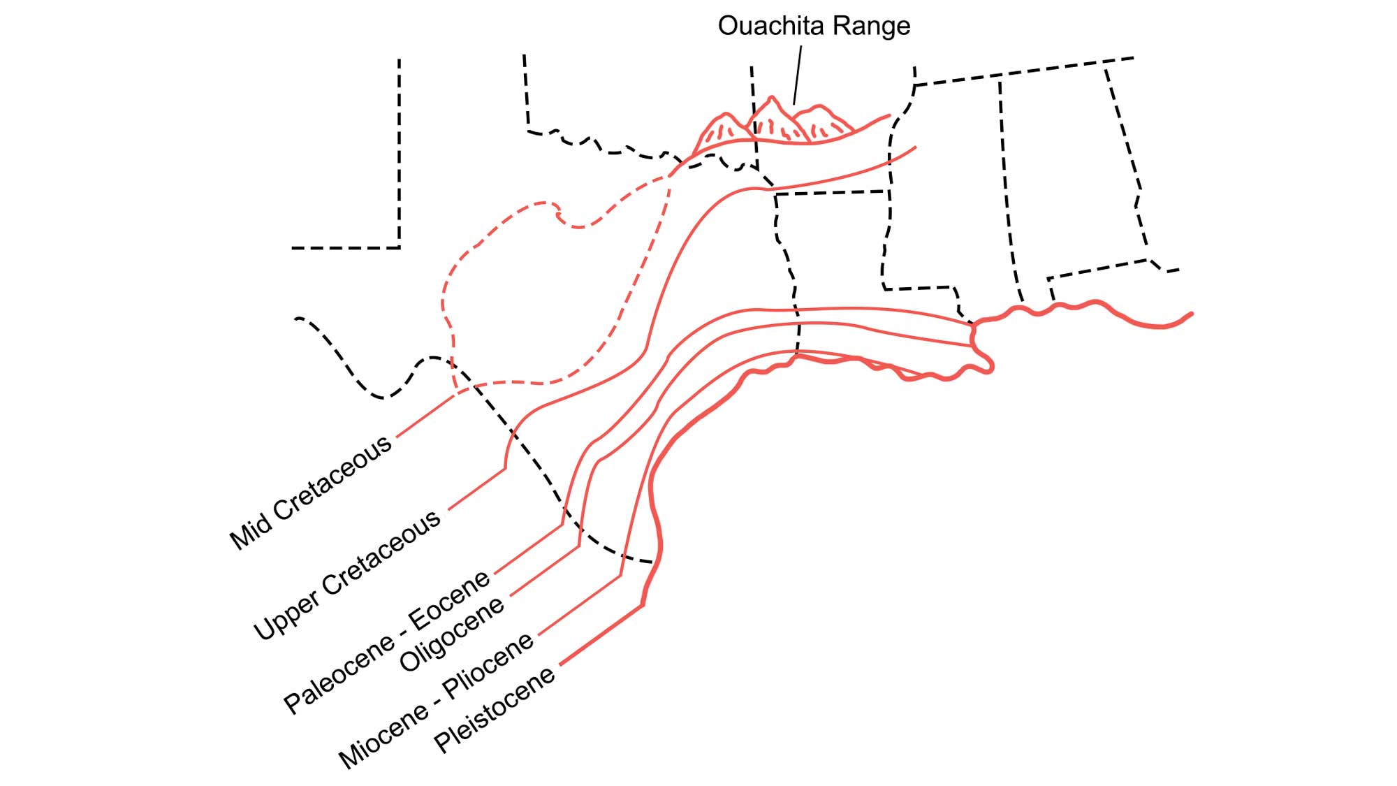
The Mississippi Embayment (with shoreline changes over the past 140 million years). Image modified from original by Wade Greenberg-Bran, in turn adapted from image by D. Spearing, 2007, Roadside Geology of Louisiana, Mountain Press Publishing Company, Missoula, MT.
When sea level later fell due to glaciation, erosion removed some material from the Coastal Plain.
Throughout the Cenozoic era, the Coastal Plain extended 400 kilometers (250 miles) into the Gulf of Mexico, with sediment deposits 15,000 to 18,000 meters (50,000 to 60,000 feet) thick. The depositional settings of the South Central’s Coastal Plain are similar to those seen today, including river, floodplain, shoreline, delta, and shallow marine environments. The Mississippi River Delta is an extremely important coastal area in North America, and it is the United States’ largest drainage basin, creating a very active depositional environment. The deposits become increasingly younger toward the gulf, due to a depositional process called progradation. During this process, the river forms a deposit at its margin, and then overflows it and deposits material on the far side in a continual outward movement.
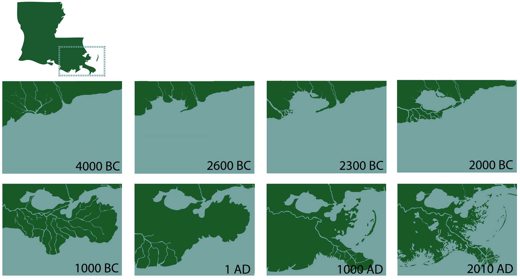
Evolution of the Mississippi River Delta over the past 6000 years. Image by "Dboutte" (Wikimedia Commons; Creative Commons Attribution 3.0 United States license).
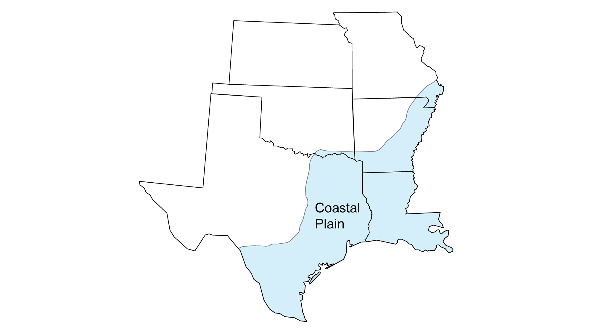
Louisiana and Texas
The entire state of Louisiana is found within the Coastal Plain, with Cenozoic deposits forming as the sea advanced and retreated on several occasions. The topography of Louisiana is limited, with the highest point—Driskill Mountain—at 163 meters (535 feet) above sea level, and the lowest point—New Orleans—at an average elevation of 2 meters (6.5 feet).
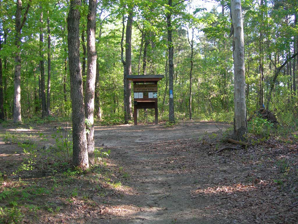
The summit of Driskill Mountain, Louisiana. Photograph by Jimmy Emerson (Flickr; Creative Commons Attribution-NonCommercial-NoDerivs 2.0 Generic license).
In Texas, the Coastal Plain extends west to the Balcones Fault and Escarpment, commonly regarded as the division between upland and lowland Texas. Similarly to the Osage Cuestas, the Inner Coastal Plain of Texas also contains a series of cuesta escarpments.
The Coastal Plain also includes many salt dome formations, which are prevalent in both Texas and Louisiana. These salt domes began as evaporite deposits that formed during the Jurassic. After later sedimentation covered the salt beds, the salt, which is lower in density and more flexible than the overlying layers, began to drift upward. This movement creates dome-shaped structures that warp the surface sediment, creating both positive and negative topography.
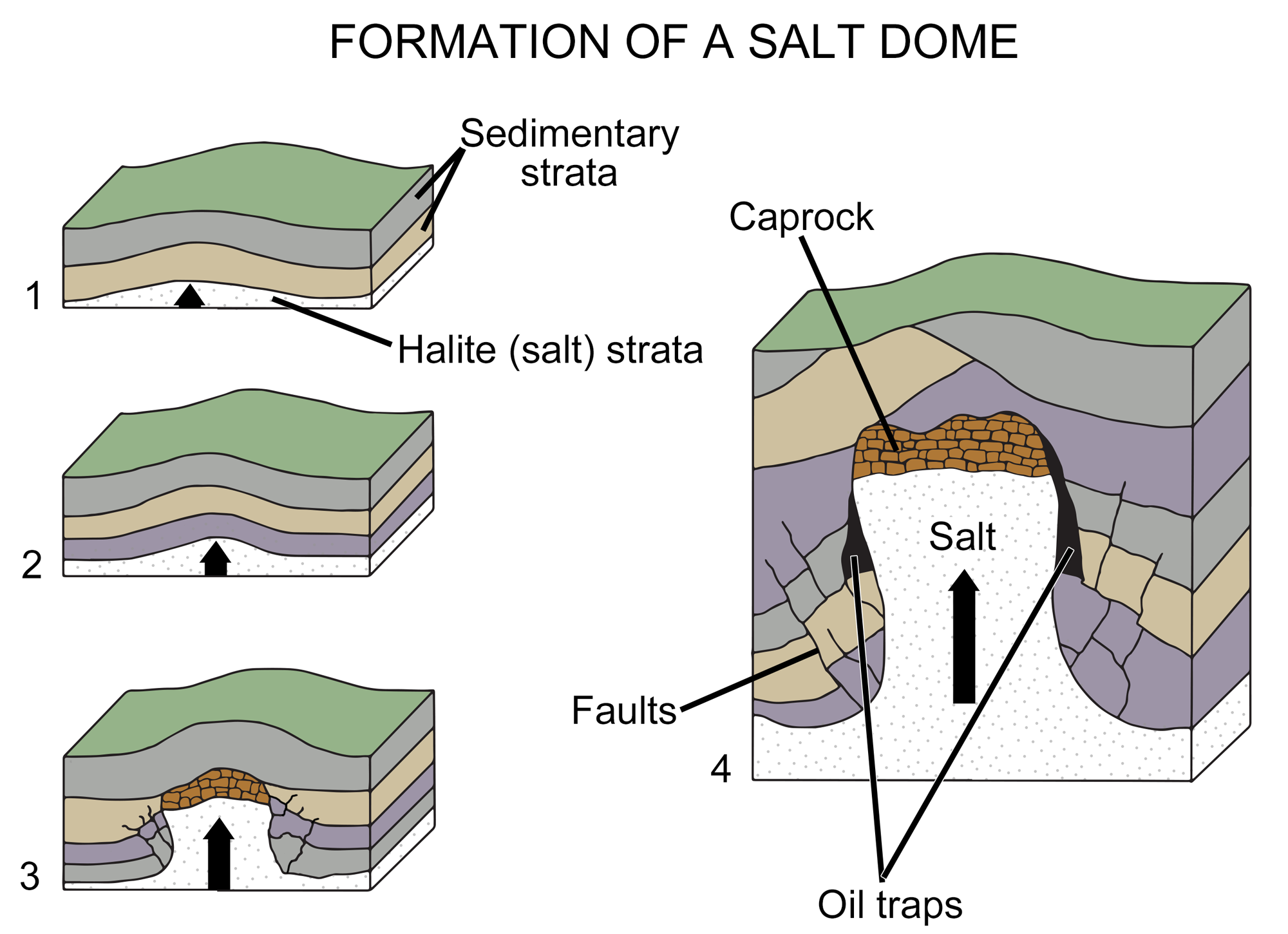
The formation of a salt dome. Modified from original by Wade Greenberg-Brand, in turn adapted from Britannica Online for Kids.
The Five Islands in Louisiana are an excellent example of positive dome-shaped topography. They are formed from five salt domes, each around three kilometers (two miles) in diameter, which were uplifted to form tall domeshaped hills in Louisiana’s Gulf Coast marshlands.
The shape and structure of salt domes make them excellent traps for pockets of oil and gas, and such pockets are especially prevalent in the Texas Gulf Coast. As a result, salt domes are critically important in the process of prospecting for fossil fuels in the Gulf. Emptied salt domes have also been used as storage caverns for liquid gas and chemical waste.