

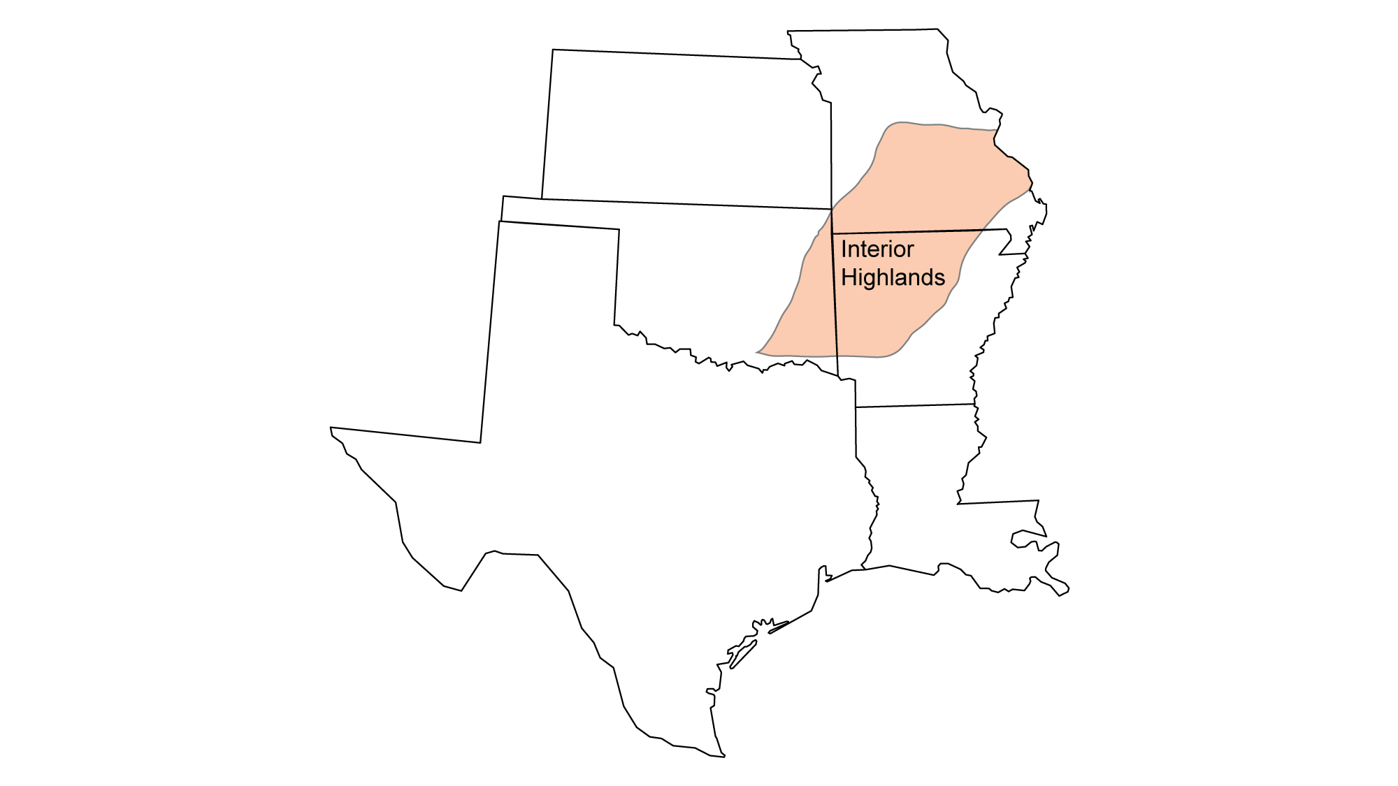
Snapshot: Overview of the mineral resources of the Interior Highlands region of the South-Central United States, including portions of Missouri, Arkansas, and Oklahoma.
Topics covered on this page: Overview; Tripoli and Novaculite; Lead; Other Metals; Resources (references and further reading about minerals).
Credits: Most of the text of this page is derived from "Mineral resources of the South Central US" by Allen Macfarlane, chapter 5 in The Teacher-Friendly Guide to the Earth Science of the South-Central U.S., edited by Mark D. Lucas, Robert M. Ross, and Andrielle N. Swaby (published in 2015 by the Paleontological Research Institution). The book was adapted for the web by Elizabeth J. Hermsen and Jonathan R. Hendricks in 2021–2022. Changes include formatting and revisions to the text and images. Credits for individual images are given in figure captions.
Updates: Page last updated February 11, 2022.
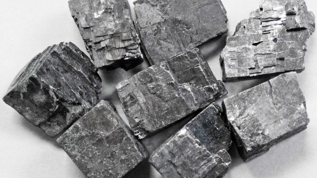
Image above: Specimens of the mineral galena from Reynolds County, Missouri. Image by James St. John (Flickr; Creative Commons Attribution 2.0 Generic license).
Overview
The Interior Highlands region consists of two areas of uplifted rock―the Ozark Uplift and the Ouachita Mountains―which have existed since the formation of Pangaea. Thick sequences of Paleozoic limestone and dolomite, with lesser thicknesses of sandstone and shale, underlie the area occupied by the Ozarks, except in the St. Francois Mountains (where erosion has stripped away the sedimentary cover and exposed Precambrian granite). Nodules of chert are present and often abundant in most of the limestone and dolomite. The weathering and erosion of these rocks has produced the chert gravels that mantle much of the Ozark Uplift.
The Interior Highlands is a source of several industrial minerals, primarily from sedimentary rocks. Episodes of marine transgression have left behind considerable resources for construction materials, including clay, limestone, sandstone, and granite.
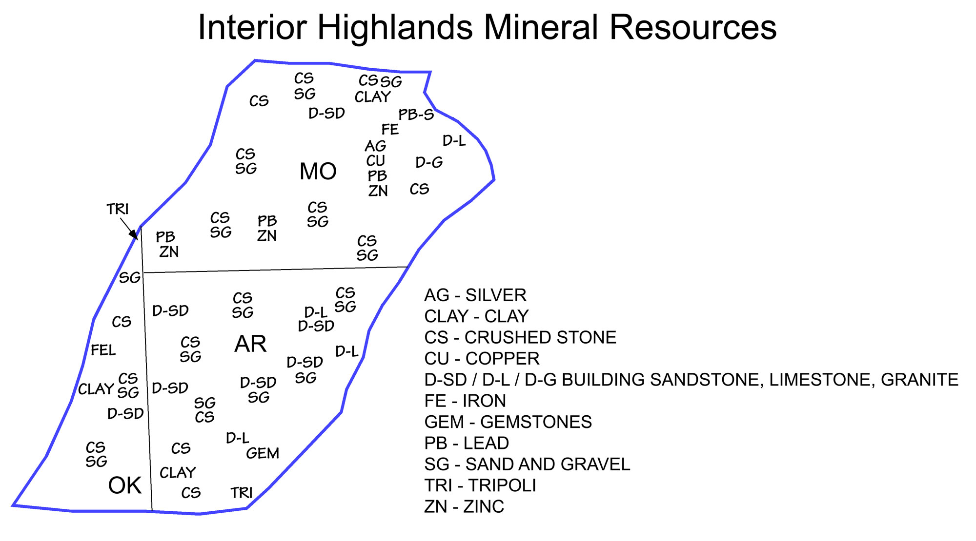
Principal mineral resources of the Interior Highlands. Image adapted from the USGS 2009 State Minerals Yearbook (public domain).
Tripoli and Novaculite
Deposits of tripoli (porous, weathered limestone mixed with silica) and novaculite (a form of chert) are mined in Missouri, Arkansas, and Oklahoma for use as abrasives. Tripoli is also used as filler in plastics, rubber, paint, and even toothpaste! Novaculite has been mined since prehistoric times. Native Americans used it to make arrow and spear points, and it has been quarried for use as whetstones since the 1800s.
Interactive 3D model of a novaculite scraper. Original caption: "Interesting, naturally-fused stone scaper with a novaculite blade. Marksville to Coles Creek Period, c. 100 BCE - 1000 CE. 36mm x 33mm x 11mm, 22.3g Found in Tensas Parish, Louisiana, 2021." Model by Frank McMains (Sketchfab; Creative Commons Attribution 4.0 International license).
Lead
Metals have also generated a historically important mining industry in the Interior Highlands. Lead and other minerals (see below) silver are all found in significant quantities, and are thought to have precipitated from hydrothermal solutions during the Carboniferous and Permian. Lead mining first began in southeastern Missouri around 1720, and it has continued into the present. There are three mining districts in the Missouri portion of the Ozark Uplift: the Southeast Lead District, the Tri-State, and the Central.
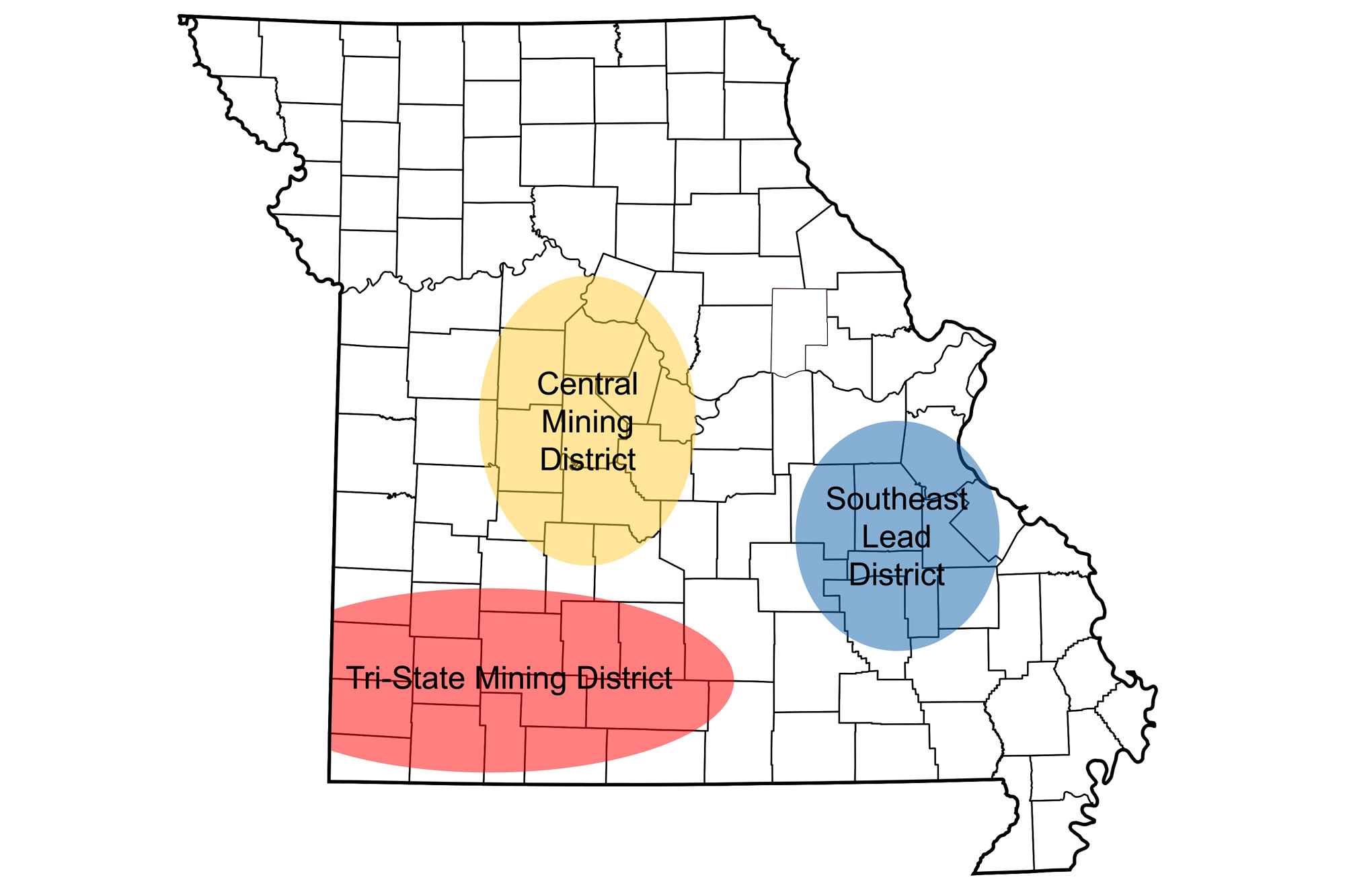
Approximate locations of the three major lead mining regions of Missouri. Image by Jonathan R. Hendricks for the Earth@Home project.
Southeast Lead District
The Southeast Lead District includes the Old Lead Belt on the eastern side of the St. Francois Mountains and the New Lead Belt on the western side. Smaller, localized deposits of lead ores are located in northern Arkansas and southeastern Oklahoma. The Southeast Lead District contains the highest known concentration of galena, a lead-bearing ore, in the world.
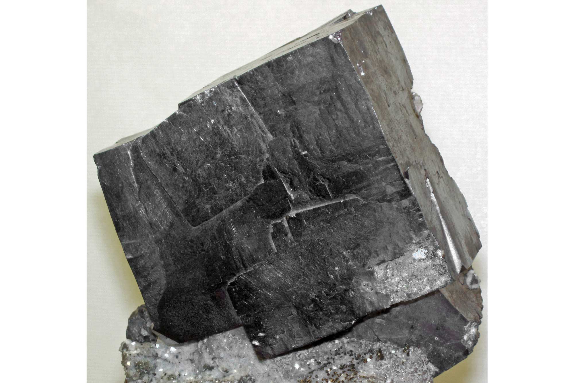
A sample of the mineral galena from Missouri. Photograph by James St. John (Flickr; Creative Commons Attribution 2.0 generic license).
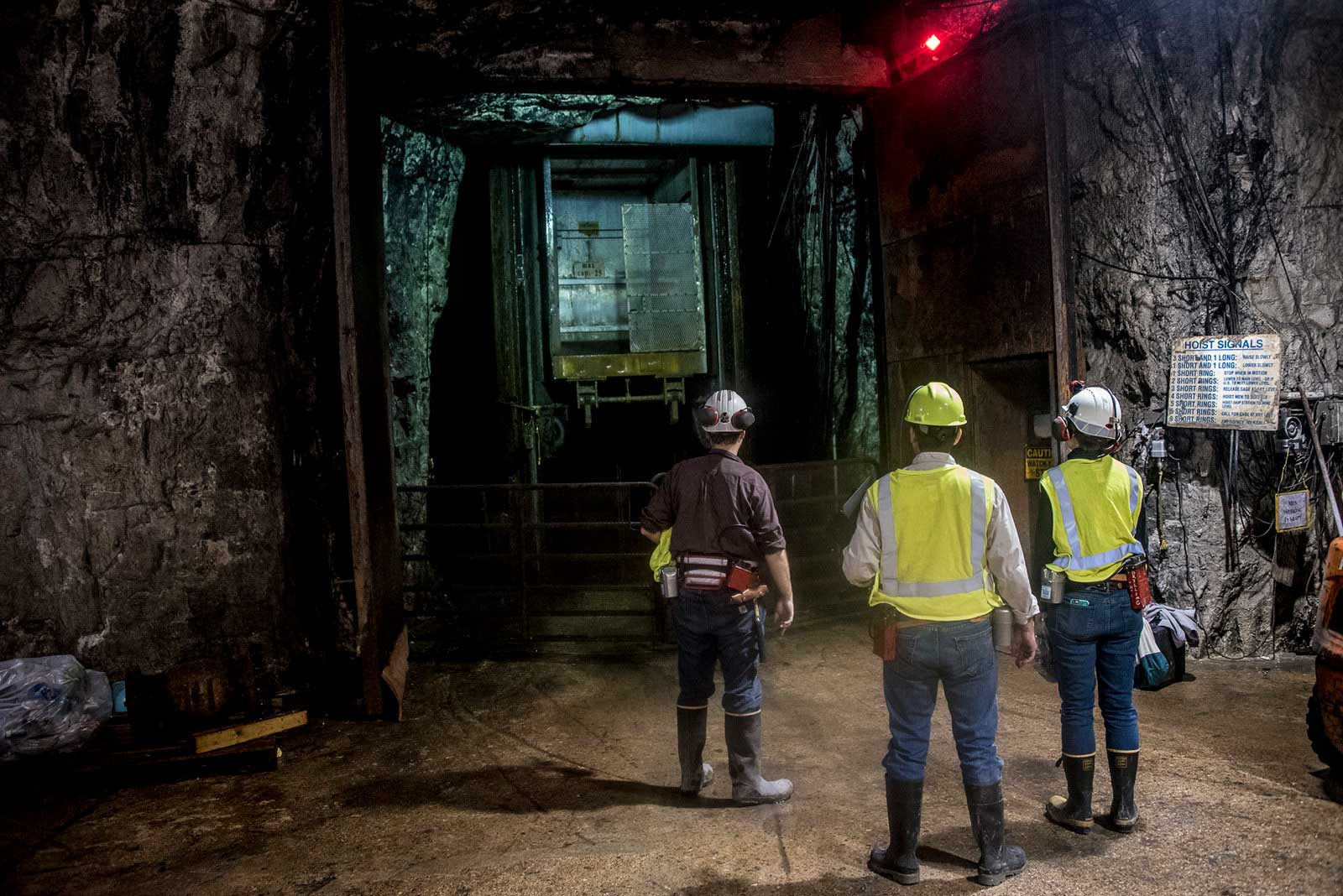
The inside of an underground lead mine in southeastern Missouri. Image by the Bureau of Land Management (Flickr; Creative Commons Attribution 2.0 Generic license).
Tri-State Mining District
Of Missouri’s three mining districts, perhaps the most famous is the Tri-State, which includes southwest Missouri around Joplin, and adjacent areas in southeast Kansas and northeast Oklahoma.
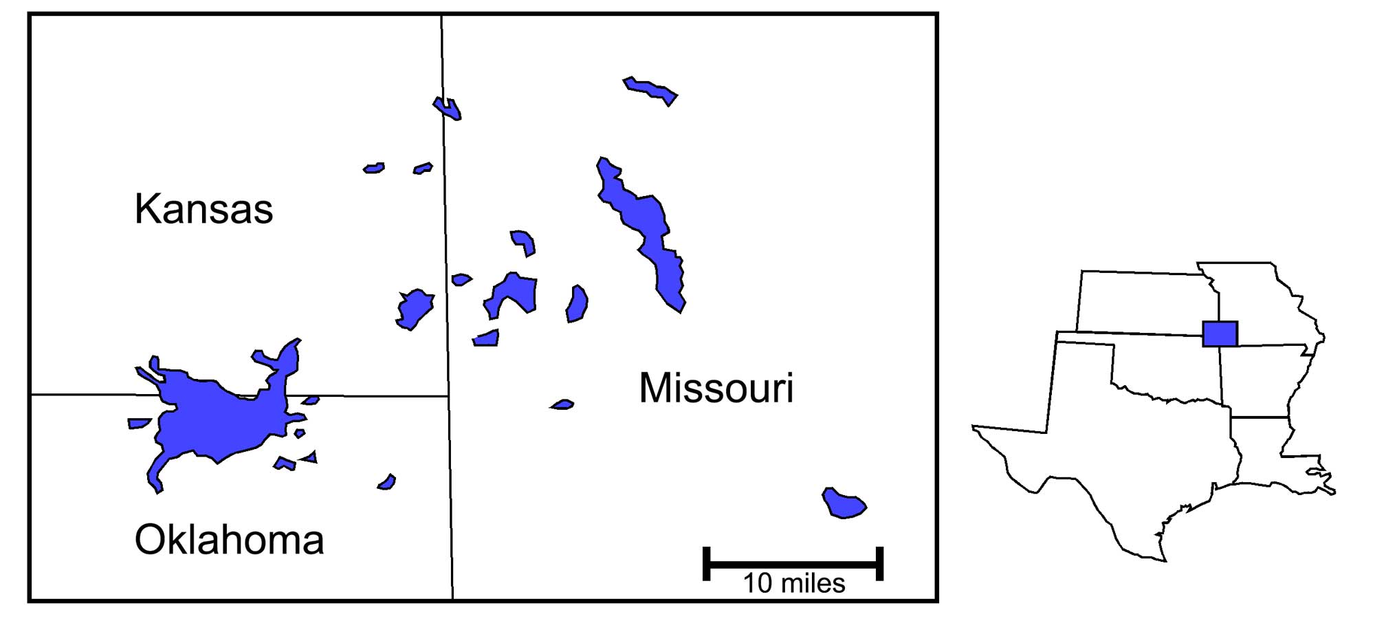
Locations of deposits of lead and zinc in the Tri-State mining district. Image modified from original by Wade Greenberg-Brand.
The discovery of ore in Joplin occurred in 1838, and mining reached full swing by the beginning of the Civil War. Both sides fought over the mines, each trying to secure a source of lead for the war effort. This conflict resulted in the suspension of most mining operations until after the war’s end. Lead mining resumed after the war, and zinc production began in the early 1870s.
In the western part of the Tri-State District, the ore bodies are deeper, and mining was conducted underground, but in the east the ore bodies are shallower and were mined using pits. Production of metals from the district fluctuated with the economic fortunes of the country and the need for wartime supplies. Production began dropping after World War II, and the last mine closed in 1970. During the district’s life, 4000 mines produced 23 million tons of zinc concentrates and 4 million tons of lead concentrates, accounting for 50% of the zinc and 10% of the lead used in the US. Today, some of the Tri- State’s mines have become Superfund sites due to the quantities of toxic waste left behind after the closure of the mines. The Tar Creek Superfund site, located near the towns of Picher and Cardin in Oklahoma, was originally a major lead-zinc mining area. After its closure, the mine left behind about 75 million tons of chat, or lead-contaminated dust.
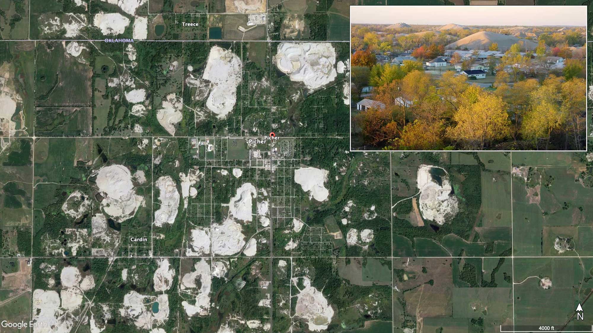
Google Earth satellite image of the ghost town of Picher, Oklahoma; the white colored blobs are piles of chat. Inset image shows a residential area in Ottawa County, Oklahoma near the Tar Creek site. Note the proximity of several large lead-contaminated chat piles. Photograph by the EPA (public domain).
Waste materials, acids, and heavy metals have seeped into the groundwater, contaminating local aquifers and other freshwater sources. The severe environmental and health impacts of Tar Creek’s mining waste have lead the EPA to declare Picher, Oklahoma as one of the most toxic places in the U.S.
Other metals
In addition to lead and zinc, mines in the Interior Highlands have also produced significant quantities of silver and copper. Other metallic elements are also present, including cadmium, nickel, and cobalt. Pyrite, calcite, dolomite, and quartz specimens from the region are highly prized by collectors.
Mining for iron ore began in Missouri in the mid-19th century, and has been intermittent since 2000. The ores precipitated from hydrothermal solutions, filling sinkholes and fractures in limestone, dolomite, and the Precambrian rocks of the St. Francois Mountains. The Interior Highlands’ iron mines produce hematite and magnetite, unique among the iron ores for its magnetic properties.
Resources
Resources from the Paleontological Research Institution
Digital Atlas of Ancient Life: Minerals (collection of 3D models on Sketchfab): https://skfb.ly/6WxTo
Digital Encyclopedia of Earth Science: Minerals: https://earthathome.org/de/minerals/