

Snapshot: Overview of the topography of the Interior Highlands region of the South-Central United States, including portions of Missouri, Arkansas, and Oklahoma.
Topics covered on this page: Overview; Ouachita Mountains; Arkansas Valley; Ozark Uplift; Resources.
Credits: Most of the text of this page is derived from "Topography of the South Central US" by Richard A. Kissel and Alex F. Wall, chapter 4 in The Teacher-Friendly Guide to the Earth Science of the South Central US, edited by Mark D. Lucas, Robert M. Ross, and Andrielle N. Swaby (published in 2015 by the Paleontological Research Institution). The book was adapted for the web by Elizabeth J. Hermsen and Jonathan R. Hendricks in 2021–2022. Changes include formatting and revisions to the text and images. Credits for individual images are given in figure captions.
Updates: Page last updated February 9, 2022.
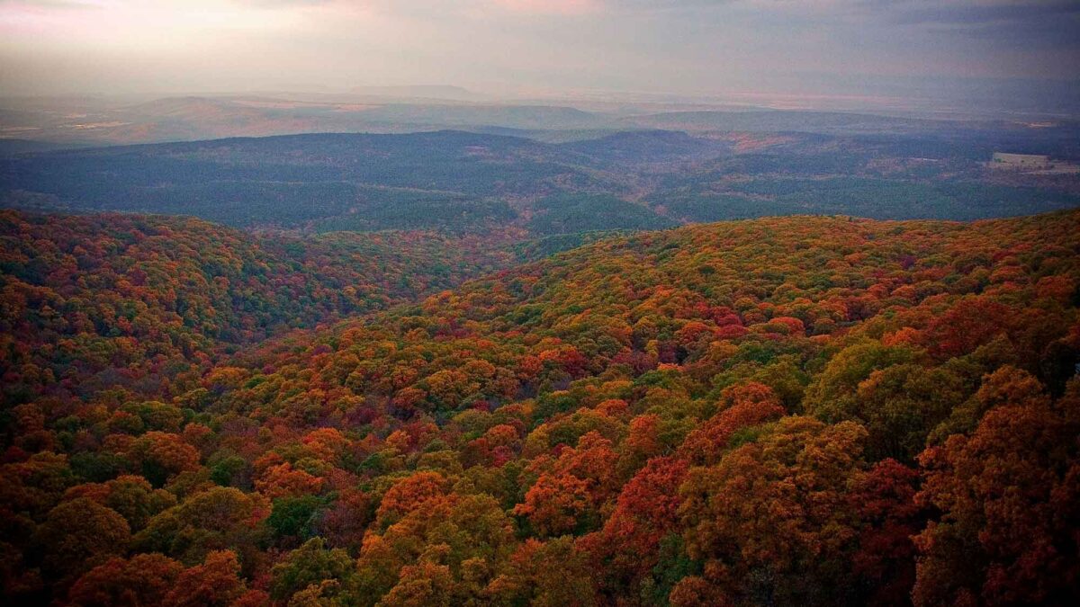
Image above: View of the Ozarks from the top of Mount Magazine, Arkansas. Photograph by "Anna" (Flickr; Creative Commons Attribution-NonCommercial 2.0 Generic license).
Overview
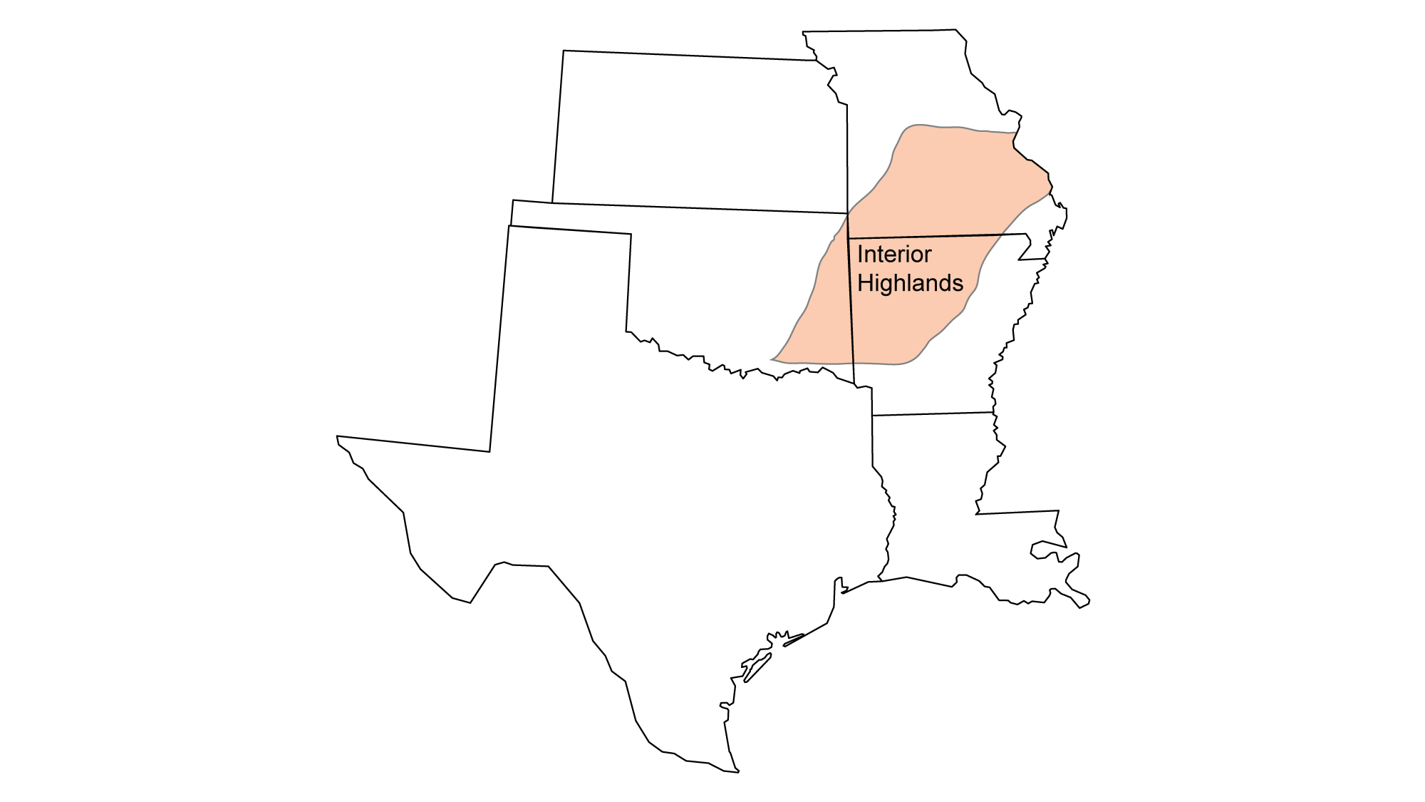
The Interior Highlands is a mountainous region that spans Oklahoma, Arkansas, and Missouri. It is the only major highland region between the Appalachian and Rocky mountains. Its three major topographic divisions are the Ouachita Mountains, Arkansas Valley, and Ozark Uplift.
The three major topographic divisions of the Interior Highlands: the Ouachita Mountains, Arkansas Valley, and Ozark Uplift. Image modified by original by Wade Greenberg-Brand, in turn adapted from image by G. G. Huffman, Oklahoma Geological Survey.
Ouachita Mountains
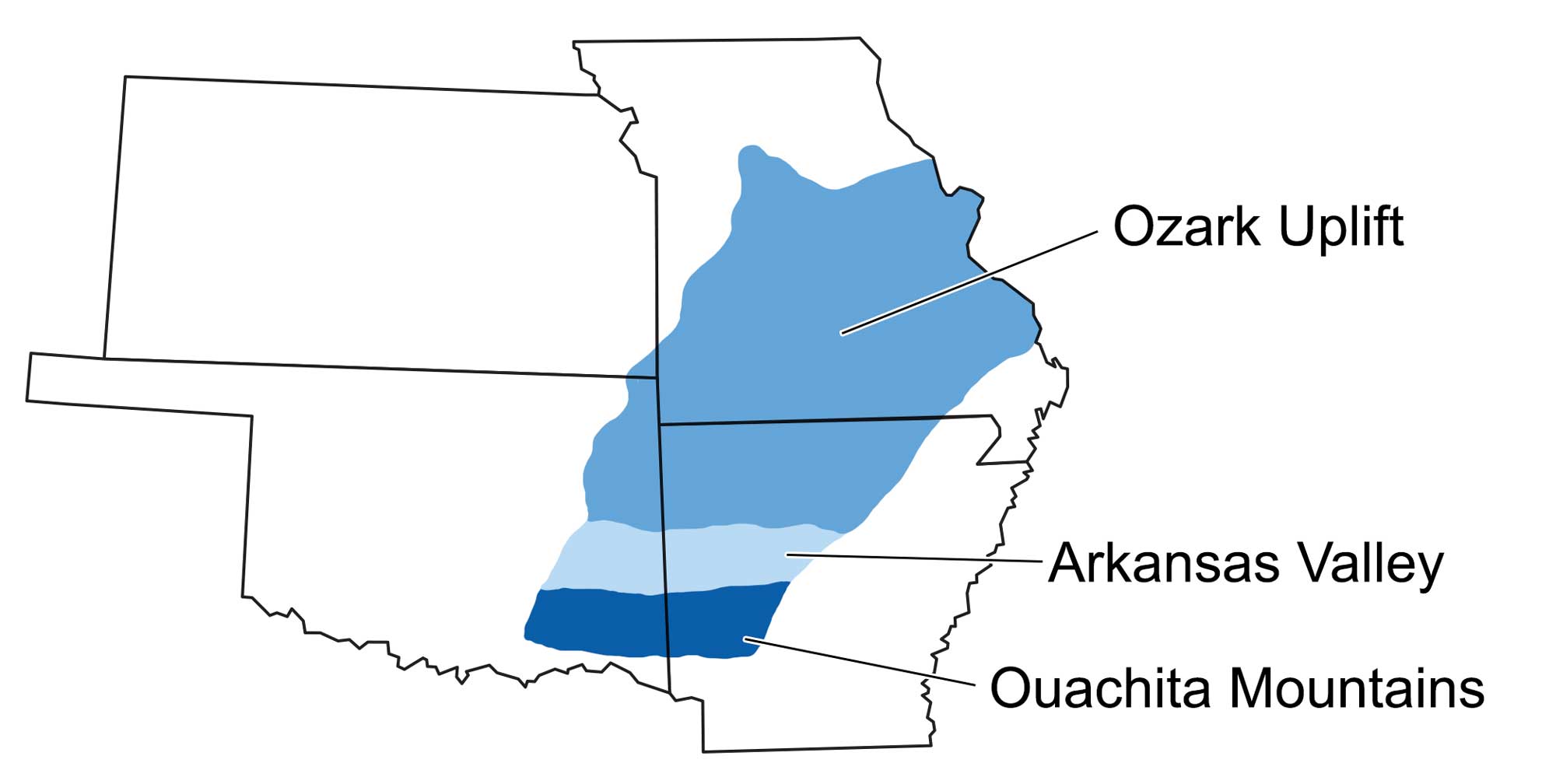
The Ouachita Mountains of southeastern Oklahoma and west central Arkansas formed during the Carboniferous, when the ocean between Gondwana and North America (known as Laurussia at this time) began to close. Initially, this collision created the Appalachian Mountains. Later, Gondwana’s collision with the North American continent during the Pennsylvanian generated the folding and faulting event that led to the formation of the Ouachita Mountains.
Earth 300 million years ago, during the end of the Carboniferous Period (Pennsylvanian). Pangaea was completed when North America finally collided with Gondwana. Reconstruction created using basemap from the PALEOMAP PaleoAtlas for GPlates and the PaleoData Plotter Program, PALEOMAP Project by C. R. Scotese (2016); map annotations by Jonathan R. Hendricks & Elizabeth J. Hermsen for PRI's Earth@Home project (CC BY-NC-SA 4.0 license).
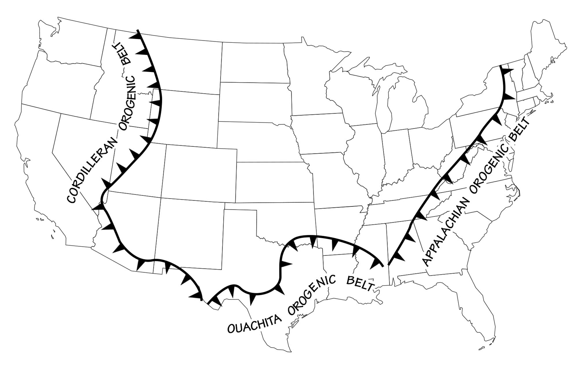
Geographic orientations of the major mountain ranges of the continental United States. Image by Wade Greenberg-Brand, adapted from image by Budnik, R. T., 1986, Left-lateral intraplate deformation along the Ancestral Rocky Mountains: implications for late Paleozoic plate motions, Tectonophysics, 132: 195–214.
East-west mountain ranges are quite unusual in North America, and the fact that most mountain ranges here are north-south has interesting cultural implications. As settlement and migration occurred over the continent, the mountains formed barriers, forcing regional isolation and lifestyle changes. This is different from the spread of humans through Asia and Europe, where most mountains run east-west, resulting in migration along latitudinal lines that allowed for similar climate and growing seasons throughout the path of settlement.
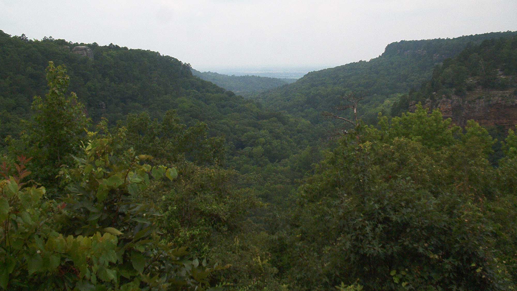
Today, the rounded topography of the Ouachitas speaks to their age. These mountains are distinctive in that volcanism, metamorphism, and intrusions are notably absent throughout most of the range. The lack of weathering-resistant rocks has also helped to shape these mountains. Much like the similarly-aged Appalachians, the Ouachitas’ once-great peaks have been blunted by 300 million years of weathering and erosion.
Arkansas Valley
The Arkansas Valley is situated between the Ouachita Mountains and Ozark Uplift. During the Ouachita Orogeny, as the mountains were folded upward, the rock of the Arkansas Valley was warped downward. This is a structural trough, meaning it was created through deformation of the crust as opposed to being carved by a river or other process of erosion. The Arkansas Valley is up to 65 kilometers (40 miles) in width, and its area includes features common to the Ouachitas and the Ozarks. The Arkansas Valley Hills subdivision, to the northeast of the Arkansas River, contains dissected plateaus similar to but much lower in height than those of the Ozarks. To the south of the Arkansas River, the valley is filled with folded strata and ridges that mark a transition to the Ouachita mountain system.
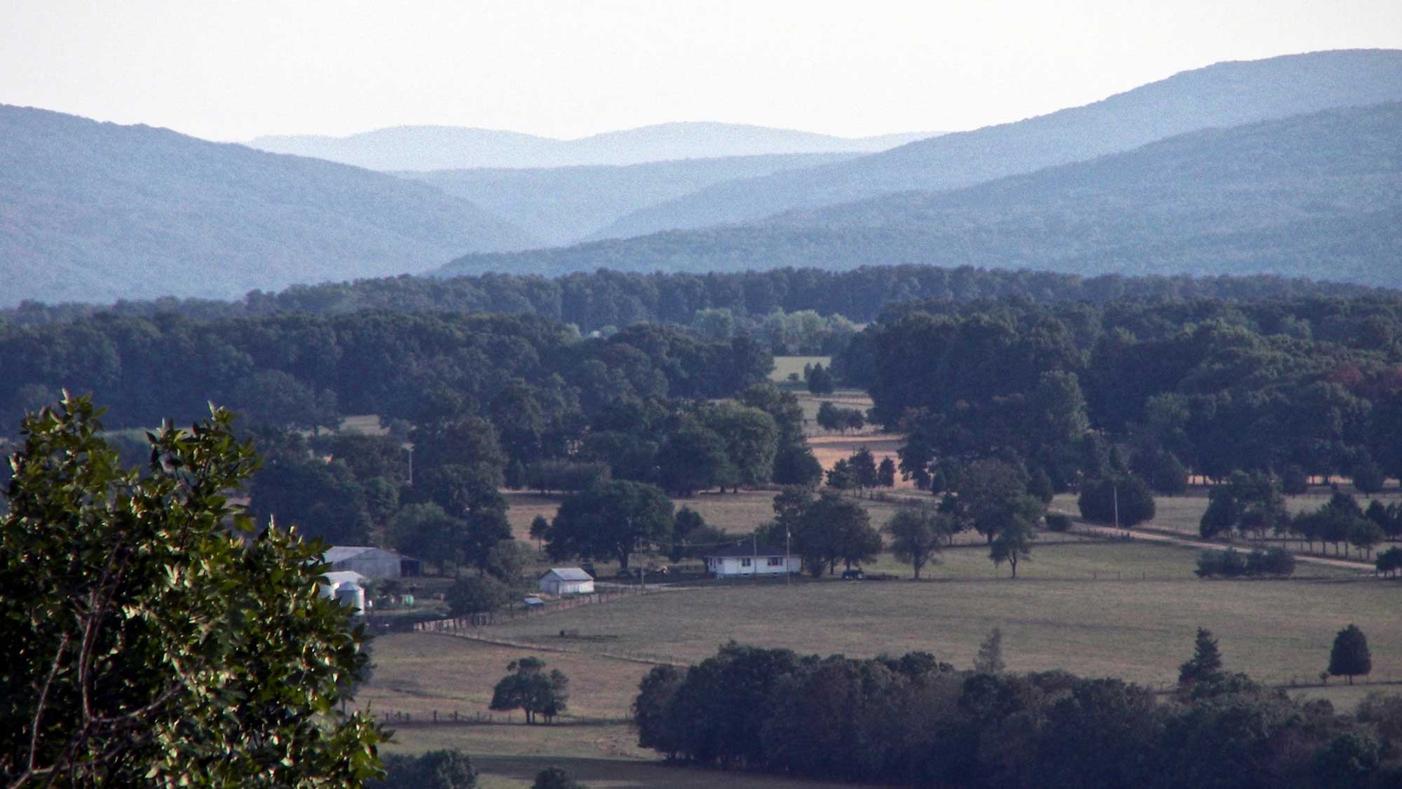
The Arkansas Valley also has its own set of characteristic physical features: isolated flat-topped mesas.
The flat-topped mesas of the Arkansas Valley, viewed from atop Petit Jean Mountain. Photograph by "Audreylski" (Wikimedia Commons; Creative Commons Attribution-Share Alike 3.0 Unported license).
One of these, Mount Magazine, is the highest point of the Interior Highlands, reaching 839 meters (2753 feet). Some 670 meters (2200 feet) separate its summit from the valleys that surround it. Both the flat floor of the valley and the steep sides of the mesas are a result of erosion by the Arkansas River.
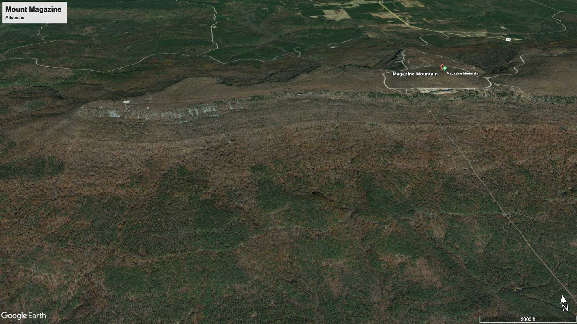
Mount Magazine, Arkansas. Image from Google Earth (Landsat / Copernicus).
Ozark Uplift
The Ouachita Orogeny led to the formation of both the Ouachita Mountains and the Ozark Uplift to the north. The two areas, however, formed in very different ways, which significantly affected the region’s topography. The Ouachitas are the result of folding, and their rock units are twisted and tilted; in contrast the Ozark Uplift is the result of uplift during the orogeny, and the strata there are therefore fairly horizontal. Since their initial uplift in the late Paleozoic, stream and river valleys have extensively dissected the Ozarks, carving into the once-flat plateau. The radial areas between these streams are often so broad as to make travelers think they are traversing a flat terrain. The Boston Mountains represent the highest section of the Ozark Uplift, with the highest named peak—Turner Ward Knob—standing at 751 meters (2463 feet) in elevation, but nearby, unnamed peaks reach beyond 760 meters (2500 feet).
The Saint Francois Mountains in southeast Missouri are the core of the Ozarks, representing an exposed portion of an igneous mountain chain from the Precambrian.
The Saint Francois Mountains, viewed from the top of Knob Lick Mountain, Missouri. Photograph by "Kbh3rd" (Wikimedia Commons; Creative Commons Attribution-Share Alike 3.0 Unported license).
They contain the tallest point of the Ozark area and the highest point within Missouri, achieving altitudes of nearly 610 meters (2000 feet) above sea level. The Saint Francois Mountains are thought to represent the only part of the American Midwest that was not submerged by the shallow seas of the Paleozoic and Mesozoic.
In Missouri, the action of groundwater contributed to the formation of more than 6000 caves and caverns within the state’s Paleozoic limestones. Missouri is famous for its caves, and many of them are popular tourist attractions. Meramec Caverns, Missouri’s most visited cave, is a limestone cavern system extending 7.4 kilometers (4.6 miles) beneath the Ozarks. Another cave can be explored at Onondaga Cave State Park.
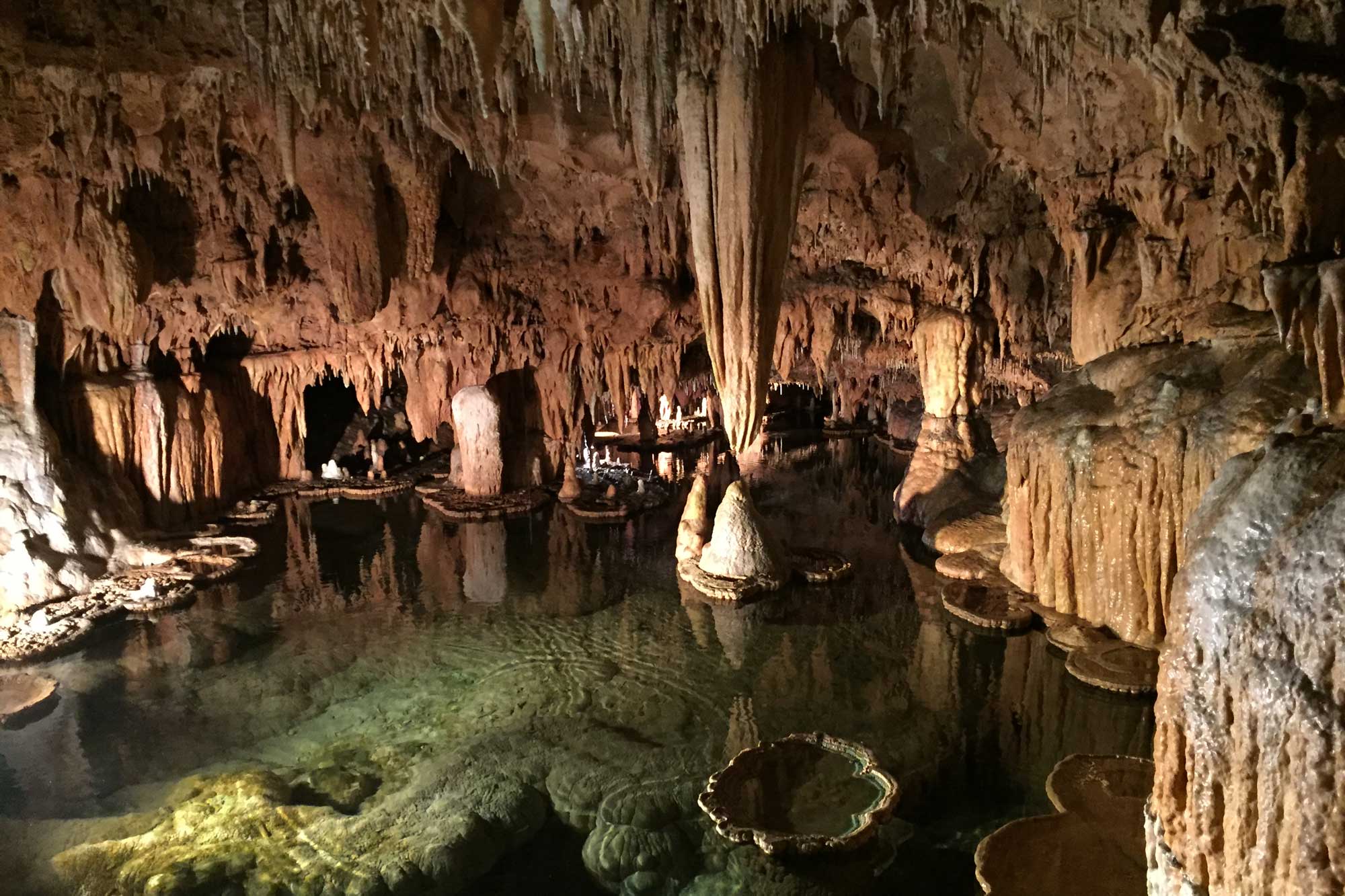
A cavern inside of Onondaga Cave State Park, Missouri. Photograph by Jonathan R. Hendricks.
Other famous locations include the Mark Twain Cave, which is the oldest public cave in the state; it played a pivotal role in Twain’s The Adventures of Tom Sawyer. These types of caverns—as well as sinkholes—are common in areas with limestone bedrock, which is easily dissolved by the acids in groundwater and rain. Such dissolution over long periods of time eventually leads to the formation of karst topography. This landscape of fractured rock can include features like towers, terraces, and complex drainage systems, which appear both above and beneath the surface of the bedrock.