Page snapshot: Arkansas State Geologic Map; Fossil; Rock; Mineral; Gem; Highest and Lowest Elevations; Places to Visit; and Additional Resources.
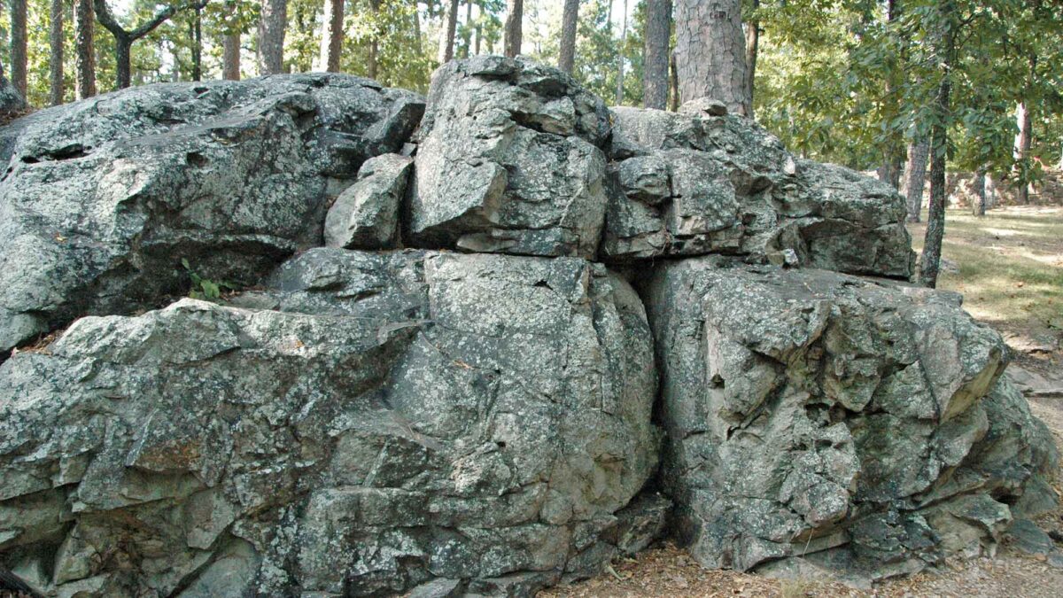
Image above: Late Paleozoic Arkansas Novaculite, a metachert at the ZigZig Mountains, Arkansas. Photograph by James St. John (Flickr; Creative Commons Attribution 2.0 Generic license; image resized).
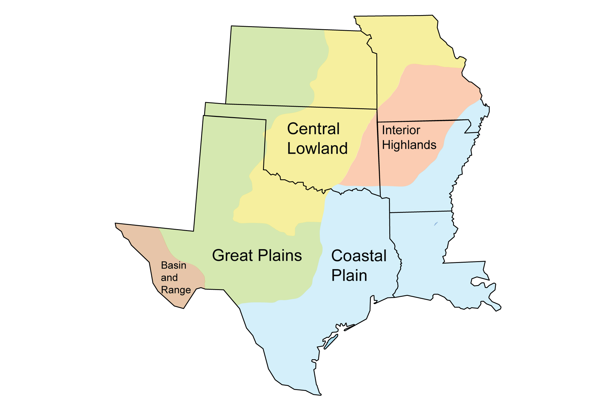
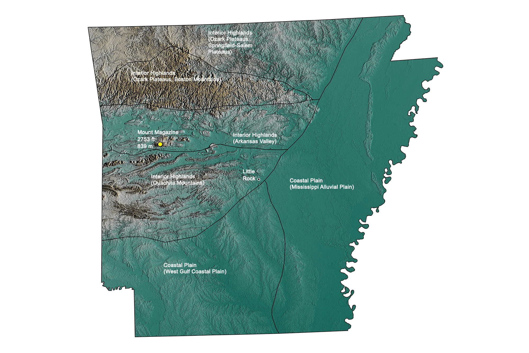
Geologic Map of Arkansas
Geologic map of Arkansas showing maximum ages of mappable units. Image by Jonathan R. Hendricks for the Earth@Home project developed using QGIS and USGS data (public domain) from Fenneman and Johnson (1946) and Horton et al. (2017).
Arkansas State Fossil (Dinosaur): Arkansaurus
Arkansas does not have an official state fossil, but it does have a state dinosaur: Arkansaurus fridayi. This small theropod (predatory dinosaur with three-toed feet) was found in Early Cretaceous-aged rocks and was named the state dinosaur of Arkansas in 2017.
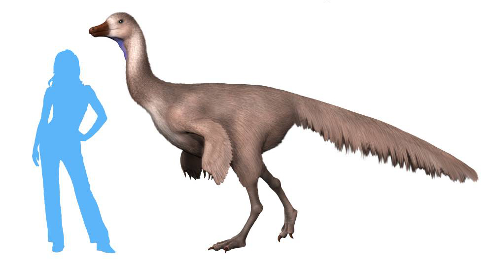
Reconstruction of Arkansaurus fridayi. Image by Nobu Tamura (Wikimedia Commons; Creative Commons Attribution-ShareAlike 4.0 International license).
Exploring Arkansas: "Arkansaurus" (video via YouTube). In this video, Joe Friday describes discovering the bones of Arkansaurus.
Arkansas State Rock: Bauxite
This reddish brown rock is made up of chemically weathered Paleocene soils that were consolidated through weathering processes. Bauxite is a principle ore of aluminum and is economically important in Arkansas.
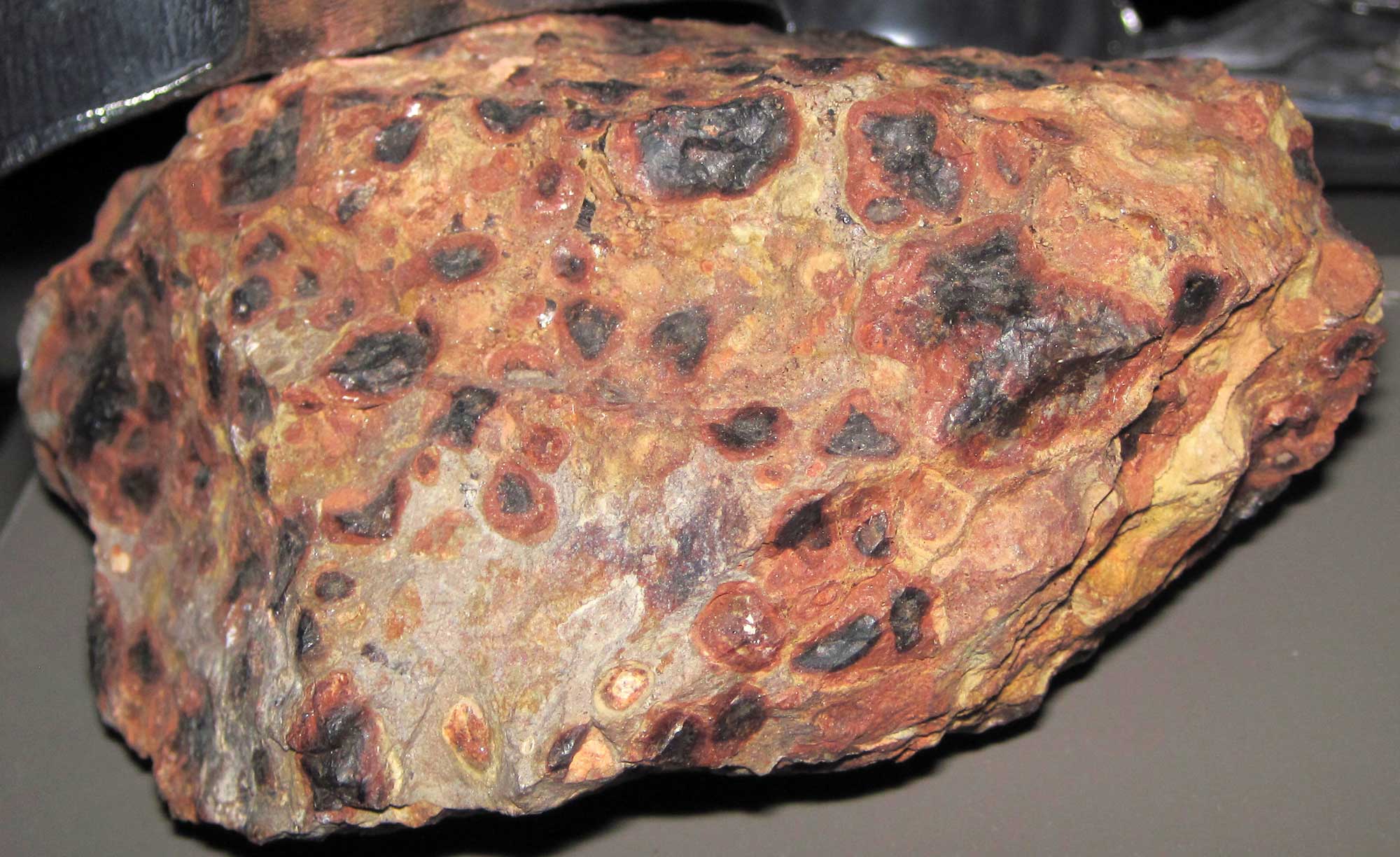
Sample of bauxite, likely from Arkansas. Photograph by James St. John (Flickr; Creative Commons Attribution 2.0 Generic license).
Arkansas State Mineral: Quartz
Arkansas produces some of the highest quality quartz crystals in the world. Most of the state’s quartz deposits are found in the Ouachita Mountains, where they crystallized into veins from hydrothermal solutions during the last phases of mountain building.
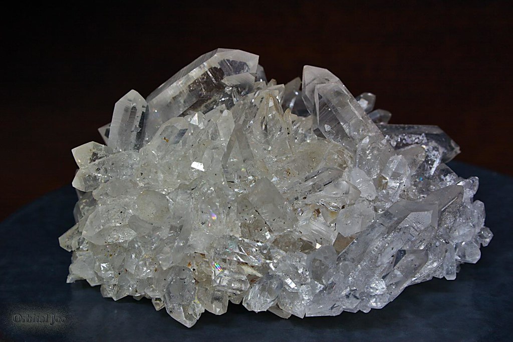
Quartz crystals from Arkansas. Photograph by "Orbital Joe" (Flickr; Creative Commons Attribution-NonCommercial-NoDerivs 2.0 Generic license).
Arkansas State Gem: Diamond
The diamonds of Arkansas originated in the mantle, where they crystallized approximately three billion years ago. Today, they are found in the remains of a 95-million-year-old eroded volcano whose exposed lava pipes were channels for magma that brought these diamonds from the mantle to the surface.
The public may collect diamonds at Crate of Diamonds State Park in Arkansas. The Strawn-Wagner Diamond was discovered at this location and is the largest diamond ever found in the United States.
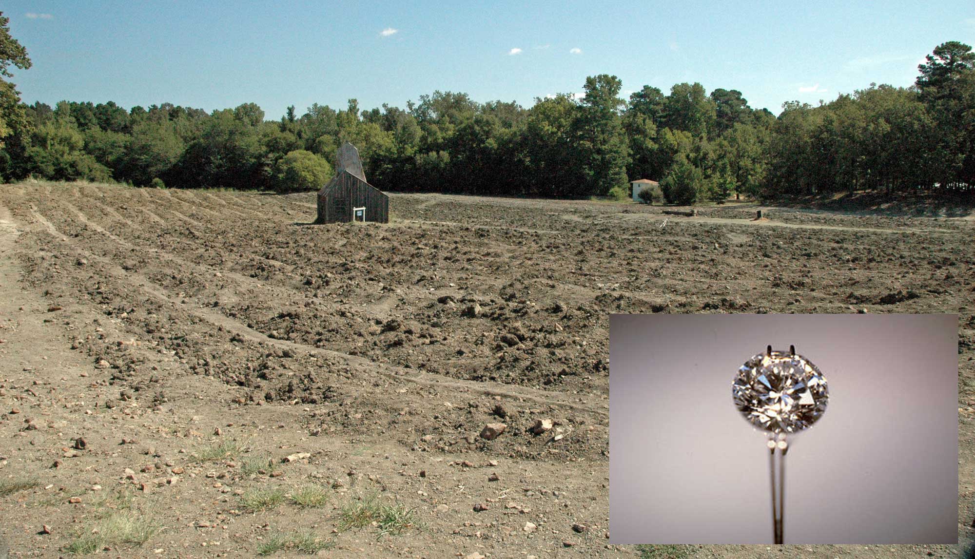
Crater of Diamonds State Park in Arkansas (photograph by James St. John; Flickr; Creative Commons Attribution 2.0 Generic license; inset image added). Inset image shows the Strawn-Wagner Diamond, which was found at this location; image by Swcom (Wikimedia Commons; Creative Commons Attribution-ShareAlike 3.0 license).
Arkansas's Highest and Lowest Elevations
Topographic map of Arkansas; greens indicate lower elevation, browns higher elevation. Topographic data derived from the Shuttle Radar Topography Mission (SRTM GL3) Global 90m (SRTM_GL3) (Farr, T. G., and M. Kobrick, 2000, Shuttle Radar Topography Mission produces a wealth of data. Eos Trans. AGU, 81:583-583.). Image created by Jonathan R. Hendricks for the Earth@Home project.
Highest Elevation: Mount Magazine
The highest point in Arkansas is Signal Hill, which is 839 meters (2753 feet) high. It is one of two peaks on Mount Magazine, a flat-topped plateau located in the Ozark National Forest.
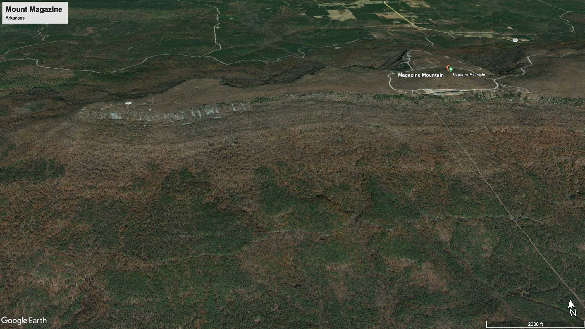
Mount Magazine, Arkansas. Image from Google Earth (Landsat / Copernicus).
Lowest Elevation: Ouachita River
Arkansas’ lowest point, at 17 meters (55 feet) above sea level, is the portion of the Ouachita River that enters northeastern Louisiana.
Places to Visit
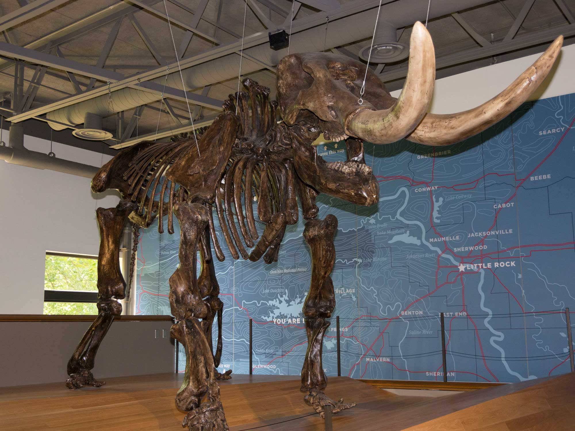
Mastodon skeleton on display at the Mid America Science Museum. Photograph by Dave Thomas (Flickr; Creative Commons Attribution-NonCommercial 2.0 Generic license).
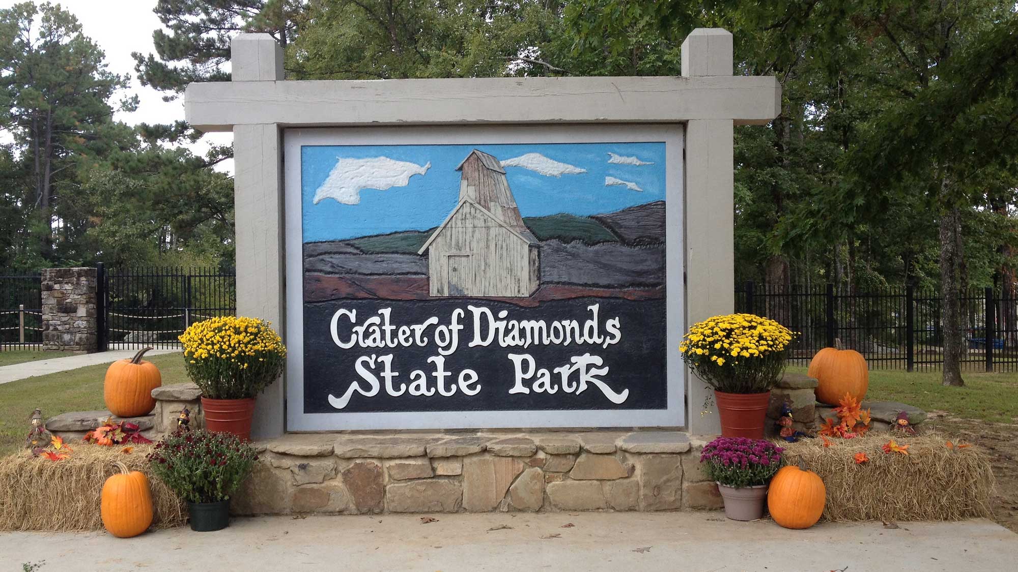
Greeting sign at Crater of Diamonds State Park in Arkansas, where the largest diamond ever found in the United States was discovered. Photograph by "Mindy" (Flickr; Creative Commons Attribution-NonCommercial-ShareAlike 2.0 Generic license; image cropped and resized).
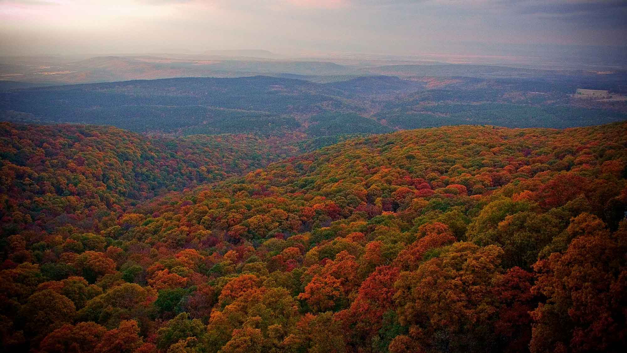
View of the Ozarks from the top of Mount Magazine, Arkansas. Photograph by "Anna" (Flickr; Creative Commons Attribution-NonCommercial 2.0 Generic license).
Additional resources