

Topics covered on this page: Overview; Missouri; Kansas; Oklahoma; Texas.
Credits: Most of the text of this page is derived from "Rocks of the South Central US" by Richard A. Kissel, Alex F. Wall, and Andrielle N. Swaby, chapter 2 in The Teacher-Friendly Guide to the Earth Science of the South Central US, edited by Mark D. Lucas, Robert M. Ross, and Andrielle N. Swaby (published in 2015 by the Paleontological Research Institution). The book was adapted for the web by Elizabeth J. Hermsen and Jonathan R. Hendricks in 2021–2022. Changes include formatting and revisions to the text and images. Credits for individual images are given in figure captions.
Updates: Page last updated January 19, 2022.
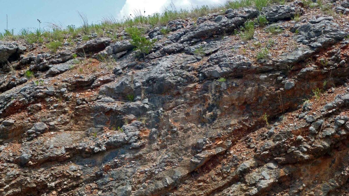
Image above: Tilted sedimentary rocks in the Arbuckle Mountains of southern Oklahoma. Photograph by Granger Meador (Flickr; Creative Commons Attribution-NonCommercial 2.0 Generic license; image cropped and resized).
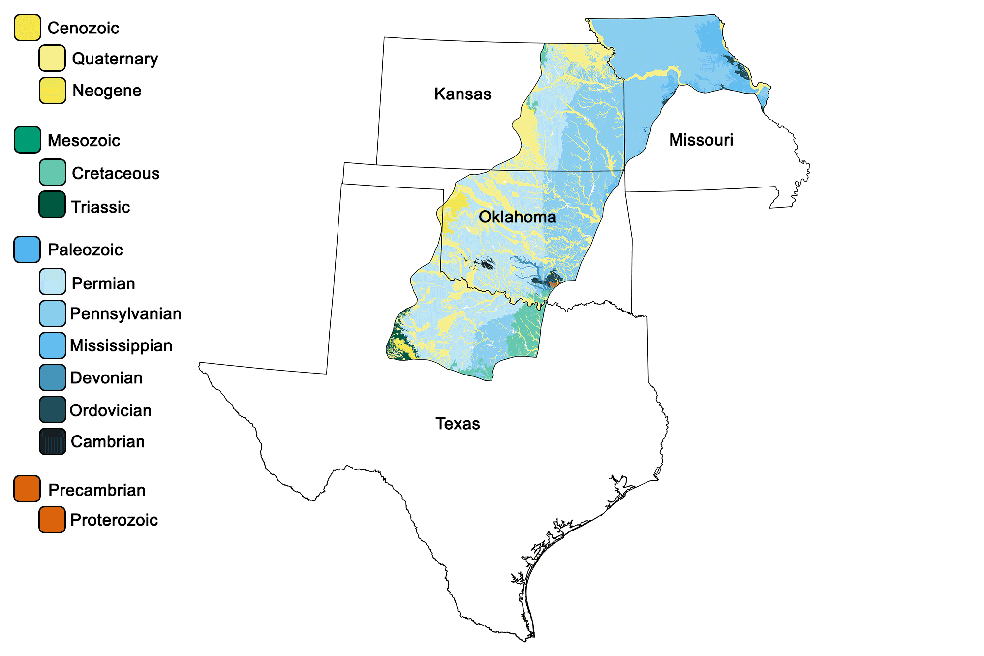
Geologic map of the Central Lowland region of the South-Central United States showing maximum ages of mappable units. Image by Jonathan R. Hendricks for the Earth@Home project developed using QGIS and USGS data (public domain) from Fenneman and Johnson (1946) and Horton et al. (2017).
Overview
The rocks of the Central Lowland, extending from northern Missouri southward into northern Texas, are primarily marine in nature. These sediments were mainly deposited during the late Paleozoic, as a shallow sea covered most of the area during the Carboniferous and Permian periods.
Missouri
Missouri’s Central Lowland is composed almost entirely of Carboniferous-aged deposits, produced from the erosion of eastern mountains formed by the Appalachian Orogeny. Enormous quantities of sediment were transported westward and deposited within the shallow sea that covered the region. The dominant rocks in this area are Pennsylvanian in age, with a thin strip of Mississippian along their eastern margin. In northwestern Missouri, repeating patterns of marine limestones and shales interbedded with non-marine sandstones indicate that the shallow sea advanced and retreated many times over this area of the state.
The Carboniferous rocks of Missouri are famous for their fossil deposits as well as being important economic sources of lead and zinc. Beneath these deposits lie Precambrian igneous and metamorphic rocks, which form the core of the continent and the basement of the Interior Plains.
Northern Missouri showcases the effects of recent glacial advances in deposits of glacial drift and wind-blown loess. The Loess Hills, found along the Missouri River Valley, extend from Iowa into the northwestern corner of Missouri.
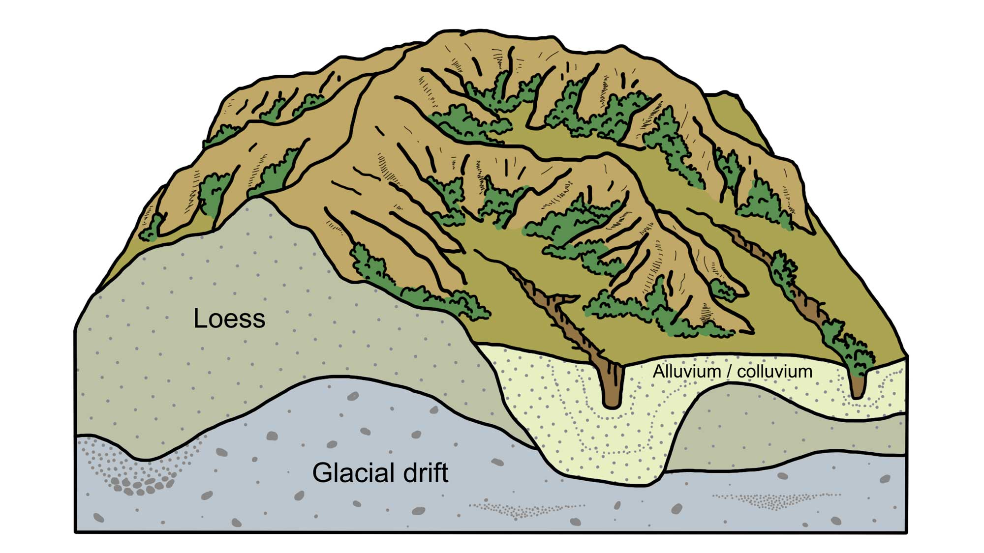
Cross-section of the Loess Hills.
The area also contains plentiful glacial erratics—these large boulders, transported from as far north as Canada, are most commonly composed of granite and quartzite.
Kansas
In Kansas, exposed Paleozoic marine rocks decrease in age as one moves westward. The oldest rocks, from the Pennsylvanian, dominate the eastern margin of the state, and chiefly contain sandstones, shales, and limestones.
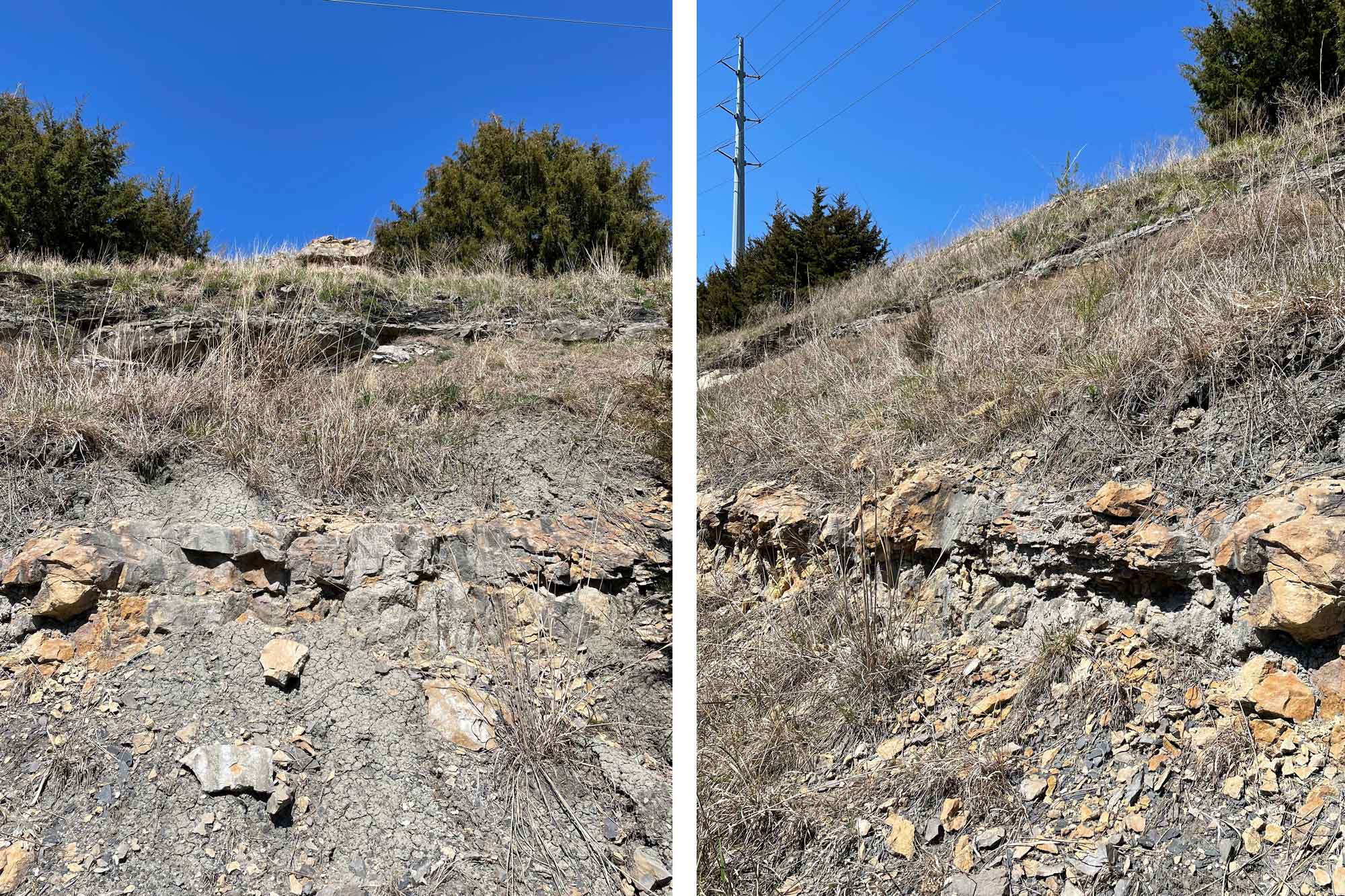
A Pennsylvanian-aged cyclothem deposit near Lawrence, Kansas. Note that some rock layers are more resistant than others and form ridges. Photographs by Bruce Lieberman for the Earth@Home project.
The Cherokee Lowlands, an area of Pennsylvanian strata located in the state’s southeastern corner, are extremely rich in coal; this area is the largest center of coal mining in Kansas. To the west lie the Flint Hills, a band of Permian rocks containing prevalent chert and limestone. Many buildings in this area are constructed out of local limestone.
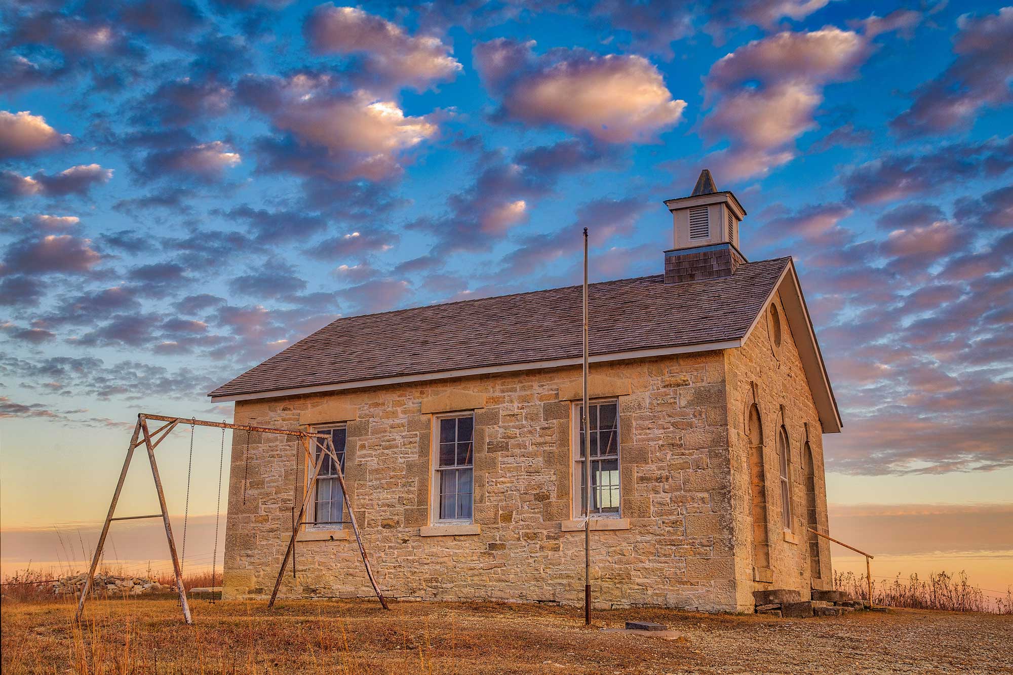
The Lower Fox Creek Schoolhouse at Tallgrass Prairie National Preserve in Chase County, Kansas was completed in 1882. It was built from Permian Cottonwood Limestone from the Flint Hills. Photograph by "Mobilus in Mobili" (Flickr; Creative Commons Attribution-ShareAlike 2.0 Generic license; image resized).
Although most surface rocks in Kansas’ Central Lowland are sedimentary, Woodson and Wilson counties in southeastern Kansas are known for their exposures of lamproite, an intrusive igneous rock that pierced the Paleozoic shales during the Cretaceous. The northeastern corner of the state, while underlain by the same Pennsylvanian and Permian sediments mentioned previously, is covered in glacial drift deposited during the ice age.
Oklahoma
Shallow seas covered Oklahoma during most of the Paleozoic, leading to sedimentary deposits overlying nearly all of the Precambrian igneous and metamorphic bedrock in the Central Lowland. Only a single exposure of Precambrian rocks occurs in the state: the Arbuckle Mountains, which contain a 1.4-billion-year-old core of gneiss and granite capped by Cambrian rhyolite. About 750 million years ago, a rift began to form in what is now southwest Oklahoma. Magma rising to near the surface cooled to form a variety of granitic rocks, which are now the oldest parts of the Wichita Mountains, and the only Oklahoman Cambrian rocks other than those found in the Arbuckles.
During the Carboniferous, rivers flowing through Oklahoma deposited vast deltas, producing a swampy landscape that was periodically flooded by rising sea levels. The alternation of marine and non-marine environments led to the creation of cyclothems, alternating sequences of terrestrial and marine sedimentary layers dominated by thick limestones and dolomites. These Pennsylvanian formations cover almost 25% of Oklahoma’s surface.
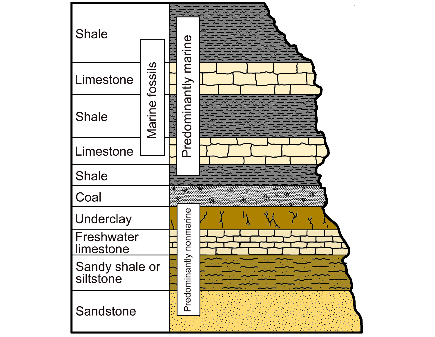
An example of a cyclothem, alternating sequences of marine and nonmarine sedimentary rocks characterized by their light and dark colors. Image modified from original by Wade Greenberg-Brand (after image from Levin, 2006, The Earth Through Time, 8th ed.), published in The Teacher-Friendly Guide to the Geology of the Southeastern U.S., 2nd ed., edited by Andrielle N. Swaby, Mark D. Lucas, and Robert M. Ross (published by the Paleontological Research Institution) (CC BY-NC-SA 4.0 license).
The most intense period of mountain building in the region also occurred during the Pennsylvanian, with the uplift of the Ouachita, Wichita, and Arbuckle mountains. This orogenic episode downwarped the crust and created basins where thick layers of shale, sandstone, and limestone were deposited.
In central Oklahoma, Permian rock predominates; it includes sand and mudstones made up of eroded sediment from the newly-formed Ouachitas, as well as thick layers of salt and gypsum deposited once the sea level began to regress. Terrestrial redbeds are also present and may be observed at Gloss Mountain State Park in Major County.
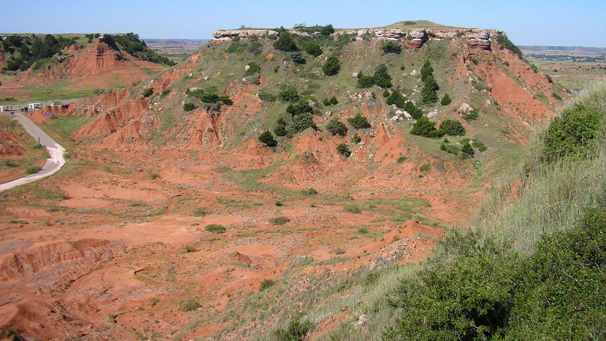
Permian redbeds in Gloss Mountains State Park in Major County, Oklahoma. Photograph by "Okiefromokla" (Wikimedia Commons; public domain).
Texas
In Texas, the Central Lowland is dominated by Permian rock, with a band of Pennsylvanian sediments and a small segment of Cretaceous shoreline sediment found to the east. After the Pennsylvanian rise of the Ouachitas to the north in Oklahoma, shallow seas were filled with sediment.
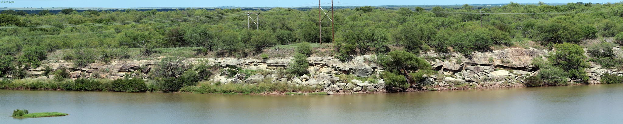
Outcropping of the Permian Nocona Formation near Halsell, Texas. Photograph by "zeesstof" (Flickr; Creative Commons Attribution-NonCommercial-NoDerivs 2.0 Generic license).
As the inland seas retreated, the area became home to broad evaporite basins, where deposits of salt, gypsum, and red muds formed throughout the hot, arid environments of the late Permian. Today, these famous red beds are home to an extensive fauna of fossilized Permian amphibians, reptiles, and synapsids (ancient relatives of mammals).
Resources
Resources from the Paleontological Research Institution
Digital Encyclopedia of Earth Science: Minerals: https://earthathome.org/de/minerals/
Earth@Home: Here on Earth: Rocks: https://earthathome.org/hoe/rocks/
Earth@Home Virtual Collection: Rocks: https://earthathome.org/vc/rocks/ (Virtual rock collection featuring 3D models of rock specimens sorted by type.)