

Snapshot: Overview of the topography of the Coastal Plain region of the northeastern United States.
Topics covered on this page: Overview; Resources.
Credits: Most of the text of this page is derived from "Topography of the Northeastern US: the BIG picture" by Jane E. Ansley, chapter 5 in The Teacher-Friendly Guide to the Geology of the Northeastern U.S. (published in 2000 by the Paleontological Research Institution). The book was adapted for the web by Elizabeth J. Hermsen and Jonathan R. Hendricks in 2020–2023. Changes include formatting and revisions to the text and images. Credits for individual images are given in figure captions.
Updates: Page last updated September 22, 2023.
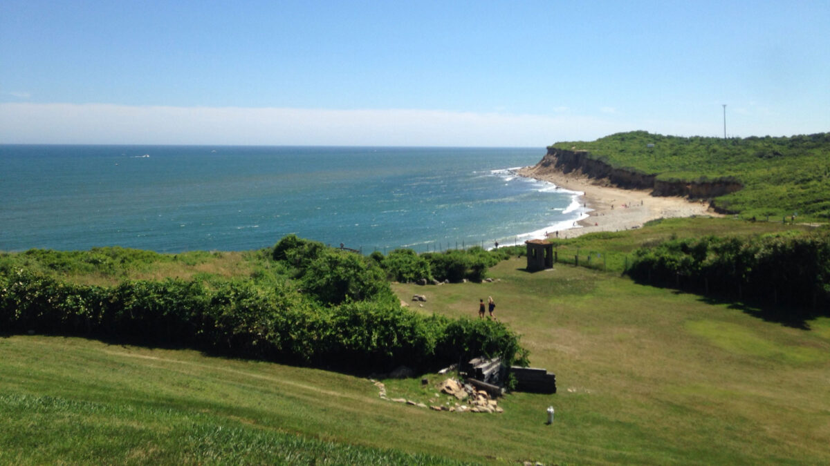
Image above: A beach on the Atlantic Ocean in The Hamptons of Long Island, which is part of the Coastal Plain. Photograph by Mark Jenney (Wikimedia Commons; Creative Commons Attribution-Share Alike 4.0 International license).
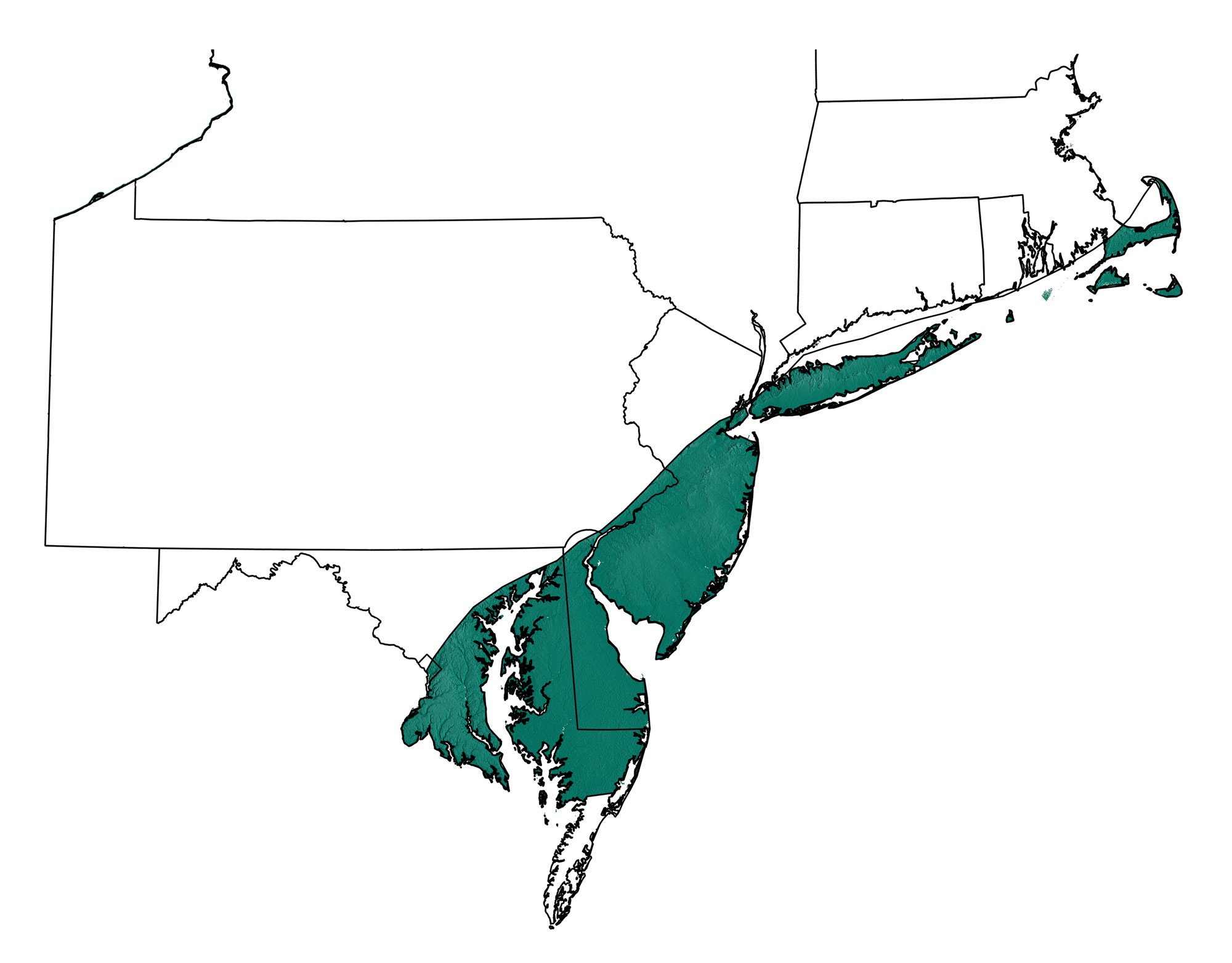
Topographic map showing the region of the northeastern United States occupied by the Coastal Plain; greens indicate lower elevation, browns higher elevation; black lines indicate physiographic boundaries of other provinces. Topographic data derived from the Shuttle Radar Topography Mission (SRTM GL3) Global 90m (SRTM_GL3) (Farr, T. G., and M. Kobrick, 2000, Shuttle Radar Topography Mission produces a wealth of data. Eos Trans. AGU, 81:583-583.). Image created by Jonathan R. Hendricks for the Earth@Home project.
Overview
Generally, the land surface of the Coastal Plain rises only about 30 meters above sea level and dips less than one degree. The primary reason for the flat nature of the Coastal Plain is the unconsolidated sediments that are the ‘bedrock’ of the region. The sediments in the Coastal Plain have not been significantly compacted or cemented and have certainly not become rock. There is little resistance to erosion because of the nature of the sediments, and therefore ridges do not form in the Coastal Plain. There is some moderate difference in relief between the western Coastal Plain and the eastern Coastal Plain due to the ages of the deposits. Cretaceous and Tertiary deposits dominating the western Coastal Plain show more relief than the younger Quaternary deposits that are close to the shoreline and constantly pounded by wave action and flooding.
Long Island, Cape Cod and the smaller islands off the New England Coast, though formed from glacial deposits, have the same flat nature as the topography of the rest of the Coastal Plain. The glacial deposits are unconsolidated sediments that erode as easily as the sediments of the Coastal Plain further south.
The wedge of sediments that forms the bulk of the Coastal Plain eroded from the topographically higher Appalachian/Piedmont region to the west. The hard bedrock of the Appalachian/Piedmont region lies beneath the Coastal Plain, but is deeply buried by the wedge of sediments. The boundary between the exposed Appalachian/Piedmont rocks and the wedge of Coastal Plain sediments is called the Fall Zone.
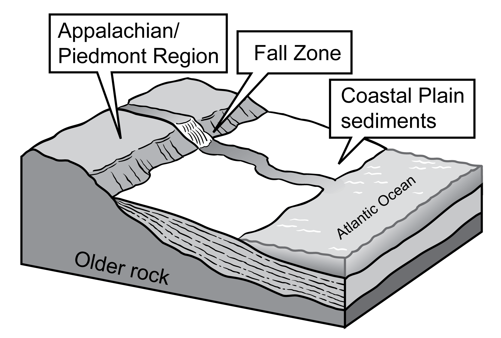
Location of the Fall Zone between the Appalachian/Piedmont and Coastal Plain regions. Figure by J. Houghton, modified for the Earth@Home project.
At numerous places along this boundary line are cascades and small waterfalls, such as the Great Falls of the Potomac. Rivers have eroded very slowly through the Appalachian/Piedmont bedrock and then very quickly through the soft Coastal Plain sediments to create a sharp drop in stream elevation at the Fall Zone.