

Snapshot: Overview of the topography of the Appalachians and Piedmont regions of the northeastern United States.
Topics covered on this page: Overview; The Great Valley; Precambrian Ridges; Taconic Mountains; Piedmont; Rift Basins; The Marble Valley; Resources.
Credits: Most of the text of this page is derived from "Topography of the Northeastern US: the BIG picture" by Jane E. Ansley, chapter 5 in The Teacher-Friendly Guide to the Geology of the Northeastern U.S. (published in 2000 by the Paleontological Research Institution). The book was adapted for the web by Elizabeth J. Hermsen and Jonathan R. Hendricks in 2020–2023. Changes include formatting and revisions to the text and images. Credits for individual images are given in figure captions.
Updates: Page last updated September 22, 2023.
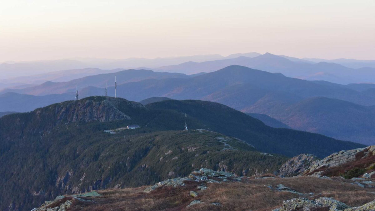
Image above: View from summit of Mount Mansfield in the Green Mountains of Vermont. Photograph by "Mike9827" (Wikimedia Commons; Creative Commons Attribution-Share Alike 4.0 International license; image cropped and resized).
Overview
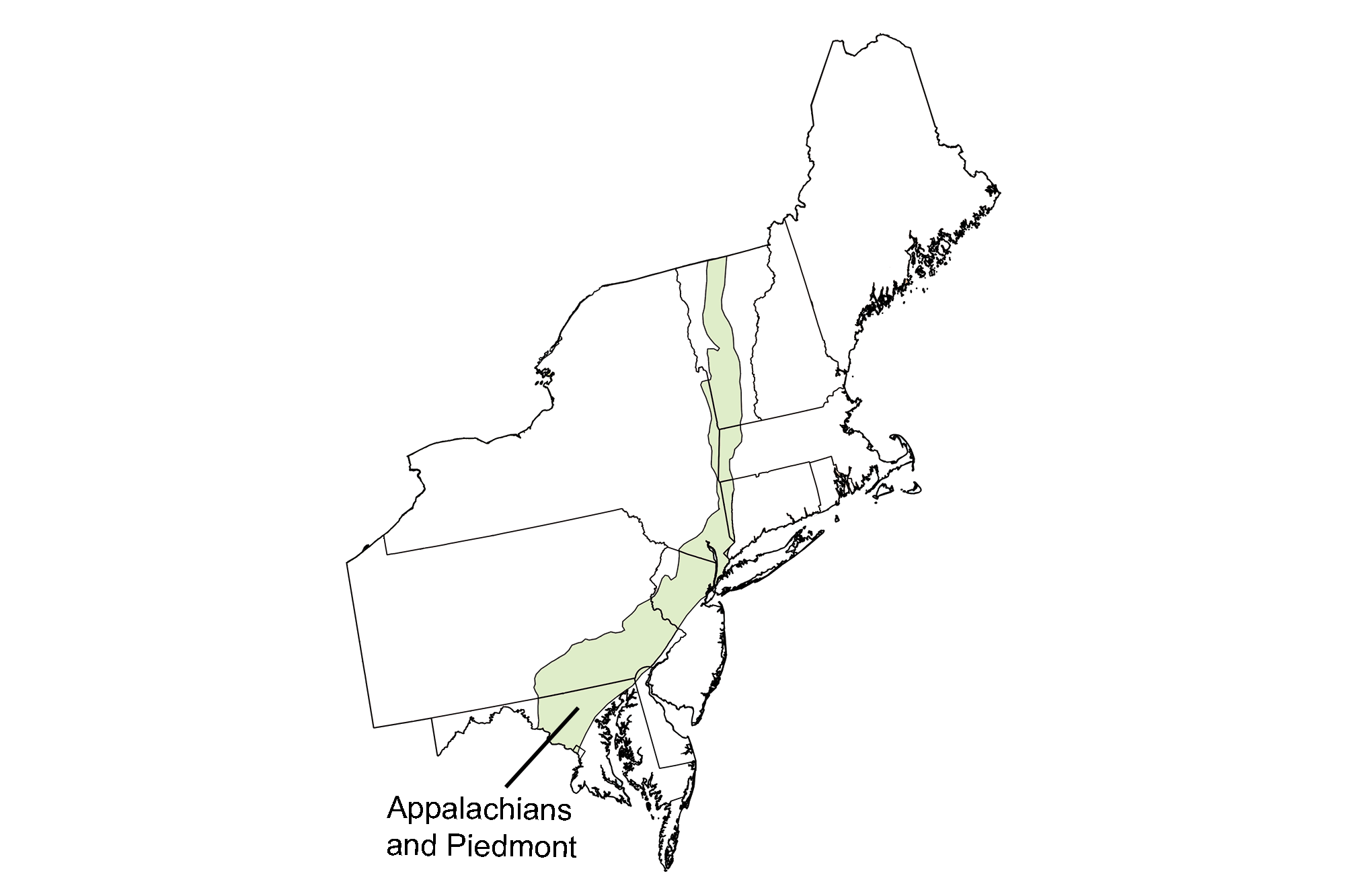
The dominance of northeast-southwest trending ridges and valleys throughout the Appalachian/Piedmont region is characteristic of the Northeast, reflecting the compression of the crust during the mountain-building events of the past. The Great Valley runs lengthwise through the whole region, defining the eastern edge of the Valley and Ridge province. The ridges of the Blue Ridge, Reading Prong, Hudson Highlands, Berkshires and Green Mountains, made of resistant Precambrian gneiss, form the spine of the Appalachian Mountains. The Taconic Mountains, made of stacked slices of Cambrian and Ordovician-age rock, stretch across the north-south border between New York and Vermont, Massachusetts and Connecticut. They were pushed westward to their present position during the Taconic mountain-building period.
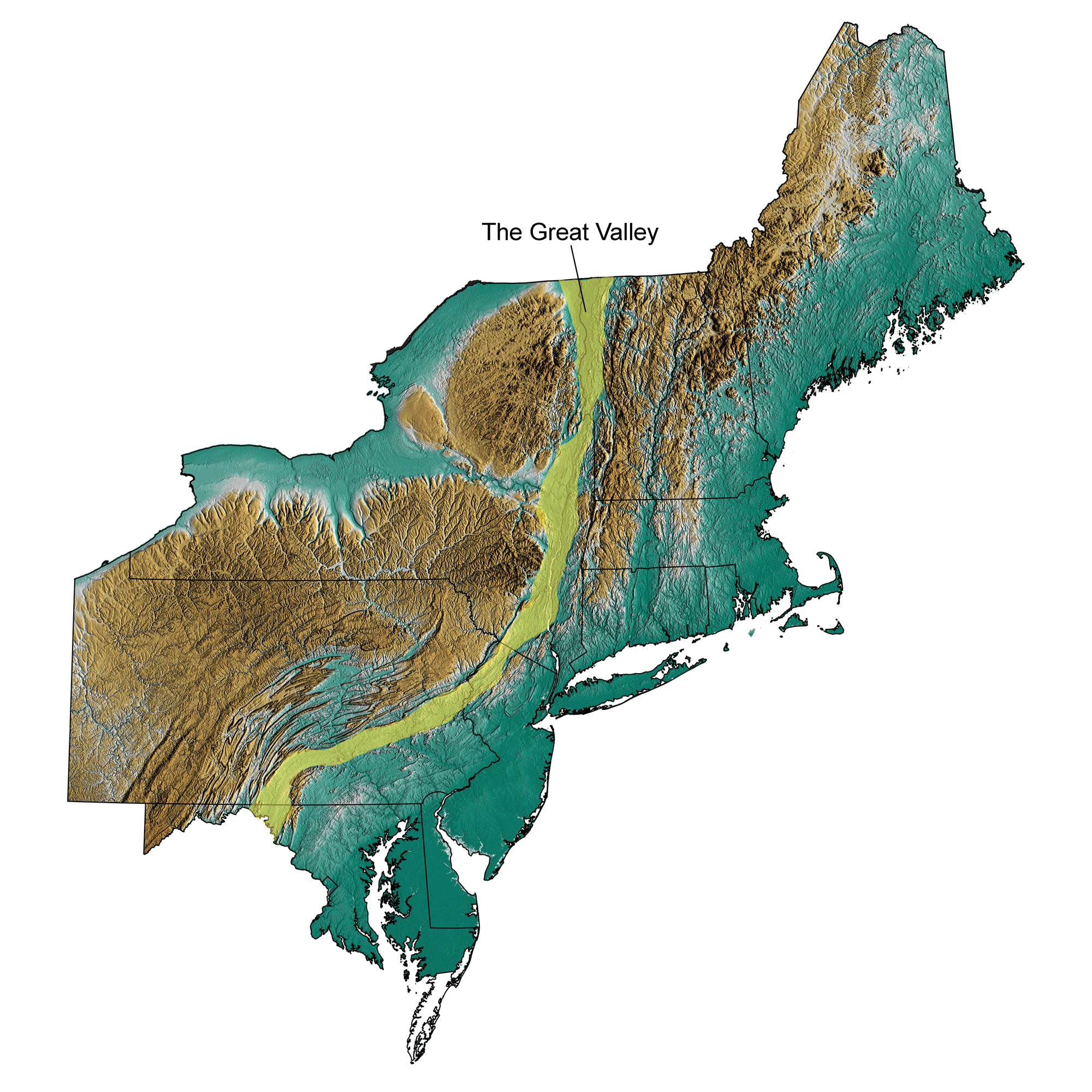
The Great Valley
The Great Valley is adjacent to the Valley and Ridge region to the west (Inland Basin), extending from New York as far south as Georgia.
Approximate position of the The Great Valley highlighted in yellow; greens indicate lower elevation, browns higher elevation. Topographic data derived from the Shuttle Radar Topography Mission (SRTM GL3) Global 90m (SRTM_GL3) (Farr, T. G., and M. Kobrick, 2000, Shuttle Radar Topography Mission produces a wealth of data. Eos Trans. AGU, 81:583-583.). Image created by Jonathan R. Hendricks for the Earth@Home project.
Floored by Cambrian and Ordovician limestone and dolostone, the wide valley forms a topographic low because of the less-resistant nature of the rock. The local names of the Great Valley vary throughout the Northeast. In Maryland the Great Valley is the Hagerstown Valley; in Pennsylvania it is the Cumberland, Lebanon and Lehigh Valley respectively from south to north. The Great Valley cuts across northern New Jersey and up into New York as the Hudson Lowlands. Finally, in Vermont, the Valley is known as the Champlain Lowlands. The Hudson and Champlain Lowlands exist because of the weak Cambrian and Ordovician rocks that line the Valley, which were easily eroded by glaciers during the most recent ice age.
Precambrian Ridges
Extending up and down the Appalachian/Piedmont region is a rigid spine of Precambrian rock.
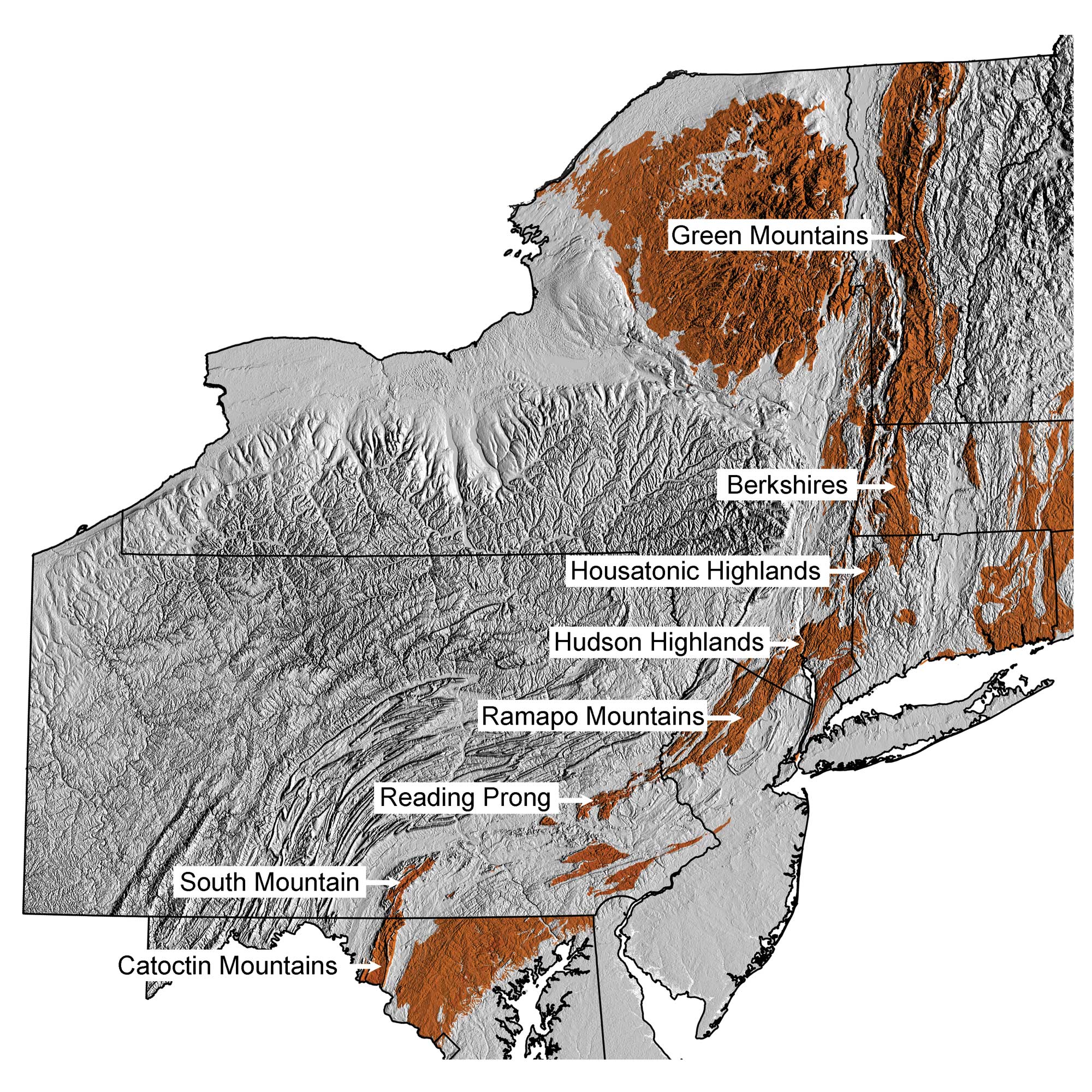
Precambrian ridges of the Appalachian and Piedmont region. Precambrian bedrock data from Fenneman and Johnson (1946) and Horton et al. (2017)using the maximum age values for each mapped unit. Topographic data are derived from the Shuttle Radar Topography Mission (SRTM GL3) Global 90m (SRTM_GL3) (Farr, T. G., and M. Kobrick, 2000, Shuttle Radar Topography Mission produces a wealth of data. Eos Trans. AGU, 81:583-583). Map by Jonathan R. Hendricks for the Earth@Home project.
The crystalline, metamorphic rock has allowed the spine to resist erosion to some extent over the last several hundred million years, while the overlying younger sedimentary rocks have eroded away. The resistant nature of the Precambrian rock is responsible for the mountainous topography of the Green Mountains, the Berkshires, Hudson and Housatonic Highlands, Reading Prong, Ramapo Mountains, South Mountain and the Catoctin Mountains.
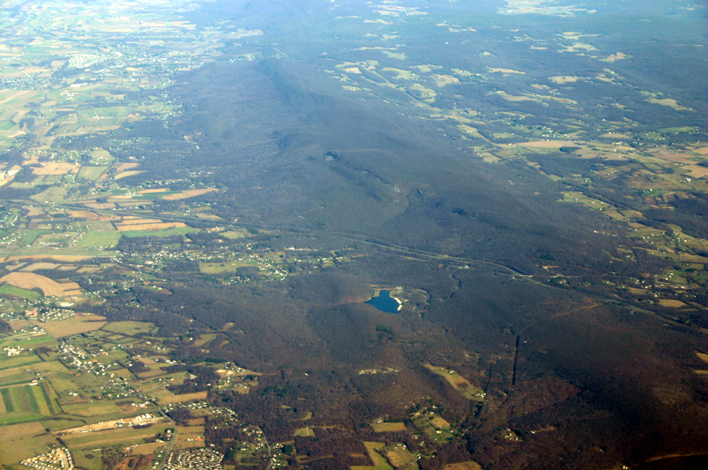
Aerial photograph of South Mountain in Pennsylvania. Photograph by James Stuby (Wikimedia Commons; public domain).
At the southern end of the Precambrian Ridges region, Pennsylvania’s South Mountain marks the northern extent of the Blue Ridge physiographic province. The Blue Ridge refers to the Precambrian rock making up the spine of the southern Appalachian Mountains from Pennsylvania to Georgia. The rocks of the Blue Ridge are bent into a large upward fold. The upward fold has many smaller folds superimposed upon it. The wrinkles cause the rolling topography of much of the mountainous Precambrian Ridge region. In Maryland, the Catoctin Mountains are part of the Blue Ridge region as well.
Taconic Mountains
The Taconic mountain-building event during the Ordovician created the modern Taconic Mountains of the Appalachian/Piedmont region, located between New York, Vermont, Massachusetts and Connecticut.
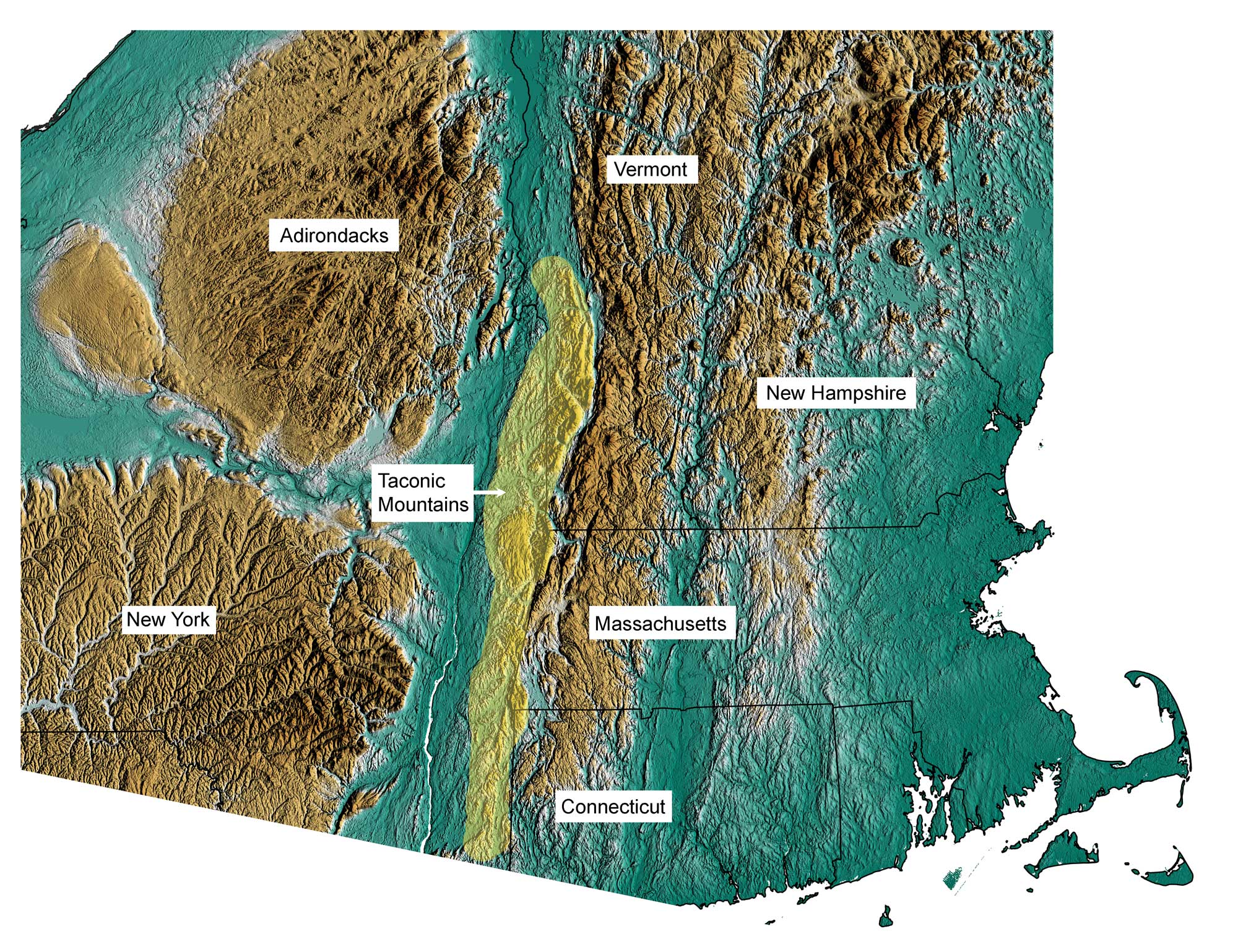
Position of the Taconic Mountains shown in yellow; greens indicate lower elevation, browns higher elevation. Topographic data derived from the Shuttle Radar Topography Mission (SRTM GL3) Global 90m (SRTM_GL3) (Farr, T. G., and M. Kobrick, 2000, Shuttle Radar Topography Mission produces a wealth of data. Eos Trans. AGU, 81:583-583.). Image created by Jonathan R. Hendricks for the Earth@Home project.
The Taconic volcanic islands, formed over the subduction zone of the North America and Baltica plates, were on a collision course with North America. As the volcanic islands drew nearer to the continent, they pushed ahead of them like a bulldozer the Cambrian and Ordovician sedimentary rocks of the seafloor. The crust continued to compress until the volcanic islands were sutured to the side of North America. The compression stacked slices of the seafloor on top of one another, like a collapsed telescope, and pushed the slices a good distance to the west. The Cambrian sedimentary rock resisted erosion, protecting the less-resistant underlying layers of rock. Today’s Taconic Mountains are a section of the stacked slices that have been isolated by erosion.
Piedmont
The Piedmont region abuts the Triassic Rift Basins of Pennsylvania and extends south through Maryland to the Coastal Plain boundary.
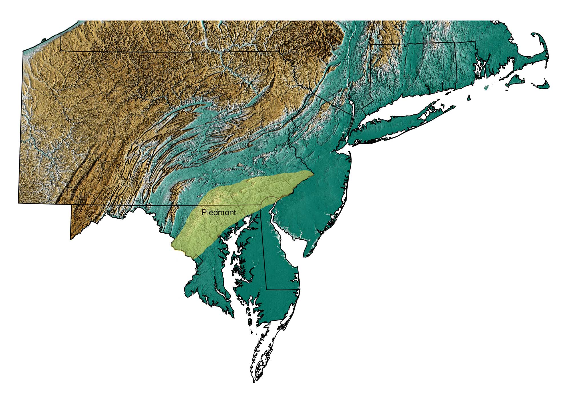
Position of the Piedmont region shown in yellow; greens indicate lower elevation, browns higher elevation. Topographic data derived from the Shuttle Radar Topography Mission (SRTM GL3) Global 90m (SRTM_GL3) (Farr, T. G., and M. Kobrick, 2000, Shuttle Radar Topography Mission produces a wealth of data. Eos Trans. AGU, 81:583-583.). Image created by Jonathan R. Hendricks for the Earth@Home project.
The topography of the Piedmont is primarily rolling hills, composed mostly of metamorphic rock that is uniform in its resistance to erosion. Therefore no ridges stand out in particular from differential weathering. There are a few notable exceptions, however, due to the presence of highly resistant rocks such as the quartzite of Sugarloaf Mountain. Near Baltimore, there are a series of ‘domes’ that have Precambrian gneiss in the middle, surrounded by rings of quartzite and marble. The Piedmont rocks have been squeezed so tightly and are so complexly deformed, that the folds have been overturned and folded, and later eroded to expose the resistant Precambrian gneiss that stand out in relief as domes.
Rift Basins
Two connected rift basins, the Gettysburg and Newark Basins, form lowlands in the Appalachian/Piedmont region.
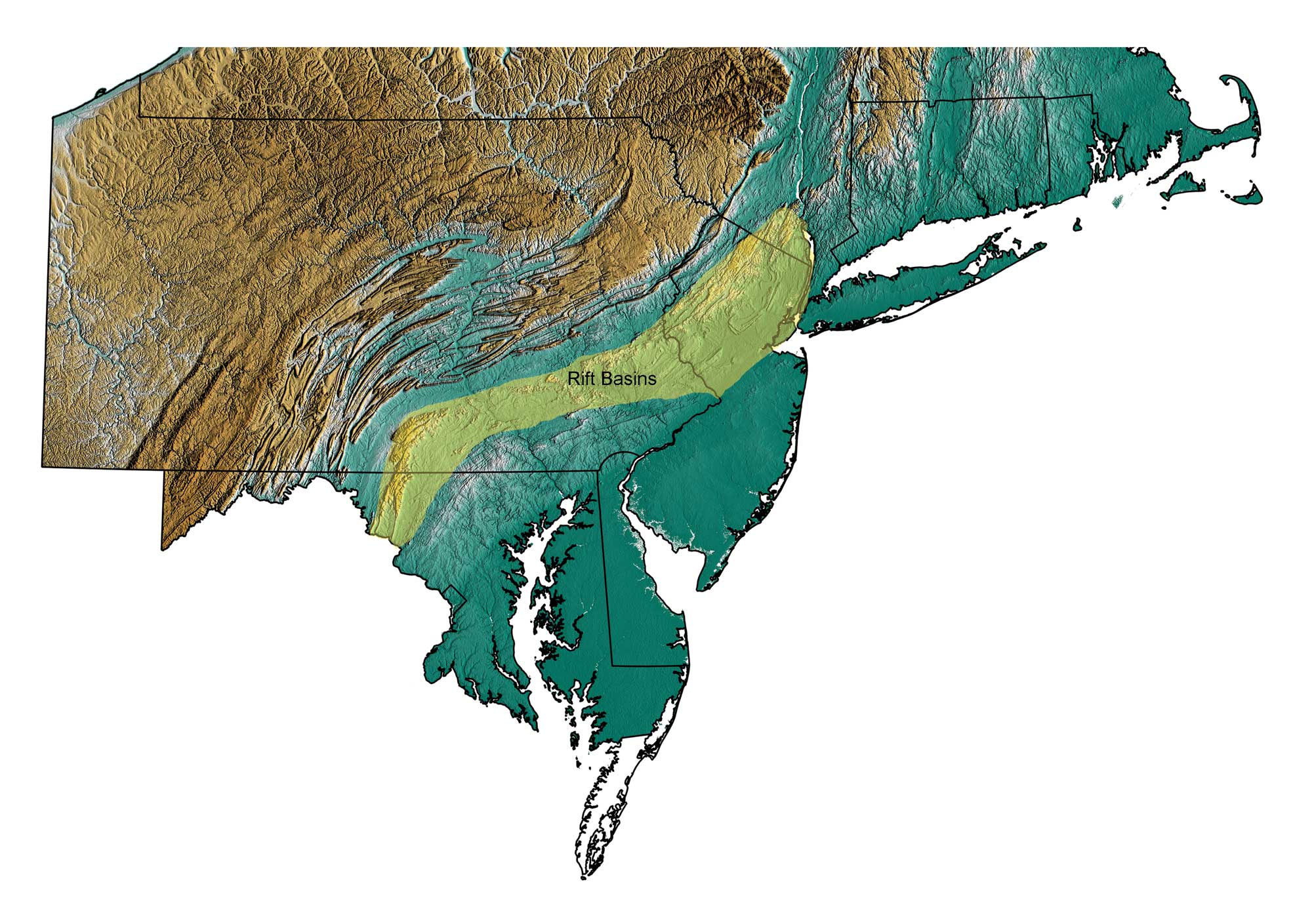
Position of the rift basins shown in yellow; greens indicate lower elevation, browns higher elevation. Topographic data derived from the Shuttle Radar Topography Mission (SRTM GL3) Global 90m (SRTM_GL3) (Farr, T. G., and M. Kobrick, 2000, Shuttle Radar Topography Mission produces a wealth of data. Eos Trans. AGU, 81:583-583.). Image created by Jonathan R. Hendricks for the Earth@Home project.
The basins begin at the southeastern tip of New York and continue through New Jersey, Pennsylvania, and Maryland. The basins exist because of the rifting of Pangea during the Triassic and Jurassic. As the continents tore apart, cracks in the crust acted as fault planes on which blocks of crust slipped downward to form basins. The basins were filled with layers of less-resistant sedimentary rock as well layers of cooling lava on the surface, which formed basalt. Occasionally, the magma did not make it to the surface. Instead, it squeezed its way between the rock layers and cooled to form diabase. Over time, the basins were tilted and eroded, exposing the alternating layers of sedimentary and igneous rock. The layers of basalt and diabase are far more resistant to erosion than the sedimentary rock, so they stick out in relief as ridges while the surrounding sedimentary rock is eroded away.
The Palisades, along the west side of the Hudson River in New York and New Jersey, are resistant exposures of diabase. The Wachtung Mountains of New Jersey are tilted remnants of three basaltic lava flows. The basin remains a topographic low today, bounded on the west by the up-faulted Precambrian Ramapo Mountains.
The Marble Valley
A narrow valley bounded by steep walls runs from southern Vermont through western Massachusetts and Connecticut.
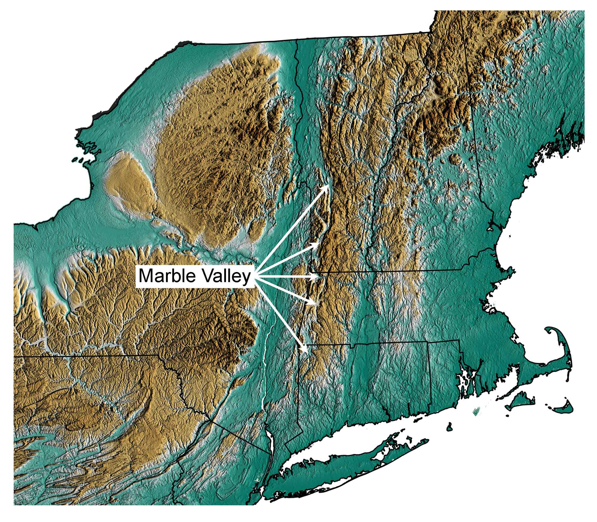
Position of the marble valley indicated by arrows; greens indicate lower elevation, browns higher elevation. Topographic data derived from the Shuttle Radar Topography Mission (SRTM GL3) Global 90m (SRTM_GL3) (Farr, T. G., and M. Kobrick, 2000, Shuttle Radar Topography Mission produces a wealth of data. Eos Trans. AGU, 81:583-583.). Image created by Jonathan R. Hendricks for the Earth@Home project.
The valley is floored with Cambrian and Ordovician limestone that has been metamorphosed to marble. Due to the less-resistant nature of marble, a valley was scoured out by weathering and erosion, separating the Green Mountains from the Taconic Mountains.