

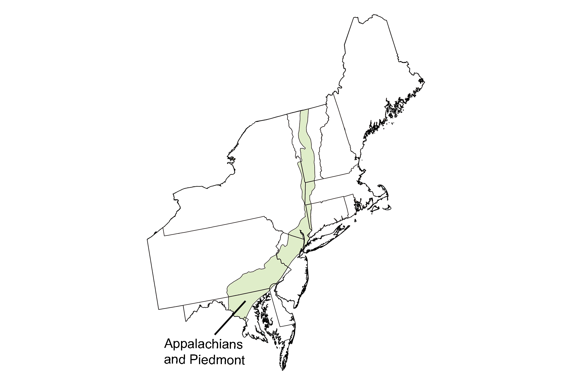
Spotlight: Overview of the rocks of the Appalachians and Piedmont regions of the northeastern United States, including Vermont, eastern New York, western Massachusetts and Connecticut, New Jersey, Pennsylvania, and Maryland.
Topics covered on this page: Overview; Precambrian; Cambrian and Ordovician; Late Paleozoic; Triassic and Jurassic; Resources.
Credits:Most of the content of this page is derived from The Teacher-Friendly Guide to the Geology of the Northeastern U.S. (published by the Paleontological Research Institution) by Jane E. Ansley, with substantial updates by Andrielle Swaby and Jonathan R. Hendricks.
Updates: Page last updated September 28, 2023.
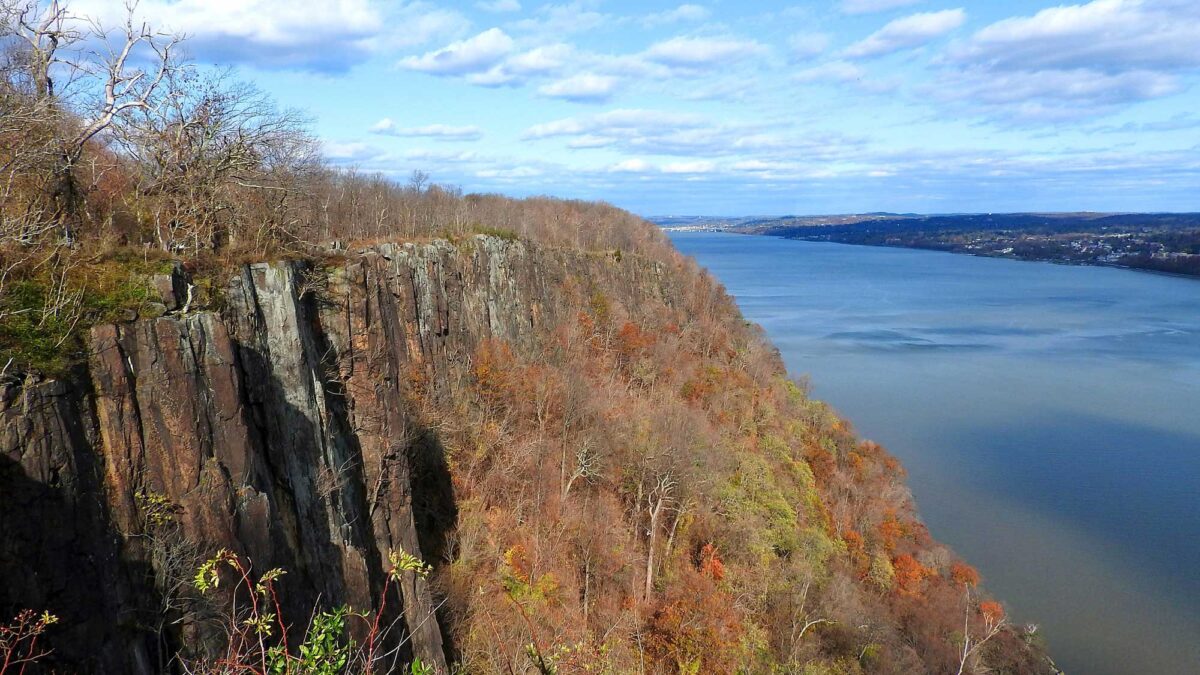
Image above: View of the Hudson River from the Palisades. Photograph by Stanley Zimny (Flickr; Creative Commons Attribution-NonCommercial 2.0 Generic license).
Overview
The Appalachians (or Blue Ridge, at their southern end) and Piedmont are distinct physiographic areas, but they share similar types of crystalline igneous and metamorphic rocks. This region was at the center of several orogenic events that occurred throughout the Precambrian and Paleozoic, and many of the rocks found here were metamorphosed by the compressive forces of mountain building. The core of the Appalachian mountain range and the Inner Piedmont are the most highly metamorphosed, having been located nearly at the center of the continental collisions; the Outer Piedmont is more variably metamorphosed. During the Paleozoic, continental collision compressed the Appalachian and Piedmont region further, causing folds, faults, intrusion by magma, shearing, and uplift. The region was pushed over 160 kilometers (100 miles) west, telescoping into a series of folded, thrusted crustal sheets that carried older rocks atop younger rocks, overturning the stratigraphic sequence. The Piedmont was thrust over the Appalachians, which were in turn thrust over the rocks that lie farther west. The rocks of the Taconic Mountains, wherein older Cambrian rocks form a resistant cap atop less resistant Ordovician sedimentary rocks, are a perfect example of overthrust.
Precambrian
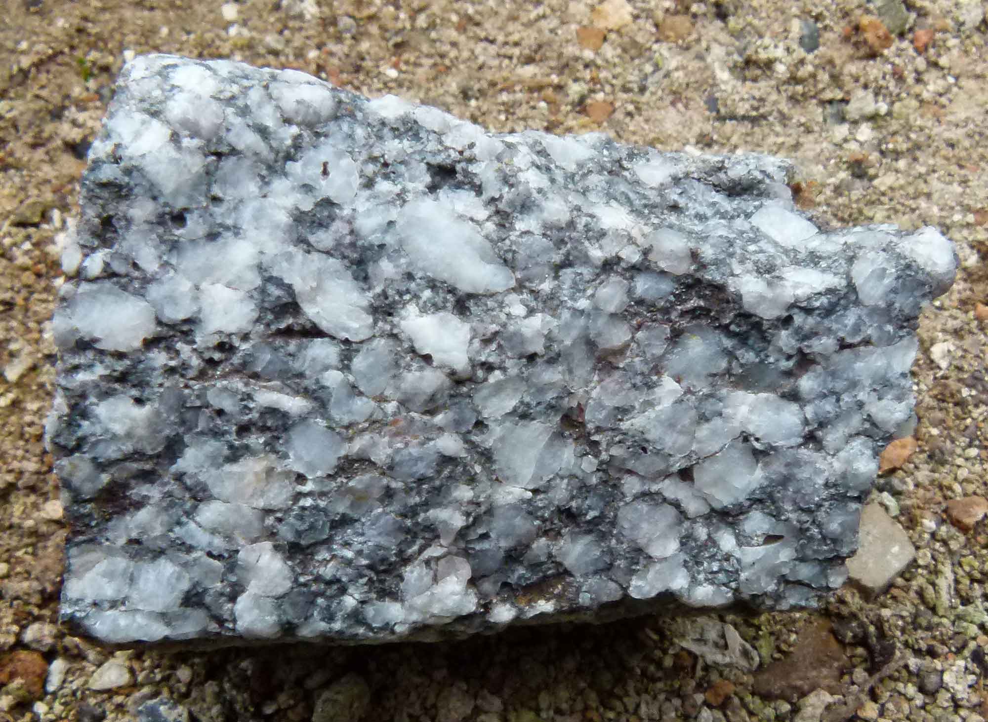
The Appalachians are dominated by rocks of Precambrian origin, including highly metamorphosed igneous and sedimentary rocks formed more than a billion years ago during the Grenville Orogeny. These Precambrian rocks are the oldest materials found at the surface in the Northeast, including the 1.2-billion-year-old Baltimore Gneiss in Maryland.
Outcropping of Baltimore Gneiss in Carroll County, Maryland. Photograph by "JStuby" (Wikimedia Commons; Creative Commons CC0 1.0 Universal Public Domain Dedication).
At each exposure, metamorphosed sedimentary rocks are visible. Grenville-aged rocks were originally sandstone, shale, and limestone deposited in a zone called the Grenville Series (also called the Grenville Belt), a warm, shallow ocean along the eastern margin of proto-North America. During the formation of Rodinia, the Grenville Series sediments were squeezed and pushed up onto the continental margin, forming the Grenville Mountains. The intensity of compression metamorphosed the sedimentary rocks; sandstone became quartzite, gneiss, or schist, limestone became marble, and shale became gneiss and schist.
During the Grenville Orogeny, friction between the converging plates pushed magma into the overlying crust. Some magma rose high enough to intrude through the overlying sedimentary rocks. These blobs eventually cooled and crystallized, forming igneous rocks including granite, anorthosite, and, less commonly, gabbro. As the Grenville Orogeny continued, the cooled plutons and sedimentary rocks of the Grenville Belt were later covered by as much as 30 kilometers (19 miles) of sediment! High pressures and temperatures associated with the weight of the overlying material caused further metamorphism of the buried rocks. Today, these resistant igneous and metamorphic rocks can be seen at locations like Mount Mansfield in Vermont, Breakneck Ridge in New York, and South Mountain in Pennsylvania, where they have been exposed by erosion.
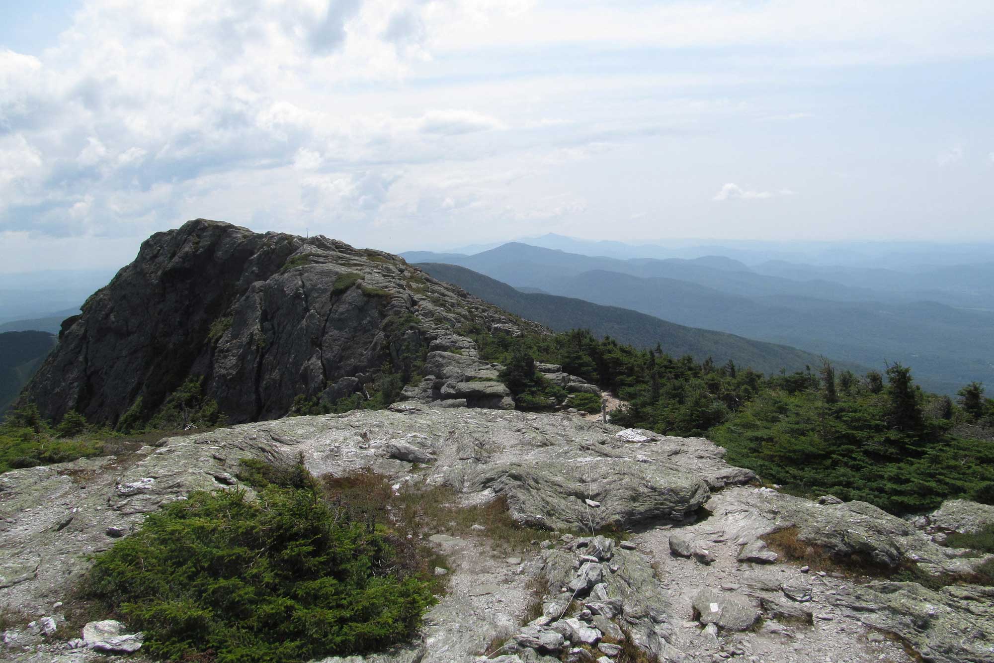
Grenville rocks exposed at the top of Mount Mansfield in Vermont. Photograph by Doug Kerr (Flickr; Creative Commons Attribution-ShareAlike 2.0 Generic license; image cropped and resized).
Grenville rocks exposed at Breakneck Ridge in New York. Photograph by "Schezar" (Flickr; Creative Commons Attribution 2.0 Generic license; image resized).
Grenville-aged rocks are present in many other parts of the Northeast besides the Appalachians, but they are often deeply buried by younger overlying sedimentary rocks. Precambrian rocks are visible at the surface in the Appalachian and Piedmont region only because of the intense thrusting and deformation that occurred during Paleozoic mountain building events (especially the Alleghanian Orogeny), uplifting layers of rock that were once buried beneath many kilometers (miles) of crust. The rocks of the Appalachians were compressed into a giant anticline, or upward fold, that has become the "backbone" of the Appalachian range, preventing the mountains from being worn completely flat. Softer sedimentary rocks were eroded away at the peak of the fold, exposing the resistant Precambrian rocks at its center. The Green Mountains of Vermont clearly expose this backbone of Precambrian gneiss and quartzite. The Hudson Highlands, Berkshire Mountains, Manhattan Prong, and Trenton Prong follow the same line of resistant ridges of Precambrian rock.
Maryland’s Precambrian Baltimore Gneiss is actually a series of domes, made of Precambrian gneiss surrounded by rings of quartzite and marble. These domes are not simple upwarps of the crust. The rocks of this region have been squeezed so tightly and have been so complexly deformed, that the folds have overturned, folded again, and later eroded to expose the Precambrian gneiss. The gneiss is a hard, resistant metamorphic rock that has remained while surrounding softer rocks have worn away. A granitic pluton called the Woodstock Quartz Monzonite, which intrudes through the Baltimore Gneiss in Granite, Maryland, was quarried extensively in the late 1800s and used in the construction of buildings including the Capitol Building, the Library of Congress, and the Baltimore Custom House.
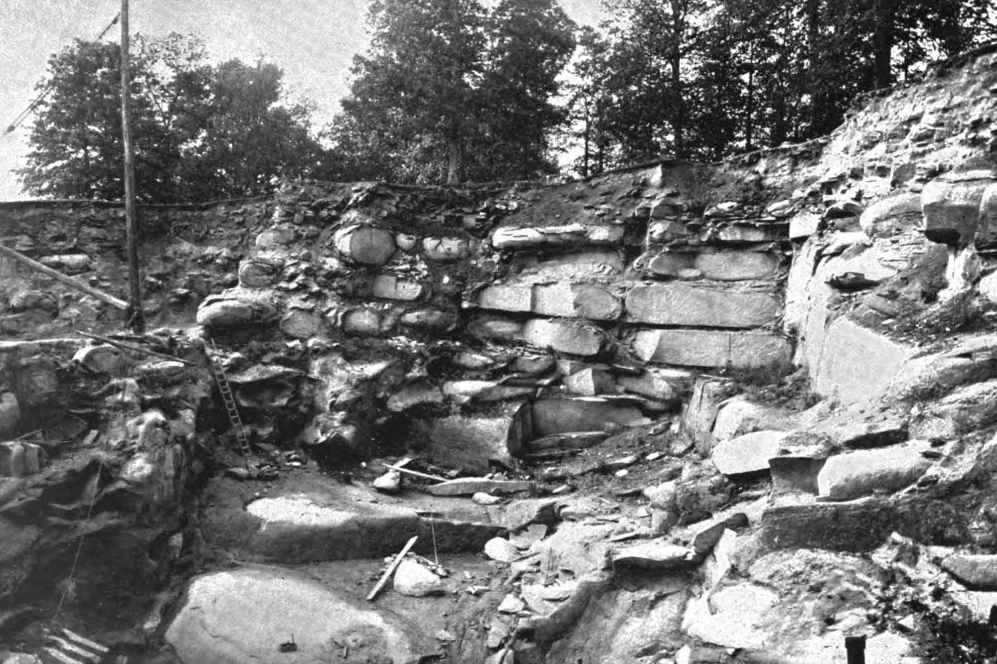
Quarry operation showing mining of Woodstock Quartz Monzonite in Woodstock, Maryland (ca. 1895). Photograph published by Charles R. Keyes (Wikimedia Commons; public domain).
Beginning around 570 million years ago during the late Precambrian and early Cambrian, North America began to rift apart. As the rifts enlarged, many became basins that eventually filled with sediment eroded from the Grenville Mountains. Remnants of these ancient rift basins can found in the rocks at Catoctin Mountain Park in Maryland and the South Mountain area of Pennsylvania. The last sediments to fill the rift basins, known as the Chilhowee Group, were deposited in the early Cambrian. Over time, the rift basin sediment was compacted and cemented together to become conglomerate, sandstone, siltstone, and shale. These rocks were metamorphosed to slate, phyllite, and quartzite during later orogenic events, and they are often referred to as "metasedimentary" due to the fact that their sedimentary structures are often well preserved.
Weverton Formation metabreccia from Catoctin Mountain Park in Maryland. Photograph by Catoctin Mountain Park (Flickr; Creative Commons Attribution-NonCommercial-ShareAlike 2.0 Generic license; image resized).
As a result of continental rifting and the widening of the Iapetus Ocean, volcanic activity was common along the margin of North America. Rifts and fractures in the crust made pathways for emerging lava that poured out across the surface for a period of several million years, covering over 10,300 square kilometers (4000 square miles) of land and cooling to form basalt. Basalts, rhyolites and other Precambrian volcanic rocks, as well as Precambrian gneiss and quartzite, are found stretching across the Pennsylvania-Maryland border along the Catoctin Formation, which underlies Maryland’s Catoctin Mountains and Pennsylvania’s South Mountain. The Catoctin Basalt, originally a dark-colored volcanic rock, was highly metamorphosed during the formation of the Appalachian Mountains, and became a fine-grained dark green to light grey greenstone.
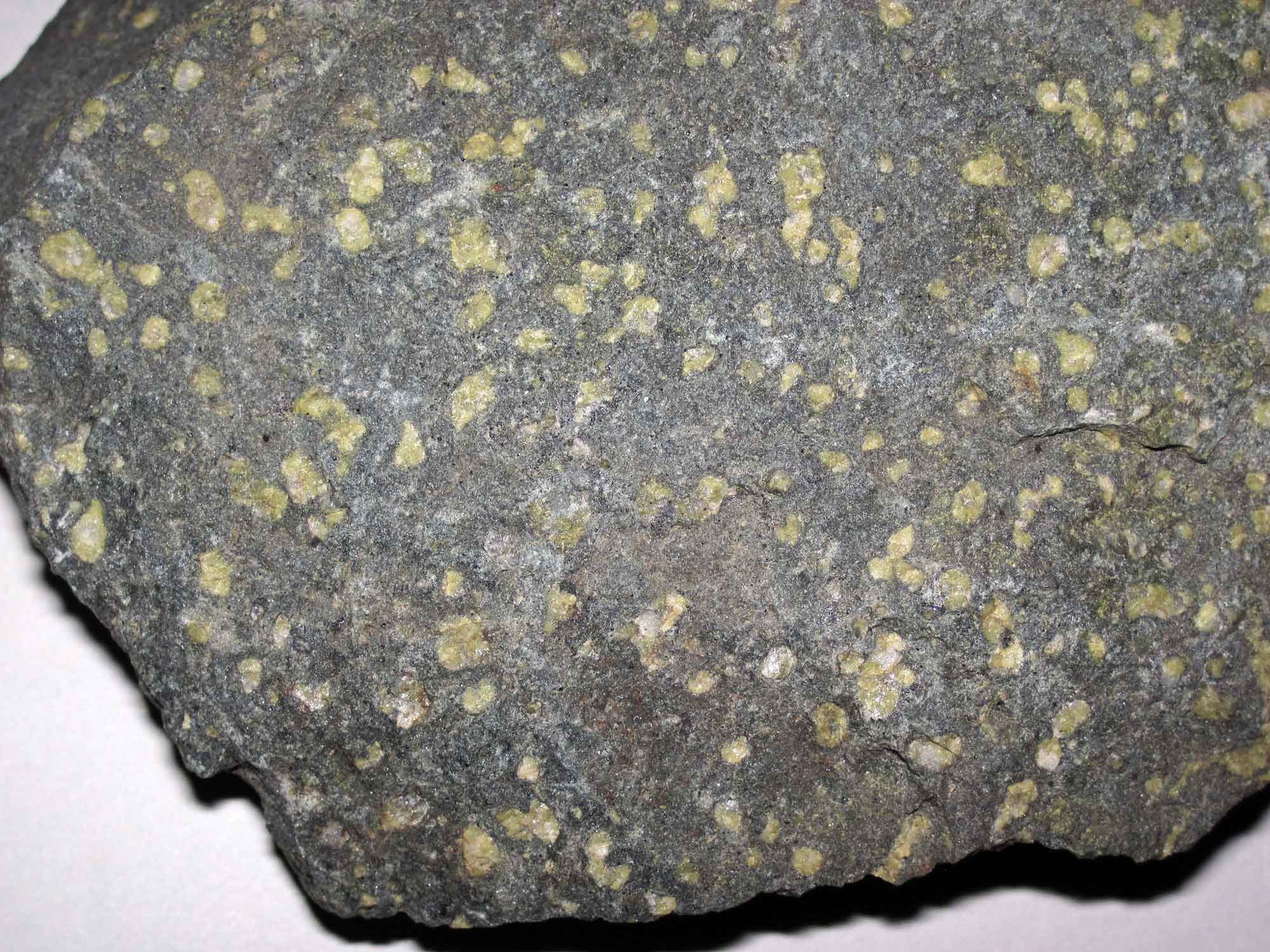
Catoctin Formation greenstone. Photograph by James St. John (Flickr; Creative Commons Attribution 2.0 Generic license; image resized).
Although most Catoctin greenstones are found as boulders or jagged cliffs, the cooling basalt occasionally contracted to form polygonal structures called columnar joints. Areas where new lava flows advanced over older ones are often marked by breccia, a chaotic layer of cemented sediments and rock fragments.
Cambrian and Ordovician
Most ancient rocks in the Appalachians are related to major Precambrian and Cambrian tectonic events, from the Grenville Orogeny to Cambrian rifting. However, most Piedmont rocks actually formed somewhere other than North America and were attached to the continent in a patchwork of volcanic islands, fragments of land (exotic terranes), and former ocean-bottom sediments. Many Piedmont rocks are metamorphosed to varying degrees, and it is difficult to determine their exact origin or age of formation. Nevertheless, they are separated into two basic divisions, the Iapetus rocks and the Avalon rocks, based on their inferred origins.
The Iapetus rocks (also known as the Inner Piedmont) include sediments deposited in the ancient Iapetus Ocean, which continued to widen throughout the Cambrian. These sedimentary rocks were once part of a wide carbonate bank that formed along the continental margin after eroded sediment dwindled from the nearly worn-down Grenville Mountains. During this time, most of the Northeast (and most of proto-North America) was entirely underwater. Sandstone and shale were the dominant rocks generated from eroding sediments in the continental highlands, and limestone formed from carbonate sediments and shelled organisms living in the ocean. However, between 500 and 460 million years ago, the direction of plate movement shifted. The Iapetus Ocean began to close as the continental plates once again moved toward each other, and the Taconic volcanic island arc developed at the subduction zone where the plates came together. As these islands approached North America, compression metamorphosed the limestone, sandstone, and shale, forming marble, quartzite, slate, phyllite, and schist. These Cambrian and Ordovician rocks underlie the Champlain Valley of Vermont, the Taconic Mountains and highlands of western New England and eastern New York, and the prominent ridges and valleys further south in Pennsylvania, New Jersey and Maryland. The Marble Valley, which stretches across western Massachusetts, Connecticut, and southern Vermont, also dates from the Taconic Orogeny, where it was metamorphosed from limestone formed at the bottom of the Iapetus Ocean. The marble is extensively exposed at the surface in a wide valley that was once vigorously quarried for buildings and monuments.
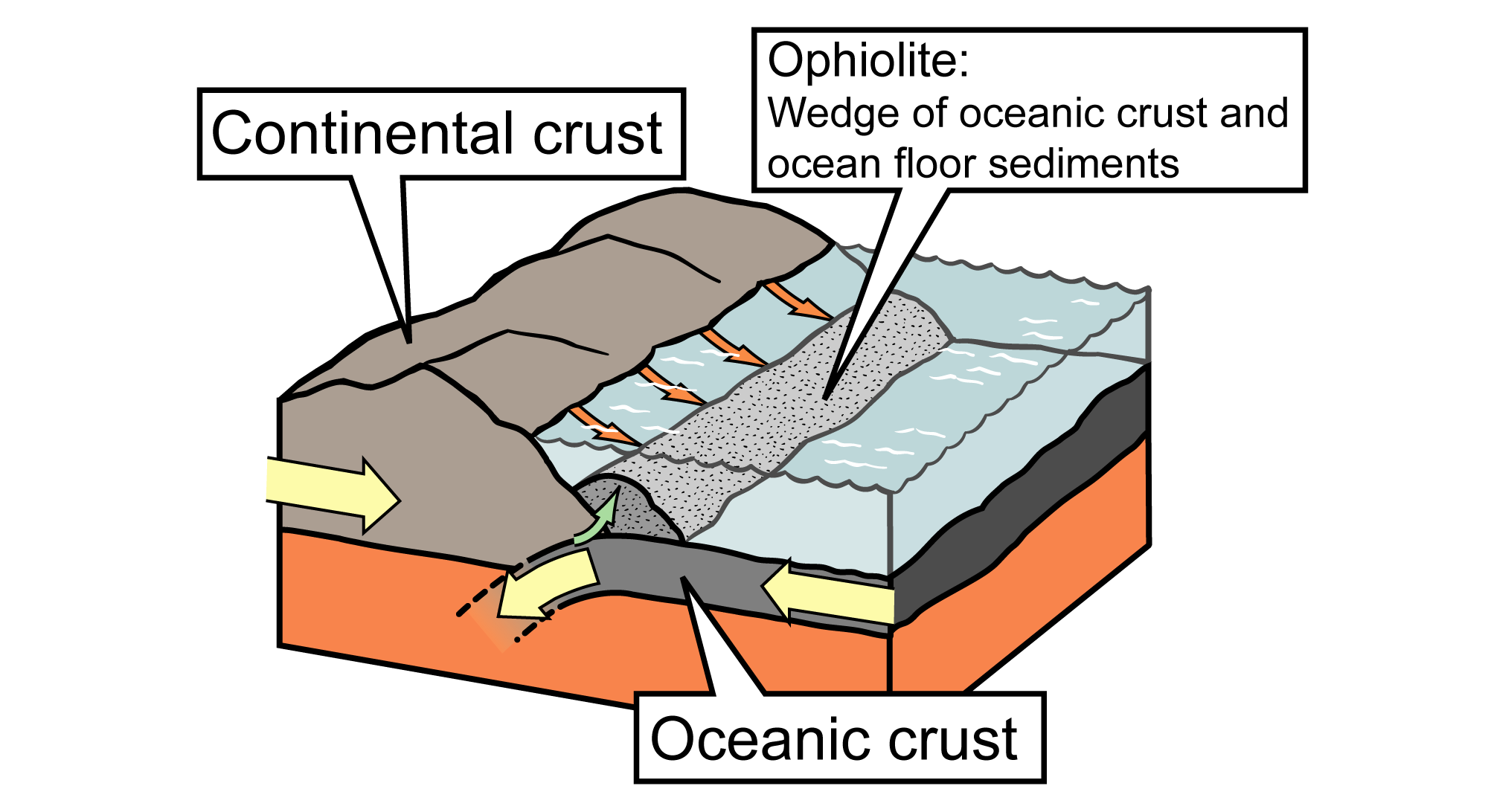
Simplified diagram showing how an ophiolite sequence can form at a subduction plate boundary. Image by J. Houghton, modified for the Earth@Home project.
The resulting rock sequences are some of the most helpful tools we have for studying oceanic crust. An ophiolite sequence includes sedimentary rock from the deep sea, such as chert, underlain by pillow basalts that were extruded into the water at a mid-ocean ridge. Below the pillow basalts are intrusions of basalt known as sheeted dikes, formed as the mid-ocean ridge pulled apart. Below the basalt is gabbro, the plutonic version of basalt, and finally peridotite, the rock that composes the Earth's upper mantle. Peridotite is commonly altered slightly through metamorphism into a greenish rock called serpentinite.
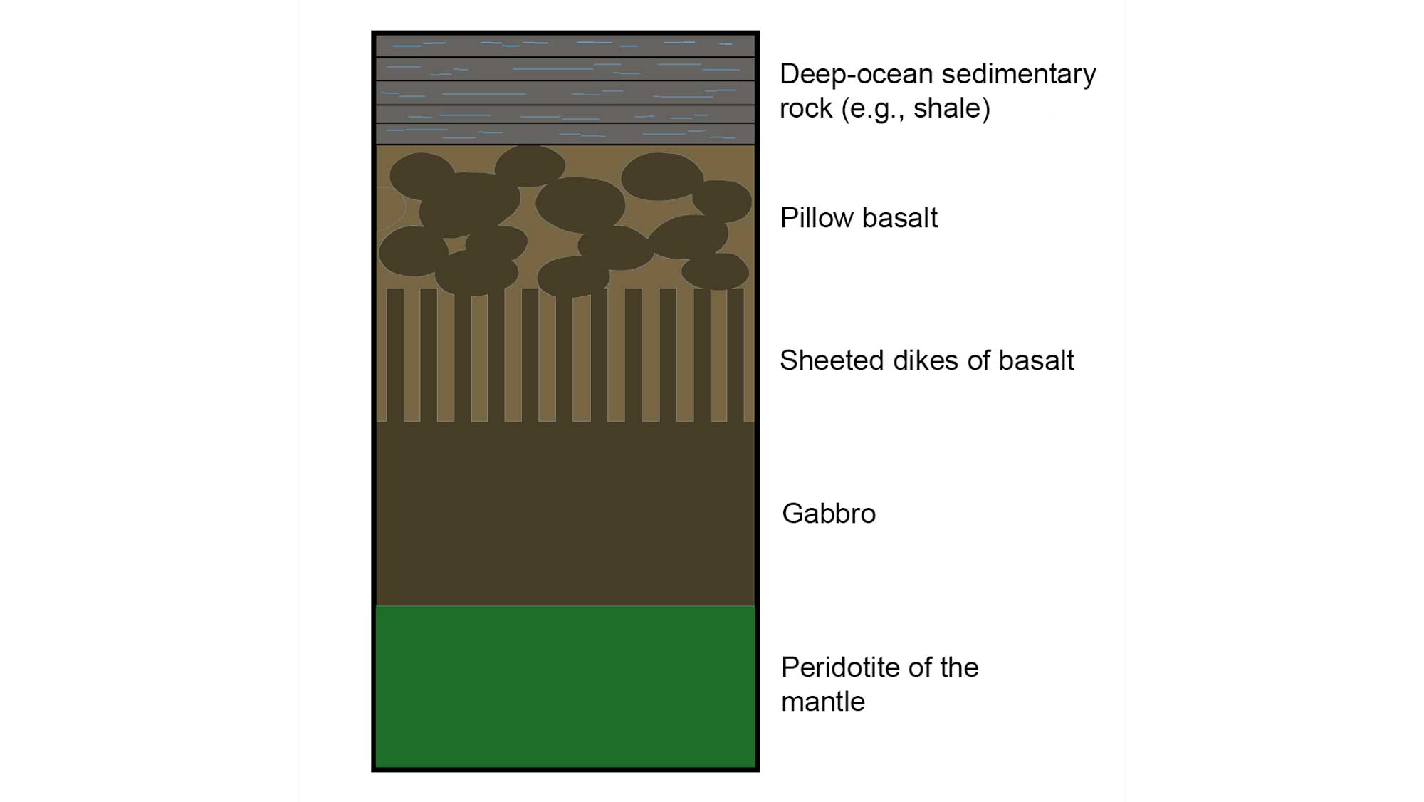
Simplified illustration showing the composition of an ophiolite sequence.
Late Paleozoic
The Avalon rocks (also known as the Outer Piedmont) were accreted to the margin of North America during the late Devonian. These rocks include the Avalon microcontinent (made up of volcanic sediment, sandstone, mudstone, and intrusions) and the surrounding ocean basin sediment (made up of mud, ash, and sand) on either side of the microcontinent. During the microcontinent’s collision with North America, the Avalon rocks underwent varying degrees of metamorphism based on their distance from the center of the collision. Marine sediments became argillite, slate, gneiss, schist, phyllite, and quartzite; preexisting intrusions were metamorphosed to amphibolite, greenstone, serpentinite, metagabbro, and metabasalt. The collision of Avalon with North America also resulted in igneous intrusions throughout the Piedmont, similar to earlier intrusions formed during the Ordovician. Some of these intrusions formed pegmatites.
Africa collided with North America during the Alleghanian Orogeny of the late Pennsylvanian and Permian, uplifting the Appalachian Mountains and resulting in the formation of the supercontinent Pangaea. The collision resulted in intense metamorphism of the Appalachians and Inner Piedmont, moderate metamorphism in the Outer Piedmont, westward thrusting of the crust, and igneous intrusions throughout the Appalachians and Piedmont region. The greatest amount of deformation associated with the Alleghanian Orogeny occurred in the Southeastern US, and most of the associated intrusions in the Northeast are hidden deep below the surface.
Triassic and Jurassic
During the late Triassic and early Jurassic, Pangaea broke apart. Rifts formed in the crust along the margin of North America (as well as along the margins of Africa and western Europe), and blocks of crust slid down fault planes to form rift basins of varying size. The basins were periodically filled with water, forming shallow lakes in which were deposited thin, dark layers of poorly sorted sediment that solidified into red-colored sandstone and shale. Two connecting basins, the Newark Basin and the Gettysburg Basin, dissect the southeastern tip of New York, northern New Jersey, eastern Pennsylvania and Maryland. In Connecticut, there are a few other mini-versions of the large rift basins, where smaller faults formed tiny basins that preserved Triassic- and Jurassic-aged sediments. The Northeast's Triassic- and Jurassic-aged rift basin deposits are part of a sequence of rocks known as the Newark Supergroup, which can reach thicknesses of up to six kilometers (four miles). Where they are found at the surface, they often expose characteristic reddish-brown sedimentary rock and igneous basalt or diabase, also known locally as "traprock."
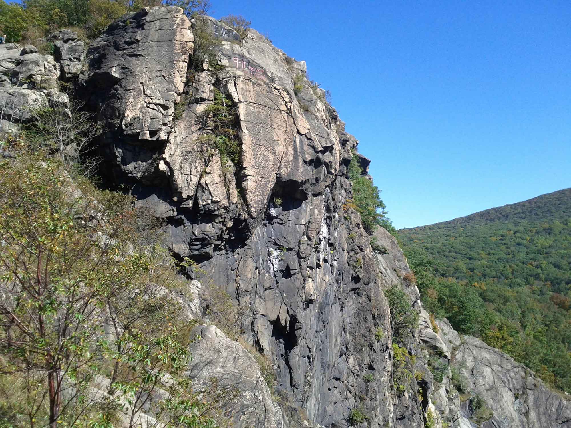
The rift valley’s igneous rocks formed as magma pushed up through fractures in the rifted crust, pouring out on the surface of the basin as lava or cooling and crystallizing below ground as igneous intrusions. Diabase dikes and sills that formed during the Triassic and Jurassic rifting period are found not only in the region’s rift basins, but also throughout the Piedmont. Sills occur when rising magma forces its way between layers of rock, spreading out parallel to the layers and creating a flat intrusion like the Palisades Sill along the Hudson River in New York.
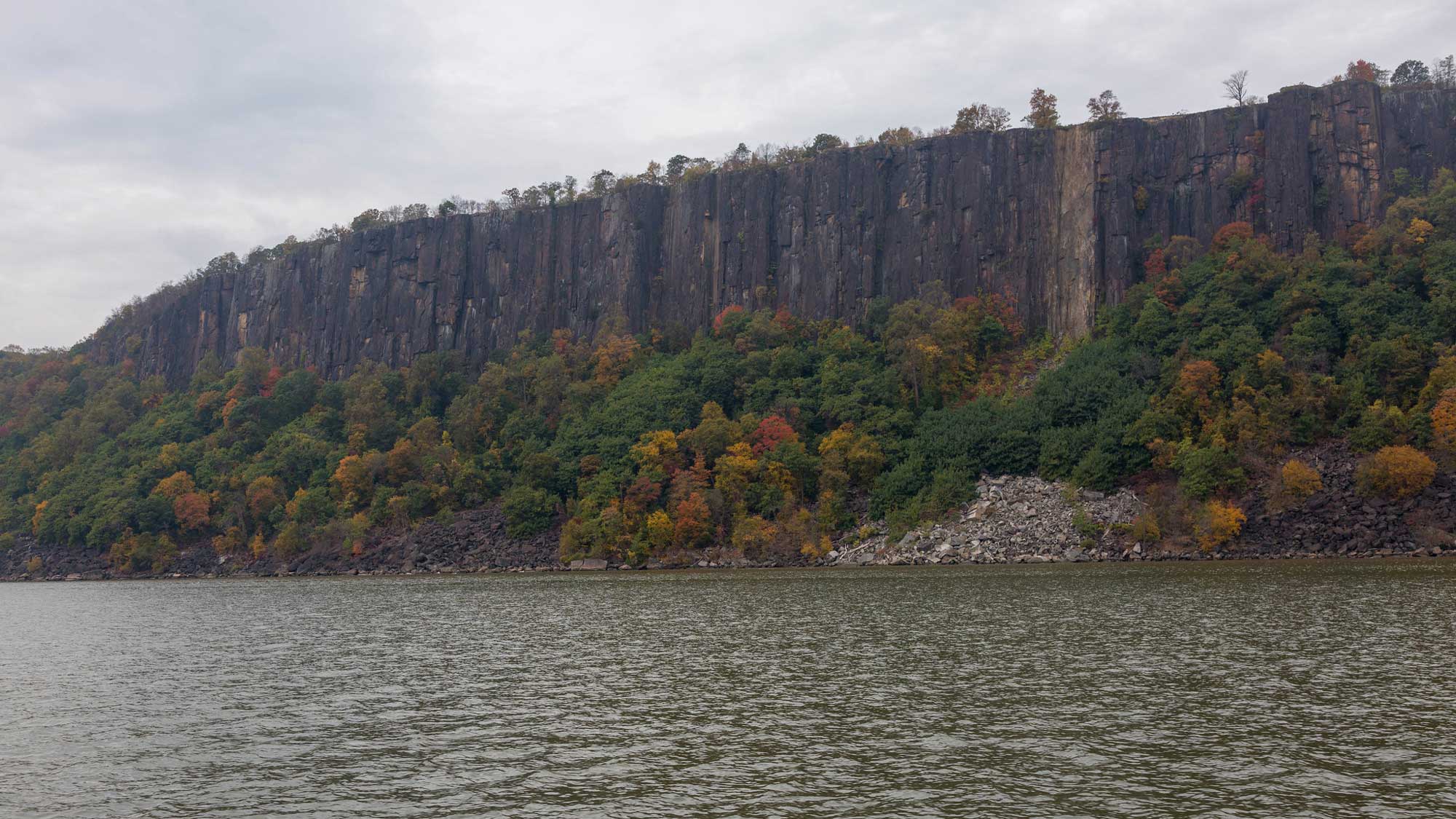
The Palisades along the Hudson River in New York. Photograph by David Brossard (Flickr; Creative Commons Attribution-ShareAlike 2.0 Generic license; image cropped and resized).
The same magma that formed the Palisades Sill continued to rise towards the surface, cutting through the overlying layers and bursting out to spread basaltic lava over the basin. These lava flows are recorded by the Wachtung Mountains of New Jersey, left standing because of the resistance of the tilted lava beds in comparison to the weaker sedimentary rocks above and below.
Resources
Resources from the Paleontological Research Institution
Digital Encyclopedia of Earth Science: Minerals.
Earth@Home: Introduction to Rocks.
Earth@Home: Geologic time scale.
Earth@Home: Geologic maps.
Earth@Home Virtual Collection: Rocks (Virtual rock collection featuring 3D models of rock specimens sorted by type.)