

Page snapshot: Rhode Island State Geologic Map; Fossil; Rock; Mineral; Gem; Highest and Lowest Elevations; Places to Visit; and Additional Resources.
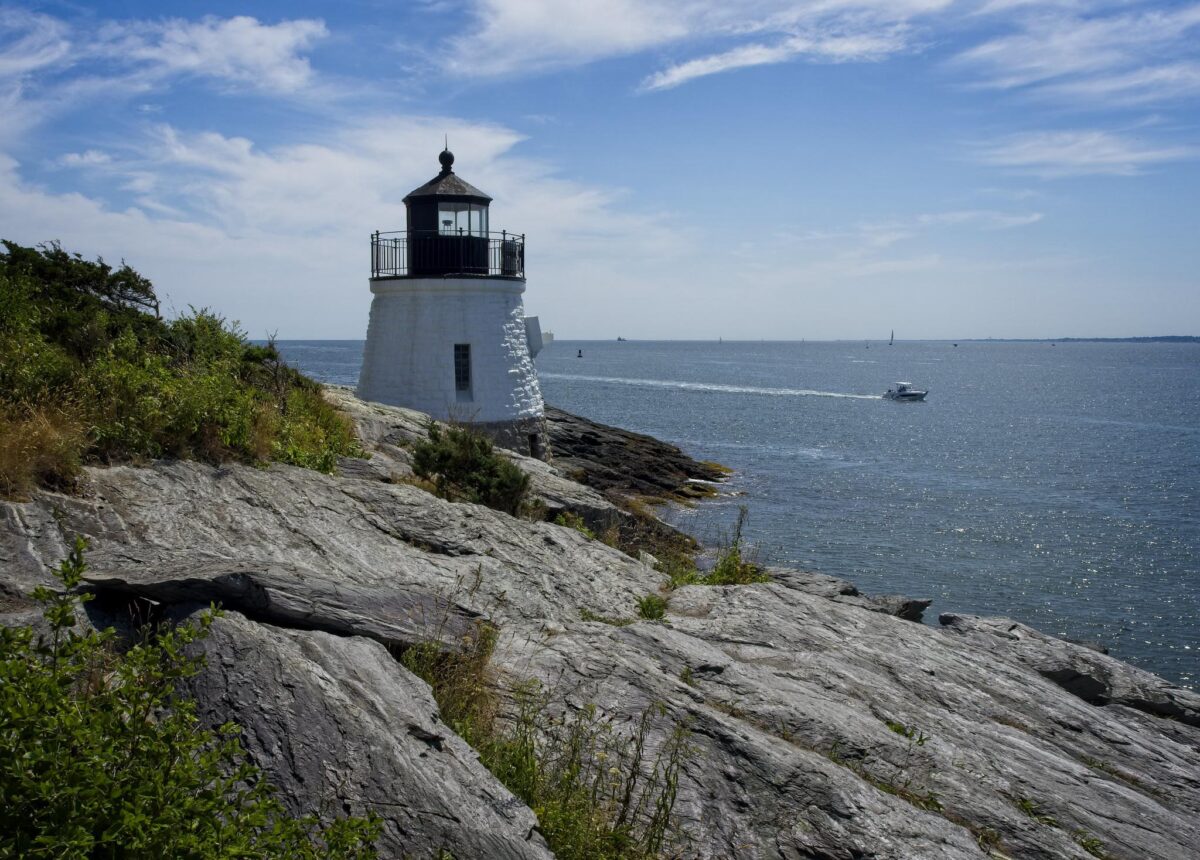
Image above: Castle Hill Lighthouse on the Proterozoic rocky coastline of Newport, Rhode Island. Photo by Patrick Franzis (Flickr; Creative Commons Attribution-NonCommercial-NoDerivs 2.0 Generic license).
Geologic Map of Rhode Island
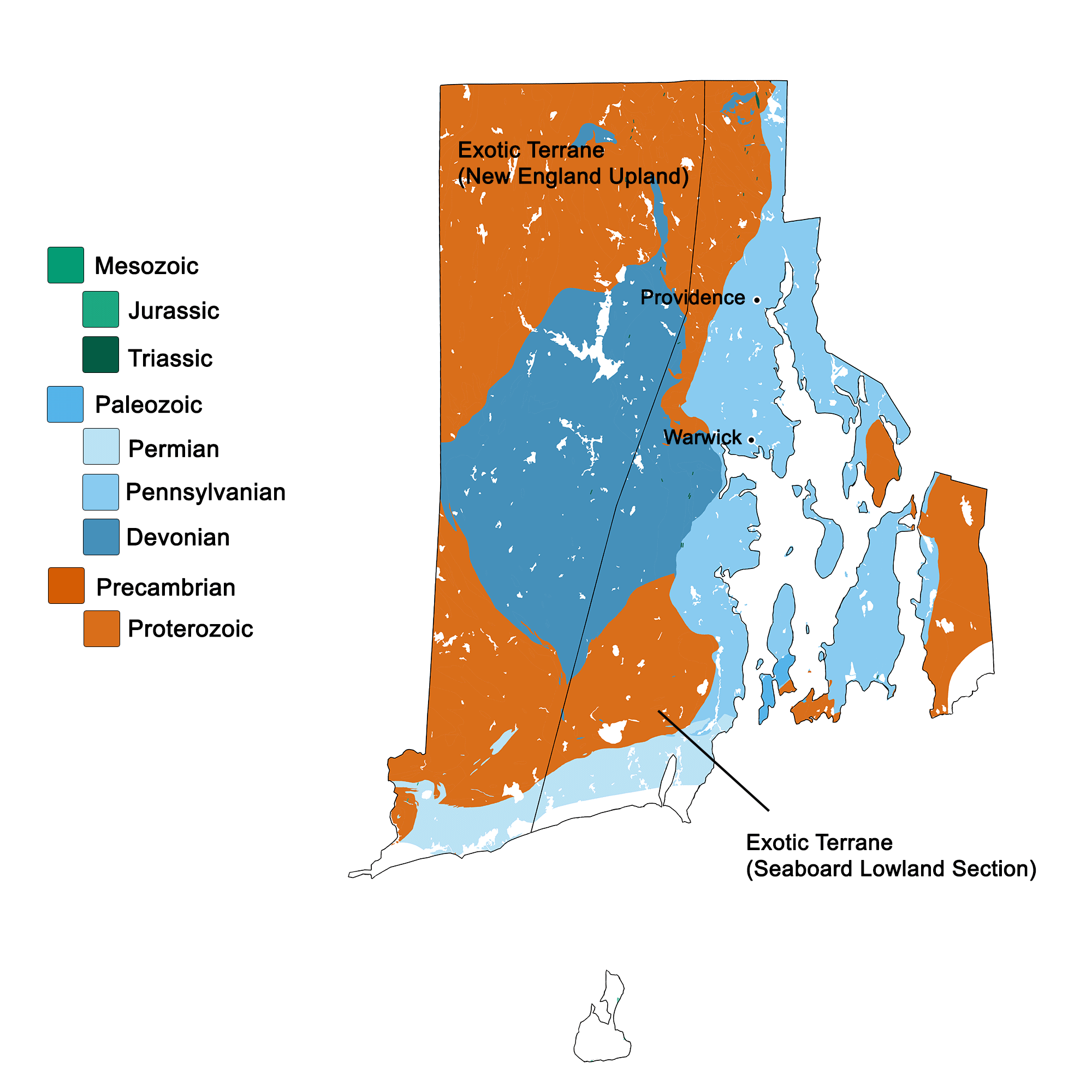
Geologic map of Rhode Island showing maximum ages of mappable units. Image by Kiera D. Crowley for the Earth@Home project developed using QGIS and USGS data (public domain) from Fenneman and Johnson (1946) and Horton et al. (2017).
Rhode Island State Fossil: Trilobite
In 2022, Rhode Island designated trilobites (genus and species not stated) as the state fossil.
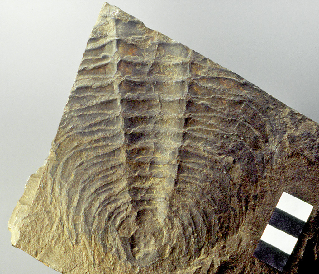
Thorax (body) and pygidium (tail) of a fossil specimen of the trilobite Acadoparadoxides harlani from the Middle Cambrian Braintree Formation of Massachusetts. Photograph by James St. John (Flickr; Creative Commons Attribution 2.0 Generic license). Paradoxid trilobites like those found in Rhode Island and eastern parts of Massachusetts share close affinity with trilobites from northern Africa and parts of Europe. Why? Learn more about Paradoxids and continental drift on our Northeast Regional Guide to Fossils of the Exotic Terrane.
Rhode Island State Rock: Cumberlandite
Cumberlandite is a dense, slightly magnetic igneous rock found in northern Rhode Island. It comes from only a single locality near the town of Cumberland, although specimens have been scattered across the state due to movement by glaciers.
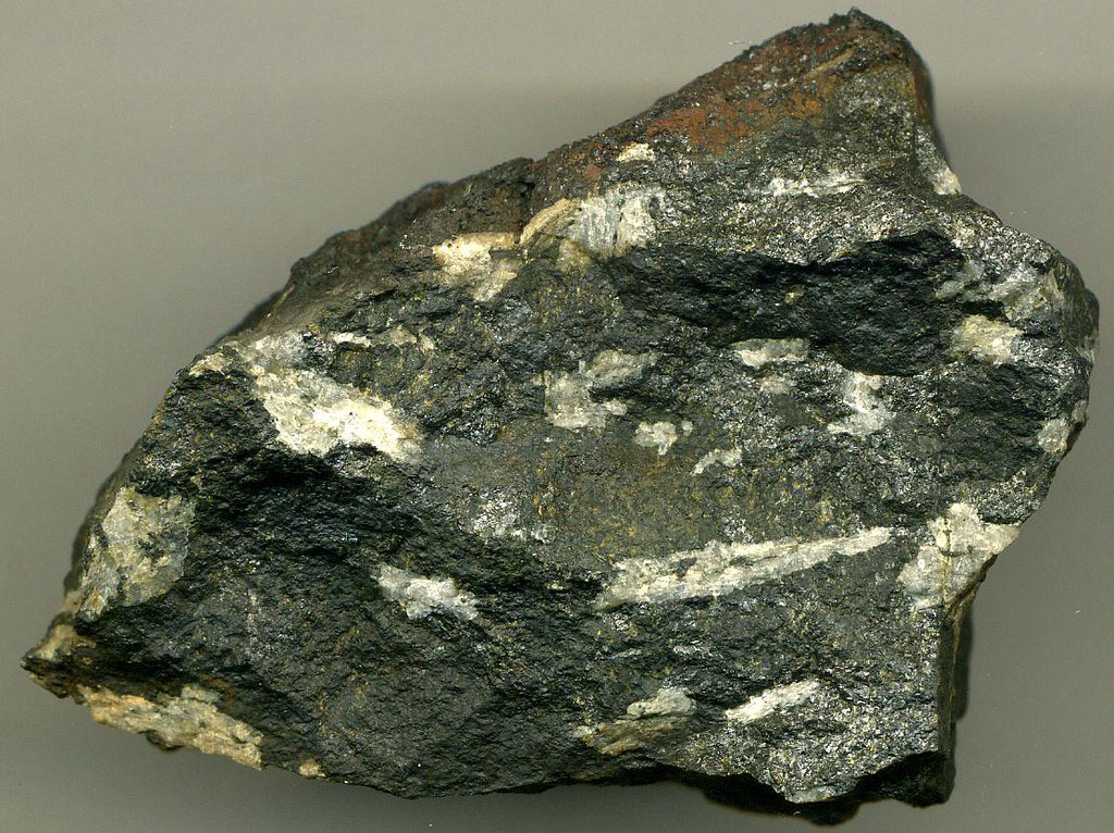
Neoproterozoic to Late Devonian aged Cumberlandite specimen from Rhode Island. Photo by James St. John (Flickr; Creative Commons Attribution 2.0 Generic license; image resized).
Rhode Island State Mineral: Bowenite
Bowenite is found in northern Rhode Island and was named after the geologist who first discovered it, George Bowen.
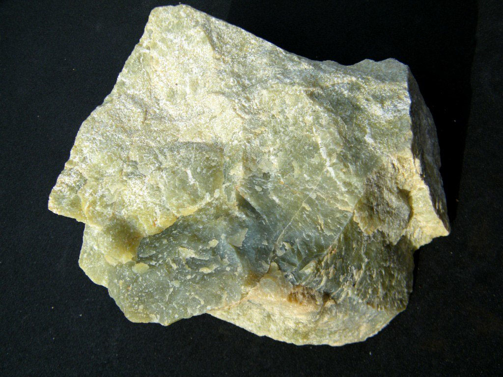
Sample of Bowenite from Warren County, New York. Photo by John Krygier (Wikimedia Commons; public domain).
Rhode Island State Gem: None
Rhode Island does not yet have an official state gem.
Rhode Island's Highest and Lowest Elevations
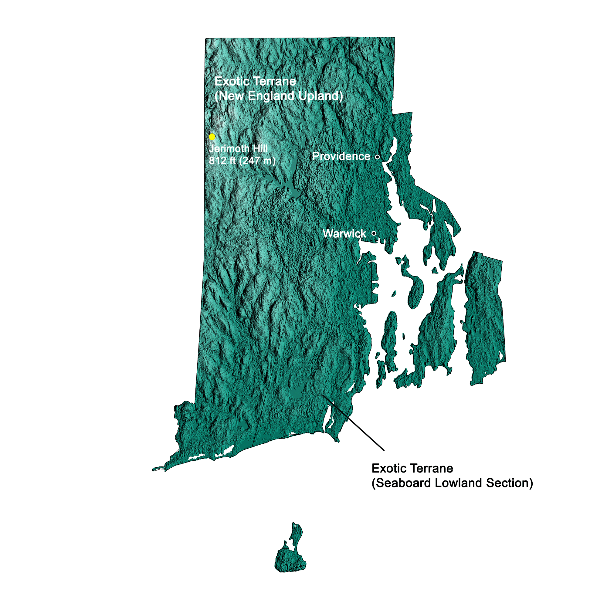
Topographic map of Rhode Island with physiographic regions and point of highest elevation identified. Topographic data are derived from the Shuttle Radar Topography Mission (SRTM GL3) Global 90m (SRTM_GL3) (Farr, T. G., and M. Kobrick, 2000, Shuttle Radar Topography Mission produces a wealth of data. Eos Trans. AGU, 81:583-583). Image by Kiera D. Crowley for the Earth@Home project.
Highest Elevation: Jerimoth Hill
At 247 meters (812 feet) above sea level, Jerimoth Hill in northwestern Rhode Island is the highest point in the state.
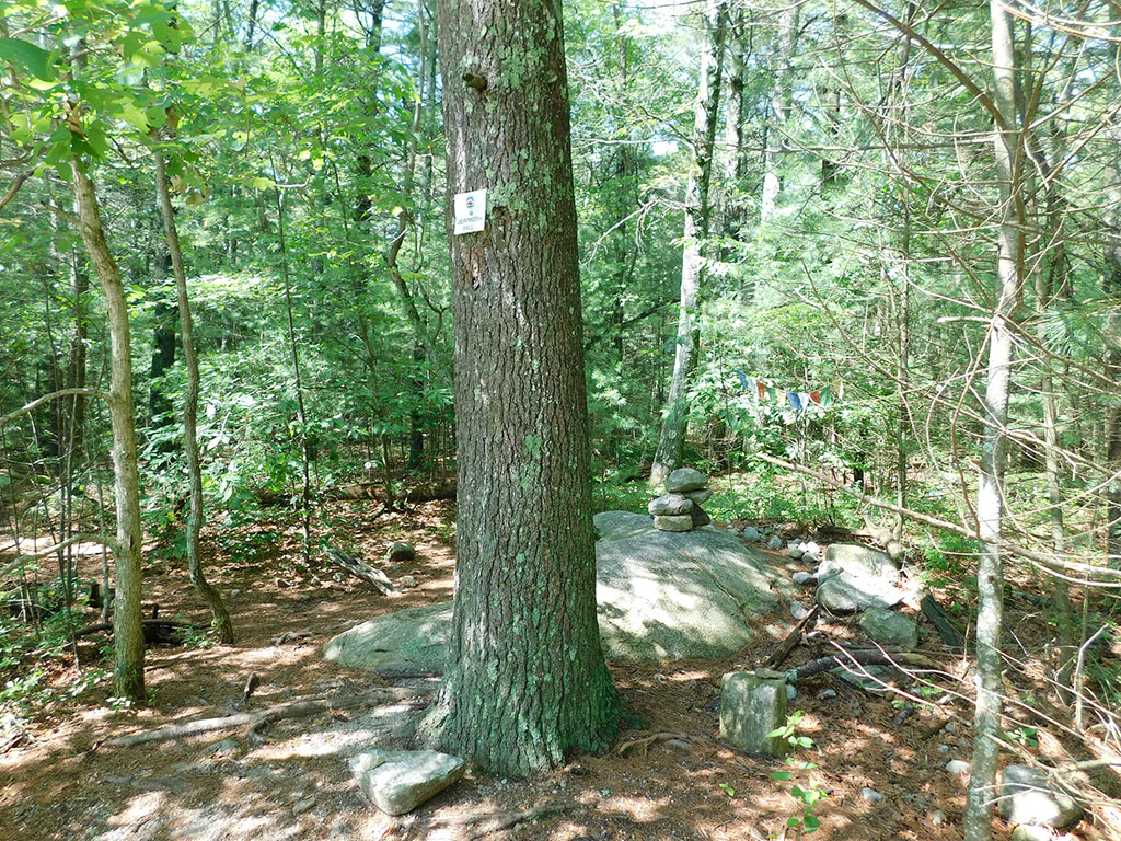
Summit of Jerimoth Hill, the point of highest elevation in Rhode Island. Photo by Jimmy Emerson (Flickr; Creative Commons Attribution-NonCommercial-NoDerivs 2.0 Generic license).
Lowest Elevation: Atlantic Coast
Rhode Island's lowest points are along its coastline, where the shore is at sea level.
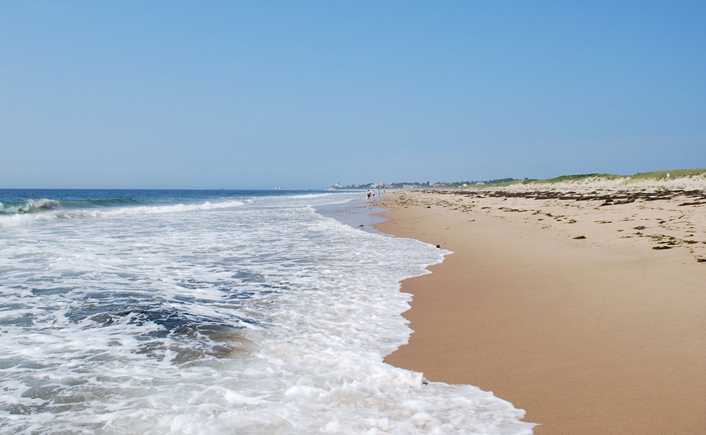
Misquamicut State Beach in Westerly, Rhode Island. Photo by Julian Colton (Flickr; Creative Commons Attribution-NonCommercial 2.0 Generic license; image resized).
Places to Visit
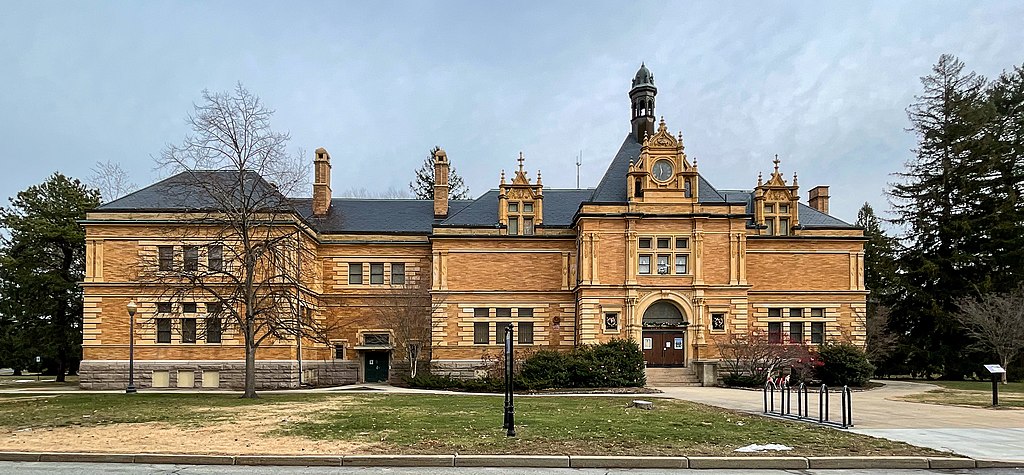
Museum of Natural History and Planetarium in Roger Williams Park, Providence, Rhode Island. Photo by Kenneth Zirkel (Wikimedia Commons; Creative Commons Attribution-ShareAlike 4.0 International license).
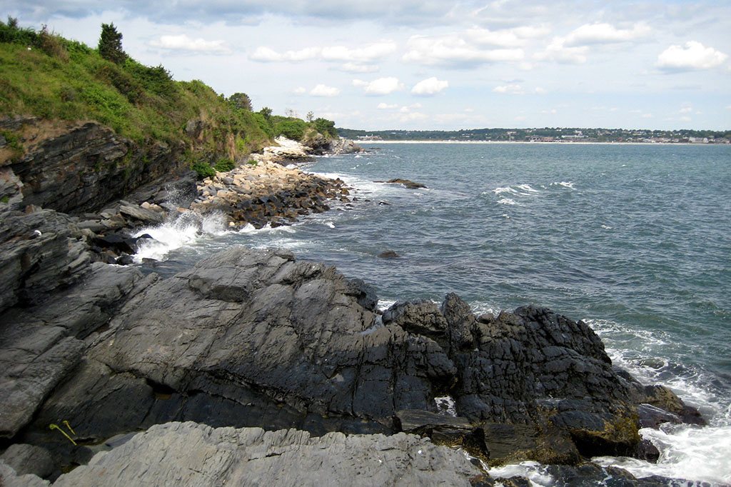
Shoreline of the Cliff Walk in Newport, Rhode Island. Photo by Wally Gobetz (Flickr; Creative Commons Attribution-NonCommercial-NoDerivs 2.0 Generic license).
Additional resources

Earth@Home resources about Rhode Island and nearby states:
- Rocks: Central Lowland, Inland Basin, Appalachians and Piedmont, Coastal Plain, and Exotic Terrane.
- Fossils: Central Lowland, Inland Basin, Appalachians and Piedmont, Coastal Plain, and Exotic Terrane.
- Topography: Central Lowland, Inland Basin, Appalachians and Piedmont, Coastal Plain, and Exotic Terrane.
- Mineral Resources: Central Lowland, Inland Basin, Appalachians and Piedmont, Coastal Plain, and Exotic Terrane.
Earth@Home resources about the northeastern region of the United States: