

Page snapshot: Maine State Geologic Map; Fossil; 3D models; Rock; Mineral; Gem; Highest and Lowest Elevations; Places to Visit; and Additional Resources.
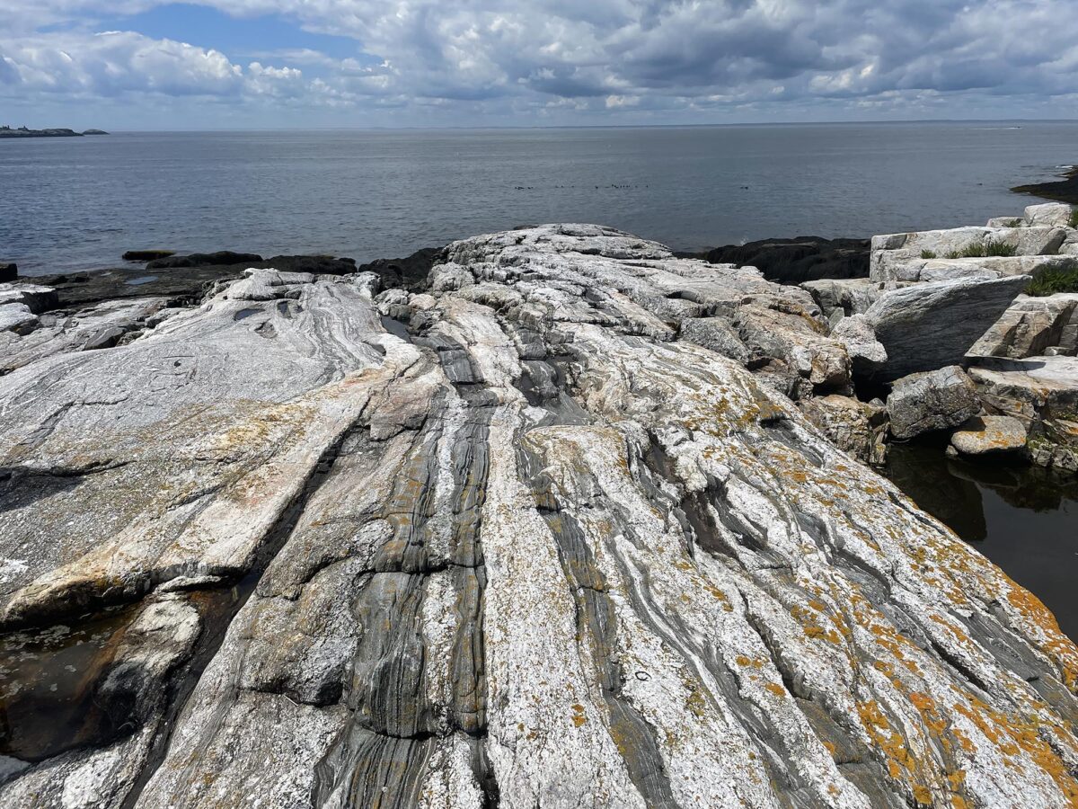
Image above: Granitic gneiss rocks exposed on the shores of Appledore Island in the Isles of Shoals, seven miles off the coast in York County, Maine. Photograph by Kiera D. Crowley.
Geologic Map of Maine
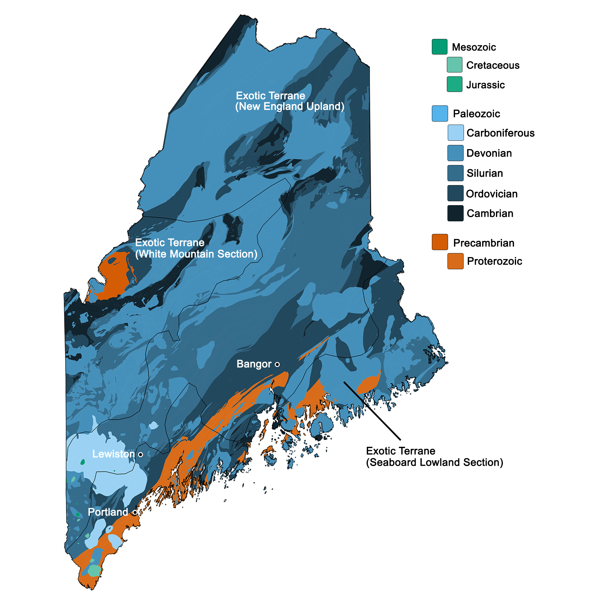
Geologic map of Maine showing maximum ages of mappable units. Image by Kiera D. Crowley for the Earth@Home project developed using QGIS and USGS data (public domain) from Fenneman and Johnson (1946) and Horton et al. (2017).
Maine State Fossil: Trimerophyte Plant
Maine's state fossil is the Devonian plant Pertica quadrifaria, a type of plant known as a trimerophyte. Pertica was first found in Baxter State Park, Maine.
Trimerophytes were early vascular plants, or plants that had the conducting tissues phloem (food-conducting tissue) and xylem (water-conducting tissue). Trimerophytes had unequally branched stems, unlike some other types of early, simple vascular plants, which had equally sized, forking branches. Trimerophytes are thought to be the ancestors of the euphyllophytes, the major group of plants that includes living ferns, horsetails, and seed plants.
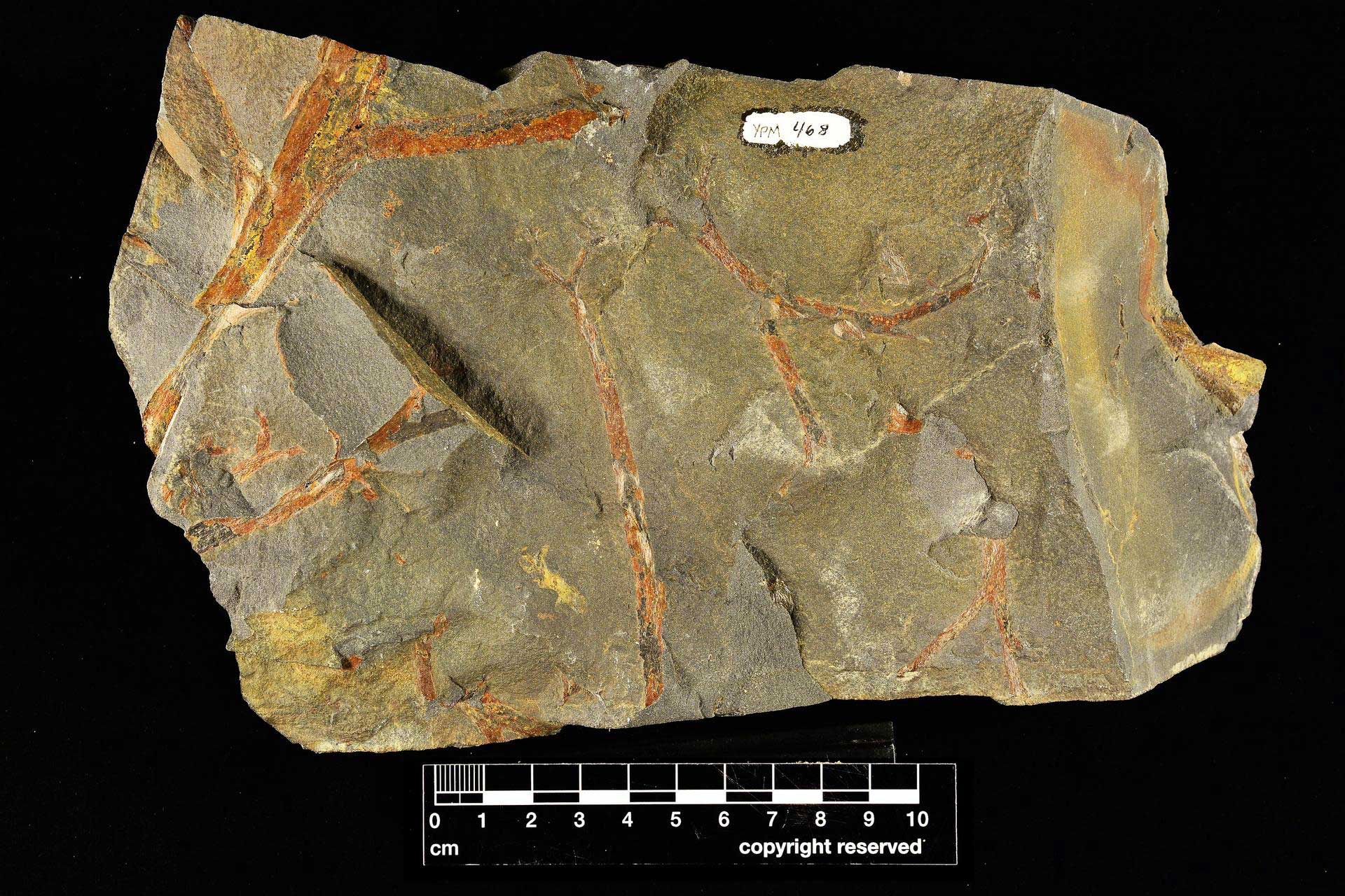
The trimerophyte (a type of early vascular plant) Pertica quadrifaria from the Devonian of Piscataquis County, Maine. Photo of YPM PB 000468 by Robert Swerling, Yale Peabody Museum, 2020 (CC0 1.0 Universal/public domain dedication).
Maine State Rock: None
Maine does not yet have an official state rock.
Maine State Mineral: Tourmaline
The colorful species of tourmaline found in Maine, elbaite, can be found in crystals as big as a foot long! The pegmatite granite common throughout the state provides open cavities in the rock in which these crystals can grow.
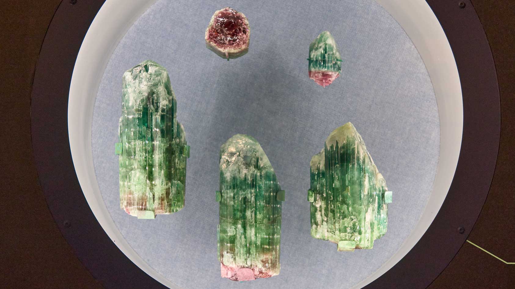
Samples of multicolored tourmaline from Maine. Photograph by Graeme Churchard (Flickr; Creative Commons Attribution 2.0 Generic license; image cropped and re-sized).
Maine State Gem: None
Maine does not yet have an official state gem, although its state mineral, Tourmaline, is also often considered to be the state gemstone.
Maine's Highest and Lowest Elevations
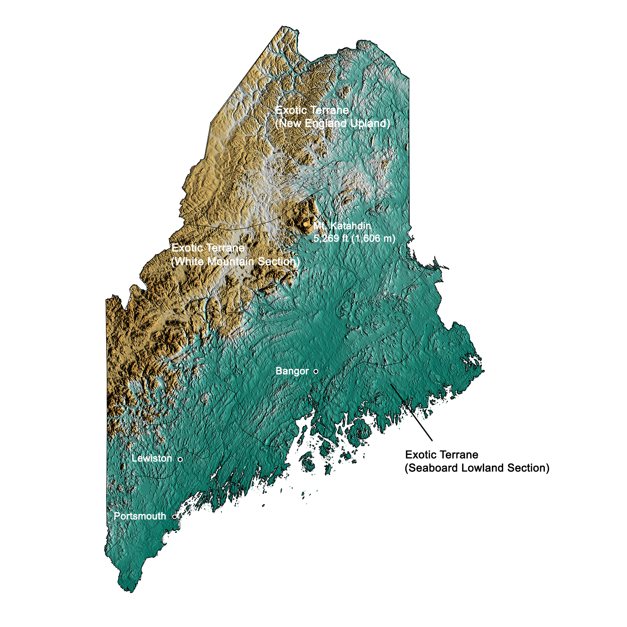
Topographic map of Maine with physiographic regions and point of highest elevation identified. Topographic data are derived from the Shuttle Radar Topography Mission (SRTM GL3) Global 90m (SRTM_GL3) (Farr, T. G., and M. Kobrick, 2000, Shuttle Radar Topography Mission produces a wealth of data. Eos Trans. AGU, 81:583-583). Image by Kiera D. Crowley for the Earth@Home project.
Highest Elevation: Mt. Katahdin
At 1,606 meters (5,269 feet) above sea level, Mount Katahdin, in Baxter State Park, is the highest point in the state of Maine.
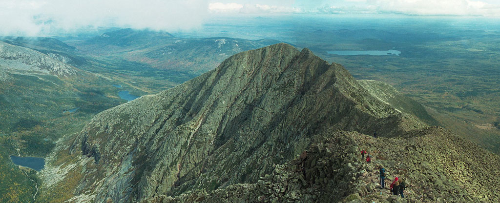
Mount Katahdin, the point of highest elevation in Maine. Photograph by Josh Delp (Flickr; Creative Commons Attribution-NonCommercial 2.0 Generic license; image cropped and re-sized).
Lowest Elevation: Atlantic Coast
Maine's lowest points are along its Atlantic coastline, where the shore is at sea level.
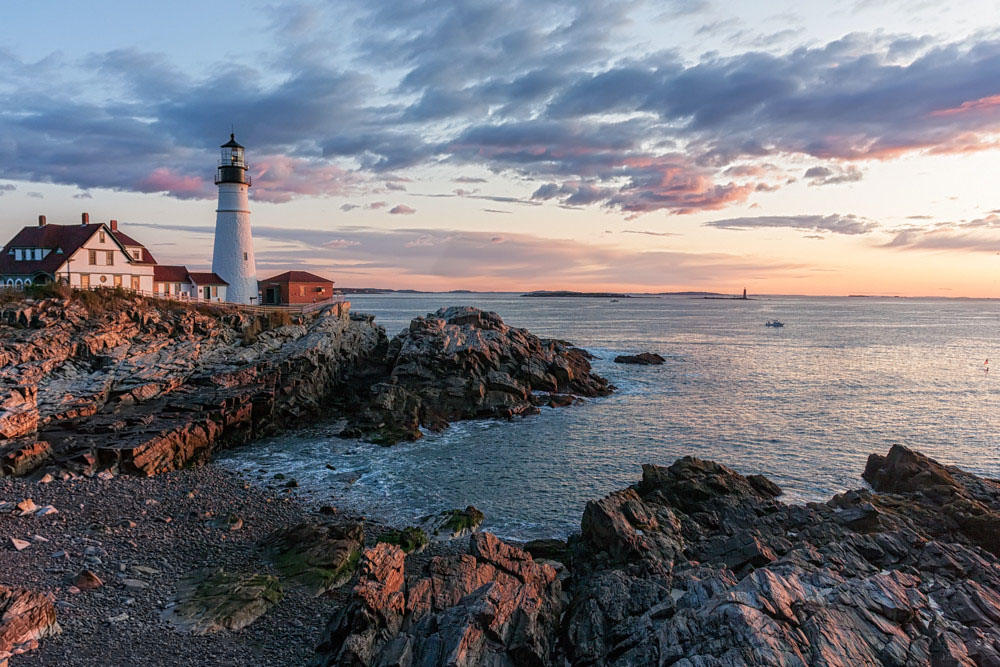
Portland Head Lighthouse on the rocky shores of Maine. Photograph by Matthew Paulson (Flickr; Creative Commons Attribution-NonCommercial-NoDerivs 2.0 Generic license).
Places to Visit
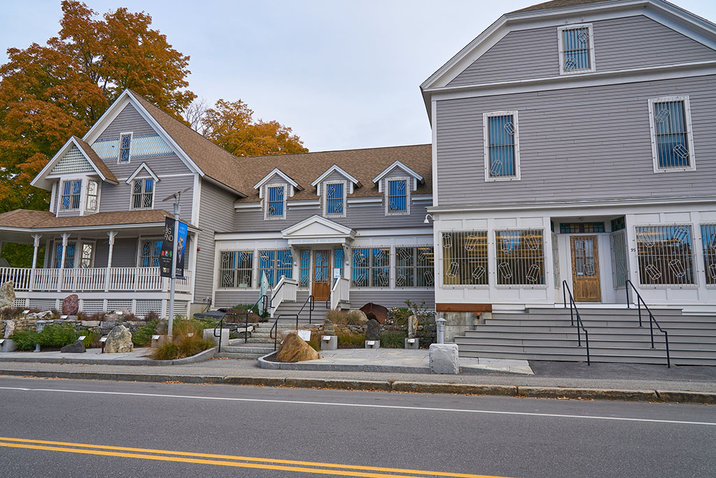
The Maine Mineral and Gem Museum. Photograph by Graeme Churchard (Flickr; Creative Commons Attribution 2.0 Generic license; image cropped and re-sized).

The Maine State Museum, Archive, and Library building. Photograph by J. Stephen Conn (Flickr; Creative Commons Attribution-NonCommercial 2.0 Generic license; image cropped and re-sized).
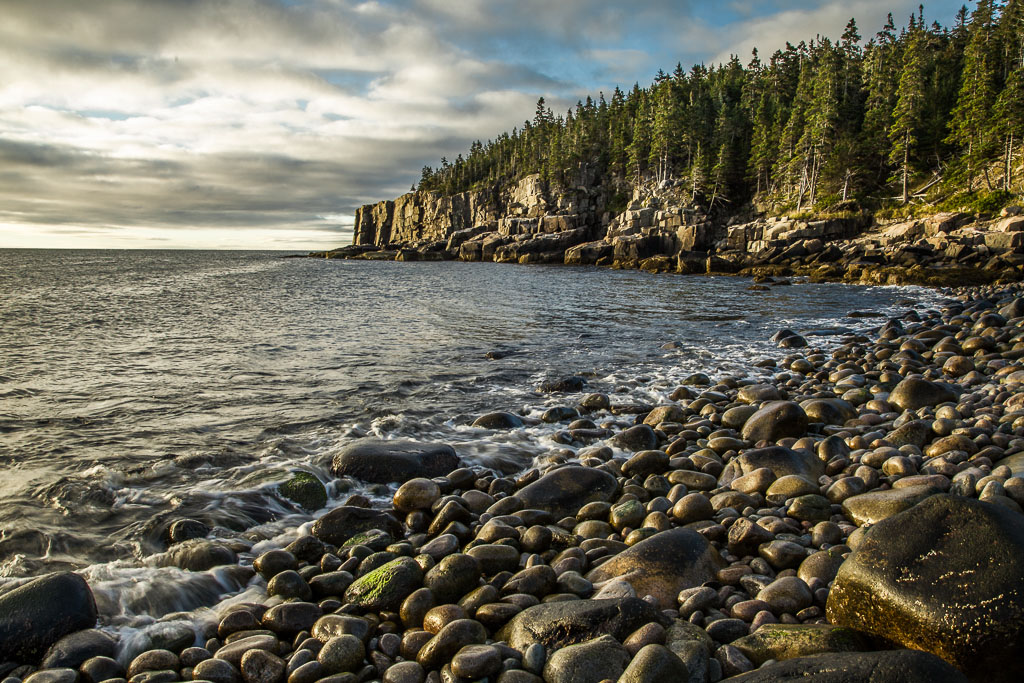
Sunrise on the rocky shore of Acadia National Park. Photograph by Barbara Friedman (Flickr; Creative Commons Attribution-NonCommercial 2.0 Generic license; image re-sized).
Additional resources

Earth@Home resources about Maine and nearby states:
- Rocks: Central Lowland, Inland Basin, Appalachians and Piedmont, Coastal Plain, and Exotic Terrane.
- Fossils: Central Lowland, Inland Basin, Appalachians and Piedmont, Coastal Plain, and Exotic Terrane.
- Topography: Central Lowland, Inland Basin, Appalachians and Piedmont, Coastal Plain, and Exotic Terrane.
- Mineral Resources: Central Lowland, Inland Basin, Appalachians and Piedmont, Coastal Plain, and Exotic Terrane.
Earth@Home resources about the northeastern region of the United States: