

Page snapshot: Vermont State Geologic Map; Fossils; 3D model; Rock; Mineral; Gem; Highest and Lowest Elevations; Places to Visit; and Additional Resources.
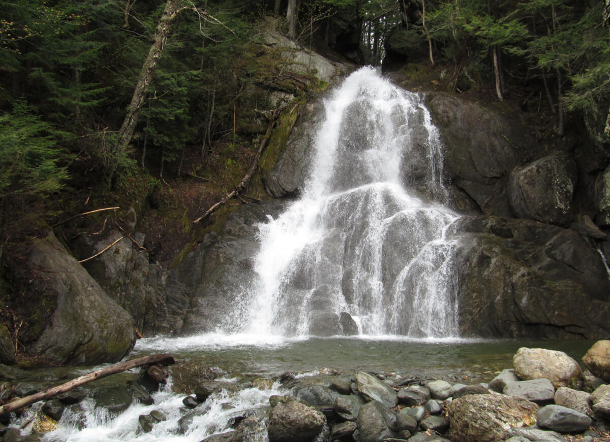
Image above: Moss Glen Falls in Granville, Vermont. Water cascades over a hundred feet down rock of the Green Mountains. Photo by Doug Kerr (Flickr; Creative Commons Attribution 2.0 Generic license; image resized).
Geologic Map of Vermont
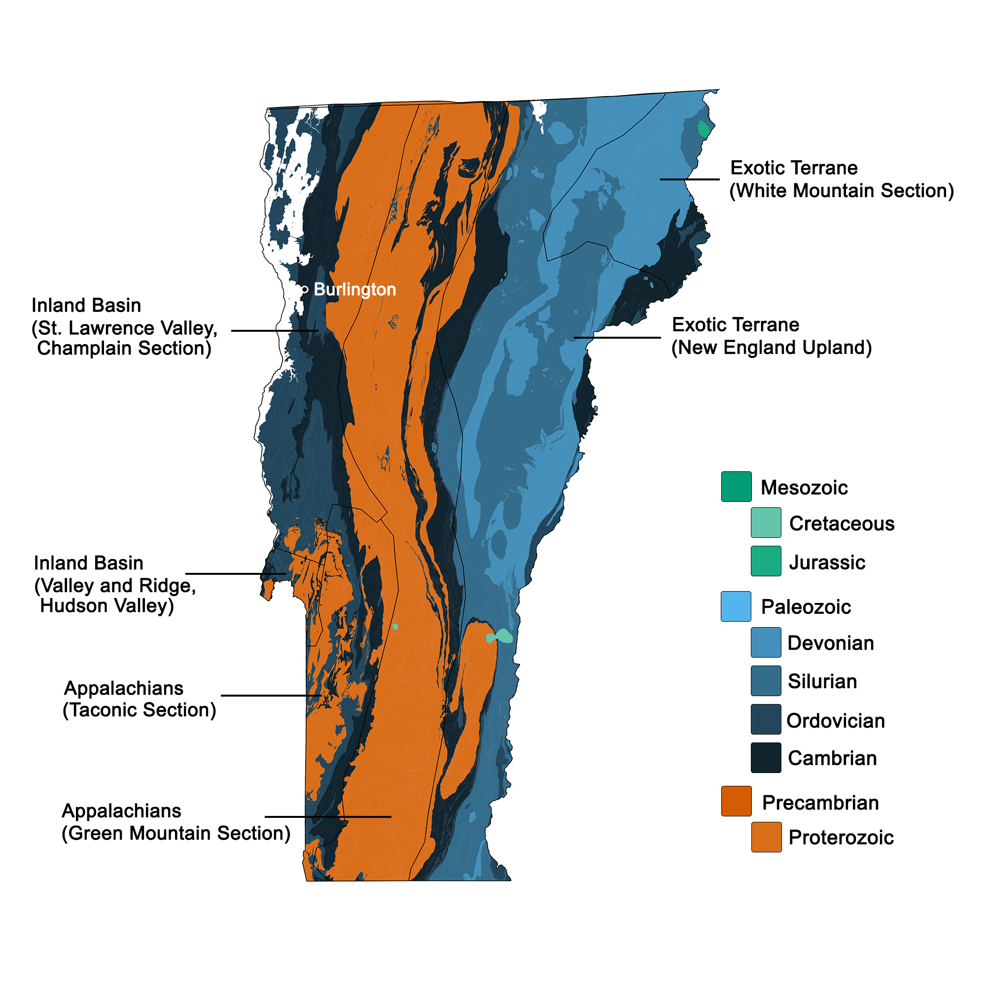
Geologic map of Vermont showing maximum ages of mappable units. Image by Kiera D. Crowley for the Earth@Home project developed using QGIS and USGS data (public domain) from Fenneman and Johnson (1946) and Horton et al. (2017).
Vermont State Fossils:
Vermont has two state fossils, both from the Pleistocene epoch: the Mount Holly Mammoth (Mammuthus primigenius) and the Charlotte Whale (Delphinapterus leucas). Both were discovered during railroad construction in ~1850. The Mount Holly Mammoth is known from only fragmental material: a few bones, one tooth, and both tusks. It is housed in the collections of the University of Vermont. The 12,500-year-old skeleton of the Charlotte Whale was excavated from a site formerly underwater in the Champlain Sea. It is currently on display in the Perkins Geology Museum at the University of Vermont.
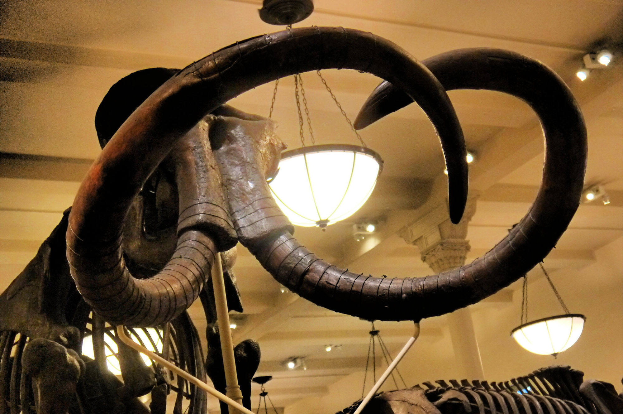
Mounted skeleton of a woolly mammoth on display at the American Museum of Natural History in New York City, which is the same species as the Mount Holly Mammoth of Vermont. Photo by "Eden, Janine and Jim" (Flickr; Creative Commons Attribution 2.0 Generic license; image resized).
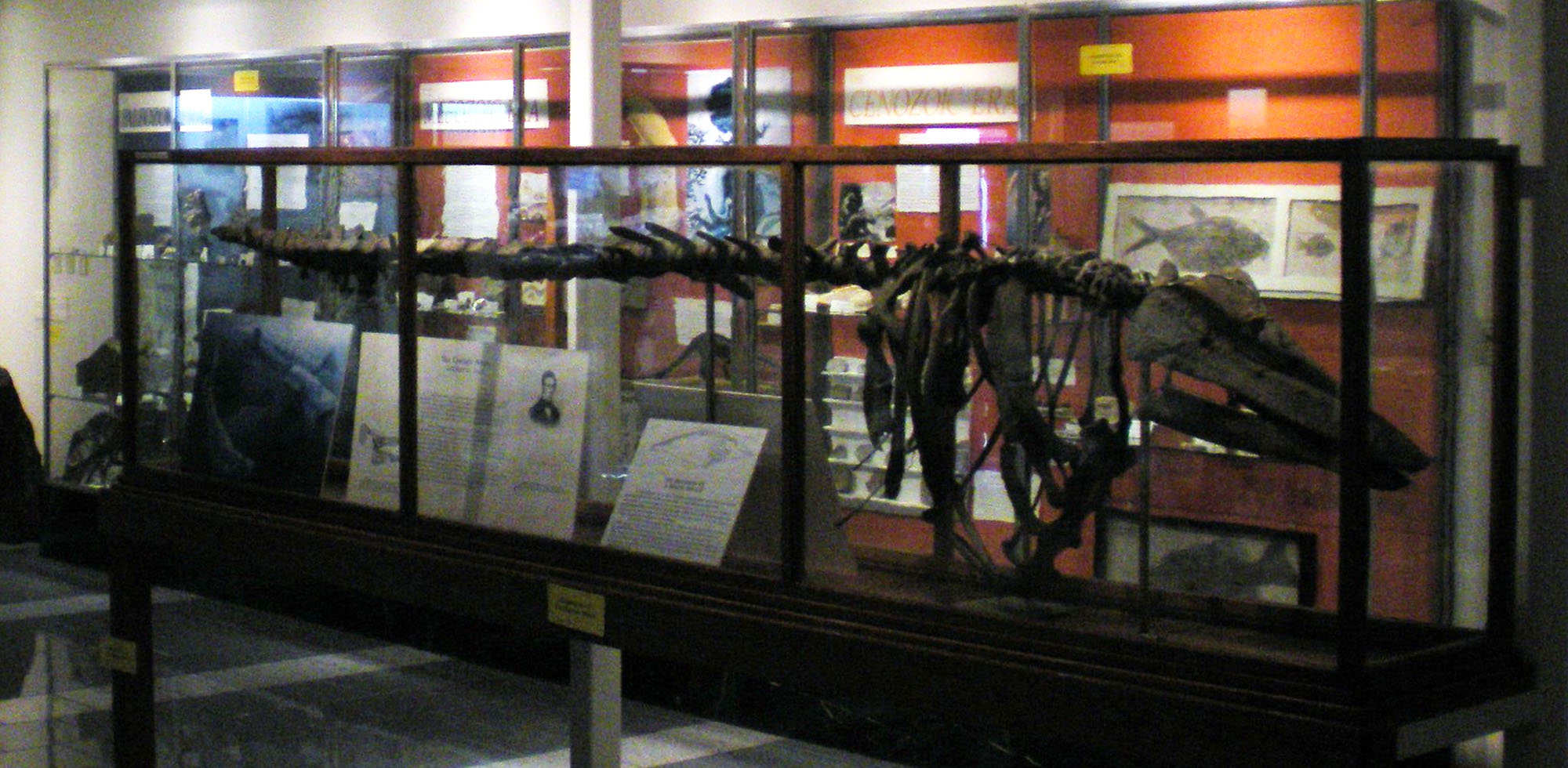
The Charlotte Whale skeleton mounted in the Perkins Geology Museum in Burlington, Vermont. Photo by "placeuvm" (Flickr; Creative Commons Attribution-NonCommercial-ShareAlike 2.0 Generic license; image cropped and resized).
Vermont State Rocks: Granite, Marble, & Slate
Vermont has three official state rocks, and all three are well-renowned outside of the state. Vermont granite formed from igneous intrusions during the Acadian mountain-building event several hundred million years ago, and is part of the New Hampshire Plutonic Series. The famed Barre Granite of Vermont is commercially valuable worldwide for building and monument stone, and it makes a great outdoor sculpture medium due to its fine grain and high weather resistance. Vermont marble was used to construct the Jefferson Memorial in Washington, D.C., and Vermont slate makes the roof of the White House.
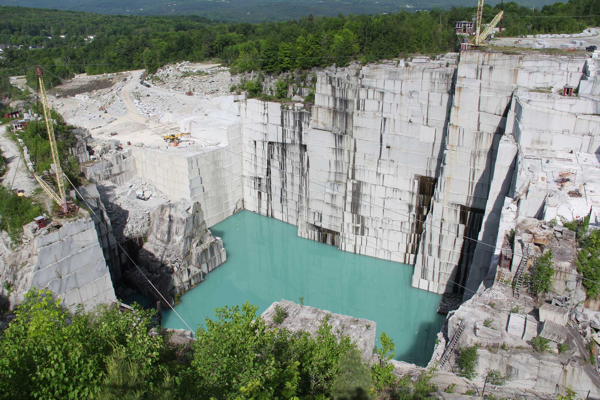
Rock of Ages Granite Quarry, Barre, Vermont. Photo by Mrosen99 (Wikimedia Commons, Creative Commons Attribution-ShareAlike 4.0 International license, image resized).
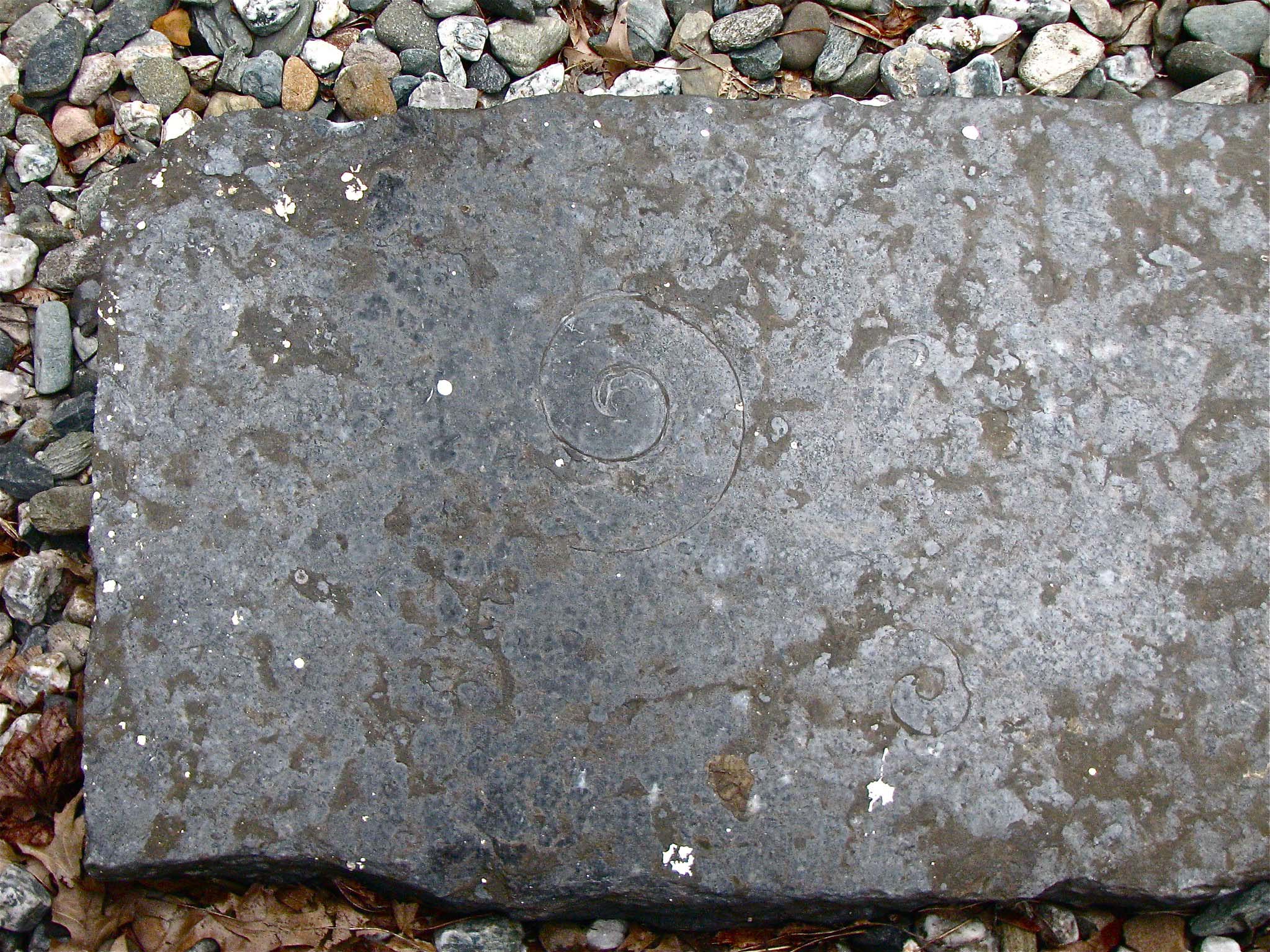
Slab of black marble from Isle La Motte, Vermont. Note the circular cephalopod outlines visible in this fossiliferous marble. Photo by Don Shall (Flickr; Creative Commons Attribution-NonCommercial-NoDerivs 2.0 Generic license).
3D Model of Vermont Marble
Rock sample of white marble from Rutland, Vermont. Marble like this is one of Vermont's three state rocks. Specimen is from the collections of the Paleontological Research Institution, Ithaca, New York. Length of specimen is approximately 8.5 cm.
Vermont State Mineral: Talc
Talc is a magnesium hydroxyl silicate mineral that is found with serpentinite in many localities throughout Vermont. It is commonly white, and more rarely foliated green (see image below). Vermont is one of the top states in the country for commercial talc output. Soapstone, a composite of talc and chlorite, also has historic significance for Vermont's economy given its heat-resistant uses in plumbing and fireplaces, among many others.
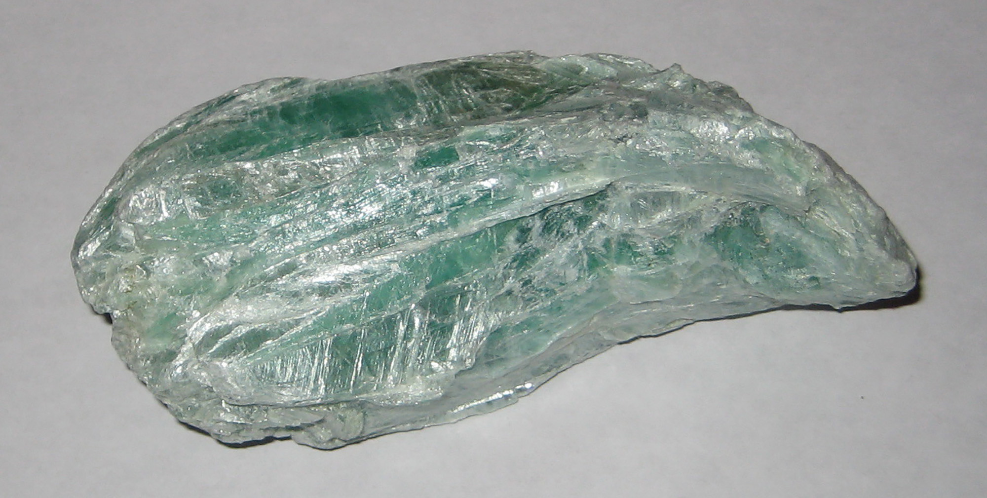
Mineral specimen of green-colored talc from Argonaut Quarry, in Windsor County, Vermont. Photo by Stephanie Clifford (Flickr; Creative Commons Attribution 2.0 Generic license).
Vermont State Gem: Grossular Garnet
Garnet is a silicate mineral, and grossular garnet is a calcium-aluminum garnet that usually forms with the metamorphosis of certain limestones. The Belvidere asbestos mine in Lowell, Vermont, has been described as the finest quarry for this type of garnet in the world.
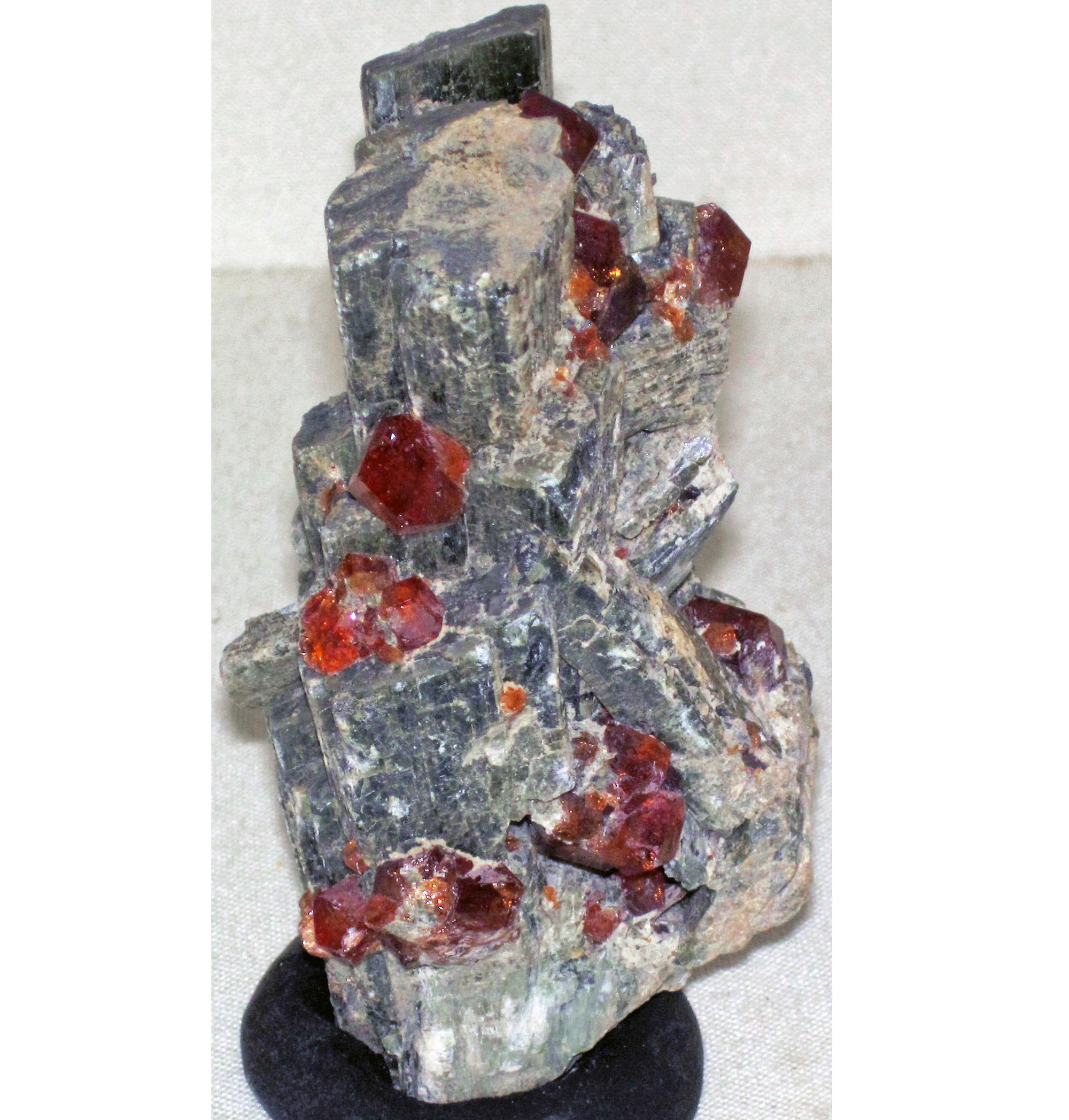
Mineral specimen of grossular garnet (red) and diopside (grey) from Belvidere asbestos mine, in Lowell, Vermont. Photo by James St. John (Flickr; Creative Commons Attribution 2.0 Generic license).
Vermont's Highest and Lowest Elevations
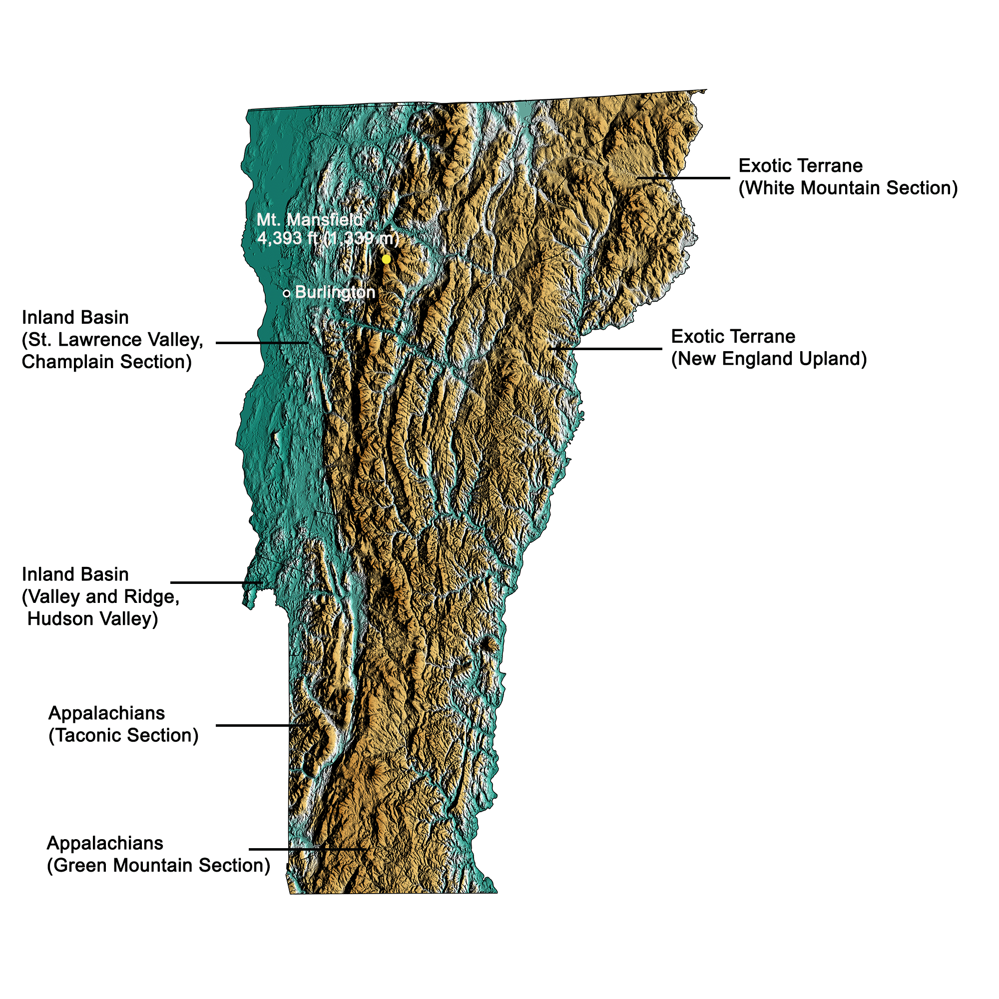
Topographic map of Vermont with physiographic regions and point of highest elevation identified. Topographic data are derived from the Shuttle Radar Topography Mission (SRTM GL3) Global 90m (SRTM_GL3) (Farr, T. G., and M. Kobrick, 2000, Shuttle Radar Topography Mission produces a wealth of data. Eos Trans. AGU, 81:583-583). Image by Kiera D. Crowley for the Earth@Home project.
Highest Elevation: Mount Mansfield
At 1,339 meters (4,393 feet) above sea level, Mount Mansfield is the highest point in the state of Vermont.
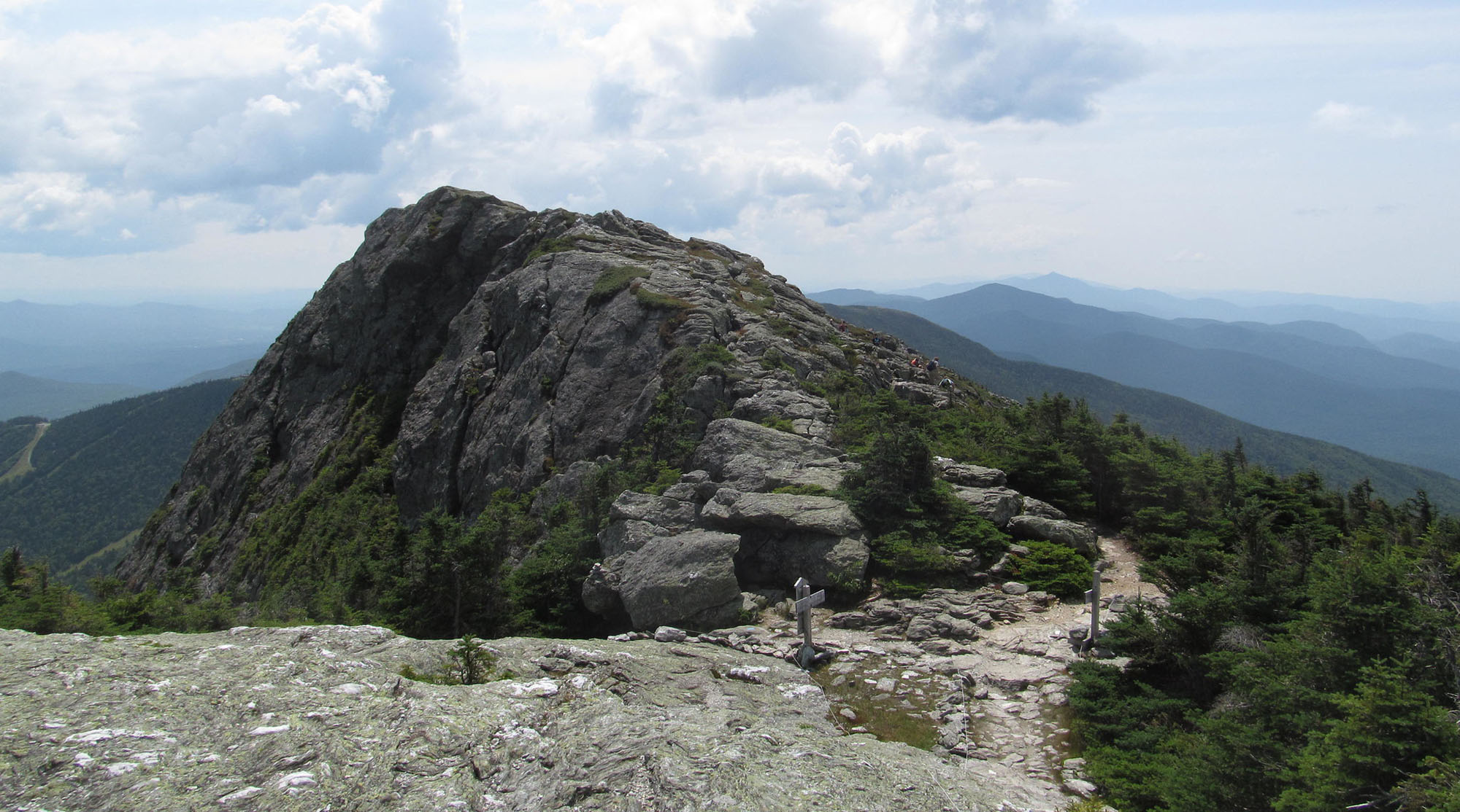
View of the peak of Mount Mansfield in Vermont. Photo by Doug Kerr (Flickr; Creative Commons Attribution-ShareAlike 2.0 Generic license; image cropped and resized).
Lowest Elevation: Lake Champlain
Lake Champlain, along the New York border in northwestern Vermont, is the lowest point in the state with an elevation of 19.5 meters (64 feet).
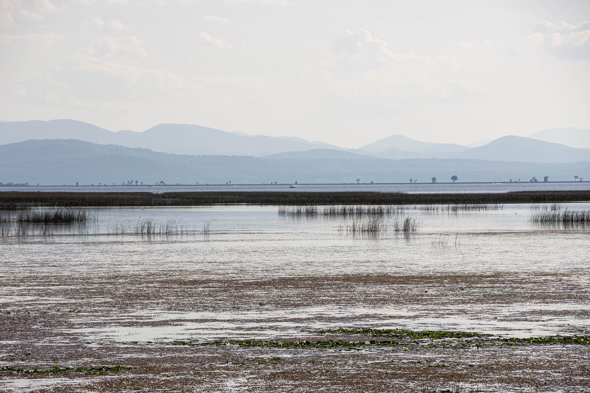
View of Lake Champlain from Sand Bar State Park in Vermont, looking towards the Adirondacks of New York. Photo by Billy Wilson (Flickr; Creative Commons Attribution-NonCommercial 2.0 Generic license; image resized).
Places to Visit
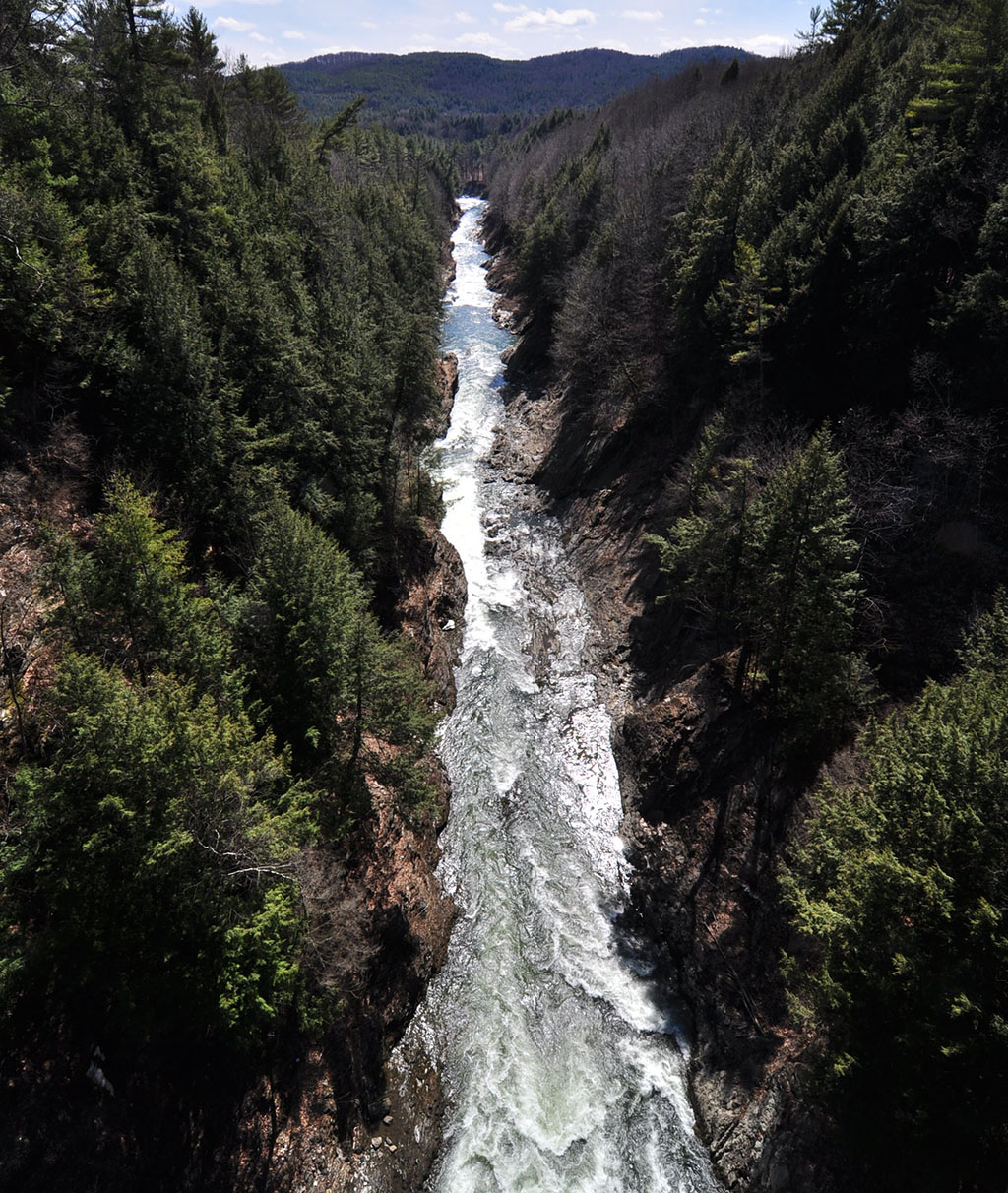
Photo by "pedrik" (Flickr; Creative Commons Attribution 2.0 Generic license; image cropped and resized).
View of the peak of Mount Mansfield in Vermont. Photo by Doug Kerr (Flickr; Creative Commons Attribution-ShareAlike 2.0 Generic license; image cropped and resized).
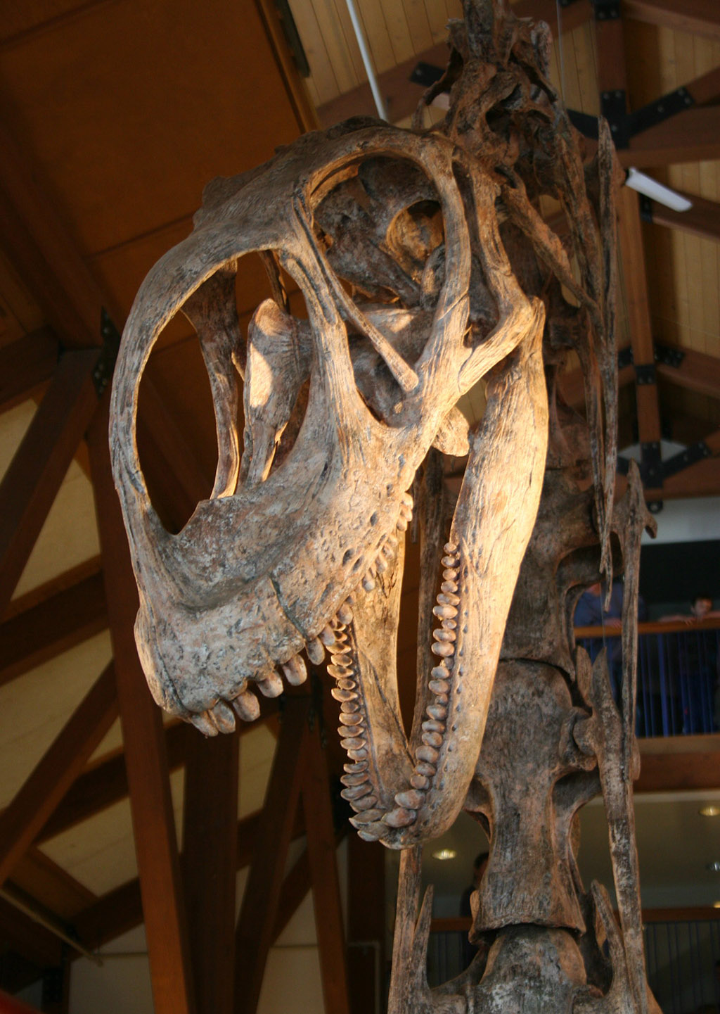
Photo by Abigail Batchelder (Flickr; Creative Commons Attribution 2.0 Generic license; image cropped and resized).
Additional resources

Earth@Home resources about Vermont and nearby states:
- Rocks: Central Lowland, Inland Basin, Appalachians and Piedmont, Coastal Plain, and Exotic Terrane.
- Fossils: Central Lowland, Inland Basin, Appalachians and Piedmont, Coastal Plain, and Exotic Terrane.
- Topography: Central Lowland, Inland Basin, Appalachians and Piedmont, Coastal Plain, and Exotic Terrane.
- Mineral Resources: Central Lowland, Inland Basin, Appalachians and Piedmont, Coastal Plain, and Exotic Terrane.
Earth@Home resources about the northeastern region of the United States: