

Page snapshot: Massachusetts State Geologic Map; Fossils; Rock; Mineral; Gem; Highest and Lowest Elevations; Places to Visit; and Additional Resources.
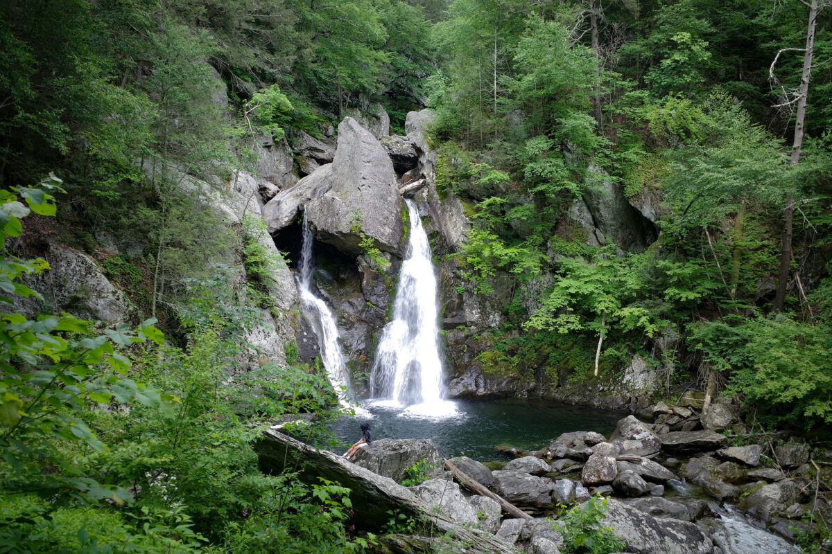
Image above: Bish Bash Falls, in Berkshire County, is the tallest waterfall in the state of Massachusetts with a series of cascades totaling nearly 61 meters (200 feet). Photograph by Fabio Bruna (Flickr; Creative Commons Attribution-ShareAlike 2.0 Generic license; image resized).
Geologic Map of Massachusetts
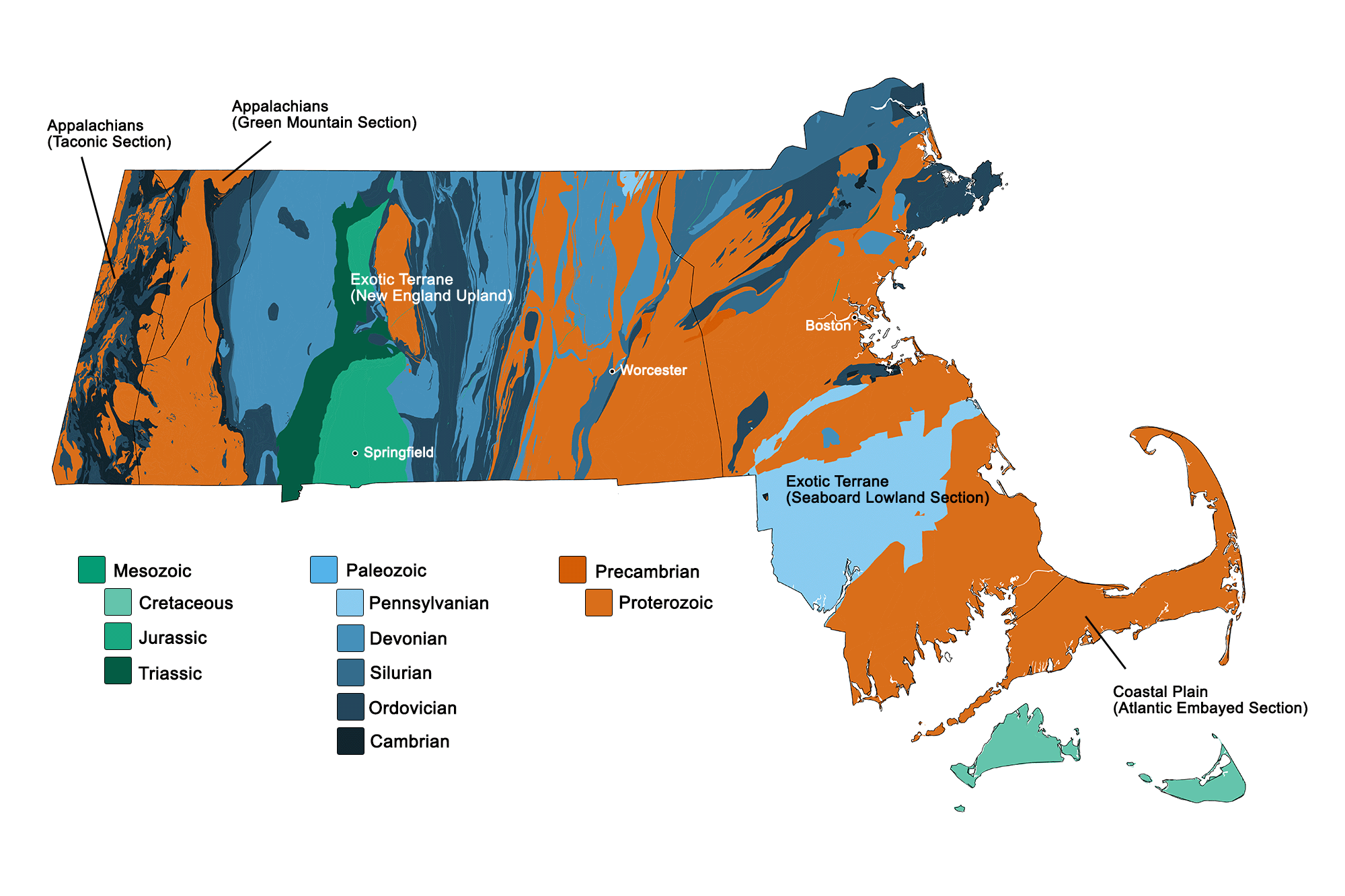
Geologic map of Massachusetts showing maximum ages of mappable units. Image by Kiera D. Crowley for the Earth@Home project developed using QGIS and USGS data (public domain) from Fenneman and Johnson (1946) and Horton et al. (2017).
Massachusetts State Fossils: Dinosaur Tracks & Podokesaurus
The state fossil of Massachusetts is the trace fossil Eubrontes, which is a type of dinosaur footprint that is found in the Triassic to Jurassic rocks of the Newark Supergroup in the Northeast. Examples of these footprints are preserved under a dome at Dinosaur State Park in Connecticut. Fossils of the prosauropod dinosaur Anchisaurus polyzelus, which may have made the Eubrontes tracks in the Northeast, have been found in Connecticut and Massachusetts.
In 2022, Massachusetts officially designated its state dinosaur as Podokesaurus holyokensis. Discovered by Mignon Talbot in 1910, this Mid-Jurassic dinosaur is one of only two dinosaur species known from the state (the second being Anchisaurus, mentioned above).
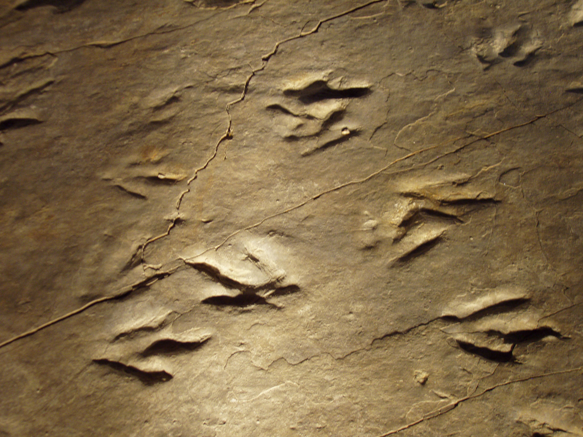
Eubrontes tracks at Dinosaur State Park in Connecticut. Photo by Daderot (Wikimedia Commons, Creative Commons Attribution-ShareAlike 3.0 Unported license).
Listen to Daring to Dig: Adventures of Women in American Paleontology's Alana McGillis explain how paleoartists reconstruct the appearances of dinosaurs like Podokesaurus.
Massachusetts State Rock: Roxbury Puddingstone
Roxbury puddingstone is a conglomerate with sandstone and abundant, rounded pebbles and cobbles of quartzite and granite. The Roxbury Conglomerate Formation is Ediacaran in age (~570 to 595 million years old) and is named after the town of Roxbury, near Boston, where prominent exposures of this rock are exposed at the surface. Roxbury puddingstone has been used in construction in the Boston area for several hundred years.
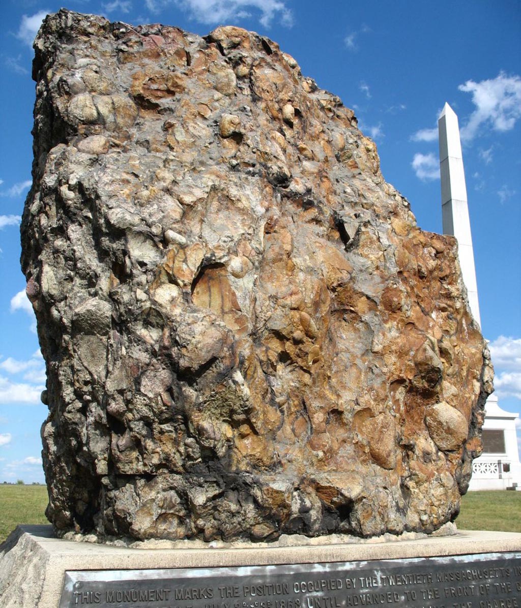
Large block of Roxbury conglomerate sourced from Massachusetts, now on display in Gettysburg, Pennsylvania, as a monument to the 20th Massachusetts Infantry of the Civil War. Photo by "nikoretro" (Flickr; Creative Commons Attribution-ShareAlike 2.0 Generic license; image cropped and resized).
Massachusetts State Mineral: Babingtonite
Babingtonite is a dark-green to black colored silicate mineral containing iron and manganese. It forms in the cavities of mafic volcanic rocks, and in Massachusetts, is thought to be a crystallization product of magmas brought to the surface during the break-up of Pangaea in the Triassic. Babingtonite was first described from samples in Norway, and was named after the Irish mineralogist William Babington. It was not reported from Massachusetts until 1844.
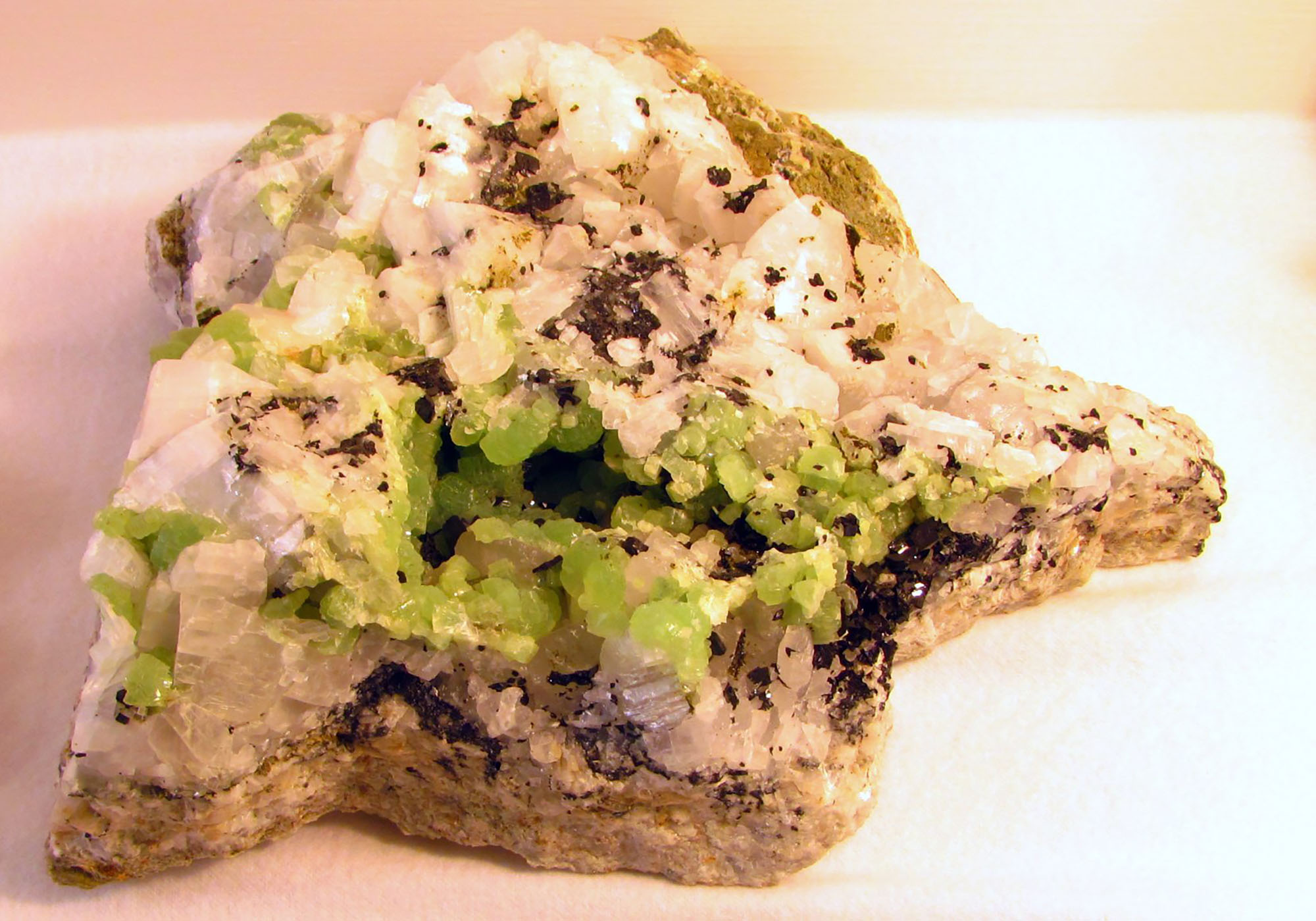
Specimen of babingtonite (black) with commonly associated crystals of prehnite (green) and calcite (white) from Lane Traprock quarry in Hampden County, Massachusetts. Photo by Rhiannon Boyle (Flickr; Creative Commons Attribution-NonCommercial-NoDerivs 2.0 Generic license).
Massachusetts State Gem: Rhodonite
Rhodonite is a silicate mineral with red- to pink-colored hues from the manganese it contains. When polished, the mineral is used for ornamental purposes such as making jewelry.
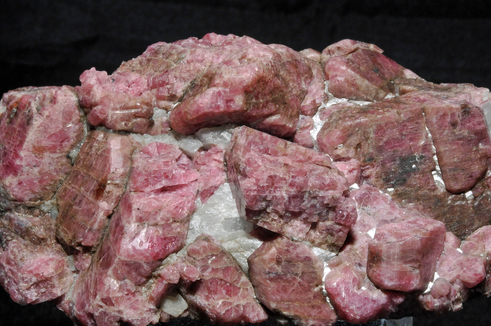
Mineral specimen showing rhodonite crystals (pink) and calcite crystals (white) from Franklin Mine, Sussex County, New Jersey. Similar stones are found in Massachusetts. Photo by Géry Parent (Flickr; Creative Commons Attribution-NoDerivs 2.0 Generic license).
Massachusetts's Highest and Lowest Elevations
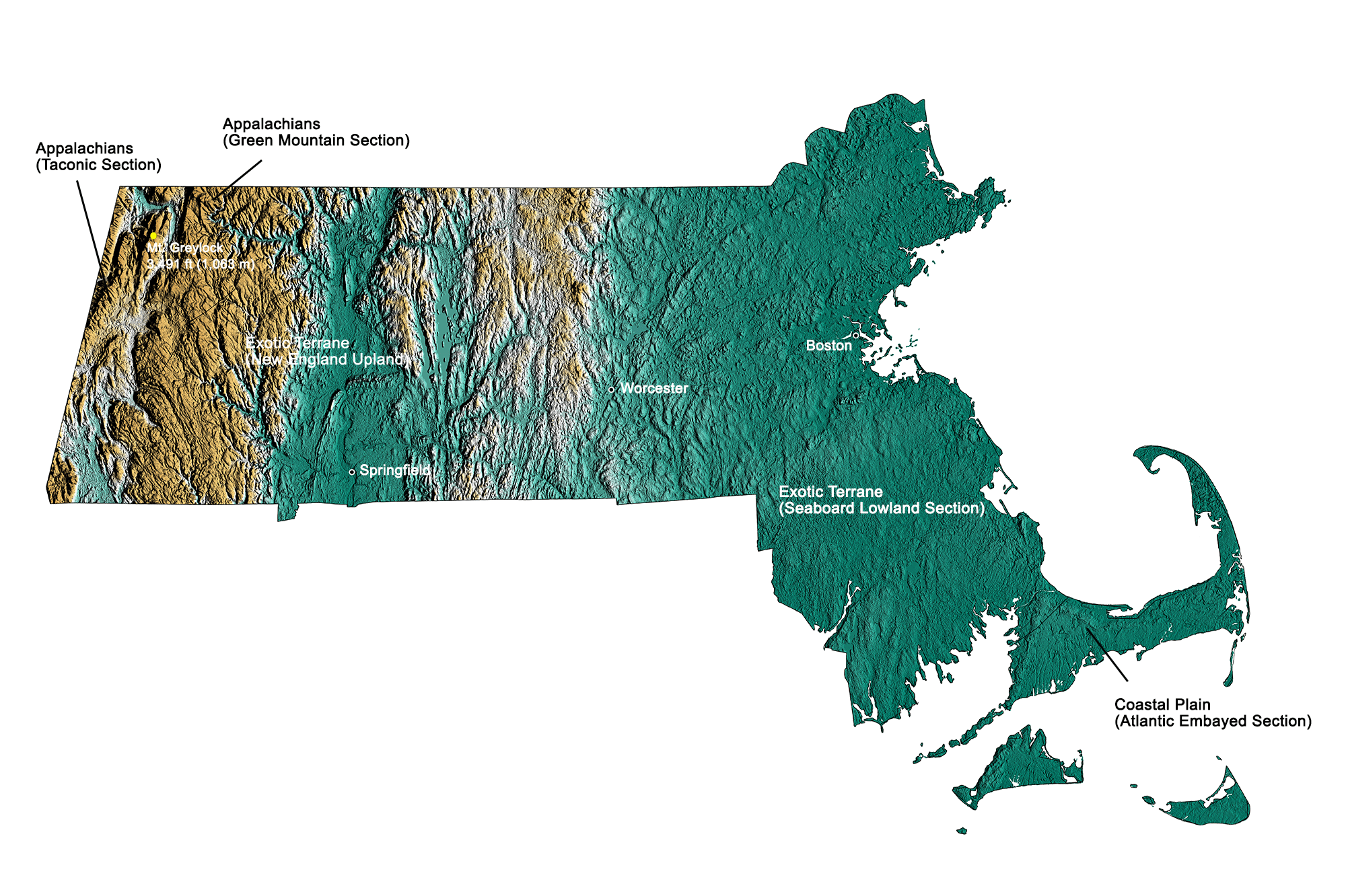
Topographic map of Massachusetts with physiographic regions and point of highest elevation identified. Topographic data are derived from the Shuttle Radar Topography Mission (SRTM GL3) Global 90m (SRTM_GL3) (Farr, T. G., and M. Kobrick, 2000, Shuttle Radar Topography Mission produces a wealth of data. Eos Trans. AGU, 81:583-583). Image by Kiera D. Crowley for the Earth@Home project.
Highest Elevation: Mount Greylock
At 1,063 meters (3,489 feet) above sea level, Mount Greylock, in northwestern Massachusetts, is the highest point in the state.
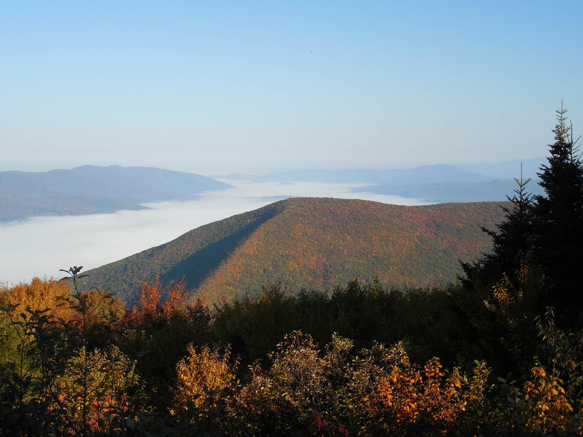
View of Mount Greylock, the point of highest elevation in Massachusetts, which is found in the northwestern part of the state near the town of Adams. Photo by Doug Kerr (Flickr; Creative Commons Attribution-ShareAlike 2.0 Generic license; image resized).
Lowest Elevation: Atlantic Coast
The lowest points of Massachusetts are along its Atlantic coastline, where the shore is at sea level.
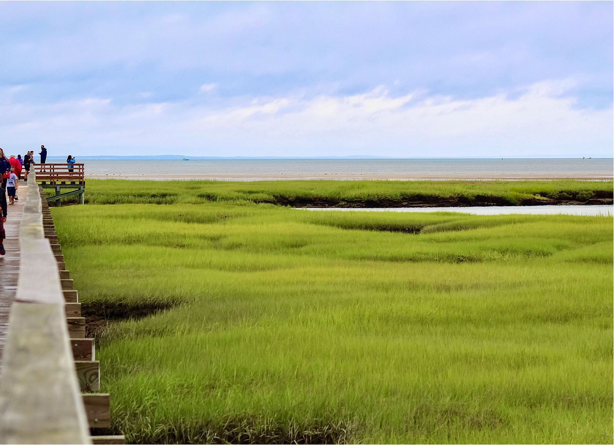
View of Bass Hole Boardwalk and the surrounding marsh, looking out towards the Atlantic Ocean in Yarmouth, Massachusetts. Photo by Robert Laliberte (Flickr; Creative Commons Attribution-NonCommercial 2.0 Generic license; image cropped and resized).
Places to Visit

Tyrannosaur docent welcoming visitors into the Museum of Science in Boston. Photo by Linden Tea (Flickr; Creative Commons Attribution-NonCommercial-NoDerivs 2.0 Generic license).
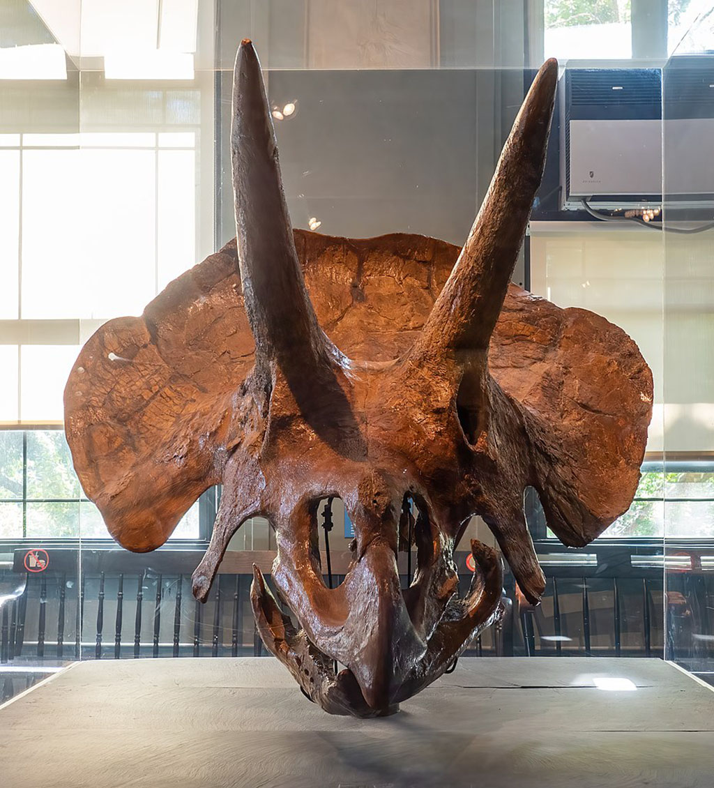
Triceratops skull on display at the Harvard Museum of Natural History. Photo by "Rhododendrites" (Wikimedia Commons; Creative Commons Attribution-ShareAlike 4.0 International license; image resized).
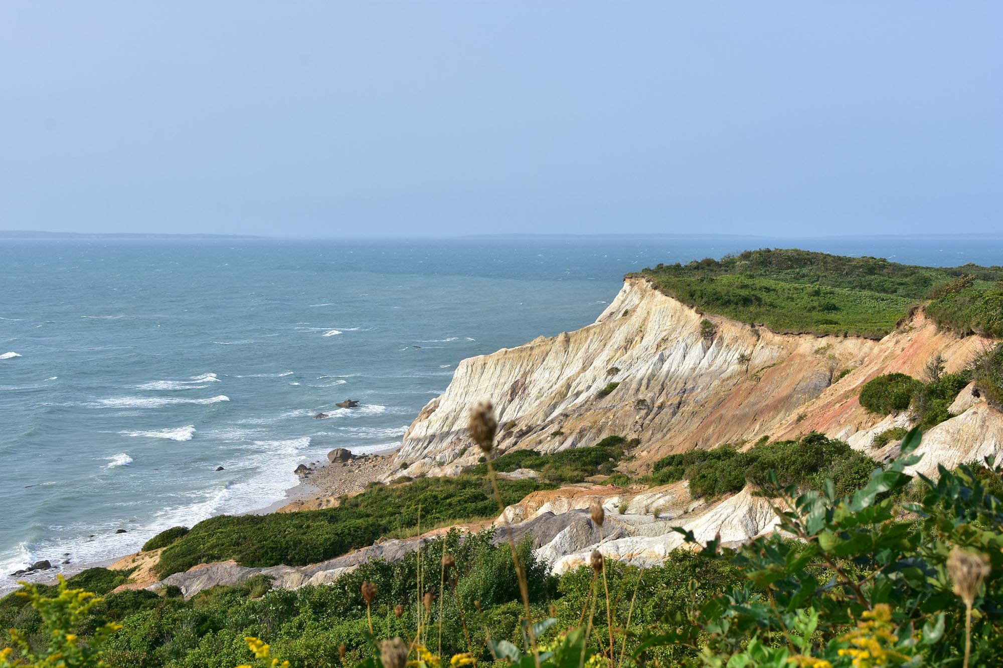
The chalk cliffs of Aquinnah on Martha's Vineyard Island, Massachusetts. Photo by "pedrick" (Flickr; Creative Commons Attribution 2.0 Generic license; image resized).
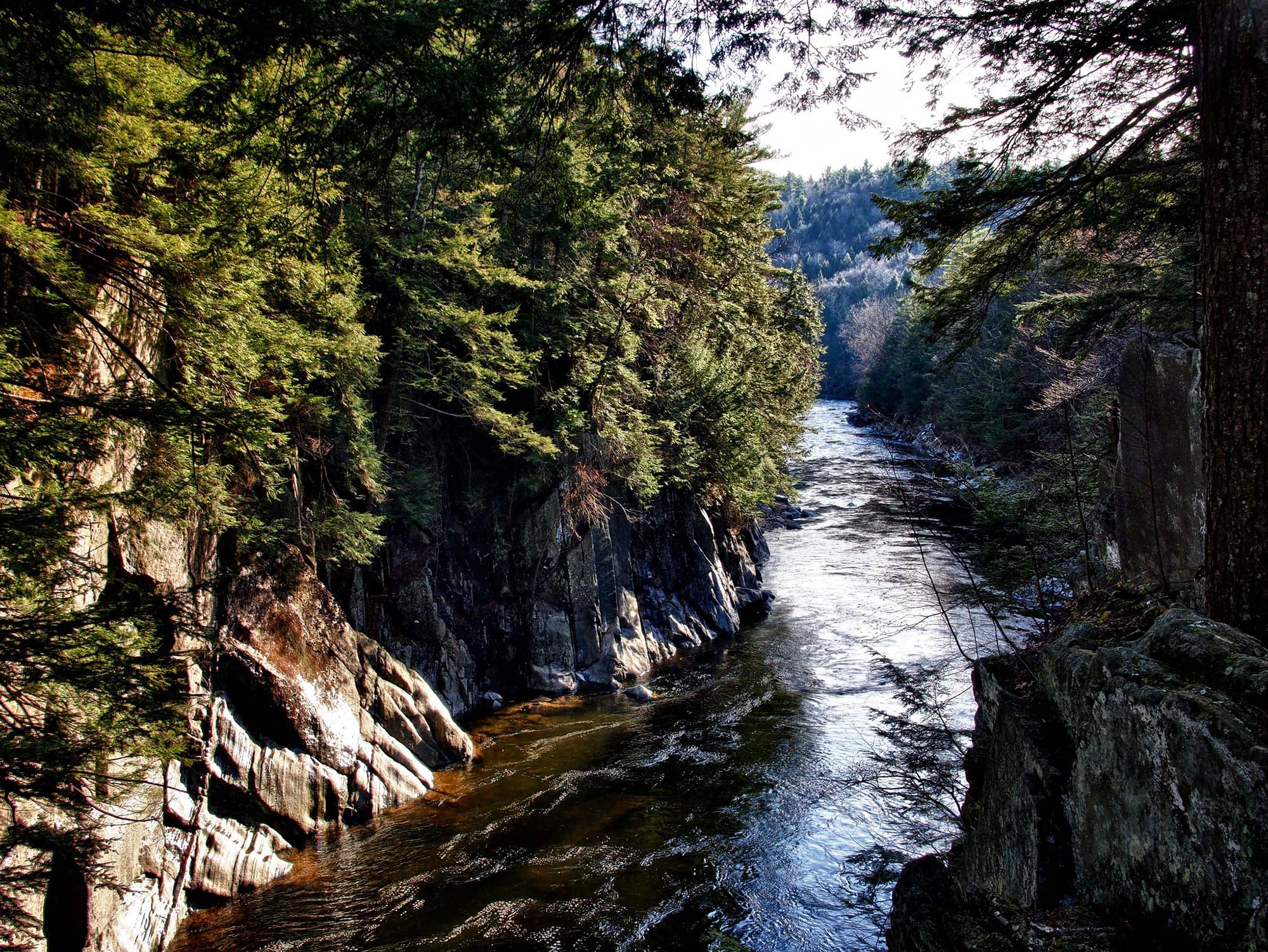
View of Chesterfield Gorge and the Westfield River carving it, from the Chesterfield Gorge Reservation in Massachusetts. Photo by Jack Amick (Flickr; Creative Commons Attribution-NonCommercial 2.0 Generic license; image resized).
Additional resources

Earth@Home resources about Massachusetts and nearby states:
- Rocks: Central Lowland, Inland Basin, Appalachians and Piedmont, Coastal Plain, and Exotic Terrane.
- Fossils: Central Lowland, Inland Basin, Appalachians and Piedmont, Coastal Plain, and Exotic Terrane.
- Topography: Central Lowland, Inland Basin, Appalachians and Piedmont, Coastal Plain, and Exotic Terrane.
- Mineral Resources: Central Lowland, Inland Basin, Appalachians and Piedmont, Coastal Plain, and Exotic Terrane.
Earth@Home resources about the northeastern region of the United States: