

Page snapshot: New Hampshire State Geologic Map; Fossil; Rock; Mineral; Gem; Highest and Lowest Elevations; Places to Visit; and Additional Resources.
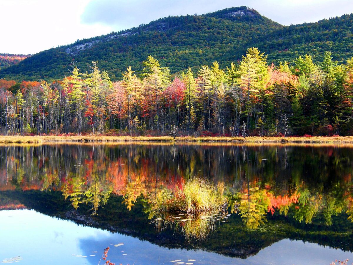
Image above: Autumn descends in the White Mountains of New Hampshire. A major component of these mountains is the granite which gives New Hampshire its nickname: "the granite state". Photo by Stanley Zimny (Flickr; Creative Commons Attribution-NonCommercial 2.0 Generic license; image resized).
Geologic Map of New Hampshire
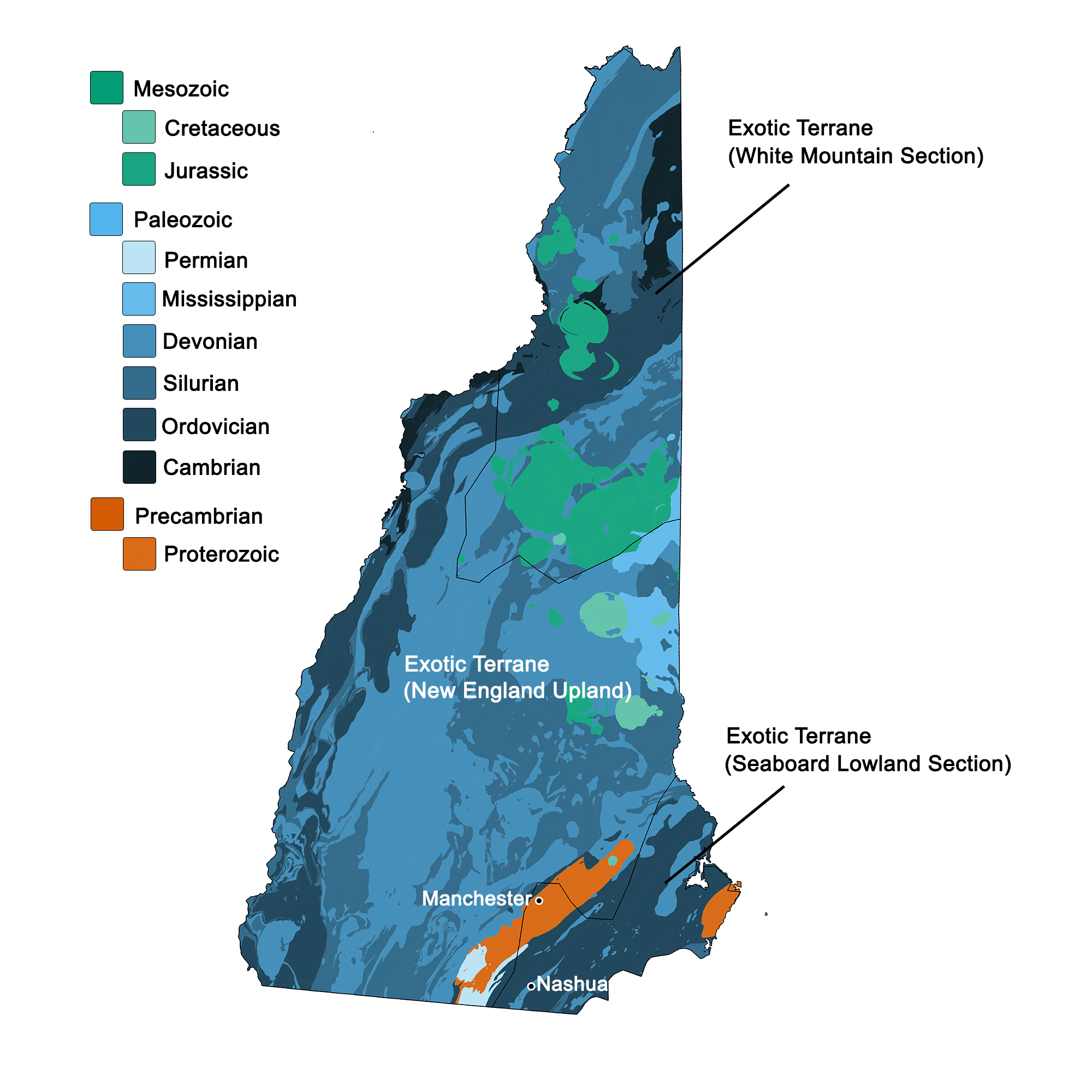
Geologic map of New Hampshire showing maximum ages of mappable units. Image by Kiera D. Crowley for the Earth@Home project developed using QGIS and USGS data (public domain) from Fenneman and Johnson (1946) and Horton et al. (2017).
New Hampshire State Fossil: None
New Hampshire does not yet have an official state fossil.
New Hampshire State Rock: Granite
The Granite State is well known for its strong and aesthetic granite rocks, which have been used in numerous construction projects throughout the state and beyond. Notably, the Library of Congress in Washington, D.C., is composed of New Hampshire granite. Much of the bedrock of the state is comprised of granite, and it was made widely visible at the surface when glaciers in the last glacial period scraped off overlying sediments and deposited them further south.
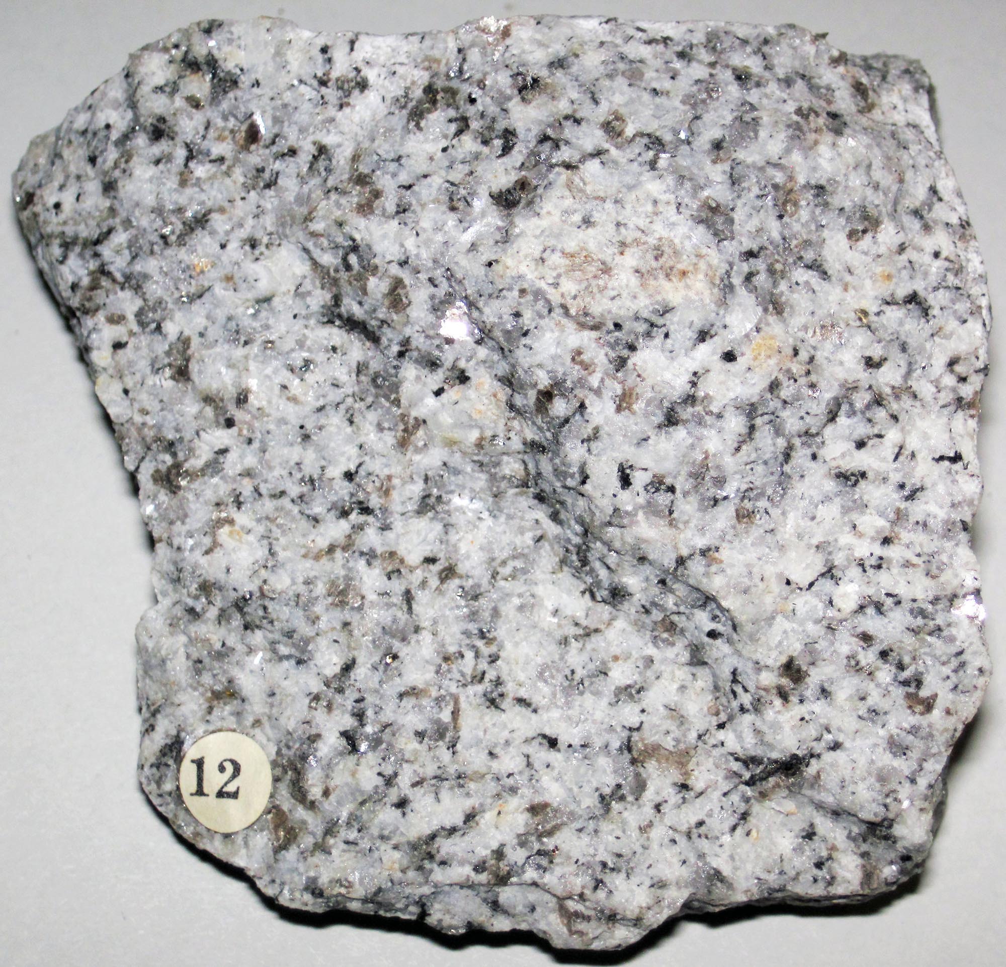
Chunk of granite from Concord, New Hampshire. This Devonian-aged rock formed in an igneous intrusion and is part of the New Hampshire Plutonic Series. Photo by James St. John (Flickr; Creative Commons Attribution 2.0 Generic license; image resized).
New Hampshire State Mineral: Beryl
Beryl is a silicate mineral with beryliium and aluminum, which comes in various colors (green, blue, yellow, pink). In fact, some of the most well known gemstones are color varieties of beryl, such as emerald and aquamarine. Beryl is commonly found in granitic pegmatites, which are frequent in the Exotic Terrane of New England.
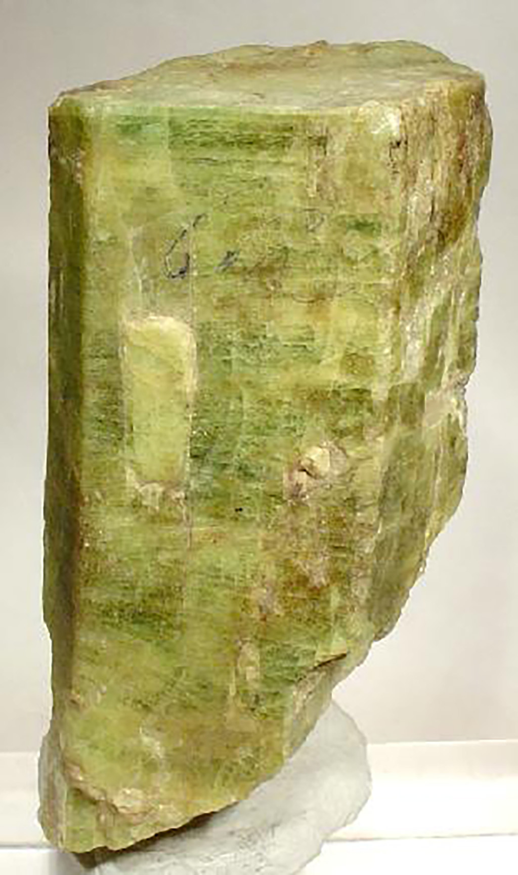
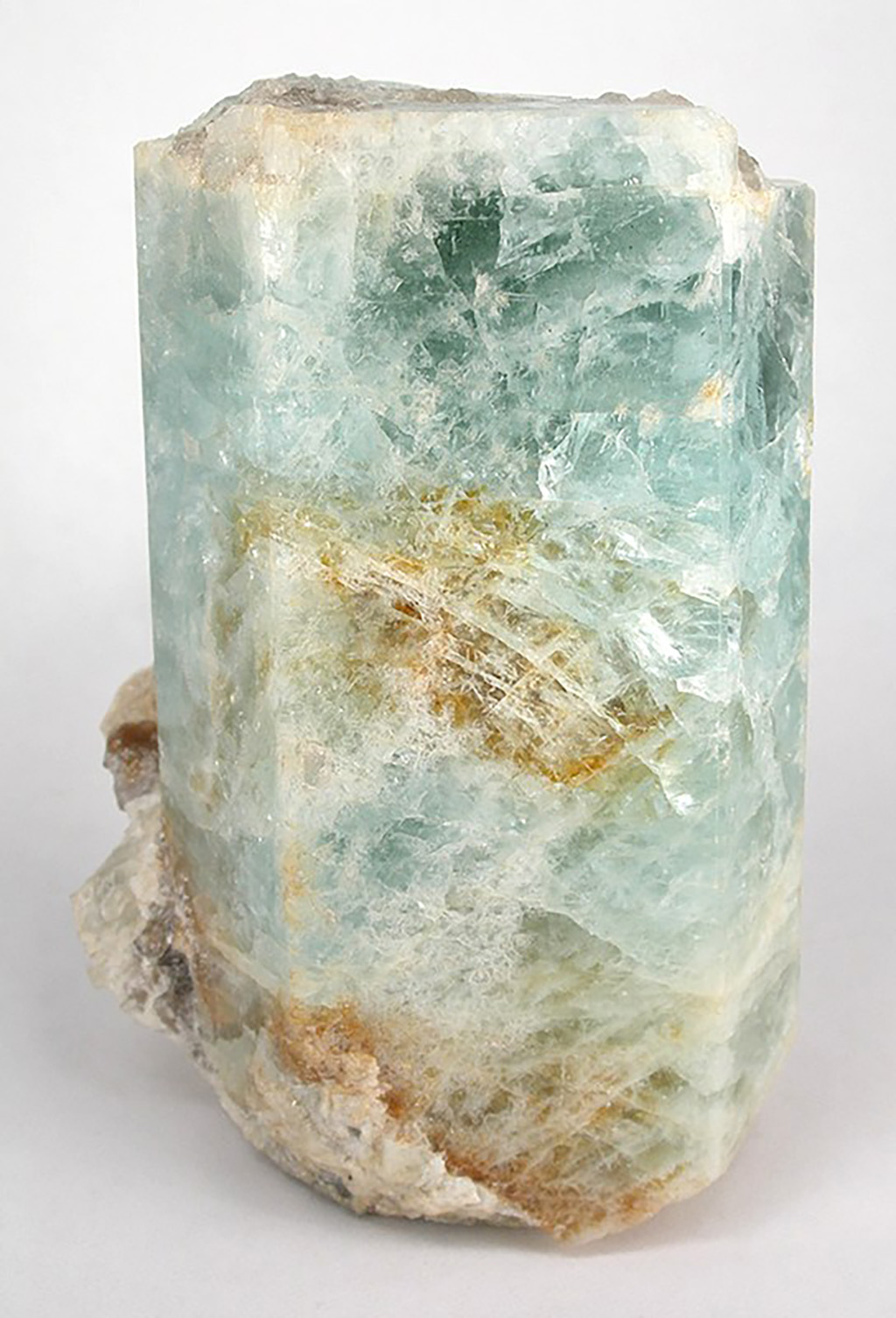
Left: Green beryl crystal from Grafton County, New Hampshire. Photo by Robert Lavinsky (Wikimedia Commons; Creative Commons Attribution-ShareAlike 3.0 Unported license; image resized). Right: Blue beryl crystal from Grafton County, New Hampshire. Photo by Robert Lavinsky (Wikimedia Commons; Creative Commons Attribution-ShareAlike 3.0 Unported license; image resized).
New Hampshire State Gem: Smoky Quartz
Quartz is a silicate mineral that comes in a wide range of colors depending on which trace elements it contains (e.g. amethyst is quartz with iron & aluminum impurities; citrine is quartz with ferric hydroxide impurities; rose quartz contains iron, manganese, or titanium impurities). The "smoky" hue of New Hampshire's state gem comes from irradiated trace aluminum within the quartz crystal.
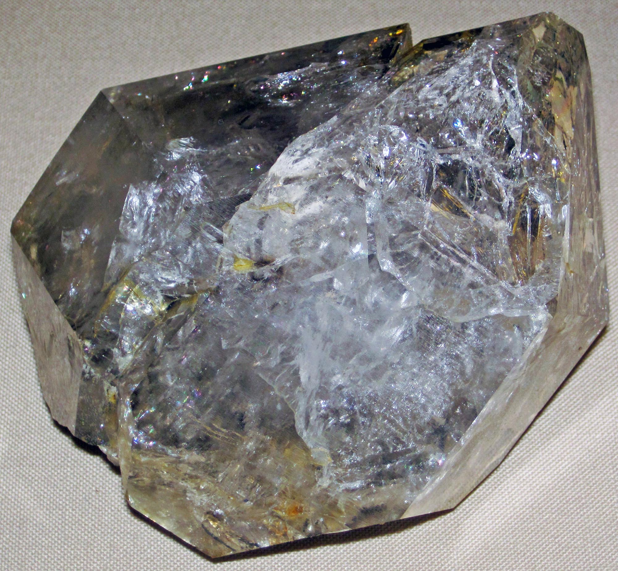
Mineral specimen of quartz from Groton, New Hampshire. Note the earthy gray color which marks this as Smoky Quartz. Photo by James St. John (Flickr; Creative Commons Attribution 2.0 Generic license; image resized).
New Hampshire's Highest and Lowest Elevations
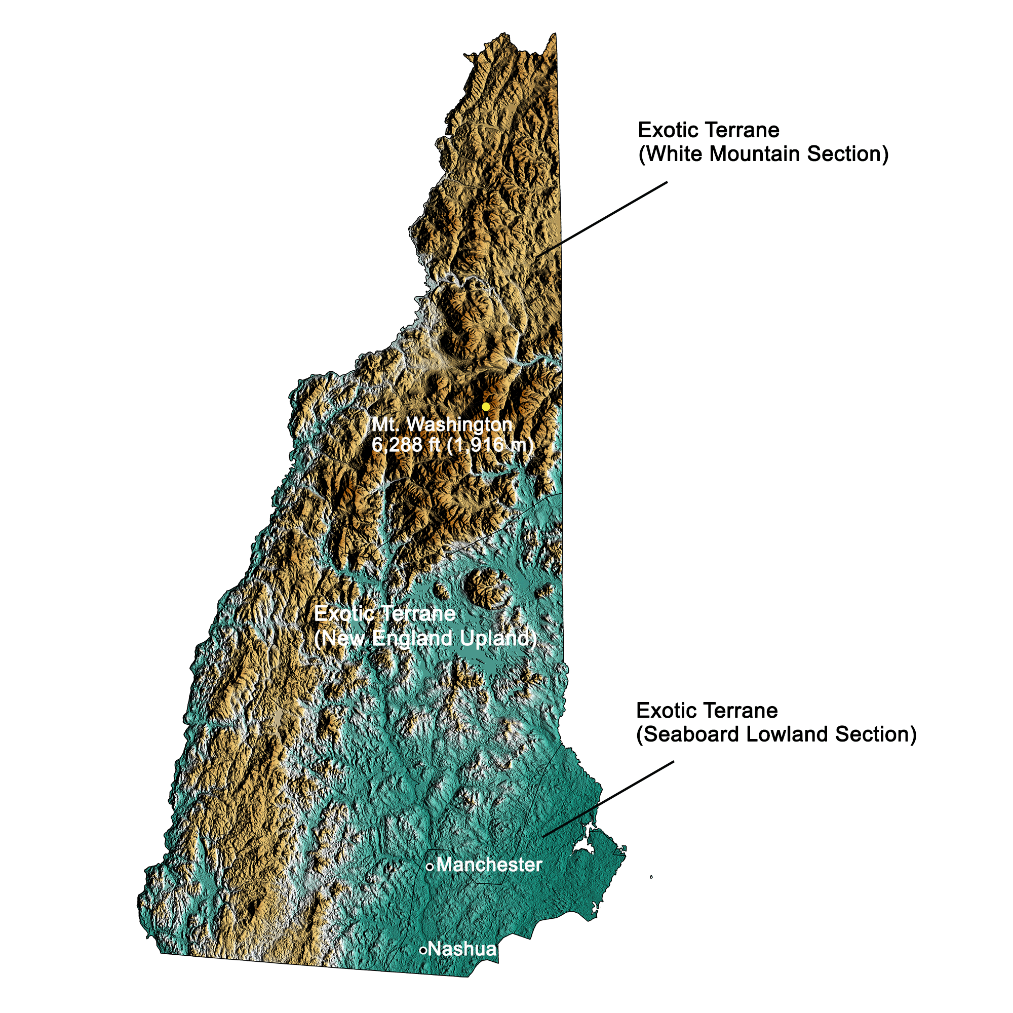
Topographic map of New Hampshire with physiographic regions and point of highest elevation identified. Topographic data are derived from the Shuttle Radar Topography Mission (SRTM GL3) Global 90m (SRTM_GL3) (Farr, T. G., and M. Kobrick, 2000, Shuttle Radar Topography Mission produces a wealth of data. Eos Trans. AGU, 81:583-583). Image by Kiera D. Crowley for the Earth@Home project.
Highest Elevation: Mount Washington
At 1,916 meters (6,288 feet) above sea level, Mount Washington, in the Presidential Range of the White Mountains, is the highest point in the state of New Hampshire.
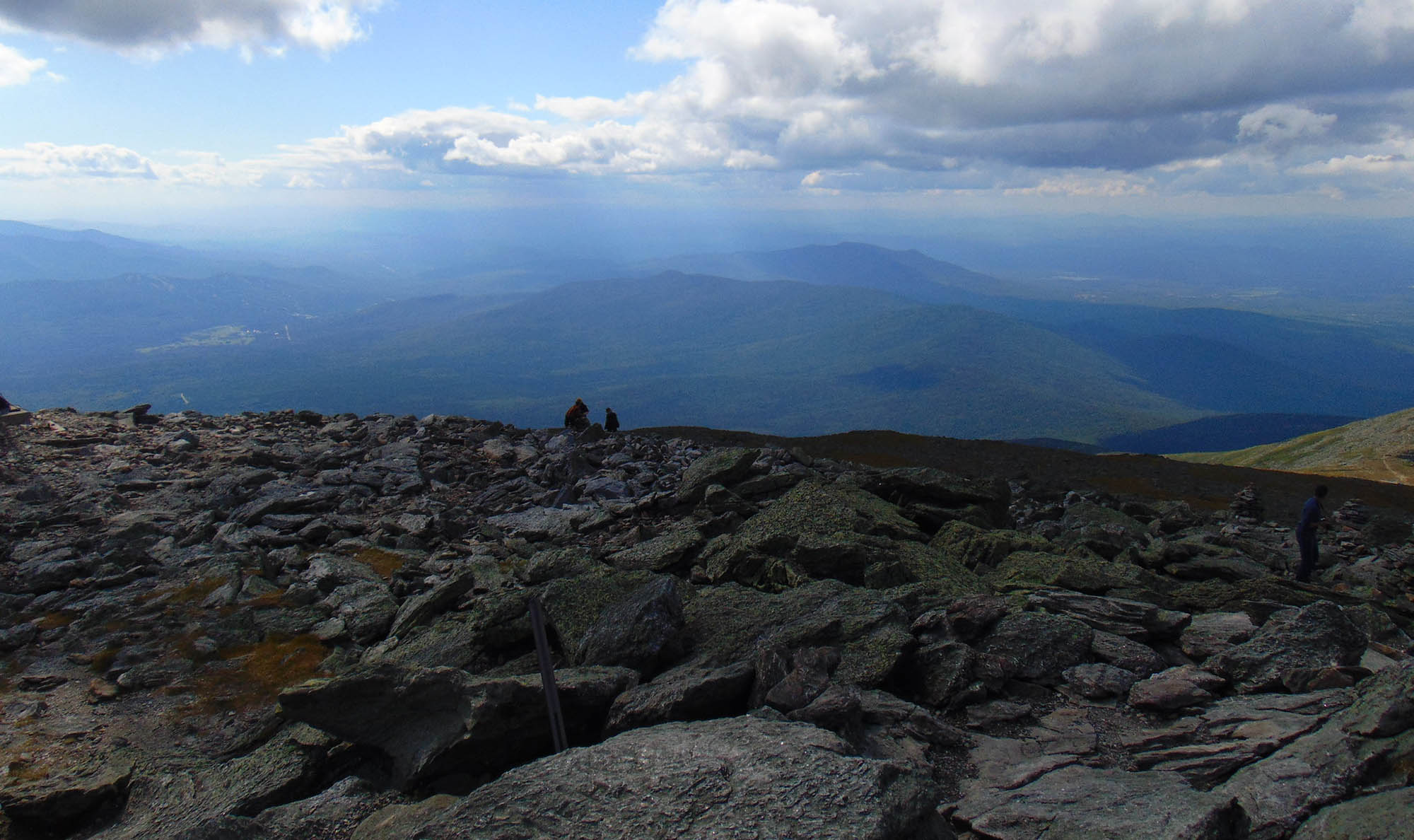
Summit of Mount Washington in northern New Hampshire. Photo by "JJBers" (Flickr; Creative Commons Attribution 2.0 Generic license; image resized).
Lowest Elevation: Atlantic Coast
New Hampshire's lowest points are along its Atlantic coastline, where the shore is at sea level.
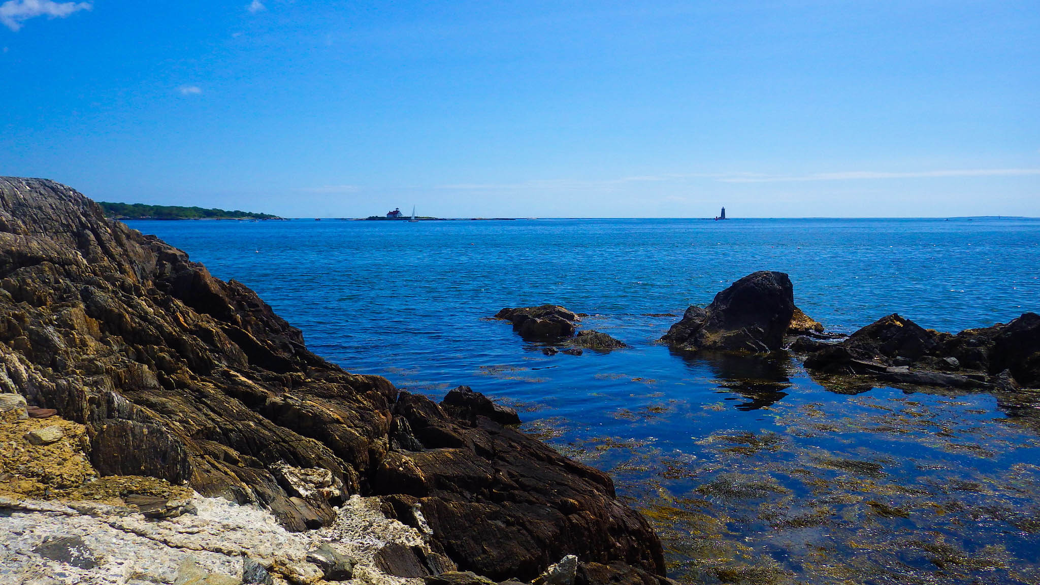
The rocky New England coast in New Castle, New Hampshire. Photo by "spablab" (Flickr; Creative Commons Attribution-NoDerivs 2.0 Generic license).
Places to Visit
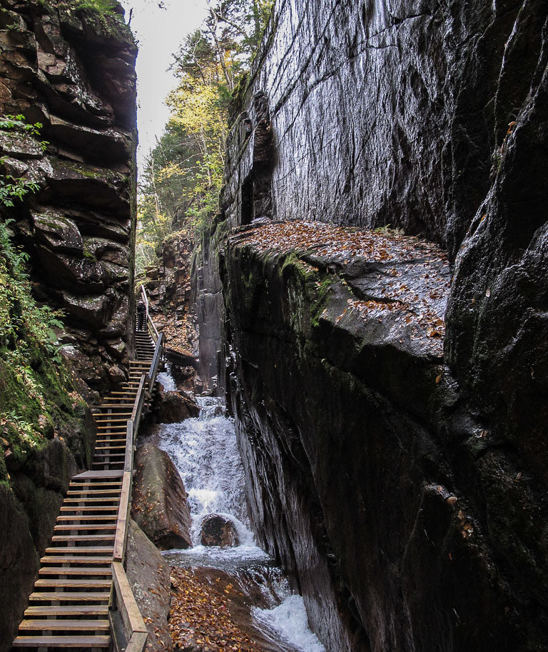
Flume Gorge extends 245 meters (800 feet) through the rock at the base of Mount Liberty in Franconia State Park in northern New Hampshire. Photo by Neil Hunt (Flickr; Creative Commons Attribution-NonCommercial 2.0 Generic license; image cropped and resized).
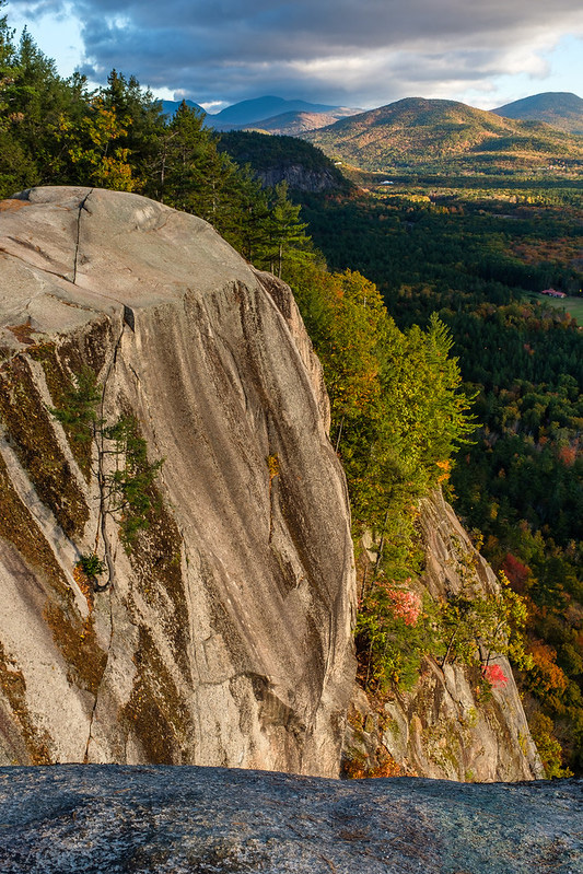
Photo by "alh1" (Flickr; Creative Commons Attribution-NoDerivs 2.0 Generic license).
Additional resources

Earth@Home resources about New Hampshire and nearby states:
- Rocks: Central Lowland, Inland Basin, Appalachians and Piedmont, Coastal Plain, and Exotic Terrane.
- Fossils: Central Lowland, Inland Basin, Appalachians and Piedmont, Coastal Plain, and Exotic Terrane.
- Topography: Central Lowland, Inland Basin, Appalachians and Piedmont, Coastal Plain, and Exotic Terrane.
- Mineral Resources: Central Lowland, Inland Basin, Appalachians and Piedmont, Coastal Plain, and Exotic Terrane.
Earth@Home resources about the northeastern region of the United States: