

Illinois
Geologic map of Illinois with physiographic regions identified.
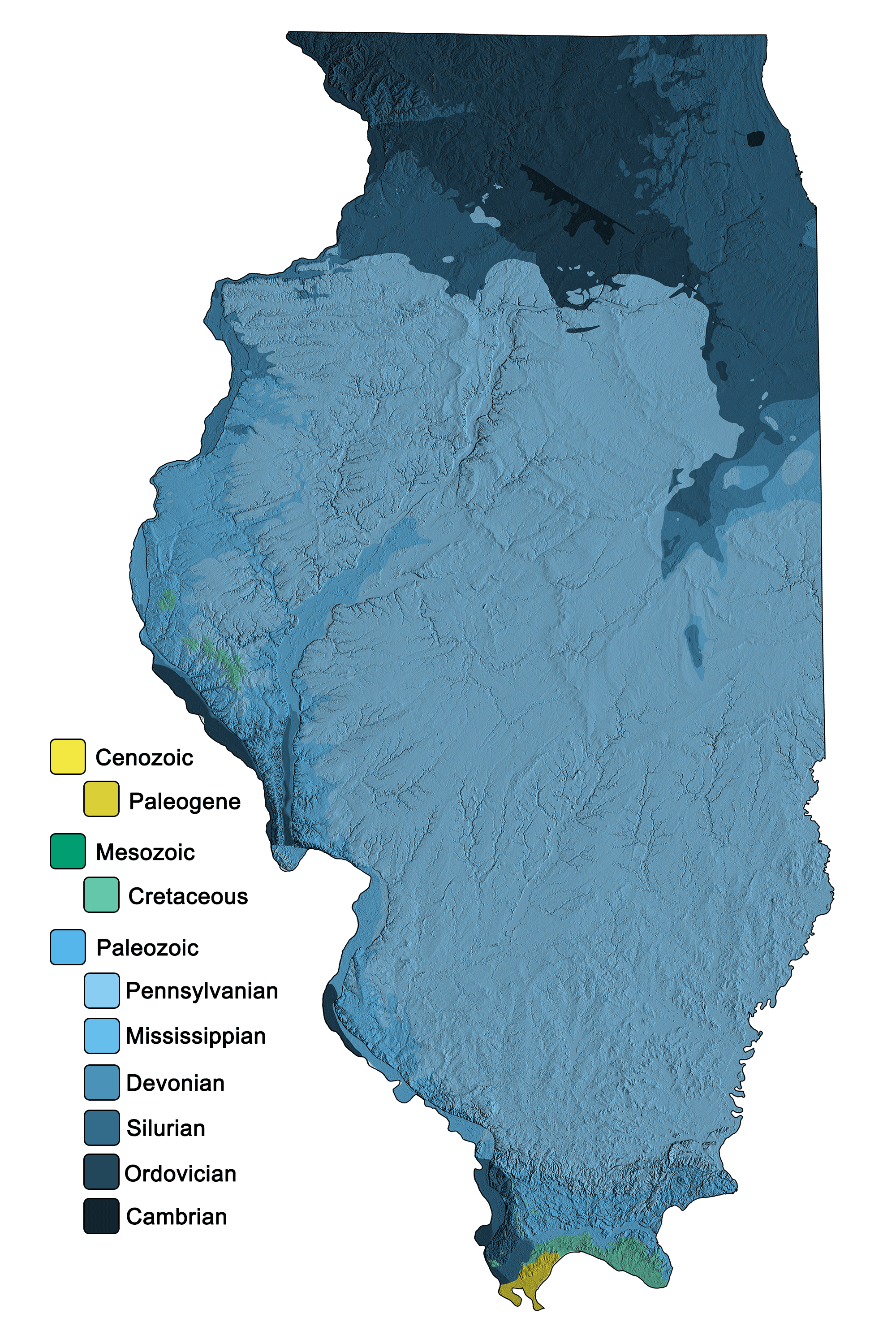
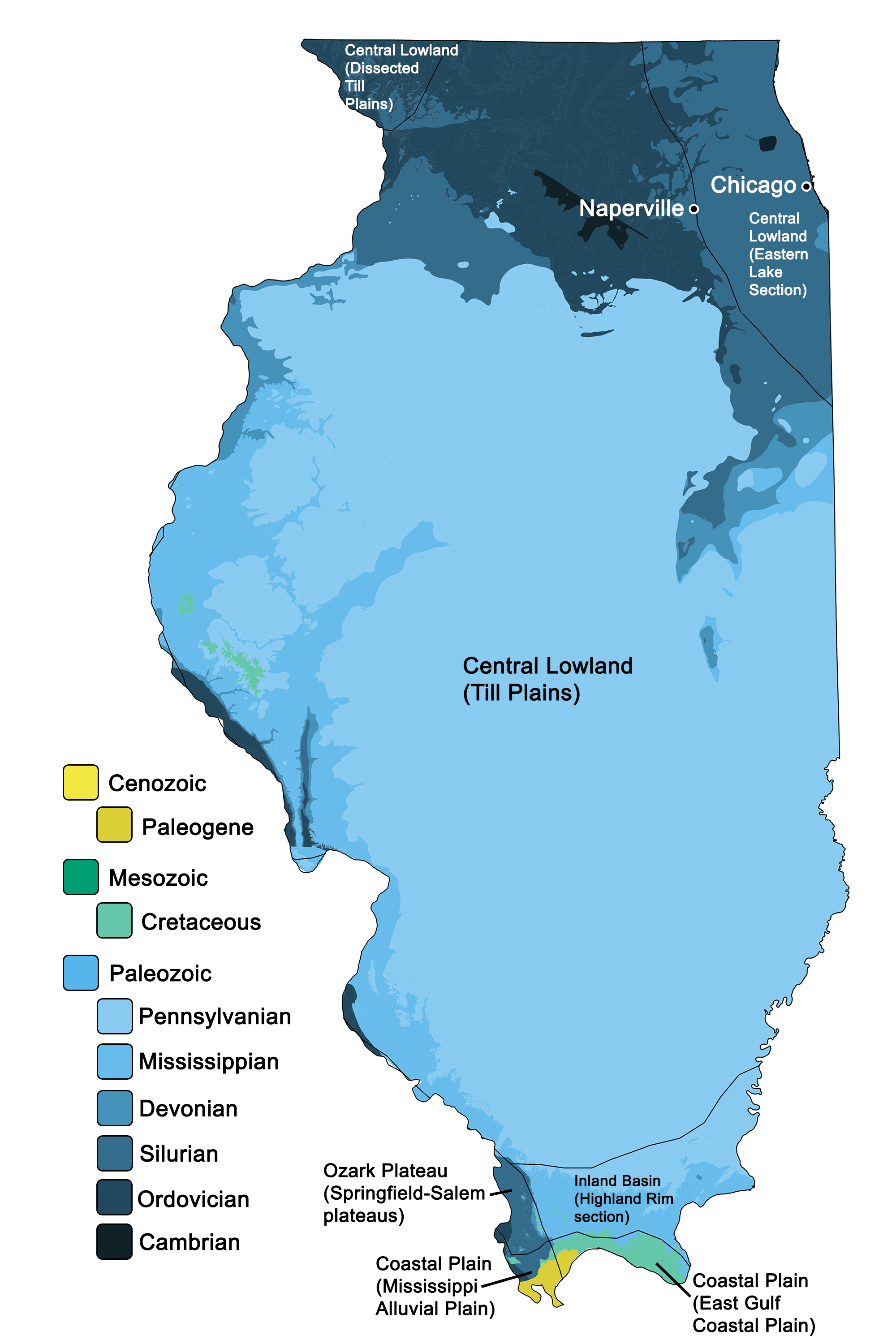
Geologic and topographic map of Illinois. Geologic data from Horton et al. (2017) using the maximum age values for each mapped unit. Topographic data are derived from the Shuttle Radar Topography Mission (SRTM GL3) Global 90m (SRTM_GL3) (Farr, T. G., and M. Kobrick, 2000, Shuttle Radar Topography Mission produces a wealth of data. Eos Trans. AGU, 81:583-583).
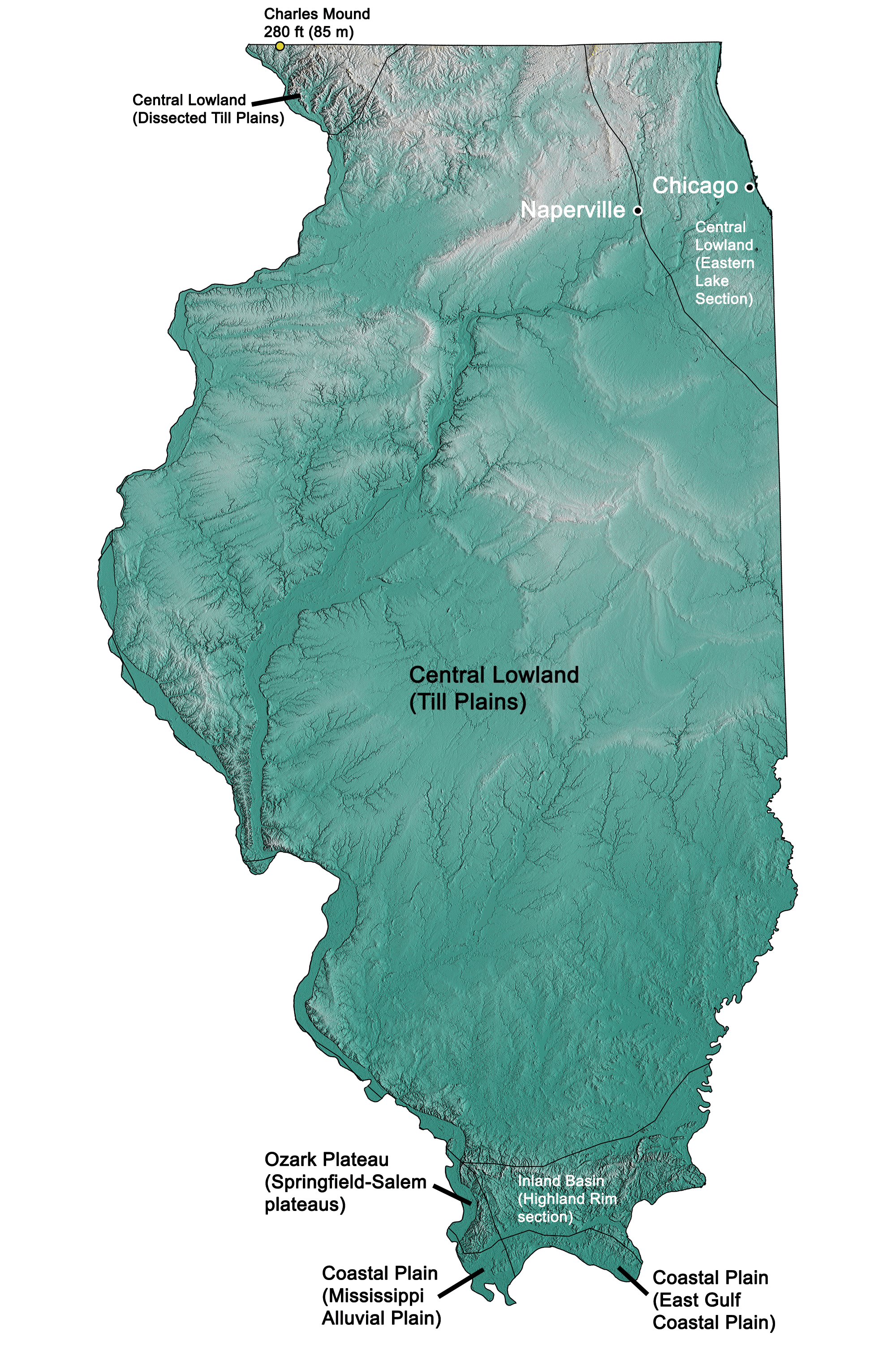
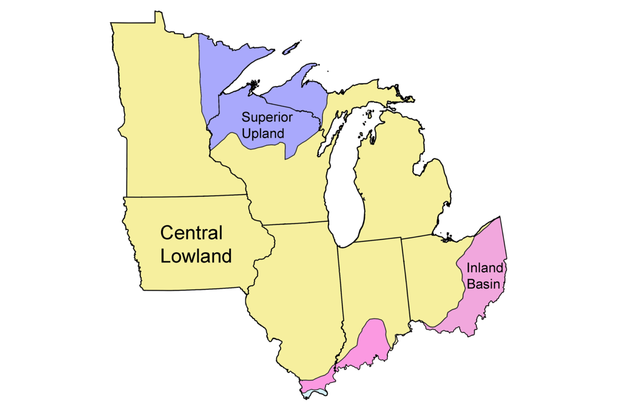
Topographic map of Illinois with physiographic regions identified.
Indiana
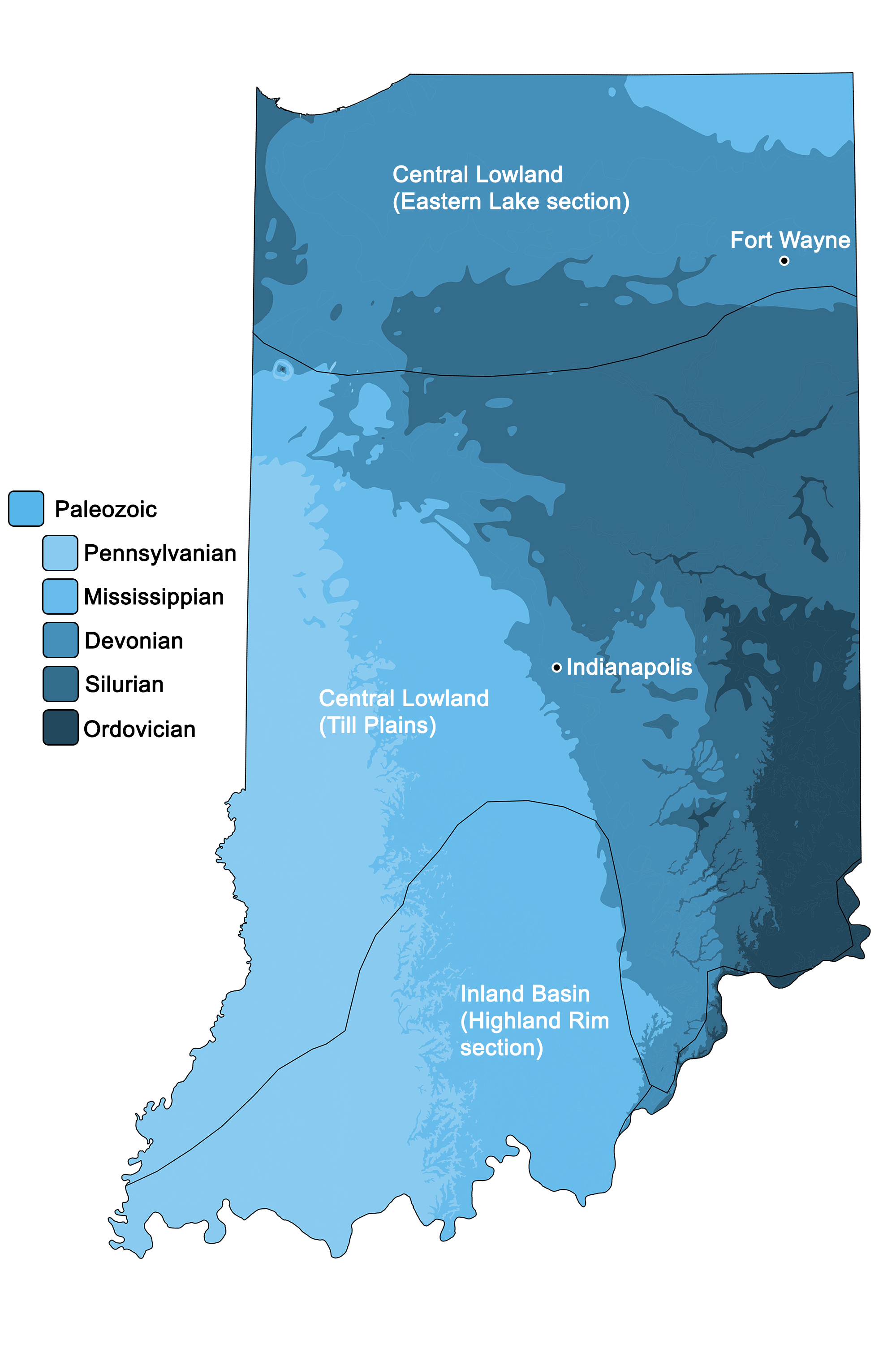
Geologic map of Indiana with physiographic regions identified.
Geologic and topographic map of Indiana. Geologic data from Horton et al. (2017) using the maximum age values for each mapped unit. Topographic data are derived from the Shuttle Radar Topography Mission (SRTM GL3) Global 90m (SRTM_GL3) (Farr, T. G., and M. Kobrick, 2000, Shuttle Radar Topography Mission produces a wealth of data. Eos Trans. AGU, 81:583-583).
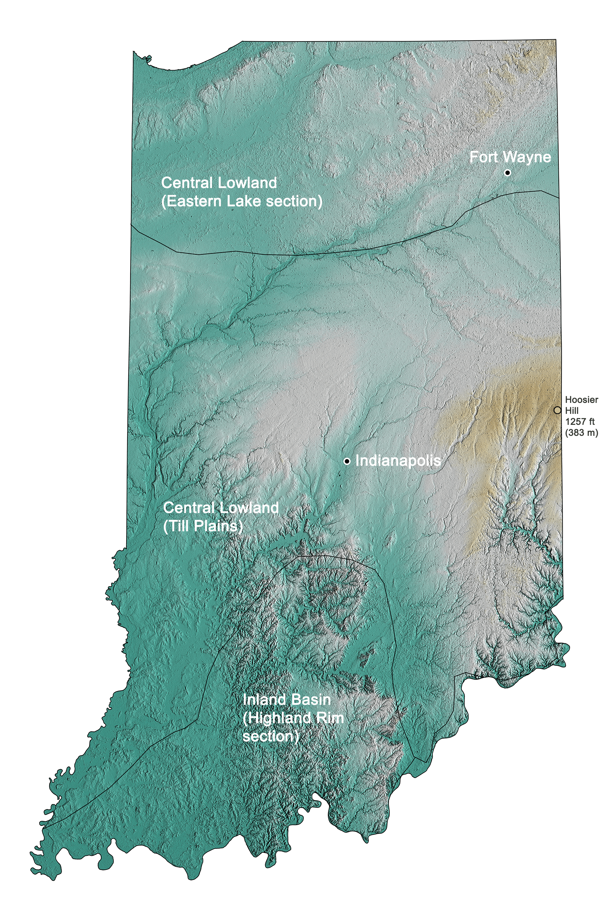
Topographic map of Indiana with physiographic regions identified.
Iowa
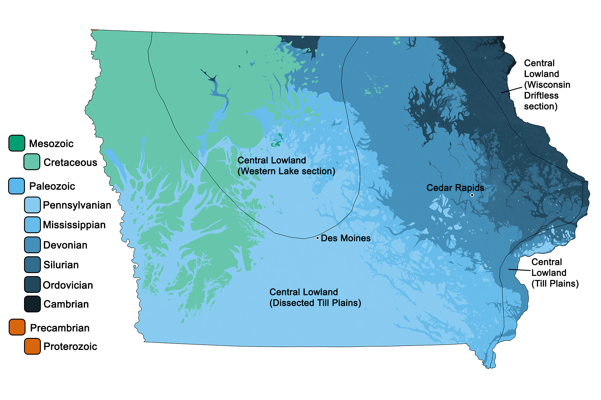
Geologic map of Iowa with physiographic regions identified.
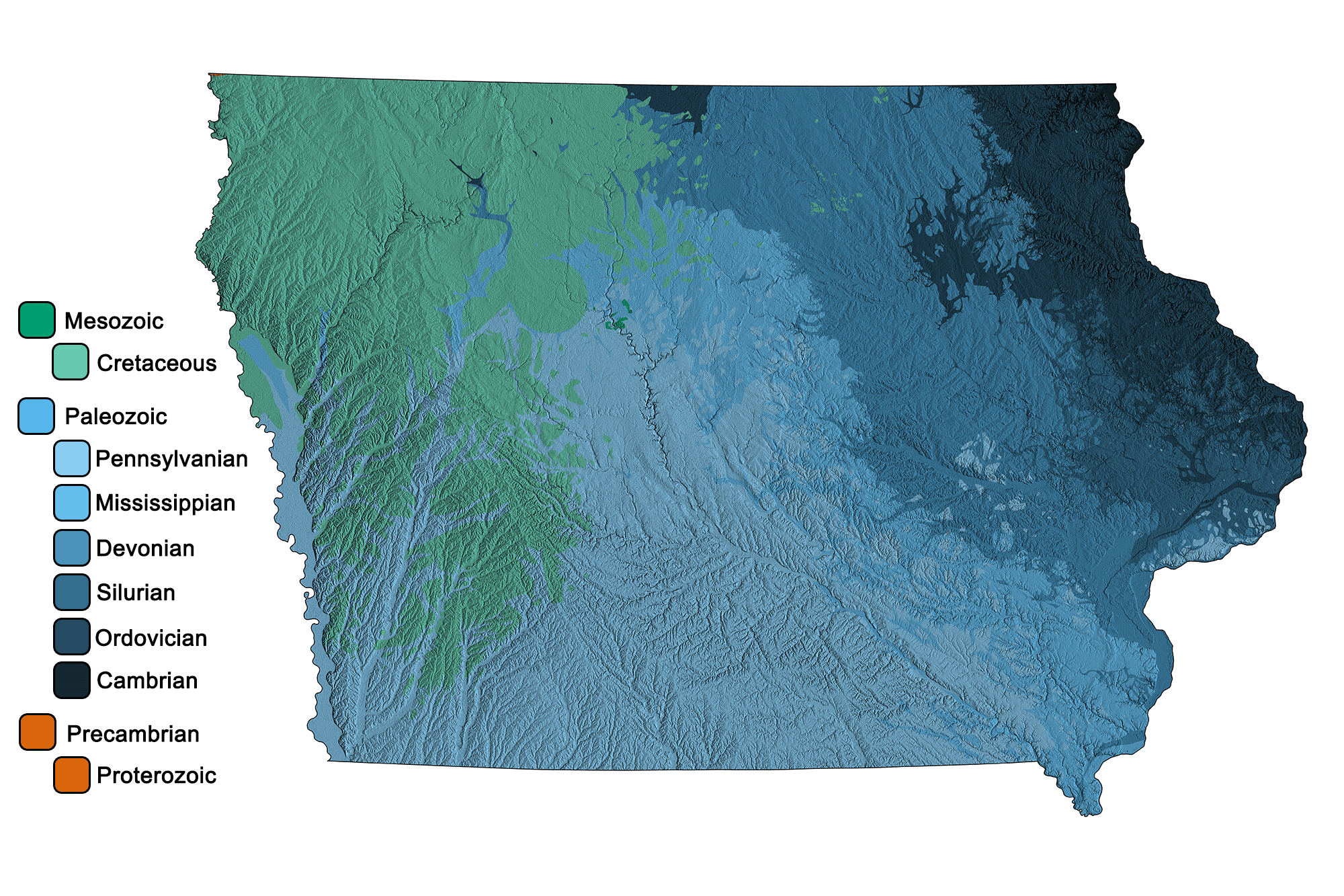
Geologic and topographic map of Iowa. Geologic data from Horton et al. (2017) using the maximum age values for each mapped unit. Topographic data are derived from the Shuttle Radar Topography Mission (SRTM GL3) Global 90m (SRTM_GL3) (Farr, T. G., and M. Kobrick, 2000, Shuttle Radar Topography Mission produces a wealth of data. Eos Trans. AGU, 81:583-583).
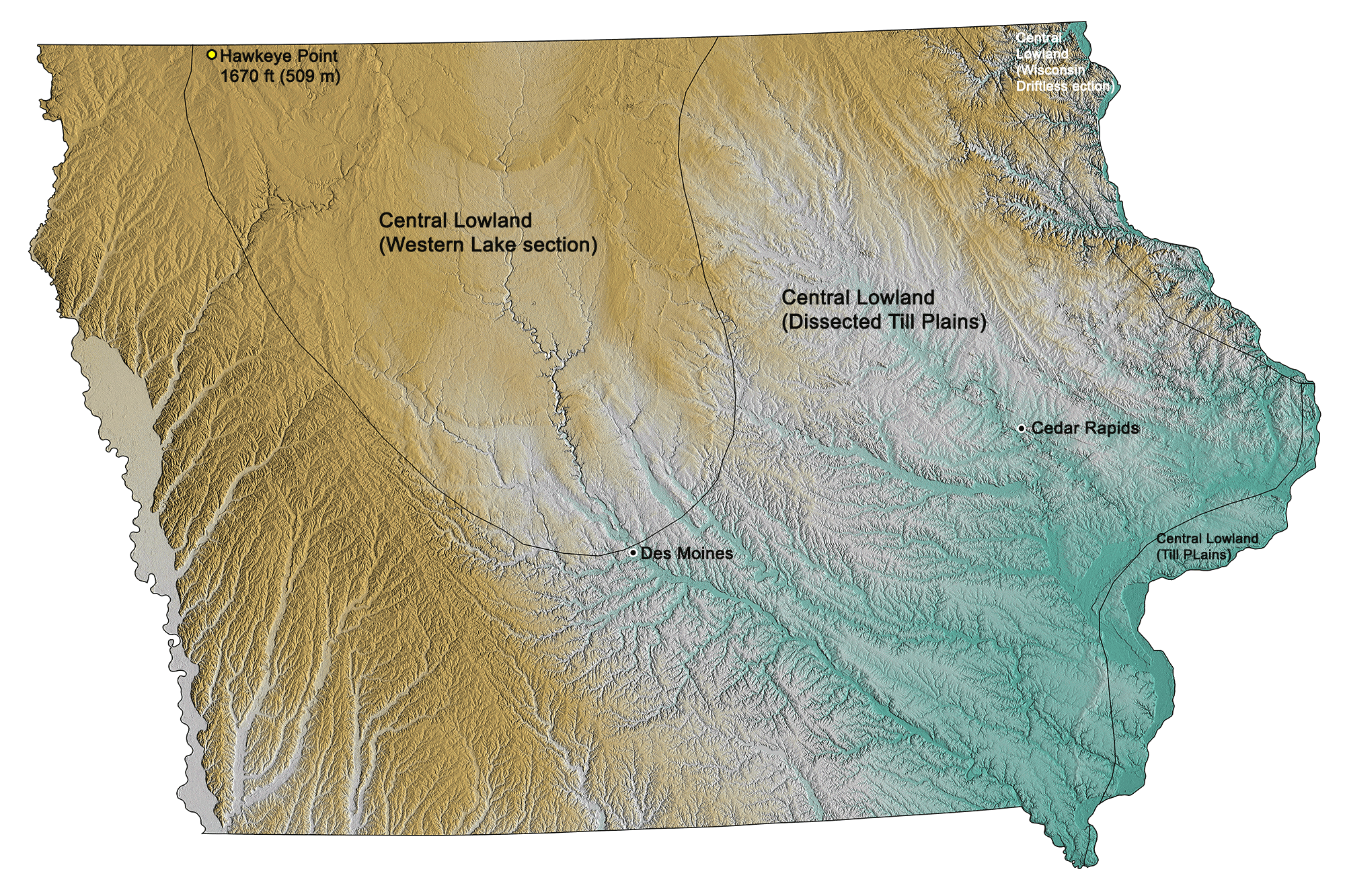
Topographic map of Iowa with physiographic regions identified.
Michigan
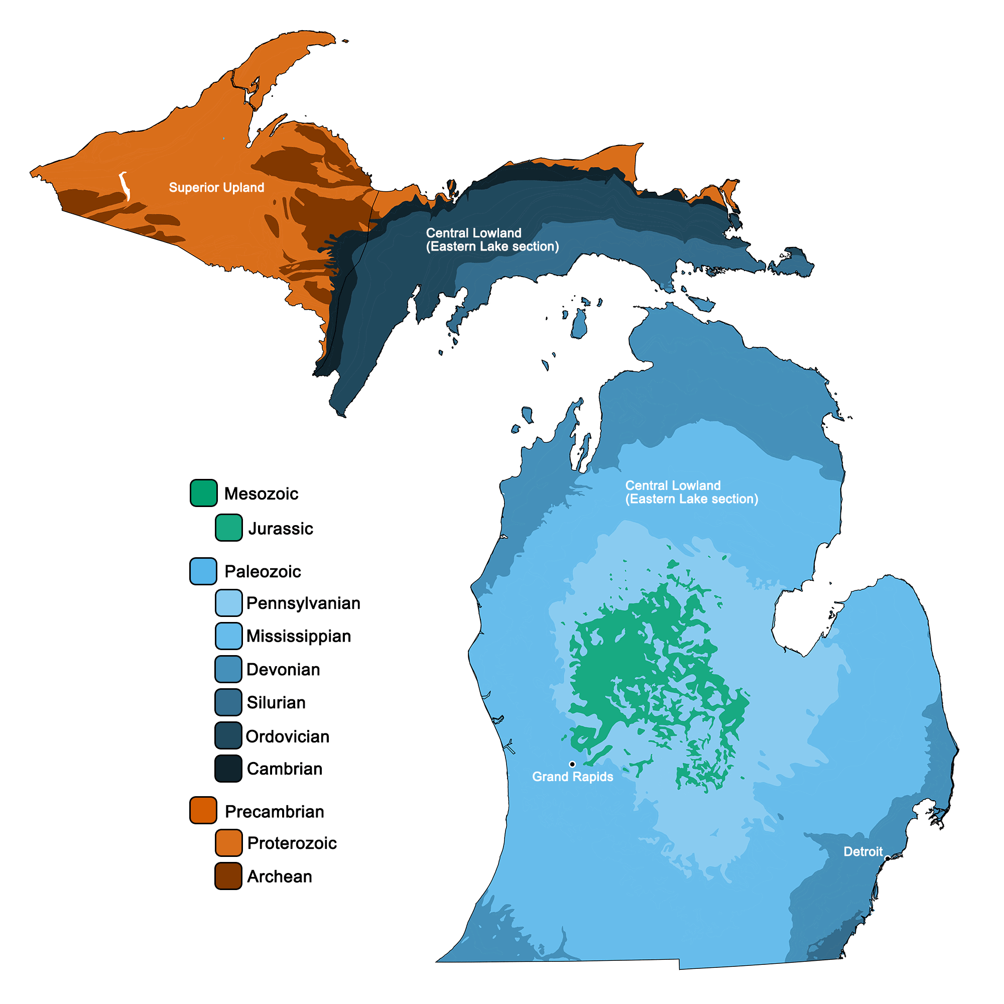
Geologic map of Michigan with physiographic regions identified.
Geologic and topographic map of Michigan. Geologic data from Horton et al. (2017) using the maximum age values for each mapped unit. Topographic data are derived from the Shuttle Radar Topography Mission (SRTM GL3) Global 90m (SRTM_GL3) (Farr, T. G., and M. Kobrick, 2000, Shuttle Radar Topography Mission produces a wealth of data. Eos Trans. AGU, 81:583-583).
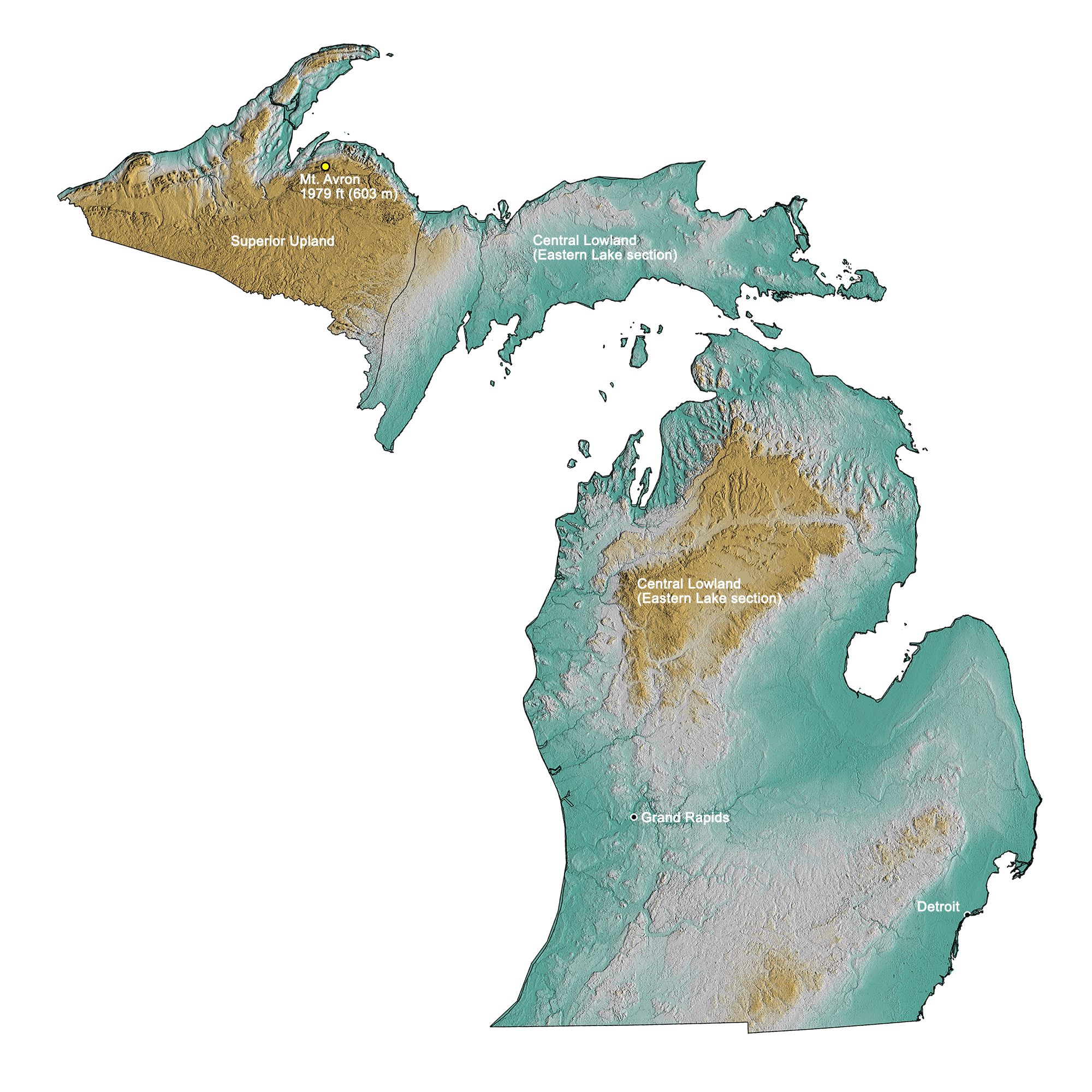
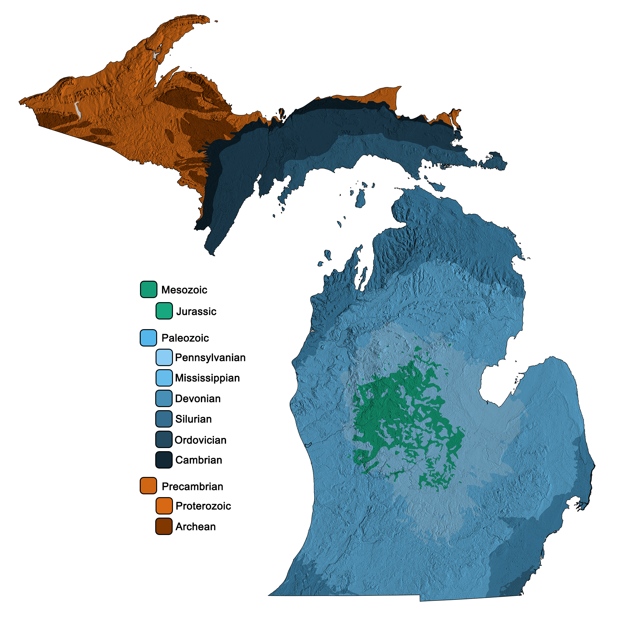
Topographic map of Michigan with physiographic regions identified.
Minnesota
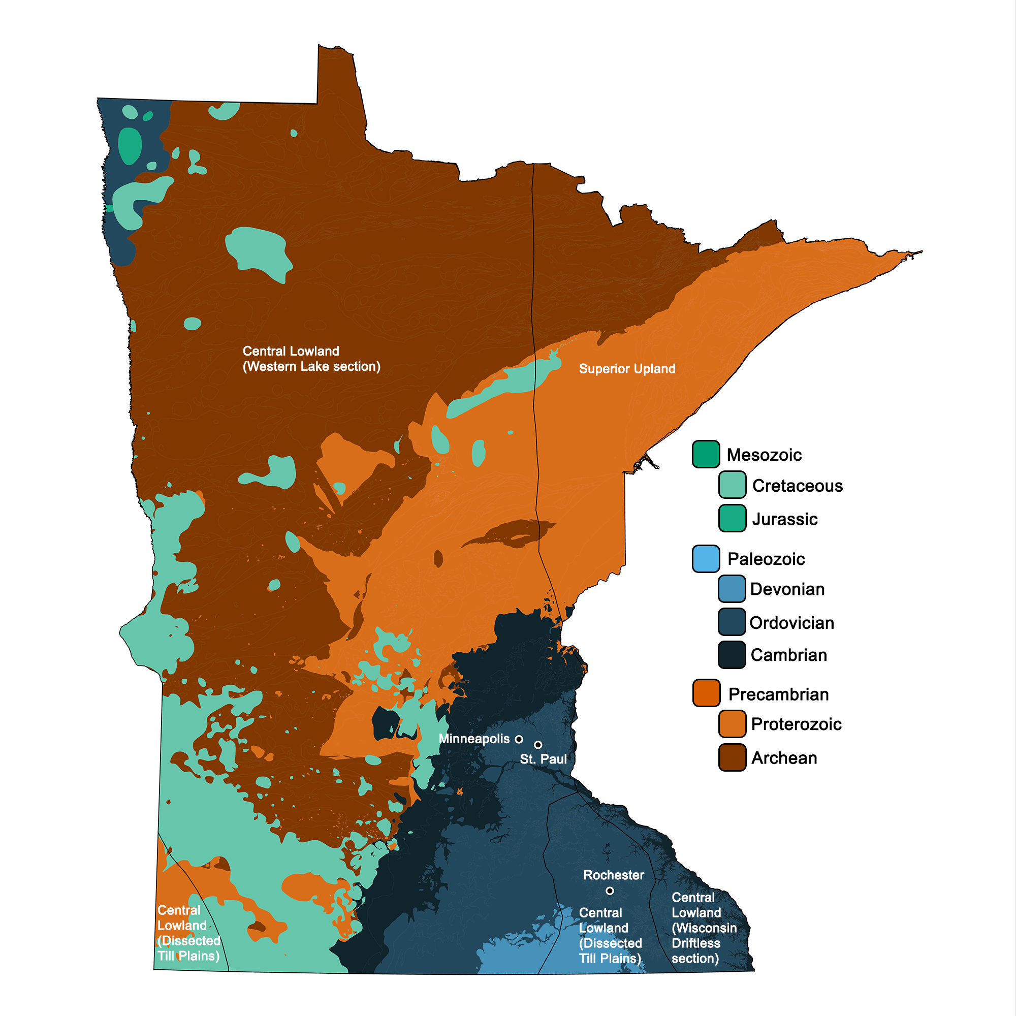
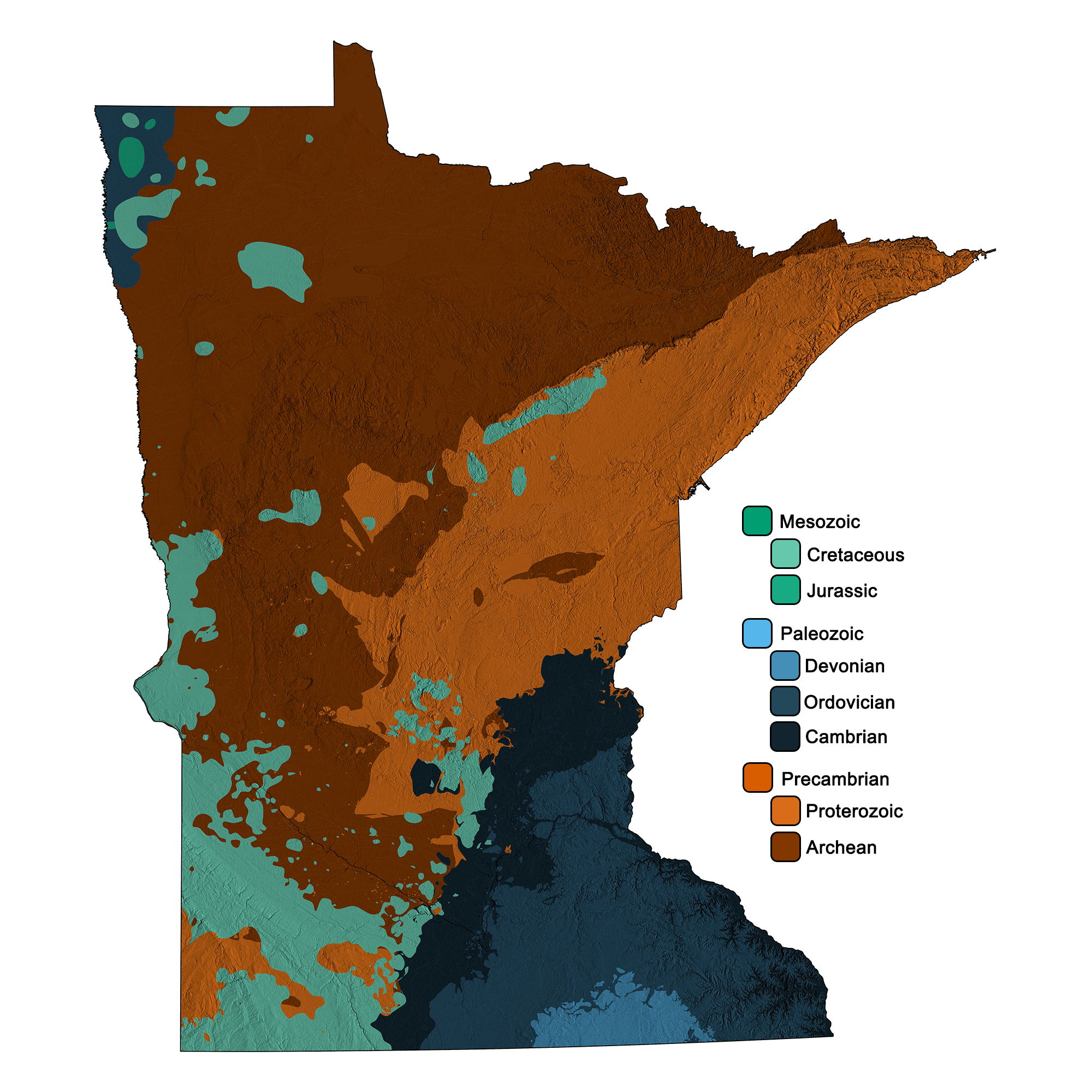
Geologic map of Minnesota with physiographic regions identified.
Geologic and topographic map of Minnesota. Geologic data from Horton et al. (2017) using the maximum age values for each mapped unit. Topographic data are derived from the Shuttle Radar Topography Mission (SRTM GL3) Global 90m (SRTM_GL3) (Farr, T. G., and M. Kobrick, 2000, Shuttle Radar Topography Mission produces a wealth of data. Eos Trans. AGU, 81:583-583).
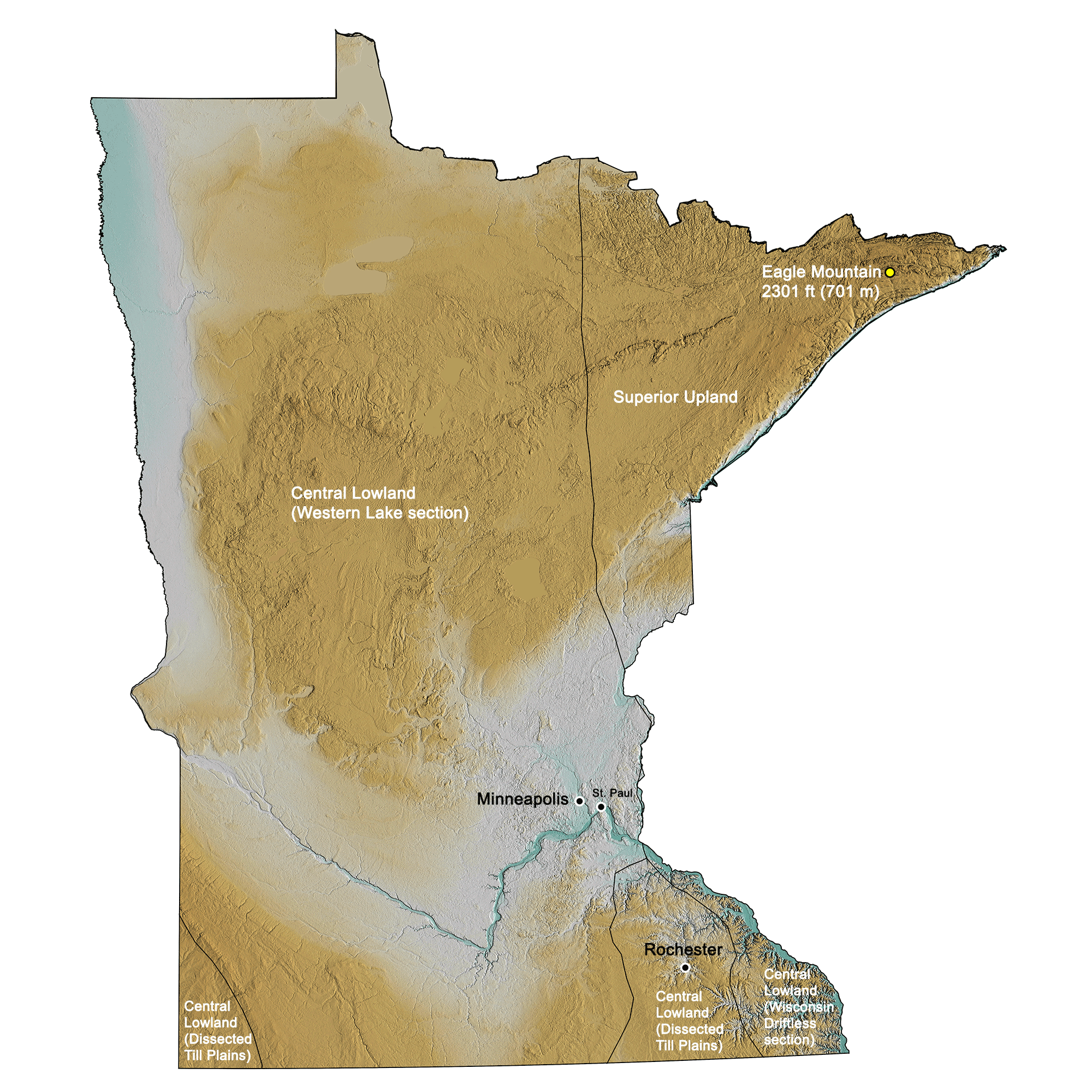
Topographic map of Minnesota with physiographic regions identified.
Ohio
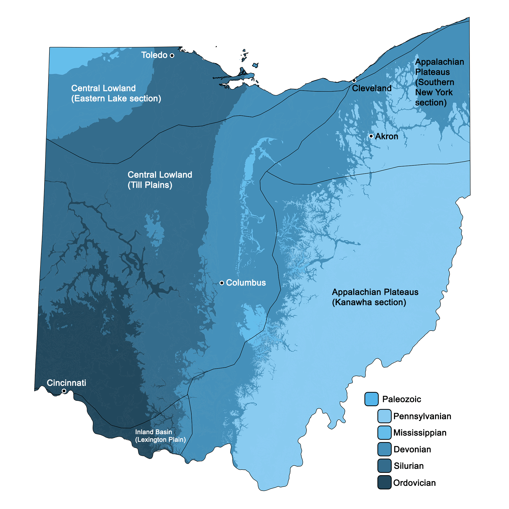
Geologic map of Ohio with physiographic regions identified.
Geologic and topographic map of Ohio. Geologic data from Horton et al. (2017) using the maximum age values for each mapped unit. Topographic data are derived from the Shuttle Radar Topography Mission (SRTM GL3) Global 90m (SRTM_GL3) (Farr, T. G., and M. Kobrick, 2000, Shuttle Radar Topography Mission produces a wealth of data. Eos Trans. AGU, 81:583-583).
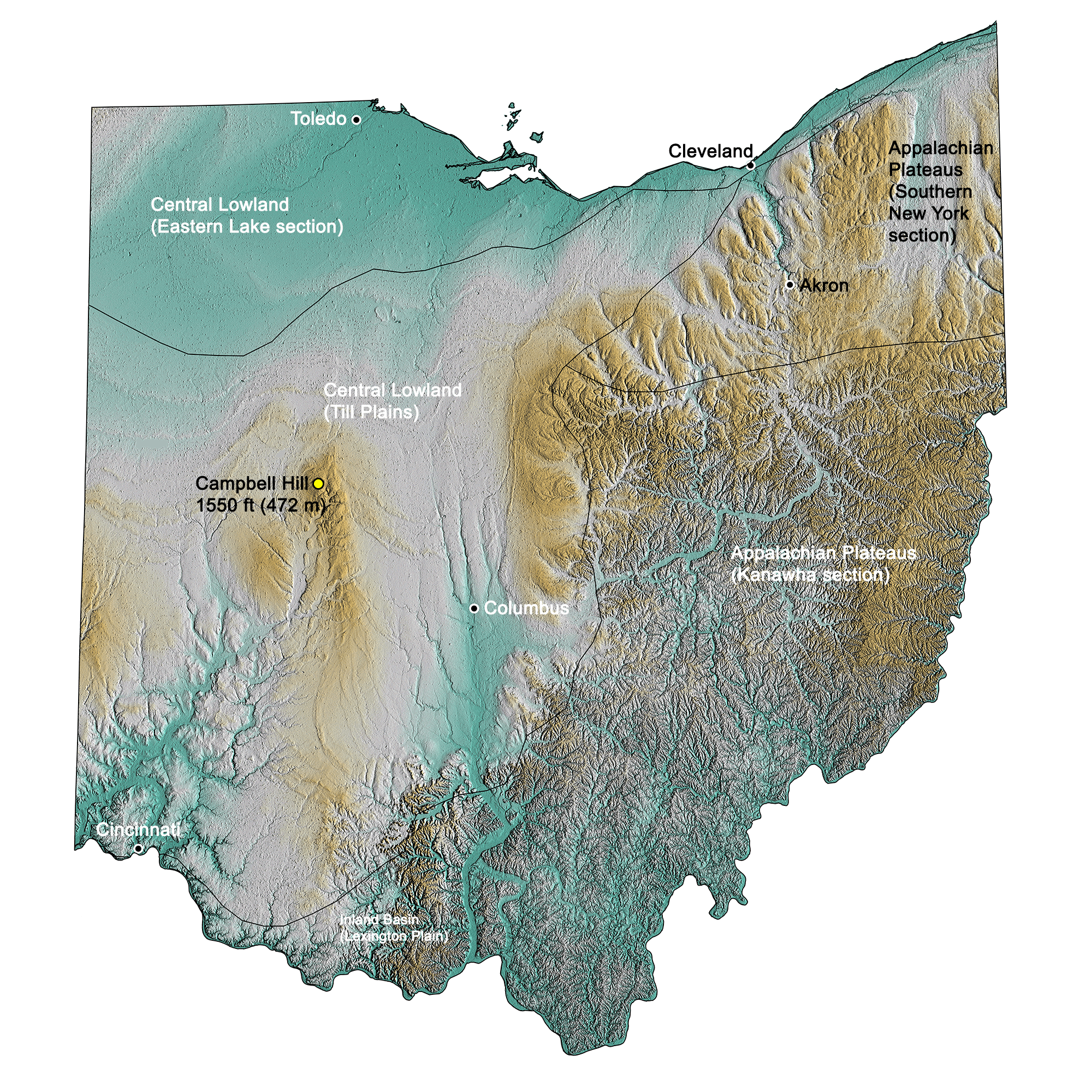
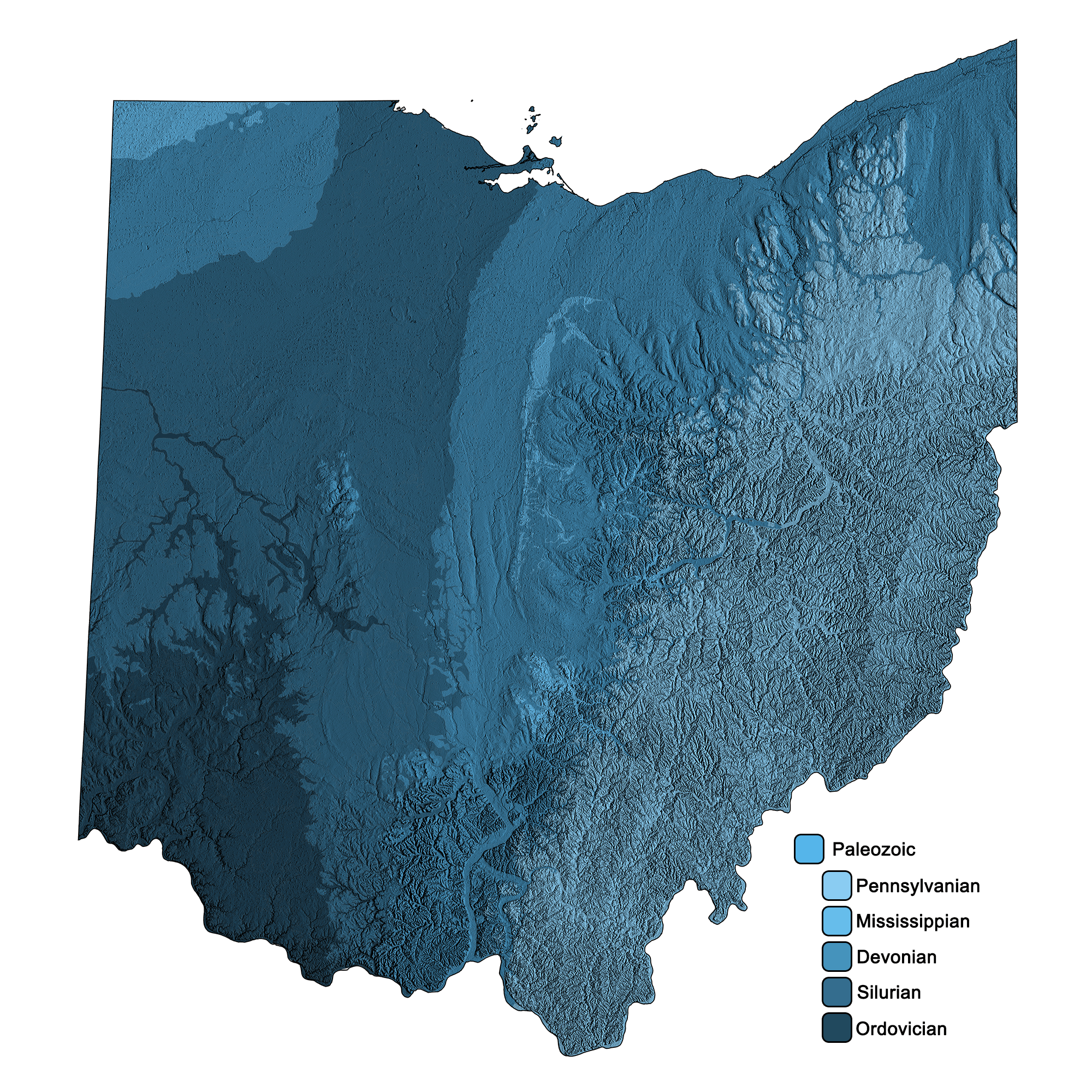
Topographic map of Ohio with physiographic regions identified.
Wisconsin
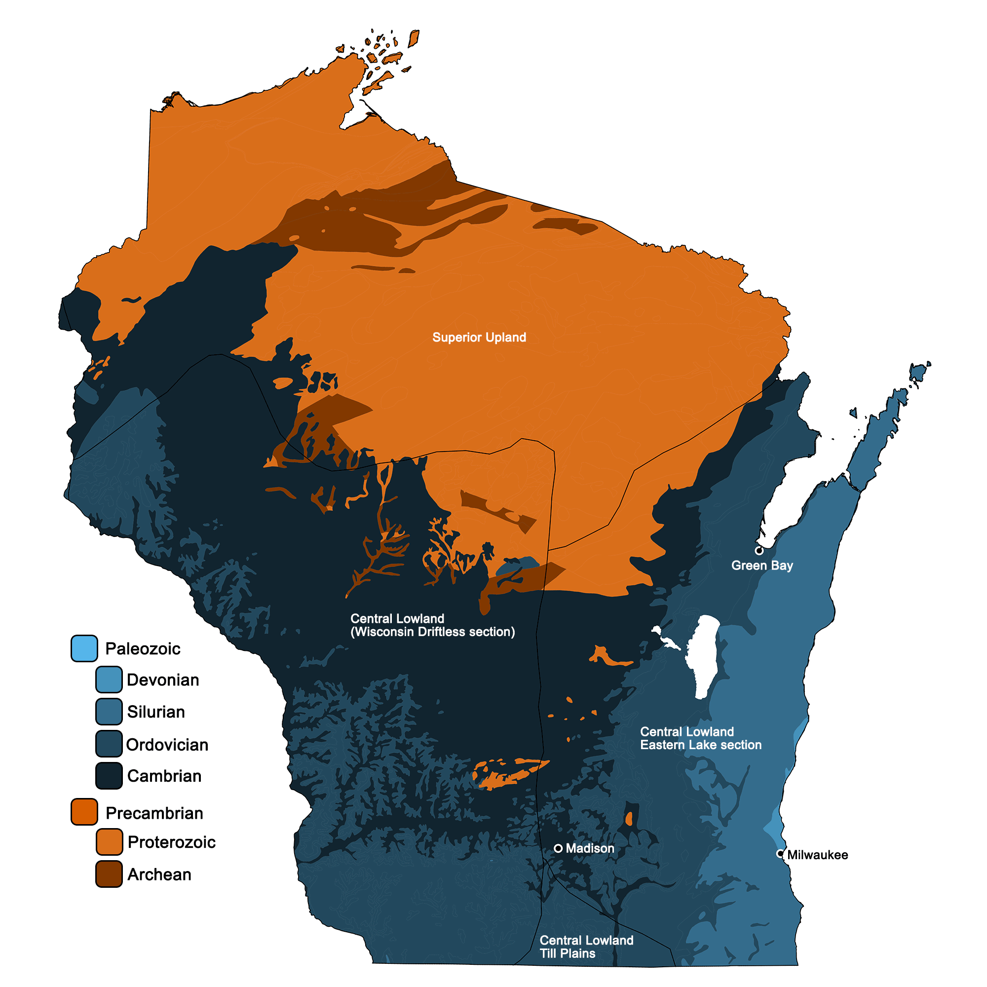
Geologic map of Wisconsin with physiographic regions identified.
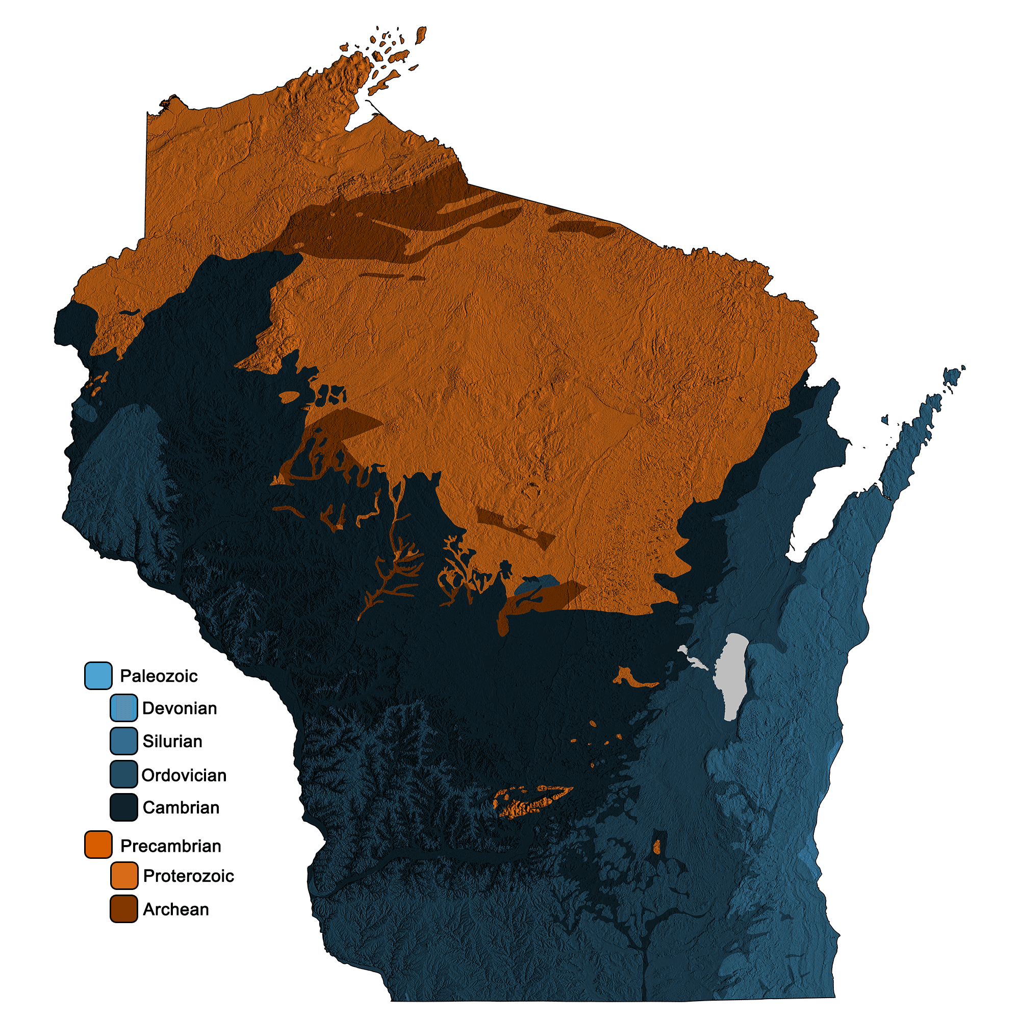
Geologic and topographic map of Wisconsin. Geologic data from Horton et al. (2017) using the maximum age values for each mapped unit. Topographic data are derived from the Shuttle Radar Topography Mission (SRTM GL3) Global 90m (SRTM_GL3) (Farr, T. G., and M. Kobrick, 2000, Shuttle Radar Topography Mission produces a wealth of data. Eos Trans. AGU, 81:583-583).
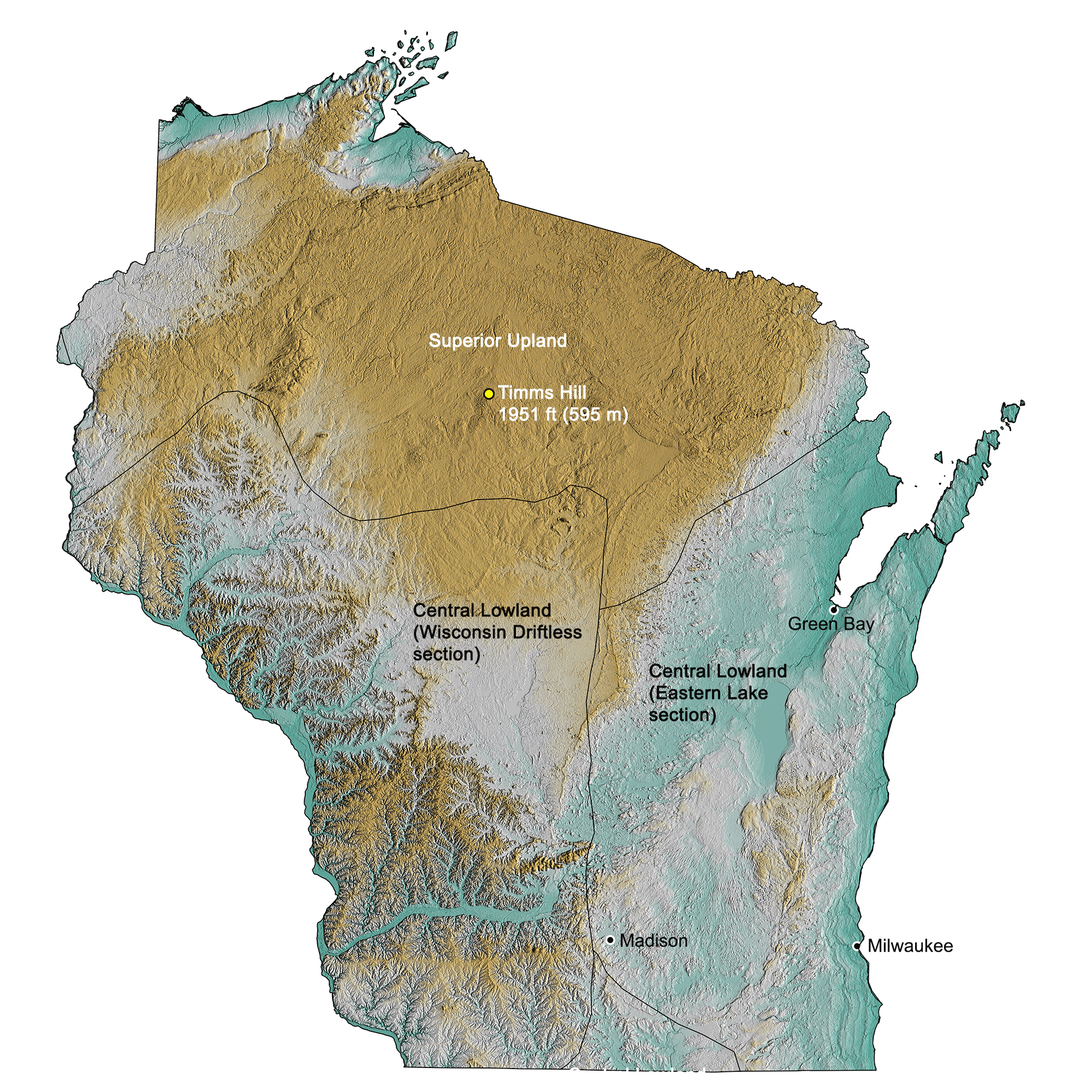
Topographic map of Wisconsin with physiographic regions identified.
Credits and permissions:
The maps on this page were created by Jonathan R. Hendricks for the Earth@Home project. Unless otherwise indicated, geologic maps were created using QGIS and USGS data from Fenneman and Johnson (1946) and Horton et al. (2017) using the maximum age values for each mapped unit. Unless otherwise indicated, the topographic data are derived from the Shuttle Radar Topography Mission (SRTM GL3) Global 90m (SRTM_GL3) (Farr, T. G., and M. Kobrick, 2000, Shuttle Radar Topography Mission produces a wealth of data. Eos Trans. AGU, 81:583-583); greens indicate lower elevation, browns higher elevation; points of highest elevation are marked, as are major cities and physiographic regions. All maps above have a Creative Commons Attribution-NonCommercial-ShareAlike 4.0 International license. You are welcome to use them for any educational purpose.
This page was last updated on August 15, 2023.