Page snapshot: California State Geologic Map; Fossil; Rock; Mineral; Gem; Highest and Lowest Elevations; Places to Visit; and Additional Resources.
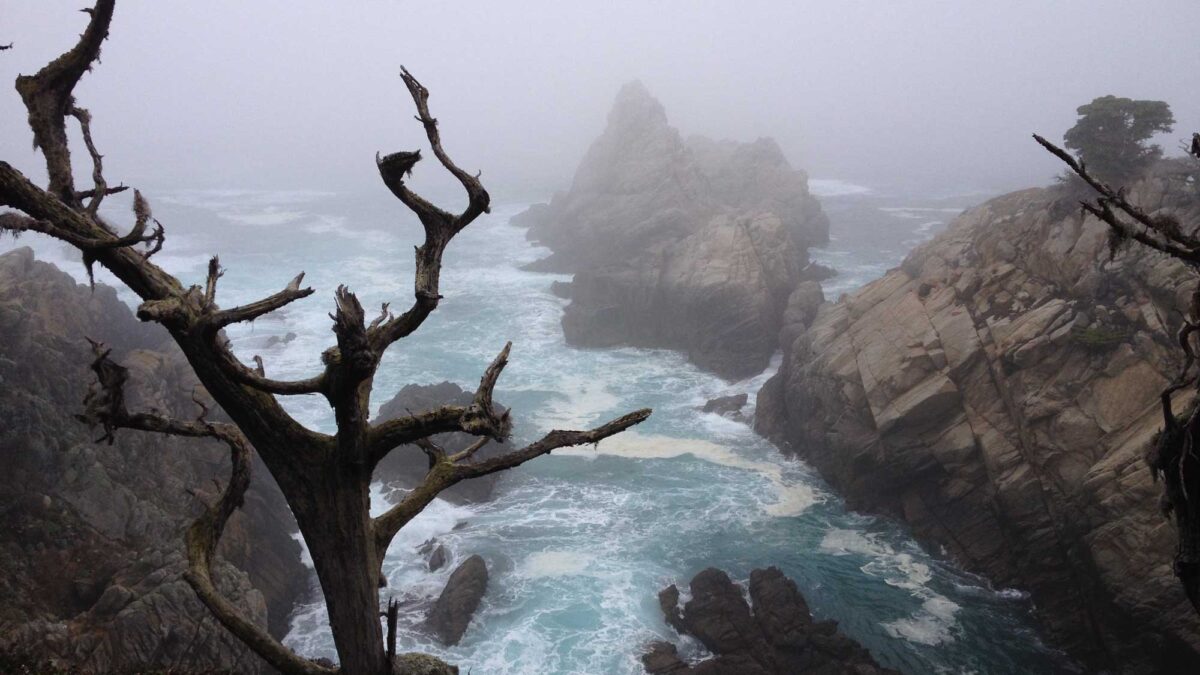
Image above: The Pacific Ocean at Point Lobos State Natural Reserve in Monterey County, California. Photograph by Jonathan R. Hendricks.
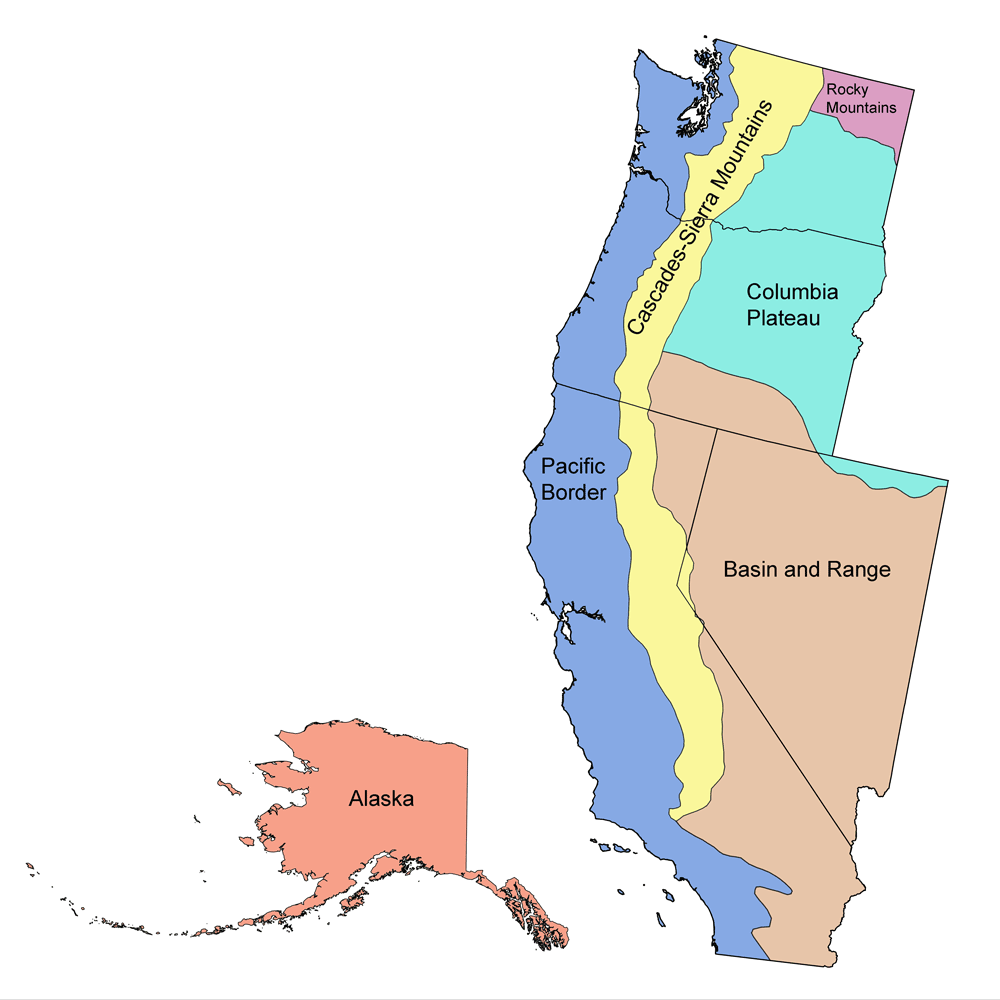
Geologic Map of California
Geologic map of California showing maximum ages of mappable units. Image by Jonathan R. Hendricks for the Earth@Home project developed using QGIS and USGS data (public domain) from Fenneman and Johnson (1946) and Horton et al. (2017).
California State Fossil: Smilodon fatalis
The state fossil of California is Smilodon fatalis, the saber-toothed cat. Smilodon fatalis is among the most famous species represented in the La Brea Tar Pits. This extinct big cat is well known for its prominently elongated canine teeth. While these animals are sometimes referred to as “saber-toothed tigers,” they are not actually close relatives of tigers or any other living feline group. Smilodon belongs to the group known as “dirk-toothed” cats, which possess teeth with fine serrations.
The elongated canines of Smilodon were fairly thin and would have broken if they bit into bone, so these teeth would likely have been used to kill prey that was already subdued. The cats’ most common prey were likely bison and camels; dire wolves were probably their direct competitors.
Smilodon went extinct around 10,000 years ago, along with many of the large mammals it utilized for food. These extinctions have been related to both climate change and hunting by humans, although the relative importance of each of these factors is still debated.
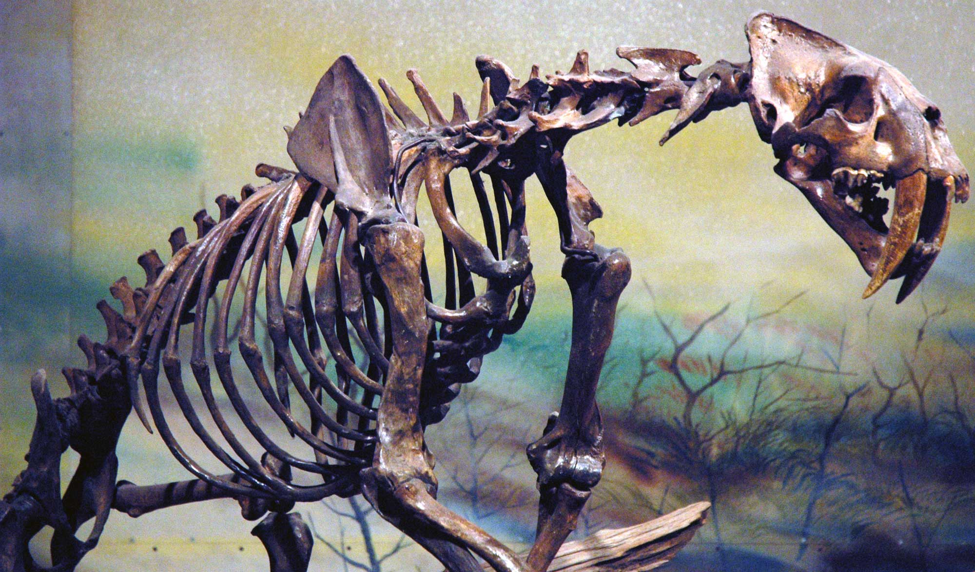
Skeleton of a saber-tooth cat (Smilodon fatalis), La Brea Tarpits, Pleistocene, Los Angeles, California. Photo by James St. John (flickr, Creative Commons Attribution 2.0 Generic license, image resized).
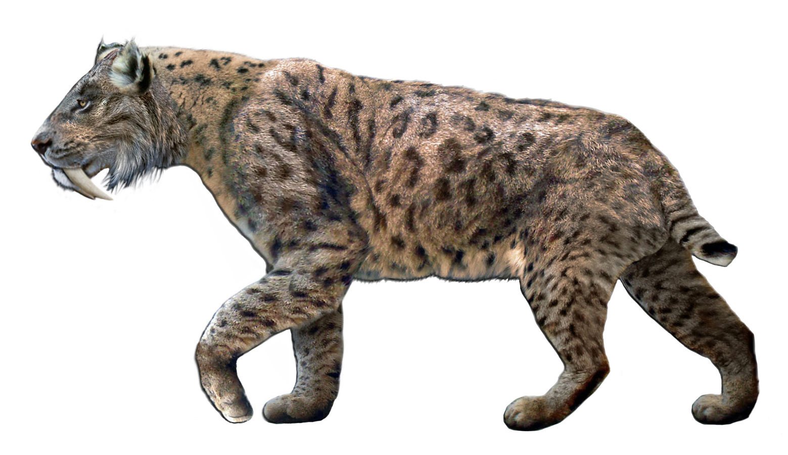
Illustration of a saber-toothed cat (Smilodon fatalis) by Dantheman9758 (Wikimedia Commons, Creative Commons Attribution 3.0 Unported license).
California State Rock: Serpentine
This green metamorphic rock is found throughout California’s Coast Ranges, Klamath Mountains, and Sierra Nevada foothills. It formed through the metamorphism of oceanic peridotite during subduction.
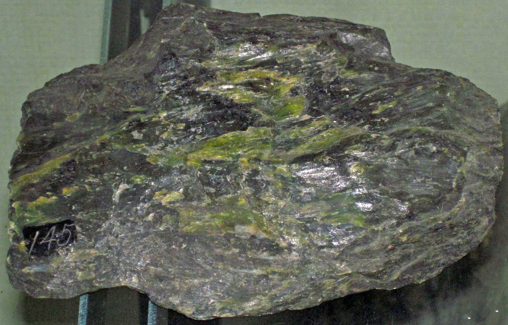
A sample of serpentinite from Plumas County, California. Photograph by James St. John (Flickr; Creative Commons Attribution 2.0 Generic license).
California State Mineral: Gold
California’s nickname is the “Golden State.” Its early population expansion and modern development, including roads and infrastructure, can be traced back to the discovery of gold there in 1848 and the ensuing gold rush.
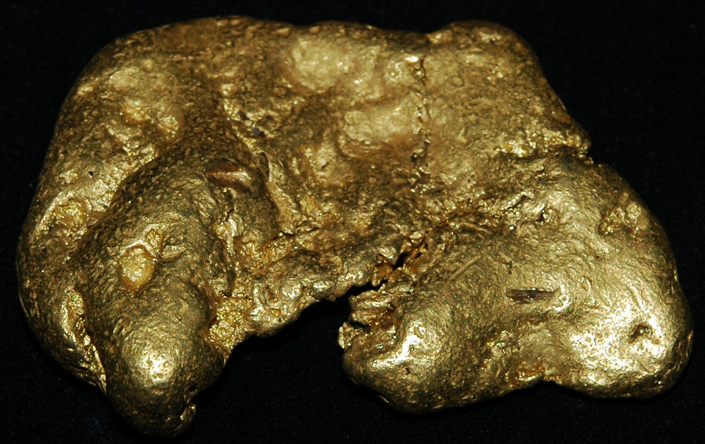
Gold nugget from California. Photograph by James St. John (Flickr; Creative Commons Attribution 2.0 Generic license).
California State Gem: Benitoite
Benitoite is a rare blue fluorescent mineral formed when serpentine undergoes metamorphism.
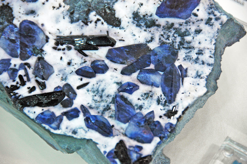
Original caption: "Blueschist with benitoite-neptunite-natrolite vein (Franciscan Complex, Jurassic-Cretaceous; Middle Miocene vein mineralization, 12 Ma; Dallas Gem Mine, California, USA)." The benitoite crystals are bright blue in color. Photograph by James St. John (Flickr; Creative Commons Attribution 2.0 Generic license).
California's Highest and Lowest Elevations
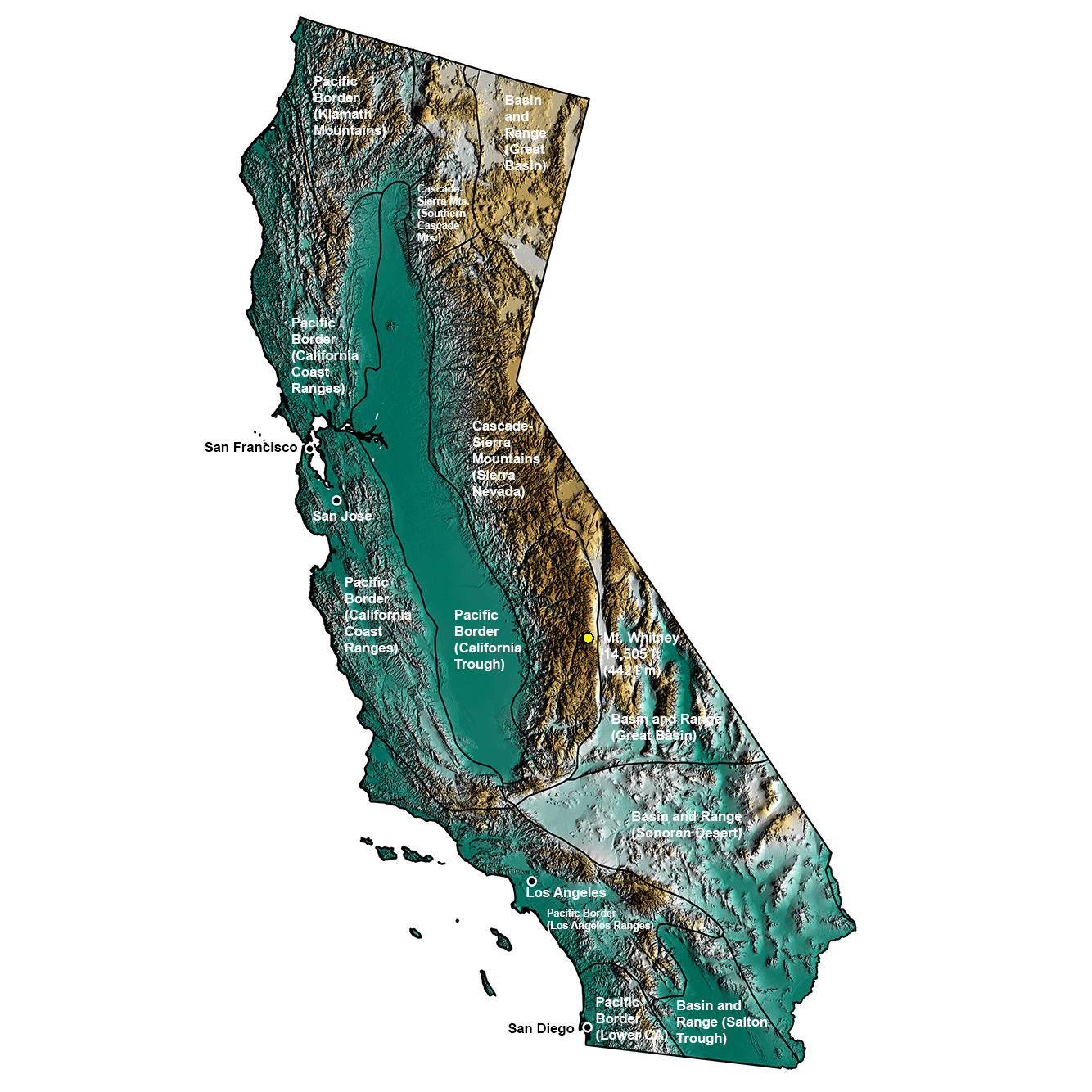
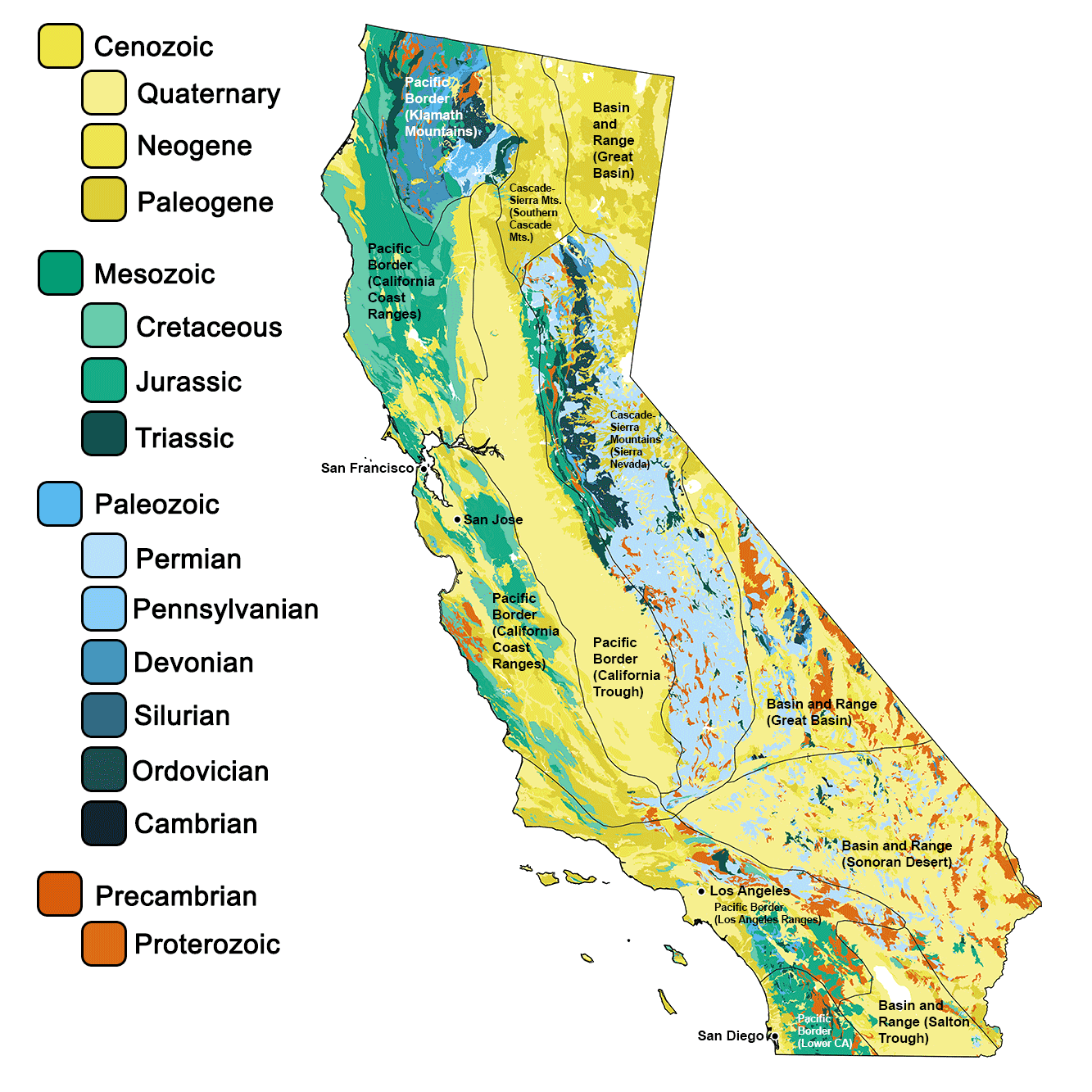
Topographic map of California with physiographic regions and point of highest elevation identified. Topographic data are derived from the Shuttle Radar Topography Mission (SRTM GL3) Global 90m (SRTM_GL3) (Farr, T. G., and M. Kobrick, 2000, Shuttle Radar Topography Mission produces a wealth of data. Eos Trans. AGU, 81:583-583).
Highest Elevation: Mt. Whitney
California’s highest point—and also the highest point in the contiguous 48 states—is Mt. Whitney, at 4421 meters (14,505 feet) in elevation. Mt. Whitney is located at the southeastern end of the Sierra Nevada.
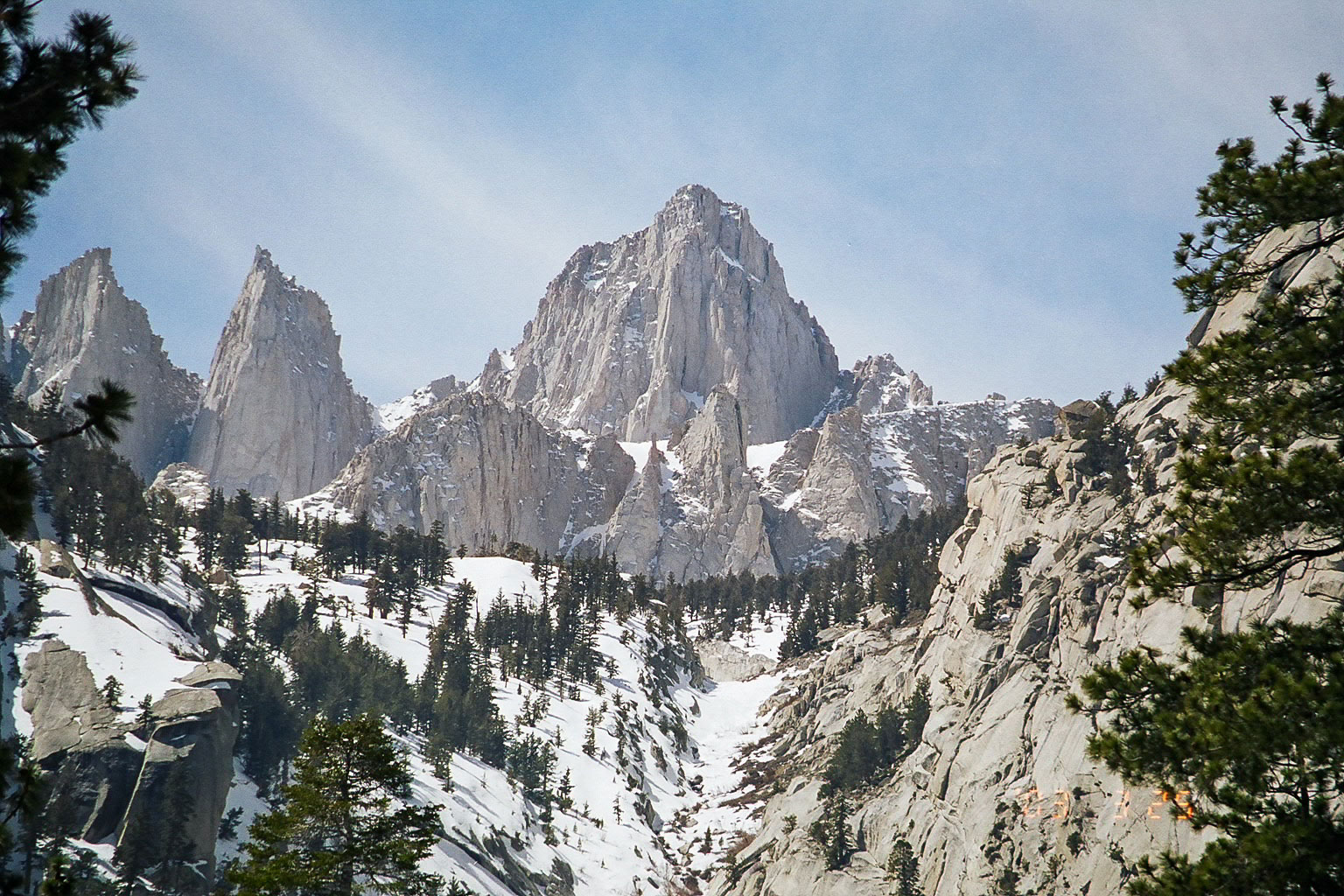
Mount Whitney, California. Photograph by "Geographer" (Wikimedia Commons; Creative Commons Attribution 1.0 Generic license).
Lowest Elevation: Badwater Basin, Death Valley
California's point of highest elevation (Mt. Whitney) is only 85 miles northwest from Badwater Basin in Death Valley, which at 86 meters (282 feet) below sea level is the lowest point in all of North America.
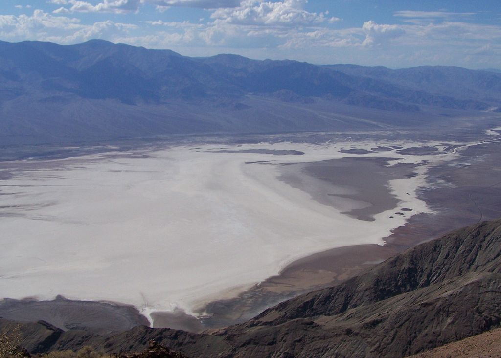
Badwater Basin in Death Valley National Park, California. Photograph by "HappyJake" (Wikimedia Commons; Creative Commons Attribution 3.0 Unported license).
Places to Visit
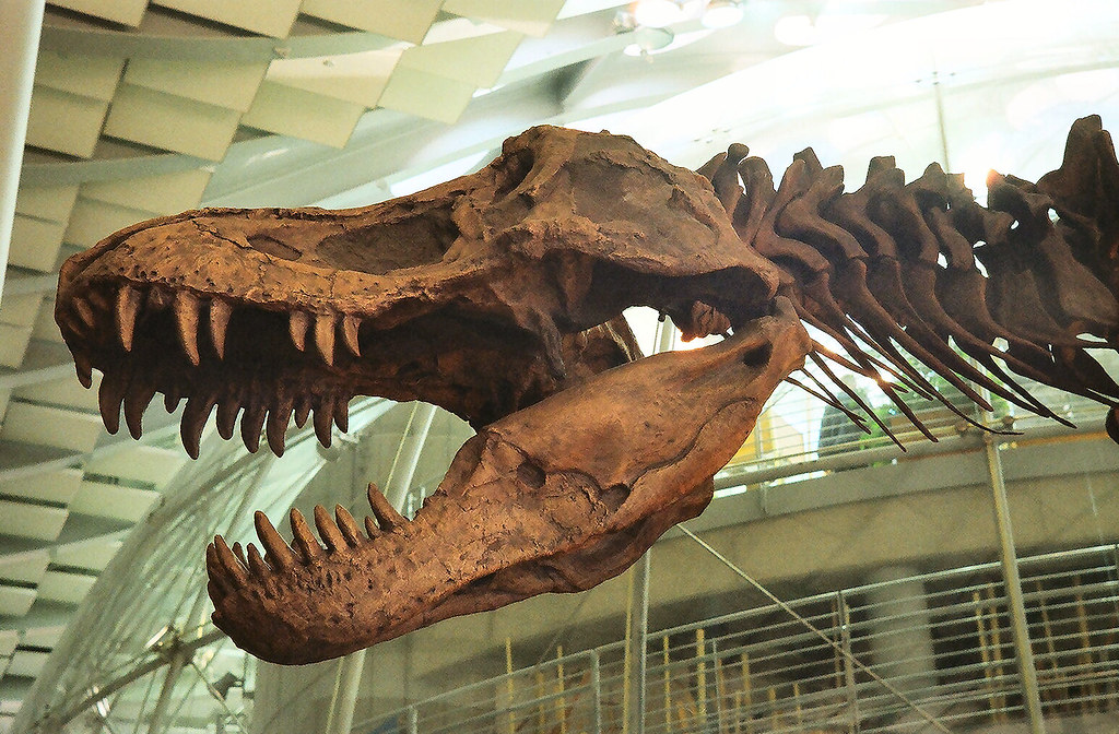
Cast of a Tyrannosaurus on display at the Academy of Natural Sciences in San Francisco. Photograph by Michael Fraley (Flickr; Creative Commons Attribution 2.0 Generic license).
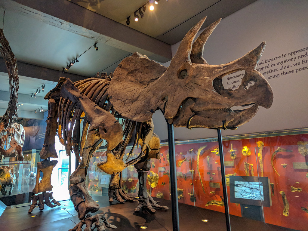
Triceratops skeleton on display at the Natural History Museum of Los Angeles County in California. Photograph by Matthew Dillon (Flickr; Creative Commons Attribution 2.0 Generic license).
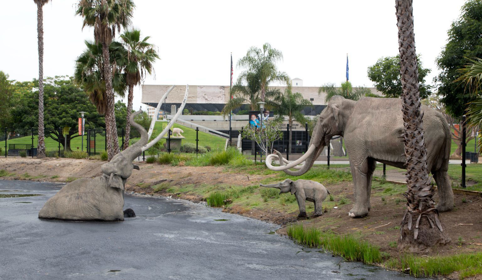
Recreation of a Columbian mammoth trapped in a tarpit, La Brea Tarpits, Los Angeles, California, 2012. Photo by Carol M. Highsmith (Reproduction number LC-DIG-highsm-21992, Carol M. Highsmith Archive, Library of Congress Prints and Photographs Division, no known restrictions on publication).
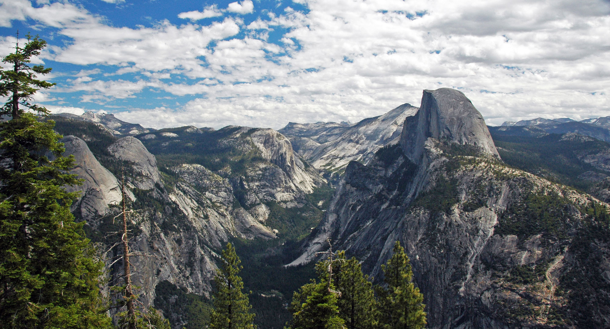
Yosemite Valley and Half Dome (the projecting rock formation on the right), Yosemite National Park, eastern California. Photo by James St. John (flickr, Creative Commons Attribution 2.0 Generic license, image resized).
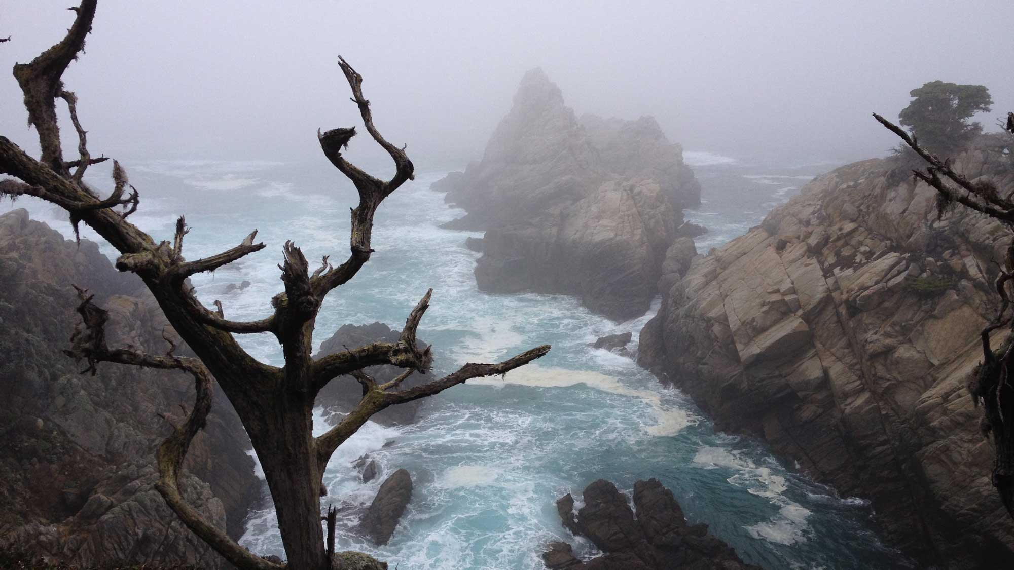
The Pacific Ocean at Point Lobos State Natural Reserve in Monterey County, California. Photograph by Jonathan R. Hendricks.
Additional resources