Page snapshot: Florida State Geologic Map; Fossil; Rock; Mineral; Gem; Highest and Lowest Elevations; Places to Visit; and Additional Resources.
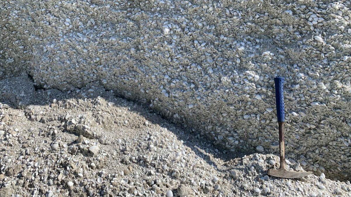
Image above: Thousands of Pleistocene-aged fossil bivalves in a quarry exposure of the Nashua Formation in Florida. Photograph by Jonathan R. Hendricks.
Geologic Map of Florida
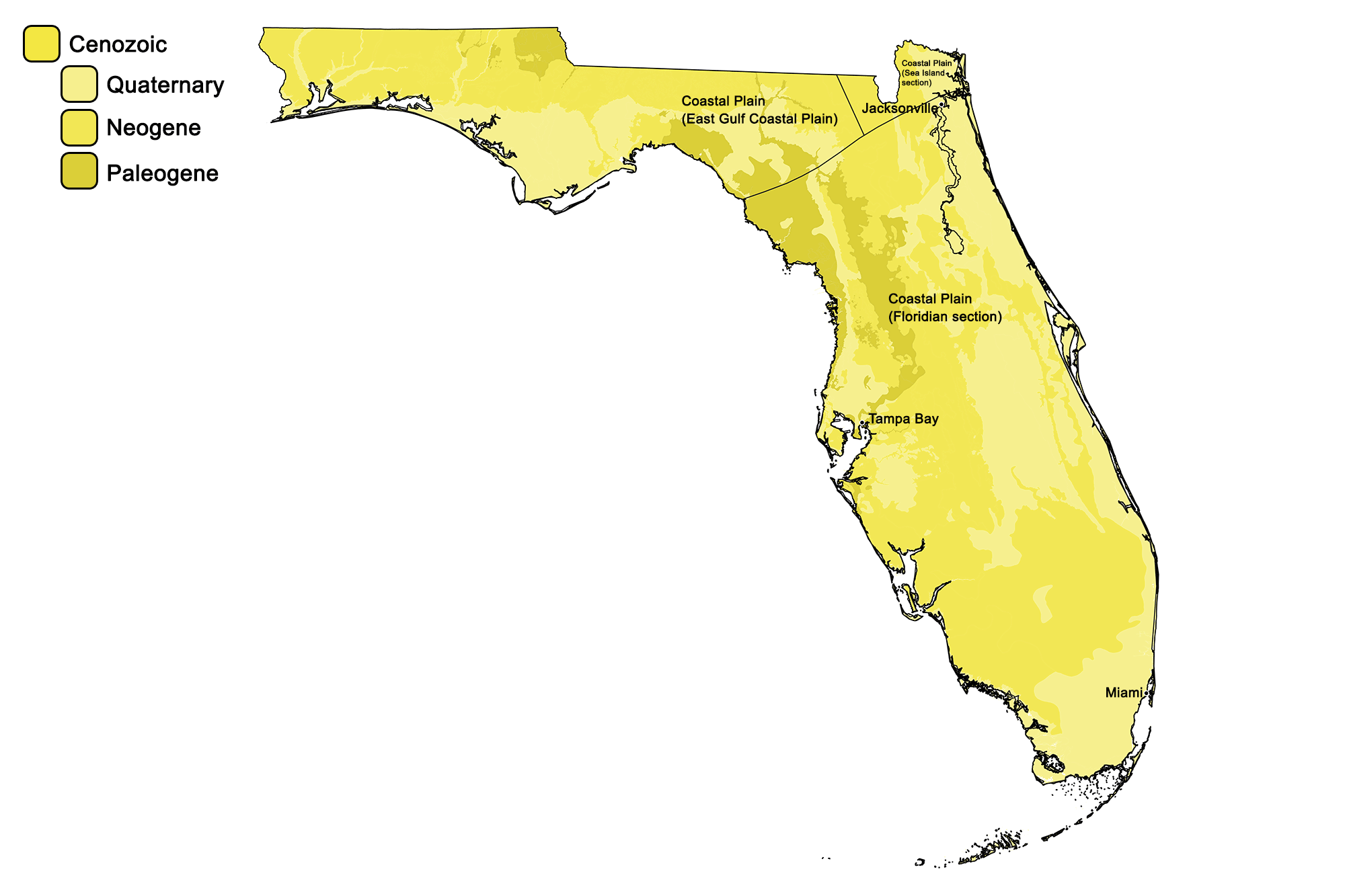
Geologic map of Florida showing maximum ages of mappable units. Image by Jonathan R. Hendricks for the Earth@Home project developed using QGIS and USGS data (public domain) from Fenneman and Johnson (1946) and Horton et al. (2017).
Florida State Fossil: None
Despite having an incredible Cenozoic fossil record, Florida does not have an official state fossil (though its state rock is agatized coral). What do you think it should be? Answer in the comments!
Florida State Rock: Agatized Coral
Although technically a fossil, agatized coral became Florida’s state "rock" in 1979. These corals are unique formations found in the Econfina and Suwanne riverbeds as well as Tampa Bay. They formed over a period of 20–30 million years as silica in the ocean water replaced the coral polyps with chalcedony.
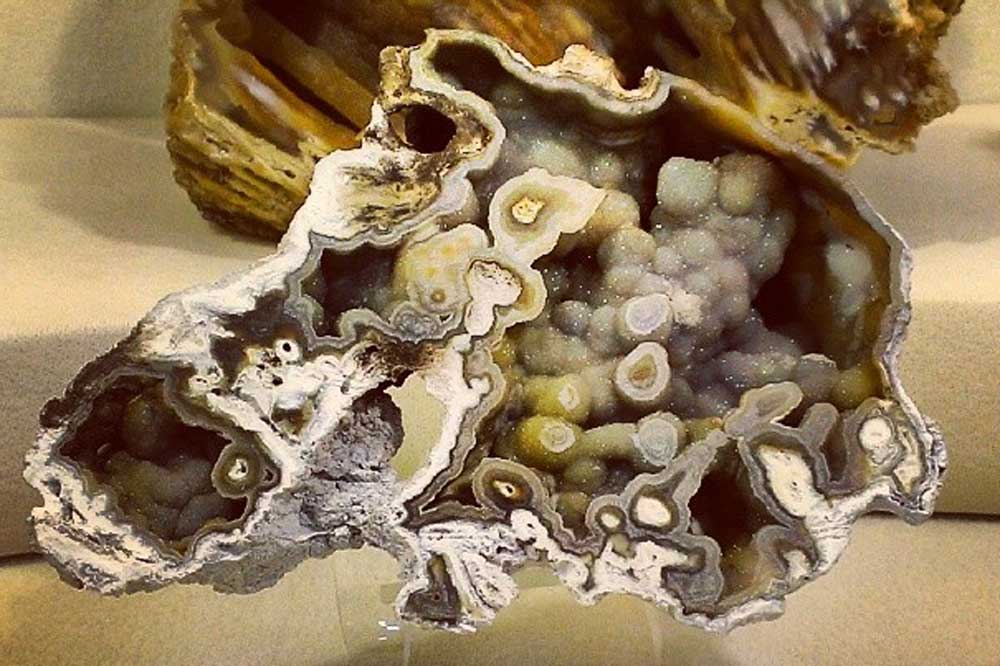
Sample of agatized coral from Florida. Photograph by "Fatemeh" (Flickr; Creative Commons Attribution-NonCommercial 2.0 Generic license; image cropped and resized).
Florida State Mineral: None
Florida does not have an official state mineral. What do you think it should be? Answer in the comments!
Florida State Gem: Moonstone
Moonstone, a variety of feldspar that refracts light, is not actually found in Florida (or on the moon for that matter)! Moonstone was selected as Florida's state gem because the moon-landing missions were launched and controlled from the Kennedy Space Center in Cape Canaveral.
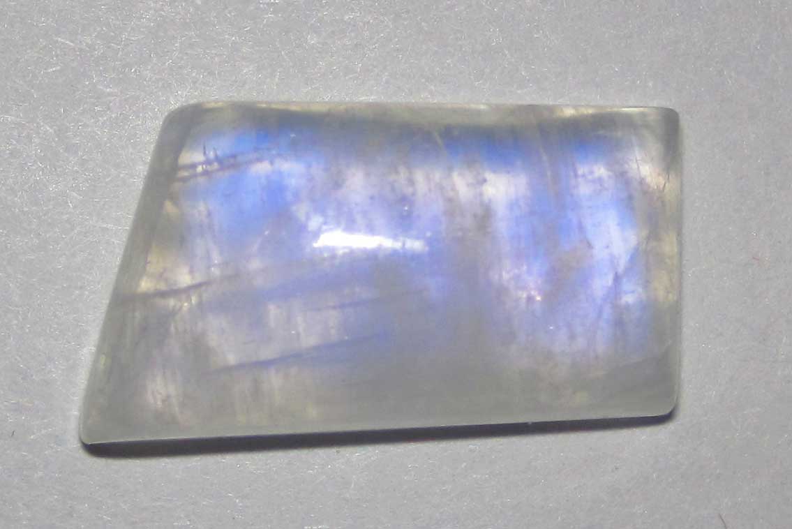
Sample of moonstone (~1.9 cm across at widest point). Photograph by James St. John (Flickr; Creative Commons Attribution 2.0 Generic license; image cropped).
Florida's Highest and Lowest Elevations
Highest Elevation: Britton Hill
Britton Hill, rising 105 meters (345 feet) above sea level, is Florida's highest natural point. The hill, located in Lakewood Park in Walton County, is about a half mile south of the Alabama border. It is the lowest state high point in the US.
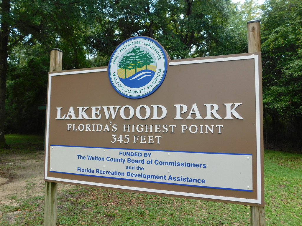
Britton Hill, located in Lakewood Park, is Florida's highest point. Photograph by Jimmy Emerson (Flickr; Creative Commons Attribution-NonCommercial-NoDerivs 2.0 Generic license).
Lowest Elevation: Gulf and Atlantic Shorelines
The lowest points in Florida are found at sea level along the state's Atlantic and Gulf coastlines.
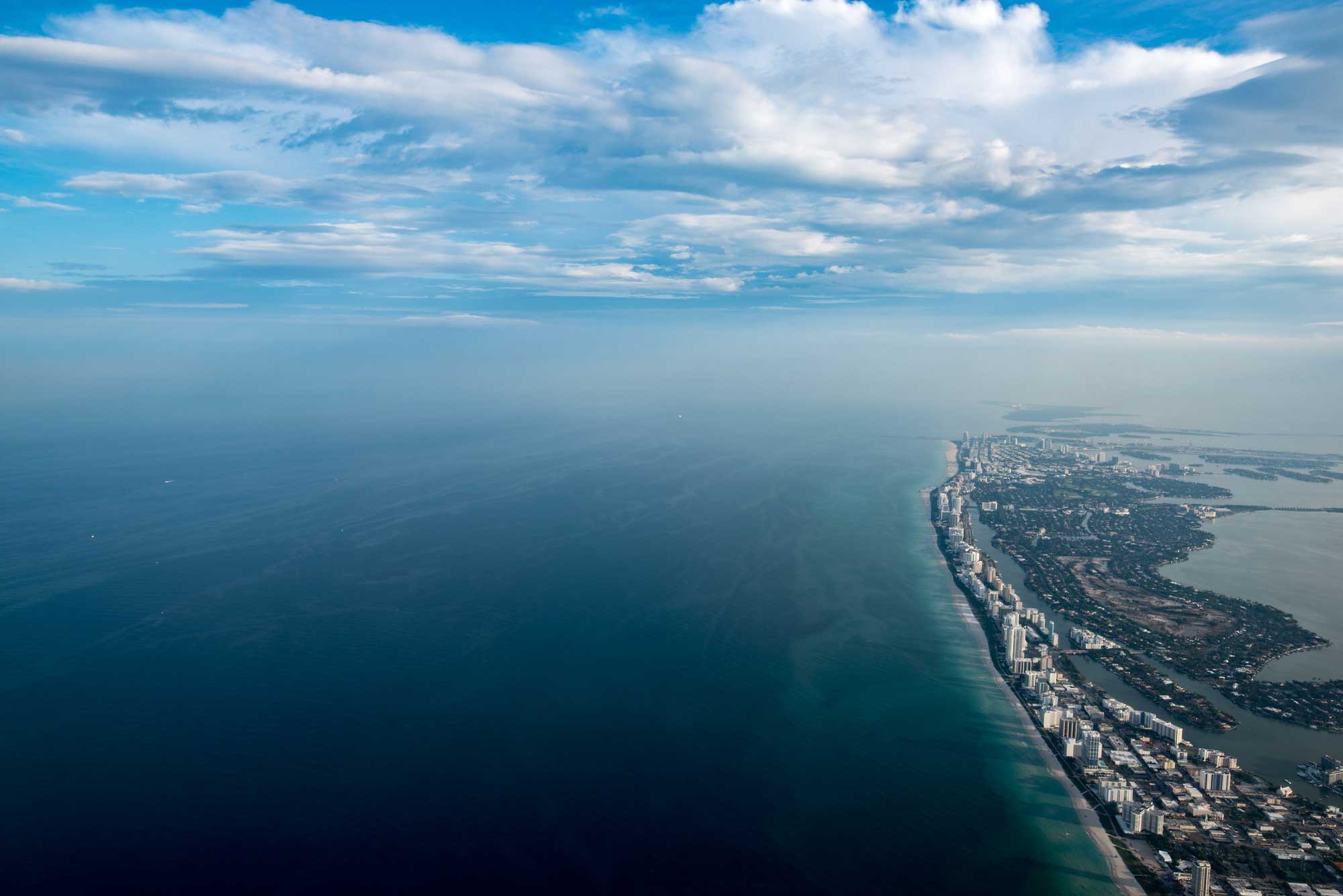
Miami Beach, Florida. Photograph by Katie Wheeler (Flickr; Creative Commons Attribution-NonCommercial 2.0 Generic license; image resized).
Places to Visit
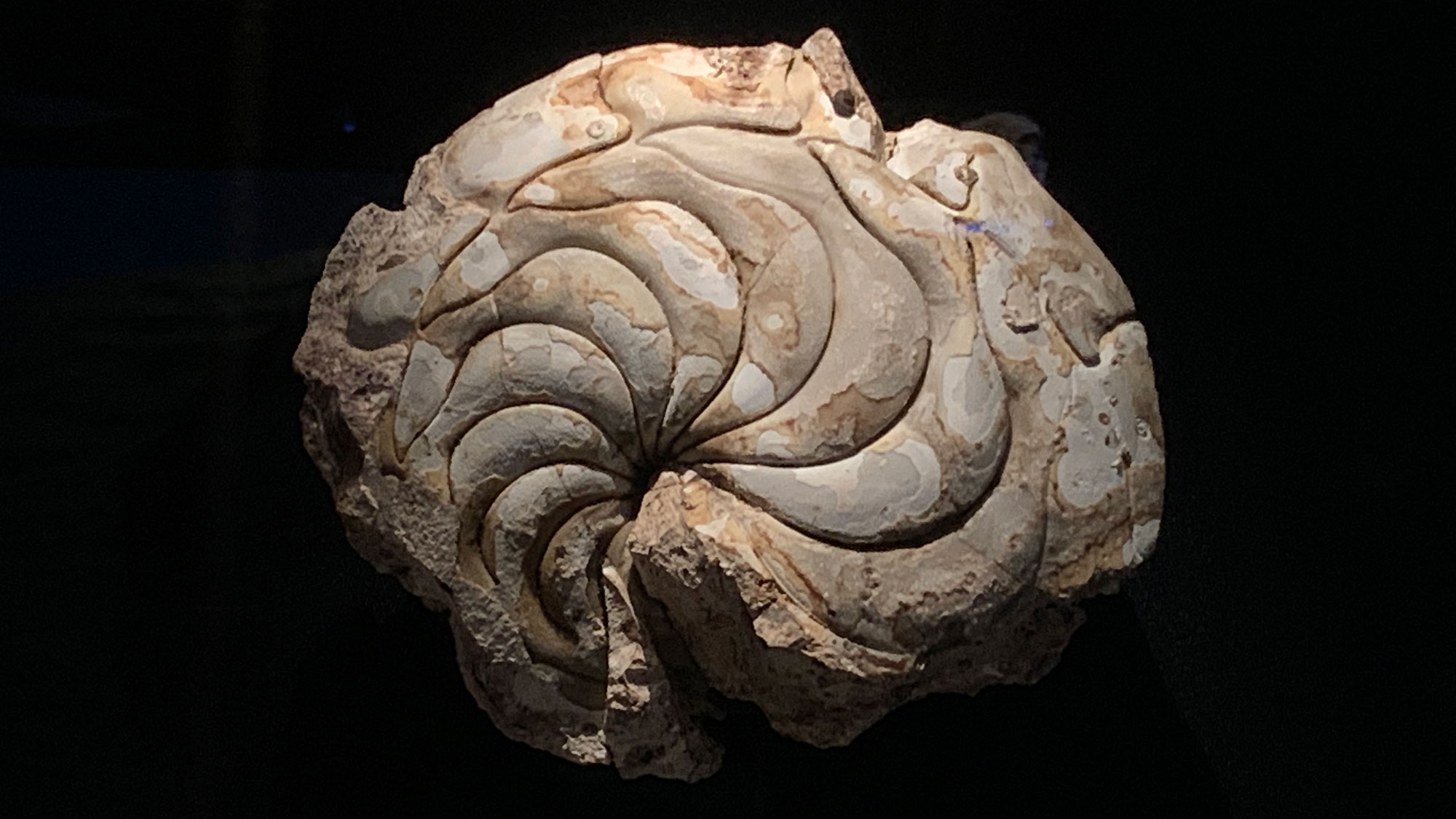
Fossil nautilus Aturia on display at the Florida Museum of Natural History. Photograph by Jonathan R. Hendricks.
Additional resources