Page snapshot: New Mexico State Geologic Map; Fossil; Rock; Mineral; Gem; Highest and Lowest Elevations; Places to Visit; and Additional Resources.
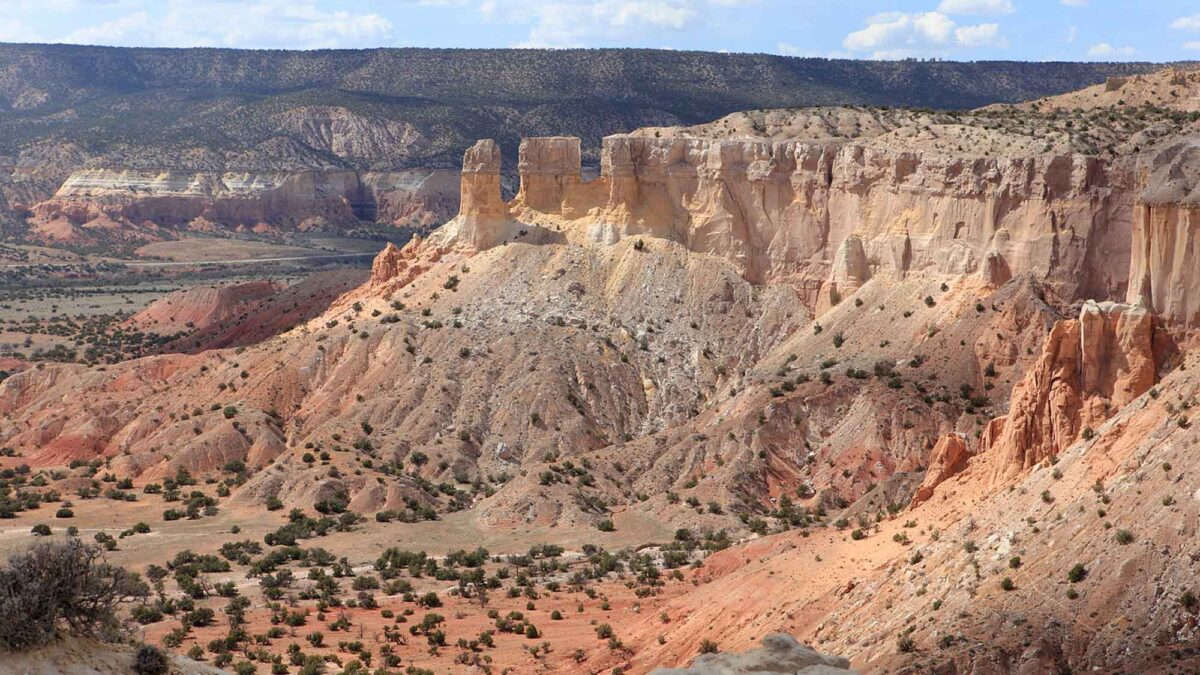
Image above: Rock exposures at Ghost Ranch Backyard, New Mexico. Photograph by "cobalt123" (Flickr; Creative Commons Attribution-NonCommercial-ShareAlike 2.0 Generic license; image cropped and resized).
Geologic Maps of New Mexico
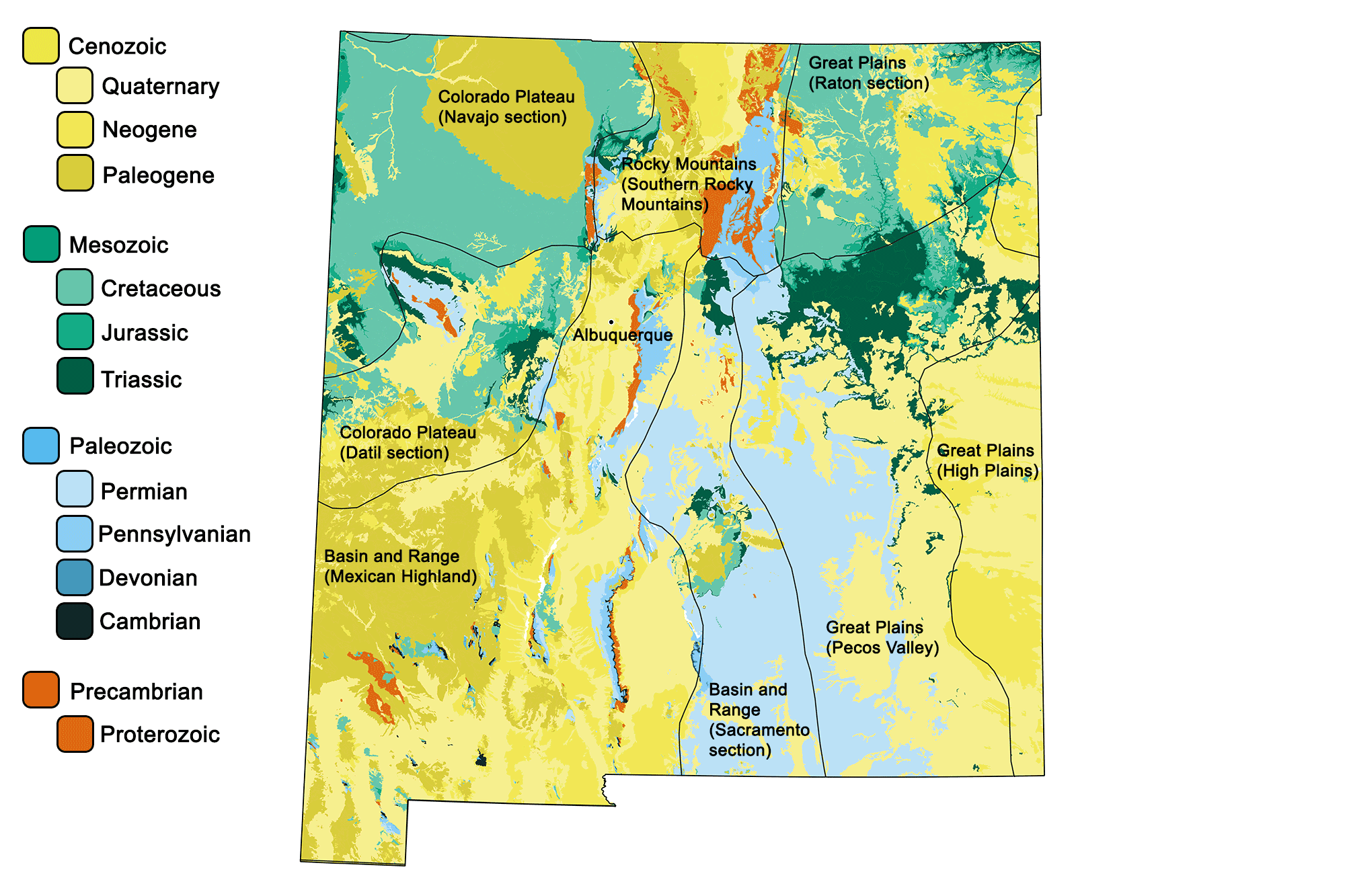
Geologic map of New Mexico showing maximum ages of mappable units. Image by Jonathan R. Hendricks for the Earth@Home project developed using QGIS and USGS data (public domain) from Fenneman and Johnson (1946) and Horton et al. (2017).
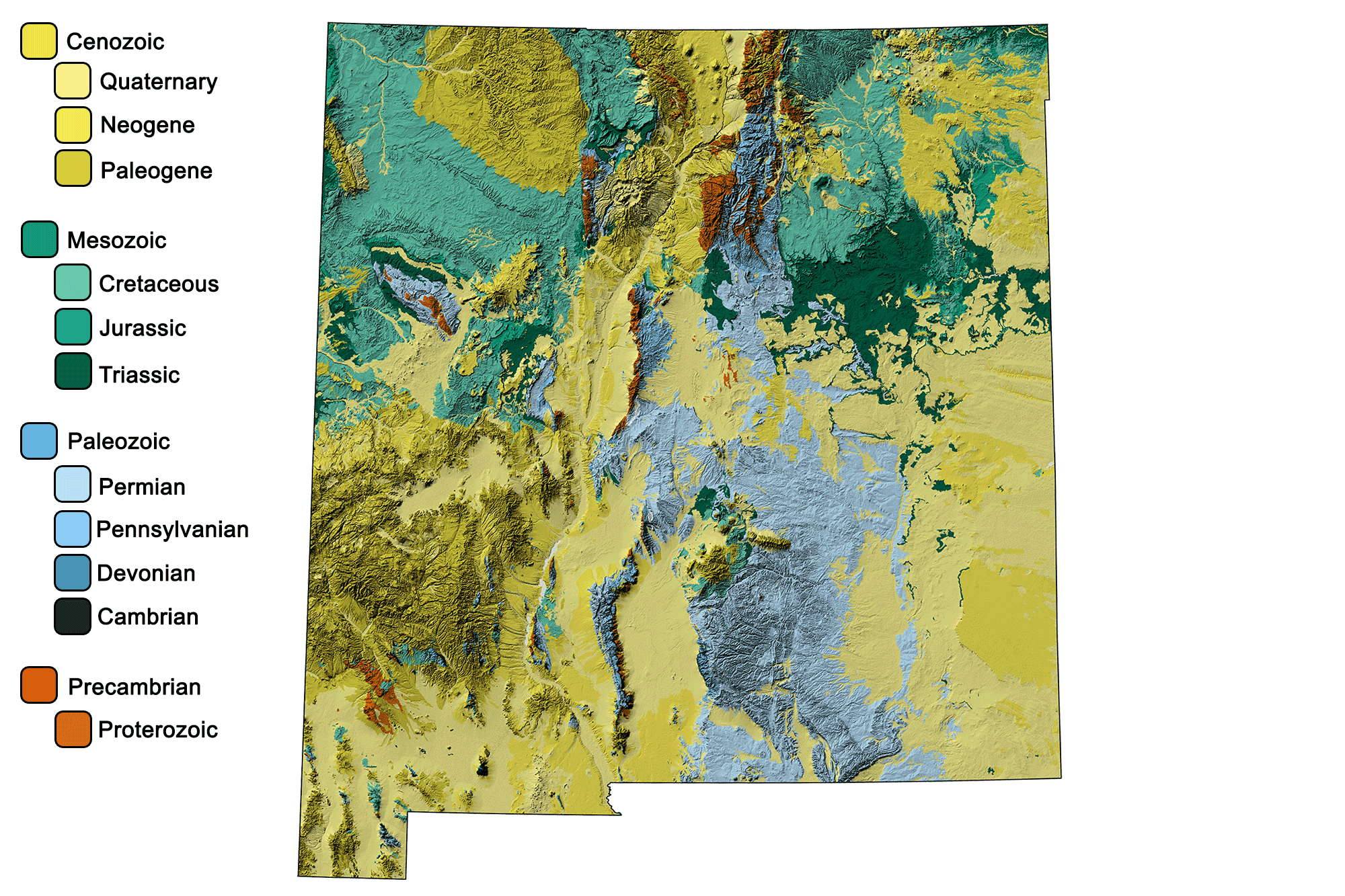
Geologic and topographic map of New Mexico. Geologic data from Horton et al. (2017) using the maximum age values for each mapped unit. Topographic data are derived from the Shuttle Radar Topography Mission (SRTM GL3) Global 90m (SRTM_GL3) (Farr, T. G., and M. Kobrick, 2000, Shuttle Radar Topography Mission produces a wealth of data. Eos Trans. AGU, 81:583-583).
New Mexico State Fossil: Coelophysis bauri
The official state fossil of New Mexico is the small, carnivorous, Triassic-aged dinosaur Coelophysis bauri.
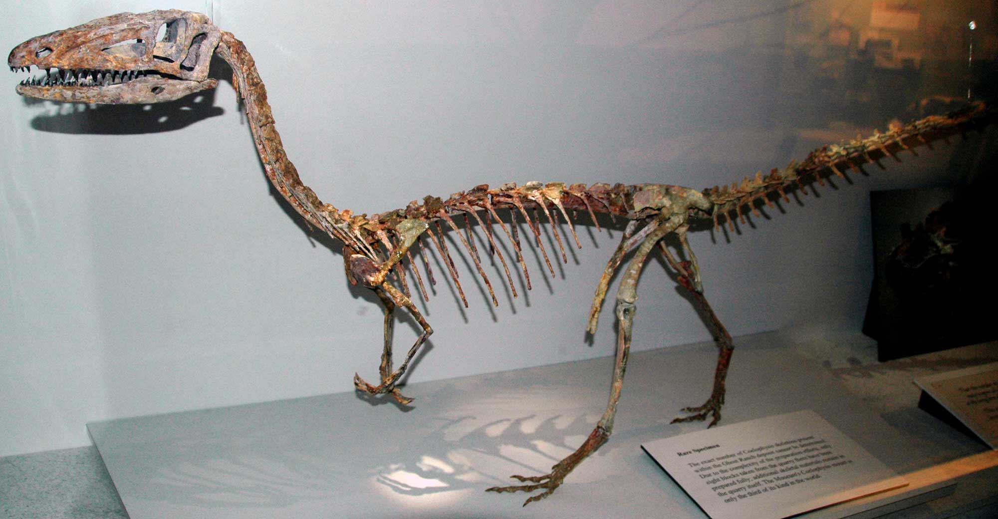
The theropod dinosaur Coelophysis bauri from the Triassic of Ghost Range, New Mexico. Photograph by James St. John (Flickr; Creative Commons Attribution 2.0 Generic license; image resized).
New Mexico State Rock: None
New Mexico does not have an official state rock. What do you think it should be? Answer in the comments!
New Mexico State Mineral: None
New Mexico does not have an official state mineral. What do you think it should be? Answer in the comments!
New Mexico State Gem: Turquoise
Large turquoise deposits in New Mexico are present in the metamorphosed volcanics of the Los Cerillos Mountains, where they have been mined since prehistoric times. Due to the processes under which it formed, this turquoise developed in over 75 different colors. New Mexico was the largest U.S. producer of turquoise until the 1920s; Arizona and Nevada have since become larger producers.
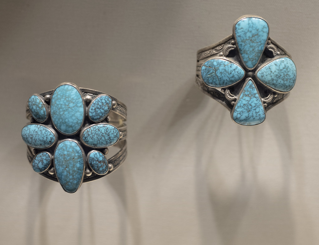
Navajo silver bracelets with turquoise on display at the Wheelwright Museum of the American Indian in Santa Fe, New Mexico. Photograph by C. Watts (Flickr; Creative Commons Attribution 2.0 Generic license).
New Mexico's Highest and Lowest Elevations
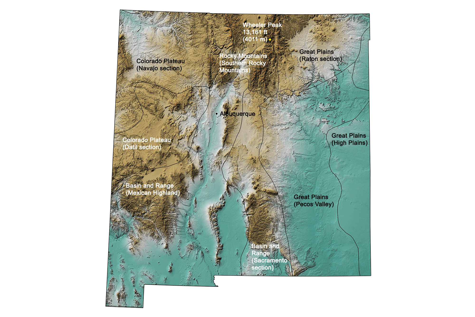
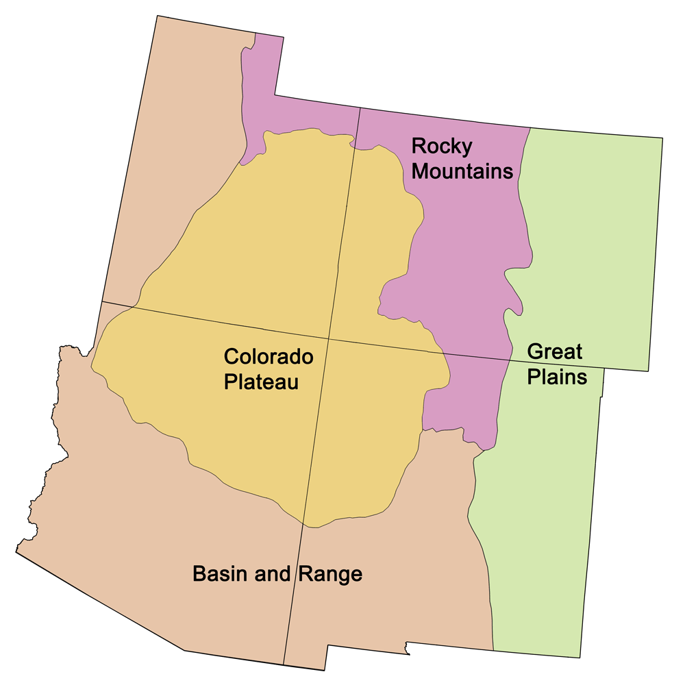
Topographic map of New Mexico with physiographic regions and point of highest elevation identified. Topographic data are derived from the Shuttle Radar Topography Mission (SRTM GL3) Global 90m (SRTM_GL3) (Farr, T. G., and M. Kobrick, 2000, Shuttle Radar Topography Mission produces a wealth of data. Eos Trans. AGU, 81:583-583).
Highest Elevation: Wheeler Peak
The Sangre de Cristo Mountains are home to Wheeler Peak, New Mexico's highest mountain. At 4011 meters (13,161 feet), the mountain is a popular hiking and climbing destination. It was named in honor of George Montague Wheeler, an American pioneering explorer and naturalist.
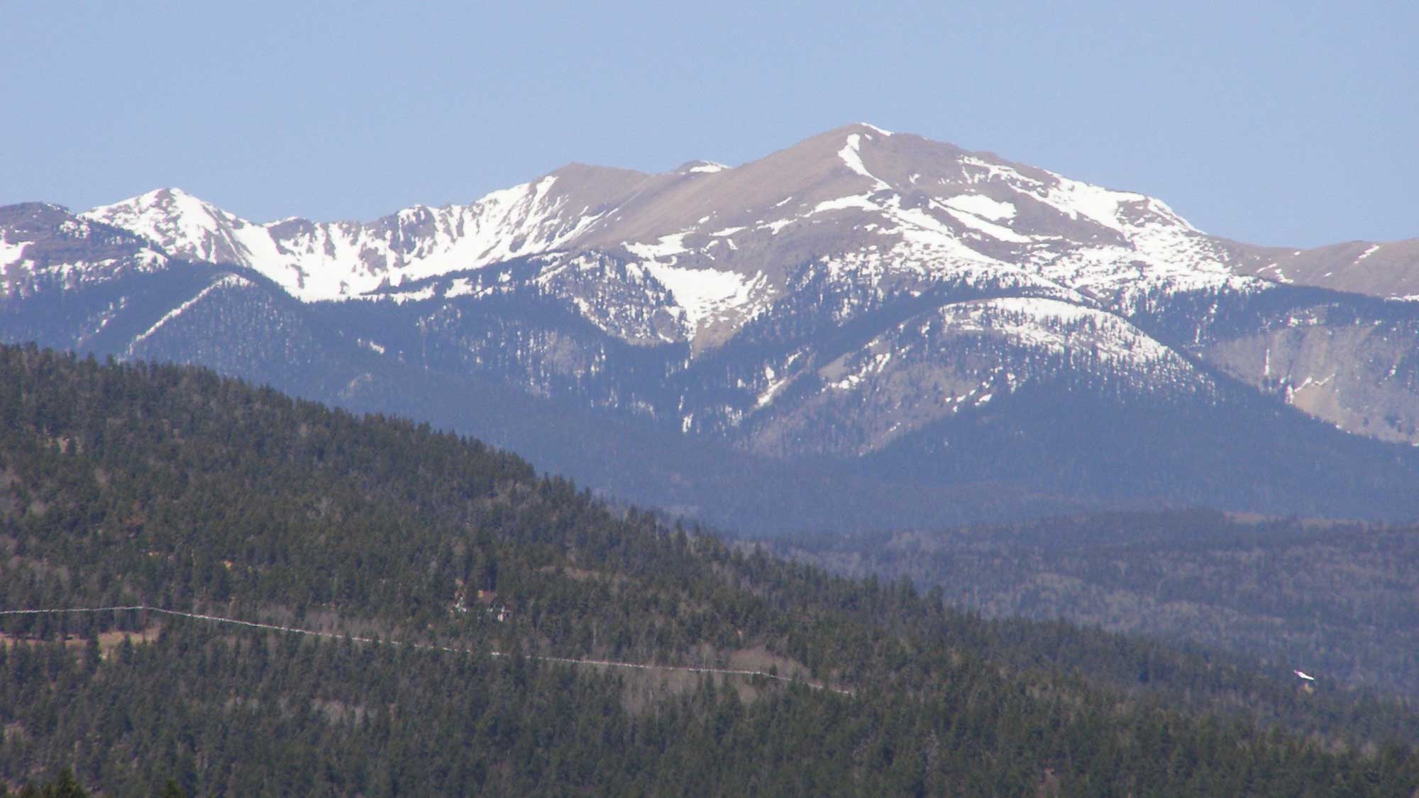
Wheeler Peak, New Mexico. Photograph by David Herrera (Flickr; Creative Commons Attribution 2.0 Generic license; image cropped and resized).
Lowest Elevation: Red Bluff Reservoir
New Mexico’s lowest point is the Red Bluff Reservoir on the Pecos River, with an elevation of 866 meters (2842 feet).
Places to Visit
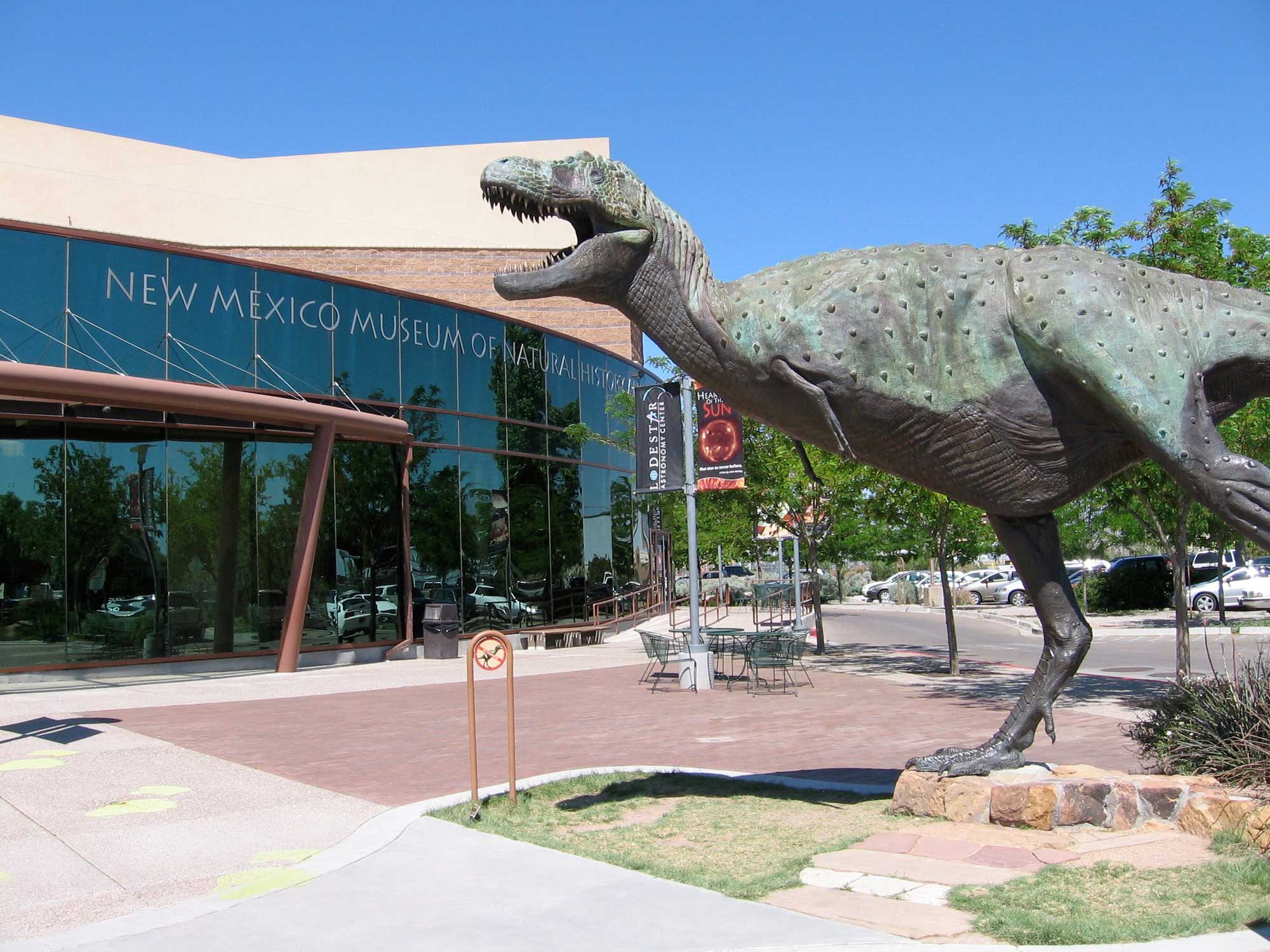
New Mexico Museum of Natural History & Science. Photograph by Marcin Wichary (Flickr; Creative Commons Attribution 2.0 Generic license).
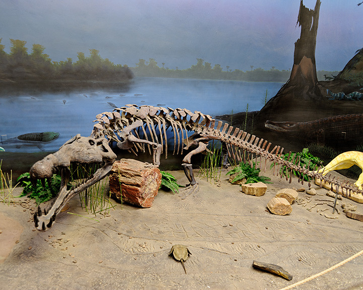
Photograph of a phytosaur skeleton on display at the Ruth Hall Museum of Paleontology at Ghost Ranch. Photograph by BFS Man (Flickr; Creative Commons Attribution 2.0 Generic license).
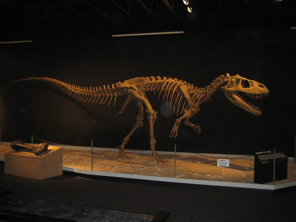
Dinosaur skeleton on display at the Mesalands Dinosaur Museum. Photograph by "Hawthorn M." (Flickr; Creative Commons Attribution-NonCommercial 2.0 Generic license).


