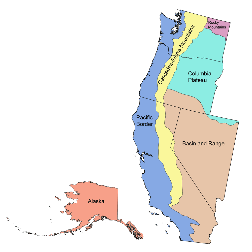
Page snapshot: Oregon State Geologic Map; Fossil; Rock; Mineral; Gem; Highest and Lowest Elevations; Places to Visit; and Additional Resources.
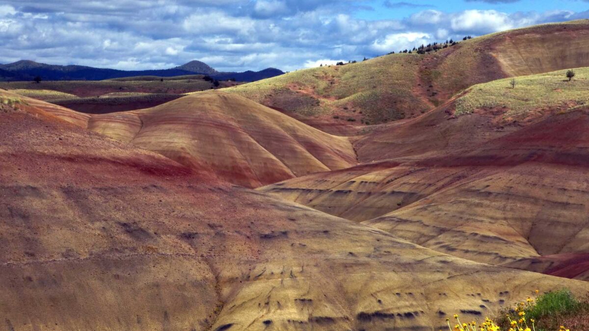
Image above: The Painted Hills at John Day Fossil Beds National Monument in Oregon. Photograph by Bruce Fingerhood (Flickr; Creative Commons Attribution-NonCommercial 2.0 Generic license; image cropped).
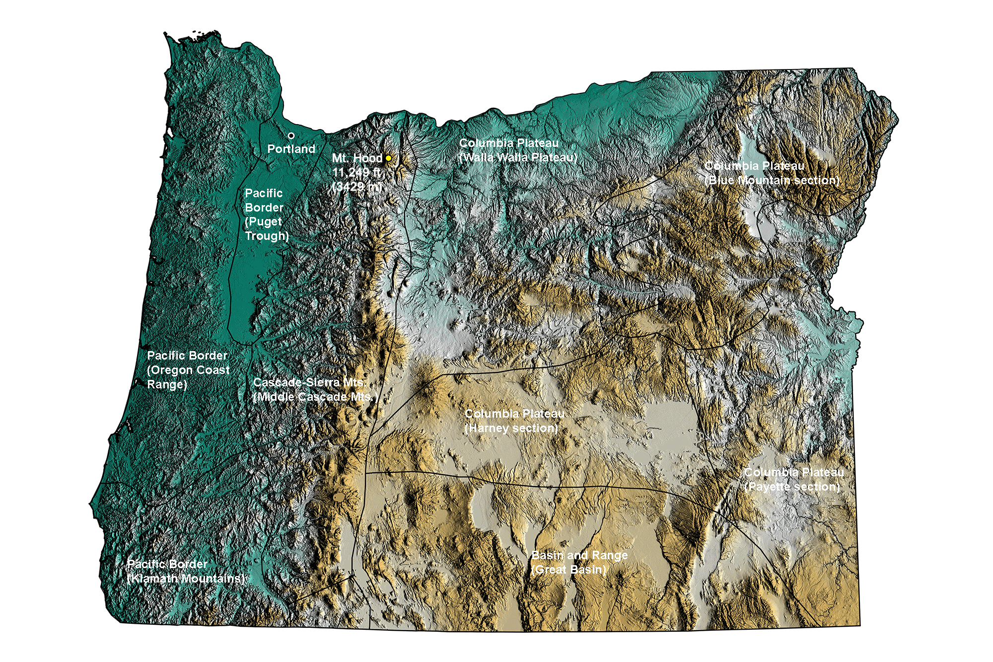
Geologic Map of Oregon
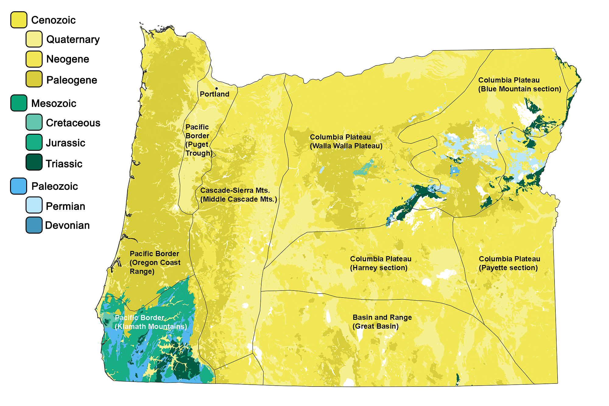
Geologic map of Oregon showing maximum ages of mappable units. Image by Jonathan R. Hendricks for the Earth@Home project developed using QGIS and USGS data (public domain) from Fenneman and Johnson (1946) and Horton et al. (2017).
Oregon State Fossil: Metasequoia
The state fossil of Oregon is Metasequoia, the dawn redwood.
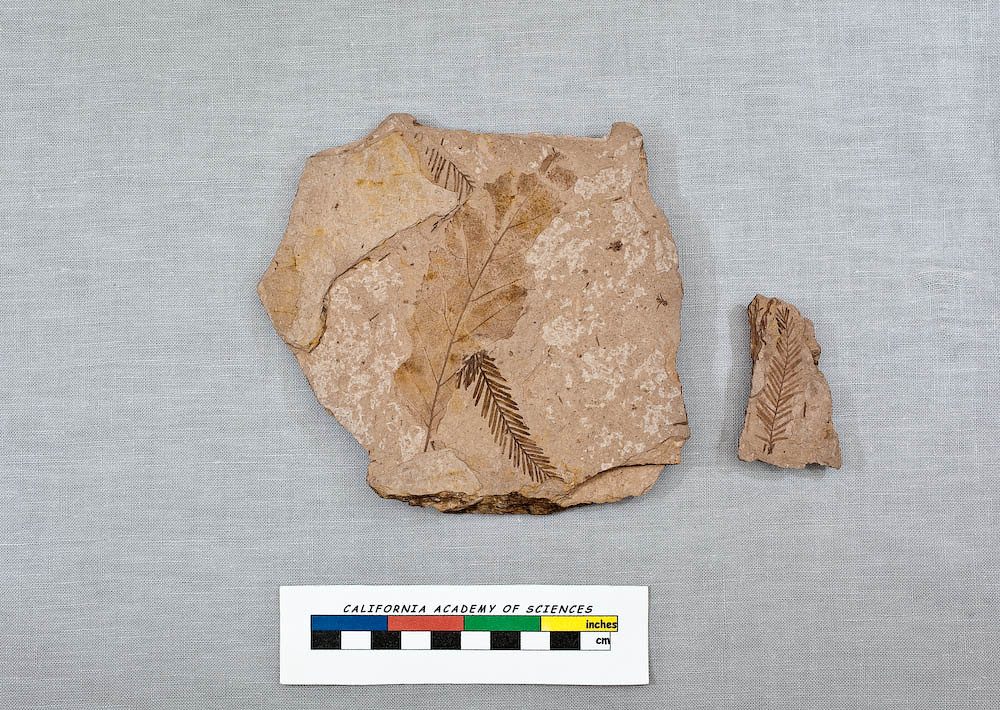
Samples of Metasequoia sp. from the Middle Eocene of Oregon; collections of the California Academy of Sciences (CASG 68224). Image by California Academy of Sciences (Flickr; Creative Commons Attribution-NonCommercial-NoDerivs 2.0 Generic license).
Oregon State Rock: Thunder Egg (Geode)
These geodes, locally called “thunder-eggs,” are found in Eocene-age rhyolite lava flows, having formed within gas pockets that served as molds.
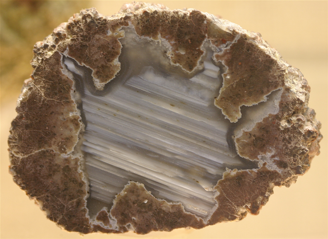
Thunderegg specimen from Oregon. Photograph by "Cacophony" (Wikimedia Commons; Creative Commons Attribution-ShareAlike 3.0 Unported license).
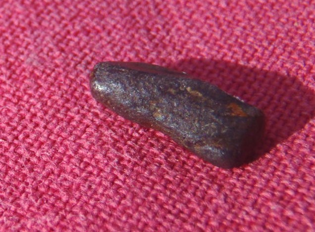
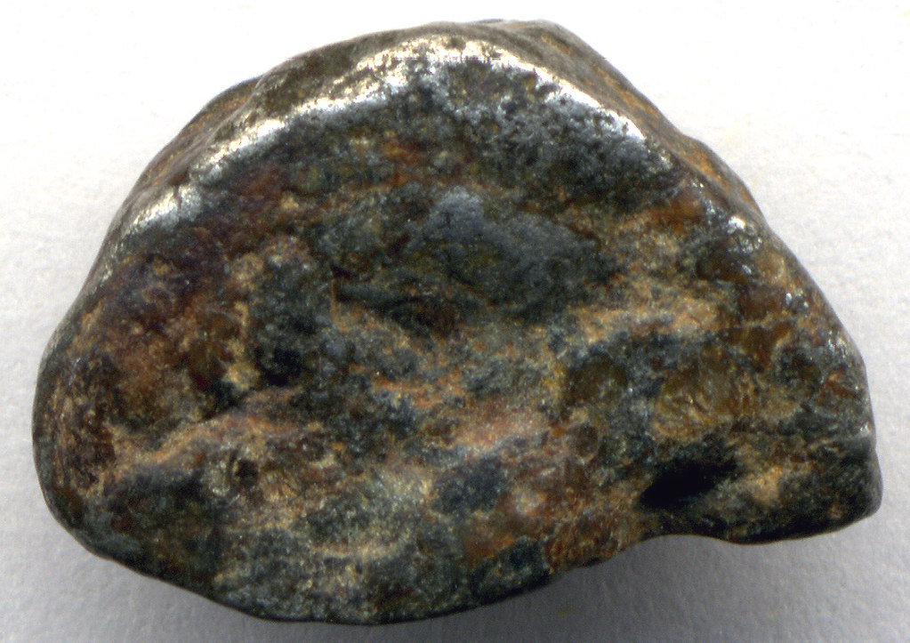
Oregon State Minerals: Oregonite and Josephinite
Oregon has two official state minerals: the sulfide oregonite (Ni2FeAs2) and the iron-nickel alloy josephinite (Ni2Fe to Ni3Fe), which is also known as awaruite..
Sample of oregonite from Oregon. Photograph by Erik Vercammen (Wikimedia Commons; Creative Commons Attribution 3.0 Unported license).
Sample of josephinite from Jackson County, Oregon. Photograph by James St. John (Flickr; Creative Commons Attribution 2.0 Generic license).
Oregon State Gem: Oregon sunstone
"Oregon sunstone" is a type of translucent feldspar formed as large crystals in basaltic lava flows.

Sunstone (faceted) from Oregon. Photograph by James St. John (Flickr; Creative Commons Attribution 2.0 Generic license).
Oregon's Highest and Lowest Elevations
Topographic map of Oregon with physiographic regions and point of highest elevation identified. Topographic data are derived from the Shuttle Radar Topography Mission (SRTM GL3) Global 90m (SRTM_GL3) (Farr, T. G., and M. Kobrick, 2000, Shuttle Radar Topography Mission produces a wealth of data. Eos Trans. AGU, 81:583-583).
Highest Elevation: Mt. Hood
Mt. Hood, about 80 kilometers (50 miles) east of Portland, is Oregon’s highest point at 3429 meters (11,249 feet). A dormant volcano, Mt. Hood is the fourth highest peak in the Cascade Range.
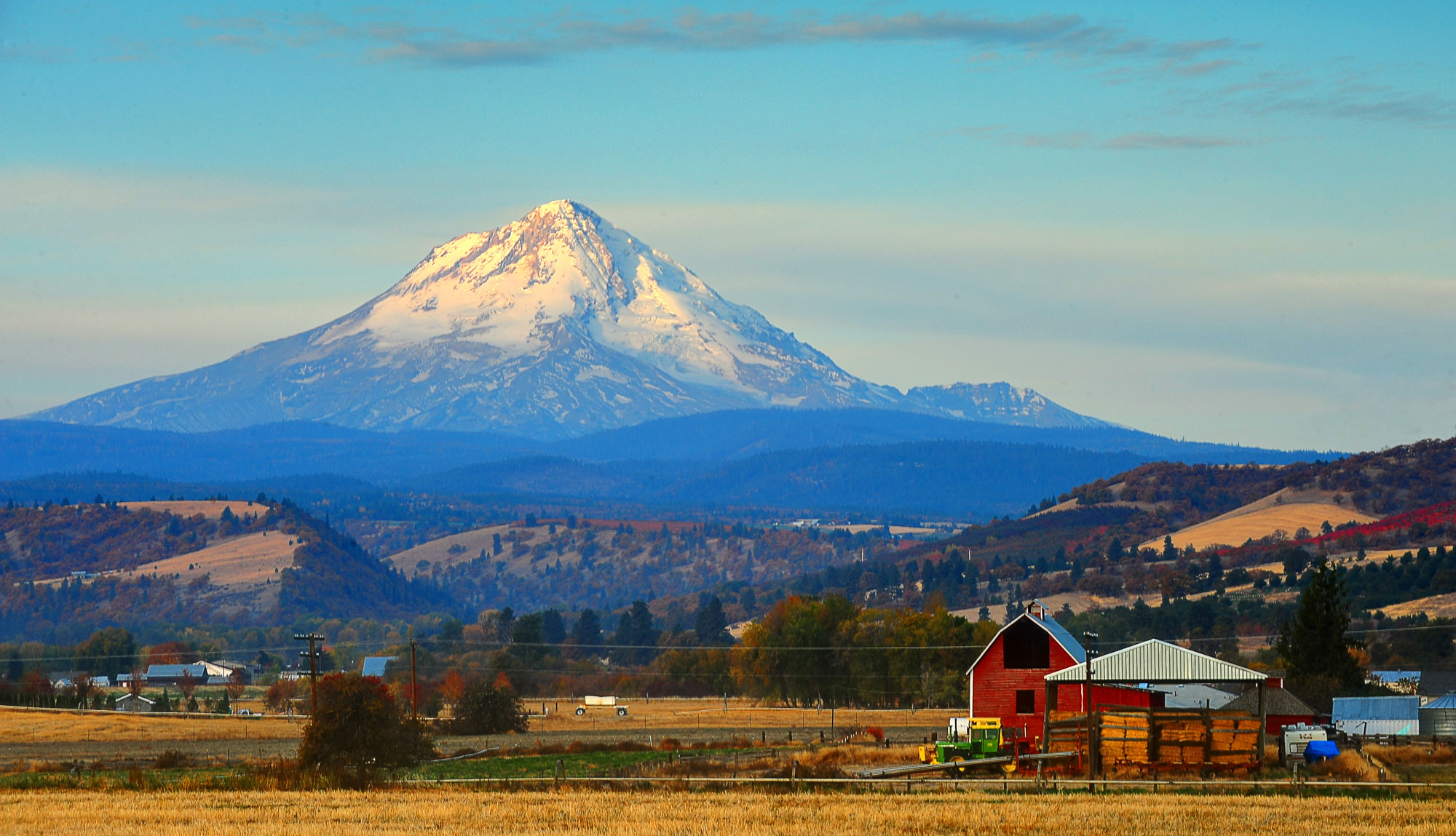
Mount Hood in Oregon is a stratovolcano in the Cascades. Source: U.S. Forest Service-Pacific Region (flickr, public domain).
Lowest Elevation: Pacific Coast
Oregon’s lowest points are found at sea level along the coast, where the shoreline meets the Pacific Ocean.
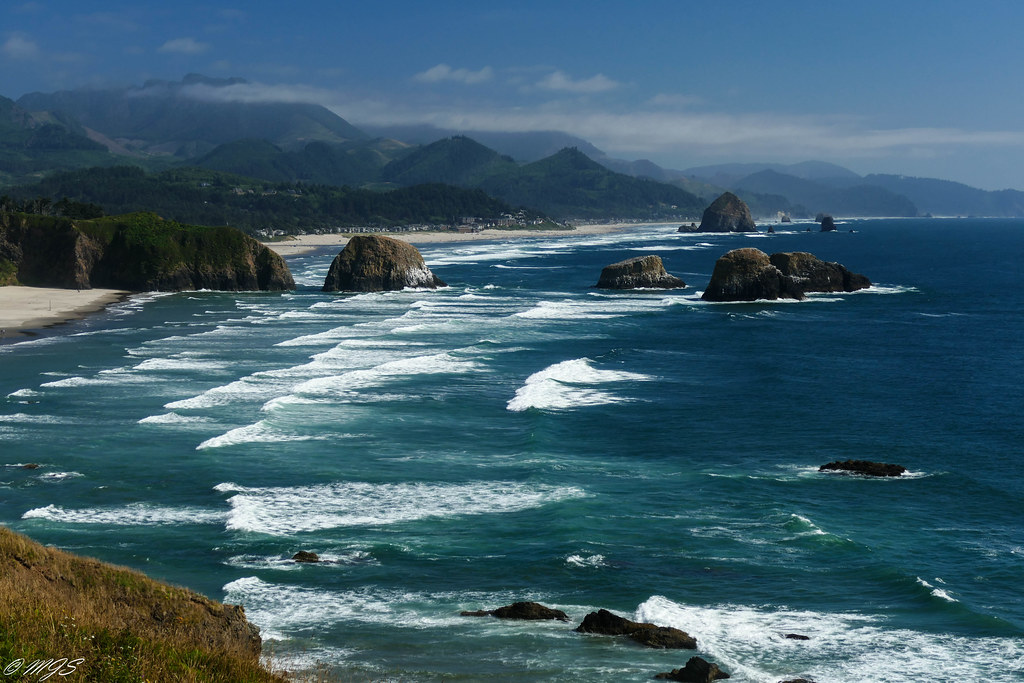
Cannon Beach on the Pacific coast of Oregon. Photograph by Mark Smith (Flickr; Creative Commons Attribution-NoDervis 2.0 Generic license).
Places to Visit
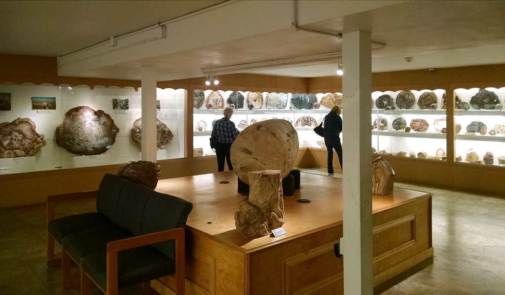
The Rice Museum of Rocks & Minerals. Photograph by Wm Gary Warren (Flickr; Creative Commons Attribution-NonCommercial 2.0 Generic license).
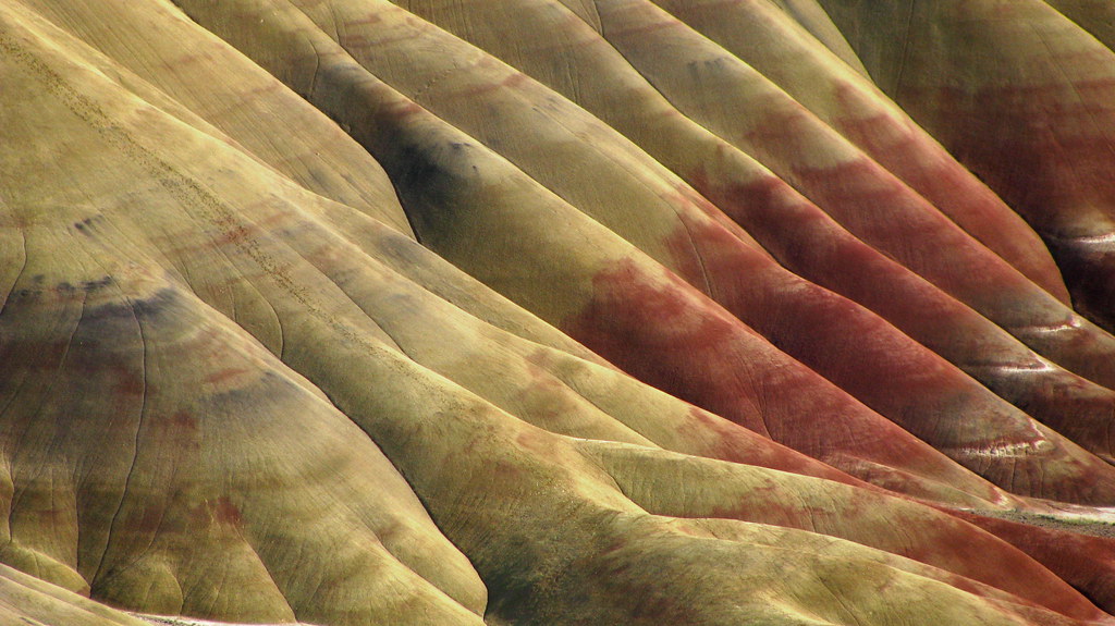
The Painted Hills at John Day Fossil Beds National Monument in Oregon. Photograph by "Dru!" (Flickr; Creative Commons Attribution-NonCommercial 2.0 Generic license).

The Columbia Gorge Discovery Center & Museum in Oregon. Photograph by A. F. Litt (Flickr; Creative Commons Attribution-NonCommercial 2.0 Generic license).