Page snapshot: Tennessee State Geologic Map; Fossil; Rock; Mineral; Gem; Highest and Lowest Elevations; Places to Visit; and Additional Resources.
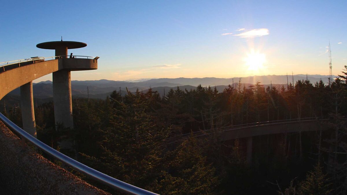
Image above:The viewing tower at Kuwohi (formerly Clingmans Dome) in Tennessee. Photograph by "devaynin" (Flickr; Creative Commons Attribution 2.0 Generic license; image cropped and resized).
Geologic Map of Tennessee
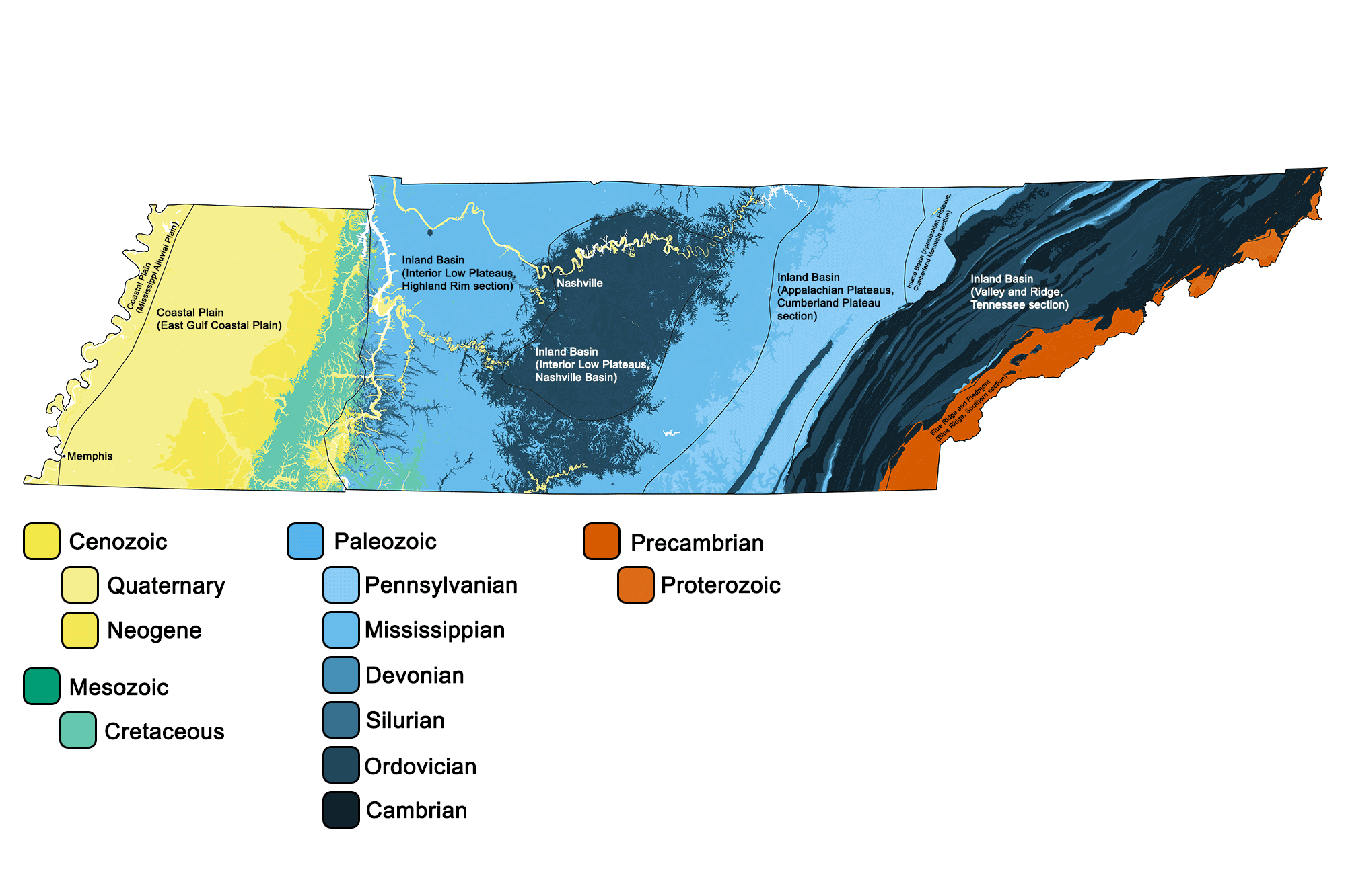
Geologic map of Tennessee showing maximum ages of mappable units. Image by Jonathan R. Hendricks for the Earth@Home project developed using QGIS and USGS data (public domain) from Fenneman and Johnson (1946) and Horton et al. (2017).
Tennessee State Fossil: Pterotrigonia (Scabrotrigonia) thoracica
Pterotrigonia (Scabrotrigonia) thoracica is a species of Cretaceous bivalve. It became Tennessee's state fossil in 1998.
Interactive 3D model. Original caption: "Pterotrigonia thoracica (Bivalvia). Coon Creek Formation, TN. Courtesy of the ETSU Department of Geosciences. Pterotrigonia was a shallow-burrowing suspension feeder that inhabited the ocean floor of West Tennessee 70 million years ago." Model by Gray Fossil Site & Museum (Sketchfab; Creative Commons Attribution 4.0 International).
Tennessee State Rock: Limestone
Limestone is abundant throughout central Tennessee, and the state even has a town named Limestone, said to be the birthplace of Davy Crockett. Tennessee limestone has historically been used as a building material and was also used in the process of smelting iron ore.
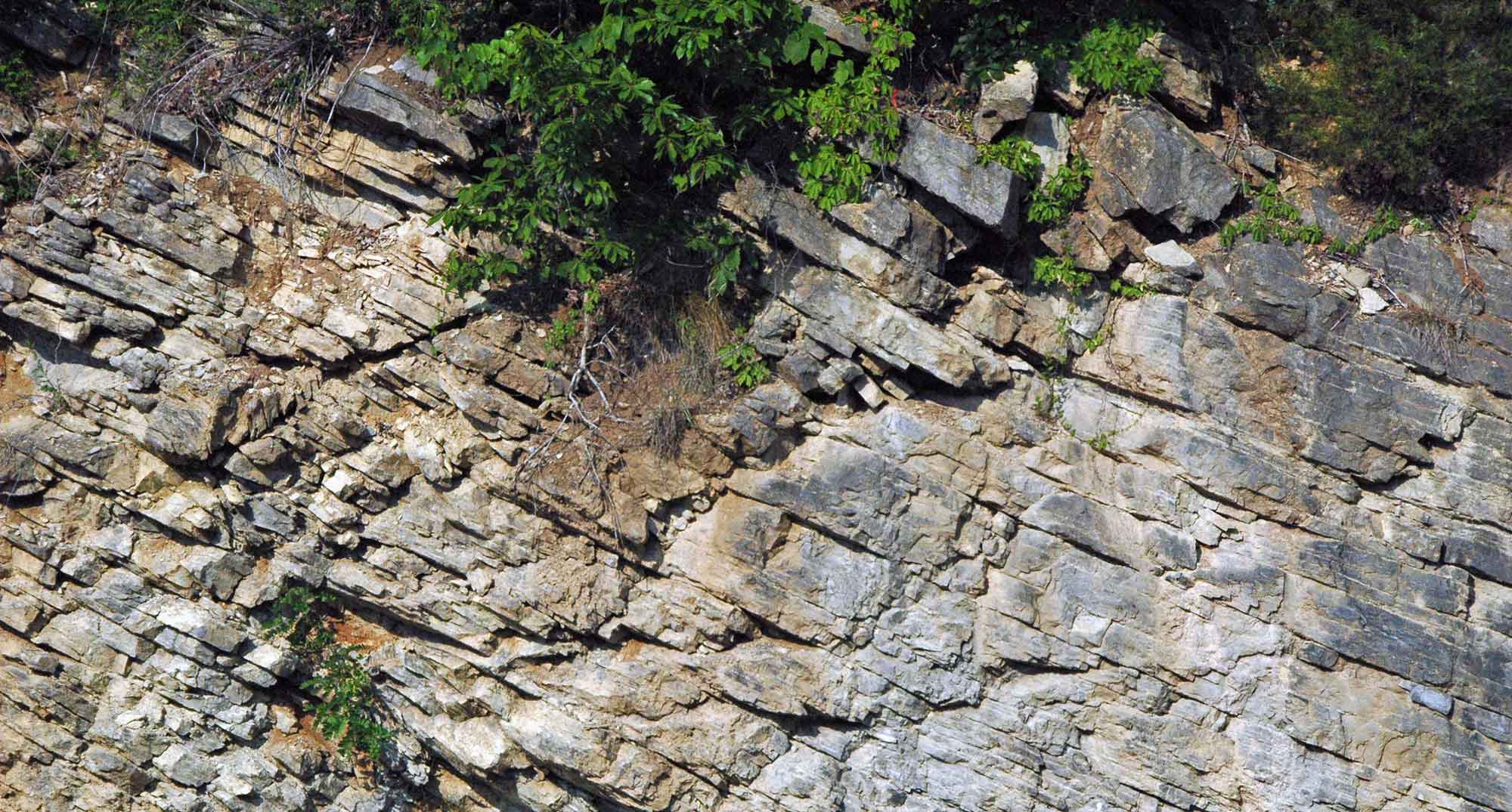
Tilted Ordovician limestone (Moccasin Formation) from northeastern Tennessee. Photograph by James St. John (Flickr; Creative Commons Attribution 2.0 Generic license; image resized).
Tennessee State Mineral: Agate
Tennessee agate is also known as "painted rock" thanks to its wide variety of colors and patterns. The silicate stone is most commonly clear or slightly milky, with swirling bands of red, yellow, and brown.
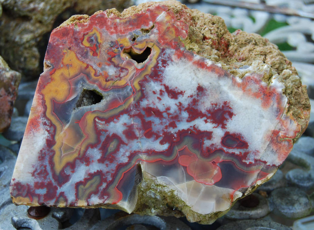
Agate specimen from Greasey Cove, Tennessee. Photograph by Dave Ault (Flickr; Creative Commons Attribution-NonCommercial-NoDerivs 2.0 Generic license).
Tennessee State Gem: Tennessee Pearl
The American Pearl Company, located in Camden and Nashville, Tennessee, is the only producer of farmed freshwater pearls in the United States, making Tennessee the leading state for pearl production since the 1960s.
"Searching for Pearls in Tennessee | Dixie Divers" by Discovery (YouTube).
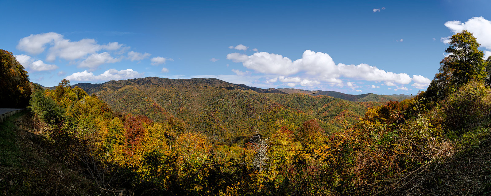
Tennessee's Highest and Lowest Elevations
Highest Elevation: Kuwohi (formerly Clingmans Dome)
Tennessee's highest point is Kuwohi, the highest mountain in the Great Smoky Mountains as well as the highest point along the 3499-kilometer (2174-mile) Appalachian Trail. At 2025 meters (6643 feet), it is the third highest mountain east of the Mississippi River, and on clear days offers a panoramic view of seven states: Tennessee, North Carolina, South Carolina, Kentucky, Virginia, Alabama, and Georgia.
Kuwohi (formerly Clingmans Dome), the highest point in Tennessee. Photograph by Tim Lumley (Flickr; Creative Commons Attribution-NonCommercial-NoDerivs 2.0 Generic license).
Lowest Elevation: Mississippi River at Tennessee's Western Border
The Mississippi River at Tennessee's western border is the state's lowest point at 54 meters (178 feet) above sea level.

Memphis, Tennessee, viewed from the Mississippi River. The western border of Tennessee along the Mississippi River has the lowest elevation in the state. Photograph by Domenico Convertini (Flickr; Creative Commons Attribution-ShareAlike 2.0 Generic license).
Places to Visit

The red panda Pristinailurus bristoli. Specimen found at Gray Fossil Site, Tennessee, on display in the museum at the site (photograph by Elizabeth J. Hermsen).

McClung Museum of Natural History & Culture. Photograph by "Rough Tough, Real Stuff" (Flickr; Creative Commons Attribution-NonCommercial-NoDerivs 2.0 Generic license).
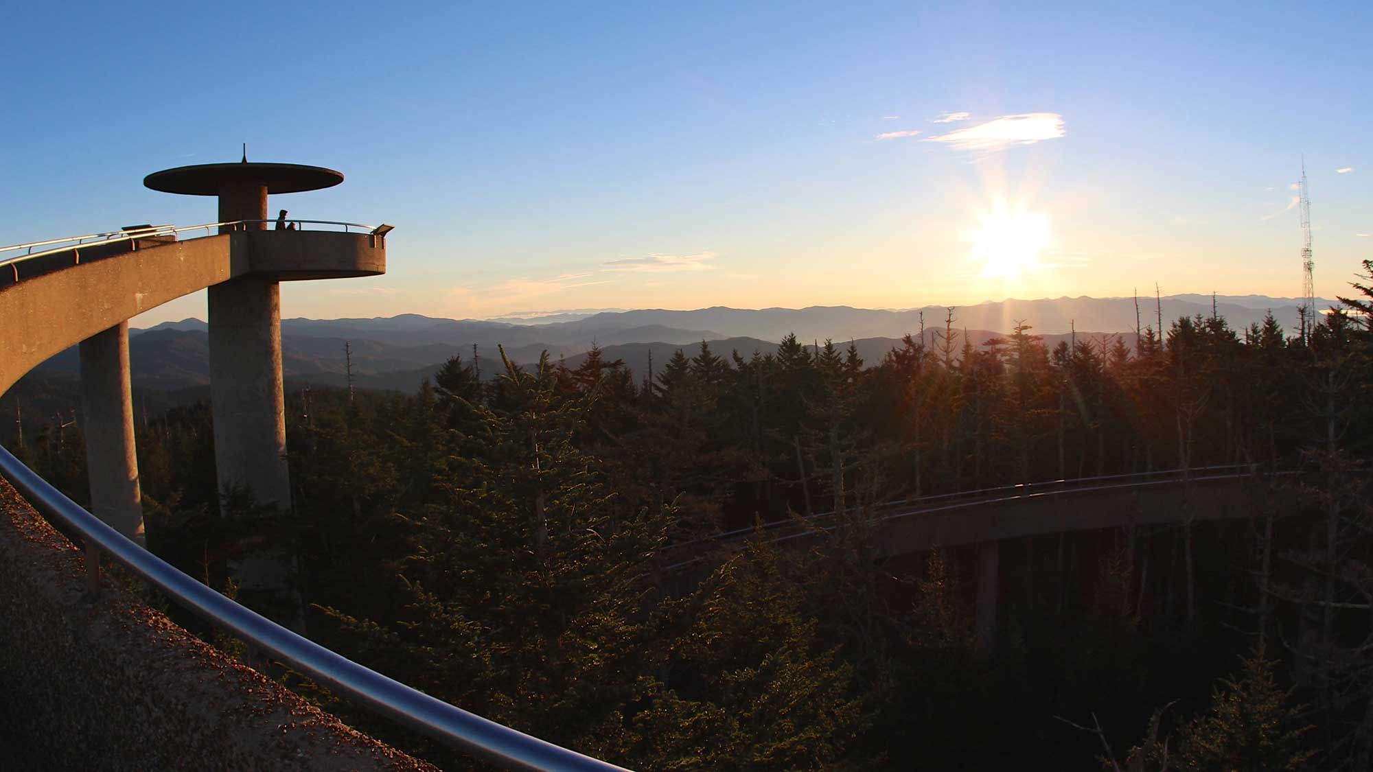
The viewing tower at Kuwohi in Tennessee. Photograph by "devaynin" (Flickr; Creative Commons Attribution 2.0 Generic license; image cropped and resized).
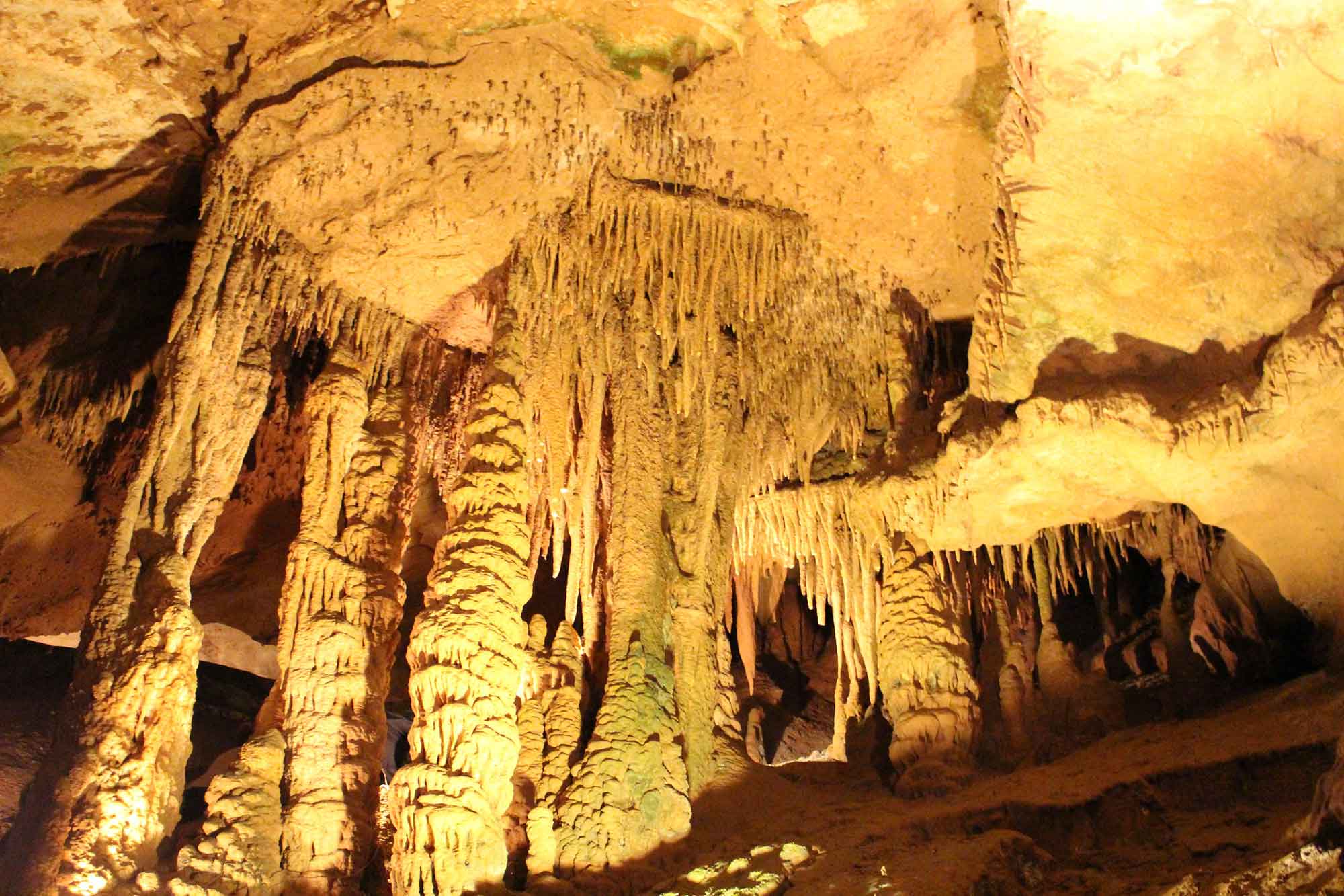
Stalactites and columns inside of Tuckaleechee Caverns, Tennessee. Photograph by Todd Fowler (Flickr; Creative Commons Attribution-ShareAlike 2.0 Generic license; image resized).
Additional resources