Page snapshot: Virginia State Geologic Map; Fossil; Rock; Mineral; Gem; Highest and Lowest Elevations; Places to Visit; and Additional Resources.
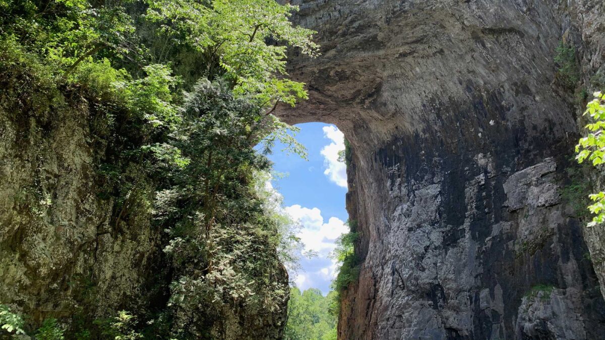
Image above: Natural Bridge, Virginia. The arch of the bridge is made up of Ordovician-aged dolomite. Photo by Elizabeth J. Hermsen.
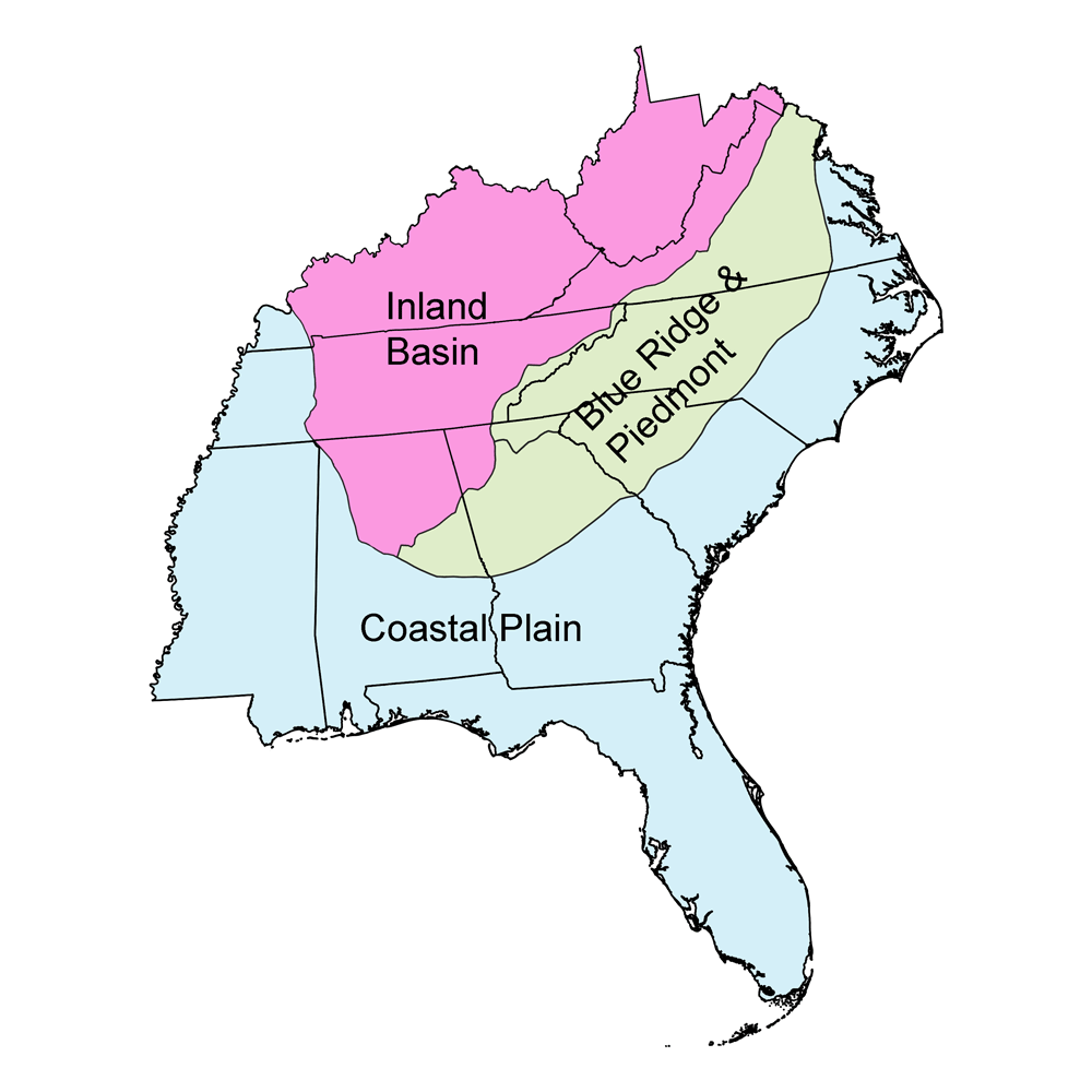
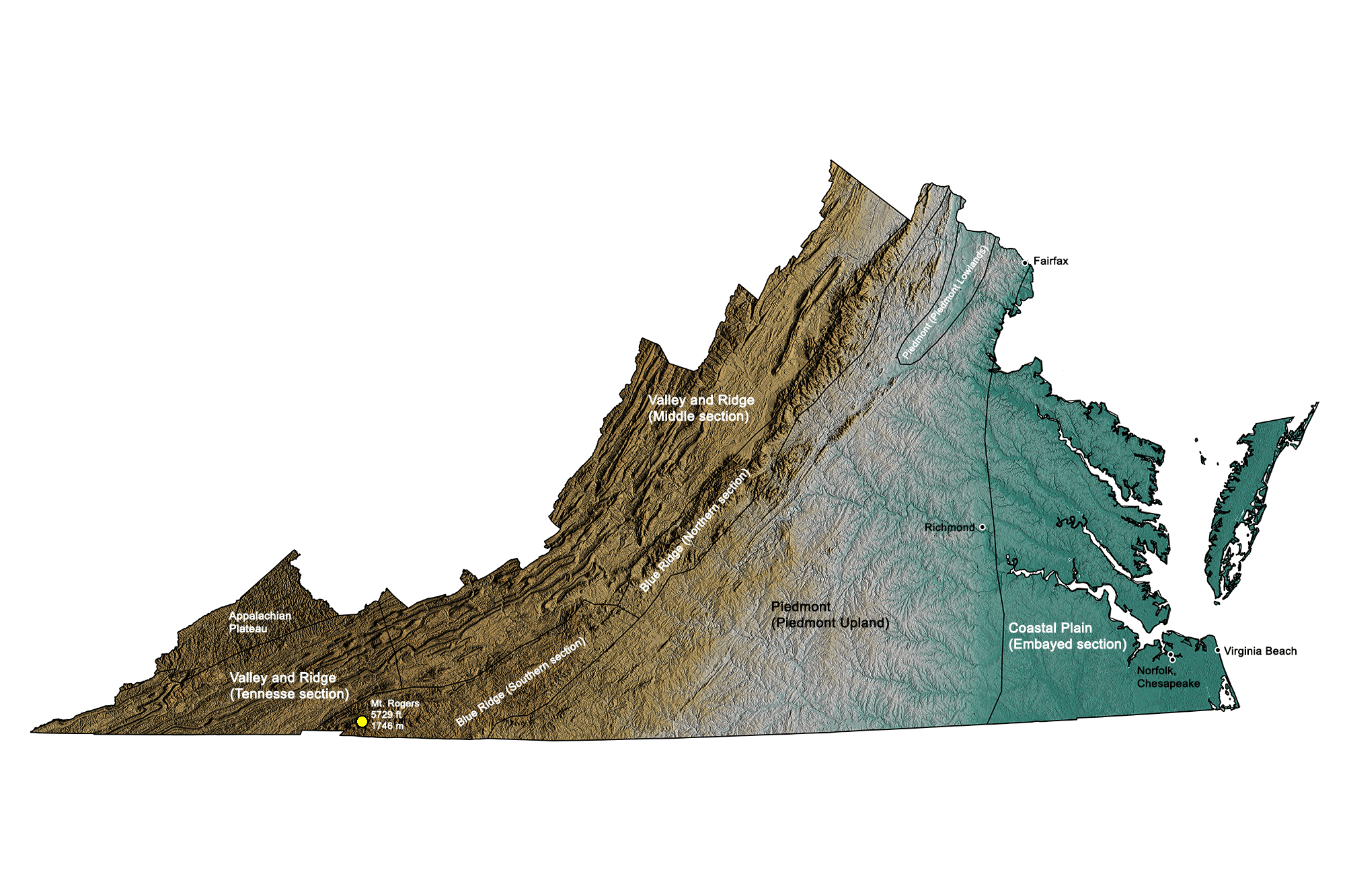
Geologic Map of Virginia
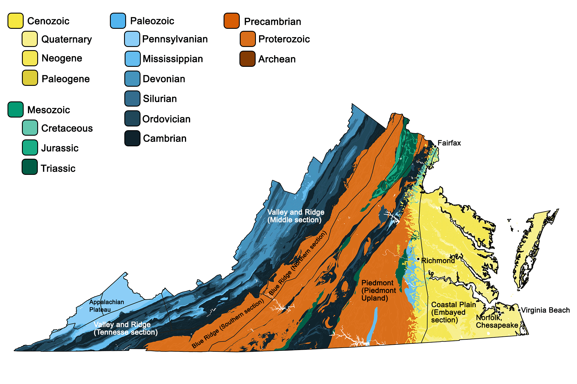
Geologic map of Virginia showing maximum ages of mappable units. Image by Jonathan R. Hendricks for the Earth@Home project developed using QGIS and USGS data (public domain) from Fenneman and Johnson (1946) and Horton et al. (2017).
Virginia State Fossil: Chesapecten jeffersonius
The state fossil of Virginia is Chesapecten jeffersonius, an extinct species of fossil scallop. Scallops are bivalve mollusk (learn more about bivalves here). Fossils of Chesapecten jeffersonius have been found in Virginia, North Carolina, Georgia, and Florida; learn more about this species here).
Interactive 3D model of Chesapecten jeffersonius. Model by Callan Bentley (Sketchfab; Attribution-NonCommercial 40 International license).
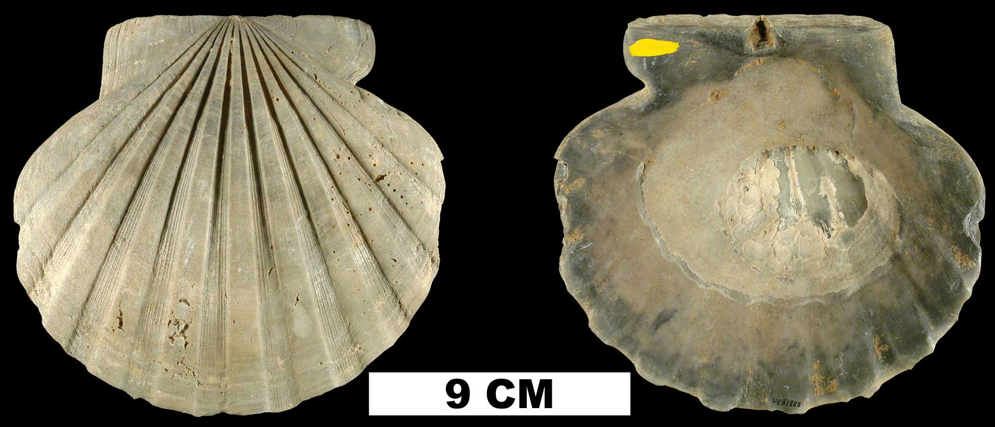
Chesapecten jeffersonius from the Plio-Pleistocene (formation unknown) of Sarasota County, Florida (UF 31888). Image from the Neogene Atlas of Ancient Life (Creative Commons Attribution-NonCommercial-ShareAlike 4.0 International license).
This species was named for Thomas Jefferson by Say in 1824. It has a special place in the history of paleontology because it was the first American fossil to be scientifically illustrated: an engraving of it (see below) was published in 1687 in Volume 3 of Historiae Conchyliorum by Martin Lister.
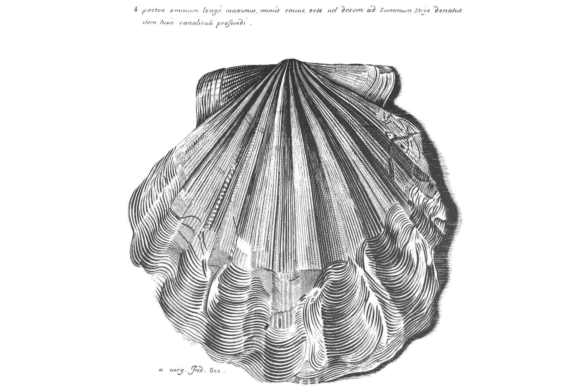
Martin Lister's 1687 illustration of Chesapecten jeffersonius. Image from reproduction in Ward and Blackwelder (1975) (USGS Professional Paper 861; public domain).
Virginia State Rock: Nelsonite
Nelsonite is a type of igneous rock that is rich in the minerals ilmenite and apatite. Titanium (used in paints and metal manufacturing) and calcium phosphate (used in agriculture) can be extracted from these minerals, making nelsonite an economically important type of rock. It was once an important economic resource in Virginia over a century ago, but is no longer mined. Because of its historical importance in Virginia, Nelsonite became recognized as the official state rock on July 1, 2016, following a campaign that began in a Piedmont Virginia Community College geology class. It is named for its type locality in Nelson, Virginia. Learn more here.
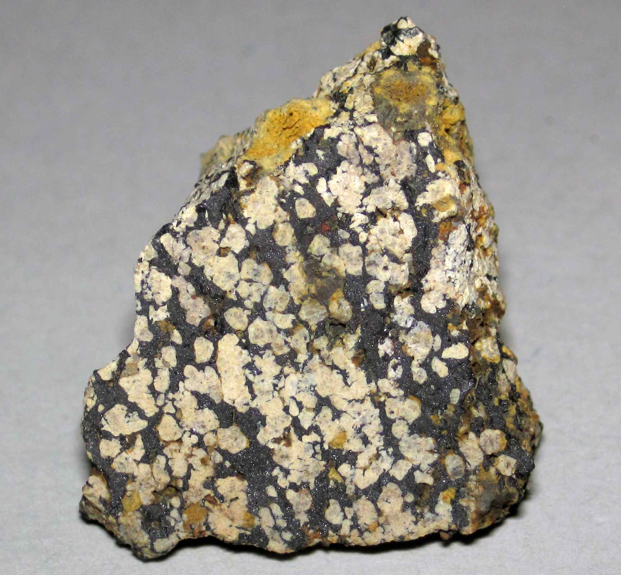
Nelsonite, the state rock of Virginia. This Precambrian-aged sample is from Nelson County, Virginia, which is the type locality. Photograph by James St. John (Flickr; Creative Commons Attribution 2.0 Generic license).
Virginia State Mineral: None
Virginia does not have a state mineral. What do you think it should be? Answer in the comments.
Virginia State Gem: None
Virginia does not have a state gem. What do you think it should be? Answer in the comments.
Virginia's Highest and Lowest Elevations
Topographic map of Virginia; greens indicate lower elevation, browns higher elevation. Topographic data derived from the Shuttle Radar Topography Mission (SRTM GL3) Global 90m (SRTM_GL3) (Farr, T. G., and M. Kobrick, 2000, Shuttle Radar Topography Mission produces a wealth of data. Eos Trans. AGU, 81:583-583.). Image created by Jonathan R. Hendricks for the Earth@Home project.
Highest Elevation: Mt. Rogers
Mt. Rogers, located in Jefferson National Forest on Virginia's border with North Carolina, is the state's highest point, with an elevation of 1746 meters (5729 feet). The mountain is named for William Barton Rogers, Virginia's first State Geologist who also went on to found the Massachusetts Institute of Technology.
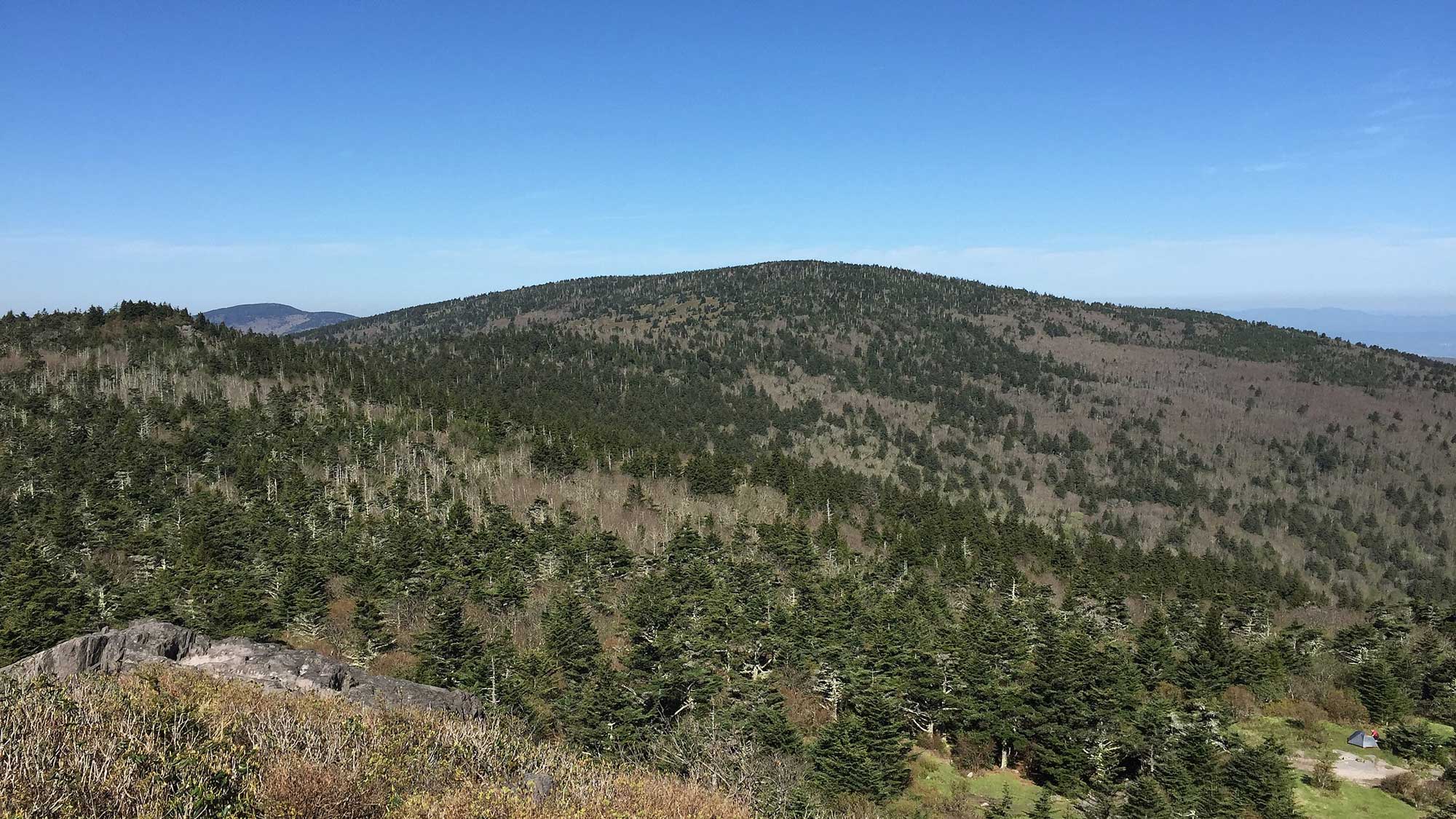
Mount Rogers, the highest point in Virginia (5729 ft), as viewed from the summit of Pine Mountain, Grayson County, Virginia. Photograph by "Famartin" (Wikimedia Commons; Creative Commons Attribution-ShareAlike 4.0 International license; image cropped and resized from original).
Lowest Elevation: Atlantic Shore
Virginia's lowest points are along the coast where the Atlantic Ocean touches the shore, for example at Virginia Beach.
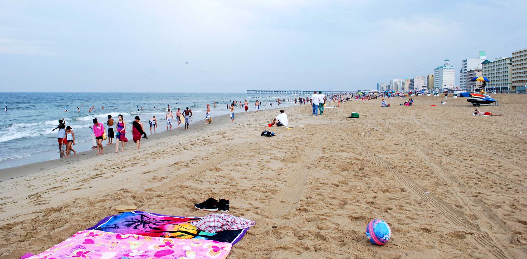
Virginia Beach, Virginia. Photograph by Lindsay Bernsen (Flickr; Creative Commons Attribution-NonCommercial-ShareAlike 2.0 Generic license; image cropped and resized).
Places to Visit
Photograph by James St. John (Wikimedia Commons; Creative Commons Attribution 2.0 Generic license).

Natural Bridge, Virginia. The arch of the bridge is made up of Ordovician-aged dolomite. Photo by Elizabeth J. Hermsen.
Virginia Beach, Virginia. Photograph by Lindsay Bernsen (Flickr; Creative Commons Attribution-NonCommercial-ShareAlike 2.0 Generic license; image cropped and resized).
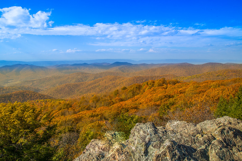
Bearfence Mountain, Shenandoah National Park. Photograph by Andrew Parlette (Flickr; Creative Commons Attribution 2.0 Generic license).
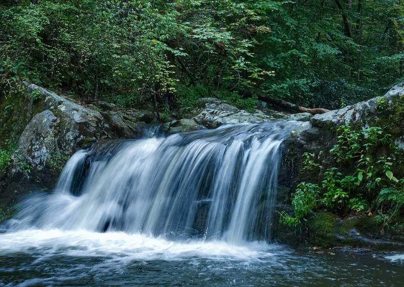
Waterfall in Jefferson National Forest near Cave Mountain Lake, Virginia. Photograph by "bobglennan" (Flickr; Creative Commons Attribution-NonCommercial-NoDerivs 2.0 Generic license).
Additional resources