

Snapshot: Overview of the topography of the Cascade-Sierra Mountains region of the western United States.
Topics covered on this page: Overview; Resources.
Credits: Most of the text of this page is derived from "Topography of the Western US" by Judith T. Parrish, Alexandra Moore, Louis A. Derry, and Gary Lewis, chapter 4 in The Teacher-Friendly Guide to the Earth Science of the Western US, edited by Mark D. Lucas, Robert M. Ross, and Andrielle N. Swaby (published in 2014 by the Paleontological Research Institution). The book was adapted for the web by Elizabeth J. Hermsen and Jonathan R. Hendricks in 2021–2022. Changes include formatting and revisions to the text and images. Credits for individual images are given in figure captions.
Updates: Page last updated August 23, 2022.
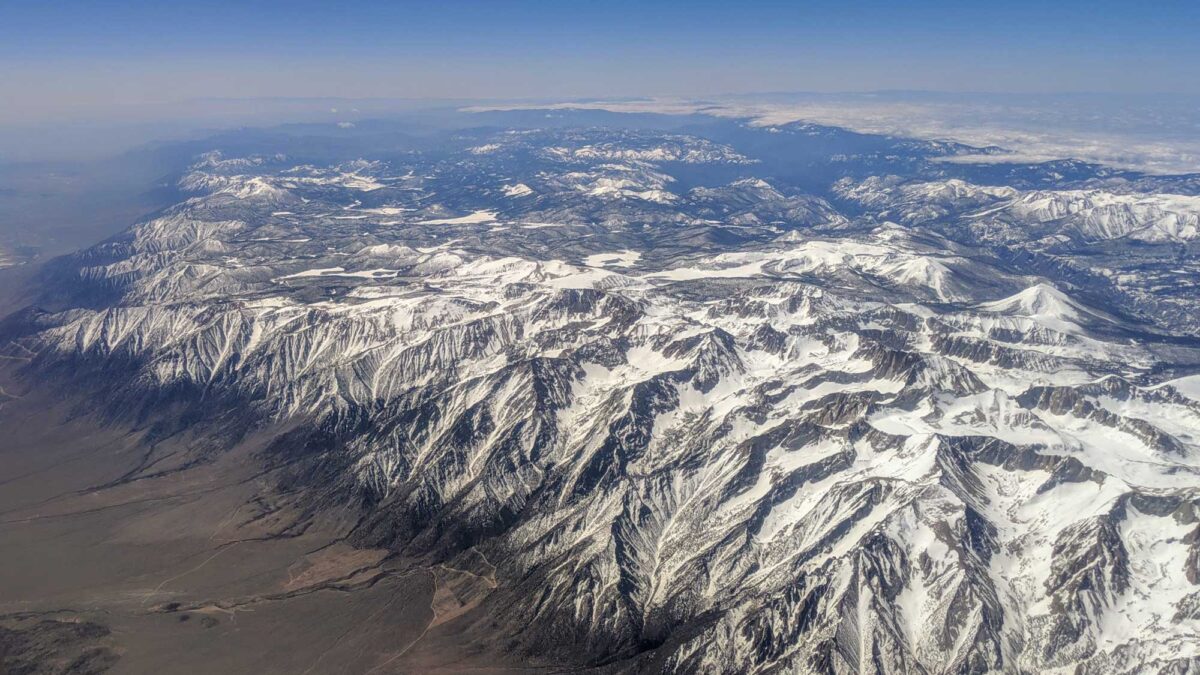
Image above: Aerial view of the Sierra Nevada Mountains, including Mount Whitney. Photograph by "Dicklyon" (Wikimedia Commons; Creative Commons Attribution-Share Alike 4.0 International license).
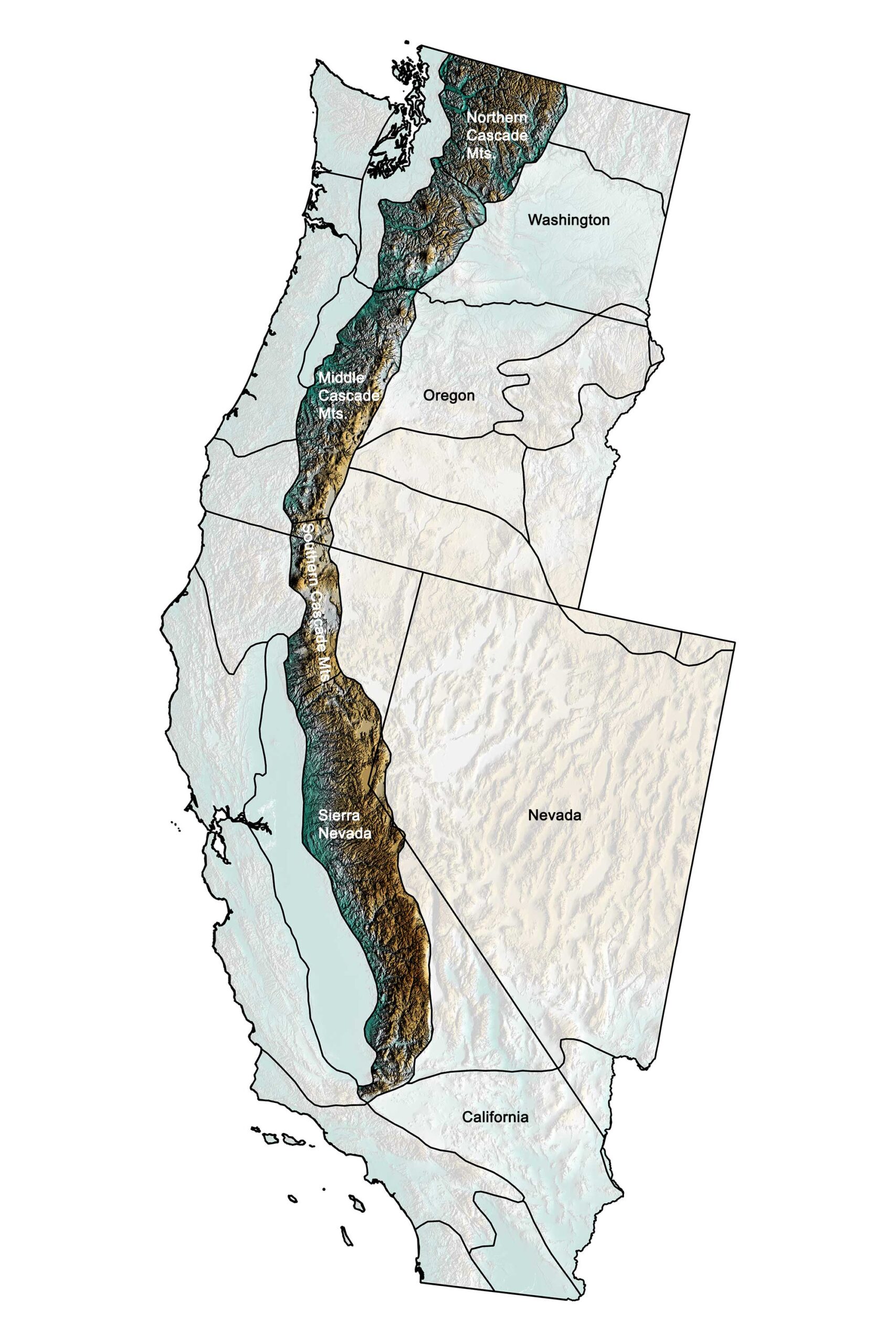
Topographic map of the Cascade-Sierra Mountains region of the western United States; greens indicate lower elevation, browns higher elevation, and black lines indicate boundaries of other physiographic provinces. Topographic data derived from the Shuttle Radar Topography Mission (SRTM GL3) Global 90m (SRTM_GL3) (Farr, T. G., and M. Kobrick, 2000, Shuttle Radar Topography Mission produces a wealth of data. Eos Trans. AGU, 81:583-583.). Image created by Jonathan R. Hendricks for the Earth@Home project.
Overview
The highest mountains in the western continental US are uniformly about 177 kilometers (110 miles) west of the Pacific coastline but are made up of two different mountain ranges, the Sierra Nevada and the Cascades, with the Klamath Mountains of northwestern California sandwiched in between. The Sierra Nevada are composed almost entirely of granodiorite and highly metamorphosed sedimentary and volcanic rocks. This granodiorite makes up the Sierra Nevada batholith, which is one of the largest in the US; it is composed of a series of plutons, large bodies of molten rock that intruded the crust and cooled, only to be revealed by erosion millions of years later.
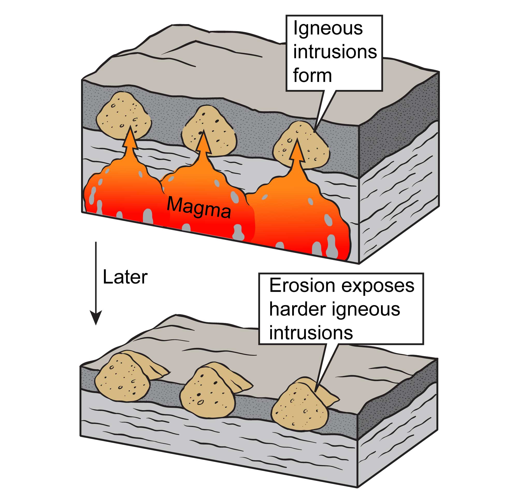
Igneous intrusions form when cooling magma is trapped beneath the surface. These rocks, which are more resistant than the surrounding material, can later be exposed at the surface through the process of erosion. Image by Jim Houghton, modified for the Earth@Home project.
Because plutons are extremely resistant to weathering and the mountains in this region are so young, the Sierra Nevada are home to some of the highest peaks in the United States. In fact, Mt. Whitney, at 4421 meters (14,505 feet), is the highest mountain in the continental US and has the most extreme relief. The town of Lone Pine, less than 21 kilometers (13 miles) away, lies at 987 meters (3237 feet), a drop of more than 163 meters per kilometer (866 feet per mile)!
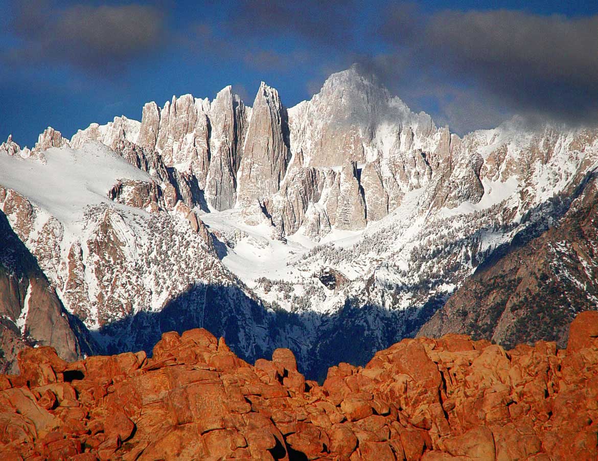
Mount Whitney, California. Photograph by "Danielle" (Flickr; Creative Commons Attribution-NonCommercial 2.0 Generic license).
The Sierra Nevada were originally thought to have been uplifted to their current height around 10 million years ago, but more recent work has provided evidence that the initial uplift occurred much earlier, as early as the Late Cretaceous, and that the Sierra Nevada may at one time have been even higher than they are today. New evidence also shows they are still rising.
The Sierra Nevada are unusual in that they are bounded on the east by an extensive fault system along which most of the uplift has occurred. This means that they are very steep on the eastern side but slope gently to the Central Valley on the western side. Because of the rain shadow effect, the climate on the mountains’ eastern side is very dry and weathering there is predominantly mechanical, while the western side is wetter and chemical weathering is more prevalent.
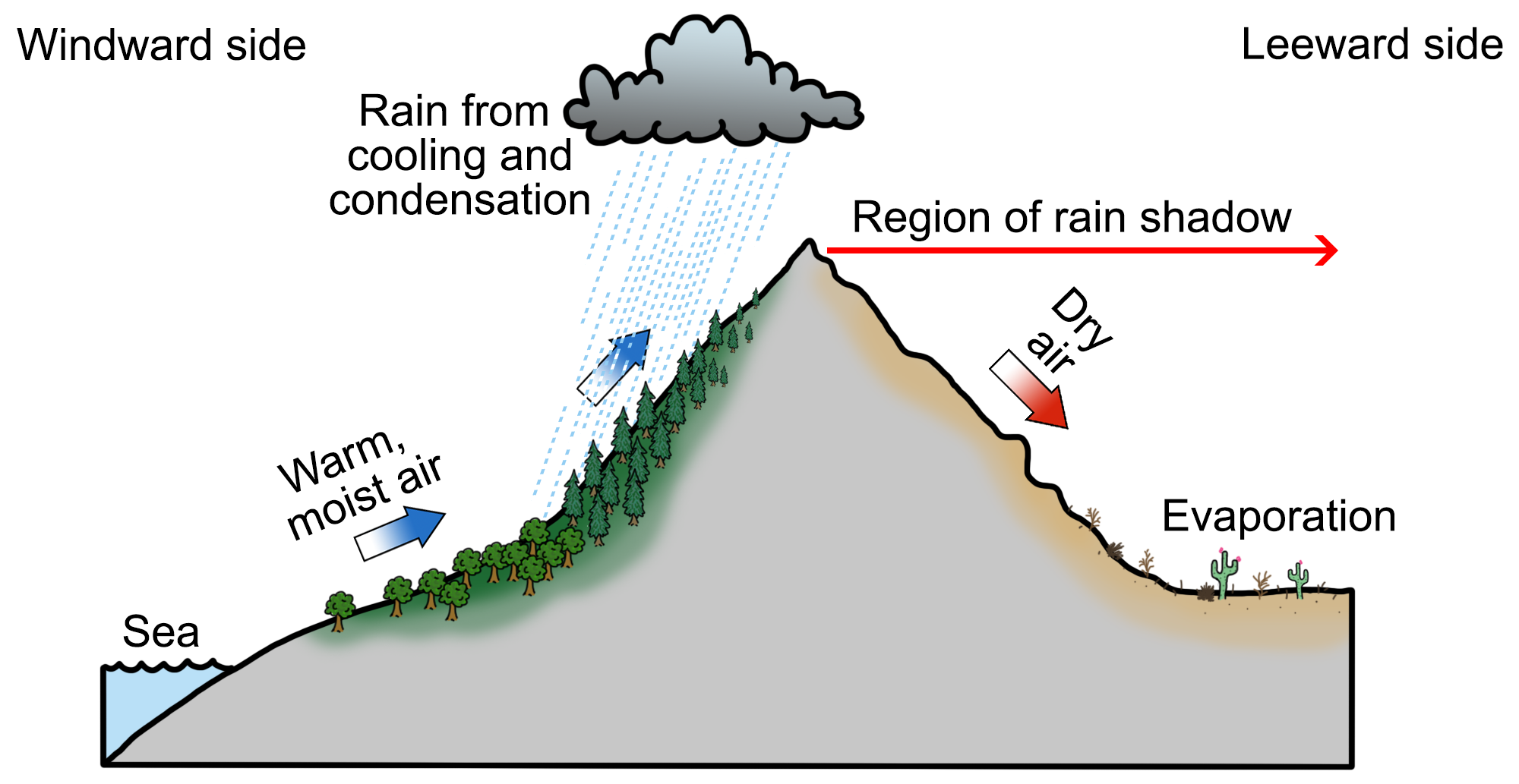
The rain shadow effect occurs when moisture-laden air rises up the windward side of a mountain, only to release this moisture as precipitation due to cooling and condensation. Once the air reaches the leeward side, it warms due to compression, promoting evaporation and a lack of precipitation. Diagram by Wade Greenberg-Brand, originally published in the Teacher Friendly Guide to Earth Science series, modified for Earth@Home.
This weathering concentrated the placer gold deposits that were the object of California’s mid-1800s gold rush. Gold is completely stable, so when the rock containing it weathered away, the gold remained behind, concentrated in the bottoms of streams.
The Cascade Mountains have largely been shaped by plate tectonics in the Pacific Ocean. Early in the Paleogene, the Cascades portion of Washington began as a series of basins and uplifts that formed when several smaller plates, along with their boundaries, were successively subducted under North America. Beginning around 37 million years ago, this subduction also created the first volcanoes that pierced the area. The remains of these extinct volcanoes define the landscape—the area that surrounds Mt. Rainier (and extends to the south) contains remnants of the ancient volcanoes themselves, while to the north only their plutonic cores remain.
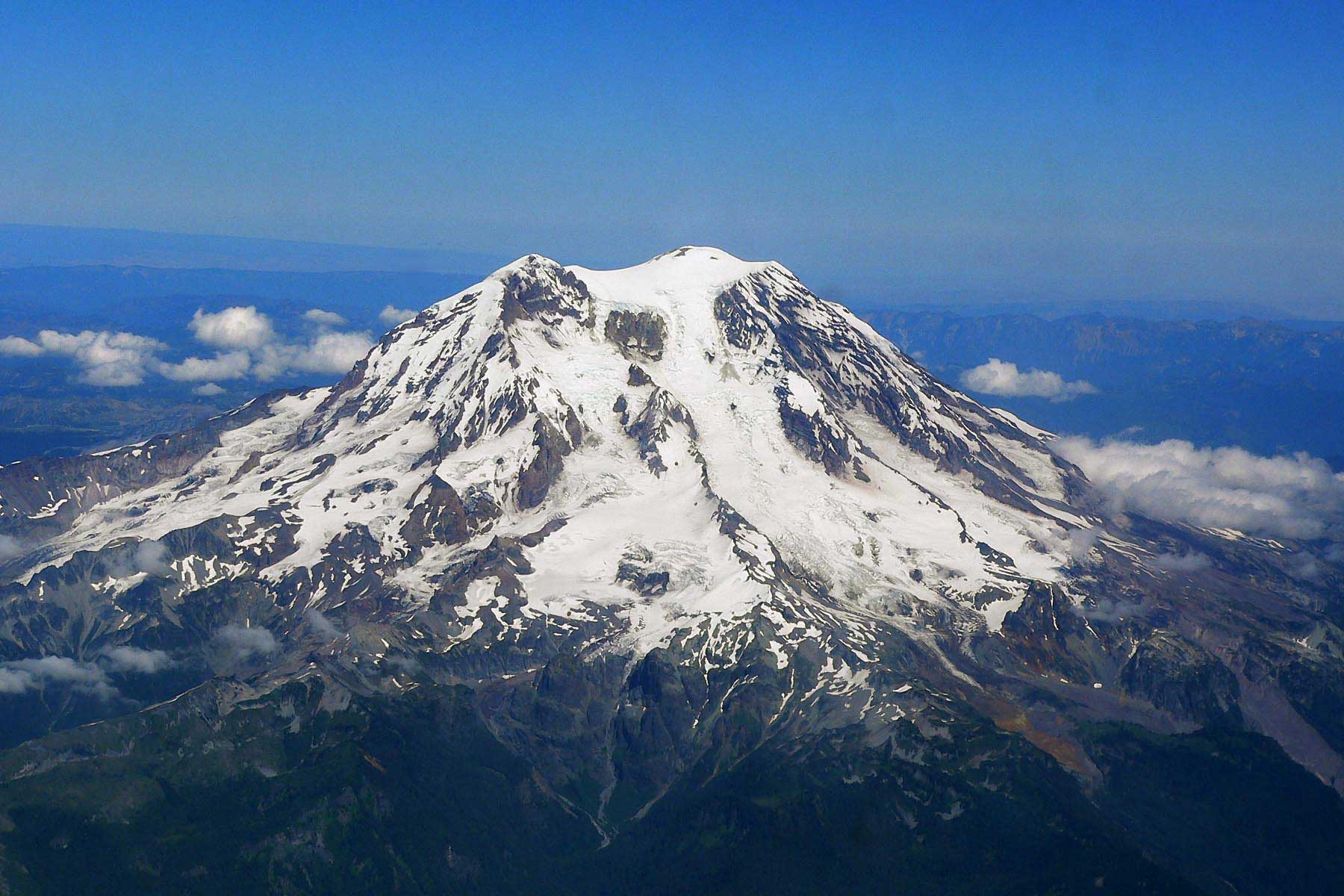
Aerial photograph of Mount Rainier. Image by Sten Shebs (Wikimedia Commons; Creative Commons Attribution-ShareAlike 3.0 Unported license).
The topography of the modern Cascades was created during the last seven million years. After a lull in volcanic activity, plate motion shifted, and new subduction created the modern volcanic arc and also uplifted the entire region. The greatest uplift took place in the north.