

Snapshot: Overview of the topography of the Inland Basin region of the Midwestern United States.
Topics covered on this page: Overview; Resources.
Credits: Most of the text of this page is derived from "Topography of the Midwestern US" by Alex F. Wall, chapter 4 in The Teacher-Friendly Guide to the Earth Science of the Midwestern US, edited by Mark D. Lucas, Robert M. Ross, and Andrielle N. Swaby (published in 2014 by the Paleontological Research Institution). The book was adapted for the web by Elizabeth J. Hermsen and Jonathan R. Hendricks in 2022–2023. Changes include formatting and revisions to the text and images. Credits for individual images are given in figure captions.
Updates: Page last updated July 12, 2023.
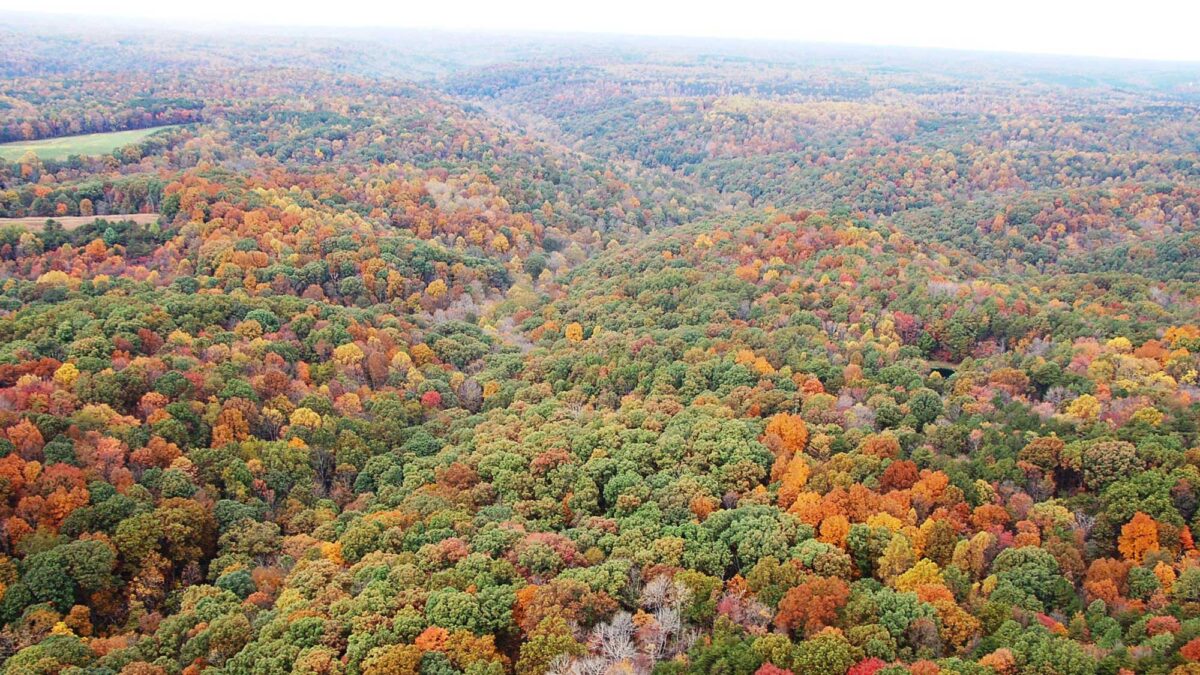
Image above: The Hocking Hills of southeastern Ohio; photograph by Britt Reints (Flickr; Creative Commons Attribution 2.0 Generic license).
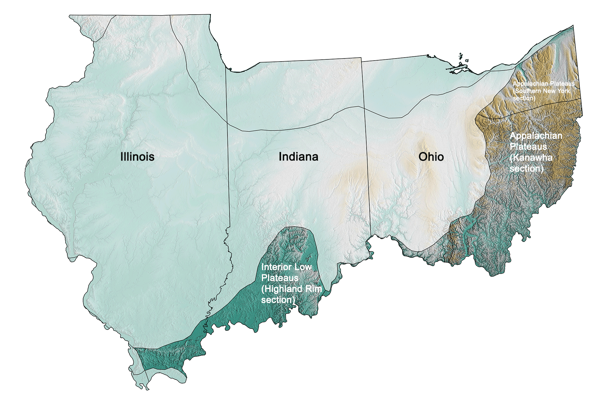
Physiographic subdivisions of the Inland Basin region of the midwestern United States; greens indicate lower elevation, browns higher elevation; black lines indicate physiographic boundaries of other provinces. Topographic data derived from the Shuttle Radar Topography Mission (SRTM GL3) Global 90m (SRTM_GL3) (Farr, T. G., and M. Kobrick, 2000, Shuttle Radar Topography Mission produces a wealth of data. Eos Trans. AGU, 81:583-583.). Image created by Jonathan R. Hendricks for the Earth@Home project.
Overview
The Inland Basin is a large region that extends from southern Illinois to northern Alabama to central New York. Its rock formed primarily in the basins of inland seas many millions of years ago, and while its origin affects the way it is eroded, its topography is quite varied. In the Midwest, the region includes only eastern Ohio, southern Indiana, and the southernmost portion of Illinois.
Most of the eastern half of Ohio is part of the Allegheny Plateau, which extends from northeastern Kentucky well into central New York. This portion of Ohio is further divided into glaciated and unglaciated areas.
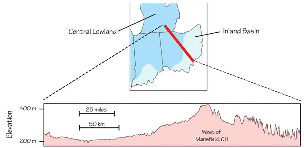
Inland Basin topography, showing the difference in elevation between glaciated and unglaciated areas. Topographic profile from Google Maps.
The glaciated northwest portion is quite flat, with relief features of little more than 30 meters (100 feet) high. The southeast portion of the state (for example, the Hocking Hills region; see image at top of page) was never flattened by glaciers or buried in till, so relief here is several times greater, occasionally reaching up to 120 meters (400 feet). Millions of years of running water carving into the bedrock has resulted in high hills, steep cliffs, and gorges.
The portions of southern Indiana and Illinois that were not glaciated have a landscape like that of southeastern Ohio: a modest degree of relief, but substantially more rugged than the northern (previously glaciated) portions of those states.
An important distinction is that—because much of the bedrock in the Inland Basin is carbonate—this area commonly displays karst features. Caves are not uncommon in Ohio, but many of them are in the Central Lowland portion of the state. The bedrock of southern Indiana and Illinois is, in areas, riddled with limestone caves.