

Snapshot: Overview of the topography of the Central Lowland region of the Northwest Central United States, including North Dakota, South Dakota, and Nebraska.
Topics covered on this page: Overview; Resources.
Credits: Most of the text of this page is derived from "Topography of the Northwest Central US" by Libby Prueher and Andrielle Swaby, chapter 4 in The Teacher-Friendly Guide to the Earth Science of the Northwest Central US, edited by Mark D. Lucas, Robert M. Ross, and Andrielle N. Swaby (published in 2015 by the Paleontological Research Institution). The book was adapted for the web by Elizabeth J. Hermsen and Jonathan R. Hendricks in 2021–2022. Changes include formatting and revisions to the text and images. Credits for individual images are given in figure captions.
Updates: Page last updated September 27, 2022.
Image above: Turtle Mountain State Recreational Forest, North Dakota. Photograph by Ken Lund (Flickr; Creative Commons Attribution-ShareAlike 2.0 Generic license).
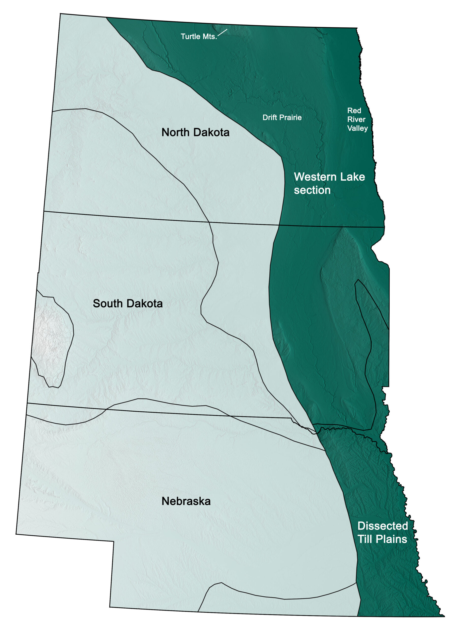
Physiographic subdivisions of the Central Lowland region of the northwest central United States; greens indicate lower elevation, browns higher elevation; black lines indicate physiographic boundaries of other provinces. Topographic data derived from the Shuttle Radar Topography Mission (SRTM GL3) Global 90m (SRTM_GL3) (Farr, T. G., and M. Kobrick, 2000, Shuttle Radar Topography Mission produces a wealth of data. Eos Trans. AGU, 81:583-583.). Image created by Jonathan R. Hendricks for the Earth@Home project.
Overview
The Central Lowland is a flat-lying region located between the Appalachian Mountains to the east and the Great Plains to the west. It extends from the Canadian Shield in the north to the Atlantic Coastal Plain in the south and is part of the North American craton (the older, stable part of the continent).
The Central Lowland is composed of flat-lying Precambrian metamorphic and igneous rocks overlain by Paleozoic and Mesozoic sedimentary rocks. The Mesozoic sediments found in the region were eroded from the Rocky, Ozark, and Ouachita mountains, then carried to and deposited in the Western Interior Seaway that covered the area. Glacial erosion and deposition during the last ice age modified and smoothed much of the region’s surface, leaving behind thick layers of Cenozoic sediment and drift. Today, rivers running through this region, including the Missouri and Red rivers, have contributed significantly to erosion.
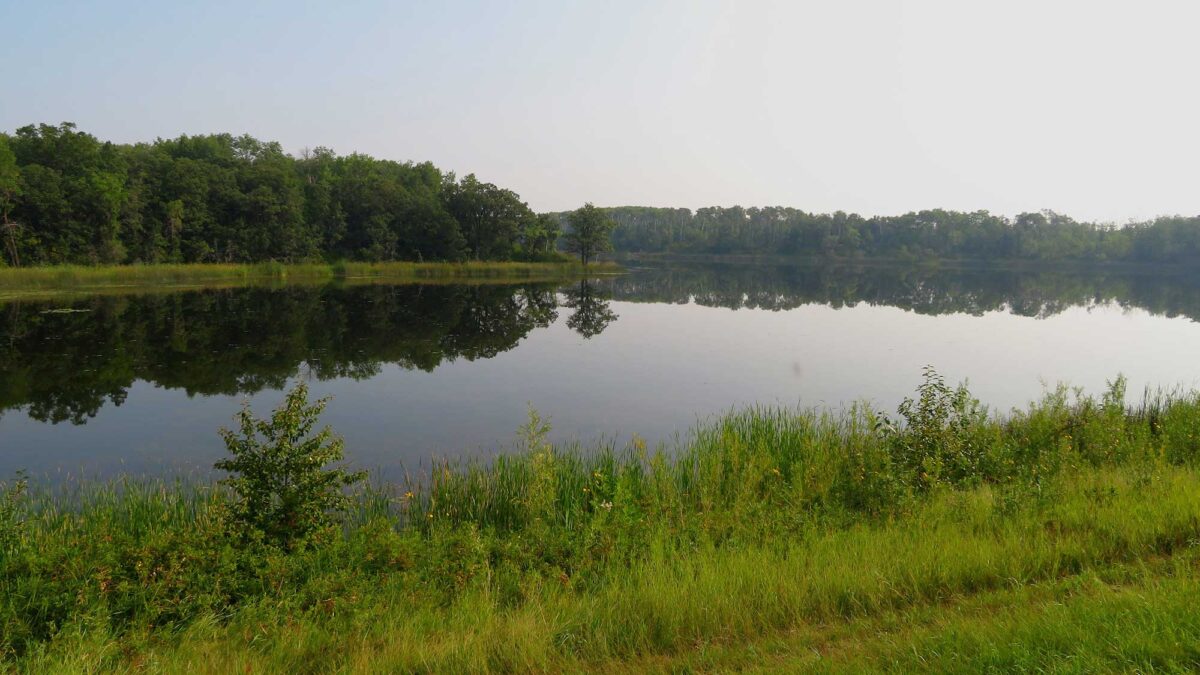
The Central Lowland has a generally smooth and flat topography, generated by glacial scouring during the ice age, as well as by the presence of enormous glacial lakes and erosion from catastrophic outbursts of meltwater. During the Quaternary, a 152-meter-thick (500-foot-thick) ice sheet flattened the landscape, leaving behind the gently rolling hills and shallow lakes that spread throughout the Drift Prairie today.
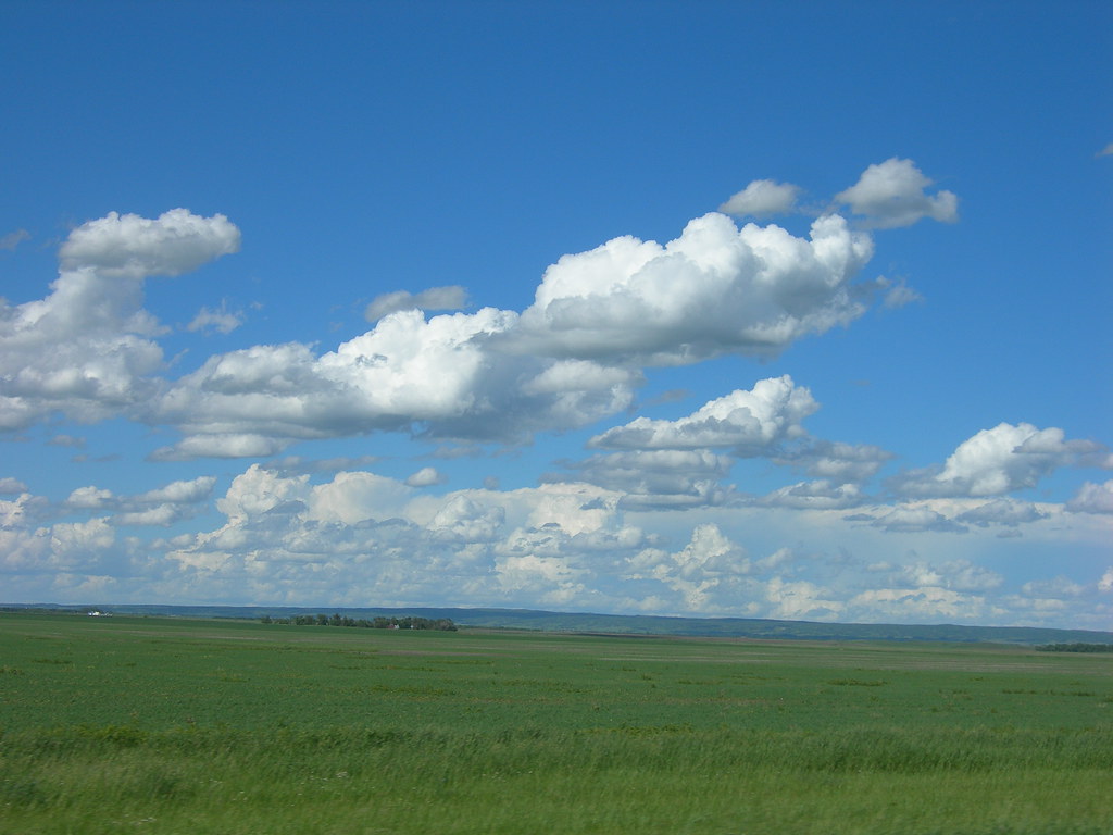
The Drift Prairie near Bottineau, North Dakota. The rolling landscape of the Turtle Mountains is visible in the far distance. Photograph by Jimmy Emerson (Flickr; Creative Commons Attribution-NonCommercial-NoDerivs 2.0 Generic license).
The ice sheet also left behind layers of till, clay, gravel, and wind-blown silt (loess), which contributed to the area’s rich agricultural soils. The Red River Valley, directly to the east in North Dakota, is a flat lowland area that marks the former floor of glacial Lake Agassiz, which was once the largest freshwater lake in North America.
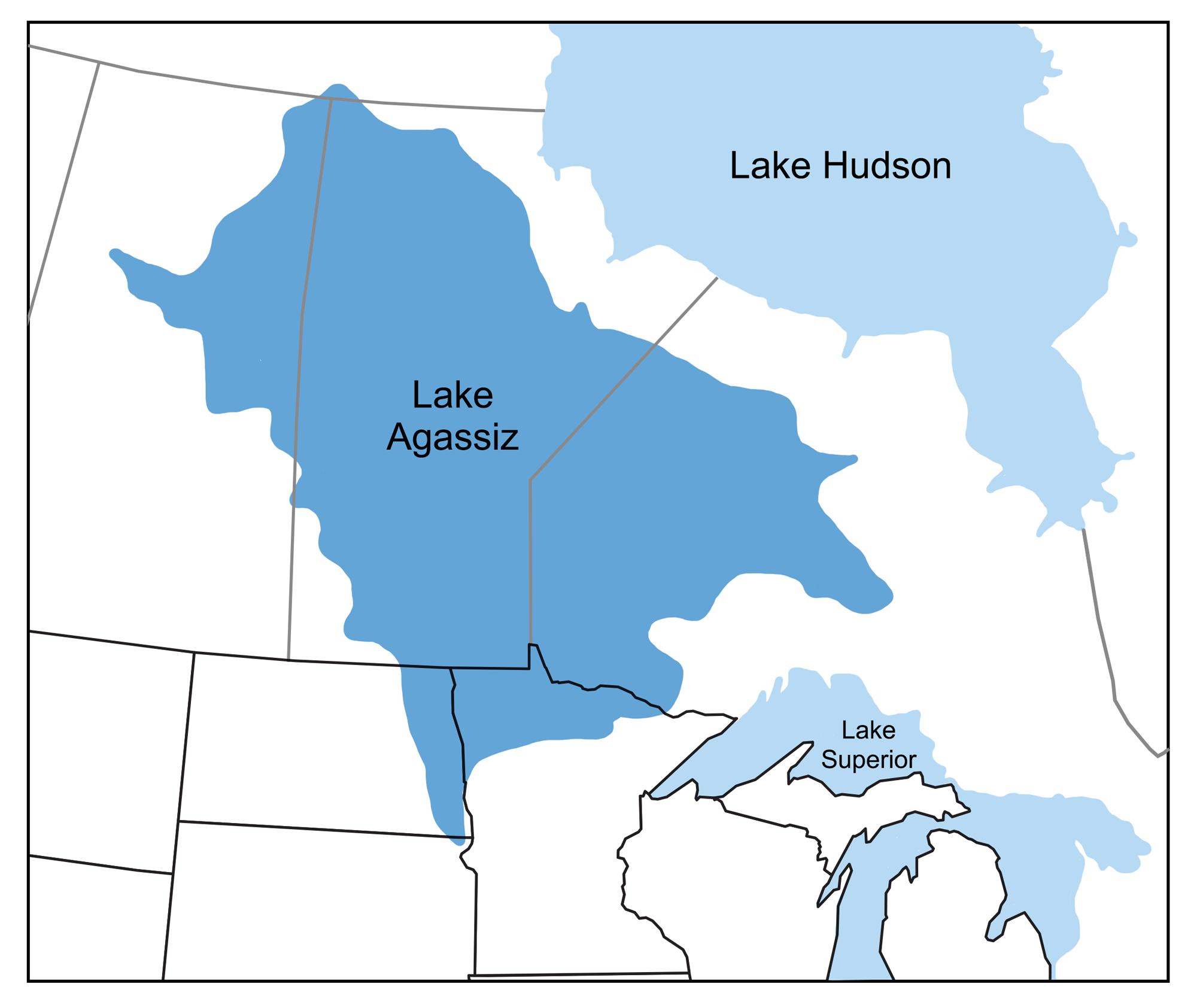
The extent of glacial Lake Agassiz during the Pleistocene. North Dakota’s Red River Valley follows the bed of this ancient lake. Image by Wade Greenberg-Brand, adapted from image by Minnesota River Basin Data Center; modified for the Earth@Home project.
About 160 kilometers (100 miles) west of the Red River Valley, the Missouri Escarpment—a ridge extending southeast from Canada to south-central South Dakota—separates the Drift Prairie from the Great Plains. Escarpments form when faulting or erosion acts to create a cliff or steep slope that separates two level or gently sloping topographical surfaces. Typically, cliffs created by faulting are called “scarps,” while “escarpments” are those formed by the differential erosion of resistant layers that alternate with softer strata.
The Missouri Escarpment was formed when catastrophic floods at the end of the ice age carved a huge canyon, channeling future ice movements and flattening the surrounding area. The Missouri Escarpment is the remnant of this canyon’s west and southwest wall.
Several landforms throughout North Dakota’s Central Lowland were formed as ice-thrust features—the weight and pressure of the advancing glacier displaced large bedrock slabs, shoving and thrusting large masses of rock and sediment, and depositing them a short distance from their original position. Geologists speculate that ice-thrust features occur so prominently in central and eastern North Dakota because the region’s water drains northward. Ice sheets advancing from the north prevented groundwater drainage, leading to increased pressure within the ground. Eventually, the weight of the glacier caused pieces of terrain to pop out of the ground, thrusting them a short distance forward and relieving the built-up pressure.
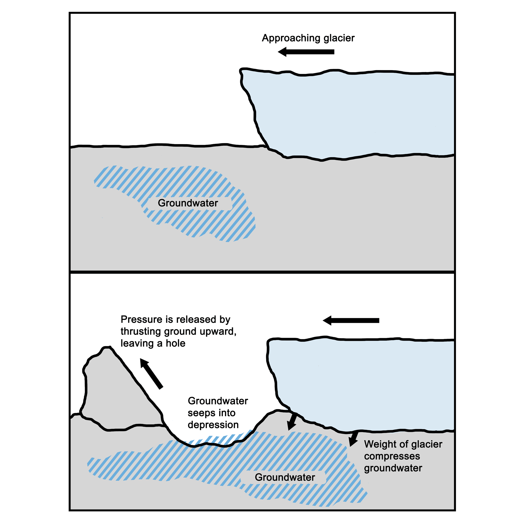
Ice-thrust features are created when pressure from the weight of an advancing glacier is released by thrusting a piece of terrain forward. Image by Wade Greenberg-Brand and Andrielle Swaby; modified for the Earth@Home project.
Ice-thrust features are often accompanied by topographic depressions (usually lakes) located to the north, from which the material was displaced. Examples include Steele Lake near Anamoose, Medicine Lake and its adjacent Grasshopper Hills, and even Devils Lake, the largest natural lake in North Dakota. The Turtle Mountains of northernmost North Dakota, a plateau lying 600 meters (2000 feet) above sea level and 90–120 meters (300–400 feet) above the surrounding land, are another example of ice-thrust terrain that was later smoothed and rounded by further glacial erosion.
The Dissected Till Plains, extending from southeast South Dakota through Nebraska, are an area of rolling hills ripe with fertile soil. The area was initially scoured and flattened during the pre-Illinoian glacial stage; during the Wisconsinian, great quantities of loess accumulated there. Glacial runoff later led to erosion that sculpted the area into valleys and hills. Today, the Missouri River cuts across the plains at the border between Nebraska and South Dakota and runs south along Nebraska’s eastern border, forming wide floodplains that support a complex environment of sandbars and wetlands.
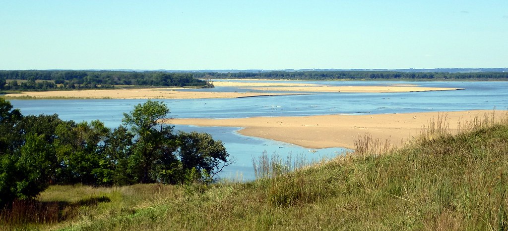
Sandbars in the Missouri River, viewed from Mulberry Bend Scenic Outlook near Dixon, Nebraska. Photograph by Ali Eminov (Flickr; Creative Commons Attribution-NonCommercial 2.0 Generic license).