

Snapshot: Overview of the topography of the Great Plains region of the northwest central United States, including North Dakota, South Dakota, Montana, and Wyoming.
Topics covered on this page: Overview; The Missouri Plateau; The Black Hills; The High Plains; Resources.
Credits: Most of the text of this page is derived from "Topography of the Northwest Central US" by Libby Prueher and Andrielle Swaby, chapter 4 in The Teacher-Friendly Guide to the Earth Science of the Northwest Central US, edited by Mark D. Lucas, Robert M. Ross, and Andrielle N. Swaby (published in 2015 by the Paleontological Research Institution). The book was adapted for the web by Elizabeth J. Hermsen and Jonathan R. Hendricks in 2021–2022. Changes include formatting and revisions to the text and images. Credits for individual images are given in figure captions.
Updates: Page last updated October 6, 2022.
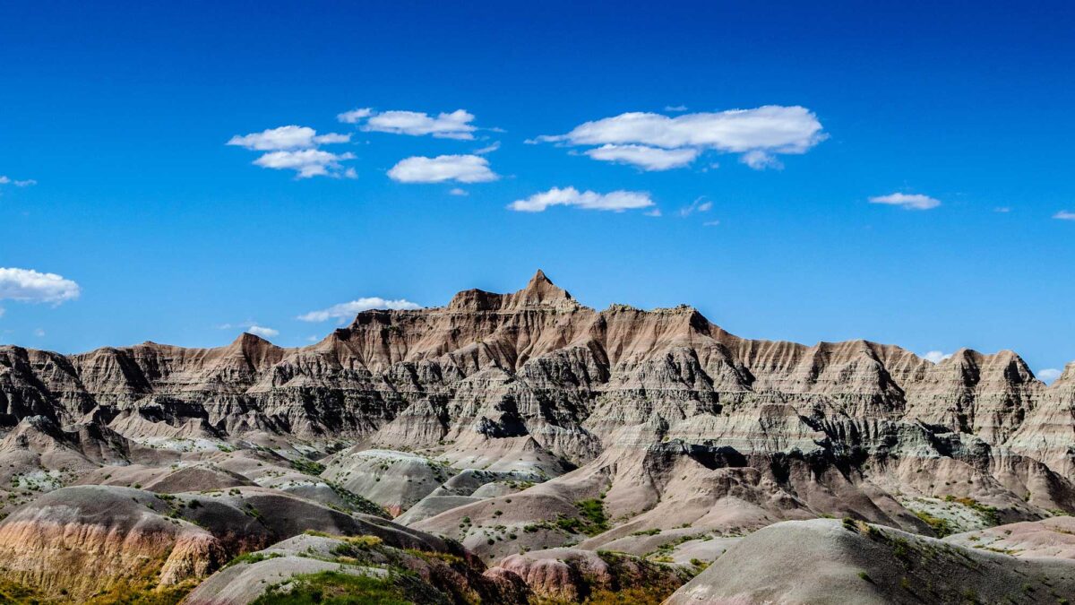
Image above: Bandlands National Park, South Dakota. Photograph by Brad Sims (Flickr; Creative Commons Attribution-NonCommercial-ShareAlike 2.0 Generic license).
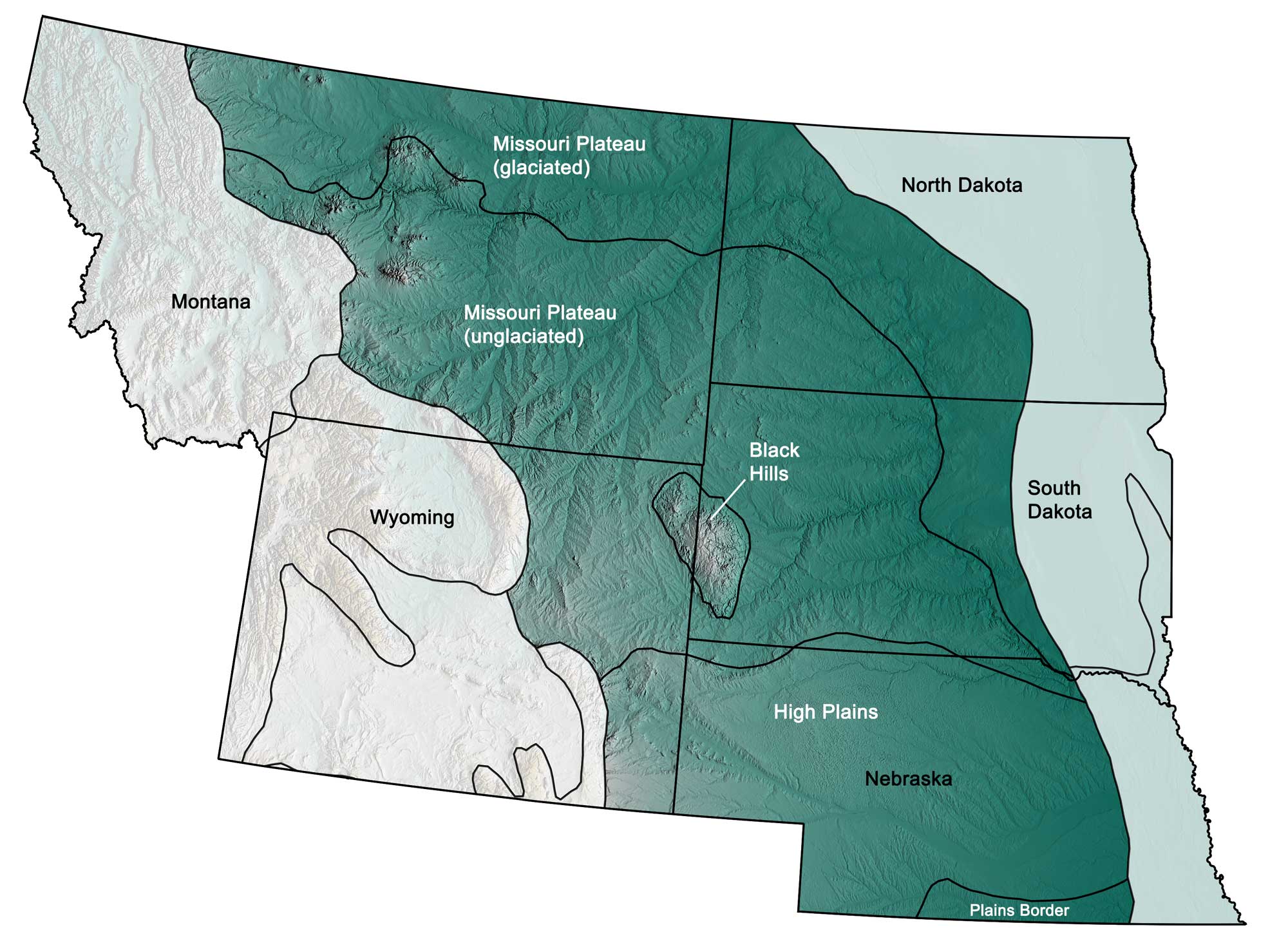
Physiographic subdivisions of the Great Plains region of the northwest central United States; greens indicate lower elevation, browns higher elevation; black lines indicate physiographic boundaries of other provinces. Topographic data derived from the Shuttle Radar Topography Mission (SRTM GL3) Global 90m (SRTM_GL3) (Farr, T. G., and M. Kobrick, 2000, Shuttle Radar Topography Mission produces a wealth of data. Eos Trans. AGU, 81:583-583.). Image created by Jonathan R. Hendricks for the Earth@Home project.
Overview
The Great Plains is a lowland area underlain by flat-lying sedimentary rocks, and located between the Central Lowland and Rocky Mountain regions. Despite its name, the Great Plains region is not entirely flat, changing in elevation from 1830 meters (6000 feet) on its western edge to 460 meters (1500 feet) on its eastern edge. The Black Hills and the Sand Hills are hilly areas in the western and southern parts of the Great Plains, and the Badlands (located in the central part of the Great Plains) contain tall cliffs, plateaus, and deep canyons. The Great Plains’ physiographic subdivisions include the Missouri Plateau, the Black Hills, and the High Plains.
The Missouri Plateau can be further divided into glaciated and unglaciated sections; the Plains Border, a subsection of the High Plains, extends from Nebraska into Kansas. Similarly to the Central Lowland, the Great Plains region has a basement of flat-lying Precambrian metamorphic and igneous rocks, overlain by Paleozoic and Mesozoic sedimentary rocks. The Mesozoic sediments consist largely of materials eroded from the Rocky and Ozark mountains and deposited in the Western Interior Seaway, which covered this area during the Cretaceous. Today, the Missouri River runs through this region, where it both deposits and erodes sediments.
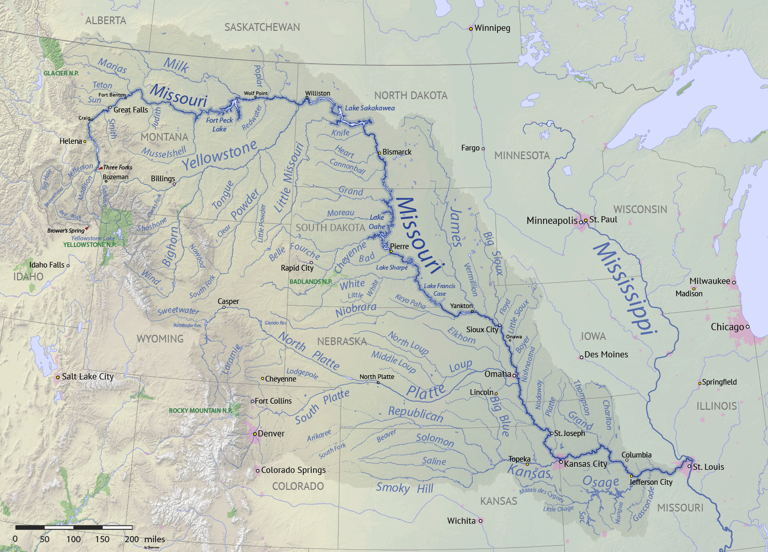
The Missouri River watershed. Image by "Shannon1" (Wikimedia Commons; Creative Commons Attribution-Share Alike 4.0 International license).
Glacial sediments can be found in the northern Great Plains, which was covered by ice sheets during the last glaciation. Additionally, some glacial sediment has been transported southward by the Missouri River and its tributaries.
The Missouri Plateau
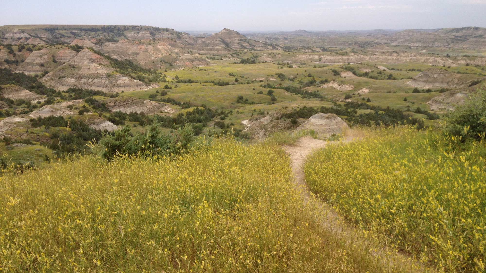
The unglaciated portion of this area is a rugged expanse of semiarid terrain characterized by landforms sculpted from eroded sedimentary rock and glacial sediment, including badlands and dunes. Older surface features such as buttes and well-developed river systems also provide breaks in the generally flat topography. A butte can form when resistant capstone allows for the surrounding rock to be eroded away at a faster pace than the rock beneath the resistant layers.
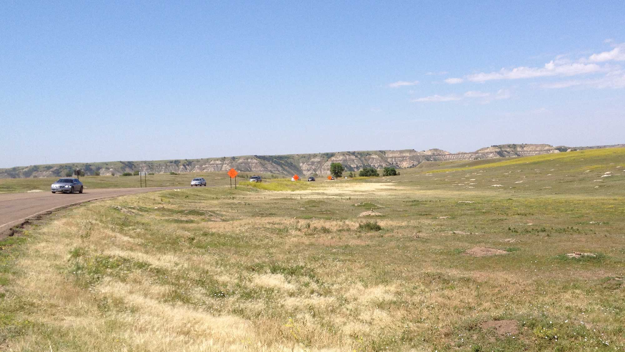
A butte and underlying badlands at Theordore Roosevelt National Park in North Dakota. Photograph by Jonathan R. Hendricks.
Over time, the differing rates of erosion will create a flat-topped hill with steep slopes. Such formations are a hallmark of an old erosional surface, since large buttes often take millions of years to form. On the Missouri Plateau, these topographical features are created from sedimentary rock that formed during erosional and depositional events associated with the uplift of the Rocky Mountains and the sedimentation of the Western Interior Seaway.
Badland topography forms in semiarid areas that experience occasional periods of heavy rainfall. Here, sloping ground composed of sandstones and calcareous sediments underlain by clay or other soft materials is eroded over time into an intricate series of gullies and ravines. Different layers of rock weather at different rates, resulting in a variety of sculpted spurs and buttresses. Harder layers crop out of softer sediments to form ledges, and isolated erosion-resistant patches protect the sediments beneath, forming tall pillars of softer rock with a hard capstone. In the Northwest Central US, badlands can be found in Wyoming, Nebraska, Montana, and the western Dakotas, and are well known for their mammal fossils. Several scenic badlands areas have been set aside as protected land, including Theodore Roosevelt National Park in North Dakota, Badlands National Park in South Dakota, Makoshika State Park in Montana, and Toadstool Geologic Park in Nebraska.
Badland topography at Theodore Roosevelt National Park in North Dakota. Photograph by Jonathan R. Hendricks.
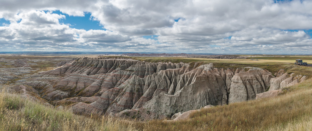
Badlands National Park, near Jackson, South Dakota. Photograph by Jim Bauer (Flickr; Creative Commons Attribution-NoDervis 2.0 Generic license).
Toadstool Geologic Park in Nebraska. Photograph by Diana Robinson (Flickr; Creative Commons Attribution-NonCommercial-NoDerivs 2.0 Generic license).
The Sandhills of Nebraska are sand dunes that were created by wind-blown glacial material.
The Sandhills in Nebraska. Photograph by Diana Robinson (Flickr; Creative Commons Attribution-NonCommercial-NoDerivs 2.0 Generic license).
During the last glaciation in the late Pleistocene, winds blowing along the edge of the ice sheet concentrated layers of sand and glacial loess in central Nebraska. This unique area, which covers 52,000 square kilometers (20,000 square miles), is the largest sand dune formation in the country. The dunes’ porous composition allows them to absorb rainwater, helping to recharge the Ogalalla Aquifer that underlies the area and supplies fresh water to much of Nebraska.
The glaciated portion of the Missouri Plateau contains typical glacial features such as moraines and kettle ponds. The Prairie Pothole Region, an expanse of tallgrass prairie filled with thousands of shallow pothole wetlands, covers most of this area, extending from Alberta and Saskatchewan all the way south into Iowa.
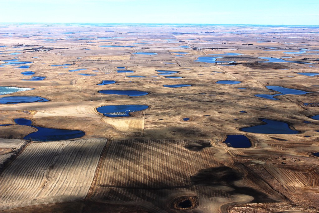
Prairie Pothole Region in North Dakota. Photograph by Krista Lundgren/USFWS (Flickr; Creative Commons Attribution 2.0 Generic license).
These potholes were formed because of glacial activity during the Wisconsinian glaciation, and the wetlands they support provide a haven for more than 50% of North America’s migratory waterfowl. Today, however, more than half of the Prairie Pothole Region has been drained and converted for use in agriculture.
The Black Hills
The Black Hills are an isolated mountain range that outcrops within western South Dakota and northeast Wyoming.
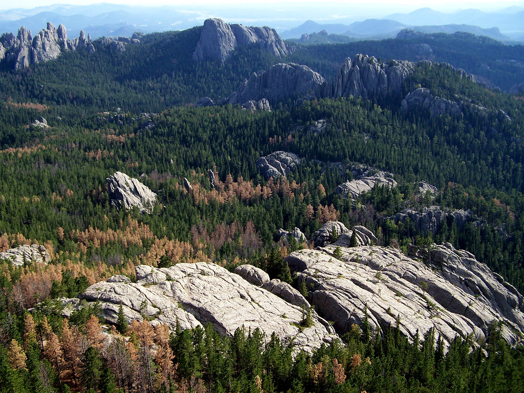
The Black Hills of South Dakota, as viewed from Harney Peak. Photograph by "blucolt" (Flickr; Creative Commons Attribution-ShareAlike 2.0 Generic license).
The mountains contain a core of 1.8-billion-year-old Precambrian granite, generated during the formation of the North American craton. This core is surrounded by a ring of metamorphic rock and layers of Paleozoic and Mesozoic sediment, including sandstone and limestone. The Black Hills were uplifted during the Cretaceous, as the Laramide Orogeny warped the landscape. Since then, the softer overlying sediment has been largely eroded, exposing remnants of the mountains’ granitic core. This granite has been used as the base material for two notable sculptures: Mount Rushmore and the Crazy Horse Memorial. The highest elevation in the Black Hills is Harney Peak, which stands at 2208 meters (7244 feet) above sea level.
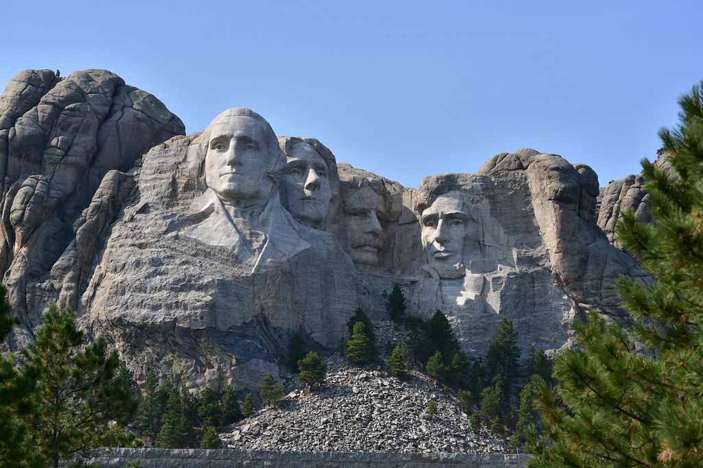
Mount Rushmore in the Black Hills of South Dakota. Photograph by "pedrik" (Flickr; Creative Commons Attribution 2.0 Generic license).
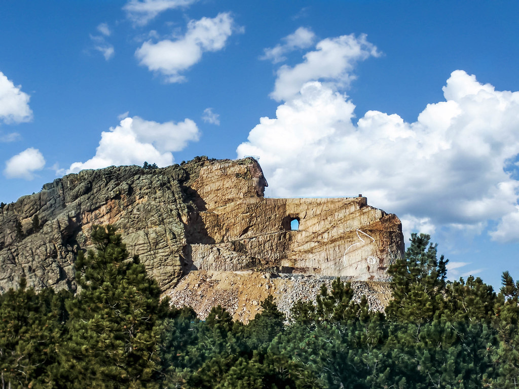
The unfinished Crazy Horse Memorial in the Black Hills. Photograph by "Udo S" (Flickr; Creative Commons Attribution-NonCommercial-NoDerivs 2.0 Generic license).
The High Plains
The High Plains, part of the vast North American Interior Plains, is a low area with flat relief that reflects 500 million years of cratonic stability in the continent’s interior. Much of this area was submerged by the Cretaceous Western Interior Seaway, leading to the deposition of sediment that overlies the area’s igneous and metamorphic core.