

Page snapshot: Introduction to energy in the Basin and Range region of the southwestern United States, including fossil fuels and renewable energy.
Topics covered on this page: Overview; Solar power; Geothermal energy; Hydroelectricity; Wind energy; Nuclear power; Resources.
Credits: Most of the text of this page comes from "Energy in the Southwestern US" by Carlyn S. Buckler and Robert M. Ross, chapter 6 in The Teacher-Friendly Guide to the Earth Science of the Southwestern US, edited by Andrielle N. Swaby, Mark D. Lucas, and Robert M. Ross (published in 2016 by the Paleontological Research Institution; currently out of print). The book was adapted for the web by Elizabeth J. Hermsen and Jonathan R. Hendricks in 2022. Changes include formatting and revisions to the text and images. Credits for individual images are given in figure captions.
Updates: Page last updated September 7, 2022.
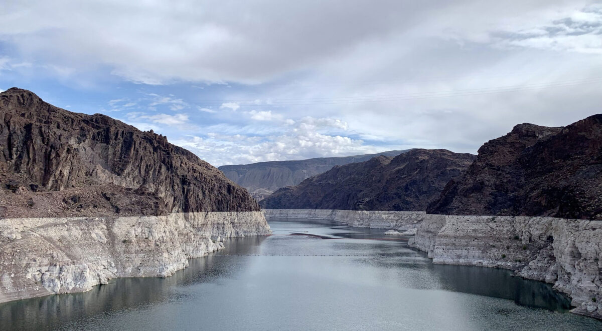
Image above: Lake Mead near Hoover Dam, Arizona-Nevada border, October 2021. Lake Mead is a major source of hydroelectricity, which is produced at Hoover Dam, in the Southwest. In 2021, the lake levels were becoming alarmingly low; the "bathtub ring," or light-colored rocks near the lake surface, show the former lake level. Photo by APK (Wikimedia Commons, Creative Commons Attribution-ShareAlike 4.0 International license, image cropped).
Overview
The Basin and Range produces nuclear energy and has significant potential for both geothermal energy and solar energy, which has been expanding rapidly. The region also develops energy from the Colorado River, which runs along the western boundary of Arizona and Nevada. Due largely to complex active tectonics, much of the Basin and Range region has poor prospects for fossil fuel production. In southern Arizona and New Mexico, the Pedregosa Basin—and the early Cretaceous rift basins that have been superimposed upon it—contains a thick sequence of upper Paleozoic rocks, including carbonates and black shales. The rocks in this basin have not been found to have commercially significant petroleum or coal deposits.
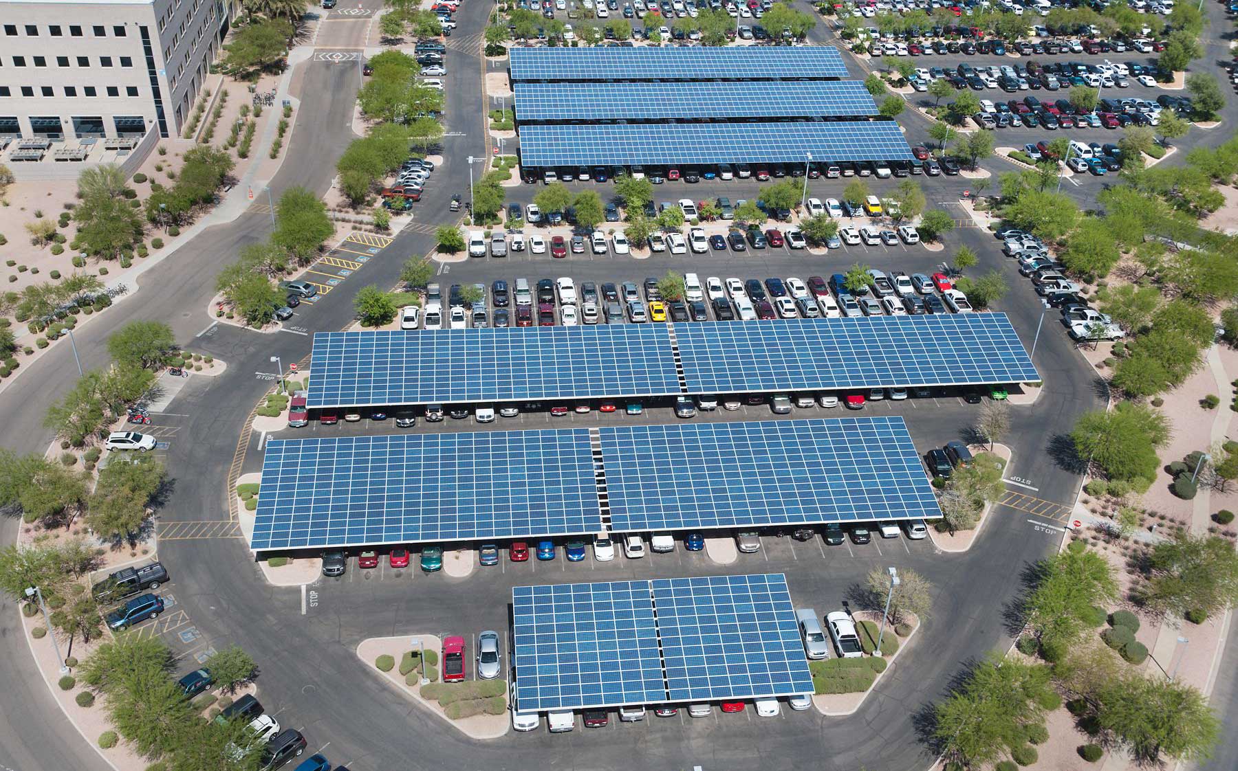
Solar panels covering the roofs of parking structures in Ocotillo, Arizona. Photo by Intel Free Press (Wikimedia Commons, Creative Commons Attribution 2.0 Generic license, image cropped).
Solar power
Solar power in the Southwest has grown extremely quickly in recent years, thanks to the solar resources located in the Basin and Range. The Sonoran Desert extends through southern Arizona and the Chihuahuan Desert from southern New Mexico into the southeastern tip of Arizona; both of these deserts make for prime solar energy territory.
Between 2010 and 2015, Arizona increased its installed solar capacity from 110 MW to 2303 MW; today, it produces 13.3% of the country's solar power and is ranked second in the nation for solar electric generation behind California. While production of solar electric power has grown exponentially in Arizona and in the U.S. as a whole, more than half of the country's solar electric production is found in California. The total U.S. output of solar power is also still dwarfed by other sources. For example, Arizona, the explosive growth of solar production brought electric production from non-hydro renewables to just 3.8% of the state's total.
The Basin and Range holds some of the world's largest photovoltaic power plants, though most of these large-scale plants are found in California or Nevada. The Agua Caliente solar project in Yuma County, Arizona currently has a 348 MW capacity, and a much larger project of 1.2 GW has been proposed just across the Arizona-California border in Needles. The Solana Generating Station near Gila Bend, Arizona is a 295 MW plant that uses parabolic mirrors to concentrate a large area of sunlight into a relatively small area. As this concentrated light is converted to heat, it drives a turbine that is connected to a power generator. The Solana Generating Station was the first solar plant in the US to use molten salt as a means of storing thermal energy.
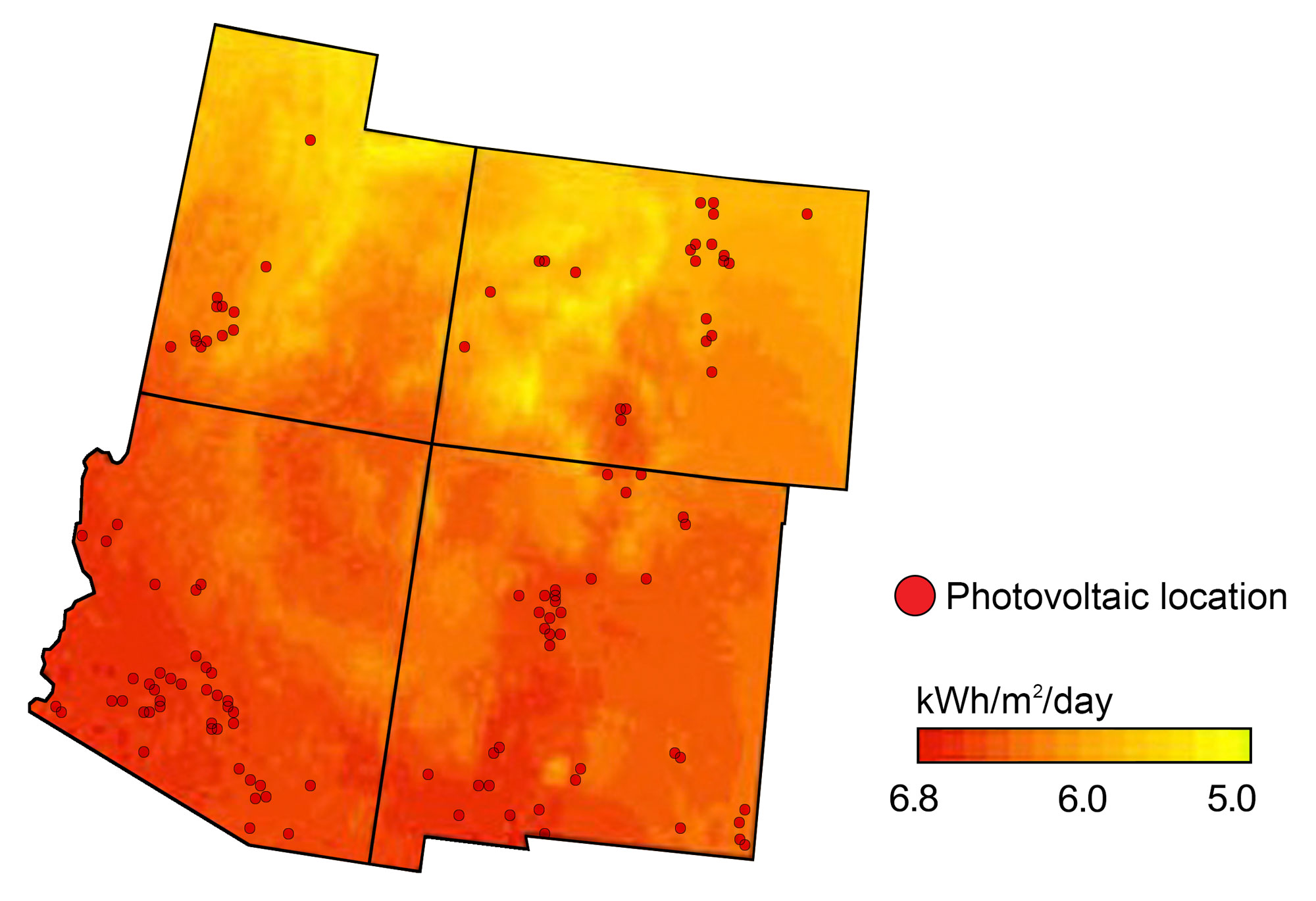
Locations of existing photovoltaic power plants overlaid on a map of the annual average solar resource for the southwestern U.S. Map modified from a map by Andrielle Swaby (adapted from images by the U.S. Energy Information Administration and the National Renewable Energy Laboratory), originally published in The Teacher-Friendly Guide to the Earth Science of the Southwestern US.
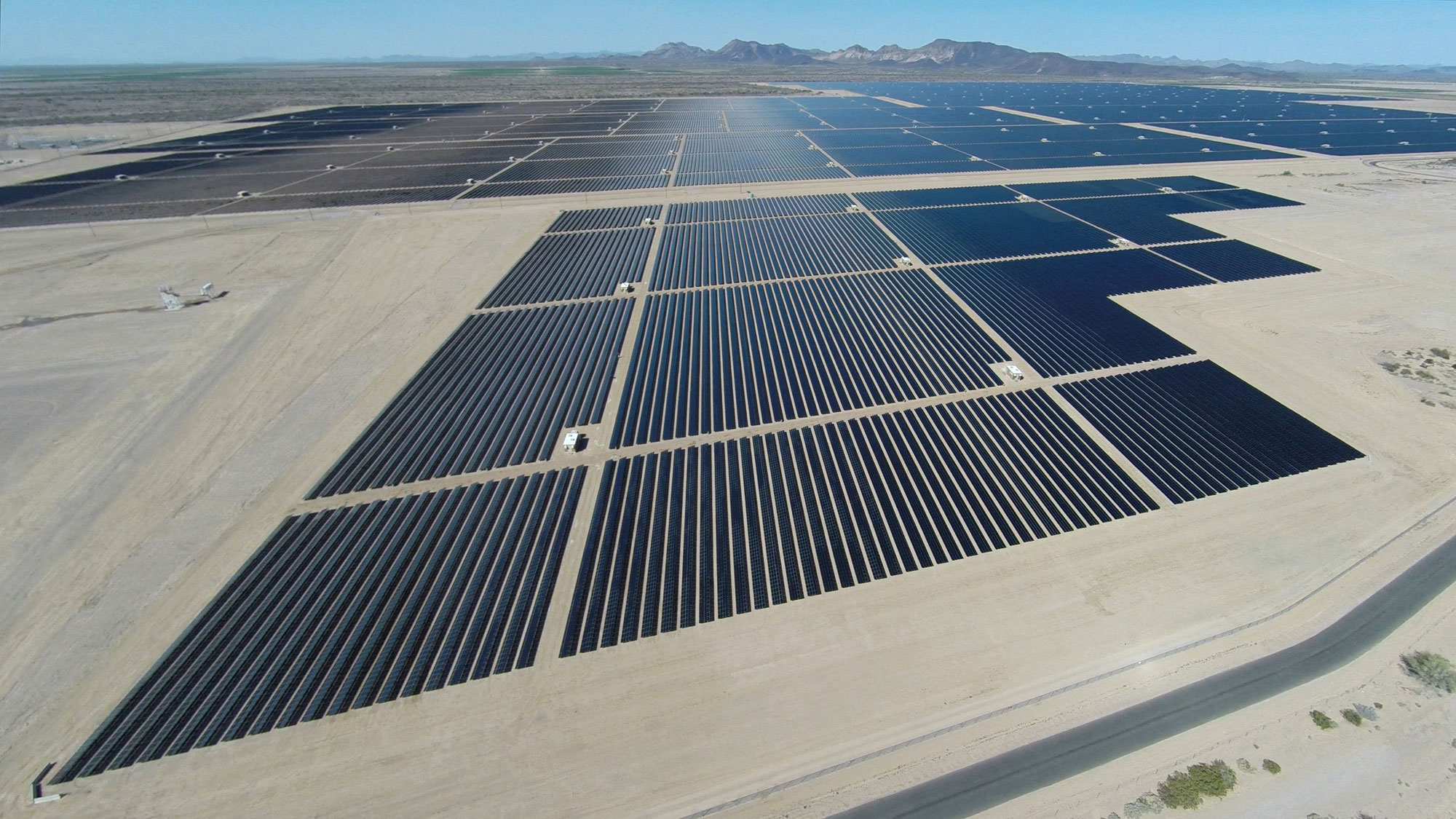
Agua Caliente solar farm, Maricopa County, Arizona. Photo by Center for Land Use Interpretation (Creative Commons Attribution-Noncommercial-ShareAlike 3.0 license, image resized).
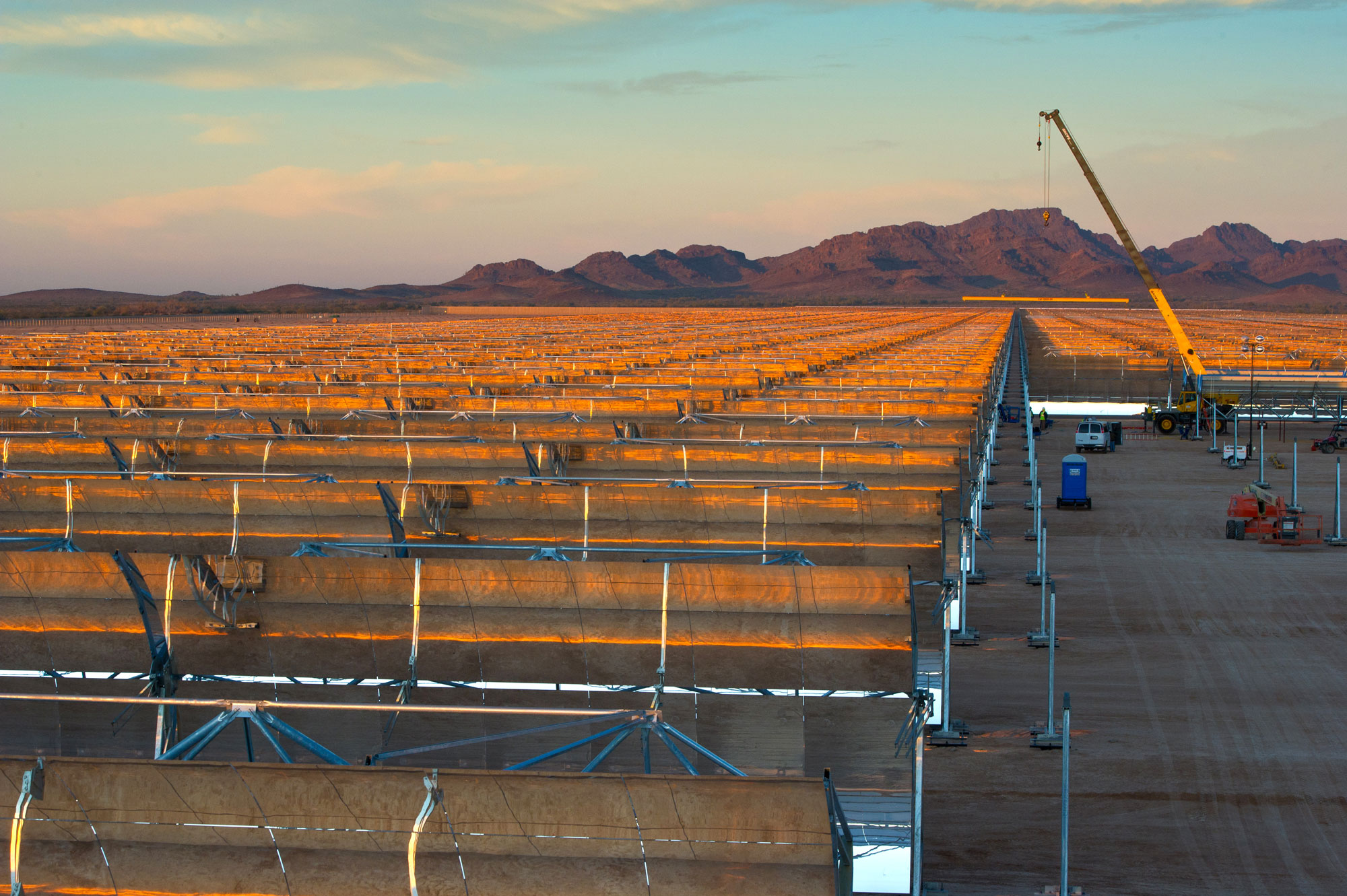
Solana Plant, Gila Bend, Arizona. Photo by Energy.gov (Wikimedia Commons, public domain).
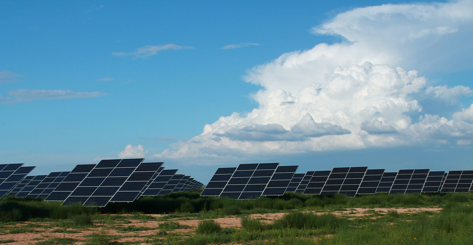
Sun Edison Solar Array, Chapparal, New Mexico. Photo by formulanone (flickr, Creative Commons Attribution-ShareAlike 2.0 Generic license, image cropped and resized).
Geothermal energy
Geothermal energy comes from heat within the Earth, which is created on an ongoing basis by radioactivity. This energy powers mantle convection and plate tectonics. The highest-temperature conditions exist in tectonically active areas, including the Basin and Range, Iceland (part of the Mid-Atlantic Ridge, an oceanic spreading center), Japan (an area of subduction), and Hawaii and Yellowstone (areas over hot spots). Hot springs associated with tectonic activity in the Basin and Range have been enjoyed by the region's inhabitants for hundreds of years, beginning with Native Americans. This tectonic thermal energy is associated with a thinning of the crust, high heat flow relatively close to the surface, and groundwater that has been heated by cooling intrusive volcanic rocks.
The heat of the Basin and Range is harnessed for both geothermal power plants and "direct use" operations (that is, use of geothermal energy at the site where it is generated). Typical examples of direct use operations include geothermally heated greenhouses, swimming pools, and buildings. Western Utah has several geothermal plants and many direct use facilities, and is the third leading producer of geothermal energy in the US (behind California and Nevada, where geothermal energy is also associated with the Basin and Range). New Mexico is also beginning to develop its geothermal resources.
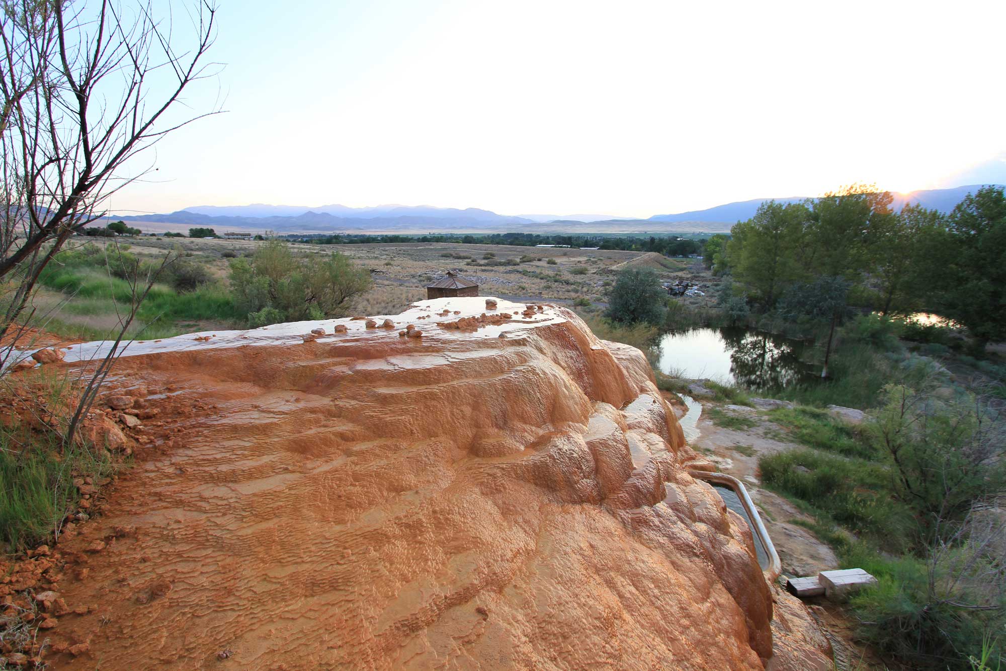
Mystic Hot Springs, Monroe, Utah. Note that you can see the part of a bathtub placed at the edge of the spring at the lower right. Photo by AJ LEON (flickr, Creative Commons Attribution 2.0 Generic license, image resized).
Hydroelectricity
Arizona ranks 10th in the U.S. for hydropower generation, with 13 hydro and pumped storage facilities producing approximately 663 gigawatt-hours (GWh) of power for the state's energy supply; however, this only accounts for about 6% of the state's demand.
Arizona's largest hydropower plant is the Hoover Dam, located on the Colorado River bordering Arizona and Nevada. When built in the 1930s it was the world's highest dam, largest electric-power generating station, and largest concrete structure. The plant's total power generating capacity is approximately 2 GW, and it is the sixth largest among U.S. hydroelectric power stations. Approximately 20% of the Hoover's generated power goes to Arizona; another 25% goes to Nevada, and the rest is used by California. As of 2022, drought conditions in the western U.S. caused levels in Lake Mead to drop significantly, which triggered mandatory water-conservation measures.
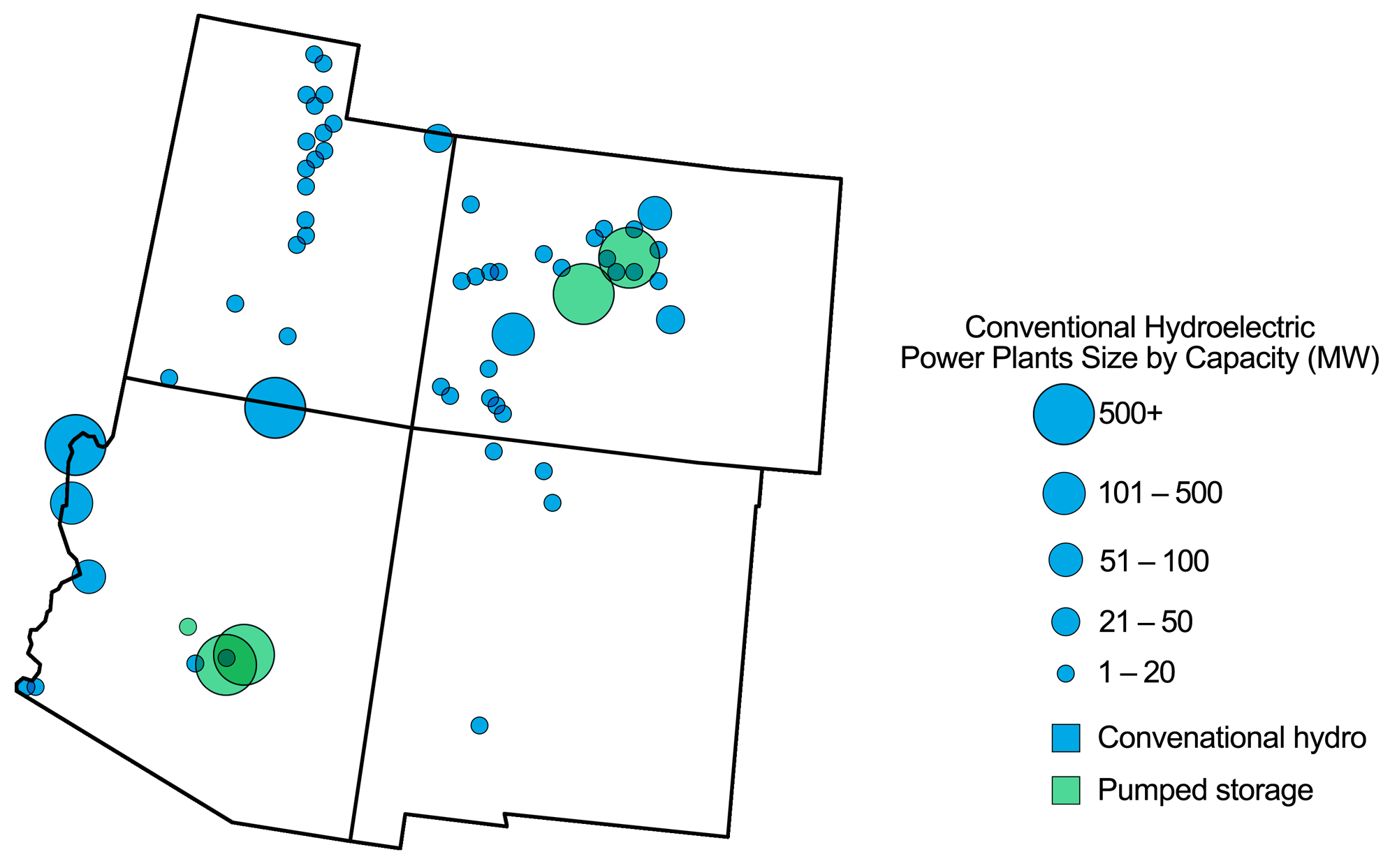
Hydroelectric power plants in the southwestern U.S. Map modified from a map by Andrielle Swaby (adapted from images by the U.S. Energy Information Administration), originally published in The Teacher-Friendly Guide to the Earth Science of the Southwestern US.
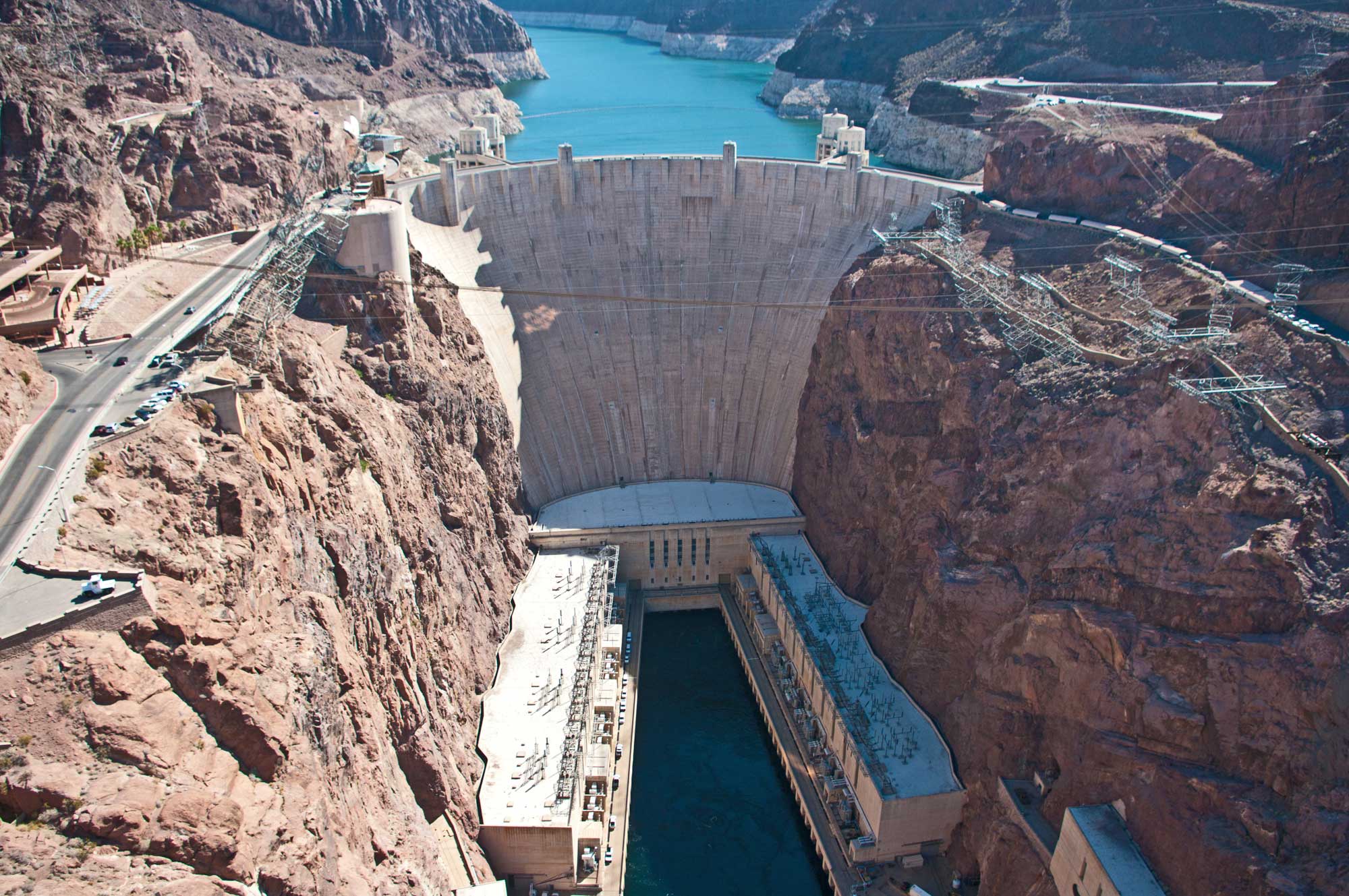
Hoover Dam, Colorado River, Arizona-Nevada border, 2013. Photo by Ron Reiring (flickr, Creative Commons Attribution 2.0 Generic license, image resized).
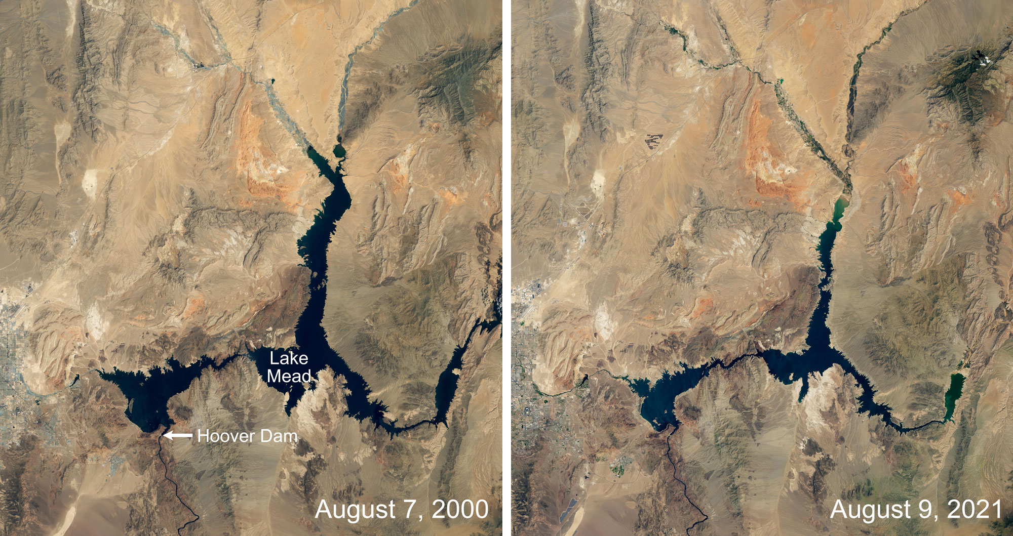
Lake Mead, the lake created by the Hoover Dam, at two points in time about 21 years apart. Images by Lauren Dauphin, NASA Earth Observatory (used following NASA's image use policy).
Wind energy
Although space is available for wind farms, wind potential is relatively low in the Basin and Range, especially when compared to the Great Plains. The only large-scale wind farm in the Basin and Range region is the Milford Wind Corridor Project in southwestern Utah, with a generating capacity of approximately 300 MW. Other smaller-scale projects are scattered throughout Arizona and New Mexico.
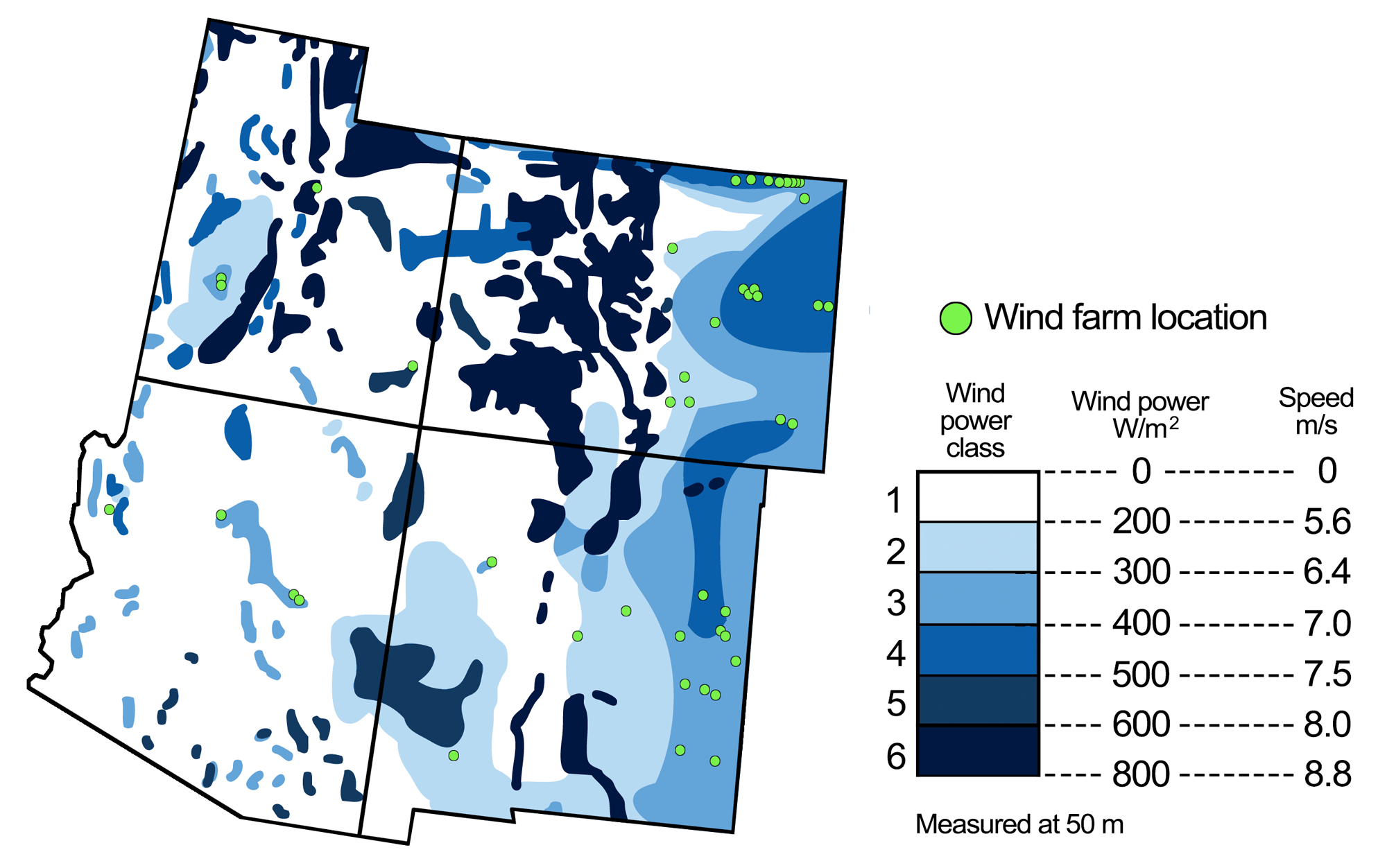
Wind energy potential in the southwest United States, with the locations of wind farms. Figure modified from a figure by Andrielle Swaby (adapted from an image by the National Renewable Energy Laboratory), originally published in The Teacher-Friendly Guide to the Earth Science of the Southwestern US.
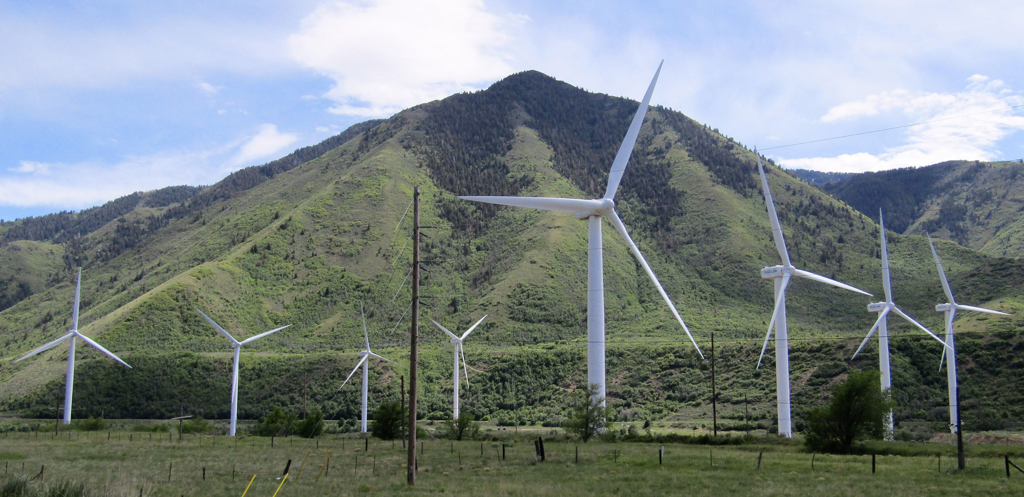
Wind turbines near Spanish Fork, Utah County, Utah, 2018. Photo by Ben P L (Wikimedia Commons, Creative Commons Attribution-ShareAlike 2.0 Generic license, image resized).
Nuclear power
The Palo Verde Nuclear Generating Station near Tonopah, Arizona is the largest nuclear power facility in the U.S., producing approximately 3.3 GW of power annually and serving more than four million people. This plant is also unique in that it is the only large nuclear power plant in the world that does not use a nearby body of water for cooling; rather, it evaporates water from the treated sewage of nearby cities. The Palo Verde plant uses 76 billion liters (20 billion gallons) of evaporated treated sewage water per year.
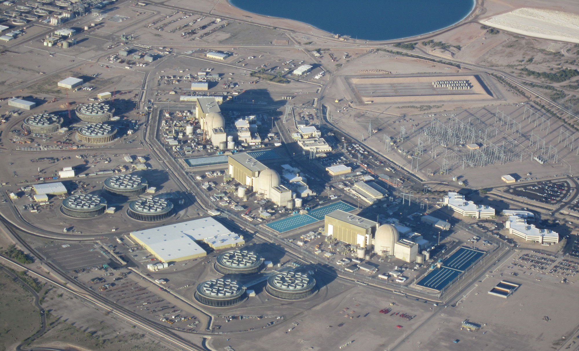
Palo Verde Nuclear Generating Station, Arizona, 2010. Photo by Cuhlik (Wikimedia Commons, public domain).
Resources
Resources from the Paleontological Research Institution
Earth@Home: Earth Science of the Northwest-central U.S.: Energy in the Columbia Plateau and Basin and Range (covers the Basin and Range region in Idaho): https://earthathome.org/hoe/nwc/energy-cp-br/
Earth@Home: Earth Science of the South-central U.S.: Energy in the Great Plains and Basin and Range (covers the Basin and Range region in western Texas): https://earthathome.org/hoe/sc/energy-gp-br
Earth@Home: Earth Science of the Western U.S.: Energy in the Basin and Range (covers the Basin and Range region in California, Nevada, and Oregon): https://earthathome.org/hoe/w/energy-br
Earth@Home: Introduction to Energy: https://earthathome.org/hoe/energy
Earth@Home: Introduction to Plate Tectonics: https://earthathome.org/hoe/plate-tectonics