

Page snapshot: Introduction to energy in the Colorado Plateau region of the southwestern United States, including fossil fuels and renewable energy.
Topics covered on this page: Overview; Oil and gas; Paradox Basin; San Juan Basin; Piceance and Uinta Basins; Green River Formation oil shale; Salt domes (oil and gas storage); Coal; Coalbed methane; Wind energy; Hydroelectricity; Nuclear power; Resources.
Credits: Most of the text of this page is derived from "Energy in the Southwestern US" by Carlyn S. Buckler and Robert M. Ross, chapter 6 in The Teacher-Friendly Guide to the Earth Science of the Southwestern US, edited by Andrielle N. Swaby, Mark D. Lucas, and Robert M. Ross (published in 2016 by the Paleontological Research Institution; currently out of print). The book was adapted for the web by Elizabeth J. Hermsen and Jonathan R. Hendricks in 2022. Changes include formatting and revisions to the text and images. Credits for individual images are given in figure captions.
Updates: Page last updated April 7, 2022.
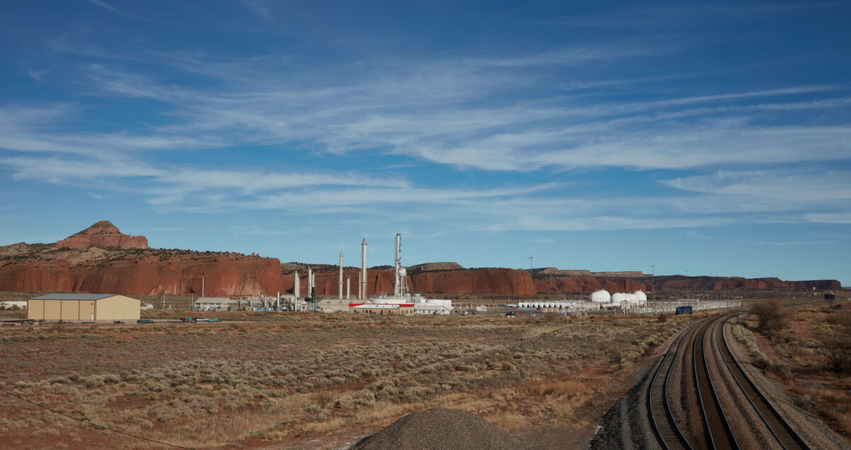
Image above: An oil refinery near Farmington, New Mexico, 2020. Photo by Carol M. Highsmith (Library of Congress Reproduction Number LC-DIG-highsm-65890, Carol M. Highsmith Archive, Library of Congress Prints and Photographs Division, no known restrictions on publication).
Overview
The Colorado Plateau's sedimentary basins have yielded oil, gas, and coal for the past century, and they contain large reserves of additional oil that could potentially be tapped through hydraulic fracturing and horizontal drilling. The high average wind speed and solar intensity on the Colorado Plateau make wind and solar energy potential future sources of electrical energy, but they currently remain minor compared to existing coal and natural gas-powered plants. A number of power plants are associated with hydroelectric dams along the Colorado River system, and the region, particularly southeastern Utah, has long been a source of uranium for use in nuclear power.
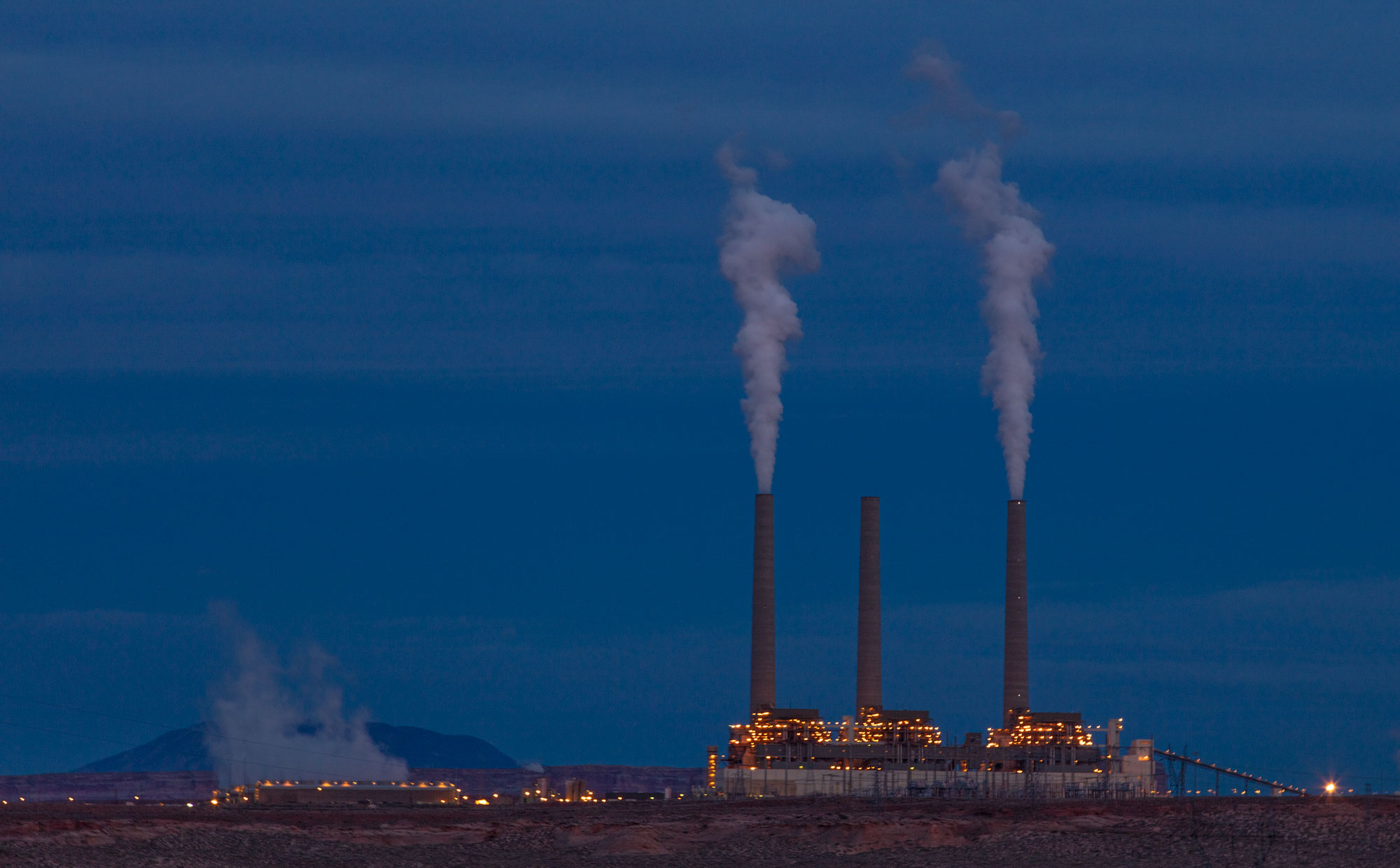
Navajo Generating Station, a coal-fired power plant that one existed near Page, Arizona. The plant was shut down in 2019 and has since been demolished. Photo by Carol M. Highsmith (Reproduction number LC-DIG-highsm-54644, Carol M. Highsmith Archive, Library of Congress Prints and Photographs Division, no known restrictions).
Oil and gas
The Colorado Plateau contains numerous sedimentary basins, each of which contains many organic-rich layers. We find petroleum and natural gas in these areas due to the region's geologic history. Mud with relatively high organic matter content tends to accumulate in shallow continental seas and coastal marine environments. Such environments were found on and off in the Southwest through geologic time. Oil and gas reservoirs (rocks where oil accumulates) in the Southwest range from Devonian to Eocene in age. Gas is produced in the Colorado Plateau as a byproduct of oil extraction and from gas reservoirs in porous rock.
The history of the Southwest's sedimentary basins extends back to the Cambrian period, when a broad shallow sea covered much of the area. Thick sequences of carbonate rocks accumulated in these basins. During the Carboniferous and Permian, sea levels dropped and tectonic changes reshaped the landscape, causing these basins to shrink. As land emerged and weathered into silt and sand, layers of sandstones and organic-rich shales were deposited, preserving organic material on the seabed. Evaporites (for example, salt and gypsum) were also deposited when shallow seawater in the basins evaporated. With time, pressure, and heat, organic material in the shale was changed into petroleum and gas, and the organic-rich shales became source beds for hydrocarbons. Later deposition of non-marine sandstones in the Mesozoic created reservoirs for oil (basically, porous rocks where oil can accumulate).
The Western Interior Seaway formed during the Cretaceous. Additional organic-rich shales along with coastal coals, sandstones, and deeper marine limestones accumulated in and on the margins of this sea. Finally, terrestrial sedimentation in large lake basins during the early Cenozoic trapped yet more organic-rich sediments in lacustrine shales. The thick set of sediments that built up over millions of years created heat and pressure in deeper layers, compacting and "cooking" much of the organic matter into forms that are now used as fuels.
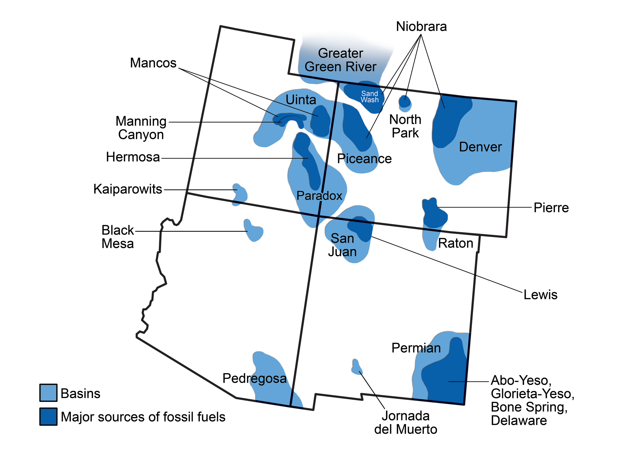
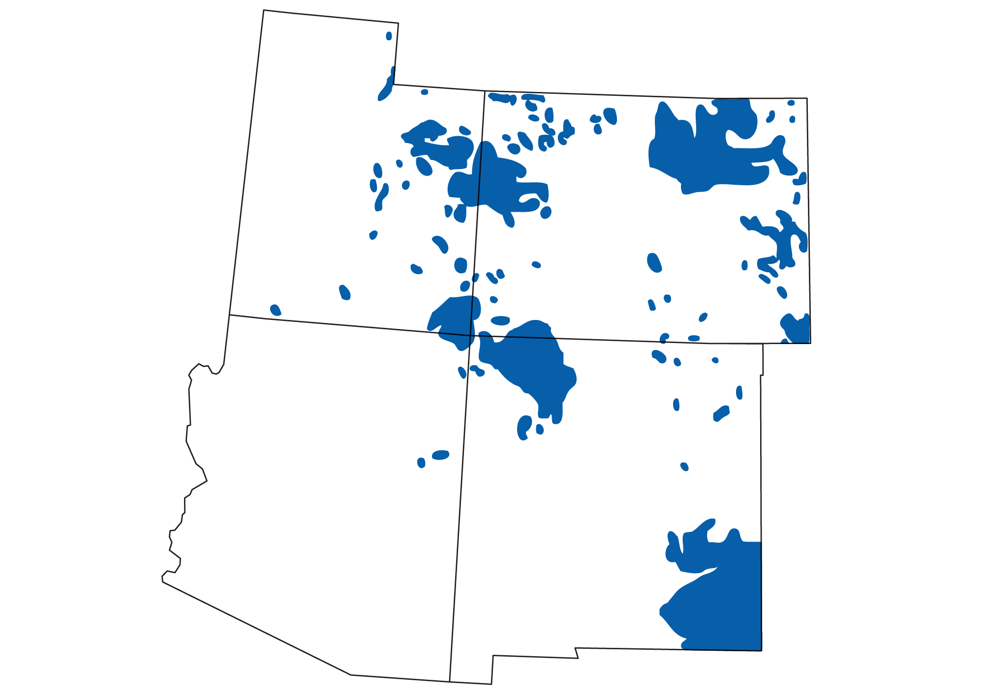
Sedimentary basins of the southwestern U.S. (light blue) and the oil-and-gas-bearing rock units in them (dark blue). Modified from a by Wade Greenberg-Brand, originally published in The Teacher-Friendly Guide to the Earth Science of the Southwestern US.
Areas of oil and gas production in the southwestern United States. The Great Plains and the Colorado Plateau are both major fuel-producing regions. Map by Andrielle Swaby, originally published in The Teacher-Friendly Guide to the Earth Science of the Southwestern US.
Paradox Basin
The Paradox Basin of southeast Utah and southwest Colorado produces oil and gas, as well as a variety of other mineral resources. The basin contains a thick sequence of Paleozoic and Mesozoic sediments. Shallow marine carbonate rocks of Devonian, Mississippian, and Pennsylvanian age act as primary reservoirs for the basin's oil. The source rock for this oil is largely organic-rich shale that is interbedded with the Pennsylvanian carbonates; the shale accumulated from the eroded sediments of the Ancestral Rockies that were uplifted immediately to the east. As oil migrated into the overlying sandstone, it ultimately pooled in reservoirs trapped under a variety of impermeable sedimentary deposits such as gypsum, anhydrite, limestone, and dolomite.
The Paradox Basin contains substantial quantities of evaporites, particularly halite (salt), which greatly influenced the structure of petroleum traps in the basin. These evaporites formed during an interval of repeated basin restrictions during Pennsylvanian and Permian sea level fluctuations. The salt structures beneath the surface of the basin explain the geographic distribution of many oil and gas reservoirs in the Paradox Basin. Impermeable rocks pushed up by salt domes became caprock underneath which oil was trapped. Occasionally, such salt domes may pierce the surface. One such salt dome is the Onion Creek salt diapir, part of the Pennsylvanian Paradox Formation.
Collapsed salt domes are also responsible for many of the region's landscape features. For example, the name "Paradox Basin" came from the paradoxical observation that the Dolores River cuts across instead of flowing down the landscape. The river is superimposed upon a buried salt anticline (an upside-down-U-shaped fold in the rock) that collapsed, leaving a long, dry valley now occupied by the river.
In the Paradox Basin, gas is extracted from Pennsylvanian and Permian sandstones; helium is also a byproduct of gas extraction from the basin's Lisbon Field.
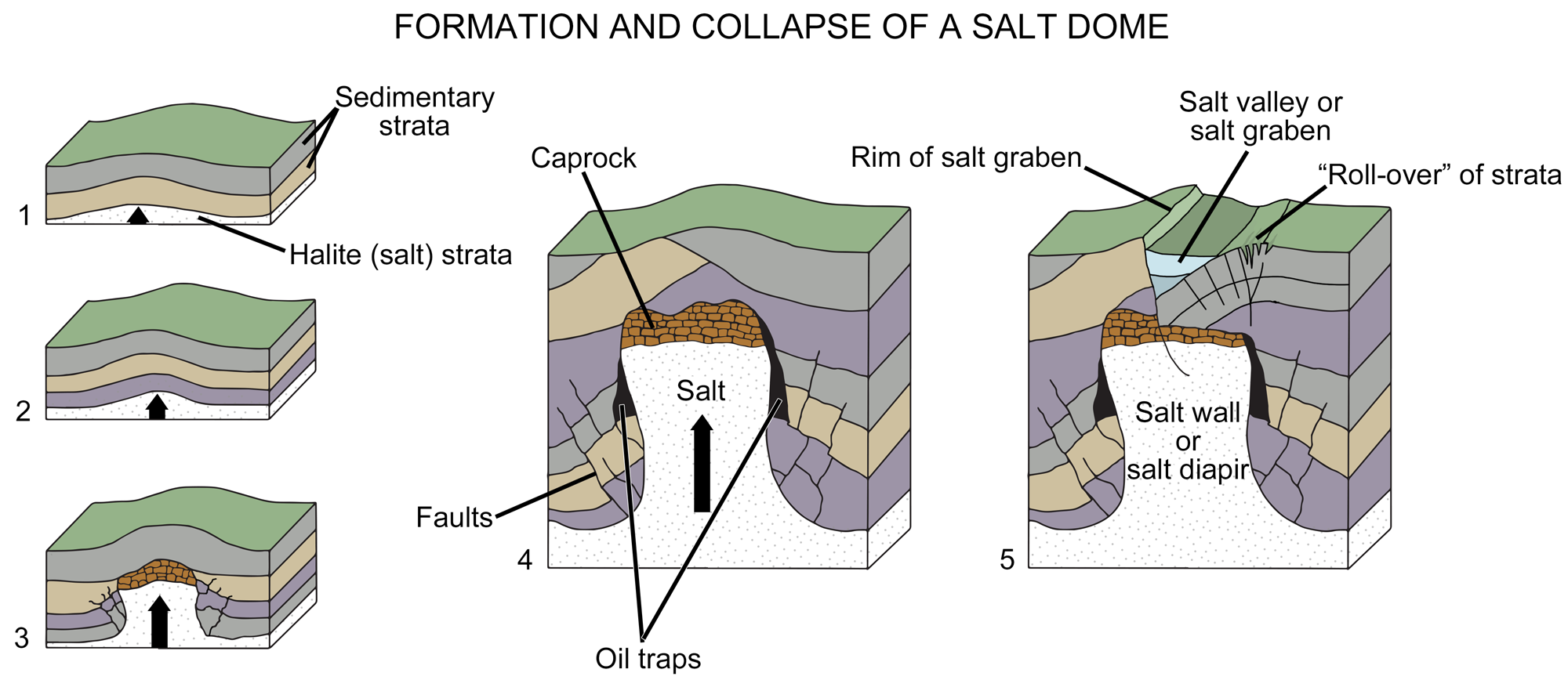
Diagram of the formation of a salt dome. In images1 to 3, a salt layer deforms, pushing upward through the rock layers above it until it is impeded by a caprock (a hard or dense rock layer). In image 4, the deformation of overlying layers by the salt has formed gaps where oil or gas has accumulated. In image 5, the rock layers under the salt have faulted and collapsed, modifying the landscape above the salt dome. Image modified from original by Wade Greenberg-Brand (after an image by Britannica online for kids), originally published in The Teacher-Friendly Guide to the Geology of the Southwestern US.
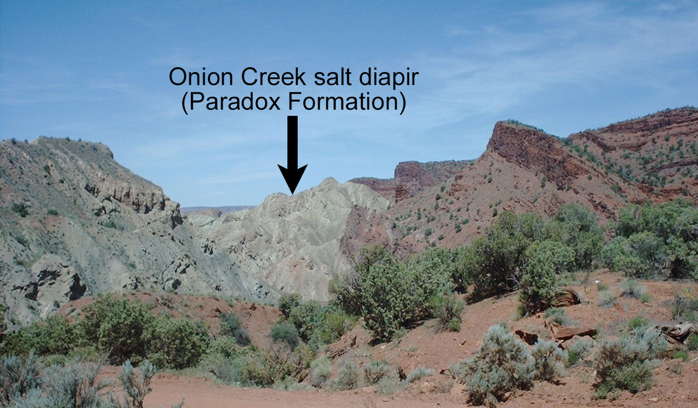
Onion Creek salt diapir, a salt dome exposed at the surface at Fisher Towers, Utah. Photo by Archaeopoda (Wikimedia Commons, Creative Commons Attribution-ShareAlike 3.0 Unported license, image cropped, resized, and labeled).
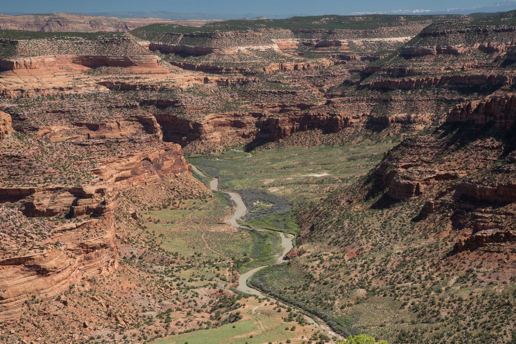
Dolores River, Colorado. Photo by Bob Wick, Bureau of Land Management (flickr, Creative Commons Attribution 2.0 Generic license, image resized).
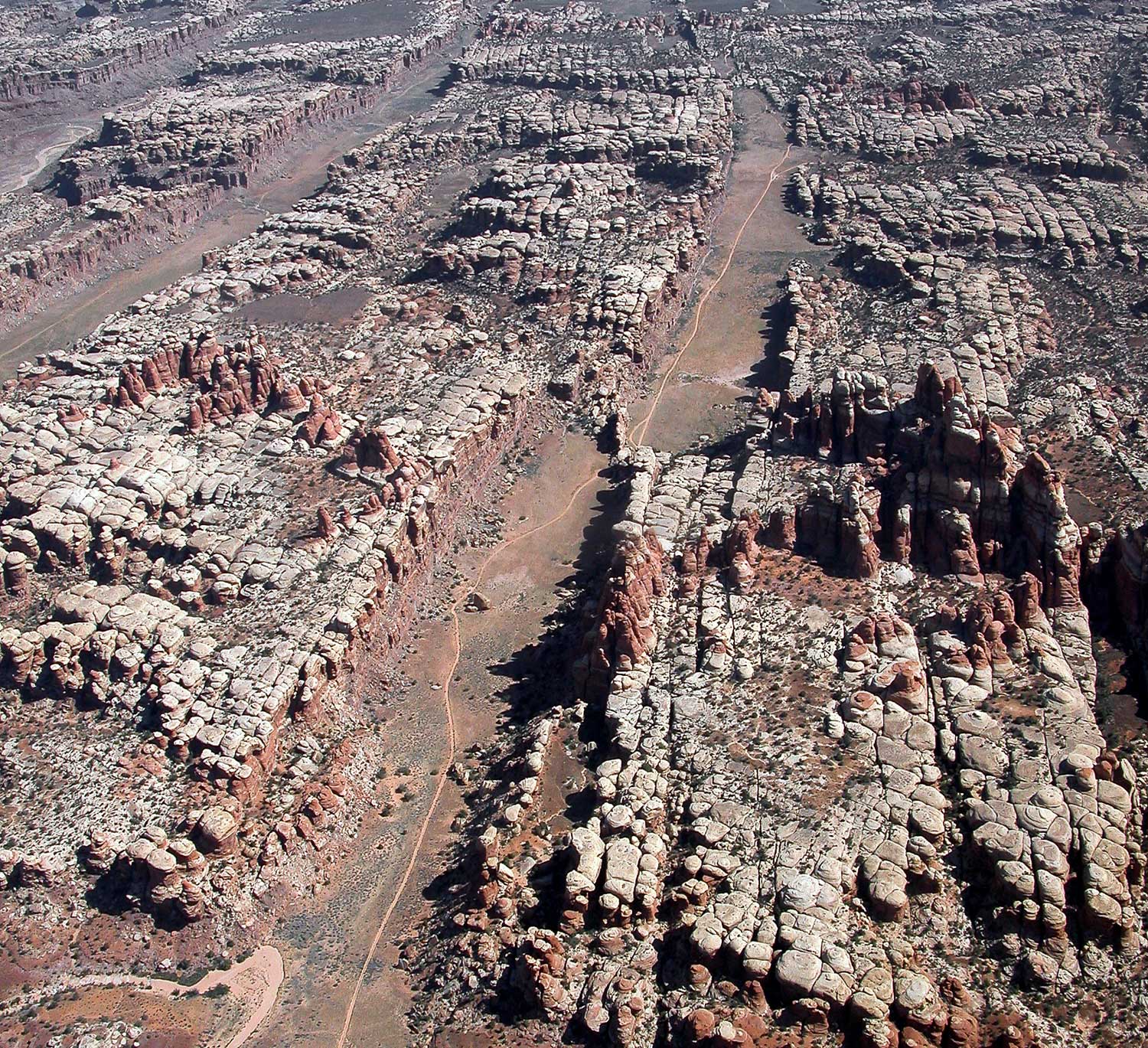
Grabens (in this photo, the long valleys) in the Needles District of Canyonlands National Park, Utah. These grabens are formed by the movement of evaporites in the Paradox Formation. Photo by Neal Herbert, National Park Service (flickr, public domain).
San Juan Basin
The San Juan Basin of northwest New Mexico and southwest Colorado contains important reservoir rocks for oil and gas, primarily late Cretaceous marine sandstones associated with the Western Interior Seaway. The basin's reservoir rocks also include late Cretaceous fluvial sandstones and coals associated with the filling of the Seaway, Jurassic aeolian sandstones, and limestones and sandstones in the shallow marine Pennsylvanian-age Paradox Formation. Source rocks in the San Juan Basin are equally varied, including organic-rich marine shales from the Paradox Formation and the Mancos and Lewis shales of the Western Interior Seaway.
In the 2010s, scientists identified the San Juan basin as a hotspot for methane (CH4) emissions in the United States. Further research showed that there were methane leaks related to harvesting, transporting, storing, and refining petroleum products in the Four Corners region (the area where Arizona, Colorado, New Mexico, and Utah come together), although these are not the only sources of methane. Methane is an especially potent greenhouse gas, so controlling methane emissions is important to slowing global warming. Specialized satellite imaging and thermal infrared cameras deployed on the ground can be used to detect methane leaks so that they can be addressed.
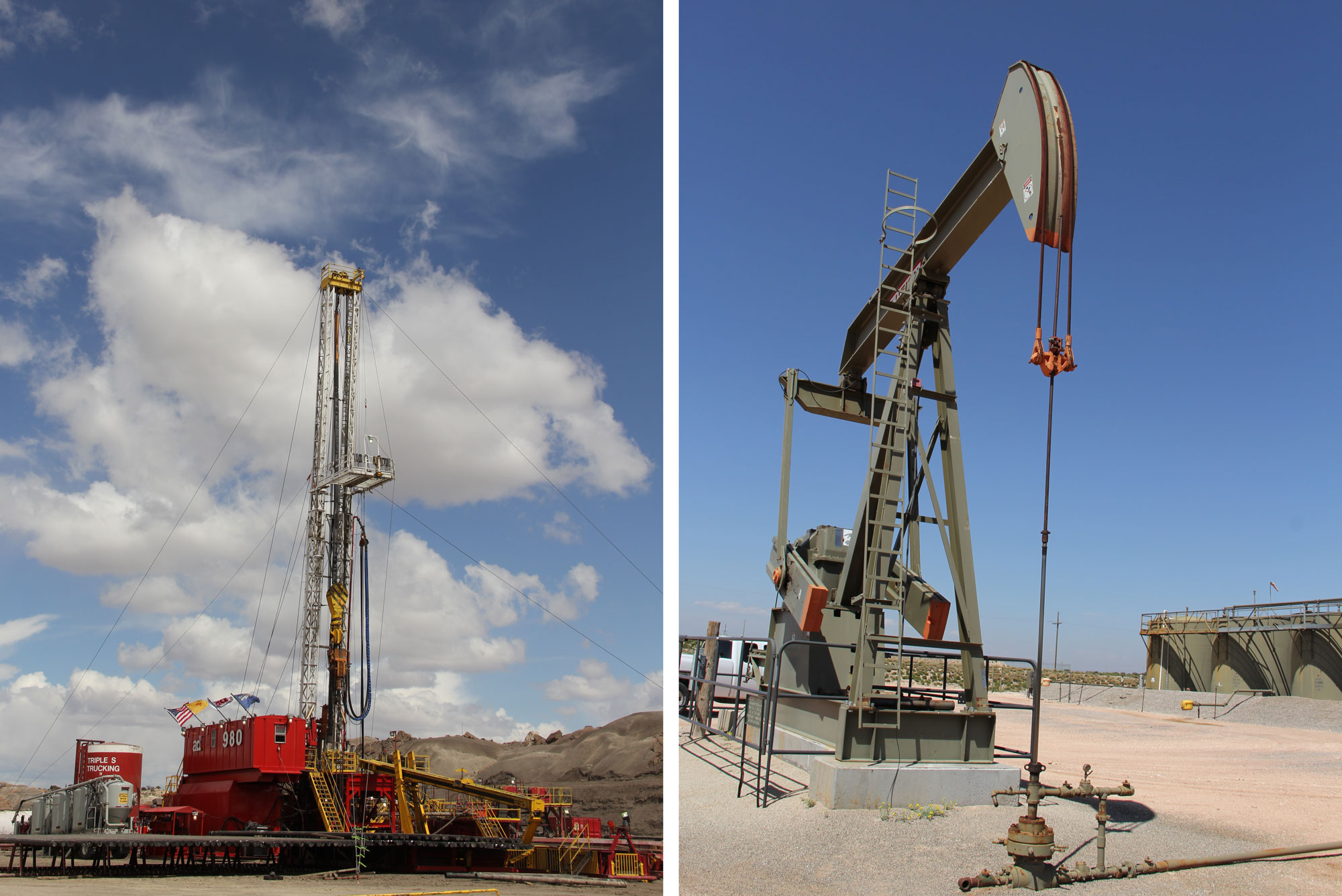
Oil and gas equipment near Farmington, New Mexico. Left: Drilling rig, 2014. Right: Pumpjack, 2016. Left photo and right photo by David Korzilius, Bureau of Land Management (flickr, Creative Commons Attribution 2.0 Generic license, images cropped and resized).
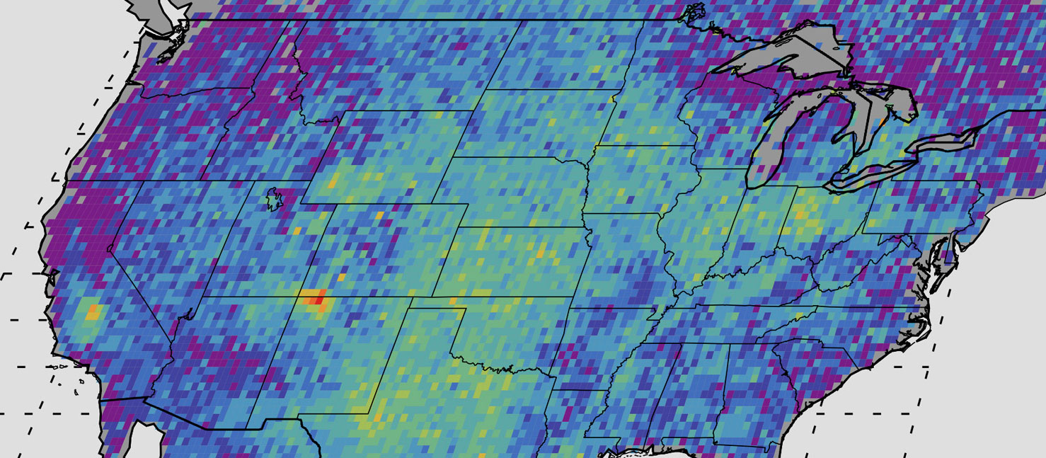
Original caption (NASA/JPL): "This map shows anomalous U.S. methane emissions (or how much the emissions differ from average background concentrations) for 2003 to 2009, as measured by the European Space Agency's SCIAMACHY instrument. Purple and dark blue areas are below average. Pale blue and green areas are close to normal or slightly elevated. Yellows and red indicate higher-than-normal anomalies, with more intense colors showing higher concentrations." Note that the San Juan Basin area is yellow and red. Image source: NASA/JPL-Caltech/University of Michigan (used in accordance with NASA/JPL's image use policy, image cropped).
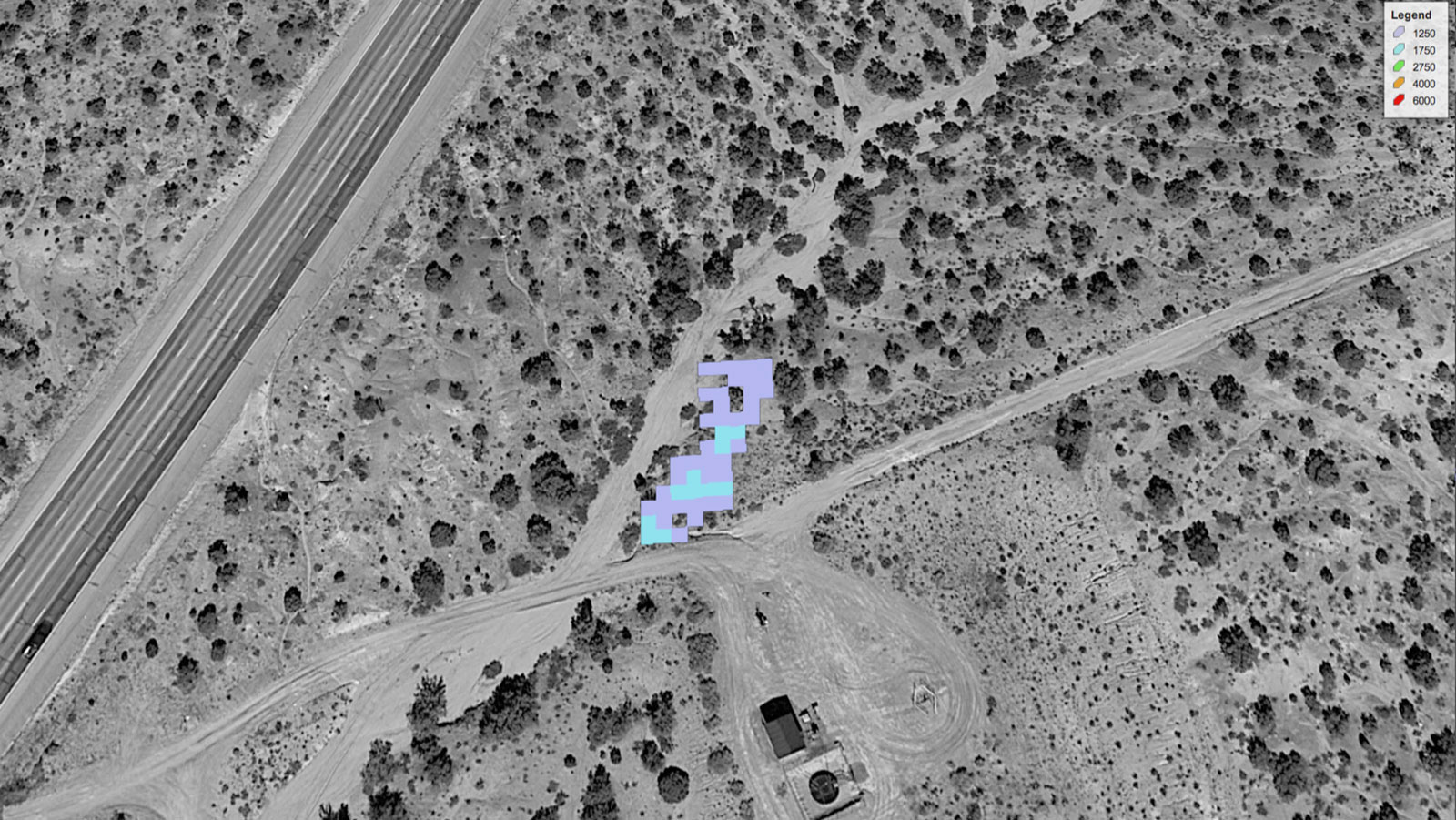
Specialized satellite image showing methane leaking from a pipeline (indicated by the blue and lavender patch) in the Four Corners region. The pipeline was later fixed. Image and information source: NASA/JPL-Caltech.
Piceance and Uinta Basins
The Piceance Basin, located in northwest Colorado, and the Uinta Basin, located in northeast Utah, also contain a wide variety of fossil fuel-bearing deposits dating from the late Paleozoic to the early Cenozoic. These two basins share much of their geological history; they are effectively part of the same east-west trending basin that developed across the Utah-Colorado state boundary during the Late Cretaceous.
The Rangely oil field, near the boundary between the Uinta and Piceance basins, has been producing oil since the 1940s. Oil was discovered at the site in 1901, but the field was not developed until after World War II due to its remoteness. Since development began there, Rangely has produced nearly 800 million barrels of oil, and it was the most prolific oil field in Colorado for many years. The oil at Rangely comes primarily from the late Pennsylvanian and early Permian Weber Sandstone, which includes permeable and porous cross-bedded aeolian dune deposits. The source for this oil is probably Carboniferous strata deep in the Uinta Basin, or the shales of the early Permian Phosphoria Formation. Some oil has also been produced from the late Cretaceous Mancos Shale, deposited as part of the Western Interior Seaway. Today, carbon dioxide (CO2) is injected into the field to increase pressure in the depleted reservoir and enable more oil extraction.
The sands of the Cretaceous-aged Mesaverde Group in the Piceance Basin have yielded substantial volumes of gas. Coals in the Williams Fork Formation of the Mesaverde Group have been a major source of that gas, but the Mancos and Niobrara strata that underlie the northern part of the Piceance Basin may also contribute to gas production there.
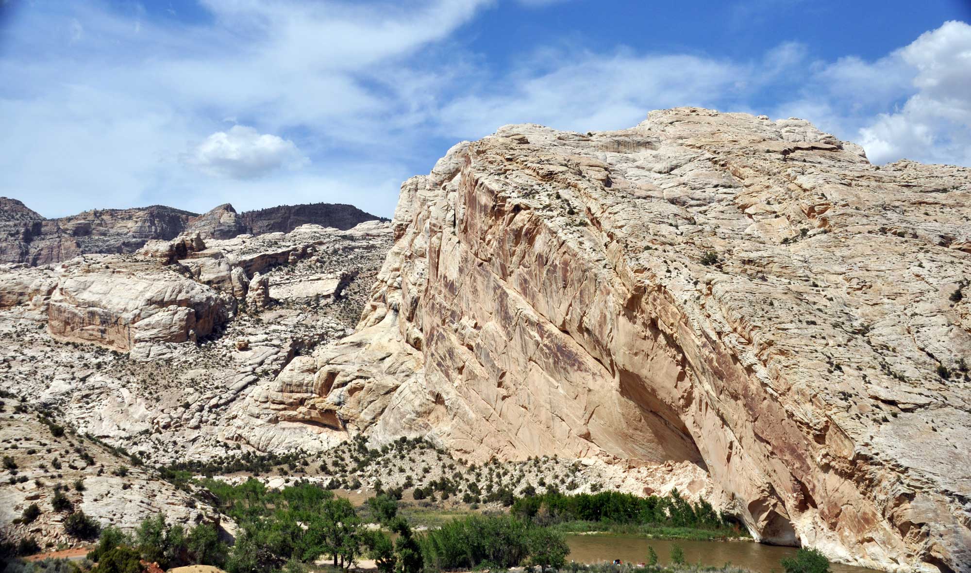
Split Mountain, Pennsylvanian to Permian-aged Weber Sandstone, Dinosaur National Monument, Utah. The Weber Sandstone is exposed in some places, but buried where it serves as a reservoir for oil. Photo by James St. John (flickr, Creative Commons Attributions 2.0 Generic license, image resized).
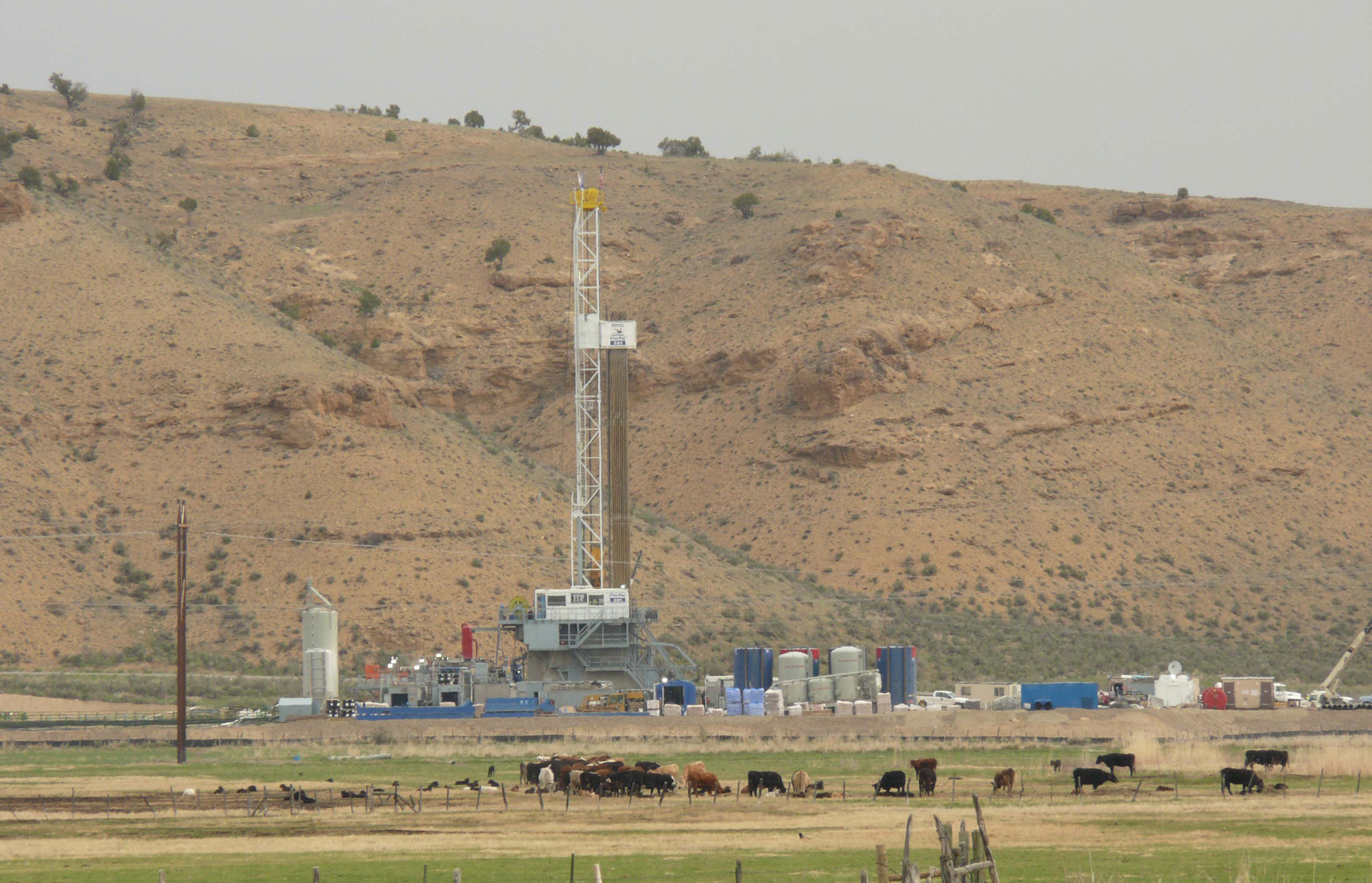
Drill rig near Piceance Creek, Rio Blanco County, Colorado, 2009. Photo by Jeff Foster (flickr, Creative Commons Attribution 2.0 Generic license, image cropped and resized).
Green River Formation oil shale
The Uinta and Piceance basins contain the largest oil shale deposits in the US. These are part of the Green River Formation, where Eocene lacustrine (lake) deposits overlie Cretaceous marine sediments from the Western Interior Seaway. These Colorado and Utah oil shales formed during the greatest extent of Lake Uinta in the Eocene, at a time of relatively high salinity in the lake and high algal productivity. Within the Uinta Basin, some organic-rich Green River shales have been buried deeply enough to generate large quantities of kerogen (a form sometimes described as "waxy oil"). Some of this kerogen migrated and was trapped in porous sandy beds of the Wasatch and Green River formations, while some is still found in its organic-rich Green River source rock. Because the cost of processing oil shale into usable hydrocarbons is so high relative to other forms of producing oil, oil shales have remained mostly untapped.
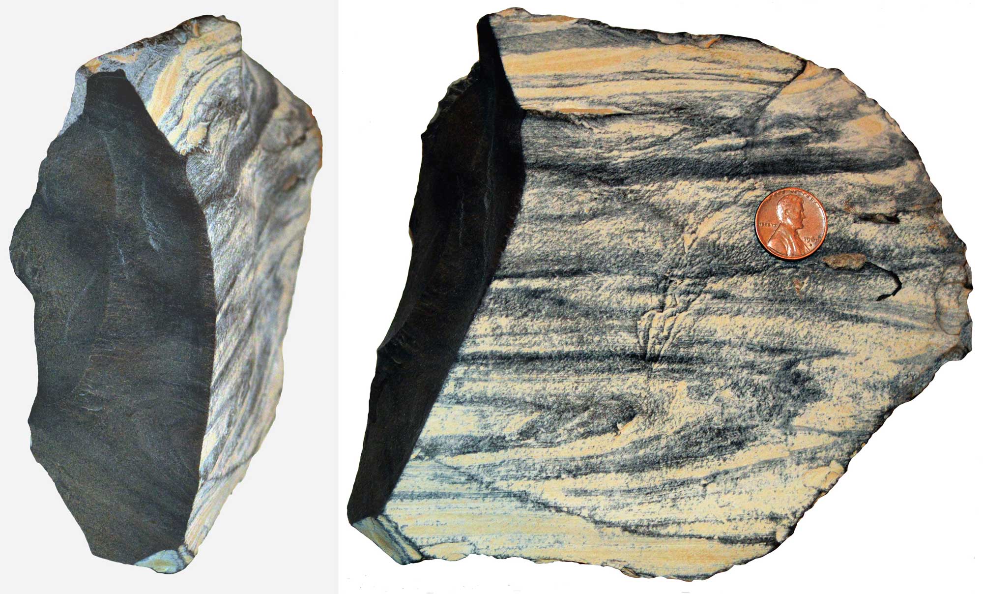
Oil shale, Green River Formation, Colorado. Photo by Georgialh (Wikimedia Commons, Creative Commons Attribution-ShareAlike 3.0 Unported license, image resized).
Salt domes (oil and gas storage)
Salt domes can be used to store large quantities of oil and gas. Storage caverns are created by injecting the salt with water to dissolve a cavity within the salt structure—a process called solution mining. Many salt domes along the Gulf Coast are used for this purpose; in the Southwest, however, the first such storage complex is being developed by the Magnum Gas Storage Project. The caverns, hollowed out of a 2100-meter-thick (7000-foot-thick) salt dome in Millard County, Utah, will be capable of storing 1.5 billion cubic meters (54 billion cubic feet) of natural gas and will be connected to an interstate natural gas pipeline system.
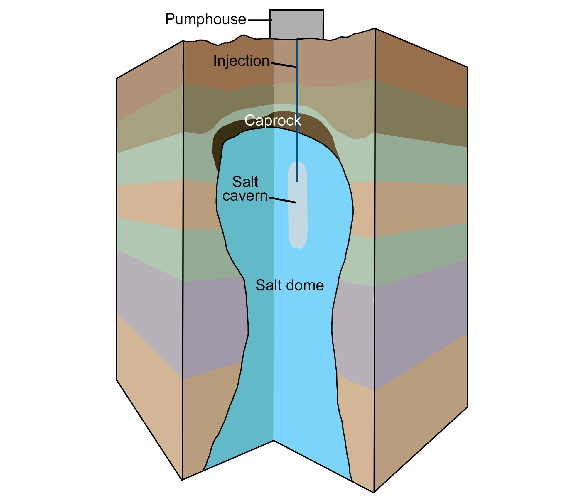
Diagram of solution mining to create a salt cavern. A pumphouse pumps water into an underground salt dome. The water dissolves the salt, and the brine (salty water) is pumped back out, creating a salt cavern (a large cavity) in the salt dome. Modified from original by Wade Greenberg-Brand for the Earth@Home project.
Coal
Billion-ton coal deposits formed in the Colorado Plateau during the late Cretaceous, as the Western Interior Seaway grew and shrank with sea level and local tectonic changes. North American Cretaceous coals are nearly as extensive as those of Carboniferous age, largely due to the widespread extent and long history of the Western Interior Seaway. The thickest coals accumulated as peat in coastal swamps while the basins in the area subsided, and others accumulated farther inland on alluvial plains. Some later Paleocene coals were also deposited in intermontane basins.
The Cretaceous and Paleocene deposits of the Colorado Plateau are typically high-volatile (low-grade) bituminous coals. Most of the region's coals are deeply buried toward the centers of the major basins, and crop out around the exposed edges of the Piceance Basin in Colorado, the Kaiparowits and Uinta basins in Utah, the Black Mesa Basin in Arizona, and the San Juan basin in Colorado and New Mexico. Coal mining has continued for over 115 years in some of these basins.
In northern Arizona and New Mexico, large strip mines have been operated on lands of the Diné (Navajo) and Hopi. These mines were established in the 1960s and 1970s and fed large power generating stations located in Arizona, New Mexico, and Nevada. Of the three major mines and associated generating stations that once existed, only the Navajo Mine and Four Corners Station in New Mexico are still active, although the Four Corners Station is projected to be shut down in 2031. While the mines contributed to the local economy, they have been criticized for their handling of archeological sites and human remains, pollution, destruction of the landscape, and groundwater depletion.
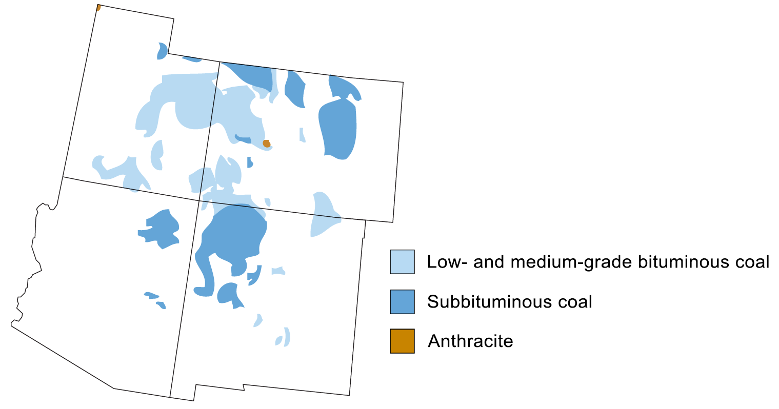
Coal-producing regions of the southwestern United States. Map modified from a map by Andrille Swaby (adapted from an image by the USGS), originally published in The Teacher-Friendly Guide to the Earth Science of the Southwestern US.
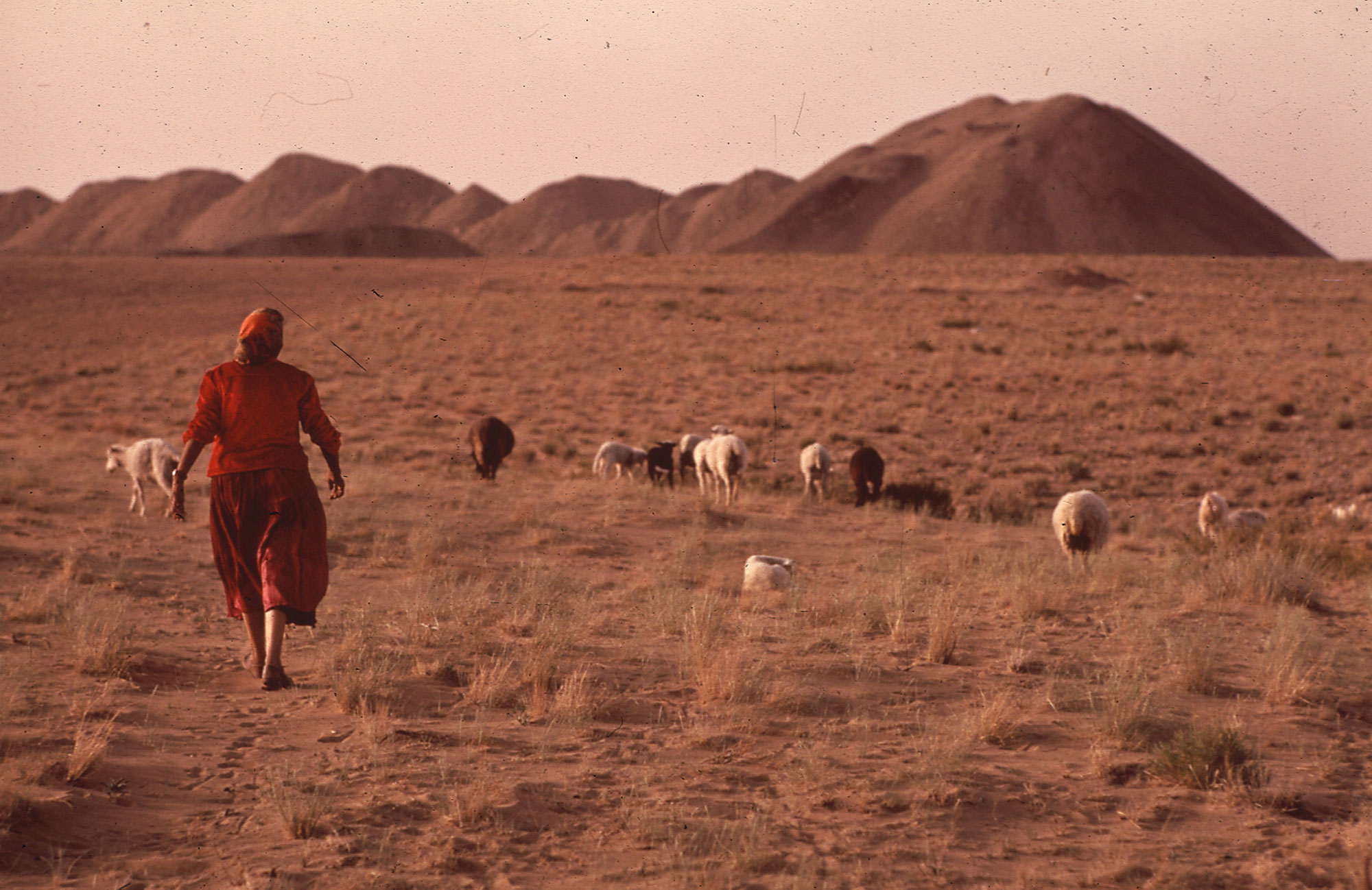
A woman herding sheep near the Navajo Mine outside of Fruitland, Navajo Nation, northern New Mexico, 1972. Photo by Terry Eiler for DOCUMERICA, EPA (National Archives Identifier 544317, U.S. National Archives, no restrictions).
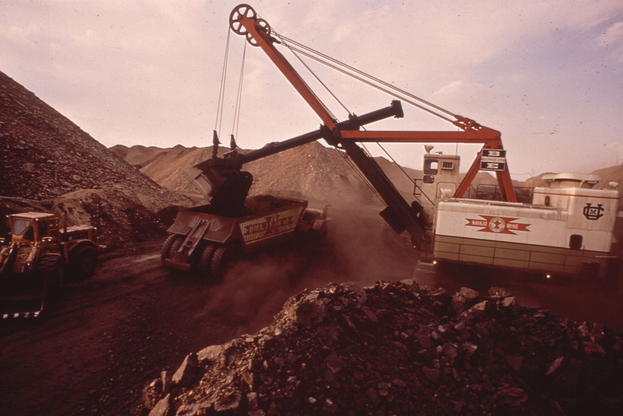
Strip mining, Navajo Mine, Navajo Nation, northern New Mexico, 1972. Photo by Lyntha Scott Eiler for DOCUMERICA, EPA (National Archives Identifier 544134, U.S. National Archives, no restrictions).
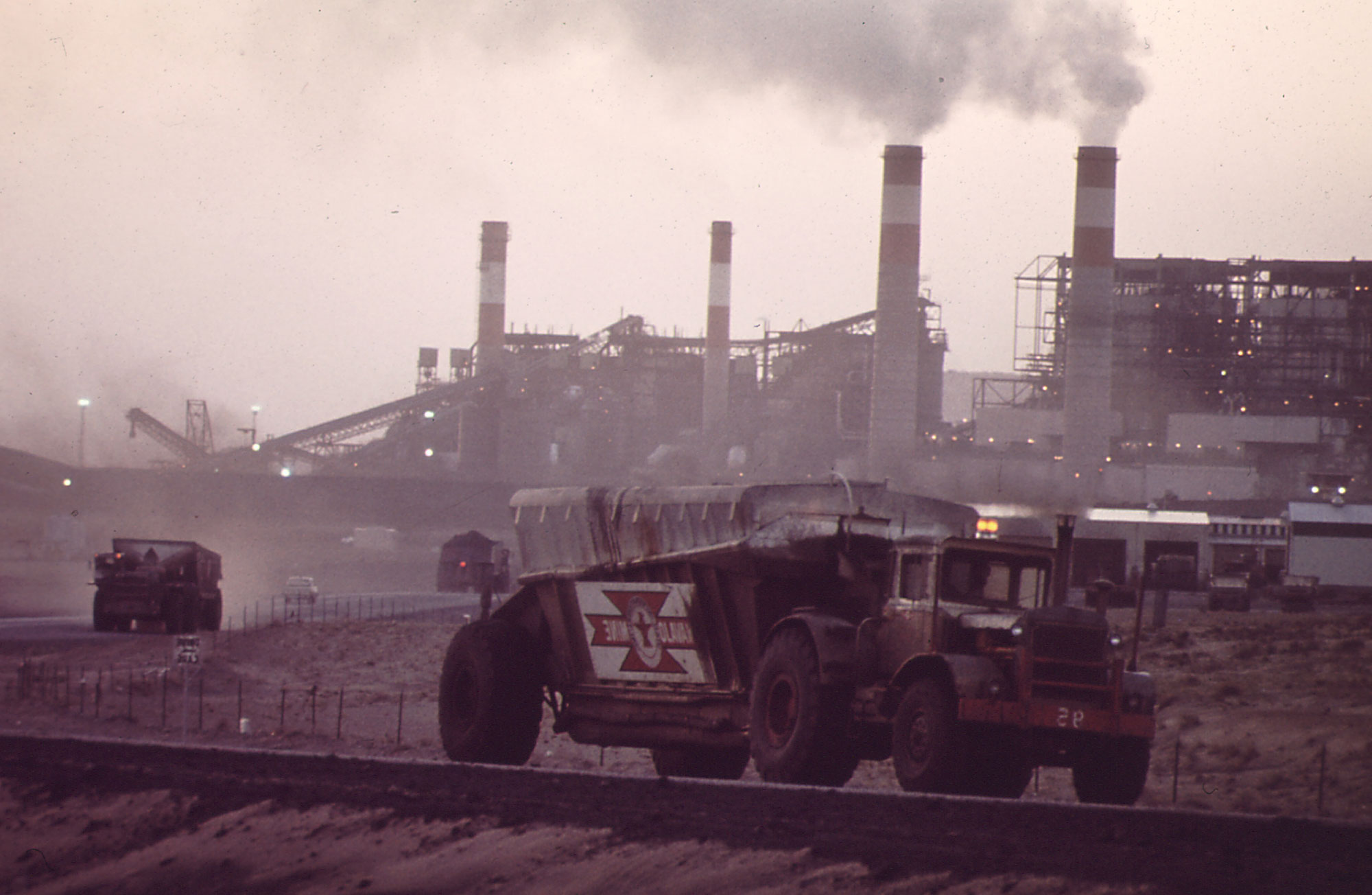
Coal being transported to the Four Corners Generating Station near, Fruitland, New Mexico, 1972. Photo by Lyntha Scott Eiler for DOCUMERICA, EPA (National Archives Identifier 544169, U.S. National Archives, no restrictions).
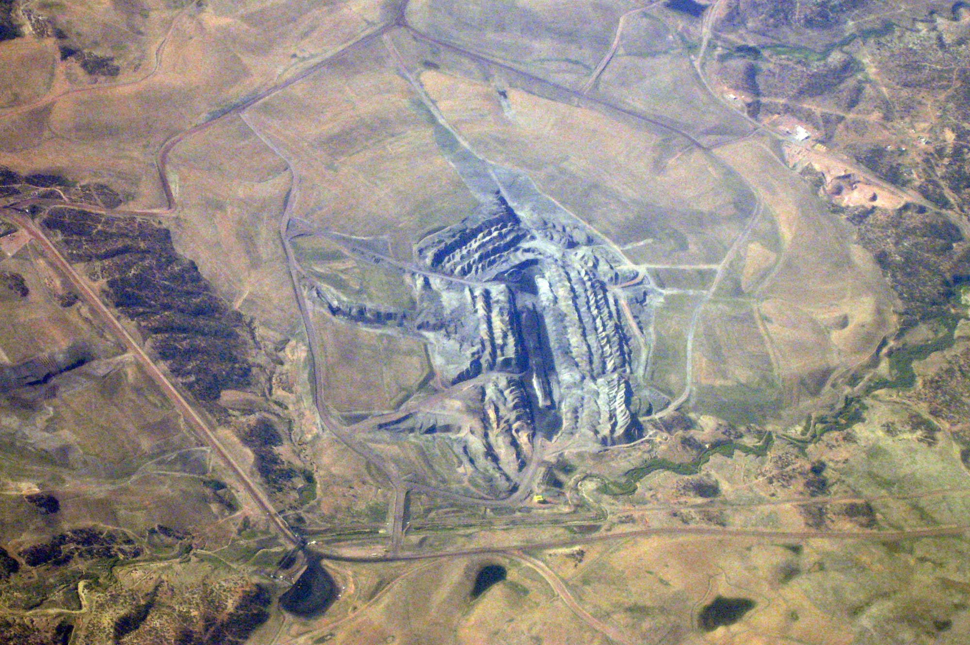
Aerial photograph of the Kayenta Coal Mine, northern Arizona, 2008. This mine fed the now-defunct Navajo Generating Station that operated near Page, Arizona. The mine closed in 2019. Photo by Doc Searls (Wikimedia Commons, Creative Commons Attribution-ShareAlike 2.0 Generic license, image cropped and resized).
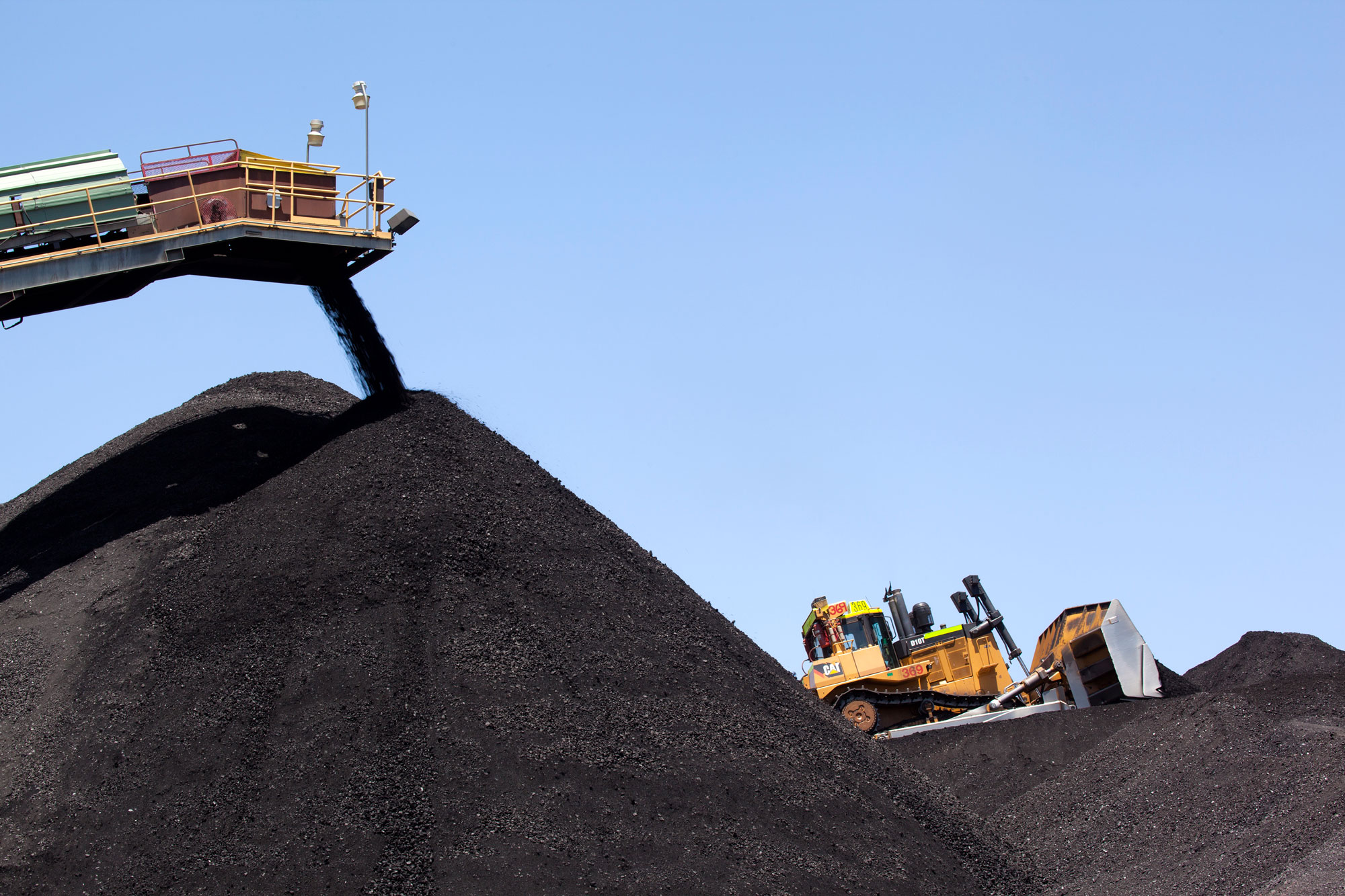
Coal stockpile as the Kayenta Coal Mine, 2014. This mine fed the now-defunct Navajo Generating Station that operated near Page, Arizona. The mine closed in 2019. Photo by Peabody Energy, Inc. (Wikimedia Commons, Creative Commons Attribution 3.0 Unported license, image cropped and resized).
Coalbed methane
Production rates for coalbed methane climbed steeply beginning in the early 1990s, although in recent years they have decreased both in absolute and relative quantity as shale gas production has increased. Some subsurface coals on the Colorado Plateau are significant sources of coalbed methane. For example, gas from the Fruitland Formation in the San Juan Basin is among the largest non-shale gas sources of natural gas in the U.S. and is by far the largest coalbed methane source in the country. Another notable coalbed gas-producing area is the Ferron Sandstone Member of the Mancos Shale, in the southwestern part of the Uinta Basin.
Wind energy
The Colorado Plateau has only a fragmented capacity for wind energy, but it does host a few wind farms. The Dry Lake Wind Power Project in Navajo County, Arizona, was the state's first utility-scale wind farm. It generates approximately 127 MW of power. Perrin Ranch Wind Farm in Coconino County, Arizona, also generates approximately 100 MW. A few smaller plants are found in the Colorado Plateau of Utah and New Mexico.
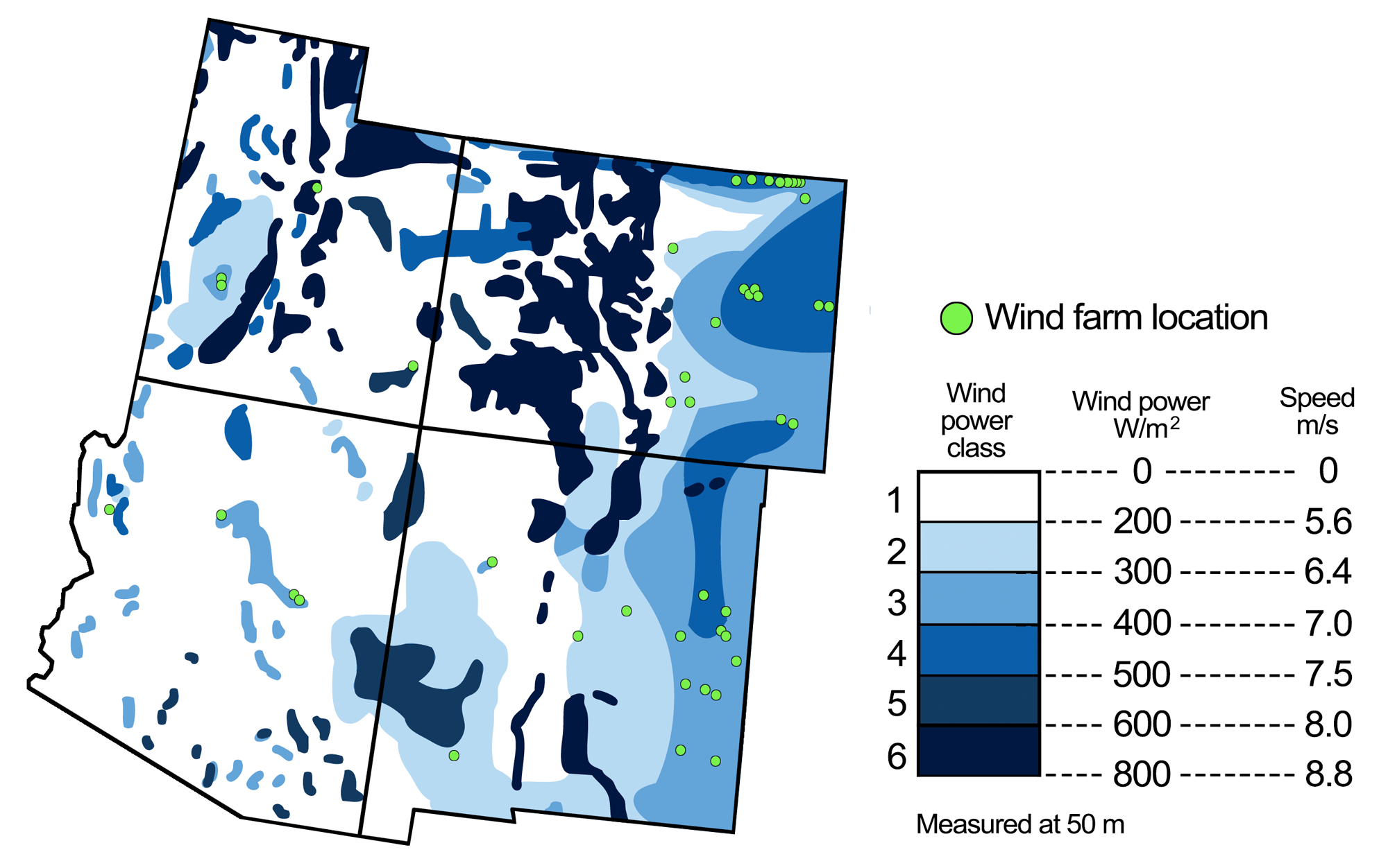
Wind energy potential in the southwest United States, with the locations of wind farms. Figure modified from a figure by Andrielle Swaby (adapted from an image by the National Renewable Energy Laboratory), originally published in The Teacher-Friendly Guide to the Earth Science of the Southwestern US.
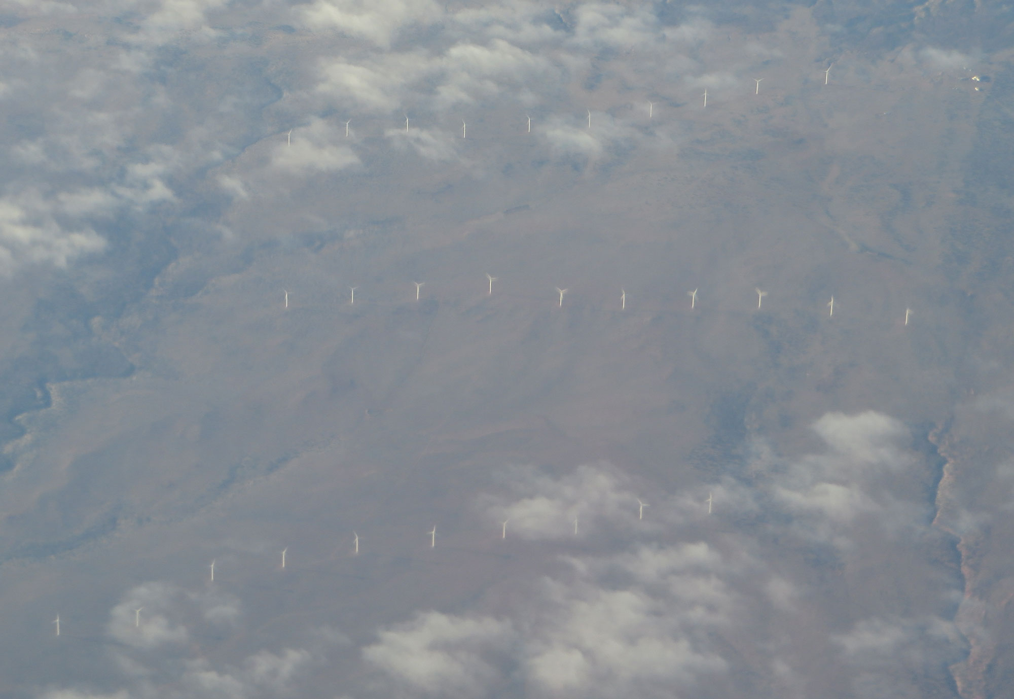
Aerial view of wind turbines near Snowflake, Navajo County, Arizona. Photo by Ken Lund (flickr, Creative Commons Attribution 2.0 Generic license, image cropped and resized).
Hydroelectricity
The Colorado River and its tributaries provide the Southwest with the potential for hydroelectric power, which uses the gravitational force of falling or rushing water to rotate turbines that convert the water's force into energy. There are also several pumped storage facilities within the region, where water is pumped uphill into reservoirs in times of excess production, essentially acting as batteries.
Many of the hydroelectric plants scattered through the Colorado Plateau are associated with the topographic drop along the region's rim. The most notable is the Glen Canyon Dam near the Arizona-Utah state line, which provides an average of 3.4 billion kWh per year. The massive concrete dam was completed in 1966 and retains Lake Powell, the second largest reservoir in the United States, with a capacity of 30 billion cubic meters (1 trillion cubic feet). In recent years, however, drought conditions have caused reservoir levels to drop, and Lake Powell was at only 30% of its maximum level in 2021. If the lake continues to drop, it is possible that it will be too low to be used in power generation.
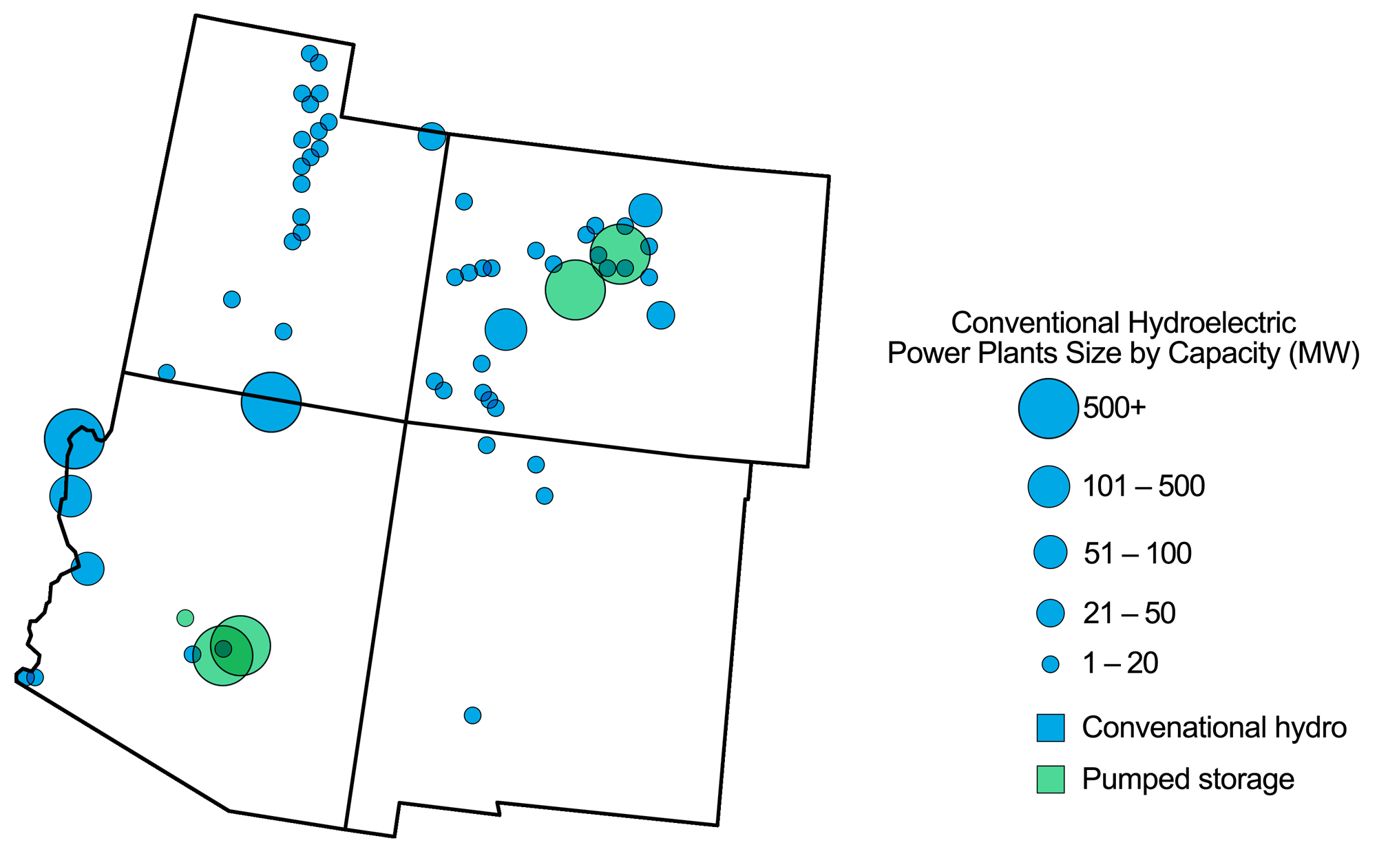
Hydroelectric power plants in the southwestern U.S. Map modified from a map by Andrielle Swaby (adapted from images by the U.S. Energy Information Administration), originally published in The Teacher-Friendly Guide to the Earth Science of the Southwestern US.
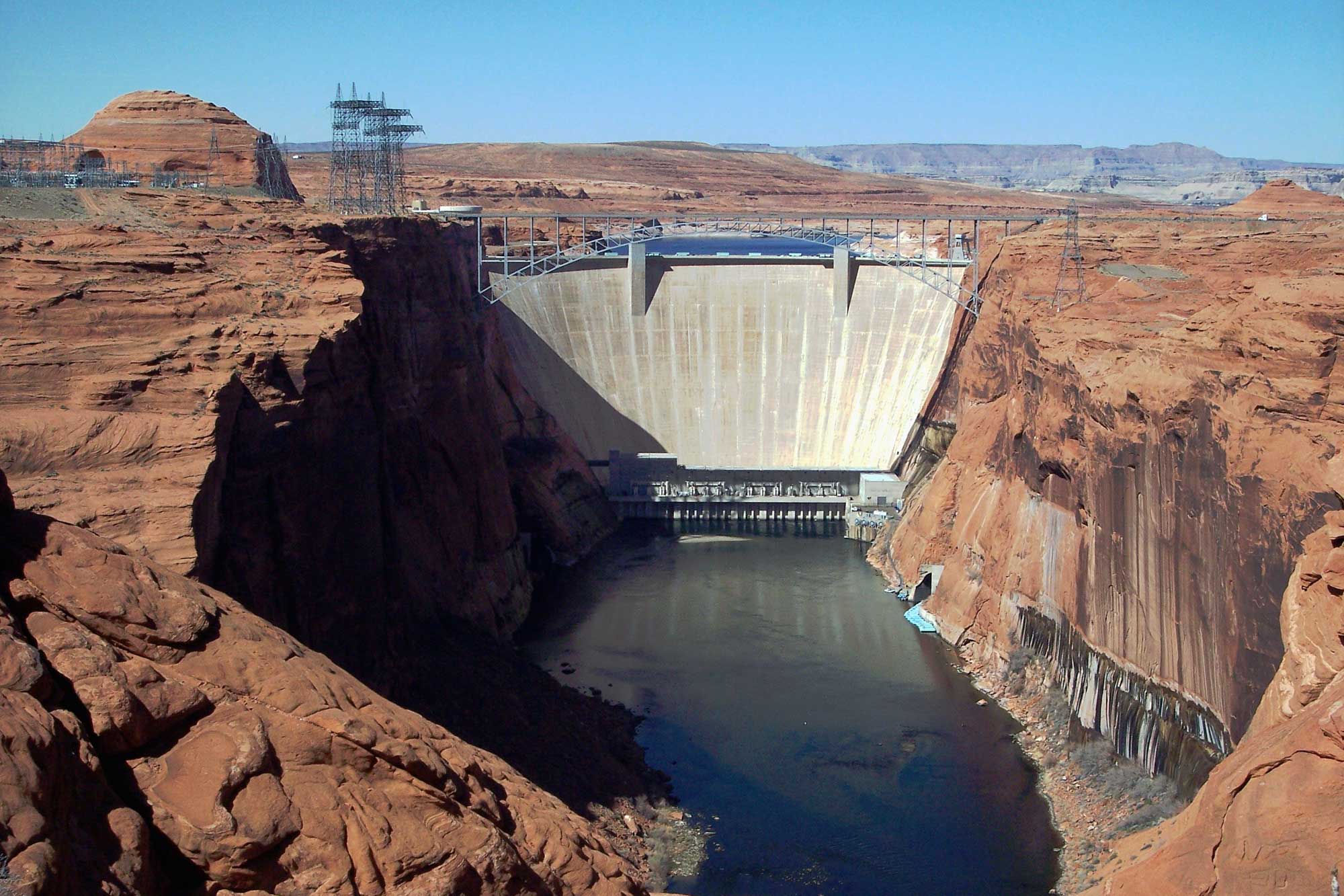
Glen Canyon Dam on the Colorado River, Arizona, 2010. Photo by Adbar (Wikimedia Commons, Creative Commons Attribution-ShareAlike 3.0 Unported license, image resized).
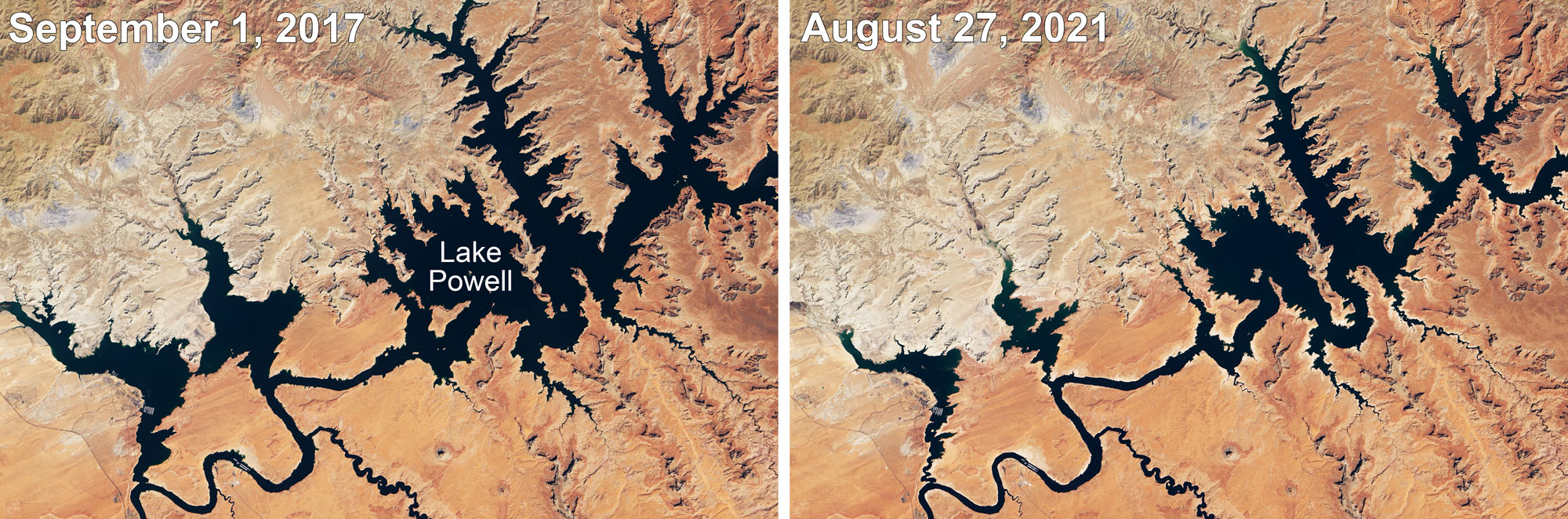
Lake Powell, the lake created by Glen Canyon Dam, at two points in time about four years apart. Photos by Lauren Dauphin, NASA Earth Observatory (used following NASA's image use policy).
Nuclear power
The Paradox Basin contains uranium in the Triassic and Jurassic fluvial sandstones of the Chinle and Morrison formations. Other deposits include breccia pipes in northwest Arizona, which are sediment-filled cavities in ancient karst terrain.
Uranium was actively mined in the second half of the 20th century as a source fuel for nuclear energy. Mining has significantly declined since, in part due to more stringent environmental regulations. Uranium mining and processing in the Four Corners area has continued irregularly in the late 20th and early 21st centuries, influenced primarily by uranium prices. Almost all uranium mined in the Southwest is exported; there are no nuclear power plants on the Colorado Plateau.
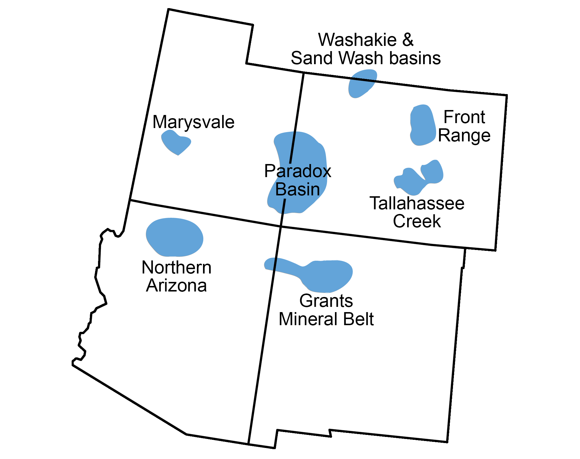
Distribution of uranium deposits in the southwestern U.S. Modified from a map by Andrielle Swaby (adapted from image by U.S. Energy Information Administration), originally published in he Teacher-Friendly Guide to the Earth Science of the Southwestern US.
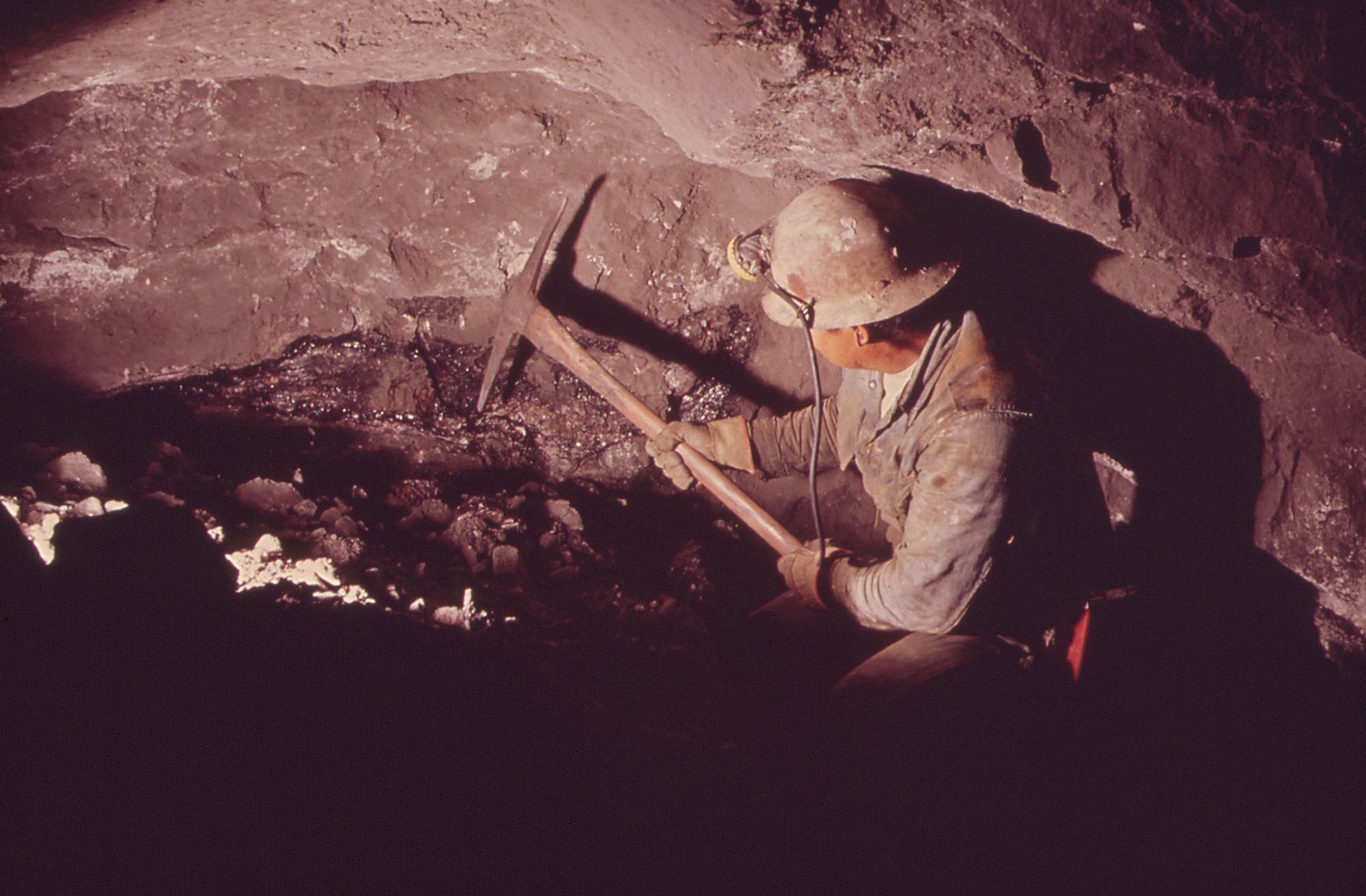
Uranium mining, Nucla, west-central Colorado, 1972. Photo by Bill Gillette, DOCUMERICA (U.S. National Archives Identifier 543775, unrestricted use).
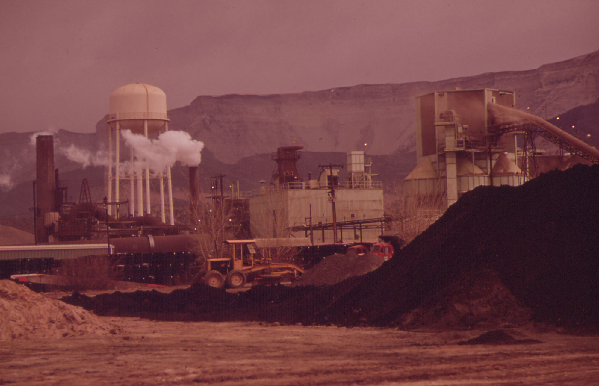
Union Carbide mill, Rifle, Colorado, 1972. This mill processed uranium until 1970 and vanadium until 1984. The mill has since been closed and the site remediated; solar panels have been installed on the site. Photo by Bill Gillette, DOCUMERICA (U.S. National Archives Identifier 543642, unrestricted use).
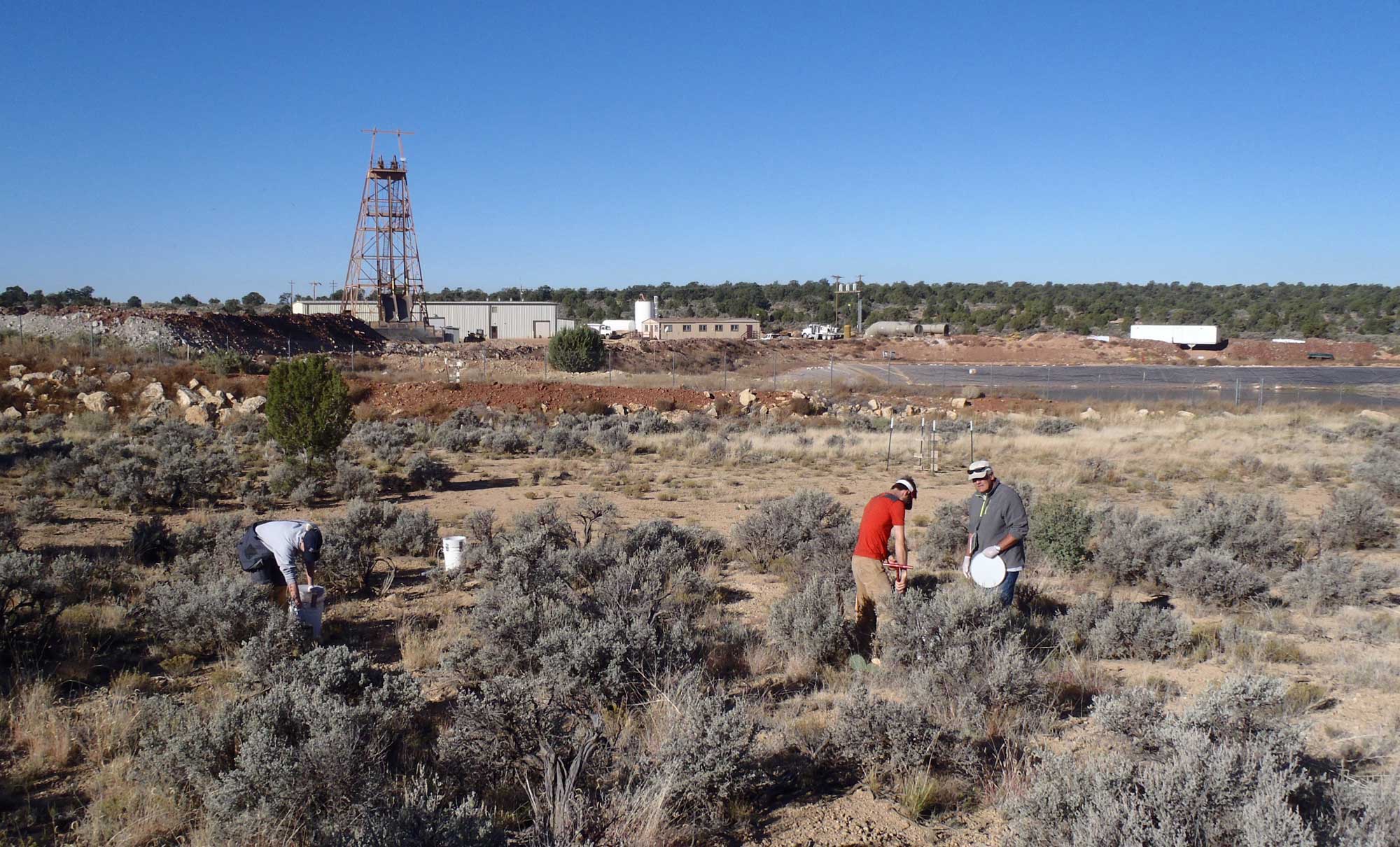
Pinenut Mine, a uranium mine located north of Grand Canyon National Park in Arizona, 2014. Original caption (USGS): "USGS Scientists Sarah Davis, Taylor Mills, and David Naftz collect soil samples near the Pinenut uranium mine. Mine features visible in the background include the gray ore stockpile at the far left, the head frame used to access the underground mine workings at mid left, and the detention pond containing all water produced on the mine site on the right." Photo by Katie Walton-Day, USGS (public domain).
Resources
Resources from the Paleontological Research Institution
Here on Earth: Introduction to Energy: https://earthathome.org/hoe/energy