Page snapshot: Alabama State Geologic Map; Fossil; Rock; Mineral; Gem; Highest and Lowest Elevations; Places to Visit; and Additional Resources.
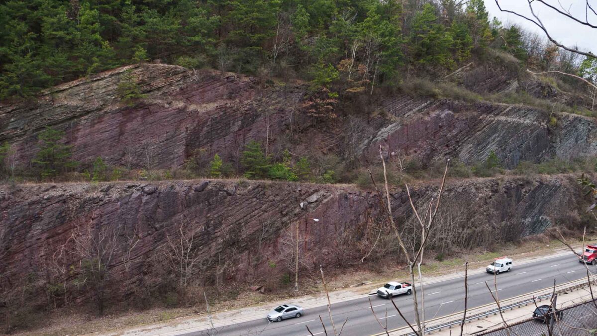
Image above:The Silurian strata of Red Mountain are exposed along this roadcut on the Red Mountain Expressway, near Birmingham, Alabama. Learn more here. Photograph by Greg Willis (Wikimedia Commons; Creative Commons Attribution-Share Alike 2.0 Generic license; image cropped and resized).
Geologic Map of Alabama
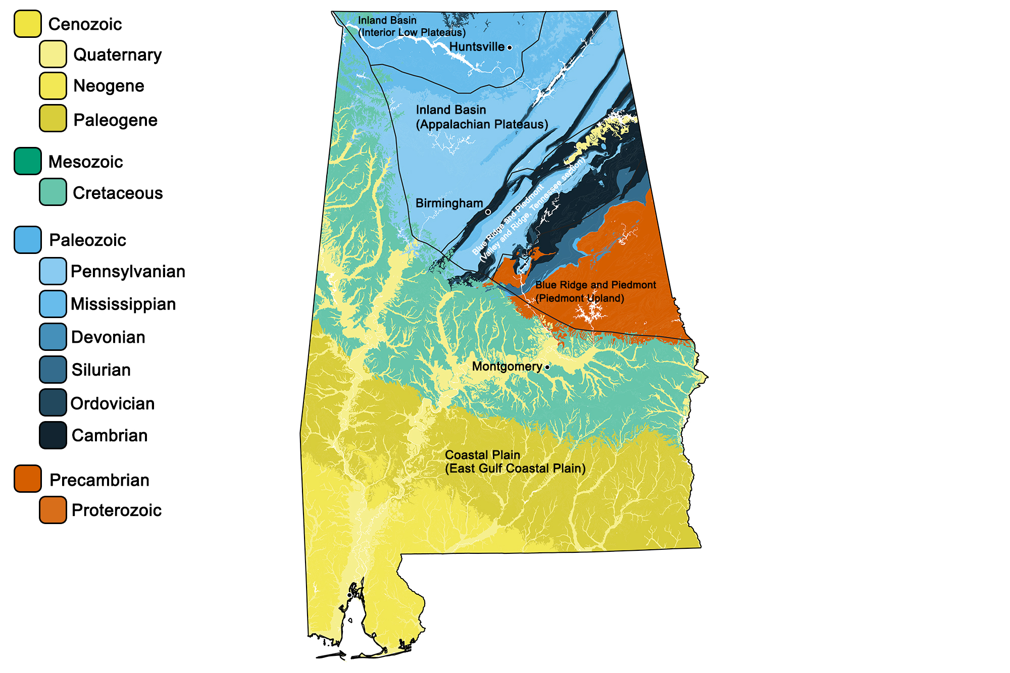
Geologic map of Alabama showing maximum ages of mappable units. Image by Jonathan R. Hendricks for the Earth@Home project developed using QGIS and USGS data (public domain) from Fenneman and Johnson (1946) and Horton et al. (2017).
Alabama State Fossil: Basilosaurus cetoides
Basilosaurus was an ancient whale. Learn more about this ancient whale and its relatives here.
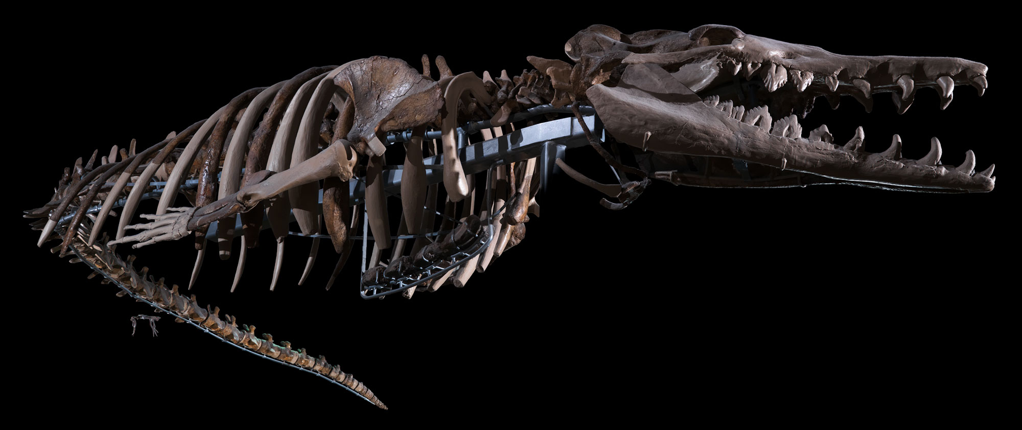
An basilosaurid whale (Basilosaurus cetoides) from the Eocene of Alabama. Basilosaurus cetoides is the largest basilosaurid, reaching about 16 m (52.5 ft) long. Specimen on display at the National Museum of Natural History in Washington, D.C. Photo of (USNM V4675) by the Smithsonian Institution (CC0/public domain).
Alabama State Rock: Marble
Also known as Sylacuaga marble, Alabama's marble has been called the "world's whitest" and has been used in sculpture and architecture throughout the United States for over 160 years. This metamorphic rock formed after limestone was put under immense pressure during the Taconic Orogeny.

The exterior of the Dime Savings Bank in Brooklyn, New York is built from Alabama's Sylacuaga marble. Photograph by "Beyond My Ken" (Wikimedia Commons; Creative Commons Attribution-ShareAlike 4.0 International license).
Alabama State Mineral: Hematite
Hematite, also called red iron ore, crystallizes from the reaction of dissolved iron and oxygen. Roughly 375 million tons of hematite were mined in central and eastern Alabama between 1840 and 1975.
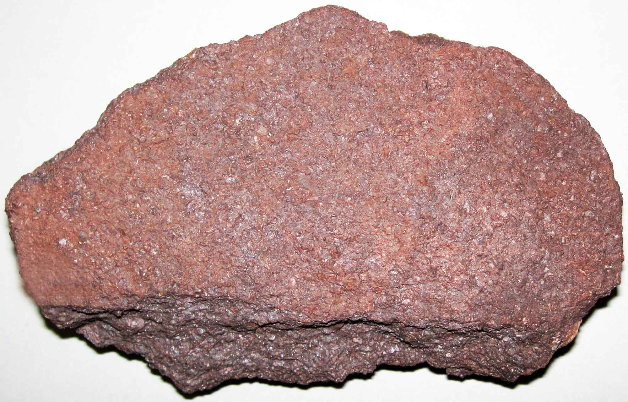
Sample of Silurian-aged red iron ore from New York. Samples of similar age and appearance are found in Alabama. Photograph by James St. John (Flickr; Creative Commons Attribution 2.0 Generic license; image resized).
Alabama State Gem: Star Blue Quartz
Although quartz is a common silicate mineral, star blue quartz has an uncommon color derived from the presence of amphibole within the crystal structure. This stone occasionally exhibits asterism, or the reflection of a star-like shape when polished.
Alabama's Highest and Lowest Elevations
Highest Elevation: Cheaha Mountain
Alabama's highest point is Cheaha Mountain, a 735-meter-high (2413-foot-high) mountain in the Talladega Mountains, the southernmost segment of the Blue Ridge. Thanks to its tall relief, today the mountain is host to a variety of radio antennas and TV transmitters.
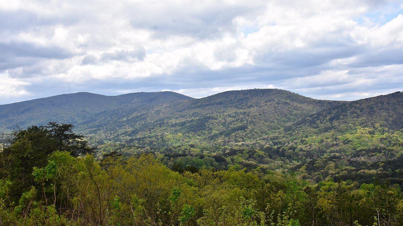
Photograph of Cheaha Mountain, the highest point in Alabama. Photograph by Skye Marthaler (Wikimedia Commons; Creative Commons Attribution-ShareAlike 4.0 International license).
Lowest Elevation: Gulf of Mexico Shoreline
The state's lowest point is the shore of the Gulf of Mexico, which lies at sea level.

Gulf Shores, Alabama. Photograph by "faungg" (Flickr; Creative Commons Attribution-NoDerivs 2.0 Generic license).
Places to Visit
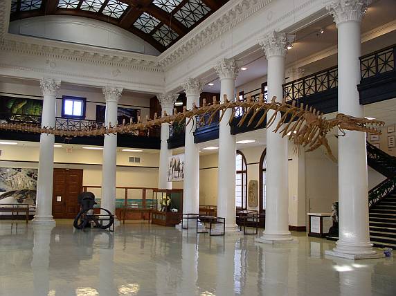
Inside the Alabama Museum of Natural History. Photograph by Michael Dressler (Flickr; Creative Commons Attribution-NonCommercial-NoDerivs 2.0 Generic license).
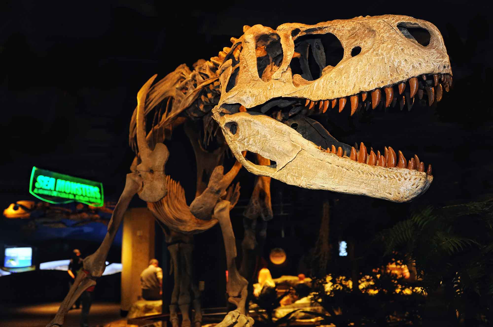
The dinosaur Appalachiosaurus on display at the McWane Science Center. Photograph by Ralph Daily (Flickr; Creative Commons Attribution 2.0 Generic license).
Additional resources