

Page snapshot: Arizona State Geologic Map; Fossil; Rock; Mineral; Metal; Gem; Highest and Lowest Elevations; Places to Visit; and Additional Resources.
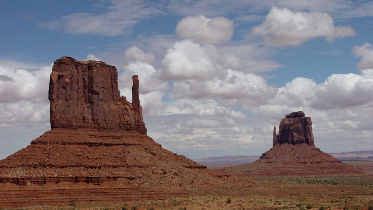
Image above:West Mitten Butte (left) and East Mitten Butte (right) at Monument Valley (Tsé BiiʼNdzisgaii) on the land of the Navajo Nation Reservation in Arizona. These spectacular rock formations are a result weathering and erosion. Photograph by Jonathan R. Hendricks.
Geologic Maps of Arizona
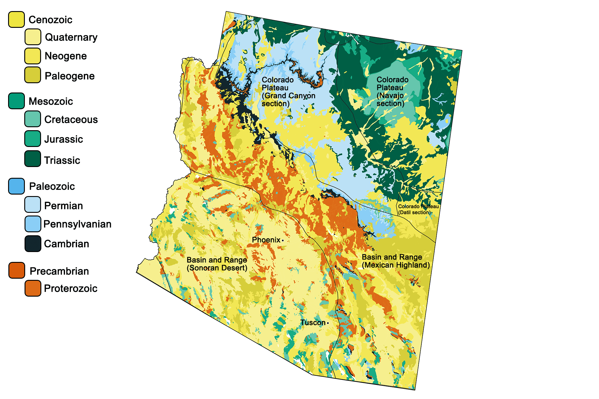
Geologic map of Arizona showing maximum ages of mappable units. Image by Jonathan R. Hendricks for the Earth@Home project developed using QGIS and USGS data (public domain) from Fenneman and Johnson (1946) and Horton et al. (2017).
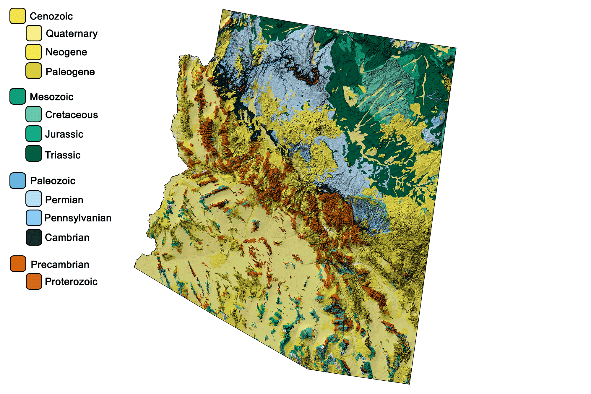
Geologic and topographic map of Arizona. Geologic data from Horton et al. (2017) using the maximum age values for each mapped unit. Topographic data are derived from the Shuttle Radar Topography Mission (SRTM GL3) Global 90m (SRTM_GL3) (Farr, T. G., and M. Kobrick, 2000, Shuttle Radar Topography Mission produces a wealth of data. Eos Trans. AGU, 81:583-583).
Arizona State Fossil: Araucarioxylon arizonicum
Arizona's state fossil is Triassic-aged petrified wood called Araucarioxylon arizonicum, a type of conifer.
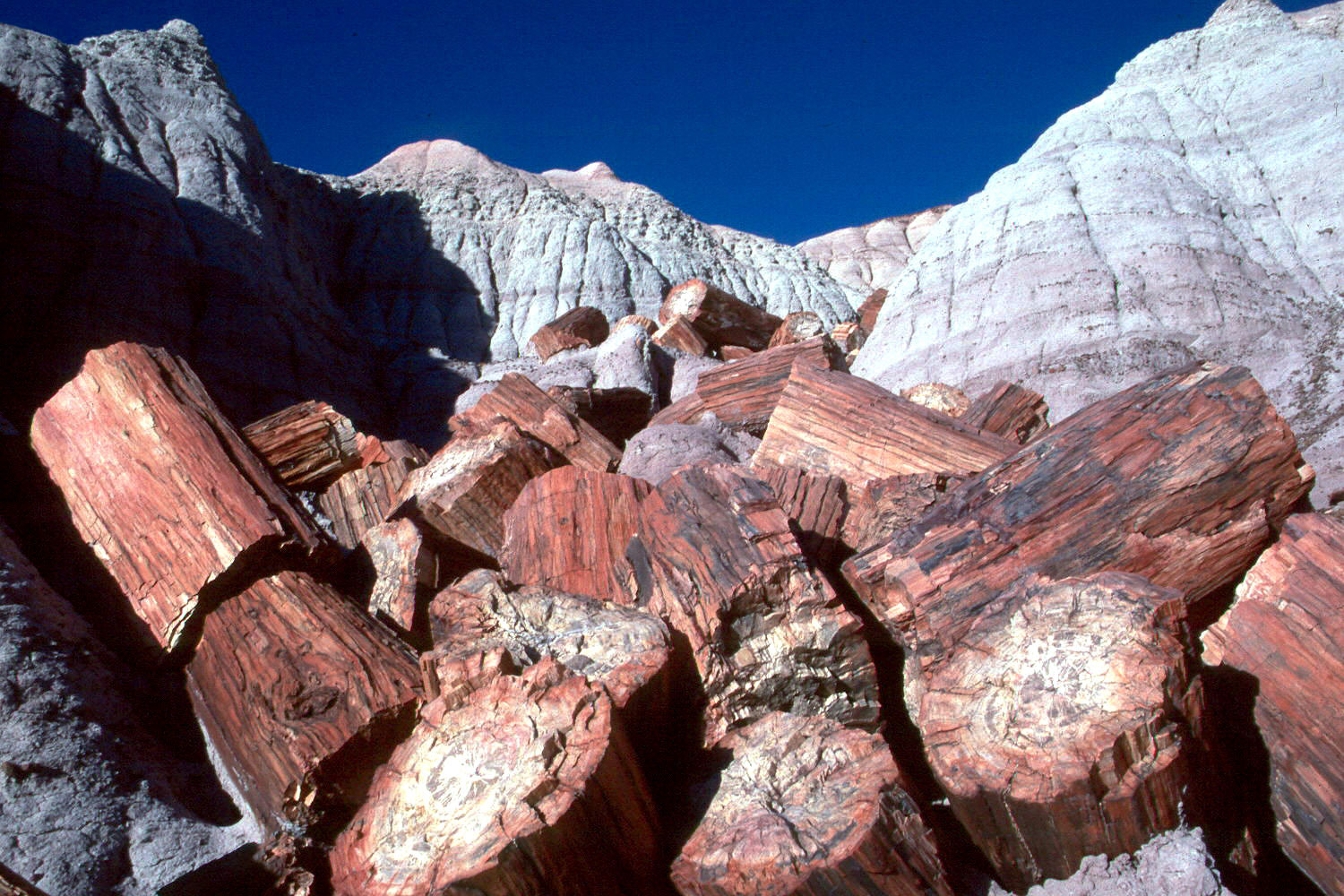
A pile of large logs from the Triassic Chinle Formation, Petrified Forest National Park, Arizona. Most fossil wood at the park is assigned to a species of conifer (Araucarioxylon arizonicum). Photo by T. Scott Williams (National Park Service, public domain).
Arizona State Rock: None.
Arizona does not have an official state rock. What do you think it should be? Answer in the comments!
Arizona State Mineral: Wulfenite
Wulfenite, a lead molybdate, became the state mineral of Arizona in 2017. Learn more about Arizona's state mineral here.
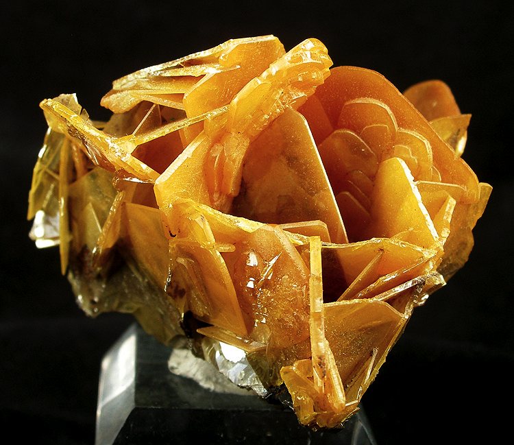
Wulfenite from the Glove Mine of Santa Cruz County, Arizona. Photograph by Robert M. Lavinsky (Wikimedia Commons; Creative Commons Attribution-ShareAlike 3.0 Unported license).
Arizona State Metal: Copper.
Arizona has an official state metal: copper. Copper mining has been a major industry in Arizona since the 19th century. The state has six of the 10 largest copper mines in the United States, including the Morenci mine in Greenlee County, Arizona, which is the largest in the country. In 2007, Arizona produced 60% of the country’s copper.
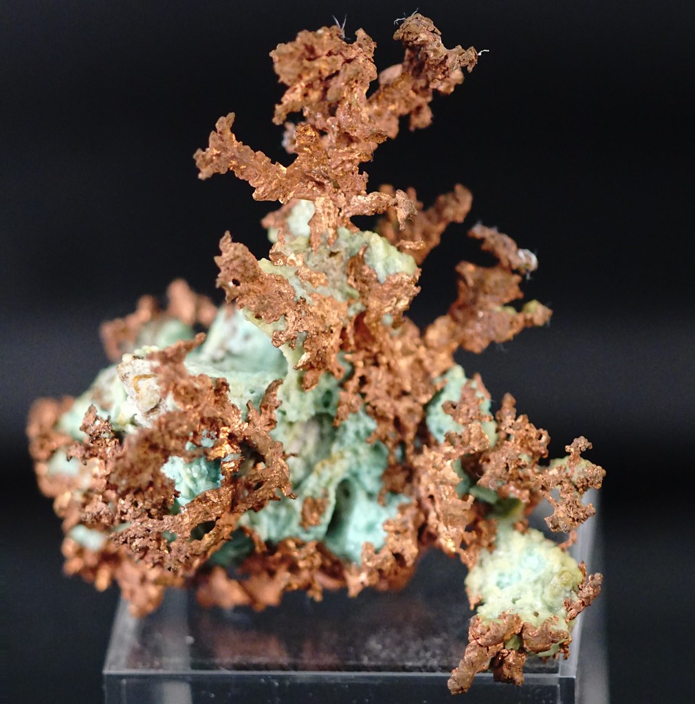
Sample of native copper from Greenlee County, Arizona. Photograph by "Tjflex2" (Flickr; Creative Commons Attribution-NoDervis 2.0 Generic license).
Arizona State Gem: Turquoise
Arizona is a major producer of turquoise, an opaque, blue-green mineral that has been popular in Native American jewelry for centuries. It contains copper and is often found in abundance near copper deposits. Arizona is currently the leading U.S. state for turquoise production.
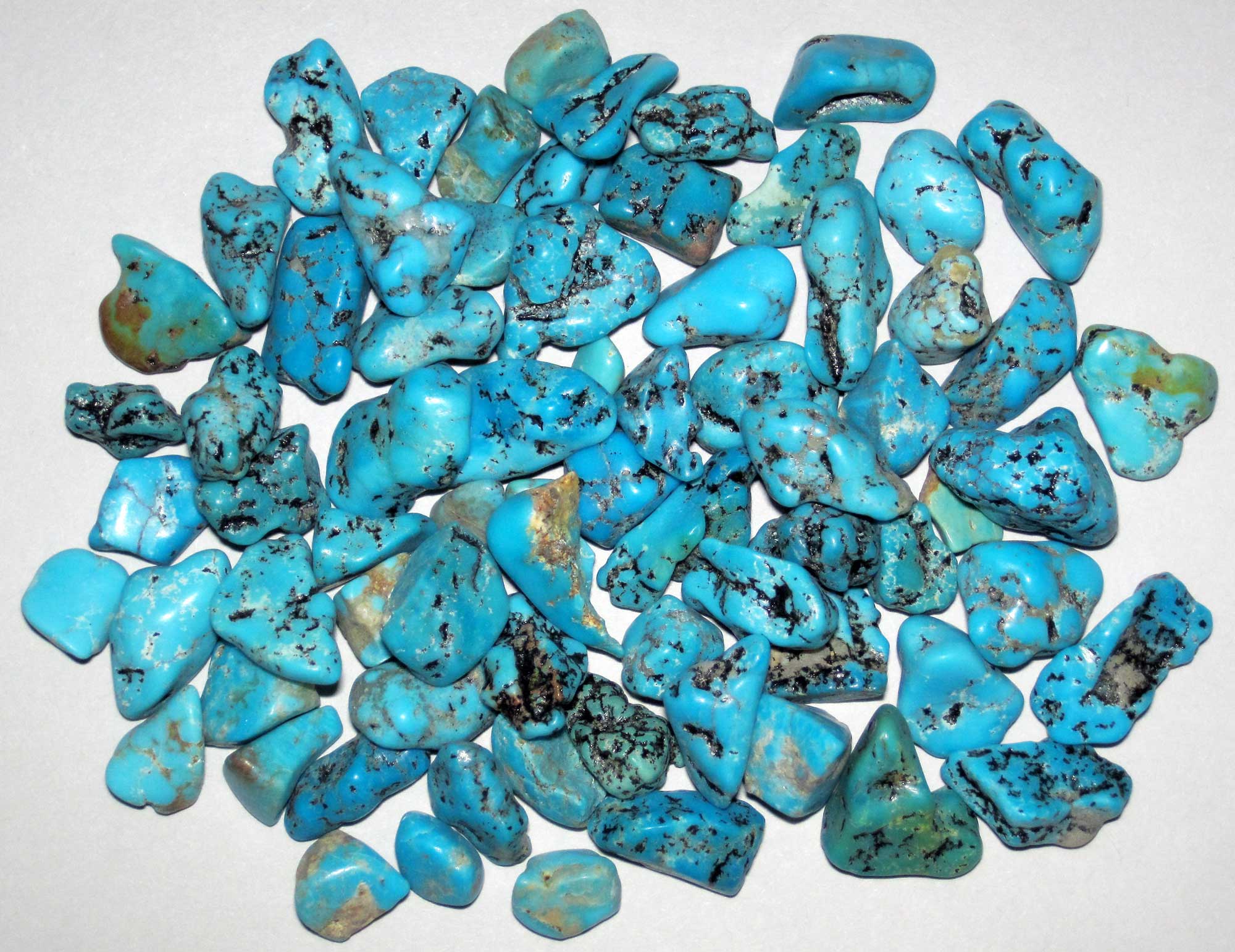
Polished pieces of turquoise from the Kingman Mining District of Arizona. Photograph by James St. John (Flickr; Creative Commons Attribution 2.0 Generic license; image resized).
Arizona's Highest and Lowest Elevations
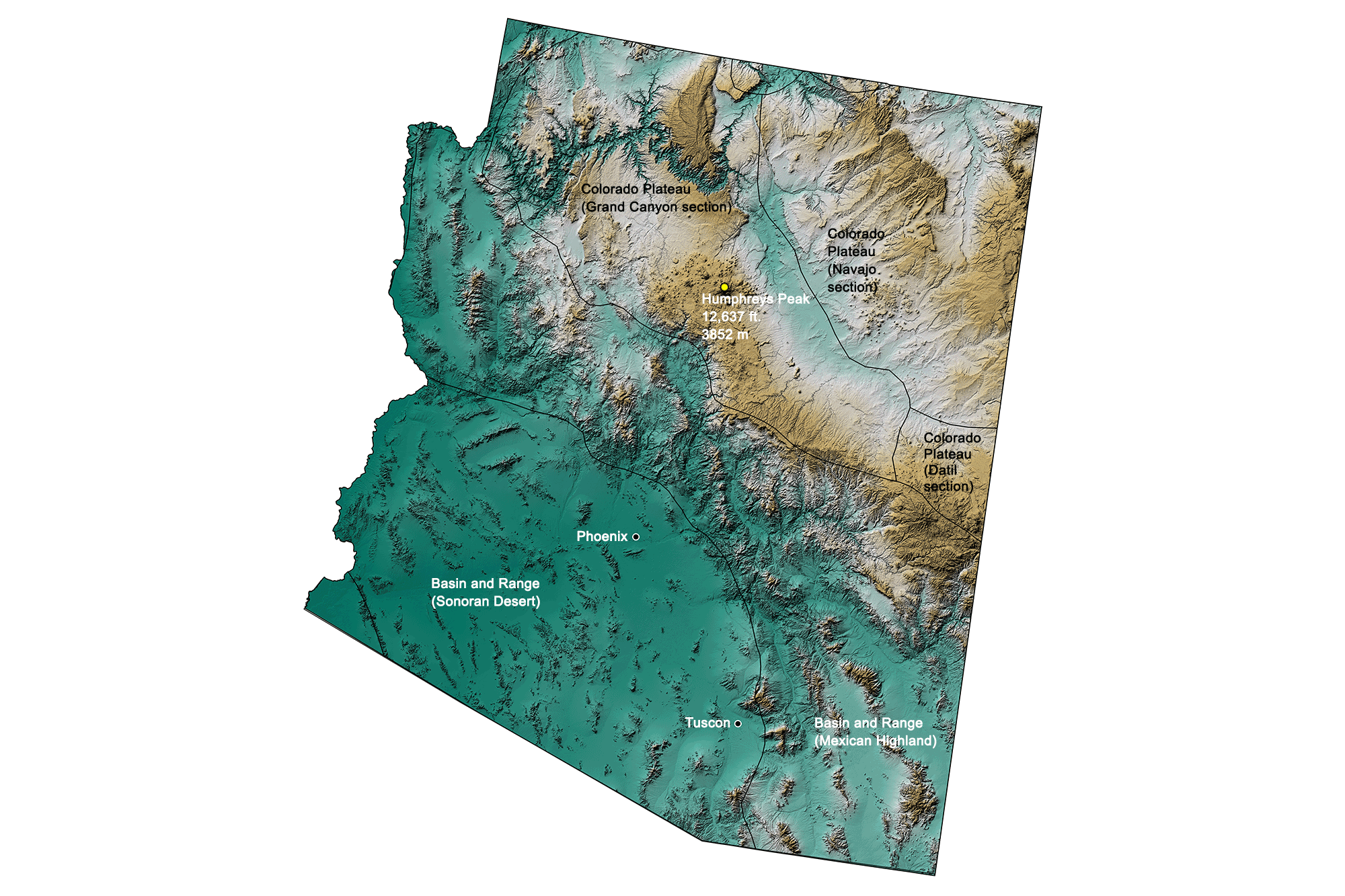
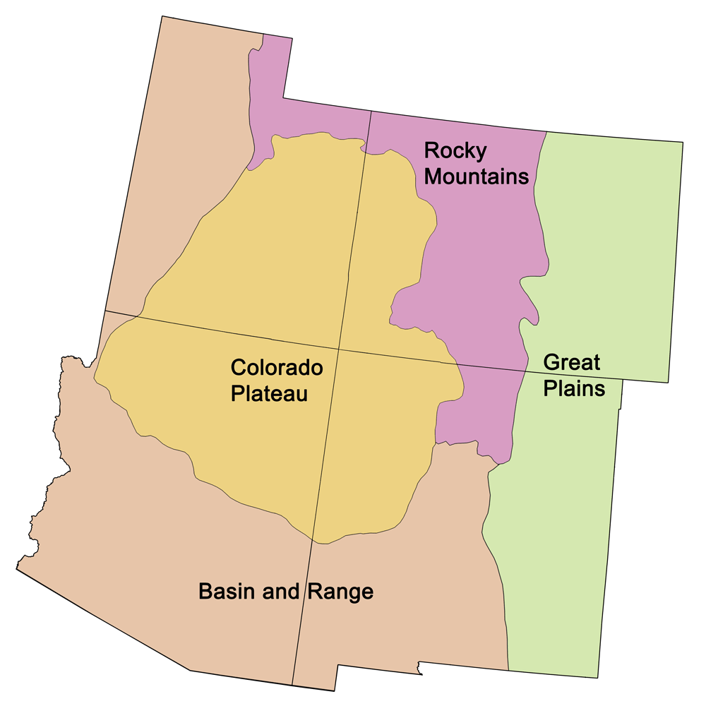
Topographic map of Arizona with physiographic regions and point of highest elevation identified. Topographic data are derived from the Shuttle Radar Topography Mission (SRTM GL3) Global 90m (SRTM_GL3) (Farr, T. G., and M. Kobrick, 2000, Shuttle Radar Topography Mission produces a wealth of data. Eos Trans. AGU, 81:583-583).
Highest Elevation: Humphreys Peak
Arizona’s highest point is Humphreys Peak, a 3852-meter-high (12,637-foothigh) mountain in the Kachina Peaks Wilderness 18 kilometers (11 miles) north of Flagstaff. It is the highest of the San Francisco Peaks, remnants of an extinct stratovolcano.
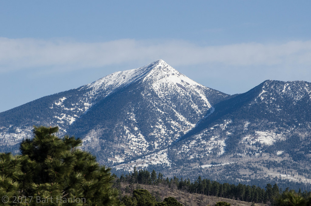
Humphreys Peak, Arizona. Photograph by Bart Hanlon (Flickr; Creative Commons Attribution-NonCommercial-NoDerivs 2.0 Generic license).
Lowest Elevation: Colorado River
The state’s lowest point is along the Colorado River near San Luis, which lies at only 22 meters (72 feet) above sea level.
Places to Visit
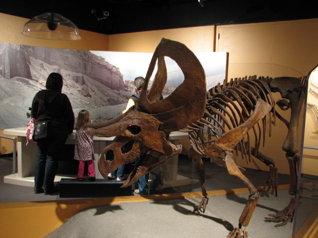
Displays inside the Arizona Museum of Natural History. Photograph by "Famresearch2009" (Flickr; Creative Commons Attribution-NonCommercial-NoDerivs 2.0 Generic license).
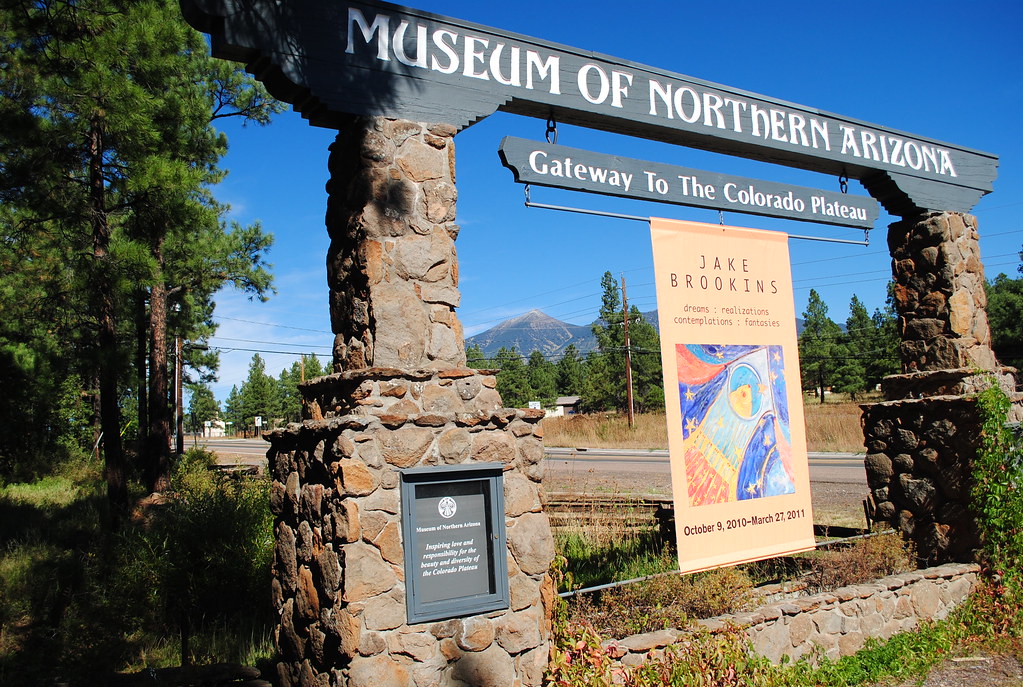
Welcome sign of the Museum of Northern Arizona. Photograph by "appaloosa" (Flickr; Creative Commons Attribution-NonCommercial-NoDerivs 2.0 Generic license).
"VISITORS WELCOME" | Alfie Norville Gem & Mineral Museum" by The University of Arizona (YouTube).
Grand Canyon National Park
Northern Arizona. Find out how the Grand Canyon formed here on Earth@Home.
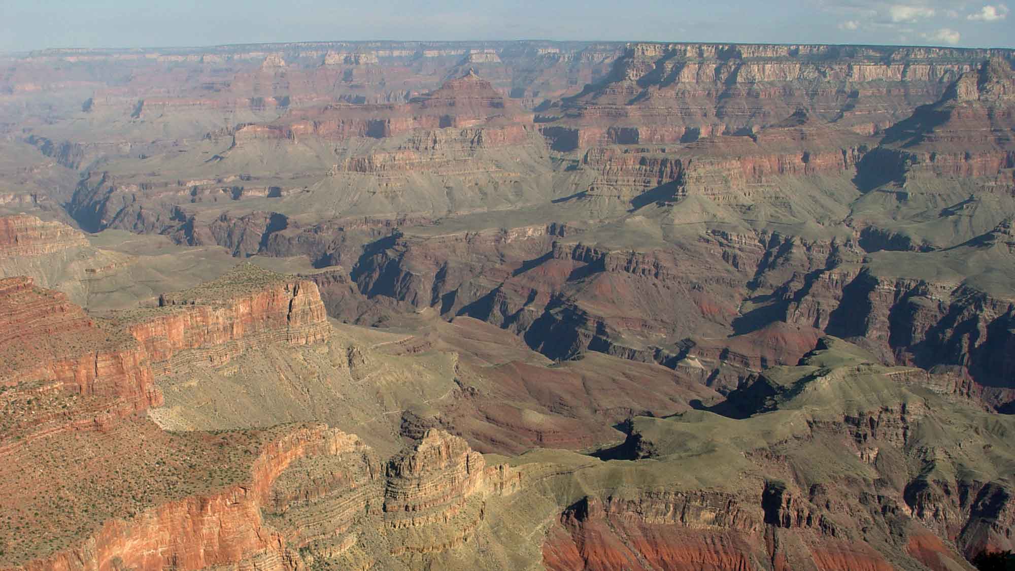
The Grand Canyon, Arizona. Photograph by Jonathan R. Hendricks.
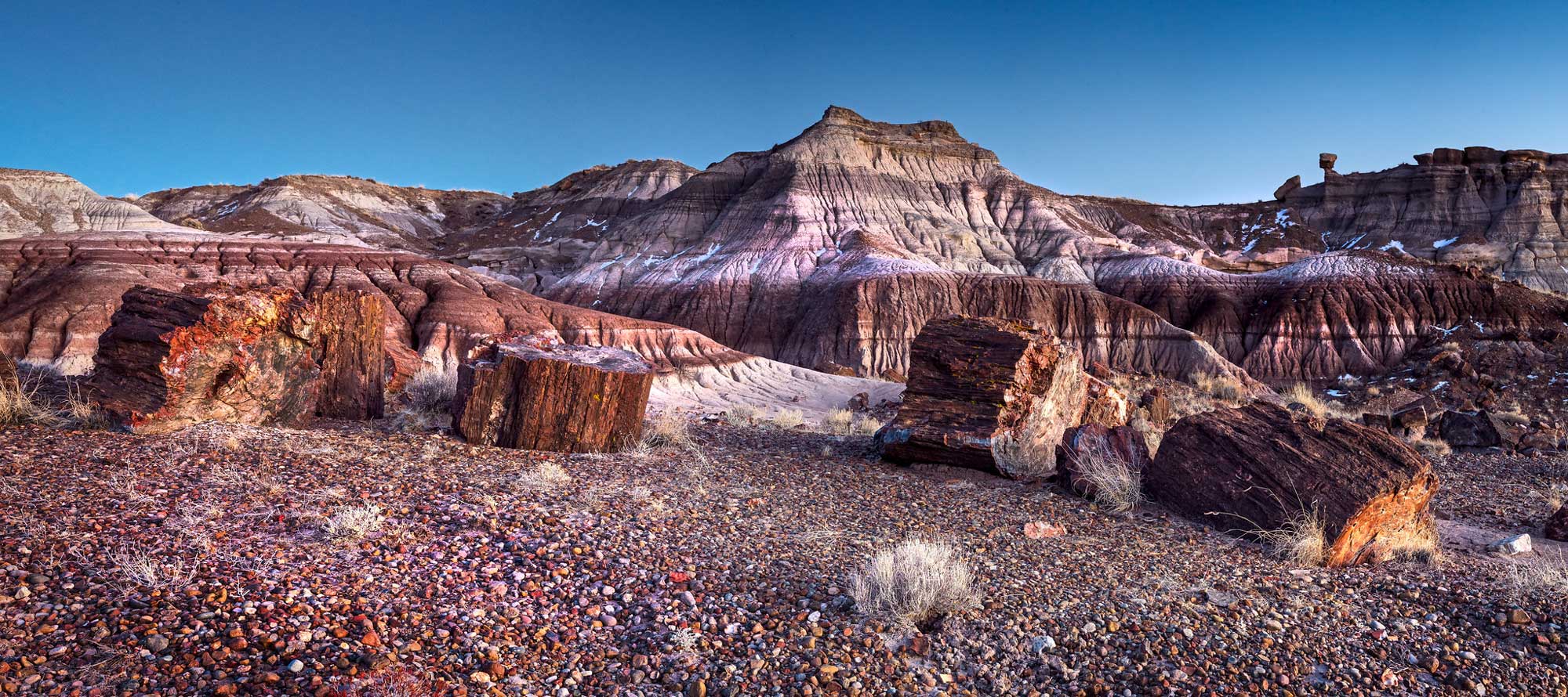
Exposure of the Triassic Chinle Formation at Petrified Forest National Park in Arizona, with petrified wood in the foreground. Photograph by Andrew Kearns (Flickr; Creative Commons Attribution 2.0 Generic license; image resized).
Additional resources
Comments 1
Hope you can update the Arizona state mineral. It was voted on in 2017 and is officially wulfenite. (https://ammnre.arizona.edu/news/2019/08/featured-mineral-wulfenite) You have copper listed here. Copper is the Arizona state metal.
Also, we hope you can add the newly opened Alfie Norville Gem & Mineral Museum located in downtown Tucson to your list of museums. https://gemandmineralmuseum.arizona.edu/