Page snapshot: Colorado State Geologic Map; Fossil; Rock; Mineral; Gem; Highest and Lowest Elevations; Places to Visit; and Additional Resources.
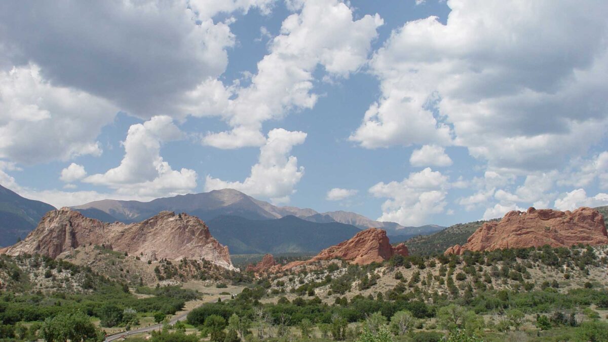
Image above: Late Paleozoic and Mesozoic-aged rock formations at Garden of the Gods in Colorado Springs, Colorado; photograph by Jonathan R. Hendricks.
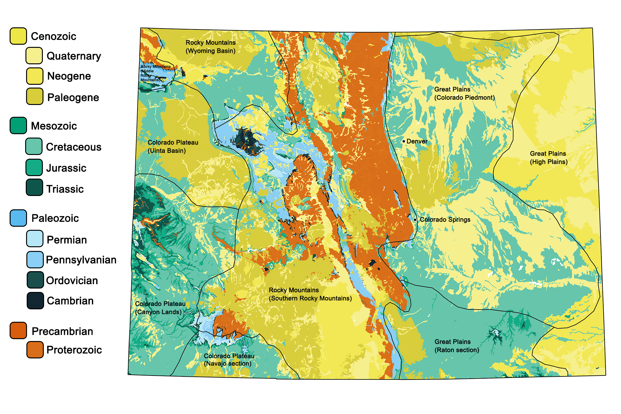
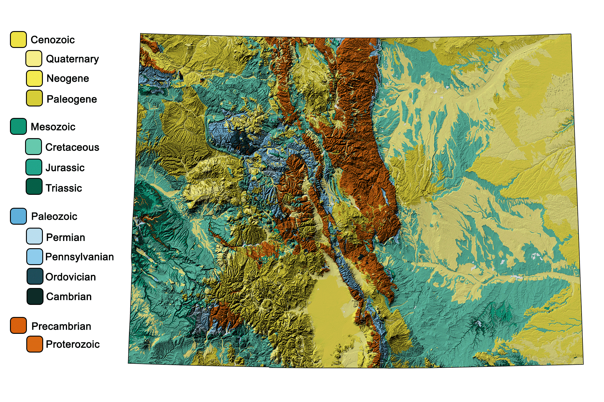
Geologic Maps of Colorado
Geologic map of Colorado showing maximum ages of mappable units. Image by Jonathan R. Hendricks for the Earth@Home project developed using QGIS and USGS data (public domain) from Fenneman and Johnson (1946) and Horton et al. (2017).
Geologic and topographic map of Colorado. Geologic data from Horton et al. (2017) using the maximum age values for each mapped unit. Topographic data are derived from the Shuttle Radar Topography Mission (SRTM GL3) Global 90m (SRTM_GL3) (Farr, T. G., and M. Kobrick, 2000, Shuttle Radar Topography Mission produces a wealth of data. Eos Trans. AGU, 81:583-583).
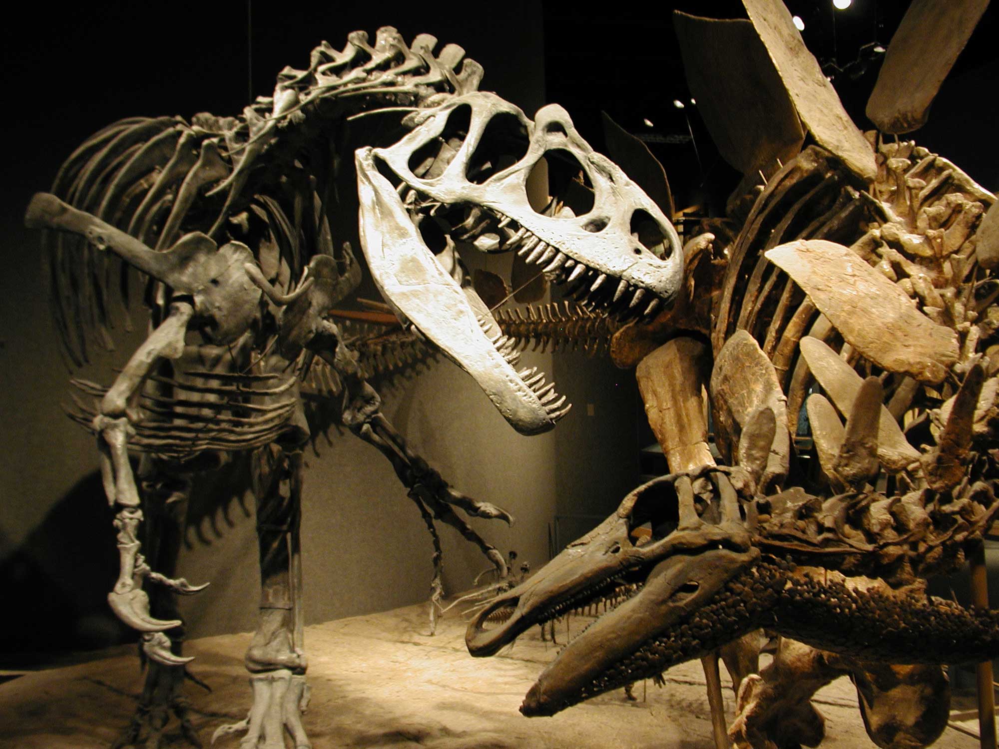
Colorado's State Fossil: Stegosaurus stenops
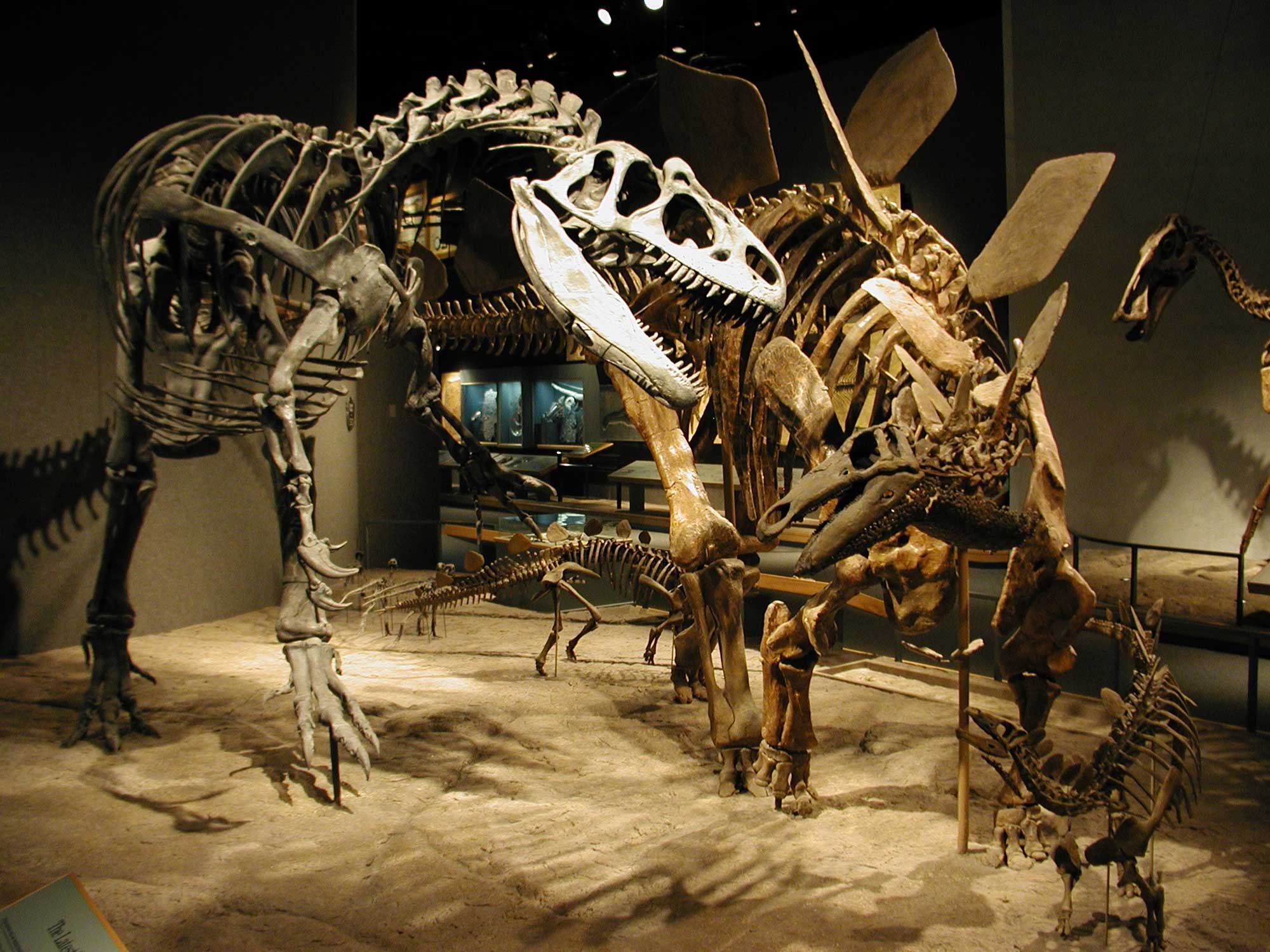
Colorado's official state fossil is the iconic Jurassic plated dinosaur Stegosaurus stenops.
Adult Stegosaurus stenops defending its young from an attacking Allosaurus, Denver Museum of Nature and Science. Photograph by Jonathan R. Hendricks.
Colorado's State Rock: Yule Marble
Yule Marble is found in the Yule Creek Valley in the West Elk Mountains of Colorado. This white, crystalline marble is composed of 99.5% calcite. It has been used in the construction of a number of prominent buildings and monuments.
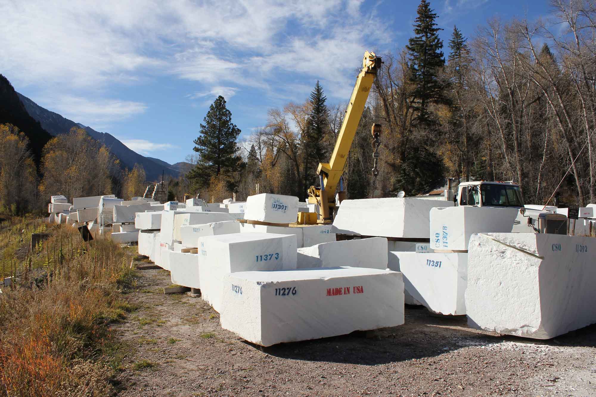
Blocks of quarried Yule Marble. Photograph by Jeffrey Beall (Flickr; Creative Commons Attribution-ShareAlike 2.0 Generic license; image resized).
Colorado's State Mineral: Rhodochrosite
Rhodochrosite is a deep red to rose pink carbonate mineral found in association with Colorado’s gold, silver, lead, zinc, and molybdenum ores. The world’s largest rhodochrosite crystal is on display at the Denver Museum of Nature and Science. Because rhodochrosite is so specifically associated with Colorado, it was chosen as the state mineral over other common minerals such as gold and silver.
Interactive 3D model. Sample of rhodochrosite from Alma, Colorado. Model by Benoît Rogez (Sketchfab).
Colorado's State Gem: Aquamarine
Aquamarine is a blue-colored variety of the mineral beryl. It was first discovered in 1881 on Mount Antero, in the Rockies of central Colorado. The state continues to be a major producer of gem-quality aquamarine.
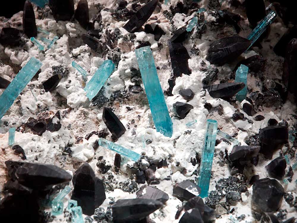
Aquamarine crystals in a sample on display at the Denver Museum of Nature and Science. Photograph by Sam Wise (Flickr; Creative Commons Attribution-NonCommercial-ShareAlike 2.0 Generic license; image resized).
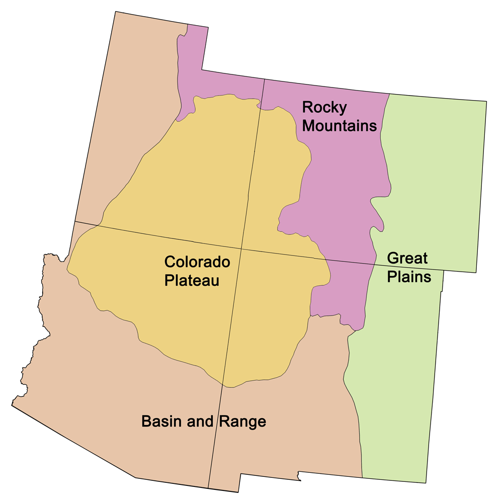
Colorado's Highest and Lowest Elevations
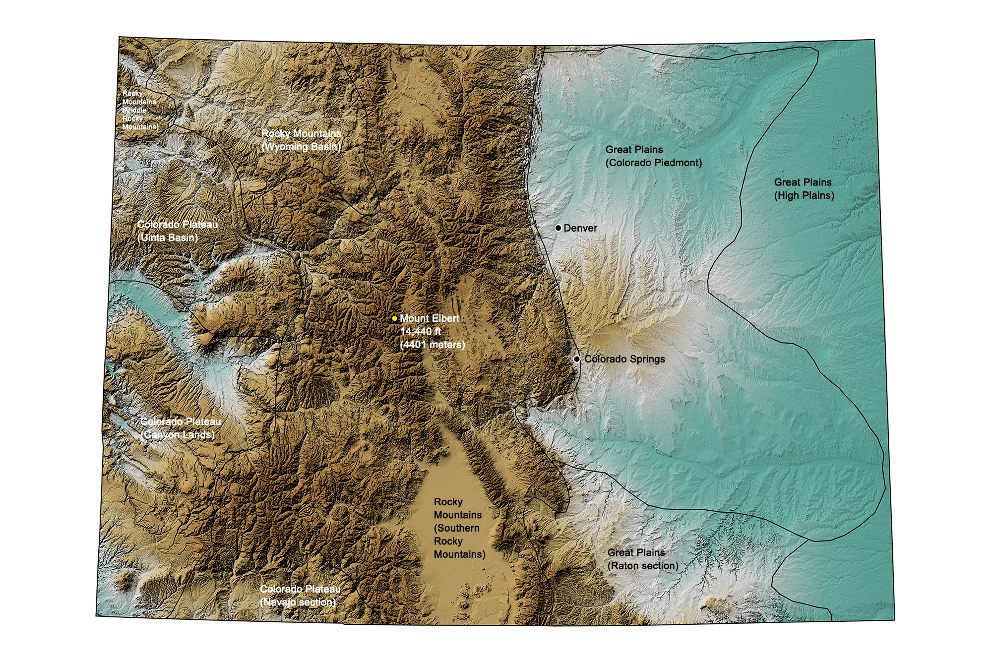
Topographic map of Colorado with physiographic regions and point of highest elevation identified. Topographic data are derived from the Shuttle Radar Topography Mission (SRTM GL3) Global 90m (SRTM_GL3) (Farr, T. G., and M. Kobrick, 2000, Shuttle Radar Topography Mission produces a wealth of data. Eos Trans. AGU, 81:583-583).
Highest Elevation: Mount Elbert
Mount Elbert, rising 4401 meters (14,440 feet) above sea level, is Colorado’s highest point as well as the highest summit in the North American Rockies. The mountain, located 19 kilometers (12 miles) southwest of Leadville, is also the second-highest summit in the continental United States.
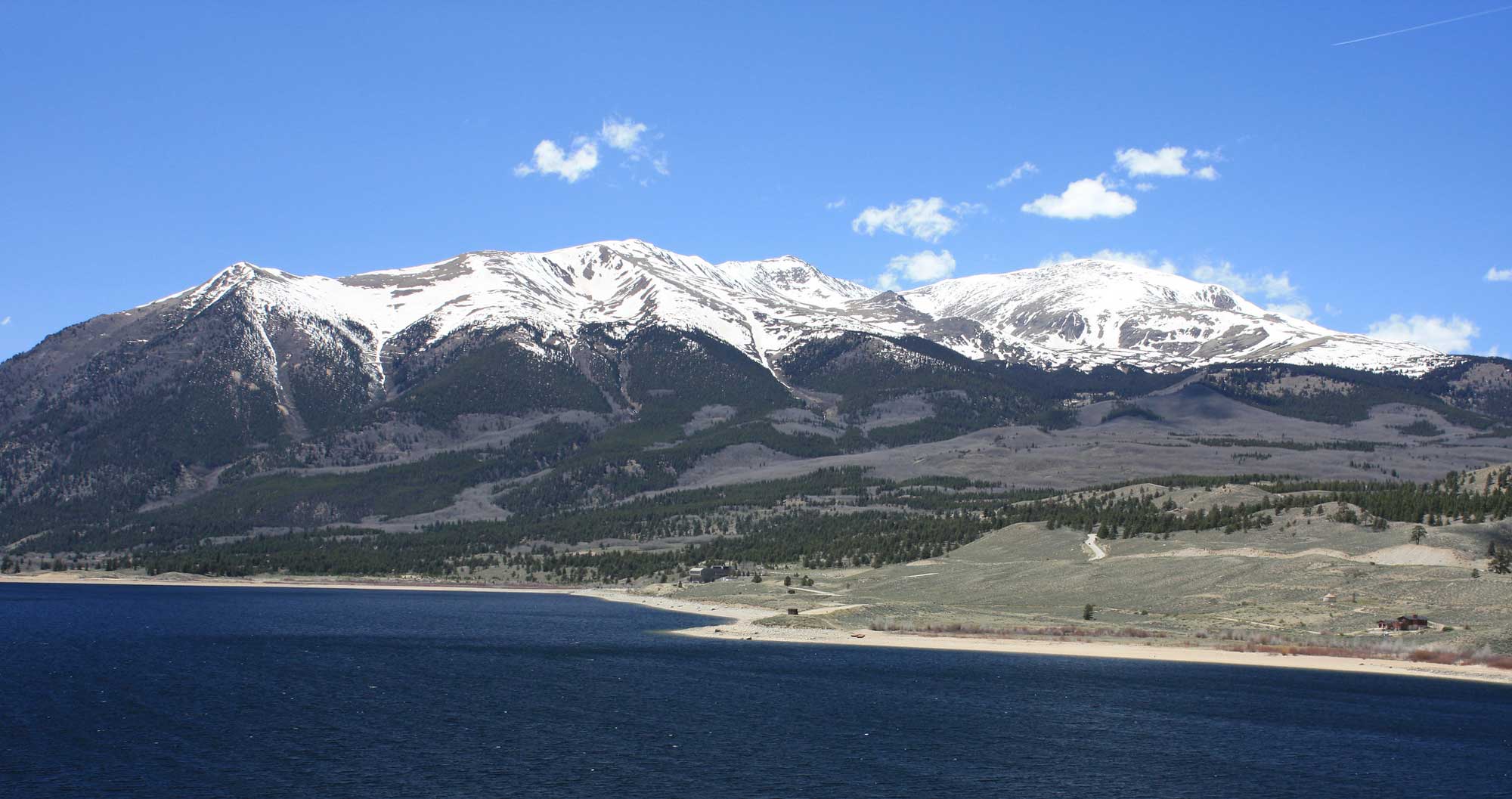
Mount Elbert, Colorado. Photograph by David Herrera (Flickr; Creative Commons Attribution 2.0 Generic license; image resized).
Lowest Elevation: Arikaree River
The lowest point in Colorado is found on the Arikaree River where it flows into Kansas, at an elevation of 1011 meters (3317 feet). This spot is also the highest low point of any U.S. state.
Places to Visit
Fossil skeletons of Allosaurus and Stegosaurus on display in the Denver Museum of Nature and Science. Photograph by Jonathan R. Hendricks.
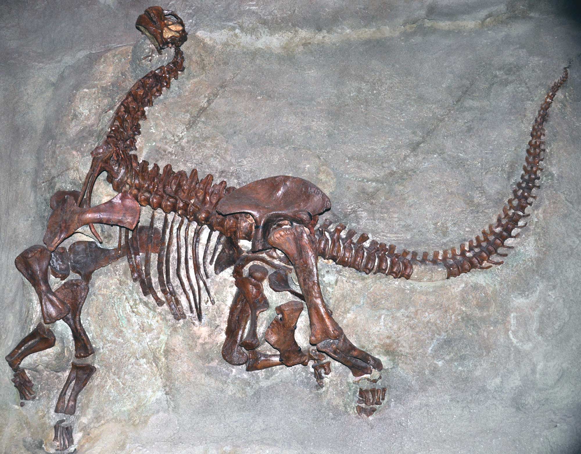
Skeleton of a juvenile Camarosaurs lentus, a type of sauropod, from the Carnegie Quarry, Jurassic Morrison Formation, Dinosaur National Monument, Utah and Colorado. Photo by James St. John (flickr, Creative Commons Attribution 2.0 Generic license, image cropped and resized).
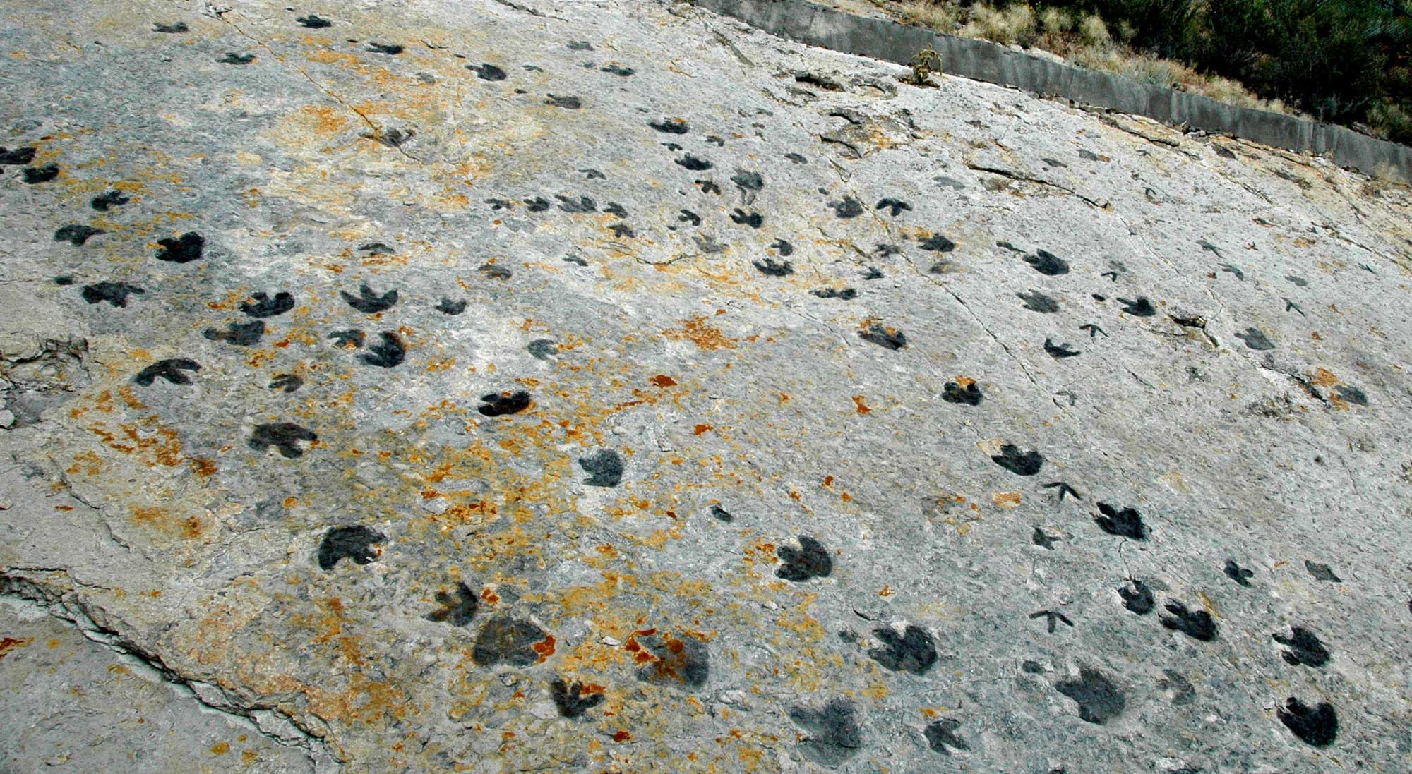
Dinosaur footprints in the Cretaceous Dakota Sandstone at Dinosaur Ridge, Colorado. Photograph by James St. John (Flickr; Creative Commons Attribution 2.0 Generic license; image resized).
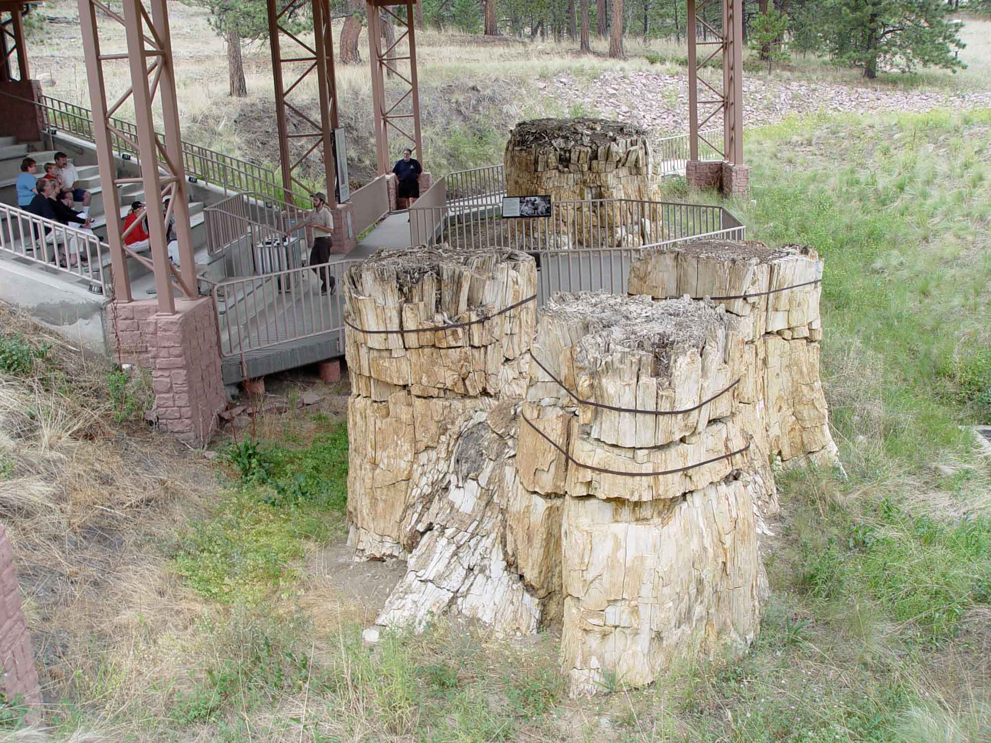
Fossilized stump of a redwood tree at Florissant Fossil Beds, Florissant, Colorado. Photograph by Jonathan R. Hendricks.
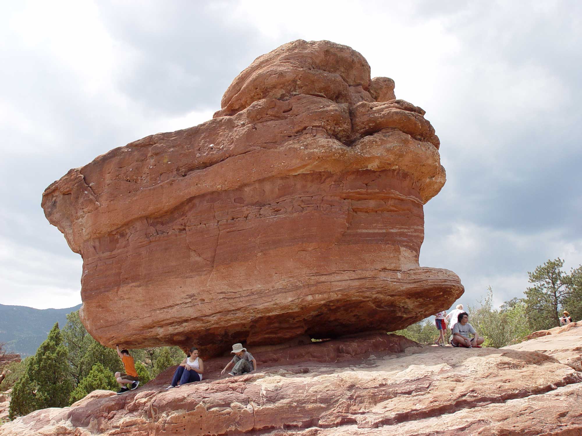
Balanced Rock at Garden of the Gods, Colorado Springs, Colorado. Photograph by Jonathan R. Hendricks.
Additional resources