

Page snapshot: West Virginia State Geologic Map; Fossil; Rock; Mineral; Gem; Highest and Lowest Elevations; Places to Visit; and Additional Resources.
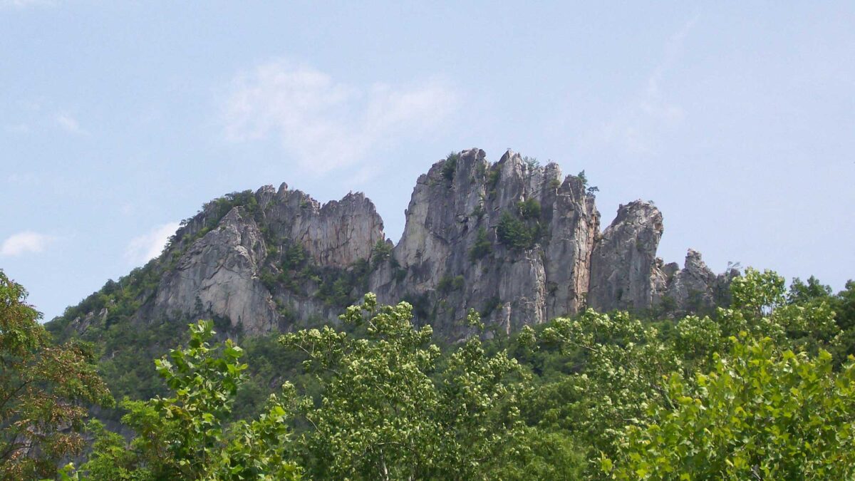
Image above: Sharp ridges of erosion-resistant, Silurian-aged Tuscarora Sandstone exposed at Seneca Rocks, West Virginia. Photograph by Ethan Gruber (Flickr; Creative Commons Attribution-ShareAlike 2.0 Generic license; image cropped and resized).
Geologic Map of West Virginia
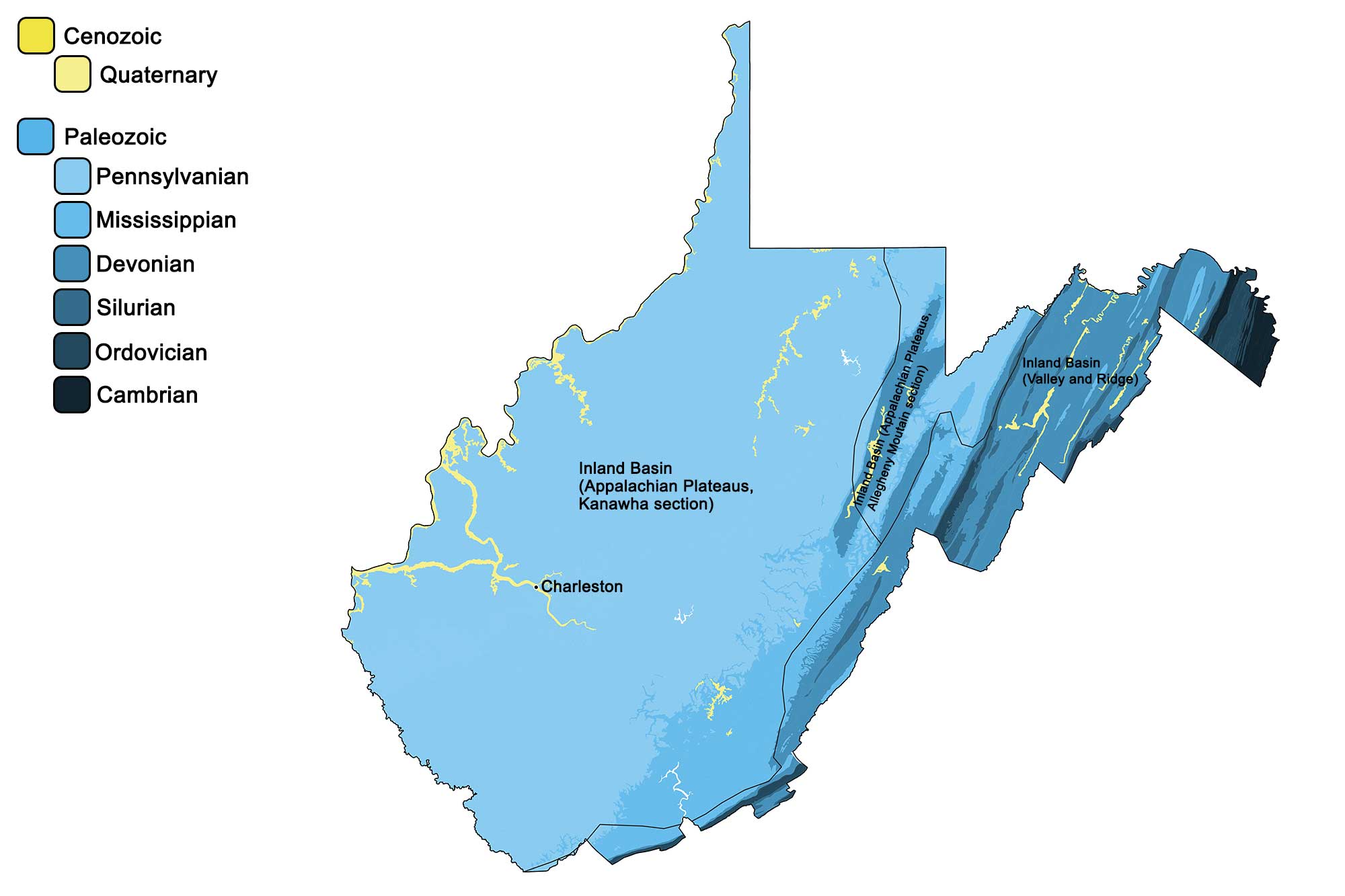
Geologic map of West Virginia showing maximum ages of mappable units. Image by Jonathan R. Hendricks for the Earth@Home project developed using QGIS and USGS data (public domain) from Fenneman and Johnson (1946) and Horton et al. (2017).
West Virginia State Fossil: Megalonyx jeffersonii
Megalonyx jeffersonii was a giant ground sloth that lived during the Pleistocene epoch. Its fossils have been found across the United States. It reached a height of nearly 10 ft and weighed over 2000 pounds. Megalonyx jeffersonii was a plant eater.
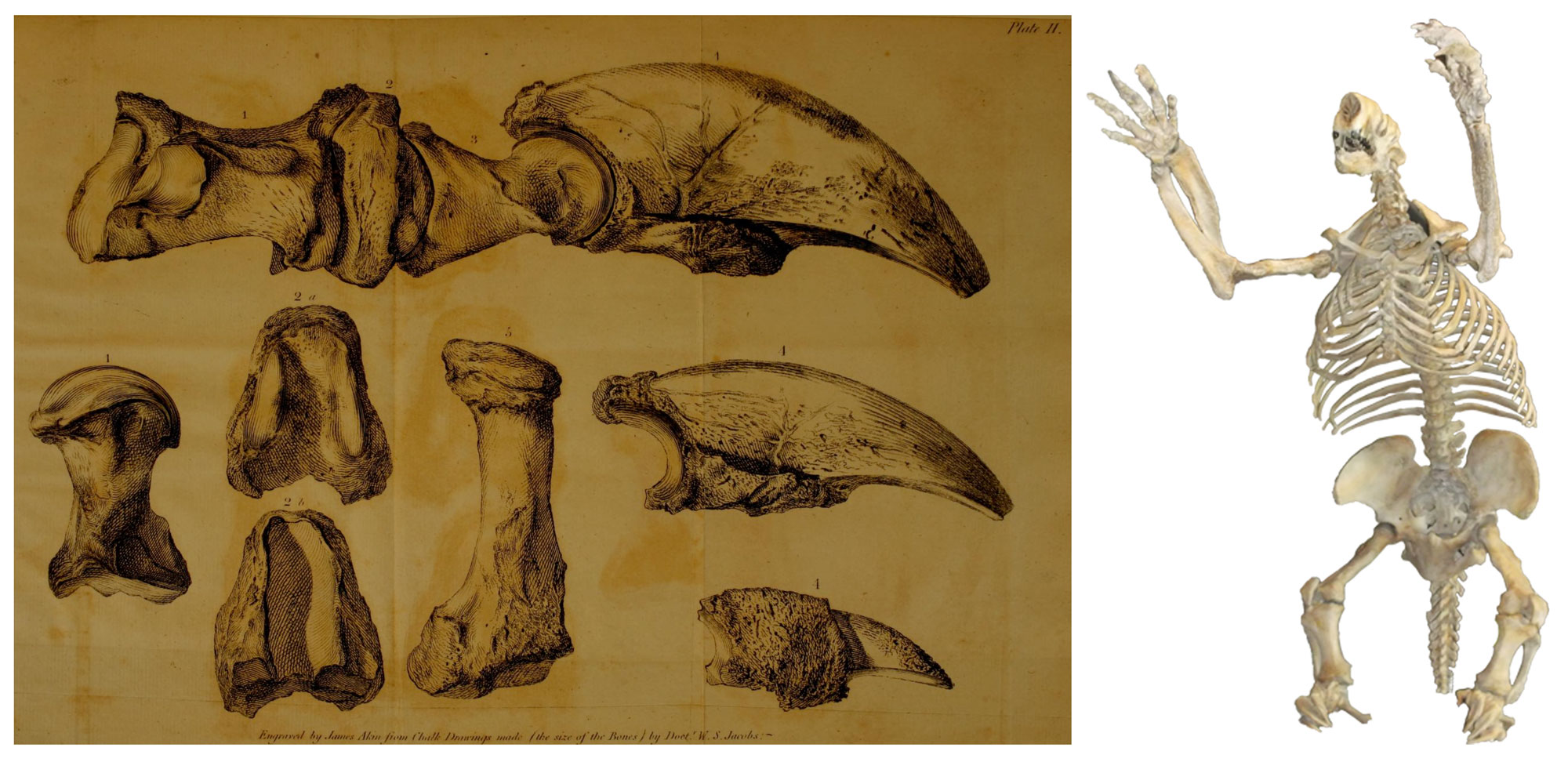
Left: The original illustrations of the claws of Megalonyx associated with Jefferson's 1797 report, which was published in 1799 (Biodiversity Heritage Library; public domain). Right: An assembled cast of the skeleton of Megalonyx jeffersonii. Image by "MCDinosaurhunter" (Wikipedia Commons; Creative Commons Attribution-Share Alike 3.0 Unported license).
Interactive 3D model. Original caption: "This giant ground sloth (Megalonyx jeffersonii) claw was sent to Thomas Jefferson in the late 1700s from a cave in what is now West Virginia. It was 3-D scanned with a NextEngine Desktop 3-D scanner on March 11, 2020 at the Academy of Natural Sciences in Philadelphia. Repository specimen number 12507. Courtesy of the Academy of Natural Sciences. The Virginia Commonwealth University Humanities Research Center supported the research trip that made this scanning effort possible." Scan by Virtual Curation Lab (Sketchfab).
"Megalonyx" means "giant claw," in reference to the animal's large claws. Its fossils were first found in West Virginia and were described in 1797 by Thomas Jefferson while he was Vice President (read his original report here). He was not sure what kind of animal the bones belonged to and compared them with those of a lion. Soon thereafter they were determined to belong to a type of giant sloth, an extinct type of animal.
The species name "jeffersonii" honors Jefferson, who is recognized as one of the first paleontologists in the United States. Megalonyx jeffersoni became West Virginia's official state fossil on March 8, 2008.
West Virginia State Rock: Bituminous coal
West Virginia is the nation's second largest producer of coal, specifically bituminous coal, a medium-grade form. The state adopted bituminous coal as its official rock in 2009 thanks to the fossil fuel’s central role in the state’s industrial economy.
Interactive 3D model of a sample of bituminous coal from Indonesia. Model by Nate Siddle (Sketchfab).
West Virginia State Mineral: None
West Virginia does not have a state mineral. What do you think it should be? Answer in the comments.
West Virginia State Gem: Lithostrotionella (chalcedony)
Lithostrotionella is not a true gemstone, but rather a silicified fossil of Mississippian coral that has been preserved as chalcedony. It can be found in Greenbrier and Pocahontas counties, and is prized for its use in jewelry.
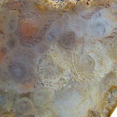
Polished slice of the rugose coral Lithostrotionella, the state gem of West Virginia. Image by "Astynax" (Wikimedia Commons; public domain).
West Virginia's Highest and Lowest Elevations
Highest Elevation: Spruce Knob
In the Appalachians, the highest point on a ridge is often called a "knob" or "dome." Spruce Knob—the summit of Spruce Mountain, the highest peak in the Allegheny Mountains—is West Virginia's highest point at 1482 meters (4863 feet) above sea level.
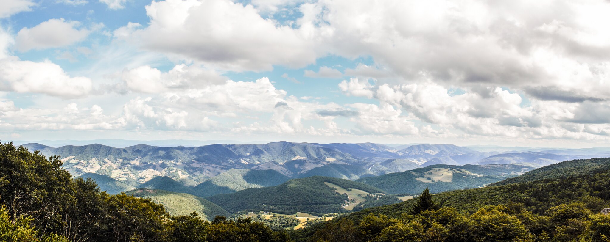
Eastward view from the top of Spruce Knob, West Virginia. Composite photograph by Devin Boggs (Flickr; Creative Commons Attribution-NonCommercial-NoDerivs 2.0 Generic license).
Lowest Elevation: Harpers Ferry
The lowest point in West Virginia is the Potomac River at Harpers Ferry in Jefferson County, with an elevation of 73 meters (240 feet).
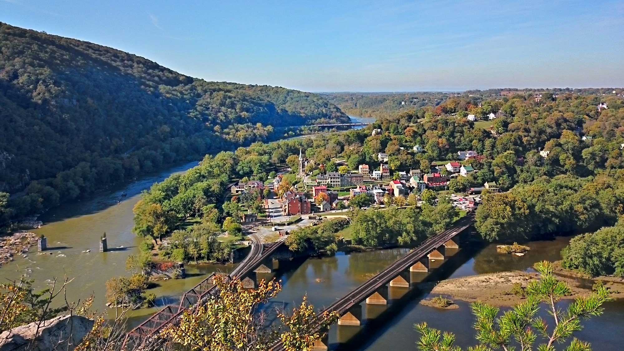
The Potomac River at Harpers Ferry, West Virginia. Photograph by Payton Chung (Flickr; Creative Commons Generic Attribution 2.0 Generic license; image cropped and resized).
Places to Visit in West Virginia
West Virginia Geological and Economic Survey's Museum of Geology and Natural History
Morgantown, WV.
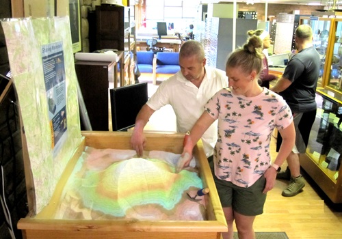
Visitors exploring the West Virginia Museum of Natural History. Image by the West Virginia Geological and Economic Survey.
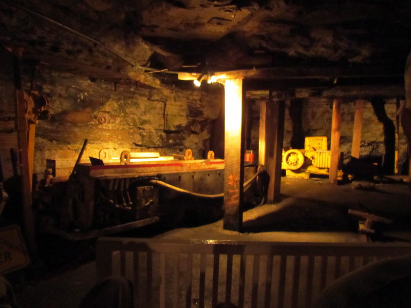
Inside the Exhibition Coal Mine in Beckley, WV. Photograph by "bobistraveling" (Flickr; Creative Commons Attribution 2.0 Generic license).
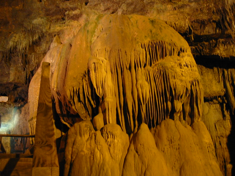
Formation inside Lost World Caverns. Photograph by Katherine Bowman (Flickr; Creative Commons Attribution 2.0 Generic license).
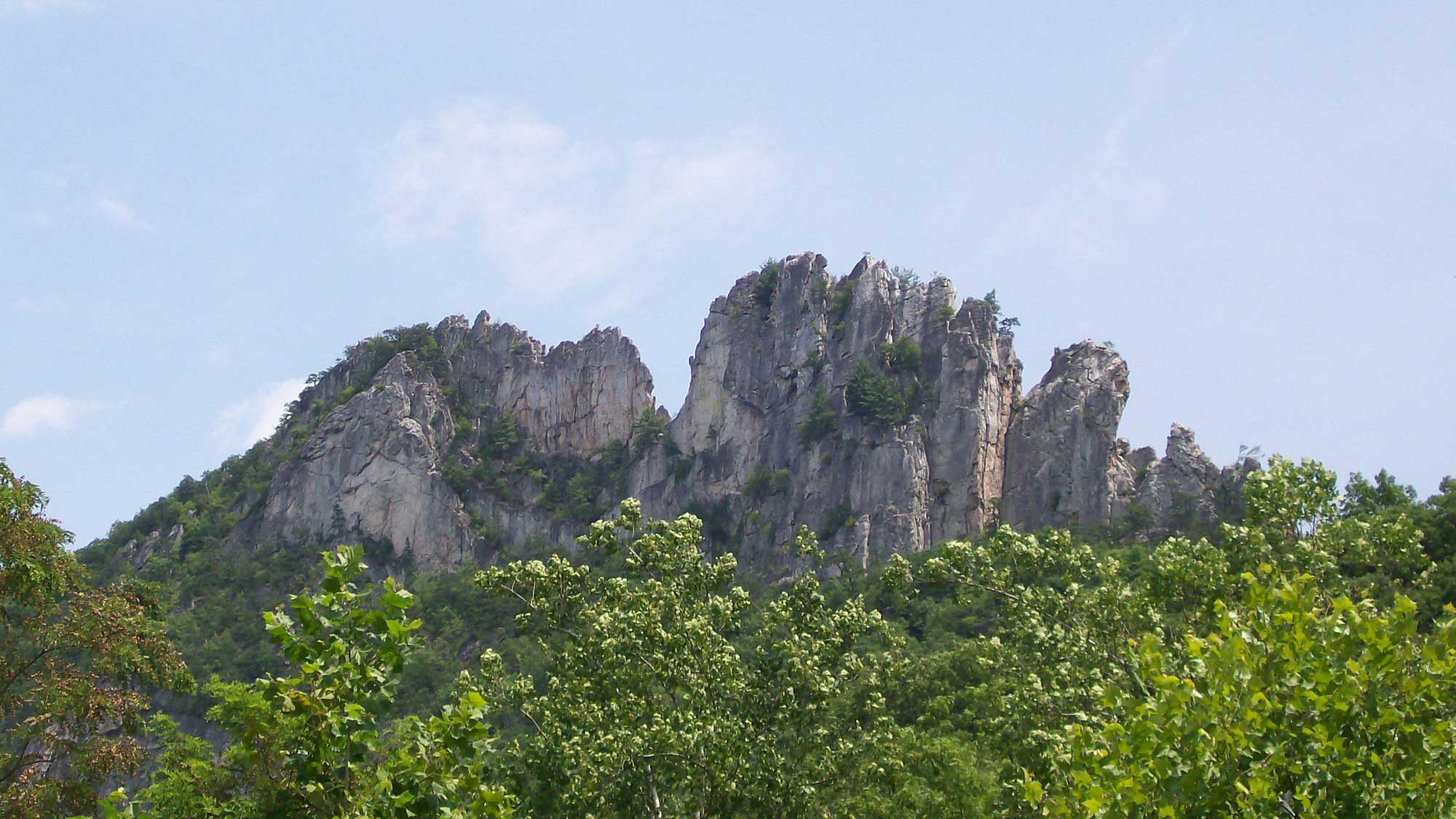
Sharp ridges of erosion-resistant, Silurian-aged Tuscarora Sandstone exposed at Seneca Rocks, West Virginia. Photograph by Ethan Gruber (Flickr; Creative Commons Attribution-ShareAlike 2.0 Generic license; image cropped and resized).
Additional resources
Comments 1
Your site asked what should West Virginia’s mineral be – salt mined from the ancient Iapetus Ocean underneath the state.