

Page snapshot: Introduction to energy in Alaska, including fossil fuels and renewable energy.
Topics covered on this page: Overview; Oil; North Slope; Trans-Alaska Pipeline; Exxon Valdez oil spill; Coal; Geothermal energy; Hydroelectricity; Wind energy; Resources.
Credits: Some of the text of this page comes from "Energy in the western US" by Carlyn S. Buckler and Gary Lewis, chapter 7 in The Teacher-Friendly Guide to the Earth Science of the Western US, edited by Mark D. Lucas, Robert M. Ross, and Andrielle N. Swaby (published in 2014 by the Paleontological Research Institution; currently out of print). The book was adapted for the web by Elizabeth J. Hermsen and Jonathan R. Hendricks in 2022. Changes include formatting, revisions, and additions to the text and images. Credits for individual images are given in figure captions.
Updates: Page last updated August 22, 2022.
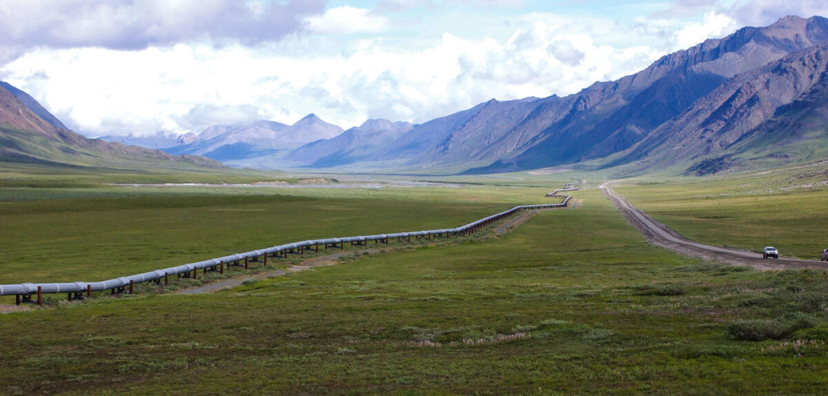
Image above: Original description (USGS): "Trans-Alaska Pipeline, northern Brooks Range, Alaska. Rocks in the background produce oil on the North Slope." Source: USGS on flickr (public domain).
Overview
Alaska has the lowest population density of any state in the Union, with only a little over one person per square mile. Many people live in rural areas, and, with about 20% of the state covered by glaciers and water, getting energy to the population is challenging. Running electrical lines throughout the state’s 1.72 million square kilometers (663,000 square miles) is not feasible when considering the number of people the lines would serve. Therefore, most people in rural areas use heating oil and/or wood for heat and energy. In isolated communities, electricity is also often generated using petroleum fuels, like diesel.
Alaska Energy Authority’s (AEA) Alternative Energy and Energy Efficiency (AEEE) program manages and funds projects and initiatives totaling $188 million in state and federal funding. Many of these projects seek to lower the cost of power and heat to Alaskan communities while maintaining system safety and reliability.
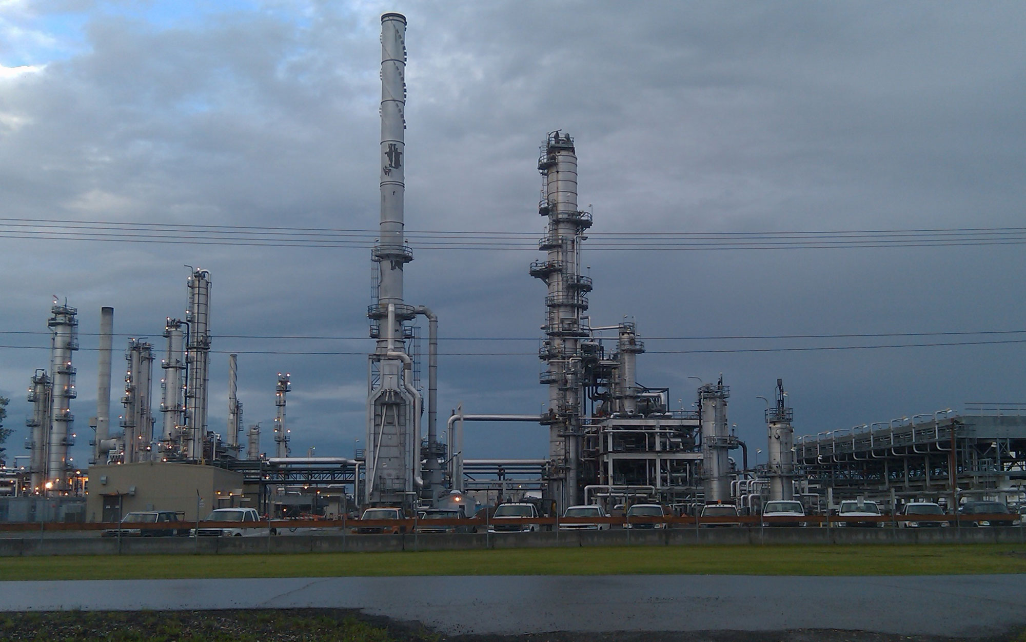
Flint Hills North Pole Refinery, North Pole (near Fairbanks), Alaska, 2011. This refinery operated between the 1970s and 2014. Photo by RadioKAOS (Wikimedia Commons, Creative Commons Attribution ShareAlike 3.0 Unported license, image resized).
Oil
North Slope
In the late 1960s, oil was discovered in Prudhoe Bay on Alaska’s North Slope, and it has proven to be the largest recoverable oil field in the U.S. Source rocks for the oil range from Mississippian to Paleogene in age, with Mesozoic marine coastal deposits being particularly rich. Significant amounts of oil and gas are trapped under the Barrow Arch, a regional belt of metamorphic and igneous rock that forms a cap for the oil reservoir. Production from the North Slope oilfields peaked in the late 1980s and has dwindled since that time. Peak production was more than two million barrels of oil per day in 1988. That number had declined to fewer than 500,000 barrels of oil per day by around 2014 and continues to drop.
Whether or not to drill for oil in the Arctic National Wildlife Refuge (ANWR) in northeastern Alaska has been the subject of heated debate for years. As part of the expansion of ANWR in 1980, the 1002 Area, a region on the coast, was set aside for potential future oil extraction. Groups opposed to drilling in ANWR contend that it will irreparably damage the sensitive wilderness in northern Alaska, whereas those in favor of drilling cite its economic benefits and argue that it will have limited effects on the landscape and wildlife.
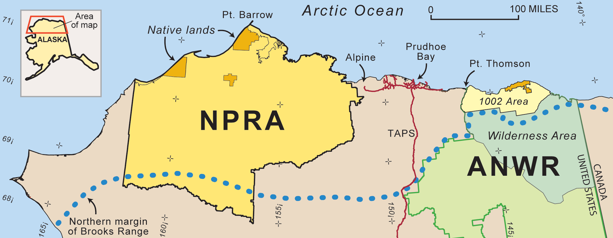
Map of the North Slope, Alaska, showing the National Petroleum Reserve-Alaska (NPRA), the Arctic National Wildlife Refuge (ANWR), an area in ANWR that is not designated as wilderness and that is subject of heated debate about oil exploration and extraction (1002 Area), and pipelines (red lines), include the Trans-Alaska Pipeline (TAPS). Source: Map from the USGS 2002 Petroleum Resource Assessment of the National Petroleum Reserve in Alaska (via Wikimedia Commons).

Chart showing the production of Alaskan crude oil from 1973 to 2021 in thousands of barrels of crude oil per day. Production peaked in 1988 at more than 2,000,000 barrels per day, but had dropped under 500,000 barrels per day by 2014. The vast majority of Alaskan crude oil is produced on the North Slope. Source: EIA.
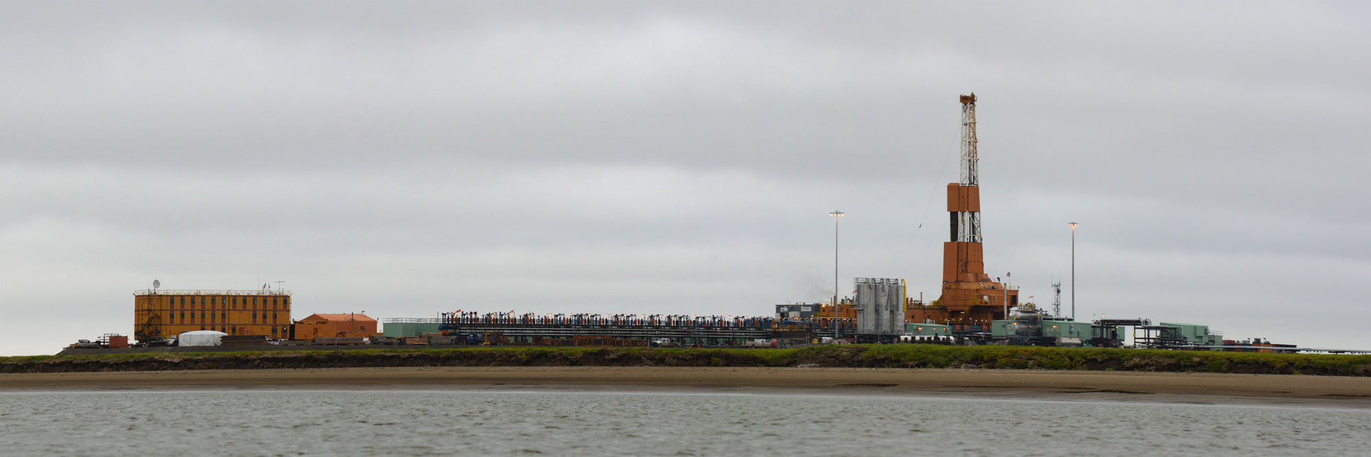
Drill rig and other structures in the Alpine Oil Field, North Slope, Alaska, 2013. Photo titled "Part of the Alpine Oil Field. North Slope, Alaska" by Paxson Woelbr (flickr, Creative Commons Attribution 2.0 Generic license, image resized).
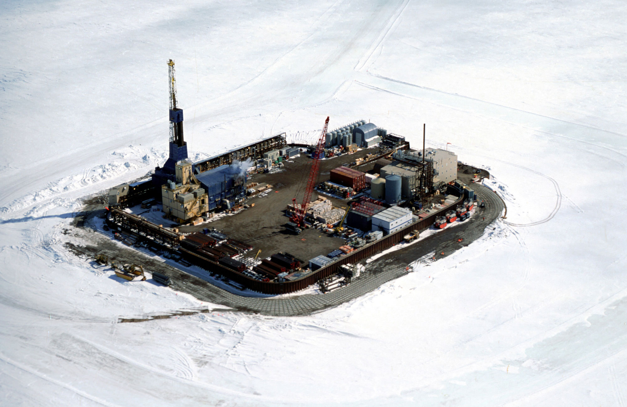
Northstar Island, a man-made island in the Beaufort Sea near Prudhoe Bay, built in 2000 for oil extraction. The snow surrounding the island is not on land, but is on sea ice in the Beaufort Sea. Photo from December 2014. Source: Bureau of Safety and Environmental Enforcement on flickr (public domain).
The head of an oil well that was drilled through the permafrost within one mile of ANWR. Source: USGS (public domain).
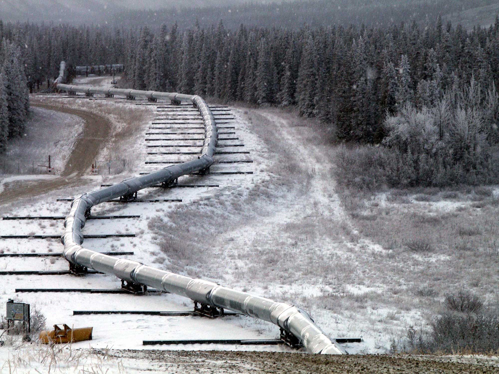
Trans-Alaska pipeline
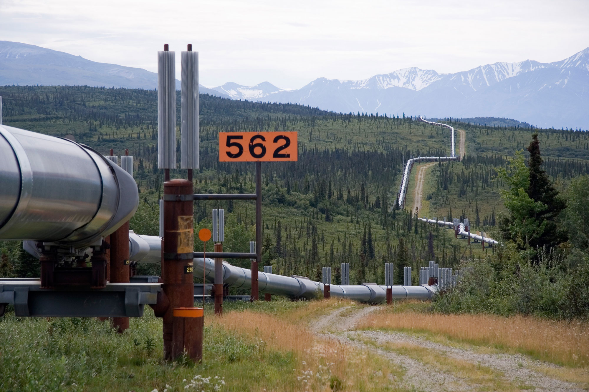
After significant negotiations with the Native populations of Alaska, the Trans-Alaska Pipeline was finished in 1977, running from the Prudhoe Bay some 800 miles south to Valdez, Alaska, on Prince William Sound. The construction of this pipeline supported the boom in oil extraction in the state in the late twentieth century.
The Trans-Alaska pipeline is currently facing several problems that threaten its integrity. One of these is declining oil production on the North Slope, leading to declining oil transport through the pipeline, which is turn causes maintenance issues (like build-up of ice and wax in the pipeline).
Another problem is melting permafrost, an issue that is being accelerated by climate change. Permafrost melt can cause the pipeline to bend or buckle as the thawing ground shifts. If the bending causes the pipeline to break, oil will spill. Thermosiphons (devices that keep the ground frozen) and other supports are being installed to keep the pipeline in place.
Trans-Alaska pipeline, 2005. The vertical structures placed at regular intervals on either side of the pipeline are thermosiphons, structures that dissipate heat to keep the ground frozen. Photo by Luca Galuzzi (www.galuzzi.it, via Wikimedia Commons, Creative Commons Attribution-ShareAlike 2.5 Generic license).
Trans-Alaska pipeline crossing the Denali fault, 2002. This portion of the pipeline is on sliders that allow it to move without rupturing. Photo by USGS (via Wikimedia Commons, public domain).
Exxon Valdez oil spill
The Exxon Valdez oil spill occurred on March 24, 1989. It was the largest oil spill in U.S. waters until the Deepwater Horizon spill in the Gulf of Mexico in 2010 (read more about the Deepwater Horizon spill on Earth Science of the South-central U.S.: Energy in the Coast Plain). The spill began when the Exxon Valdez oil tanker collided with a reef in Prince William Sound off the southern coast of Alaska. Nearly 11 million gallons of crude oil were spilled, affecting over 1000 miles of coastline; tens of thousands of animals were killed by the oil, including around 250,000 birds and more than 3,000 marine mammals (sea otters, seals, and whales). Exxon eventually paid nearly four billion dollars as a result of the spill, which included money for cleaning up the oil and restoring the environment, restitution, and penalties.
While populations of some organisms recovered within a few years following the spill, others were affected for a much longer time. Sea otter numbers, for example, did not fully rebound until more than two decades following the spill. For some animals, the effects of oil exposure were delayed. Several years following the spill, oil still contaminating the water caused the herring and salmon populations to crash, resulting in large economic losses for the commercial fishing industry. The effects of the spill are still felt in the region today, particularly on herring, which have not recovered their former numbers.
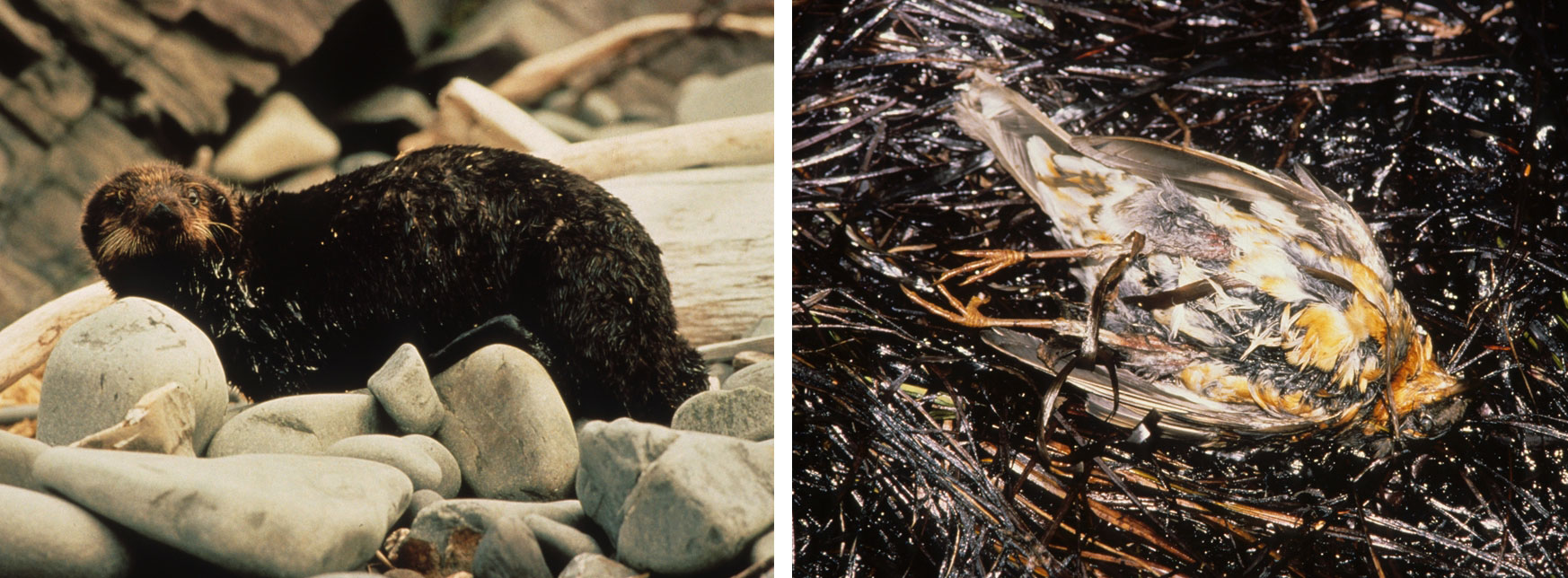
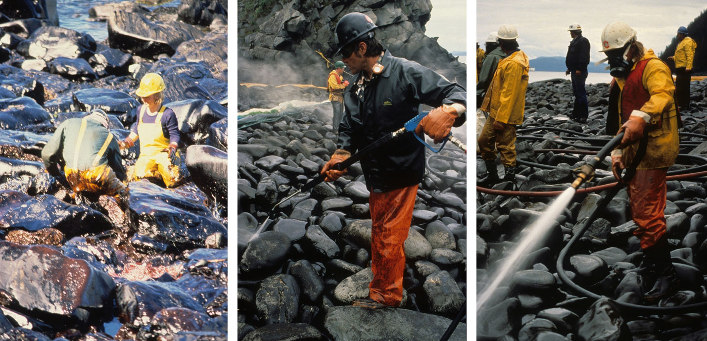
Animals affected by the Exxon Valdez oil spill, Prince William Sound, Alaska. Left: A sea otter covered in oil (June 1989). Right: An oiled woodbird in oil-covered vegetation, Bay of Isles, Knight Island (September 1989). Left photo (Exxon Valdez Oil Spill-ACE6) and right photo (Exxon Valdez Oil Spill - 0628) by ARLIS Reference on flickr (Creative Commons Attribution-ShareAlike 2.0 Generic license, images cropped).
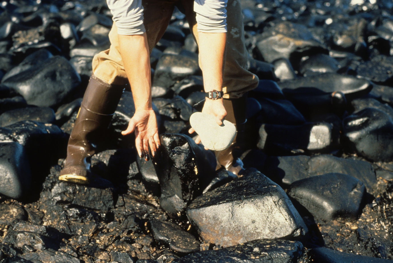
Oiled rocks on Green Island, Prince William Sound, following the Exxon Valdez spill, July 4, 1989. A person holds up a clean rock to show the contrast with the oiled rocks on the beach. Photo (Exxon Valdez Oil Spill - 0040) from ARLIS Reference on flickr (Creative Commons Attribution-ShareAlike 2.0 Generic license, image cropped).
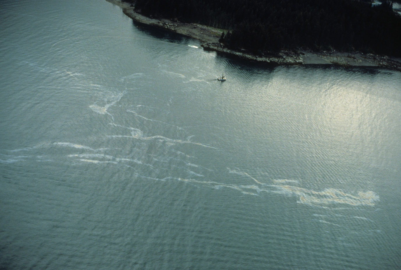
Oil slick on the water of Kachemak Bay, Gulf of Alaska, July 19, 1989. Photo (Exxon Valdez Oil Spill - 0058) from ARLIS Reference on flickr (Creative Commons Attribution-ShareAlike 2.0 Generic license, images cropped).
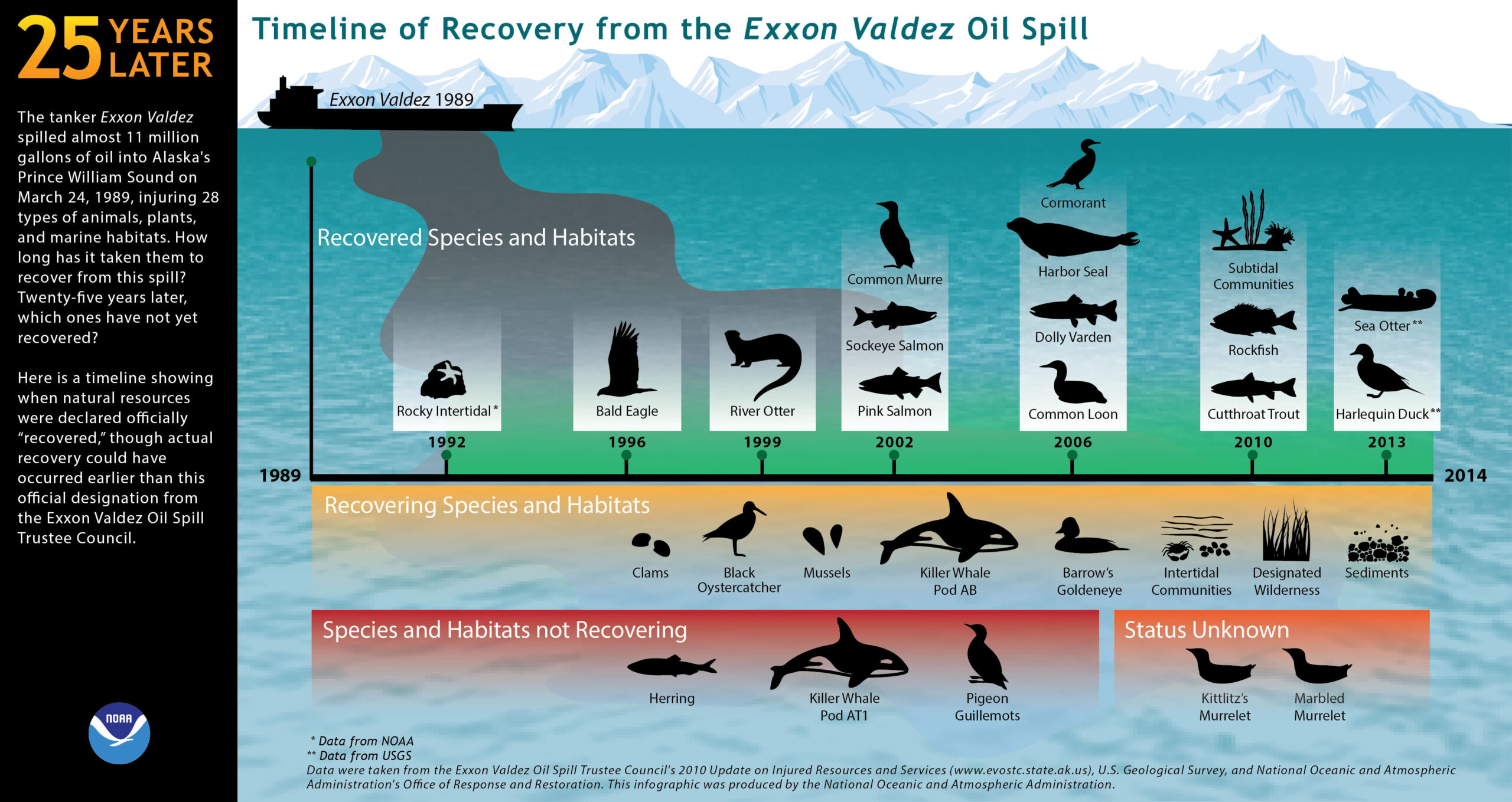
Timeline for recovery of various species following the 1989 Exxon Valdez oil spill. This graphic only covers the first 25 years following the spill. Source: NOAA.
Coal
Alaska has significant coal reserves in just one active mine, near Healy. The coal was deposited in terrestrial environments under a much warmer and wetter Miocene climate.
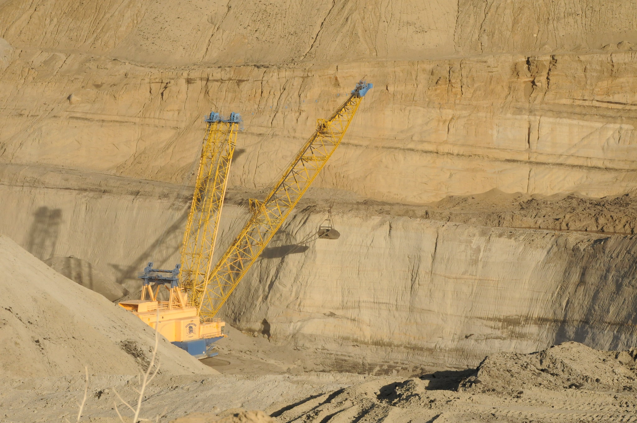
Dragline in the Usibelli Coal Mine, Healy, Alaska, 2011. Photo "DSC_3880 Dragline" by Robert Cummings (flickr, Creative Commons Attribution-NoDerivs 2.0 Generic license).
Geothermal energy
Alaska has many volcanic and geothermal features and is a prime region for development of geothermal energy resources. To date, not much geothermal energy has been brought online. Chena Hot Springs was the first geothermal plant in the state, and Pilgrim Hot Springs (near Nome) has been explored for its geothermal capacity. Geothermal holds the promise to bring cleaner, less costly electricity to some remote communities that now rely on fossil fuels.
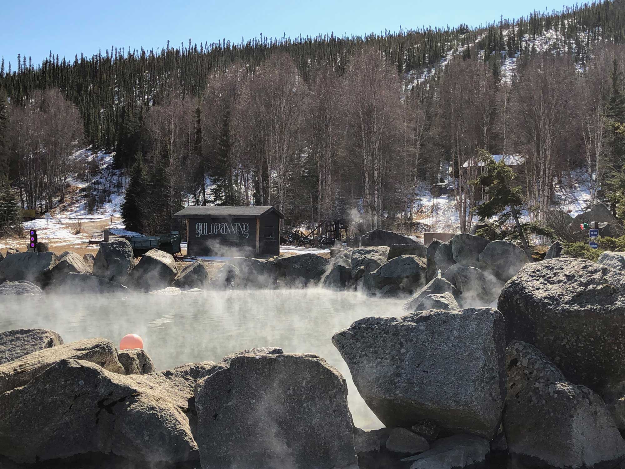
Thermal pool at Chena Hot Springs, Alaska. Photo by Craig Talbert (flickr, Creative Commons Attribution 2.0 Generic license, image resized).
Hydroelectricity
Alaska has numerous dams that provide hydroelectric power, which is not only a clean source of energy, but is also an important source of electrical power in a state were transport of fuels and construction of long-distance transmission lines is challenging. Most hydroelectric projects are located in the south-central and southeastern parts of the state.
As in the Pacific Northwest, anadromous salmon (salmon that live in the ocean but spawn in freshwater) inhabit Alaska's rivers. Because these salmon swim many miles upstream from the ocean to spawn, dams are barriers that can prevent them from reaching their spawning grounds. Alaska's anadromous fish populations have experienced less decline overall than salmon and steelhead in the Pacific Northwest due to the presence of dams. Nevertheless, salmon in some rivers are affected. One of these is the Eklutna River. The Lower Eklutna Dam, which was built in 1929 and provided power until 1955, was removed in 2017 to 2018 in part of a process to restore the Eklutna River and allow salmon populations to rebound. The Upper Eklutna Dam still provides hydropower and water for Anchorage, Alaska.
Hydroelectric power will likely be expanded in Alaska in the future. Fortunately, in at least some cases, dams can be built on stretches of river that are unreachable by salmon, and, thus, will not present a barrier to spawning.
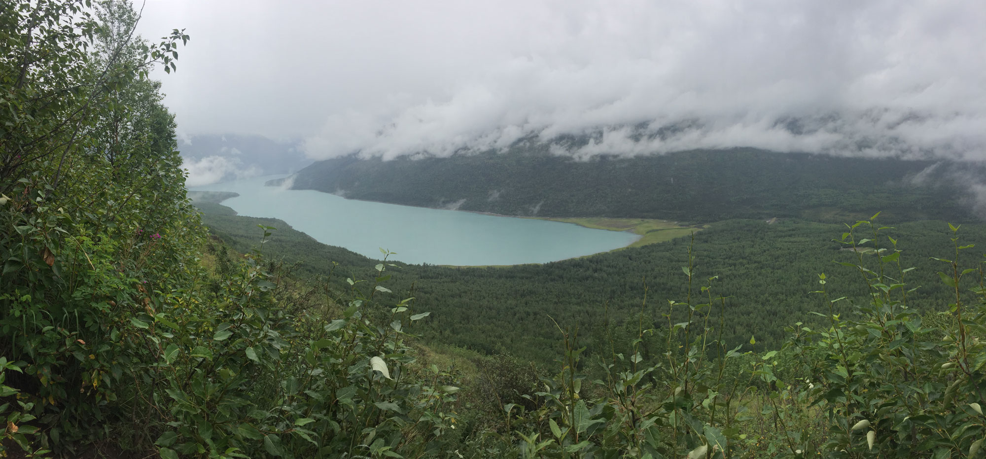
Eklutna Lake, a reservoir created by the Upper Eklutna Dam, Eklutna River, Alaska, 2017. This lake provides drinking water and hydroelectric power, and very little of the water is released downstream. Photo "Eklutna Lake" by Luke Jones (flickr, Creative Commons Attribution 2.0 Generic license, image resized).
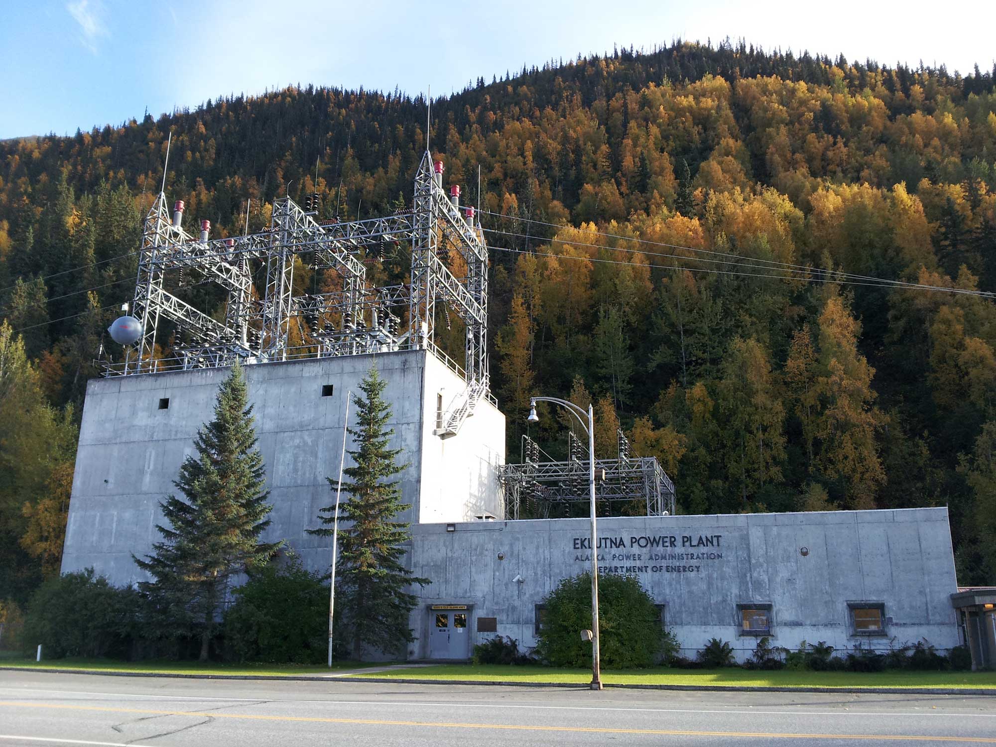
Eklunta Power Plant near Palmer, Alaska. Photo by Imke Lehmann (Wikimedia Commons, Creative Commons Attribution-ShareAlike 3.0 license, image resized).
Wind energy
Some commercial development of wind energy has occurred in Alaska. In isolated communities, generation of power from wind may be used as a complement to diesel-generated power rather than as a stand-alone resource.
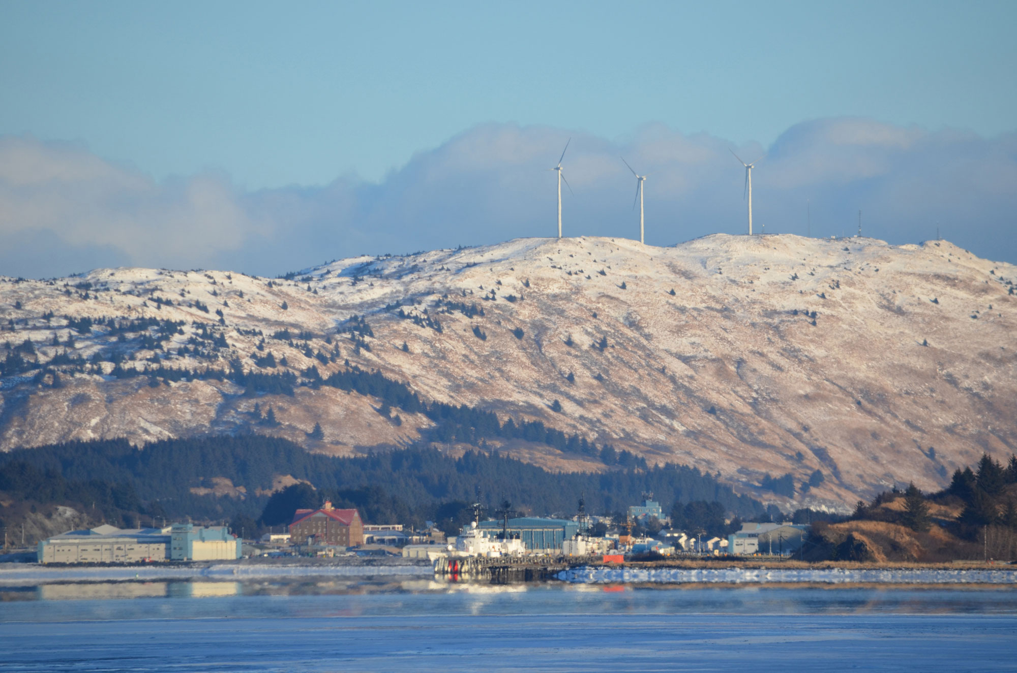
Wind turbines owned by the Kodiak Electric Association, 2011. These turbines complement diesel power and hydroelectricity. Photo "Coast Guard Kodiak" by James Brooks (flickr, Creative Commons Attribution 2.0 Generic license, image resized).
Resources
Resources from the Paleontological Research Institution & partners
Earth@Home: Introduction to Energy: https://earthathome.org/hoe/energy
Earth@Home: Introduction to Plate Tectonics: https://earthathome.org/hoe/plate-tectonics