

Snapshot: Overview of the topography of the Pacific Border region of the western United States.
Topics covered on this page: Overview; Resources.
Credits: Most of the text of this page is derived from "Topography of the Western US" by Judith T. Parrish, Alexandra Moore, Louis A. Derry, and Gary Lewis, chapter 4 in The Teacher-Friendly Guide to the Earth Science of the Western US, edited by Mark D. Lucas, Robert M. Ross, and Andrielle N. Swaby (published in 2014 by the Paleontological Research Institution). The book was adapted for the web by Elizabeth J. Hermsen and Jonathan R. Hendricks in 2021–2022. Changes include formatting and revisions to the text and images. Credits for individual images are given in figure captions.
Updates: Page last updated May 12, 2022.
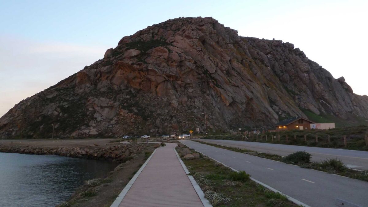
Image above: Morro Rock, an igneous volcanic plug located in Morro Bay, California. Photograph by Jonathan R. Hendricks.
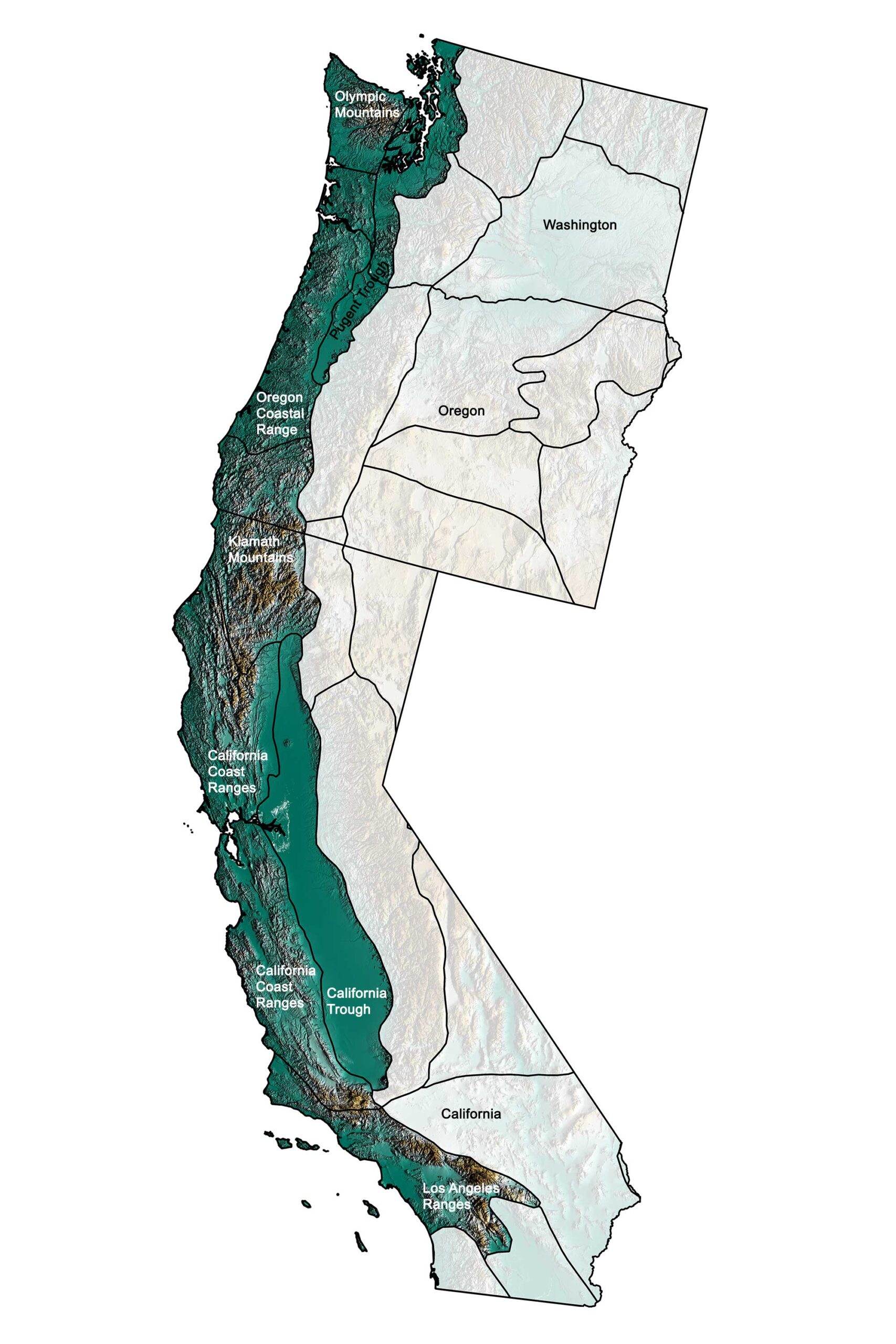
Physiographic subdivisions of the Pacific Border of the western United States; greens indicate lower elevation, browns higher elevation; black lines indicate physiographic boundaries of other provinces. Topographic data derived from the Shuttle Radar Topography Mission (SRTM GL3) Global 90m (SRTM_GL3) (Farr, T. G., and M. Kobrick, 2000, Shuttle Radar Topography Mission produces a wealth of data. Eos Trans. AGU, 81:583-583.). Image created by Jonathan R. Hendricks for the Earth@Home project.
Overview
The Pacific Border can be divided into two major areas based entirely on dominant plate tectonic forces. A transform (sideways-moving) boundary between the Pacific plate and North America extends through California.
Meanwhile, a convergent boundary subducts off the coast of Washington and Oregon, between North America and the remnants of the ancient oceanic Farallon plate. These two areas are separated by the great Mendocino fracture zone off the coast of northernmost California.
Before the formation of the San Andreas Fault system, the area south of the Mendocino fracture zone was a subduction zone. The features of subduction zones can vary, depending on how fast the plates are moving and the angle at which the subducting oceanic crust is traveling. Where the descending plate subducts at a relatively shallow angle, a forearc basin may form oceanward of the volcanic arc.
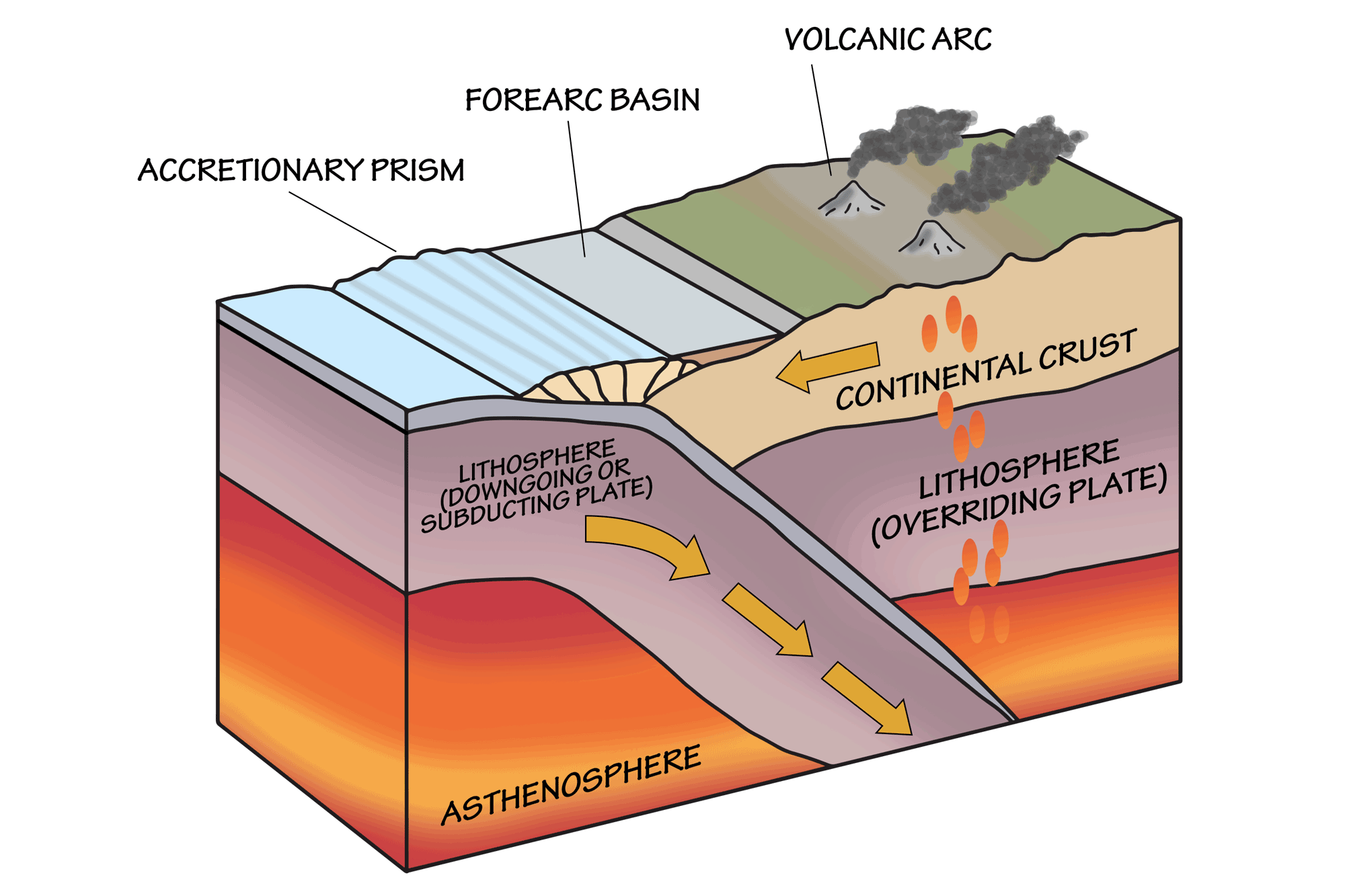
Some of the features associated with subduction zones. Image by Wade Greenberg-Brand, modified for the Earth@Home project.
The Central Valley of California is the forearc basin associated with the volcanic arc that became the Sierra Nevada, and it formed partly due to the weight of the growing mountains on the crust. West of this basin, a pile of sediments and even ocean crust, known as an accretionary prism, was scraped off the subducting oceanic plate and piled higher and higher onto the overlying continental crust. The Coast Ranges of California formed in this way.
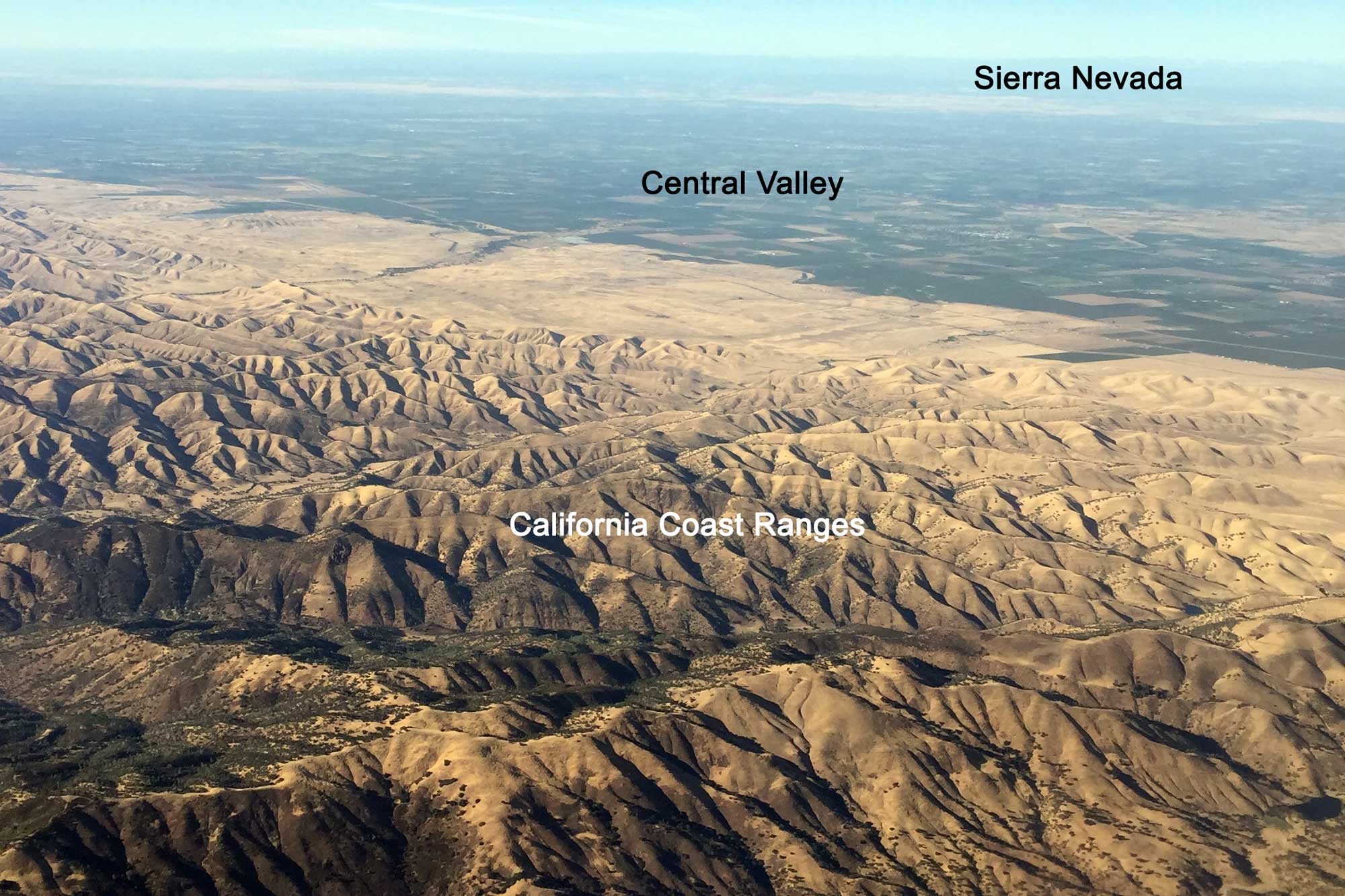
Aerial photograph of California's Central Valley and Coastal Ranges; the Sierra Nevada Mountains are visible in the background. Photograph by Jonathan R. Hendricks.
About 30 million years ago, a mid-ocean ridge called the East Pacific Rise collided with and subducted beneath North America. As this ridge subducted, the plate boundary adjacent to California gradually changed, becoming the transform boundary that formed the San Andreas Fault system. At this time, the accretionary prism that formed the Coast Ranges stopped growing. Since the fault is not a straight line but rather a system of faults, a lot of tectonic jostling, pushing, and pulling occurs in this part of California. Movement along these faults is responsible for the formation of hills and valleys, and sometimes of broad basins such as the western part of the Mojave Desert. The Transverse Ranges, Tehachapi Mountains, and southern Coast Ranges all owe much of their topography to movement along the San Andreas Fault system.
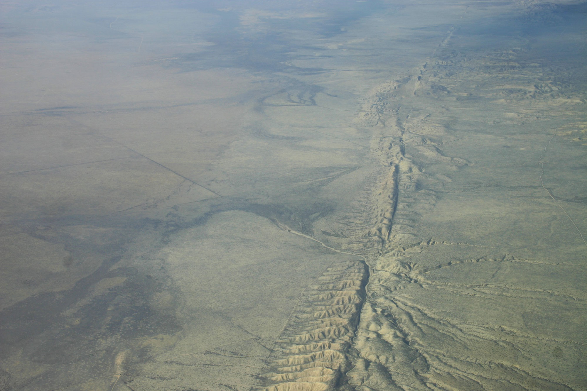
Aerial photo of the San Andreas Fault, Carrizo Plain, California. Photo by Ikluft (Wikimedia Commons, Creative Commons Attribution-ShareAlike 4.0 International license, image resized).
In fact, the Transverse Ranges have been rotated as much as 110 degrees from their original position! The southern end of the fault system lies just north of the Gulf of California, where it terminates in a rift zone. The rifting is responsible for the formation of the Imperial Valley, one of the lowest spots in North America.
Despite the overall translational motion of the San Andreas Fault system, there is a small compressional component, and this has resulted in uplift along parts of the coastline during the last three million years. This uplift can be seen in a series of wave-cut terraces that now lie well above the modern shoreline.
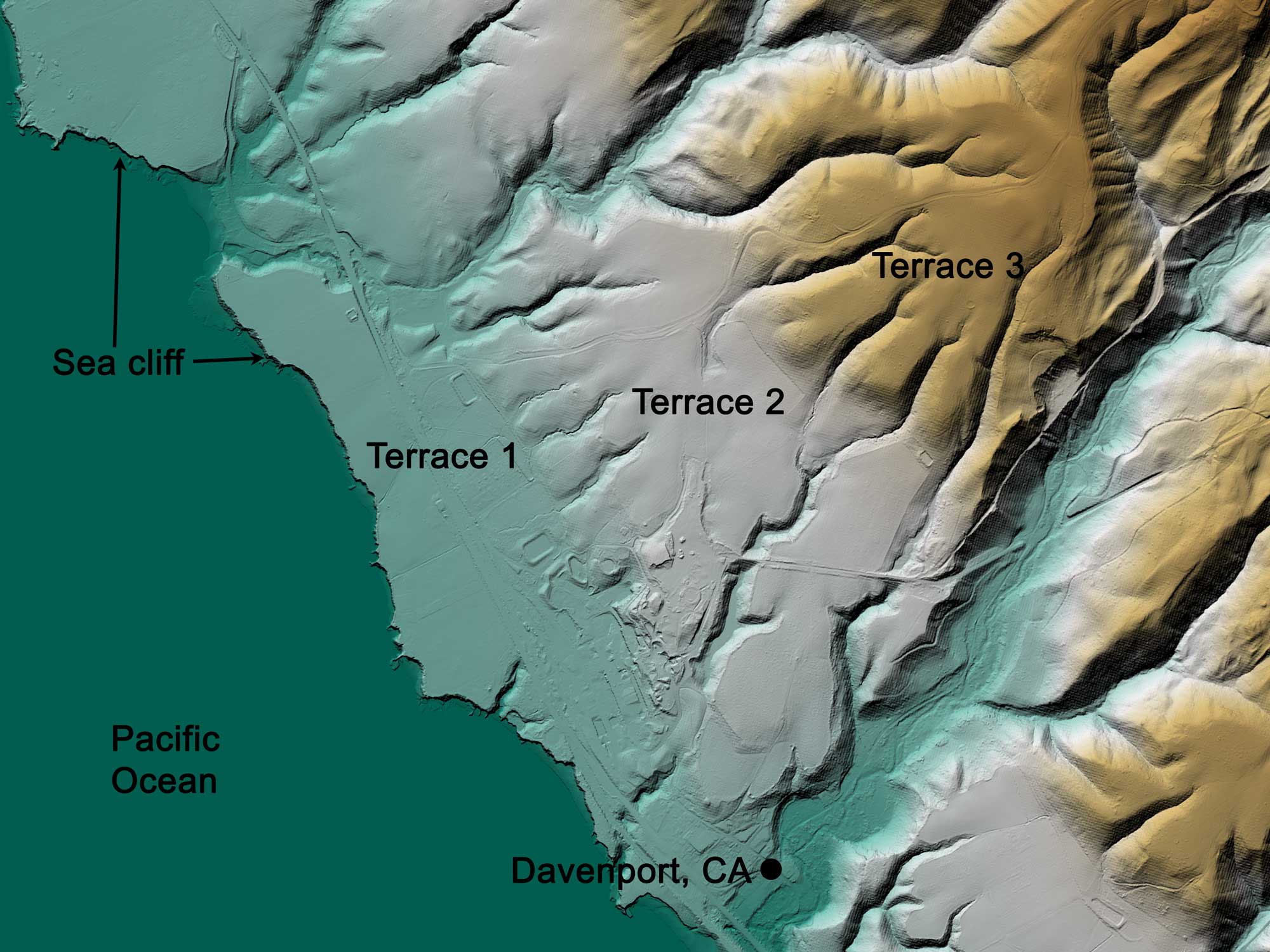
Digital elevation map showing ancient marine terraces preserved in the topography near Davenport, California. Underlying dataset from the United States Geological Survey (2021). United States Geological Survey 3D Elevation Program 1 meter Digital Elevation Model. Distributed by OpenTopography. https://doi.org/10.5069/G98K778D. Accessed: 2022-05-13. Image by Jonathan R. Hendricks for the Earth@Home project.
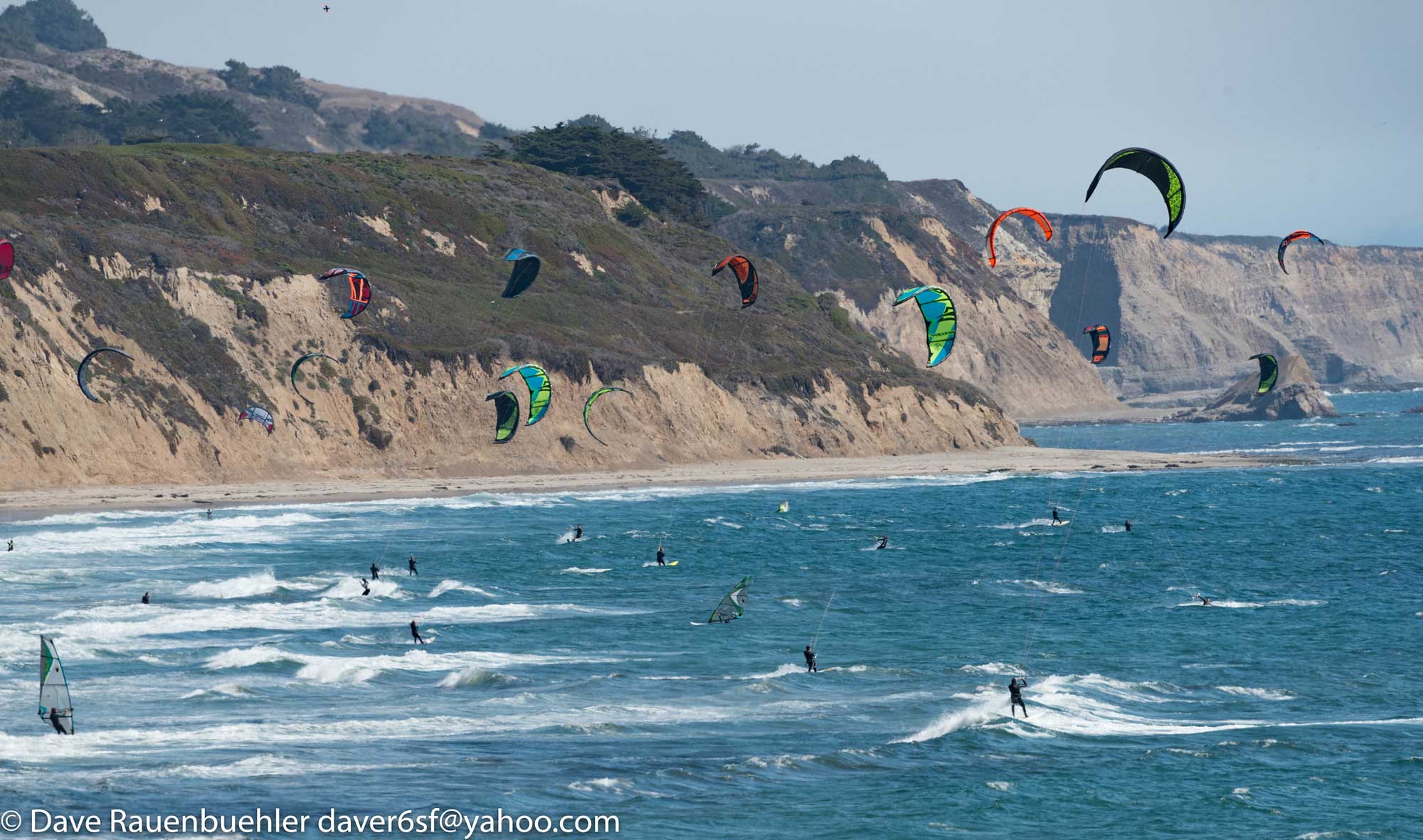
Sea cliffs, marine terraces, and kite surfers near Davenport, California. Photograph by "Dave R" (Flickr; Creative Commons Attribution-NonCommercial 2.0 Generic license).
The San Andreas Fault travels off the coastline north of San Francisco, eventually meeting up with the Mendocino fracture zone.
The Klamath Mountains, which lie directly east of the fracture zone, are part of an accretionary wedge that has been substantially uplifted. The Klamath microcontinent collided with North America in the Jurassic, causing these mountains to rise. In addition, plutonic intrusions made the mountains relatively resistant to the weathering caused by the region’s heavy winter rains.
The subduction zone north of the Mendocino fracture zone is responsible for the formation of the Oregon Coast Range and the Olympic Mountains. These mountains are part of a 66-million-year-old accretionary wedge associated with the subduction zone. In Oregon, the wedge is composed largely of an ancient volcanic arc, which was carried to the coast of Oregon on an older subducting slab. The Oregon Coast Range is lower in altitude than the coastal ranges north and south, partly because of slower uplift and partly because the wet climate of western Oregon quickly erodes the rock. Despite these conditions, marine terraces similar to those in California are found in this area. The Olympics were uplifted during the Miocene, around the same time as the most recent uplift in the northern Cascades.
Like the Central Valley of California, the Willamette Valley in Oregon and Puget Sound in Washington are parts of a forearc basin, but in this case they are associated with an active volcanic arc—the Cascades.