

Snapshot: Overview of rocks of the Inland Basin region of the northeastern United States.
Topics covered on this page: Overview; Precambrian; Cambrian and Ordovician; Silurian; Devonian; Carboniferous and Permian; Resources.
Credits: Most of the content of this page is derived from The Teacher-Friendly Guide to the Geology of the Northeastern U.S. (published by the Paleontological Research Institution) by Jane E. Ansley, with substantial updates by Andrielle Swaby and Jonathan R. Hendricks.
Updates: Page last updated September 6, 2023.
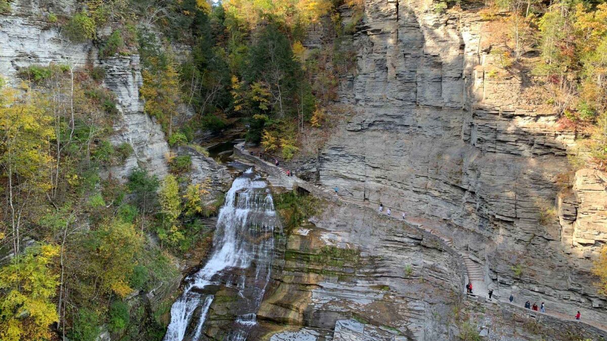
Image above: Late Devonian-aged sedimentary rocks exposed at Lucifer Falls in Robert H. Treman State Park, Tompkins County, New York. Photograph by Jonathan R. Hendricks for PRI's Earth@Home project (CC BY-NC-SA 4.0 license).
Overview
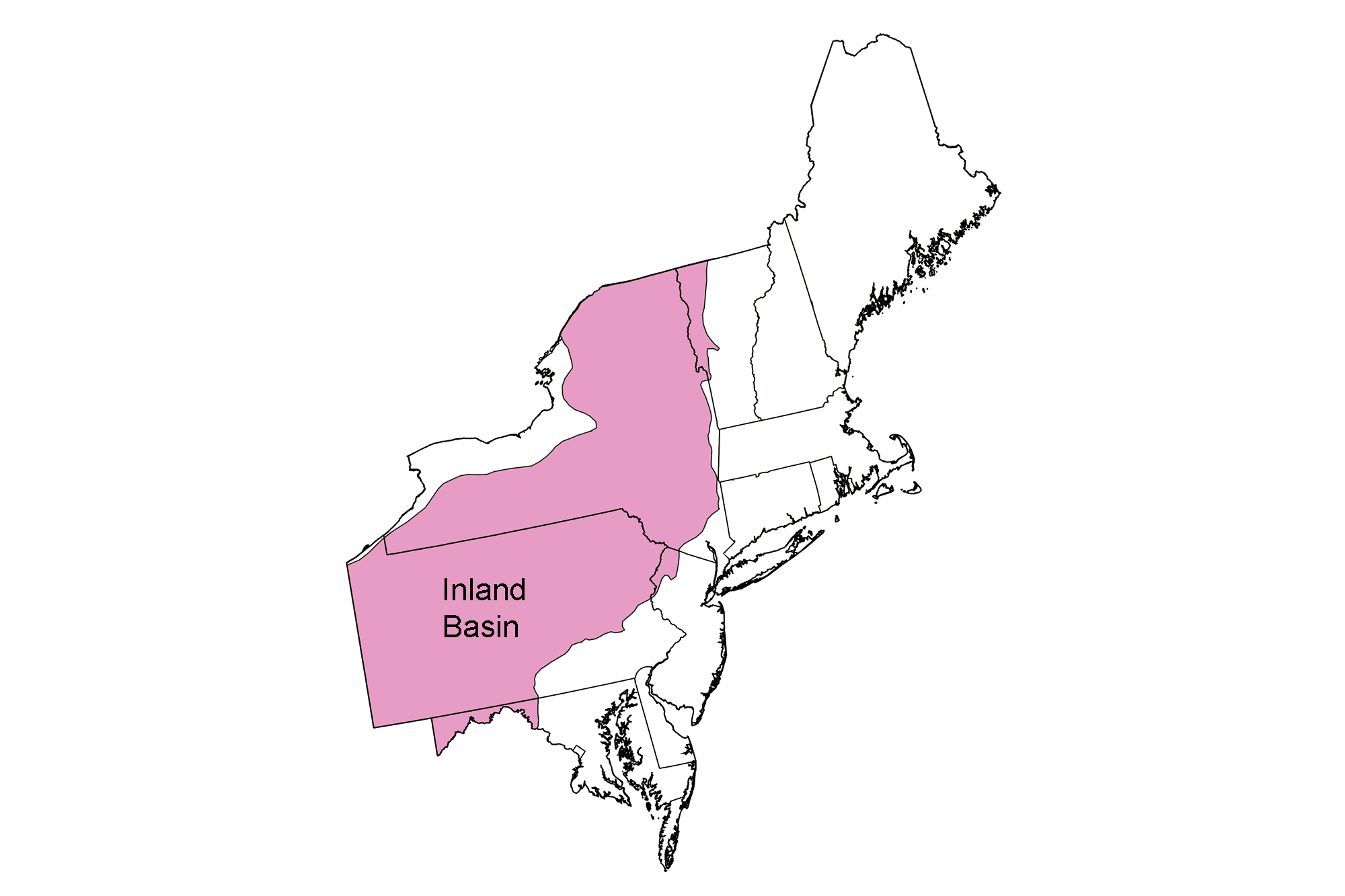
The Inland Basin is a large geophysical province that extends over much of the northeastern, central, and southeastern United States. In the Northeast, the region extends from New York through Pennsylvania and Maryland. Inland from the mountain-building events that occurred throughout the Paleozoic, the Earth’s crust was buckled (downwarped) into a series of depressions called “basins” that give the region its name. In the Northeast, there is one major basin in the Inland Basin region—the Appalachian Basin. Other, smaller basins have existed throughout the region at various times through geologic history.
Since the Inland Basin was not at the center of the tectonic collisions that occurred during the Paleozoic, there are no large igneous intrusions exposed at the surface. The Inland Basin is dominated by sedimentary rock, thanks to its low topographic relief. Basins preserve sequences of sedimentary layers because sediments are carried by water downslope toward the basin center. If sufficient sediment accumulates the basin center often subsides under the weight, providing yet more room for sediments to accumulate. The rocks of the Inland Basin, including conglomerate, sandstone, siltstone, shale, limestone, and dolostone, reveal the changing depositional environments of an inland sea as it advanced and retreated repeatedly throughout geologic time.
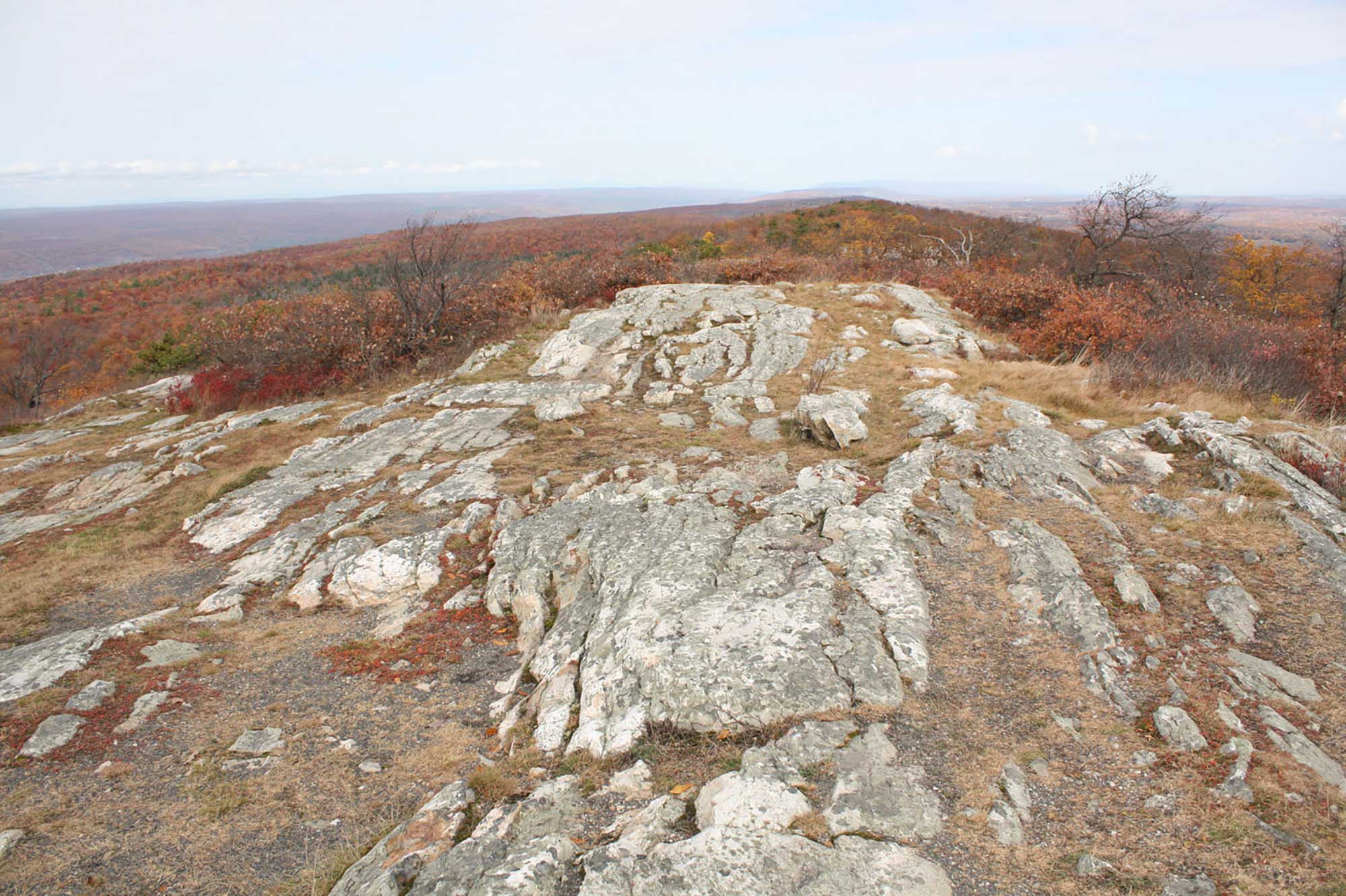
The easternmost section of this region, however, called the Valley and Ridge, was squeezed into tight folds during the Taconic, Acadian, and Alleghanian orogenies. In contrast, the Appalachian Plateau, the central section of the Inland Basin, was folded more broadly as the effects of mountain building decreased to the west (away from the collision). To the north, ancient metamorphic rocks—some of the oldest found at the surface in the Northeast—are also exposed in the Adirondacks area of New York; the Adirondacks have been uplifted since the late Miocene and were not a part of the Alleghanian orogeny.
Precambrian
Outcrops in the Adirondacks, like these in the Jay Mountain Wilderness, are composed of metamorphosed Precambrian sediments. Photograph by John Marino (flickr; Creative Commons Attribution 2.0 Generic license).
The Adirondacks are an anomaly in the sediment-dominated Inland Basin. They are composed of billion-year-old metamorphic rocks, all of which were metamorphosed during the Precambrian Grenville Orogeny—a mountain building event associated with the assembly of the supercontinent Rodinia—and later exposed by erosion. The Grenville-aged rocks that make up the core of the Adirondacks were originally sandstone, shale, and limestone deposited in a zone called the Grenville Belt, a warm, shallow ocean along the eastern margin of proto-North America. During the formation of Rodinia, the Grenville Belt sediments were squeezed and pushed up onto the continental margin, forming the Grenville Mountains. The intensity of compression metamorphosed the sedimentary rocks; sandstone became quartzite, gneiss, or schist, limestone became marble, and shale became gneiss and schist. The intensity of the Grenville Orogeny also sheared the rock as blocks of crust slid past each other in opposite directions. This is most evident in a band of rocks called mylonites, in which minerals were compressed and recrystallized upon shearing.
Example of a Late Ordovician or early Silurian mylonite from the Brindle Creek Fault in North Carolina. Gigapan interactive image by Robin Rohrback (GIGAMacro; Creative Commons Attribution-NonCommercial 4.0 International license).
For millions of years following the Grenville Orogeny, the Grenville rocks that stretch from Canada to Mexico were worn down and buried by layers of sedimentary rock. Grenville-age rocks are present in many other parts of the Northeast, but are generally deeply buried. In the Adirondacks, these ancient rocks are exposed because of uplift that occurred only 10-20 million years ago, during the Neogene. This means the Adirondacks are actually relatively young as mountains, even though they are composed of billion-year-old rocks. Their exact mode of formation is still debated—some geologists think the land was uplifted because a hot spot beneath the crust pushed plumes of magma upward, forming a dome. The softer sedimentary rocks on top of the dome were uplifted, fractured, and eroded away quickly, exposing the underlying Grenville rocks. Many of these ancient igneous and metamorphic rocks are resistant and are being eroded very slowly. In fact, the Adirondack area is still being uplifted today at about 2 millimeters (0.08 inches) each year, a rate faster than the mountains can erode.
The remaining rocks exposed in the Inland Basin are sedimentary, and range from Cambrian exposures in the north to Permian in the south. The Inland Basin is dominated by sedimentary rock thanks to its low topographic relief; basins are naturally excellent places for the preservation of thick sediment layers because they easily collect sediment and often subside from its weight. The rocks of the Inland Basin, including conglomerate, sandstone, siltstone, shale, limestone, and dolostone, reveal the changing depositional environments of the inland sea as it advanced and retreated repeatedly throughout geologic time. "Inland sea" may sound like a contradiction in terms, but there is a very simple, yet important, distinction that differentiates it from other seas: an inland sea is located on continental crust (sometimes called continental or epicontinental seas), while other seas are located on oceanic crust. An inland sea may or may not be connected to the ocean. For example, Hudson Bay is on the North American plate and connects to the Atlantic and Arctic oceans, while the Caspian Sea is on the European plate but does not drain into any ocean at all.
Following the Grenville Orogeny, global sea level began to rise, until most of North America was covered by a shallow inland sea. A period of erosion gradually wore down the Grenville Mountains, and their weathered sediments were carried westward and deposited into the Inland Basin. As the sea widened, sand and mud were deposited near shore, while organically derived carbonates including limestone and dolostone formed in deeper water. Gradually, the amount of sediment settling into the basin declined as the mountains were weathered down. Sea level remained high through the Ordovician, but the reduced sediment supply resulted in the formation of more limestone and dolostone, which are common in warm, shallow, sediment-starved seas.
Cambrian and Ordovician
Cambrian and Ordovician rocks are exposed in northernmost New York, western Vermont, and in patches around the Adirondack dome, as well as throughout central New York and into northern New Jersey.
The Cambrian-aged Potsdam Sandstone, found north and west of the Adirondack Mountains, is a Cambrian deposit formed in a near-shore coastal environment. This exposure of the formation is in Whitehall, New York. Photograph by Kyle Hartshorn (flickr; Creative Commons Attribution 2.0 Generic license).
Sample of Cambrian-aged Potsdam Sandstone from its type area at Hannawa Falls, near Potsdam, New York. The red coloring of this sample suggests a feldspar-rich sandstone, but it is instead almost entirely composed of quartz grains that are coated by red hematite dust. Maximum dimension of specimen is approximately 9 cm. Rock is from the teaching collections of the Paleontological Research Institution, Ithaca, New York (Sketchfab).
At one time, these rocks were flat-lying layers hidden beneath overlying younger rocks. The layers were tilted very gently a few degrees to the south as they were compressed by mountain building, exposing the underlying older rocks. As sea level dropped later in the Ordovician, the sedimentary rocks were exposed to intense erosion, and many layers of sediment were removed. The eroded layers represent an unconformity, a gap in the geological record where stratified layers have been interrupted or destroyed due to erosion or deformation.
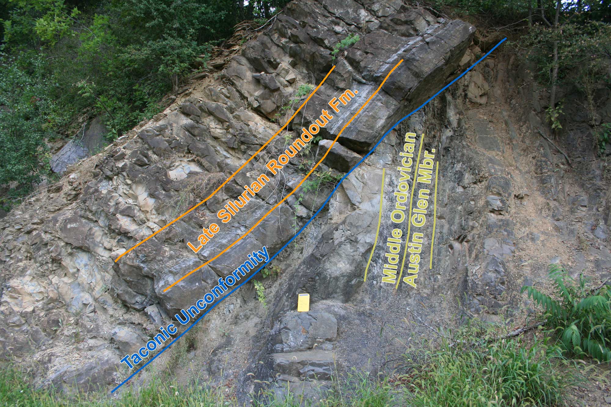
The Taconic Unconformity expressed as an angular unconformity near Catskill, New York. At this classic field locality along the side of a busy highway, the Taconic Unconformity represents over 30 million years of missing time. The Middle Ordovician Austin Glen Mbr. is nearly vertical, while the overlying late Silurian Roundout Fm. is positioned at a steep angle. Both of these sedimentary rock units were originally deposited horizontally. What sequence of events led to this arrangement of rocks? Try to work out the sequence of events yourself. Annotations added to original photograph by Michael C. Rygel (Wikimedia Commons; Creative Commons Attribution-Share Alike 3.0 Unported license).
The Ordovician Taconic unconformity is a prominent section of "missing time" in North America, but there are other examples of unconformities in the Inland Basin and throughout the US. For example, there are no rocks representing the Mesozoic, Paleogene, or Neogene in the Inland Basin. The absence of rocks deposited during certain time periods does not mean that no rocks were formed during that time. It may mean, however, that very little sediment was deposited, that the sediment was eroded away, or that the rocks are buried beneath the surface. There is no single place on Earth with a complete sequence of rocks from the Precambrian to the Quaternary. Erosion and weathering over time have removed many meters (feet)—and in some cases kilometers (miles)—of rock from the surface of the Northeast.
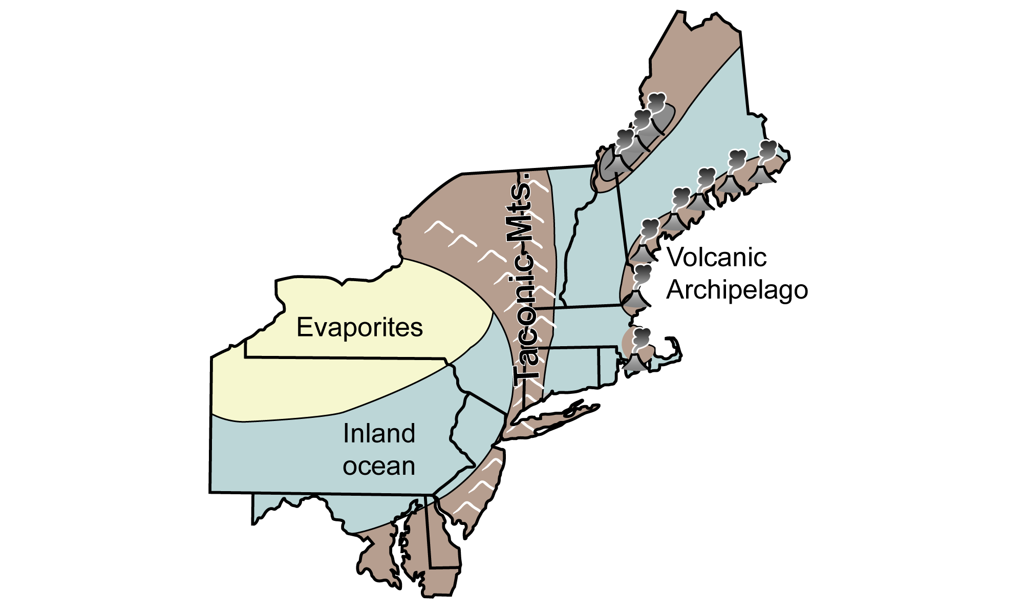
Toward the latter half of the Ordovician, the Taconic volcanic islands formed along the subduction zone between North America and Baltica. The volcanic islands collided with North America to form the Taconic Mountains and buckled the crust to the west of the mountains, forming the Appalachian Basin and an inland ocean.
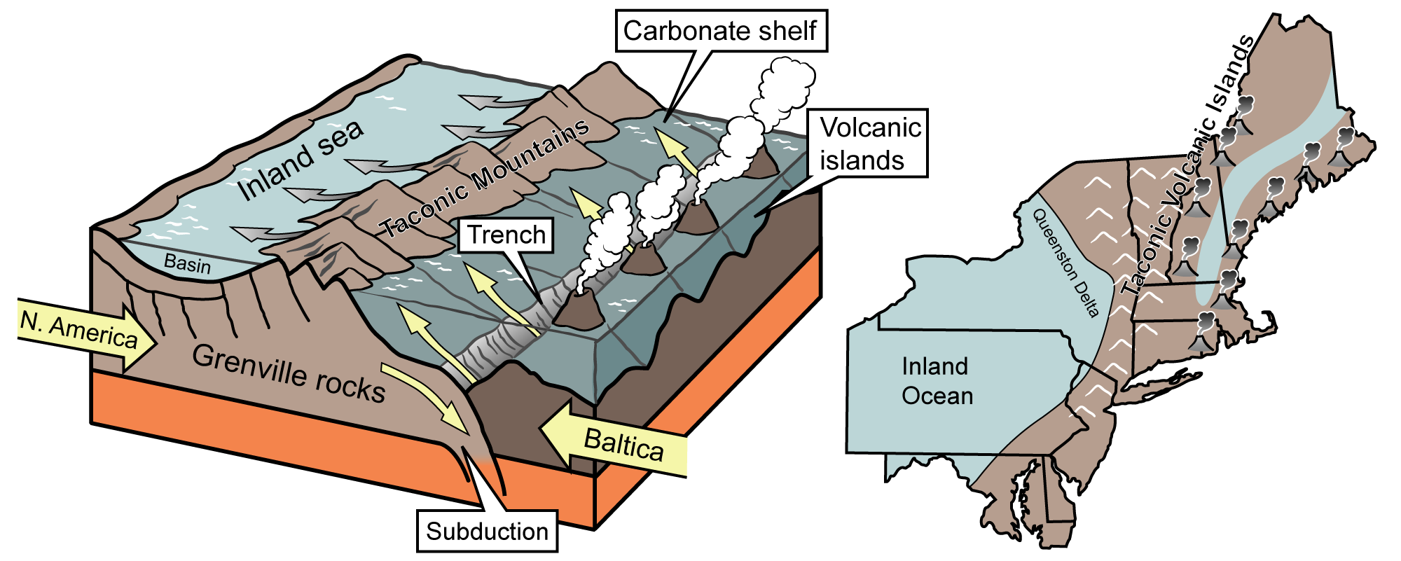
In the Ordovician Period, the Taconic volcanic islands collided with the margin of North America, forming an inland ocean that covered much of present day New York and Pennsylvania. Images modified from originals by J. Houghton first published in The Teacher-Friendly Guide to the Geology of the Northeastern U.S. by Jane Ansley (published by the Paleontological Research Institution) (CC BY-NC-SA 4.0 license).
Layers of bentonite clay, altered volcanic ash from volcanic activity during the collision, were deposited in the inland ocean and subsequently preserved within the region’s limestone and shale. The Deicke and Millbrig bentonite layers, which stretch 600,000 square kilometers (230,000 square miles) across much of eastern and central North America, were formed from a massive eruption during this time.
A deltaic wedge of sediment formed on either side of the Taconic Mountains as they eroded. Conglomerates formed close to the highlands, while streams brought sandy, muddy sediment to floodplains, lakes, estuaries, beaches, and into the inland ocean to form sandstone, siltstone, and shale. Settling within the inland ocean, sediments were compacted and cemented to become sedimentary rocks that stretch across to the western border of New York and Pennsylvania (including the Utica Shale, shown in the photograph below).
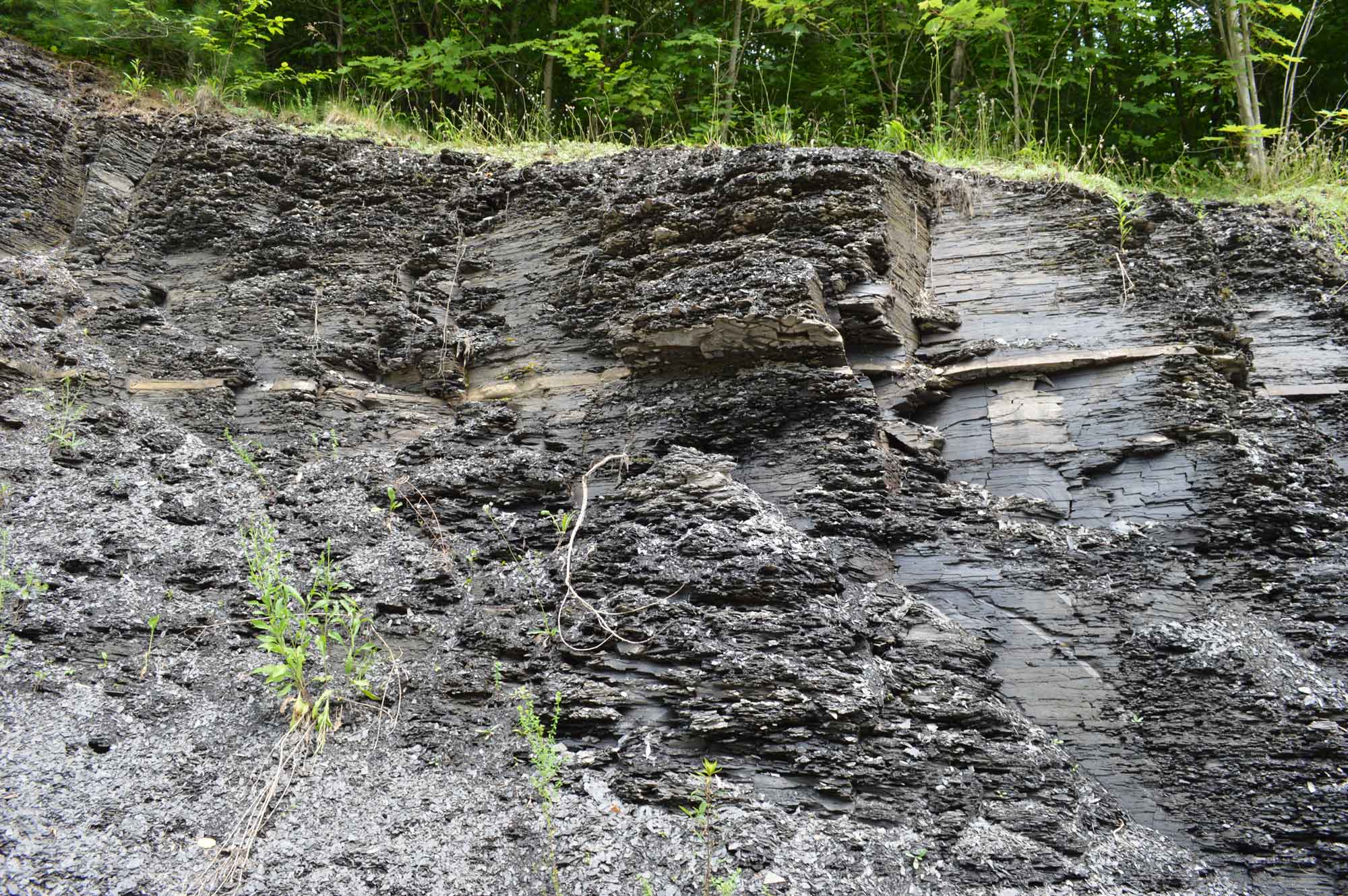
Upper Ordovician-aged Utica Shale (also known as Indian Castle Shale) exposed in Oneida County, New York. Photograph by Kyle Hartshorn (flickr; Creative Commons Attribution 2.0 Generic license).
Sediment from the Taconic highlands spread far to the south. Farther away from the highlands, carbonate rocks continued to form, along with sandstone and shale. Thanks to folds, faults, and erosion, Ordovician and Silurian rocks are exposed in the Valley and Ridge section of the Inland Basin, from New Jersey south through Pennsylvania and Maryland.
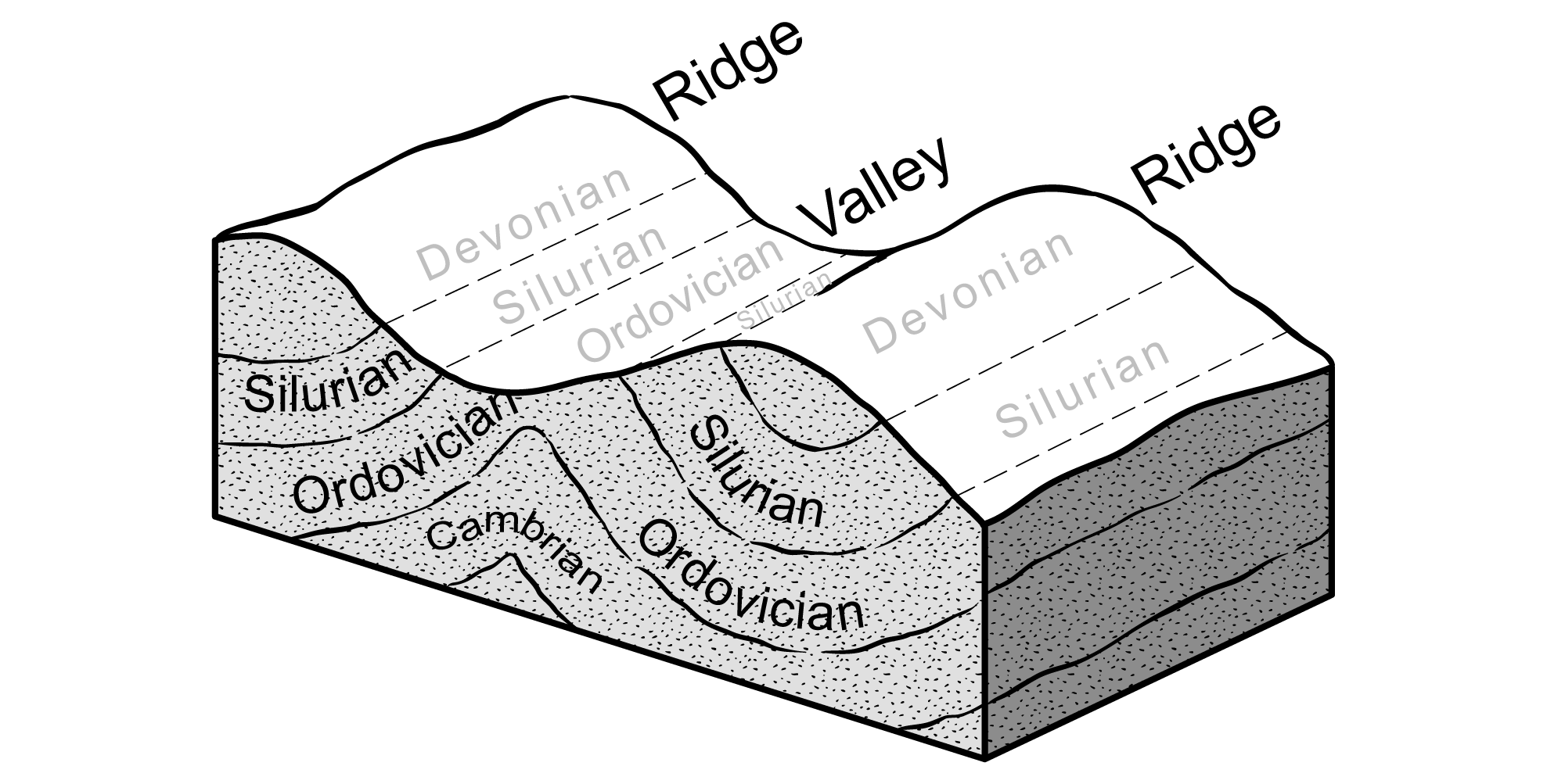
The Ordovician, Silurian, and Devonian rocks of the Inland Basin are found in long thin ribbons formed by the way layers of rock have been folded and then sliced at the surface by erosion. In the Valley and Ridge, the rocks were compressed into tight, elongated folds along the Appalachians during Paleozoic mountain building events. Rocks above these folds have been uplifted and eroded, exposing the older rock beneath. Image modified from original by J. Houghton first published in The Teacher-Friendly Guide to the Geology of the Northeastern U.S. by Jane Ansley (published by the Paleontological Research Institution) (CC BY-NC-SA 4.0 license).
Silurian
Silurian rocks are exposed in the easternmost parts of the Inland Basin, where they record the continuing story of the Paleozoic inland sea and the after-effects of the Taconic Orogeny.
Positions of the Taconic Mountains during the Silurian Period. Image modified from original by J. Houghton first published in The Teacher-Friendly Guide to the Geology of the Northeastern U.S. by Jane Ansley (published by the Paleontological Research Institution) (CC BY-NC-SA 4.0 license).
During the Silurian Period, sedimentary rocks formed in response to rising and falling sea levels as the convergence of tectonic plates continued to buckle the inland basins, deepening the ocean. Erosion of the Taconic Mountains continued to provide sediment for sandstone and shale, while carbonate rocks formed farther from shore. Fast-flowing streams tumbling off the eroding mountains left behind thick sequences of river deposits, including quartz pebbles, conglomerates, and mudstones. The Shawangunk Conglomerate, a 427-meter-thick (1400-foot-thick) coarse-grained sandstone and conglomerate that stretches throughout eastern Pennsylvania, New Jersey, and New York, was formed at this time.
Northeast-facing exposure of the Silurian Shawangunk Formation exposed at High Point State Park, New Jersey. Photograph by "Jstuby" (Wikimedia Commons; public domain).
Sample of Silurian Shawangunk Conglomerate from Pennsylvania. Gigapan interactive image by Callan Bentley (GIGAMacro; Creative Commons Attribution-NonCommercial 4.0 International license).
During the late Silurian, as the Appalachian Basin filled with sediment, the ocean became relatively shallow; many iron-rich marine sediments were oxidized upon exposure to the air, resulting in red sedimentary rocks (including sandstone, siltstone, shale and limestone). A thick band of these “red beds,” the Bloomsburg Formation, is found in the Inland Basin, extending from New York to Maryland.
Exposure of Silurian Bloomsburg Formation at Little Fort Valley, Virginia. Gigapan interactive image by Callan Bentley (GIGAMacro; Creative Commons Attribution-NonCommercial 4.0 International license).
Sample of Silurian Bloomsburg Formation from Little Fort Valley, Virginia. Gigapan interactive image by Robin Rohrback (GIGAMacro; Creative Commons Attribution-NonCommercial 4.0 International license).
Because the Silurian was a time of relatively shallow seas with poor circulation in the region, it makes sense that salt (halite) and gypsum—both evaporite rocks—are found in Silurian sedimentary rocks exposed across central New York. The salt layers are not found at the surface, since they quickly dissolve in water, but salt does come to the surface natural salt springs, around Syracuse, New York. The gentle tilt of the Silurian rocks to the south means that salt is also found and mined underground south of the salt springs, buried beneath Devonian rocks. Salt has played a key role in the economy of upstate New York, and was the reason for the founding of cities like Syracuse, NY. The Retsof Mine near Geneseo, NY was the largest underground salt mine in the world before its collapse in 1993.
Devonian
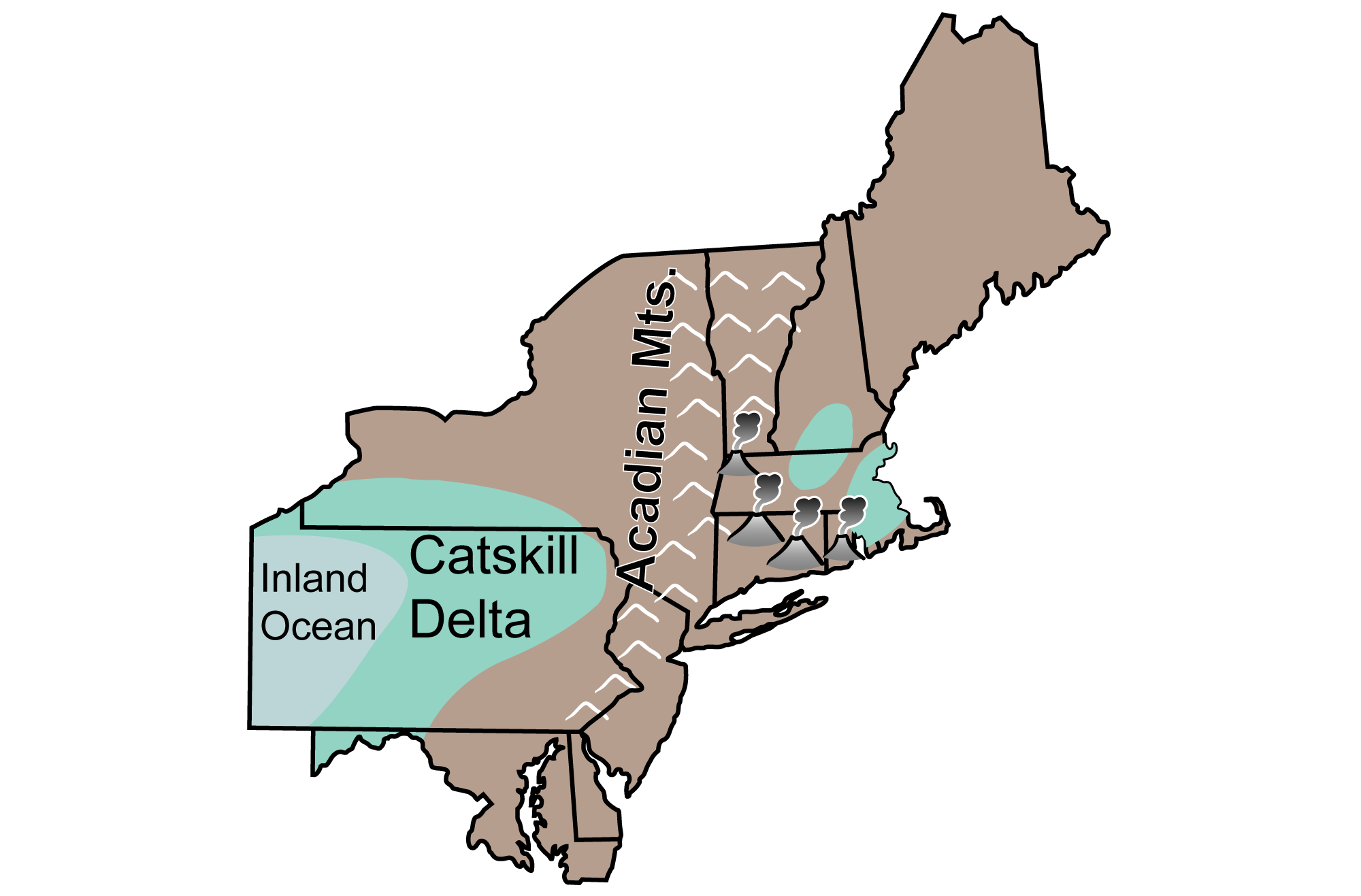
Devonian rocks in the Inland Basin record the onset of the Acadian Orogeny, which deepened the Appalachian Basin by downwarping the crust. The formation of the Acadian Mountains was similar to the formation of the Taconic Mountains. The Acadian highlands eroded rapidly, filling the Appalachian Basin with a westward spreading delta called the Catskill Delta.
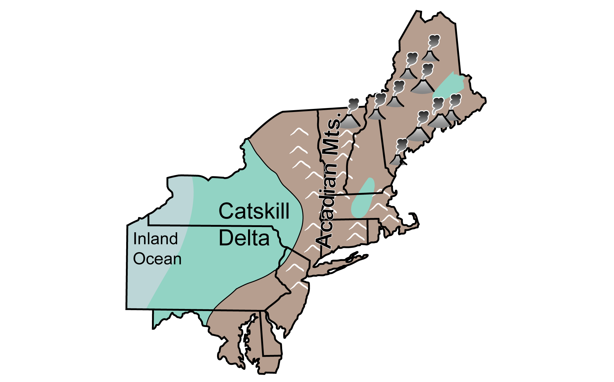
Positions of the Acadian Mountains and Catskill Delta during the Devonian Period. Image modified from original by J. Houghton first published in The Teacher-Friendly Guide to the Geology of the Northeastern U.S. by Jane Ansley (published by the Paleontological Research Institution) (CC BY-NC-SA 4.0 license).
Although the thickest sequences from this delta are found in Pennsylvania and New York, Catskill Delta deposits can also be seen throughout the panhandle of western Maryland.
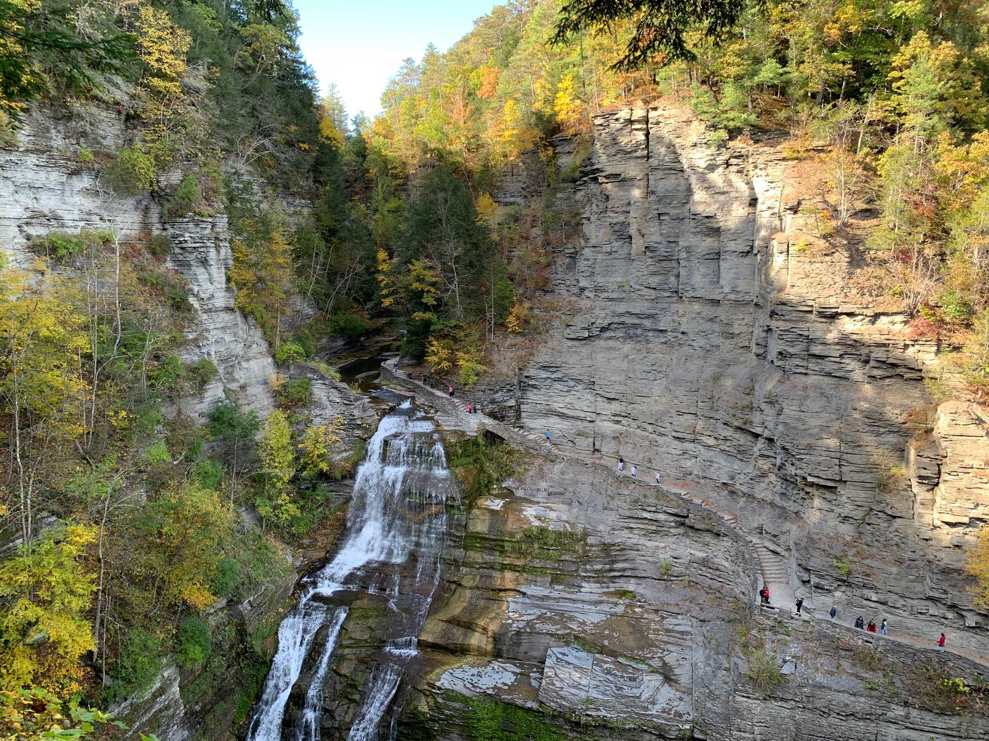
Late Devonian-aged sedimentary rocks exposed at Lucifer Falls in Robert H. Treman State Park, Tompkins County, New York. Photograph by Jonathan R. Hendricks for PRI's Earth@Home project (CC BY-NC-SA 4.0 license).
Many of the Devonian rocks produced during the Acadian Orogeny are similar to those of the Ordovician during the Taconic Orogeny: conglomerate, sandstone, siltstone, shale, and carbonates. Widespread black shales were deposited in deeper waters as organic-rich marine mud. The Devonian Marcellus Shale, a black shale found throughout the Appalachian Basin, is an important source rock for natural gas.
Carboniferous and Permian
During the Carboniferous period, the Inland Basin region was still largely an inland sea, with sediment being shed into the basin from the Acadian highlands in the east.
Positions of the Acadian Mountains and Catskill Delta during the Carboniferous Period. Image modified from original by J. Houghton first published in The Teacher-Friendly Guide to the Geology of the Northeastern U.S. by Jane Ansley (published by the Paleontological Research Institution) (CC BY-NC-SA 4.0 license).
During the Mississippian, sediment from the Acadian highlands continued to fill the basin’s deeper waters with mud, silt, and sand.
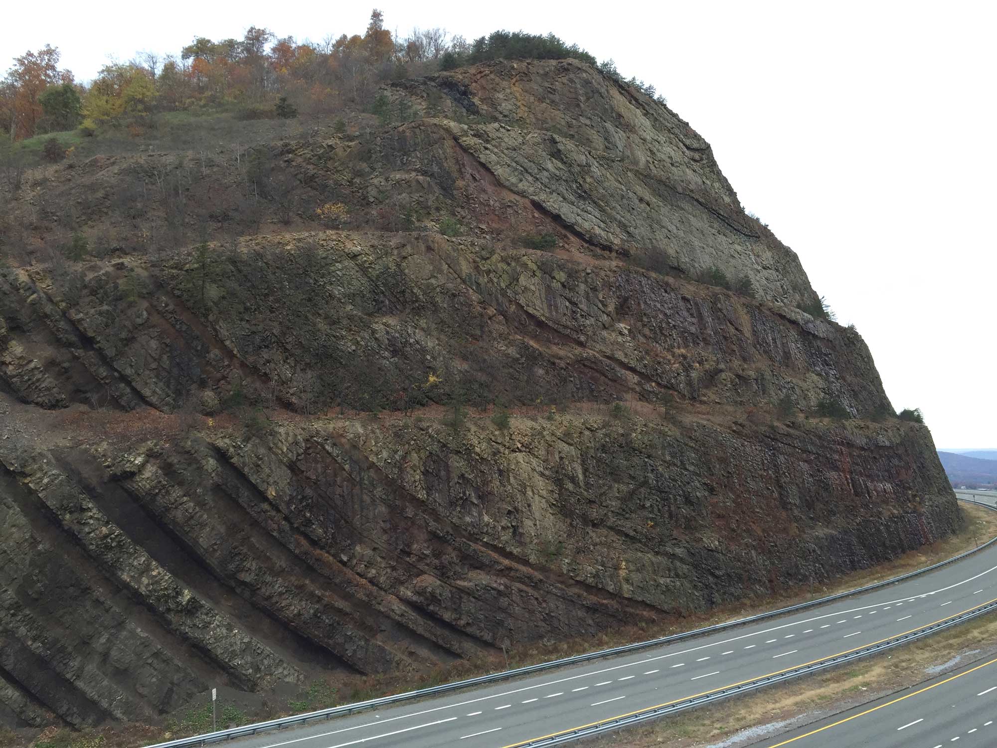
The early Mississippian Rockwell Formation at the Sideling Hill roadcut on Interstate 68, Maryland. Alternating sandstones, shales, and siltstones indicate changes in the alluvial plain environment during deposition. These beds have been structurally deformed to form a syncline. Photograph by Jonathan R. Hendricks for PRI's Earth@Home project (CC BY-NC-SA 4.0 license).
Carbonate deposits from this time are rich in silica provided from the skeletons of siliceous sponges as well as quartz sand and silt, and chert is common. Many of these carbonate rocks have since been subject to erosion and dissolution, generating a landscape of sinkholes and caverns. The Northeast’s deepest cave system, Laurel Caverns in Pennsylvania, is found in Mississippian limestone.
Toward the end of the Mississippian, sea level fluctuated, and deltas and coastlines advanced and retreated repeatedly. These rapid changes between coastal and terrestrial environments created deposits called cyclothems: alternating sequences of terrestrial and marine sedimentary layers dominated by thick limestones and dolomites.
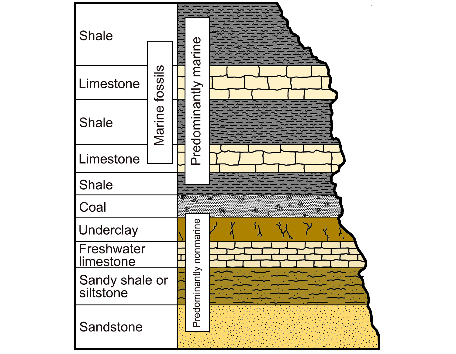
An example of a cyclothem, alternating sequences of marine and nonmarine sedimentary rocks characterized by their light and dark colors. Image modified from original by Wade Greenberg-Brand (after image from Levin, 2006, The Earth Through Time, 8th ed.), published in The Teacher-Friendly Guide to the Geology of the Southeastern U.S., 2nd ed., edited by Andrielle N. Swaby, Mark D. Lucas, and Robert M. Ross (published by the Paleontological Research Institution) (CC BY-NC-SA 4.0 license).
During the late Carboniferous, Gondwana (a landmass composed of Africa, South America, and Australia) and North America converged into the supercontinent Pangaea. By the Permian, the assembly of Pangaea was complete, and the Iapetus Ocean began to close. As the inland sea covering eastern North America retreated for the final time, the Northeast’s climate became significantly drier, and the lush Pennsylvanian coal swamps were gradually replaced by red beds and lacustrine carbonates, typical deposits of drier climates. Some of these Permian-aged deposits are exposed at the surface in southeastern Pennsylvania and western Maryland.
Resources
Resources from the Paleontological Research Institution
Websites
Digital Encyclopedia of Earth Science: Minerals: https://earthathome.org/de/minerals/
Earth@Home: Here on Earth: Rocks: https://earthathome.org/hoe/rocks/
Earth@Home Virtual Collection: Rocks: https://earthathome.org/vc/rocks/ (Virtual rock collection featuring 3D models of rock specimens sorted by type.)
Books
Vern Straeten, C. A., D. J. Over, and D. Woodrow (eds.). 2023. Devonian of New York, vols. 1-3. Bulletins of American Paleontology vols. 403-408.