

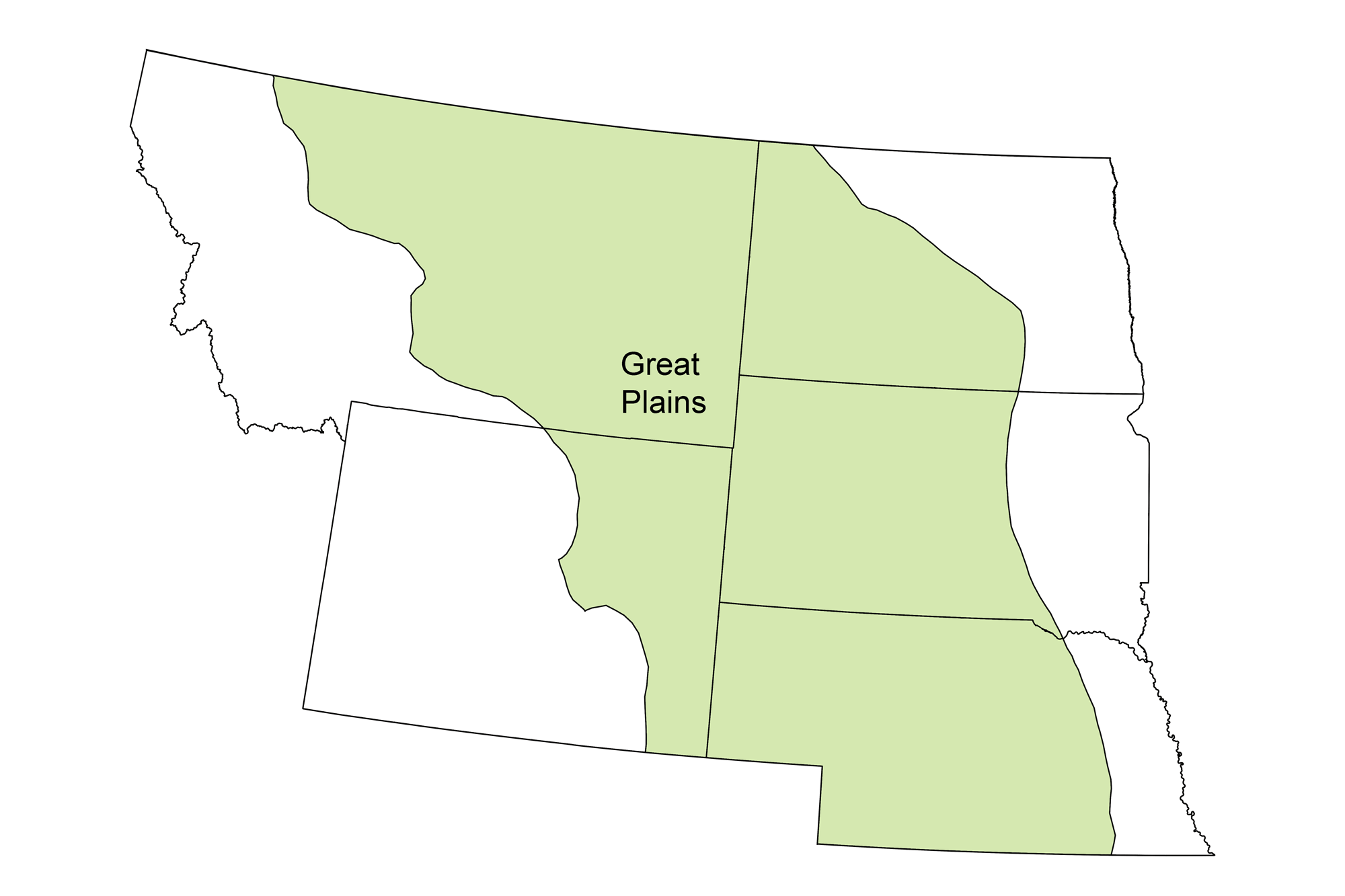
Page snapshot: Introduction to energy of Great Plains region of the northwest-central United States.
Topics covered on this page: Overview; Oil and gas; Coal and coalbed methane; Wind energy; Nuclear power; Resources.
Credits: Most of the text of this page comes from "Energy in the Northwest Central US" by Carlyn S. Buckler and Robert M. Ross, chapter 7 in The Teacher-Friendly Guide to the Earth Science of the Northwest Central US, edited by Mark D. Lucas, Robert M. Ross, and Andrielle N. Swaby (published in 2015 by the Paleontological Research Institution; currently out of print). The book was adapted for the web by Elizabeth J. Hermsen and Jonathan R. Hendricks in 2022. Changes include formatting and revisions to the text and images. Credits for individual images are given in figure captions.
Updates: Page last updated September 4, 2022.
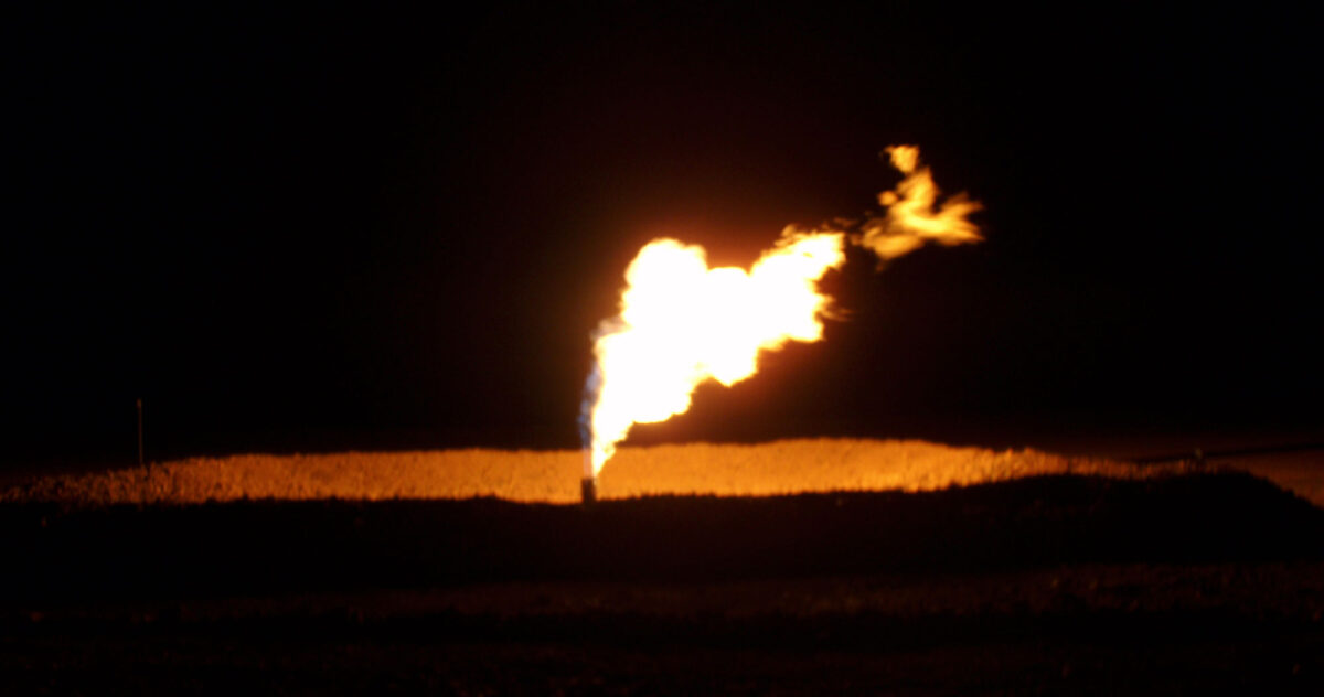
Image above: A gas flare (nature gas being burned off) in the Bakken Formation, North Dakota. Photo by Joshua Doubek (Wikimedia Commons, Creative Commons Attribution-ShareAlike 3.0 Unported license, image cropped and resized).
Overview
The Great Plains region is a broad expanse of flat land underlain by thick sequences of sedimentary rock and primarily covered in grassland and prairie. Ancient sedimentation patterns and tectonic activity have favored the placement of widespread fossil fuel resources in this region. Organic-rich sediments were deposited in inland seas that spread across much of the region, and Cenozoic swamps contributed plant matter to form thick beds of coal. The Great Plains’ sedimentary basins contain vast oil, gas, and coal reserves that dominate energy production here, but the area’s topography and climate also make it appropriate for large wind farms.
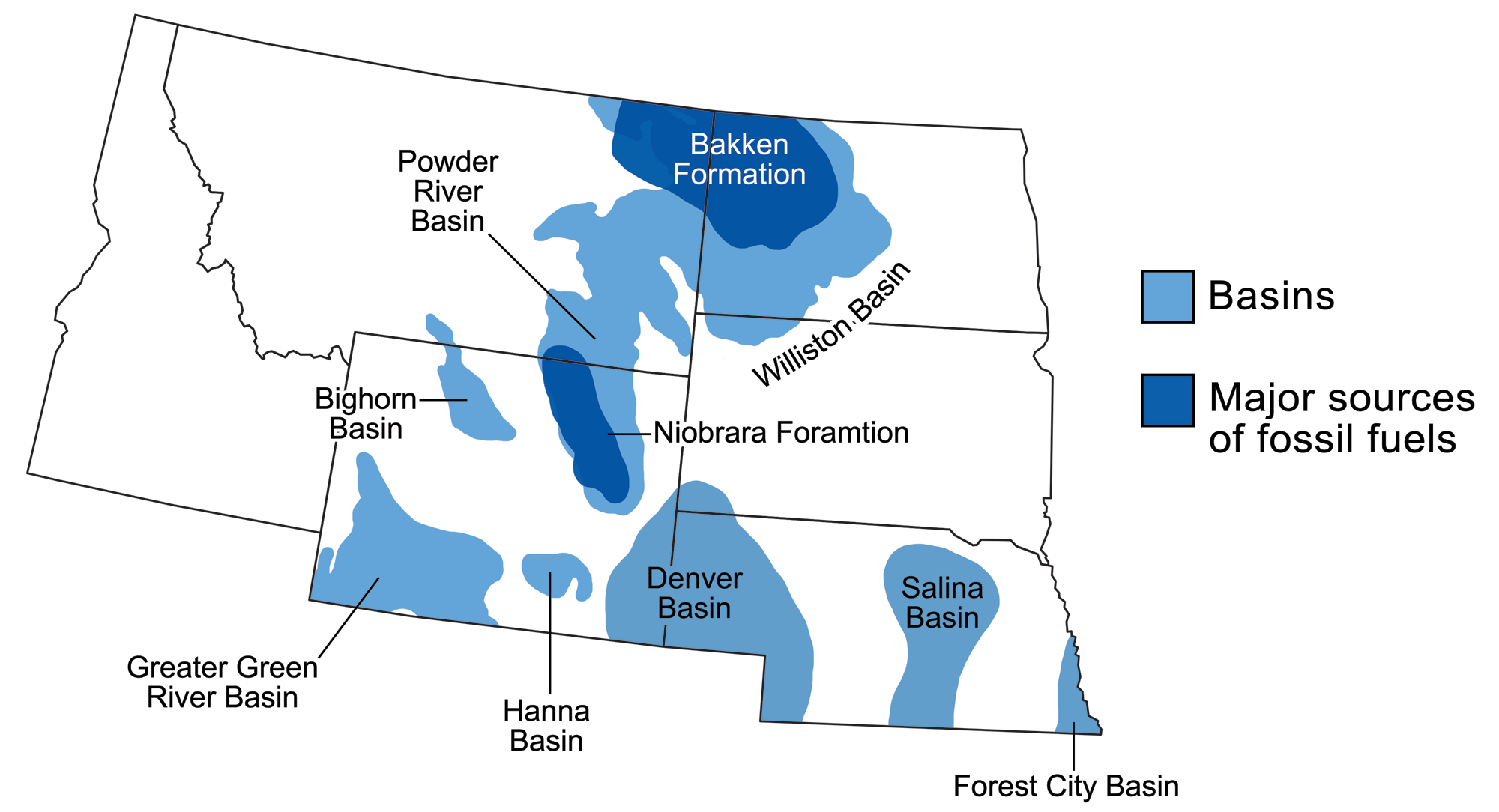
Sedimentary basins containing significant fossil fuel accumulations in the northwest-central U.S. Modified from a map by Wade Greenberg-Brand that was originally published in The Teacher-Friendly Guide to the Northwest Central US.
Oil and gas
Oil deposits from the Great Plains region are also among the largest in the U.S. It is possible to make sense of why we find petroleum and natural gas in these areas by understanding the history of marine environments. Mud with relatively high organic matter content tends to accumulate in shallow continental seas and in coastal marine environments. The northwest-central U.S. has been home to both types of environments throughout its geologic past.
Reservoir rocks in the Great Plains include dolomites, chalks, and organic-rich shales. There have been estimates of some 400 billion barrels of untapped oil in the Bakken Formation and large reserves of both oil and natural gas in the Niobrara Formation, although estimates of the size of oil and gas reserves that can or will be economically extracted are in dispute. Thanks to these geological units, this region is a net exporter of energy, providing much of the central U.S. with its oil and gas.
Petroleum-producing regions of the northwest-central U.S. Modified from a map by Wade Greenberg-Brand, adapted from an image by Peter Nester, originally published in The Teacher-Friendly Guide to the Northwest Central US.
Williston Basin (Bakken Formation)
The Bakken Formation formed in the late Devonian and early Mississippian, in a continental sea that filled what we now call the Williston Basin. The Bakken is known only from coring, as it does not outcrop at the surface. The source rock for the formation’s oil is present in its upper and lower dark shale layers, and a reservoir layer of dolomite lies between the shales. Since 2000, oil production rates in the Bakken Formation have expanded enormously through the application of horizontal drilling combined with high volume hydraulic fracturing.
Unlike some famous “fracked” formations in other areas, such as the Barnett Shale in Texas and Marcellus Shale in Pennsylvania, the part of the Bakken Formation most intensively hydraulically fractured has been its dolostone reservoir unit rather than the dark shale source rock. This unconventional drilling activity is centered in North Dakota, which has become the nation’s second largest oil-producing state after Texas.
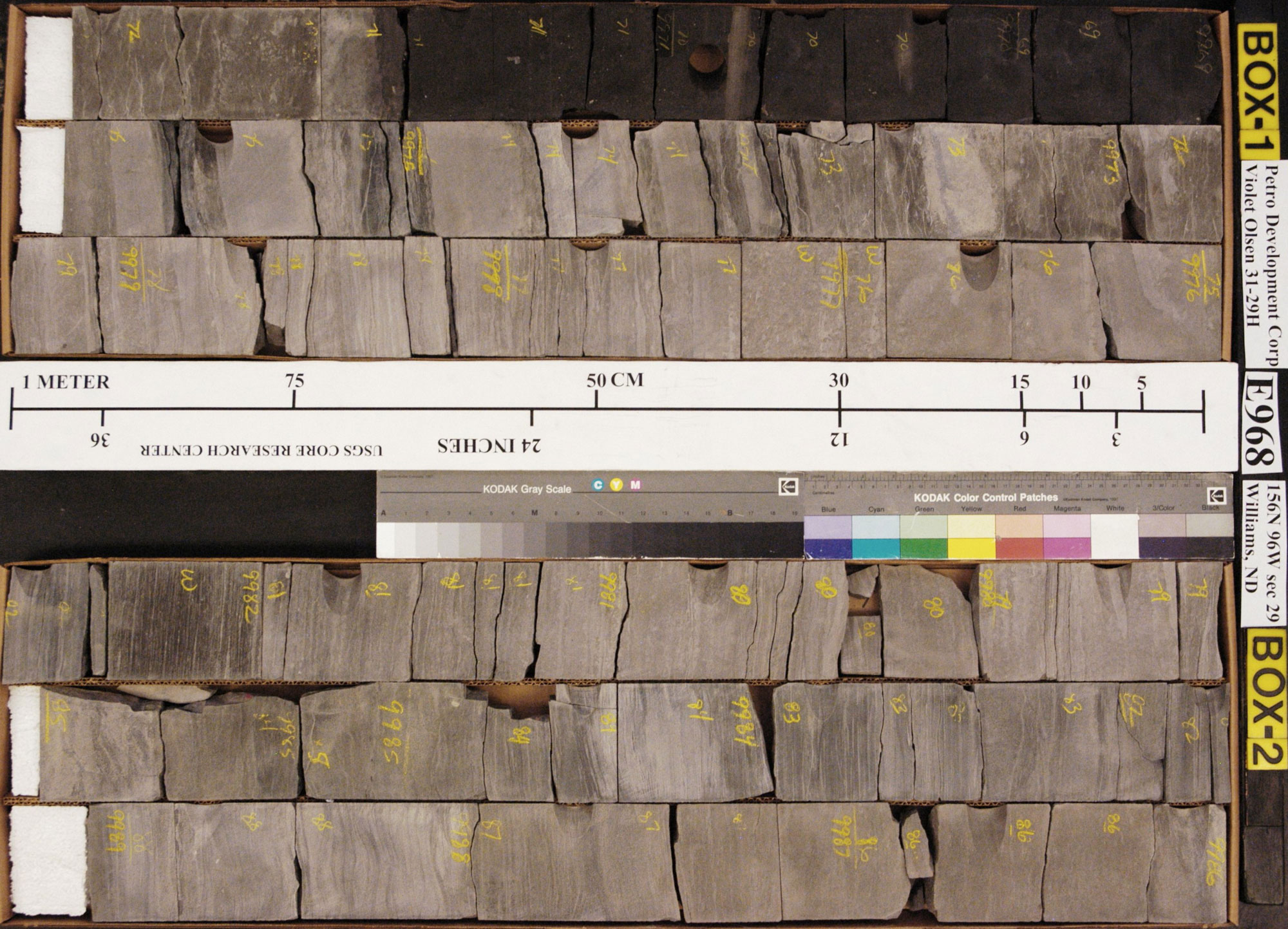
Core of the Bakken Formation. Source: USGS.
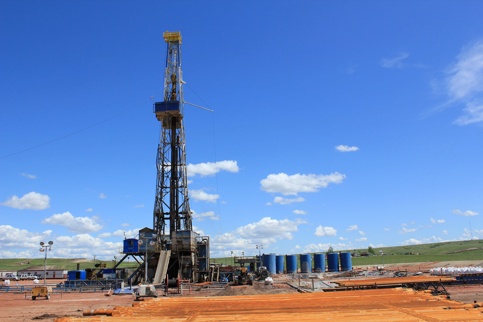
Drilling rig, Williston, North Dakota, 2011. Photo by Lindsey G (flickr, Creative Commons Attribution 2.0 Generic license, image resized).
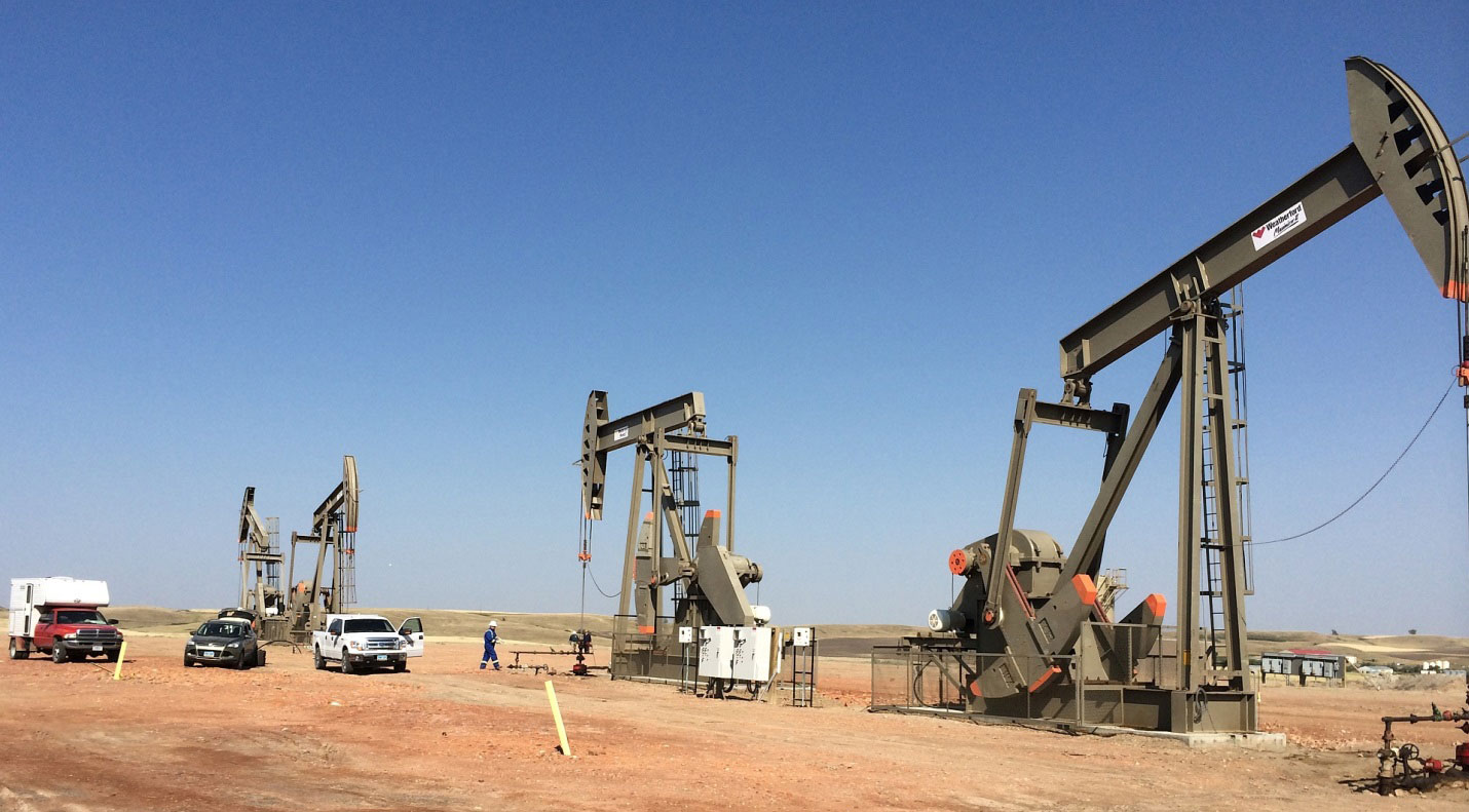
Pumpjacks at oil wells in the Bakken Formation, North Dakota. Photo by USGS (public domain).
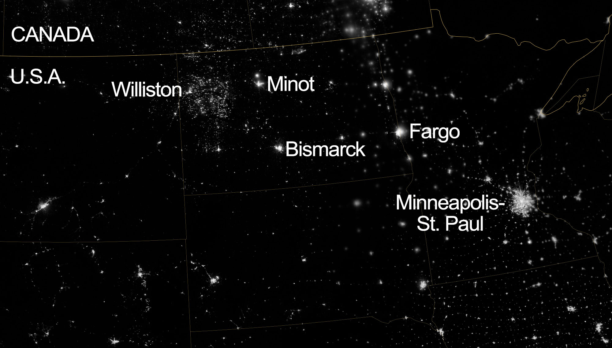
North Dakota and surrounding region at night, 2012. The lights in the large area around Williston are not a large city, but the lights from oil and gas development in the Williston Basin. Source: NASA Earth Observatory image by Jesse Allen and Robert Simmon (used following NASA's image use policy).
Niobrara Formation
The Niobrara Formation, also known as the Niobrara Chalk or Niobrara Shale, extends from the Gulf of Mexico to the Arctic, and originates from sediments deposited in the Late Cretaceous Western Interior Seaway. Where the formation outcrops at the surface, it is famous for its fossil faunas. The Niobrara is tapped for fossil fuels in the Denver Basin (also known as the Julesburg or D-J Basin), which underlies northeastern Colorado, a small corner of southeast Wyoming, and southwest Nebraska. The formation contains alternating chalks and organic-rich marls and shales; the marls and shales are a source of petroleum, and the adjacent chalks have become reservoir rocks. Natural gas and oil from conventional drilling have been extracted from the Niobrara since the early 1900s. Unconventional drilling below about 1830 meters (6000 feet) has greatly increased oil production in southeastern Wyoming in recent years.
Coal and coalbed methane
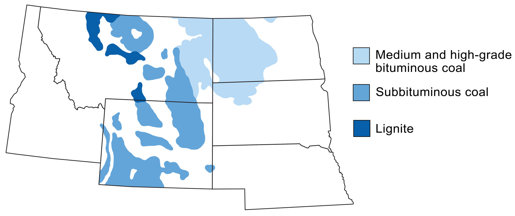
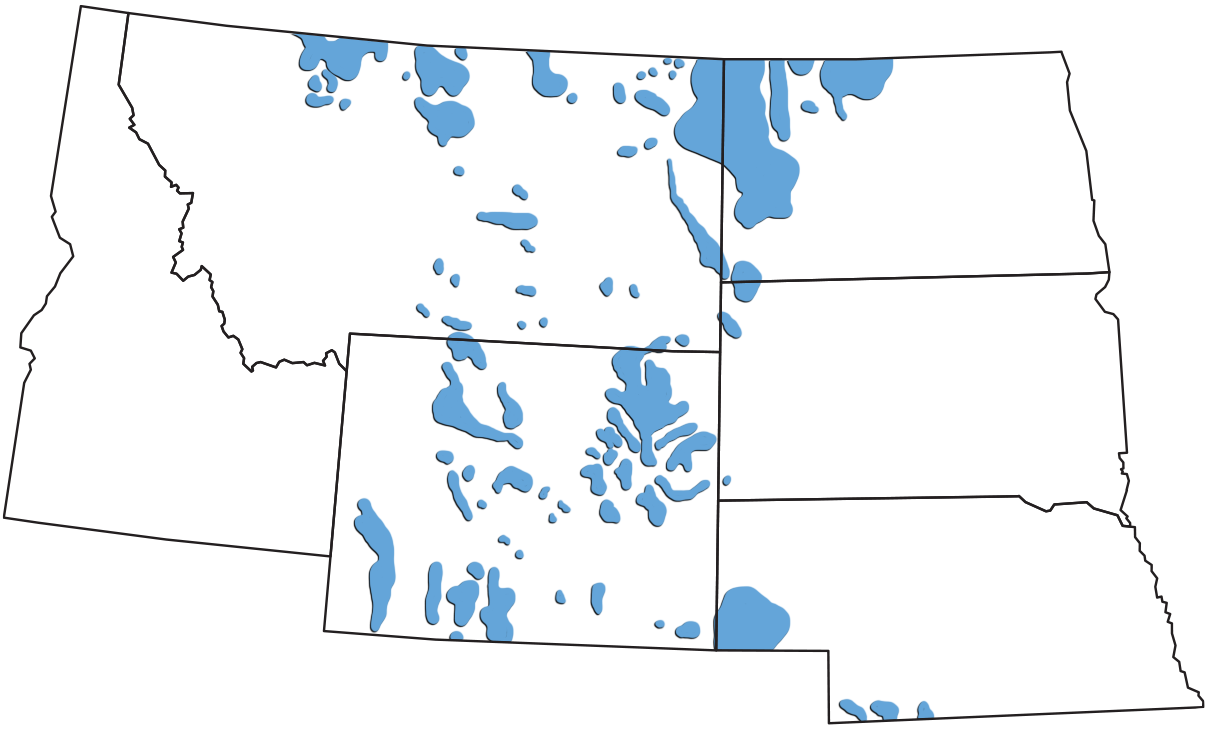
Coal-producing regions of the northwest-central U.S. Modified from a map by Wade Greenberg-Brand, adapted from an image by the USGS, originally published in The Teacher-Friendly Guide to the Northwest Central US.
Williston Basin (North Dakota)
The world’s largest known lignite coal deposit, weighing in at an estimated 351 billion tons, is found in western North Dakota’s Williston Basin. This area is known as the Fort Union coal region, named after the Fort Union Formation, a thick sequence of Paleocene-aged coal deposits lying above Cretaceous-aged marine sediments from the Western Interior Seaway. North Dakota’s supply of lignite is estimated to last more than 800 years, and the deposits are used for synthetic fuels (made of carbon monoxide and hydrogen) as well as fuel for nearby power plants. Coal mining in this area began in the 1870s, when small seasonal mines sprung up along the main routes of transportation in the area. Over 250 mines were in operation by the 1920s. Today, there are only six large coal mines in western North Dakota, from which 32 million tons of coal are extracted annually. One of these, the Freedom Mine, is the 12th largest coal mine in the US.
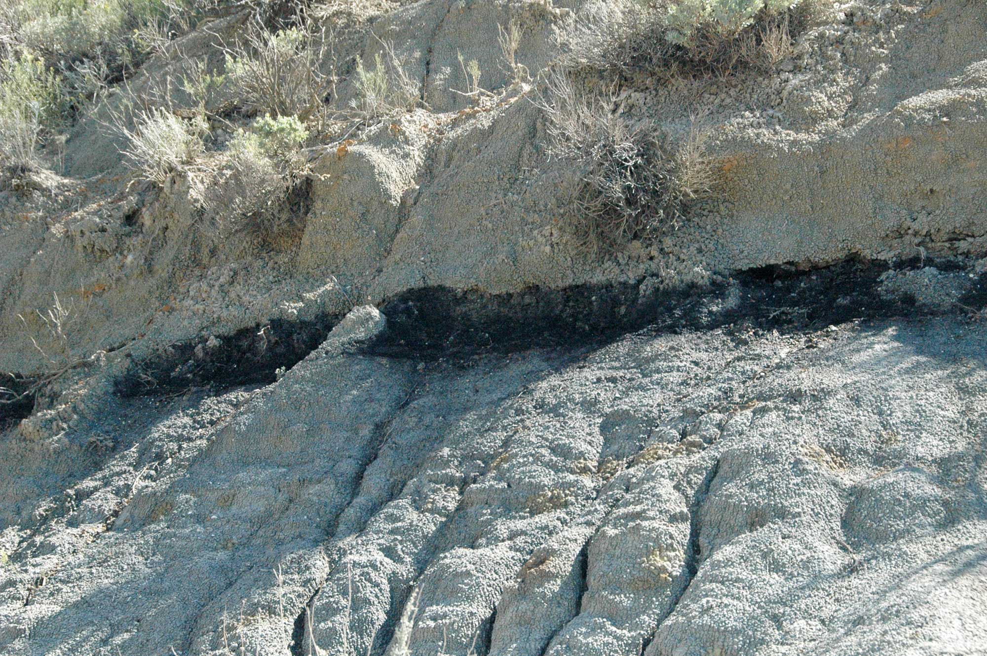
Coal seam, Paleocene Sentinel Butte Formation, North Dakota. Photo by James St. John (flickr, Creative Commons Attribution 2.0 Generic license, image resized).
Powder river basin (Wyoming)
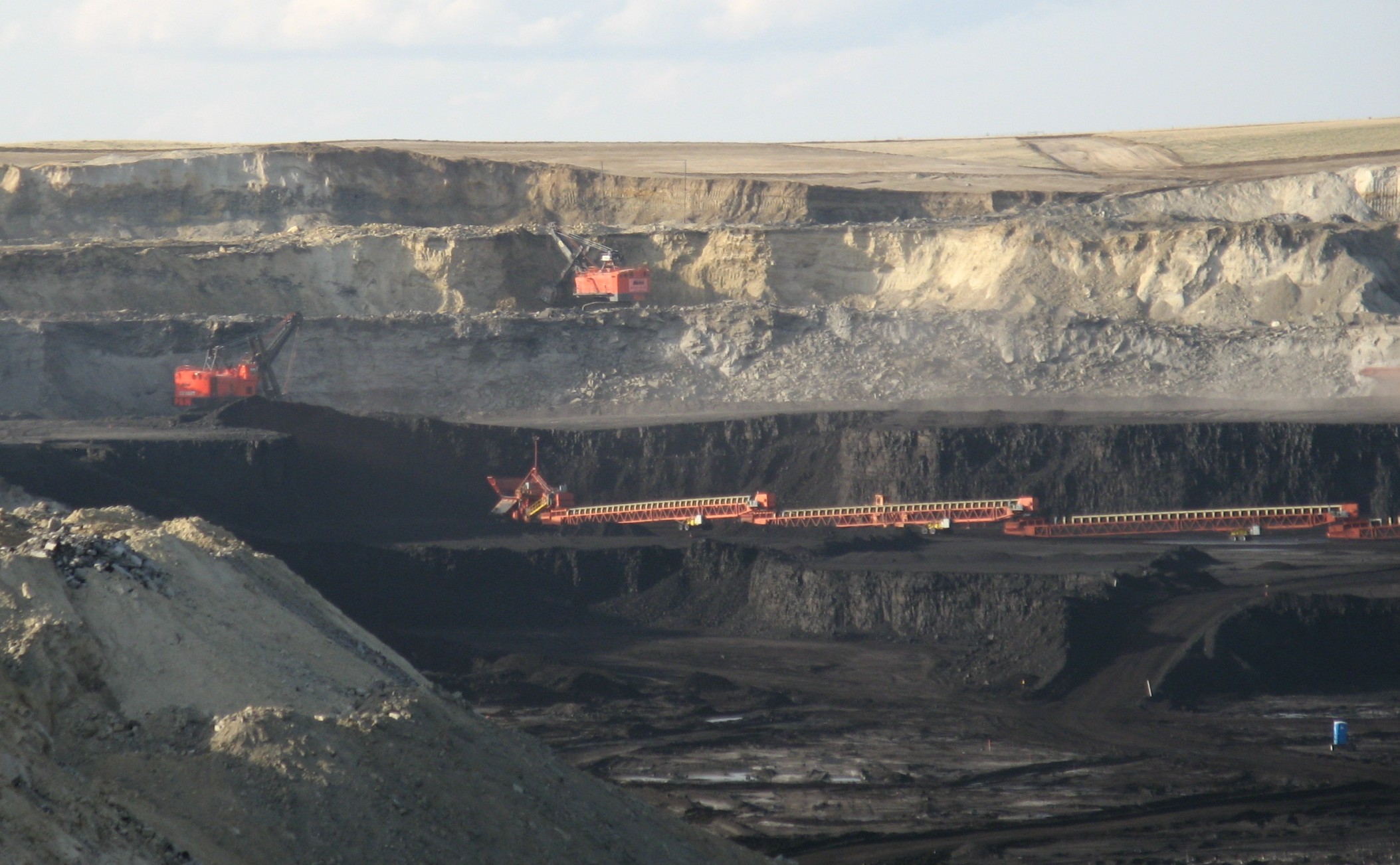
In Wyoming, great quantities of coal are produced annually from the Powder River Basin. Like the Williston Basin, the Powder River Basin contains a thick sequence of Cretaceous marine shales and sandstones formed in the Western Interior Seaway, overlain by Paleocene-aged coals of the Fort Union Formation. These coals have experienced greater heat and pressure from burial than those in the Williston Basin, and thus are higher-grade sub-bituminous coals. In fact, the Powder River Basin contains the largest resources of low-sulfur, low-ash, sub-bituminous coal in the U.S. These deposits provide more than 40% of the U.S. coal supply, making Wyoming the largest coal-producing state. The Black Thunder Coal Mine is currently the most productive coal mine in the U.S., providing 8% of the country’s coal and 20% of Wyoming’s total coal production. This mine utilizes the world’s largest dragline excavator, employed to strip the overlying rock and sediment and expose the underlying coal seams.
The Powder River Basin hosts significant quantities of coalbed methane. Coal mines have long been vented to the atmosphere, in part because of the buildup of methane (CH4, the primary gas in natural gas) released from fissures around the coal. This methane is a byproduct of the process of coalification, by which ancient plant material was transformed into coal, and it accounts for over 5% of US methane production. Wyoming is one of the three leading US states for coalbed methane production (approximately equal to that of Colorado and New Mexico), each of which account for about 25% or more of the national total.
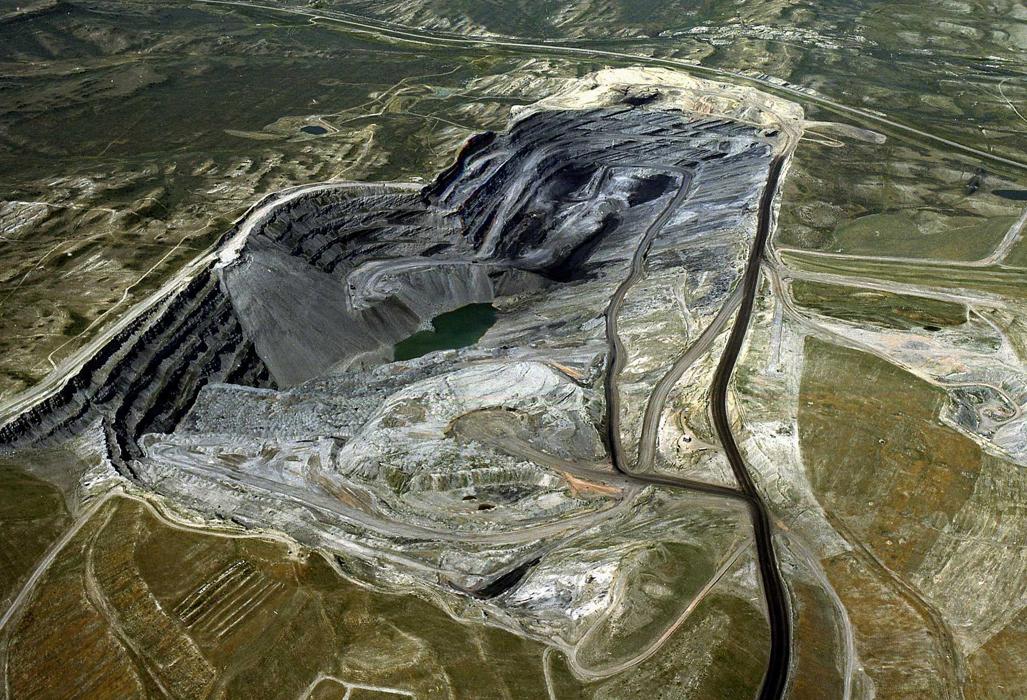
Open-pit mine in the Power River Basin, Wyoming. Photo by BLM Wyoming (Bureau of Land Management on flickr, Creative Commons Attribution 2.0 Generic license, image cropped and resized).
Open-pit mine in the Power River Basin, Gillette, Wyoming, 2008. Photo by Greg Goebel (flickr, Creative Commons Attribution-ShareAlike 2.0 Generic license, image cropped and resized).
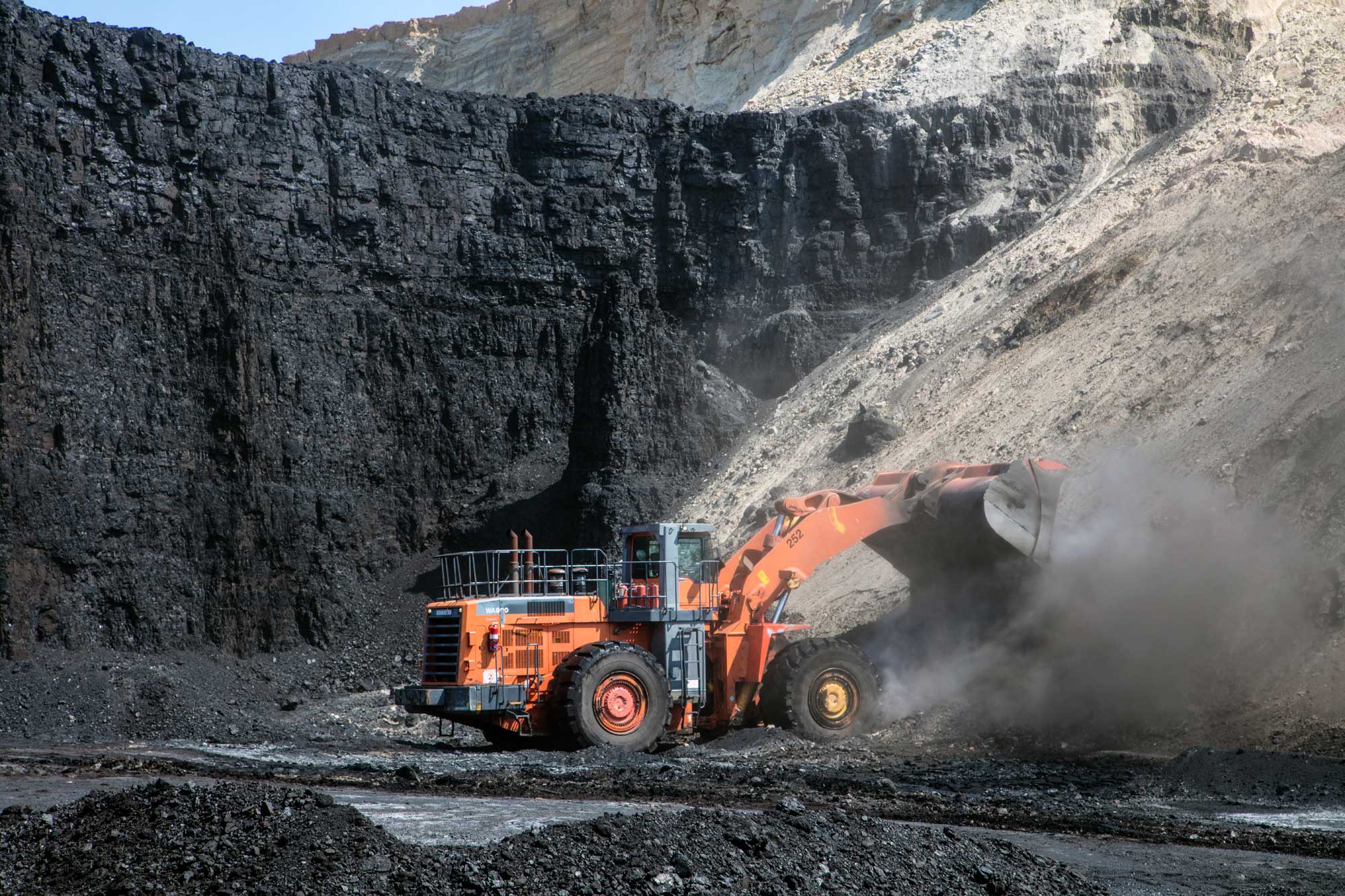
Machinery in an open-pit mine in the Power River Basin, Gillette, Wyoming, 2015. Photo by Carol M. Highsmith (Library of Congress reproduction number LC-DIG-highsm-34168, Highsmith Archive, no known restrictions on publication).
Montana
The Great Plains of Montana also produce sub-bituminous coal from the northern extension of the Powder River Basin and lignite from the western extension of Williston Basin deposits. Montana ranks 6th in the nation among coal-producing states. Considerably more coal resources lie below currently mineable depths, that is, below about 150 meters (500 feet). Not surprisingly, these zones are being considered for potential underground coal gasification projects that would convert coal to gas below the surface and then bring the gas to the surface through wells.
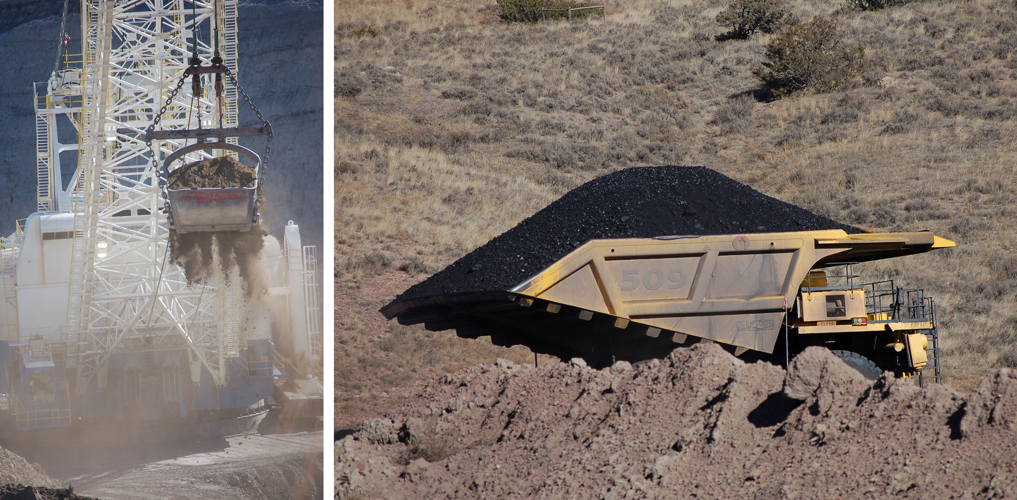
Machinery at Spring Creek Mine, Montana, including a dragline (left) and a truck hauling coal (right). Left photo and right photo by BLM (public domain).
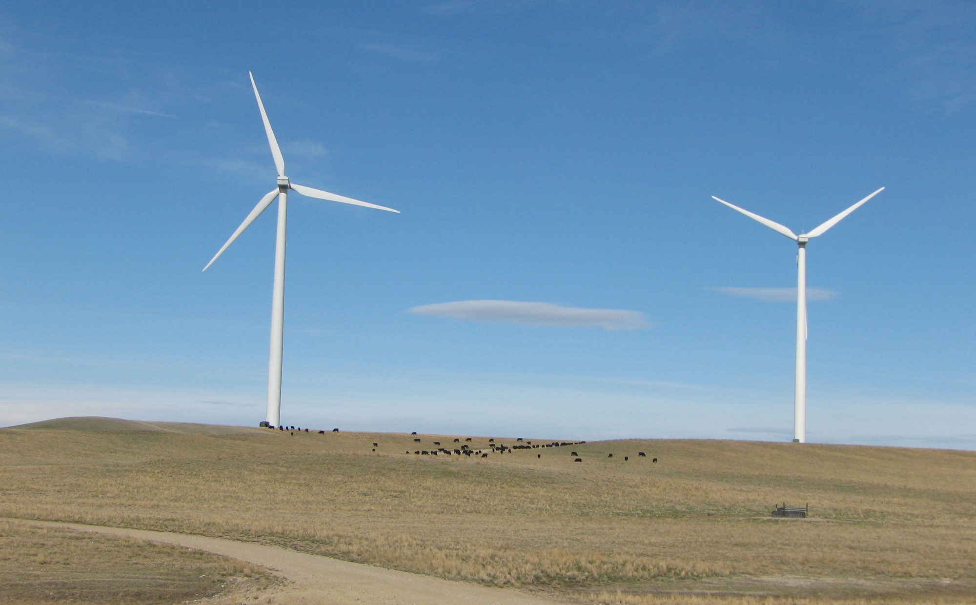
Wind energy
The Great Plains (in this case referring to the full area that runs from Texas to Montana and into Canada) has been called the “Saudi Arabia of Wind Energy,” at least in terms of potential. Wind energy provides about a third of the renewable energy produced in the U.S., with hydroelectric representing about half; solar, geothermal, and biomass account for the remaining sixth.
In contrast to hydroelectric, wind energy is growing rapidly. Wind grew tenfold on a national scale from 2004 to 2014, and wind farms on the Great Plains have played a significant role in that growth. In the northwest-central region, the five Great Plains states are among the top 16 states for wind energy as a percentage of state electricity generation (South Dakota 25%, North Dakota 18%, Wyoming 9%, Nebraska 7%, and Montana 7%). This is all the more remarkable considering the rate of local petroleum and coal extraction.
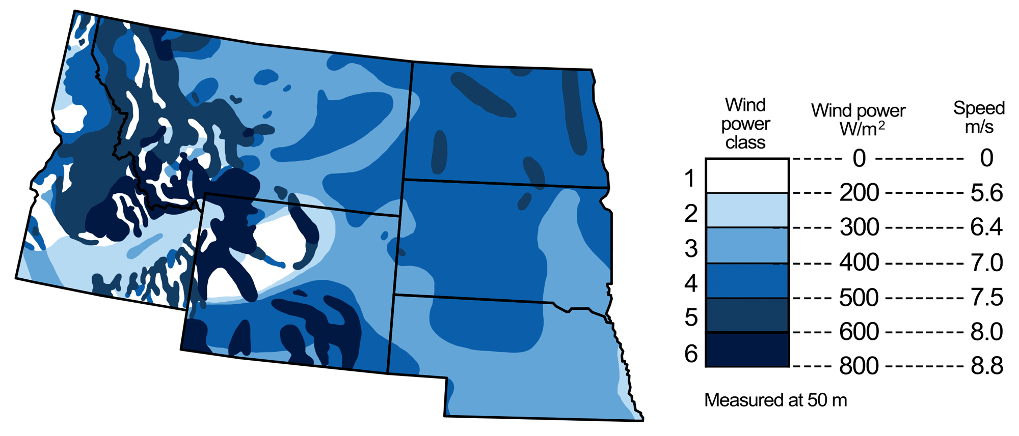
Wind energy potential in the northwest-central U.S. Map modified by a map by Wade Greenberg-Brand, adapted from image by National Renewable Energy Laboratory, originally published in The Teacher-Friendly Guide to the Earth Science of the Northwest Central US.
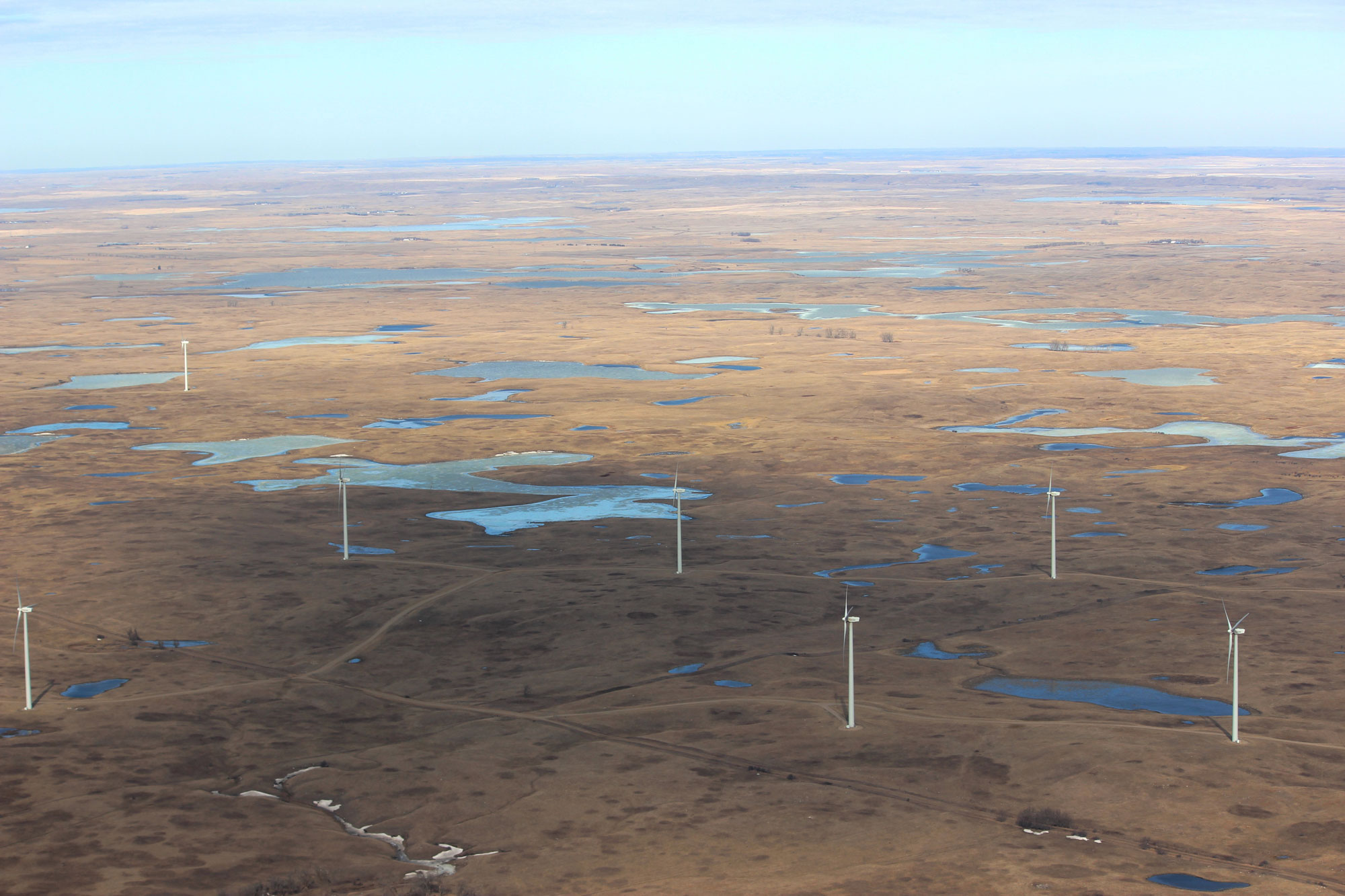
Tatanka Wind Farm, North Dakota-South Dakota border, 2015. Photo by Krista Lundgren, USFWS (U.S. Fish and Wildlife Service Mountain-Prairie on flickr, Creative Commons Attribution 2.0 Generic license, image resized).
Wind turbines near Judith Gap, Montana, 2009. Source: USDA, NRCS on flickr (public domain).
Nuclear power
Uranium used in nuclear power plants is mined from certain sedimentary rocks in the Great Plains. Economic deposits of uranium are found in Paleocene and Eocene sandstones in the southern Powder River Basin of Wyoming and in Oligocene rocks in northwest Nebraska (Crow Butte). The Paleocene lignitic coals of North Dakota also contain significant uranium content. Despite the prevalence of uranium resources throughout the Great Plains, however, nuclear power is not generated here.
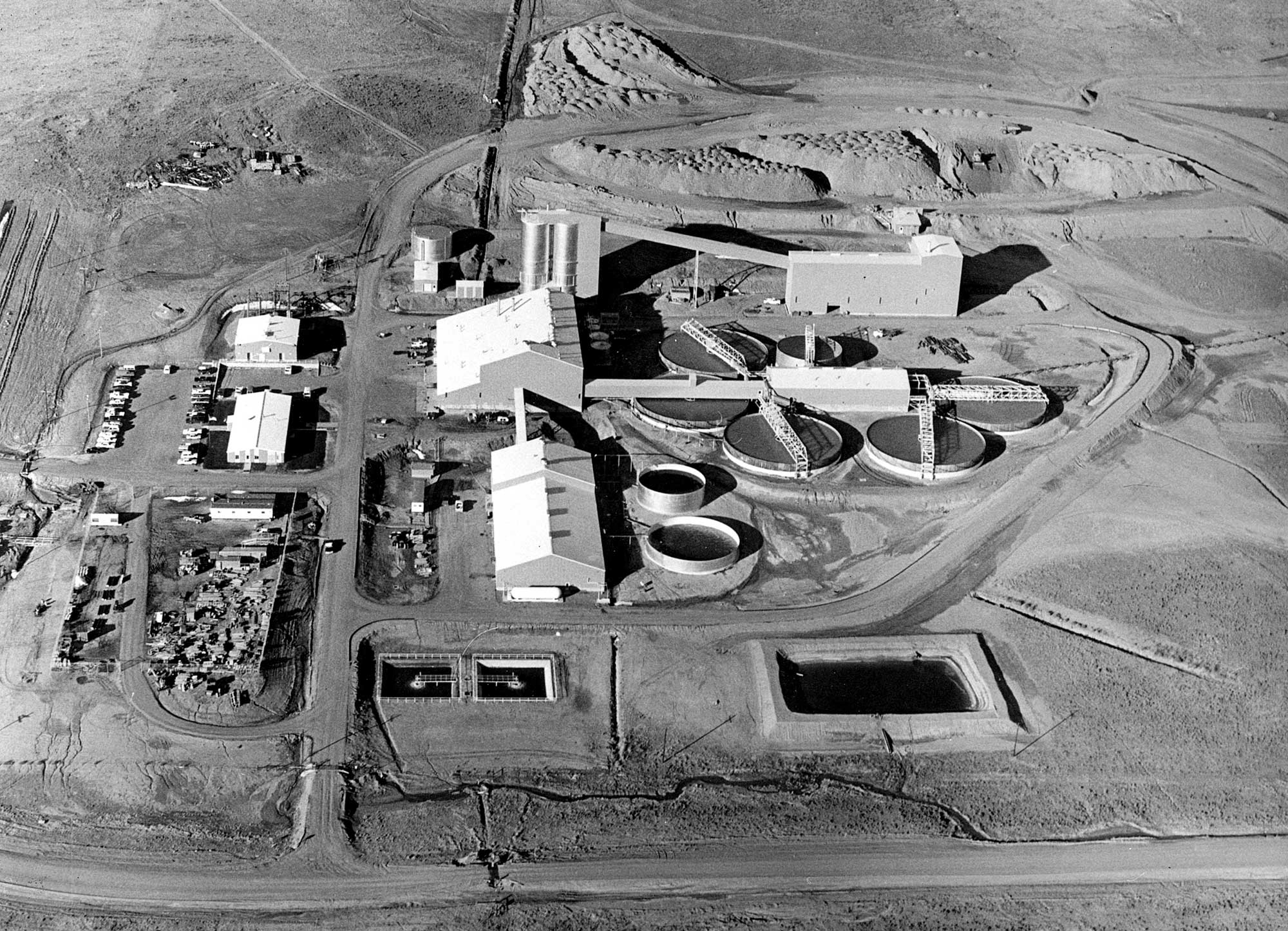
Highland Uranium Mill, Casper, Wyoming, ca. 1973. Photo source: U.S. Department of Energy HD.11D.001 (USDOE on flickr, U.S. government work).
Resources
Resources from the Paleontological Research Institution
Earth@Home: Earth Science of the South-central U.S.: Energy in the Great Plains and Basin and Range (covers the Great Plains in Kansas, Oklahoma, and Texas): https://earthathome.org/hoe/sc/energy-gp-br/
Earth@Home: Earth Science of the Southwestern U.S.: Energy in the Great Plains (covers the Great Plains in Colorado and New Mexico): https://earthathome.org/hoe/sw/energy-gp
Earth@Home: Introduction to Energy: https://earthathome.org/hoe/energy