

Page snapshot: Introduction to energy of Rocky Mountain region of the northwest-central United States, including fossil fuels and renewable enery.
Topics covered on this page: Overview; Oil and gas; Coal; Hydroelectricity; Wind energy; Resources.
Credits: Most of the text of this page comes from "Energy in the Northwest Central US" by Carlyn S. Buckler and Robert M. Ross, chapter 7 in The Teacher-Friendly Guide to the Earth Science of the Northwest Central US, edited by Mark D. Lucas, Robert M. Ross, and Andrielle N. Swaby (published in 2015 by the Paleontological Research Institution; currently out of print). The book was adapted for the web by Elizabeth J. Hermsen and Jonathan R. Hendricks in 2022. Changes include formatting and revisions to the text and images. Credits for individual images are given in figure captions.
Updates: Page last updated September 8, 2022.
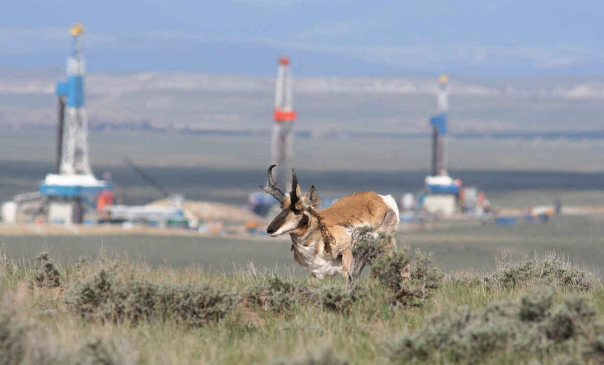
Image above: A pronghorn antelope in the Pinedale Anticline Natural Gas Field, Wyoming, 2008. Photo by Theo Stein, USFWS (USFWS Mountain-Prairie on flickr, Creative Commons Attribution 2.0 Generic license).
Overview
The high topography of the Rocky Mountains provides context both for hydroelectric power and wind energy. The same rugged peaks and valleys that contribute to localized high winds also make large-scale wind energy development difficult. The Rocky Mountains region is also known for coal, oil, and gas, in this case from large freshwater sedimentary deposits in the Greater Green River Basin.
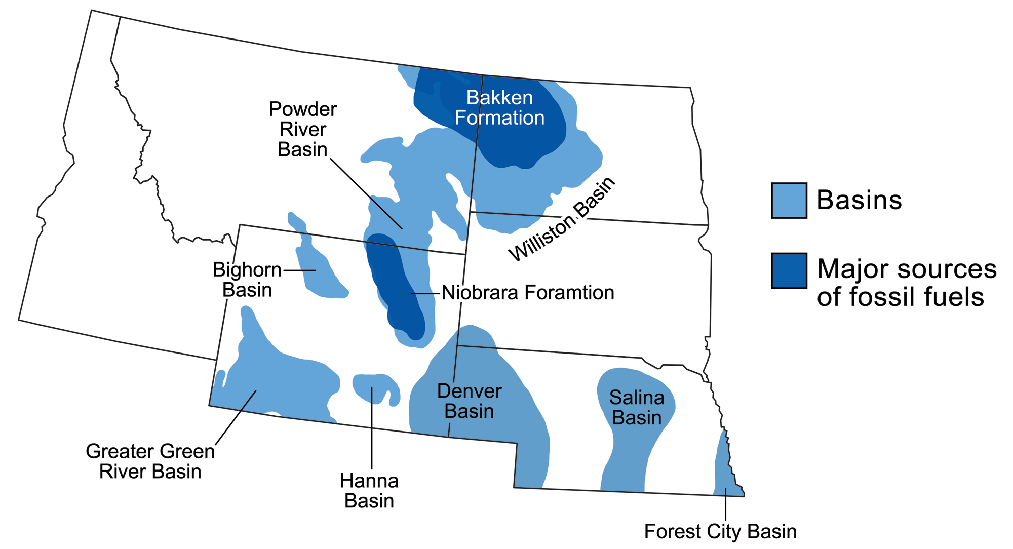
Sedimentary basins containing significant fossil fuel accumulations in the northwest-central U.S. Modified from a map by Wade Greenberg-Brand that was originally published in The Teacher-Friendly Guide to the Earth Science of the Northwest Central US.
Oil and gas
Petroleum resources are extracted in the Greater Green River Basin. The Greater Green River Basin is itself made up of several smaller basins and arches between them, formed during the Laramide Orogeny from the end of the Cretaceous period into the Eocene. The basin is known for its Eocene-aged surface rocks that contain both mineral and fossil fuel resources, along with its unusually well-preserved terrestrial fossils in the Green River Formation. Fossil fuels, thought to be derived from blue-green algae living in ancient lakes, are found in particularly thick sequences of Eocene oil shale. The Green River Formation hosts the largest known oil shale deposits in the world.
The Wamsutter gas field, occupying a 89-kilometer-long (55-mile-long) portion of Wyoming’s Red Desert, has recently experienced an energy boom.
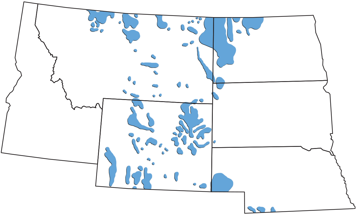
Petroleum-producing regions of the northwest-central U.S. Modified from a map by Wade Greenberg-Brand, adapted from an image by Peter Nester, originally published in The Teacher-Friendly Guide to the Earth Science of the Northwest Central US.
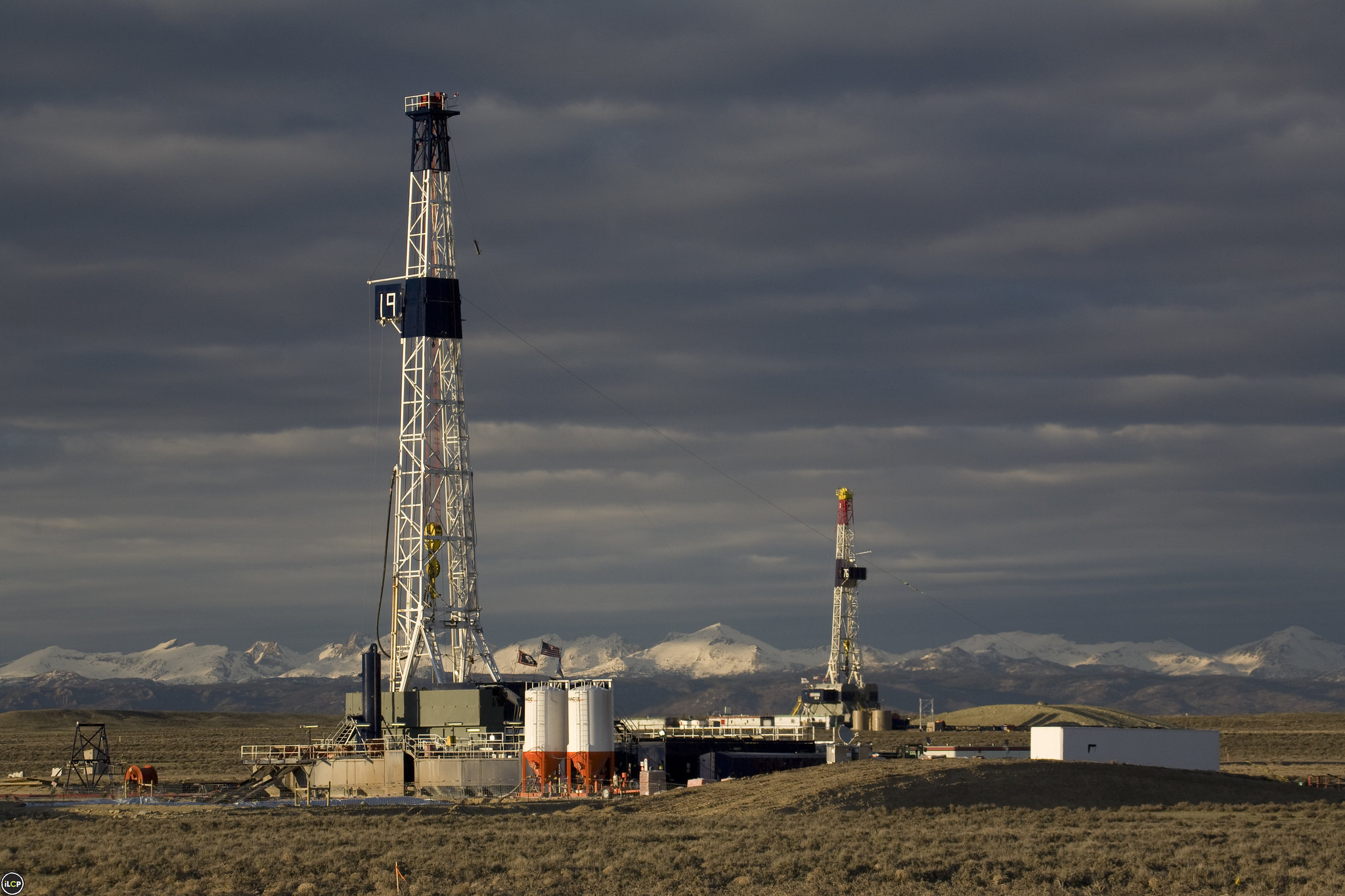
Drilling rings in the Pinedale Anticline Natural Gas Field, Green River Basin, Wyoming, 2008. Photo by Wendy Shattil and Bob Rozinski, International League of Conservation Photographers (Wyoming: Upper Green River Valley on flickr, Creative Commons Attribution 2.0 Generic license).
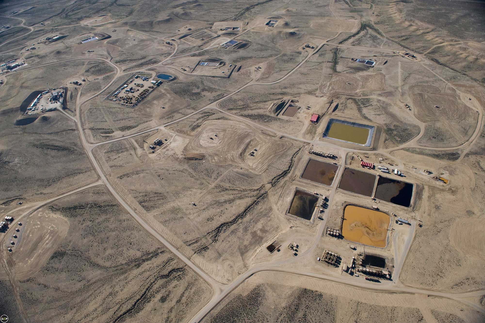
Aerial photo of waste pits and drilling infrastrcture in the Pinedale Anticline Natural Gas Field, Green River Basin, Wyoming, 2008. Photo by Tom Mangelsen, International League of Conservation Photographers (Wyoming: Upper Green River Valley on flickr, Creative Commons Attribution 2.0 Generic license, image resized).
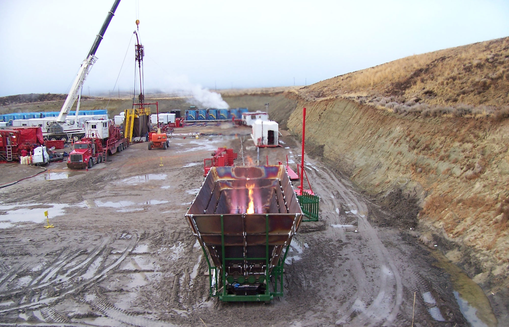
Enclosed gas flare burning waste gas in the Pinedale Anticline Natural Gas Field, Green River Basin, Wyoming, 2008. Photo by Tpmark (Wikimedia Commons, Creative Commons Attribution-ShareAlike 3.0 Unported license, image cropped and resized).
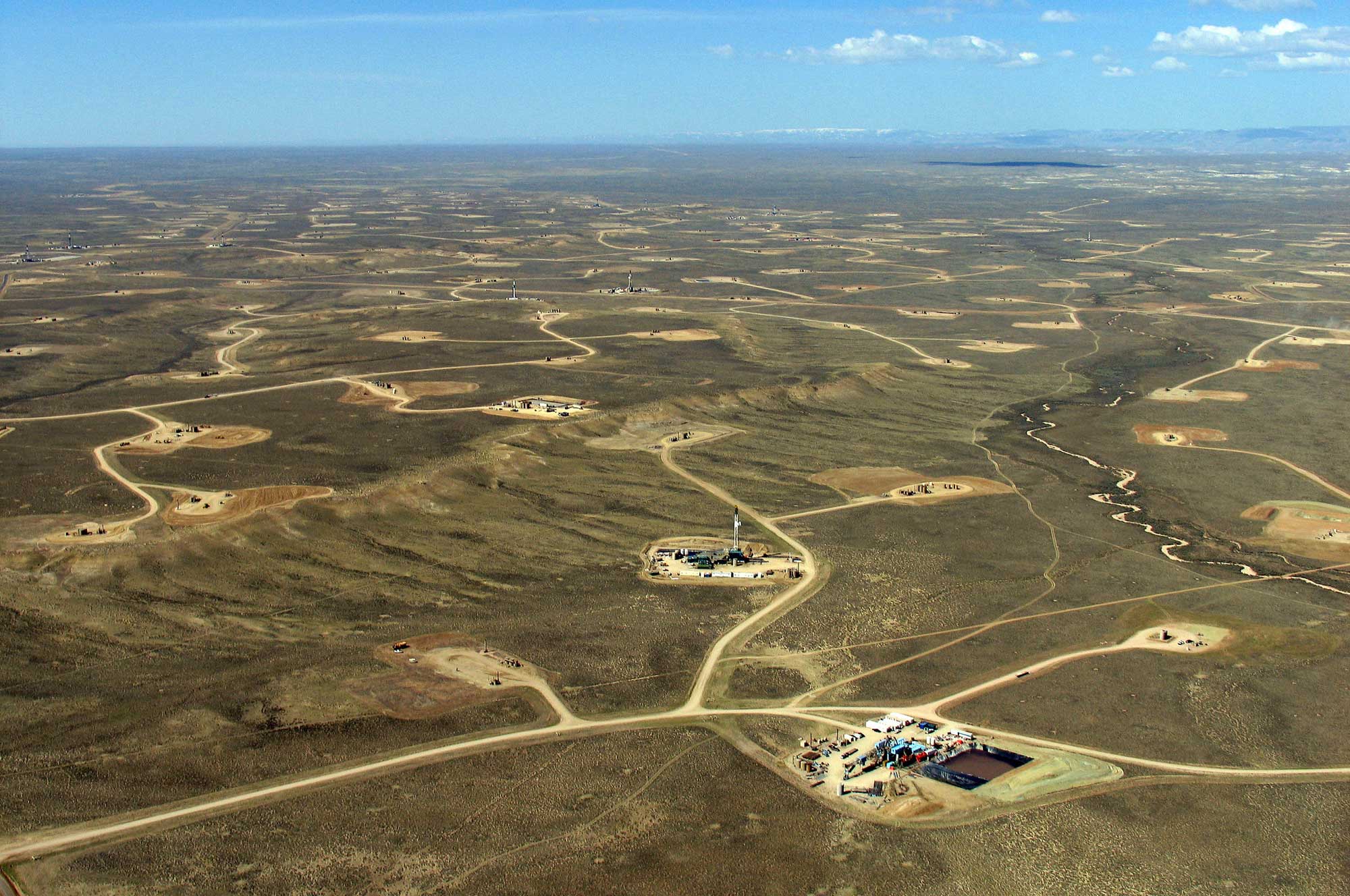
Aerial photo of the Jonah Gas Field, Green River Basin, Wyoming, 2006. Photo by Bruce Gordon, EcoFlight (Skytruth on flickr, Creative Commons Attribution-NonCommercial-ShareAlike 2.0 Generic license, image cropped and resized).
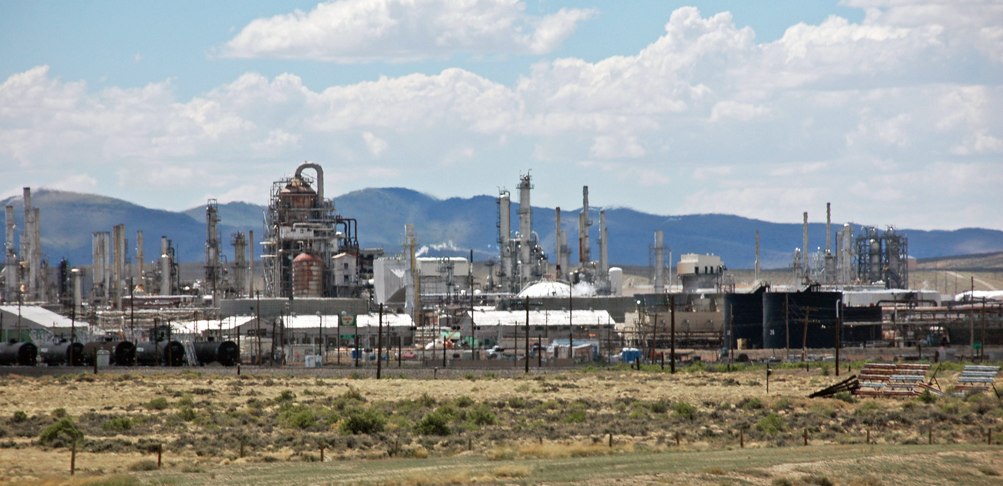
Sinclair oil refinery, Sinclair, Carbon County, Wyoming, 2011. Photo by James St. John (flickr, Creative Commons Attribution 2.0 Generic license).
Coal
The Rock Springs Uplift is the largest arch in the Greater Green River Basin, dividing the basin into the Green River Basin on the west and smaller basins in the east. The Rock Springs uplift contains coal deposits that were first mined as fuel for the Union Pacific Railroad during the building of the Transcontinental Railroad and subsequent railroad operations. Conventional oil and gas drilling has also occurred in the basin, in Cretaceous-aged deltaic rocks from the Western Interior Seaway.
The Rocky Mountains of Montana and Wyoming also produce bituminous and subbituminous coal from Cretaceous and Paleocene deposits in the Bighorn Basin. Coal mining in this basin dates back to the 1800s.
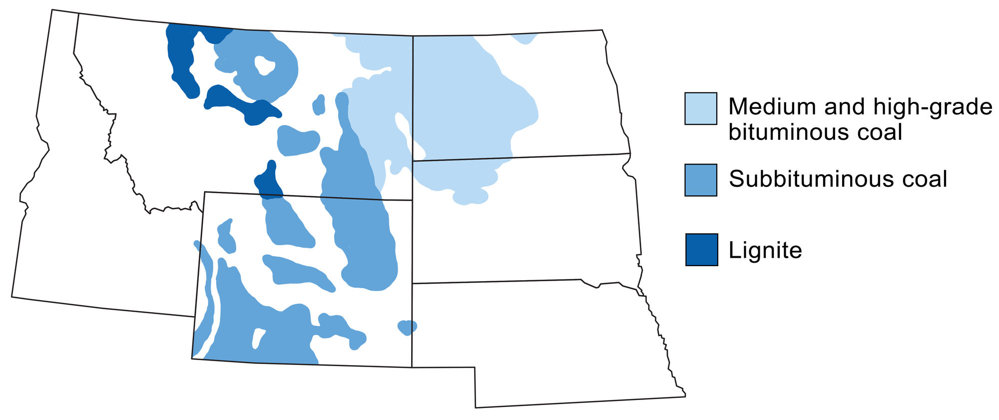
Coal-producing regions of the northwest-central U.S. Modified from a map by Wade Greenberg-Brand, adapted from an image by the USGS, originally published in The Teacher-Friendly Guide to the Earth Science of the Northwest Central US.
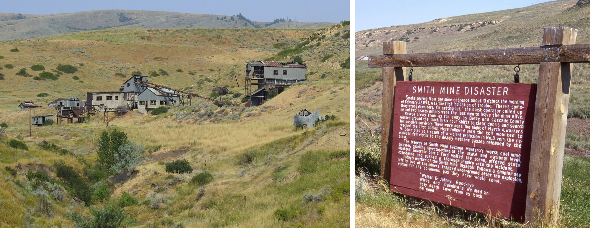
The Smith Mine in Montana was one of many coal mines where a mining disaster occurred during the 20th century in the US. The Smith Mining disaster happened on February 27, 1943, when methane in the mine ignited, causing an explosion. Ultimately, 74 men died from injuries caused by the explosion or suffocation due to toxic gases in the mine. Left: The abandoned mine. Photo by Tumbleweed 1954 (Wikimedia Commons, Creative Commons Attribution-Share Alike 4.0 International license, image cropped and resized). Right: Informational sign about the Smith Mine Disaster. Photo by Velela (Wikimedia Commons, public domain).
Hydroelectricity
Since the Rocky Mountains provide an abundance of water to lower regions in the east and west, hydroelectric power is substantial in this area. The Clark Fork and Kootenai Rivers (tributaries of the Columbia River that flow through Montana and Idaho) are major rivers that provide the potential for much of the Rocky Mountains’ hydropower, which uses the gravitational force of falling or rushing water to rotate turbines that convert the water’s force into energy. The three largest hydropower plants in Montana—Noxon Rapids Dam (580.5 MW), Libby Dam (525 MW), and Hungry Horse Dam (428 MW)—are located along these rivers and their tributaries, helping to make Montana one of the largest producers of hydropower in the US. In Idaho, the Palisades Dam on the Snake River is less than half the size (about 175 MW) of these large dams.
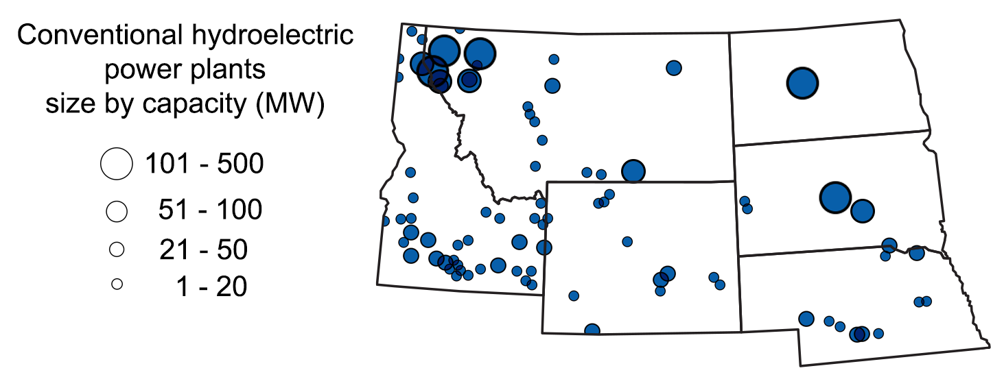
Location and capacity of hydroelectric plants in the northwest-central region. Map modified by a map by Wade Greenberg-Brand, apapted from image by U.S. Energy Information Administration, originally published in The Teacher-Friendly Guide to the Earth Science of the Northwest Central US.
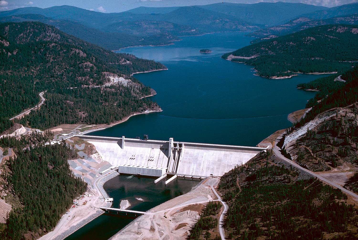
Libby Dam, Kootenai River, Montana, 1986. Photo by U.S. Army Corps of Engineers (Wikimedia Commons, pubic domain).
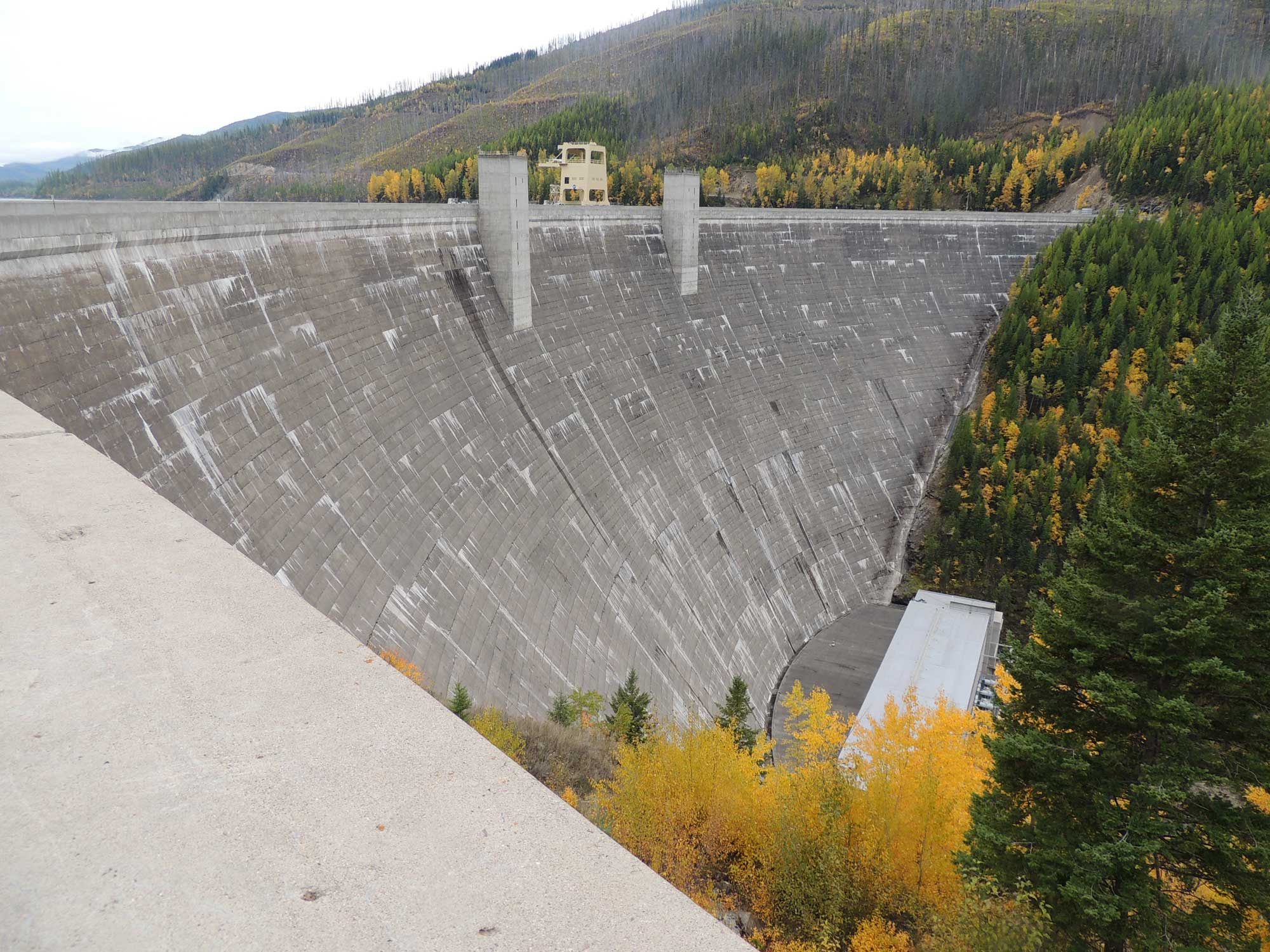
Hungry Horse Dam, Flathead River, Montana, 2013. Photo by Tonyglen14 (flickr, Creative Commons Attribution 2.0 Generic license, image resized).
Wind energy
The Rocky Mountains region has some of the highest potential for wind energy in the U.S., though the area’s terrain and lack of infrastructure can make tapping into this resource challenging. Windmills along I-80 in southeast Wyoming near Medicine Bow, where a gap exists in the Rockies, were among the first large-scale wind farms in the U.S. These facilitated high voltage transmission lines along the Interstate. There are a number of locations in southwestern Montana and northwestern Wyoming where valleys are oriented such that winds are funneled relatively consistently through the year; these areas have future potential for expanded wind farms.
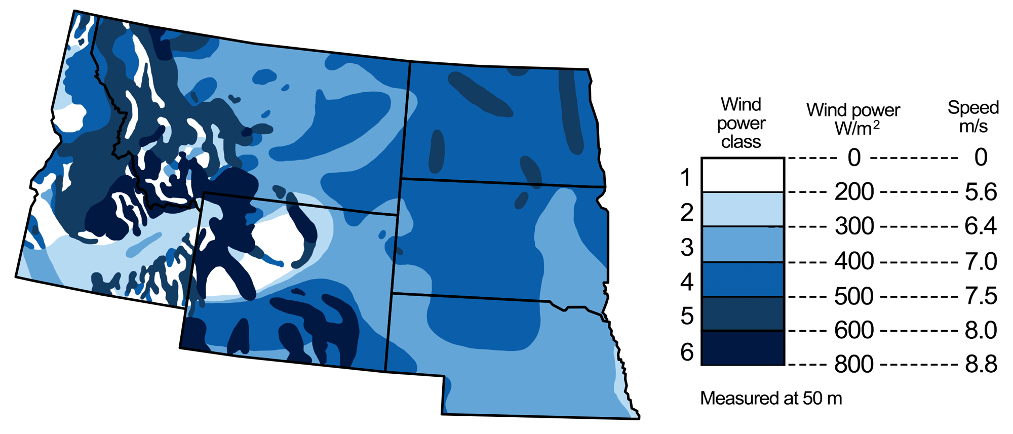
Wind energy potential in the northwest-central U.S. Map modified by a map by Wade Greenberg-Brand, adapted from image by National Renewable Energy Laboratory, originally published in The Teacher-Friendly Guide to the Earth Science of the Northwest Central US.
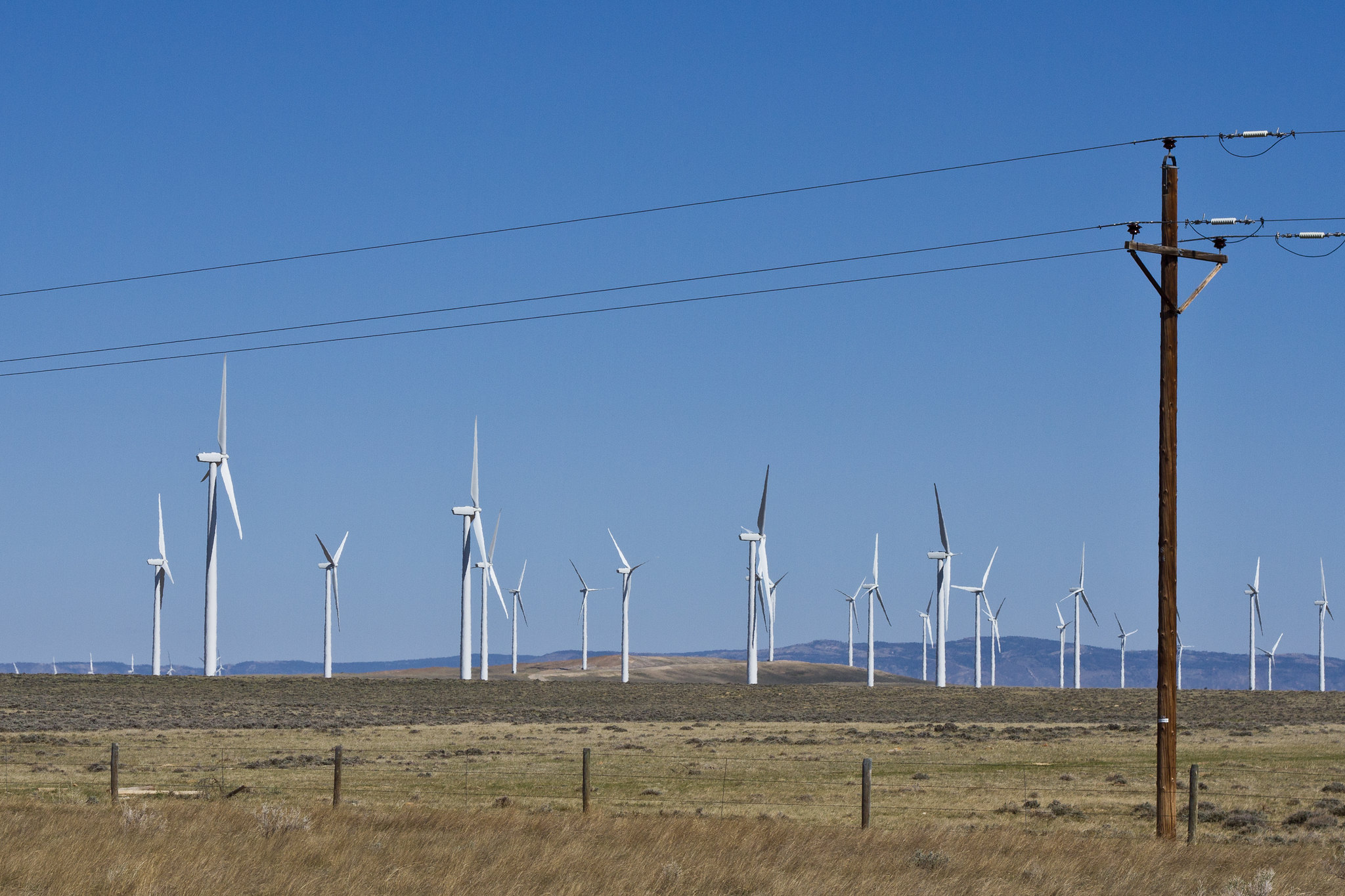
Wind farm, Medicine Bow, Wyoming, 2012. Photo by Tony Webster (flickr, Creative Commons Attribution 2.0 Generic license).
Resources
Resources from the Paleontological Research Institution
Earth@Home: Earth Science of the Southwestern U.S.: Energy in the Rocky Mountains (covers the Rocky Mountains in Colorado, New Mexico, and Utah): https://earthathome.org/hoe/sw/energy-rm
Earth@Home: Earth Science of the Western U.S.: Energy in the Columbia Plateau and Rocky Mountains (covers the Rocky Mountains in Washington): https://earthathome.org/hoe/w/energy-cp-rm/
Earth@Home: Introduction to Energy: https://earthathome.org/hoe/energy