

Page snapshot: Introduction to the climate of the western states of the contiguous United States (California, Nevada, Oregon, and Washington), including present, past, and future climate. For the climate of Alaska, see the Climate of Alaska page.
Topics covered on this page: Present climate of the western U.S.; Present temperature; Present precipitation; Regional climate variation; Past climate of the western U.S.; Paleozoic; Mesozoic; Cenozoic; Future climate of the western U.S.; Resources.
Credits: Much of the text on this page comes from "Climate of the Western US" by Ingrid H. H. Zabel, Judith T. Parrish, Alexandra Moore, and Gary Lewis, chapter 9 in The Teacher-Friendly Guide to the Earth Science of the Western US, edited by Mark D. Lucas, Robert M. Ross, and Andrielle N. Swaby (published in 2014 by the Paleontological Research Institution; currently out of print). The book was adapted for the web by Elizabeth J. Hermsen, Jonathan R. Hendricks, and Ingrid Zabel in 2022. Changes include formatting and revisions and additions to the text and images. Credits for individual images are given in figure captions.
Updates: Page last updated June 8, 2022.
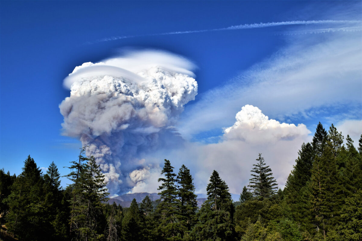
Image above: Smoke rising from the Carr Fire in northern California on July 26, 2018. The Carr Fire was started by a flat tire on a trailer (the metal tire rim hit the pavement and produced sparks, igniting the fire). It eventually burned more than 90,000 hectares (more than 200,000 acres) of land before being extinguished. Photo by Eric Coulter, BLM (Bureau of Land Managment California on flickr, public domain).
Present climate of the western U.S.
This page covers the climate of the western states of the contiguous U.S.: California, Nevada, Oregon, and Washington. For the climate of Alaska, see the Climate of Alaska page.
Because of its wide latitudinal range, the proximity of the Pacific Ocean, and the presence of long, north-south mountain ranges, the western states have an enormous variety of climatic areas. These include hot, dry deserts in the Basin and Range, a Mediterranean climate (a climate with dry summers and relatively warm, wet winters) along the southern Pacific Border, and rainforests in the northern Pacific Border. Even individual states can have tremendous climate diversity.
The lives of the residents of this region are tied to climate in critical ways. People in Southern California’s coastal area and Central Valley enjoy a pleasant climate, but they depend on water from elsewhere—mostly from snowmelt—for their everyday needs and for agricultural irrigation. As of May 2022, much of California, Nevada, and Oregon were experiencing a severe to exceptional drought. Climate is also linked to energy resources. In the Pacific Northwest, the combination of topographical variation and abundant precipitation creates an ideal environment for hydropower. However, drought conditions that lower water levels can imperil the production of hydroelectricity.
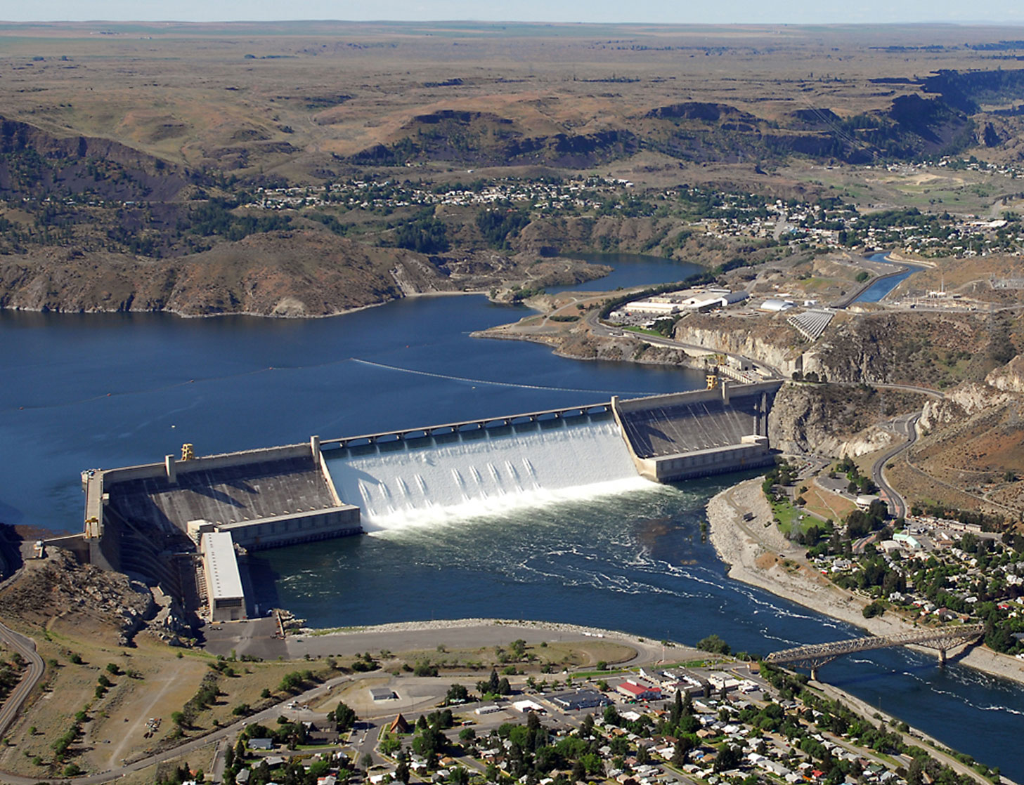
Grand Coulee Dam on the Columbia River, Washington. Photo by Bureau of Reclamation (flickr, Creative Commons Attribution-ShareAlike 2.0 Generic license).
Temperature
With such diverse climate types, a wide range of temperatures are experienced throughout the West. Generally, temperatures tend to decrease northward and also from west to east, with cooler temperatures at higher elevations and across the region's north-south mountain ranges. Temperatures in coastal areas are moderated by the Pacific Ocean and, in the northwest, by the Rocky Mountains, which prevent cold Arctic air from reaching the coast. Average lows and highs in Southern California range from 3° to 46°C (37° to 114°F) inland in Death Valley and 9° to 24°C (49° to 76°F) on the coast in San Diego. Statewide average lows and highs in Oregon run from -3° to 28°C (26° to 82°F), while in Washington, temperature ranges from -1° to 32°C (29° to 89°F). Nevada experiences average temperatures spanning from 4° to 40°C (39° to 104°F).
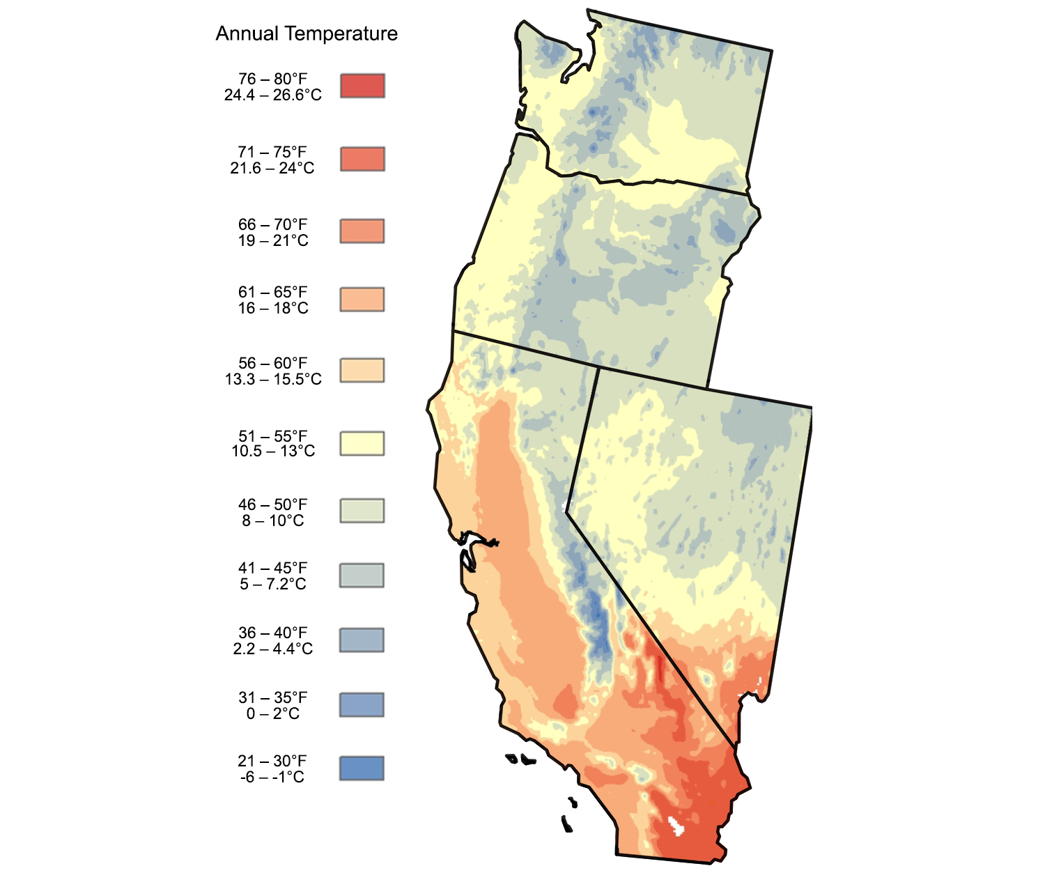
Average annual temperatures for the western states of the contiguous U.S. Image adapted from an image by Scenarios for Climate Assessment and Adaptation, first published in The Teacher-Friendly Guide to the Earth Science of the Western US.
Precipitation
The spectacular mountain ranges in the western states run from north to south. These ranges—the Coast Ranges, the Cascades, the Rockies, and the Sierra Nevada—create a pronounced east-west precipitation gradient across the region. The overall effect is to produce wet areas on the western sides of the West’s mountain ranges and dry rain shadows on the eastern sides. This effect is most pronounced from Northern California north through Washington, since the jet stream is often located over this area—especially in winter—and brings moist ocean air inland.
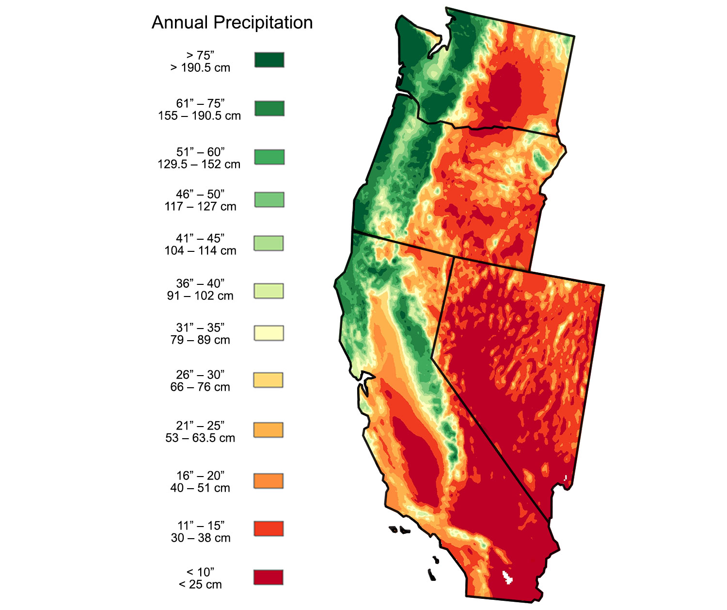
Average annual preciptiation for the western U.S. Image adapted from an image by Scenarios for Climate Assessment and Adaptation, first published in The Teacher-Friendly Guide to the Earth Science of the Southwestern US.
Regional climate variation

Köppen climate map of the 48 contiguous states of the continental United States. The first letter of each zone in the key indicates its major classification. A = Tropical (equatorial), B = Arid, C = Temperate (warm temperate), D = Continental (cold), E = polar. Modified from a map by Adam Peterson (Wikimedia Commons, Creative Commons Attribution-ShareAlike 4.0 International license).
California
California's climate is influenced by its proximity to the Pacific Ocean and its mountain ranges, including the Coast Ranges in the west and the Sierra Nevada in the east. Mount Whitney in southeastern California is the highest point in the state, at 4421 meters (14,505 feet) above sea level, whereas Badwater Basin in Death Valley is the lowest point at 86 meters (282 feet) below sea level. The long Central Valley extends roughly north-south through the center of the state, separating the coastal and inland mountain ranges.
Much of California is classified as having a Mediterranean climate, although the southeastern part of the state is desert. The mild Mediterranean climate makes California an important agricultural region and a popular place to live, although limited water supplies are increasingly posing problems for agriculture and even for towns and urban areas in the state.
The extreme topographic variation in California contributes to its place in the weather record books. The official hottest temperature ever recorded worldwide was at Furnace Creek in Death Valley, at 56.7°C (134°F) in 1913. This record was nearly broken during an extreme heat wave in 2021, and the highest average temperature in the world over a 24-hour period comes from Stovepipe Wells in Death Valley, at 47.8°C (118.1°F) on July 11, 2021. In the meantime, the Sierra Nevada mountains are known for their deep winter snow, which is important to maintaining water supplies in California. The highest 24-hour snowfall recorded in California is slightly more than 170 centimeters (67 inches).
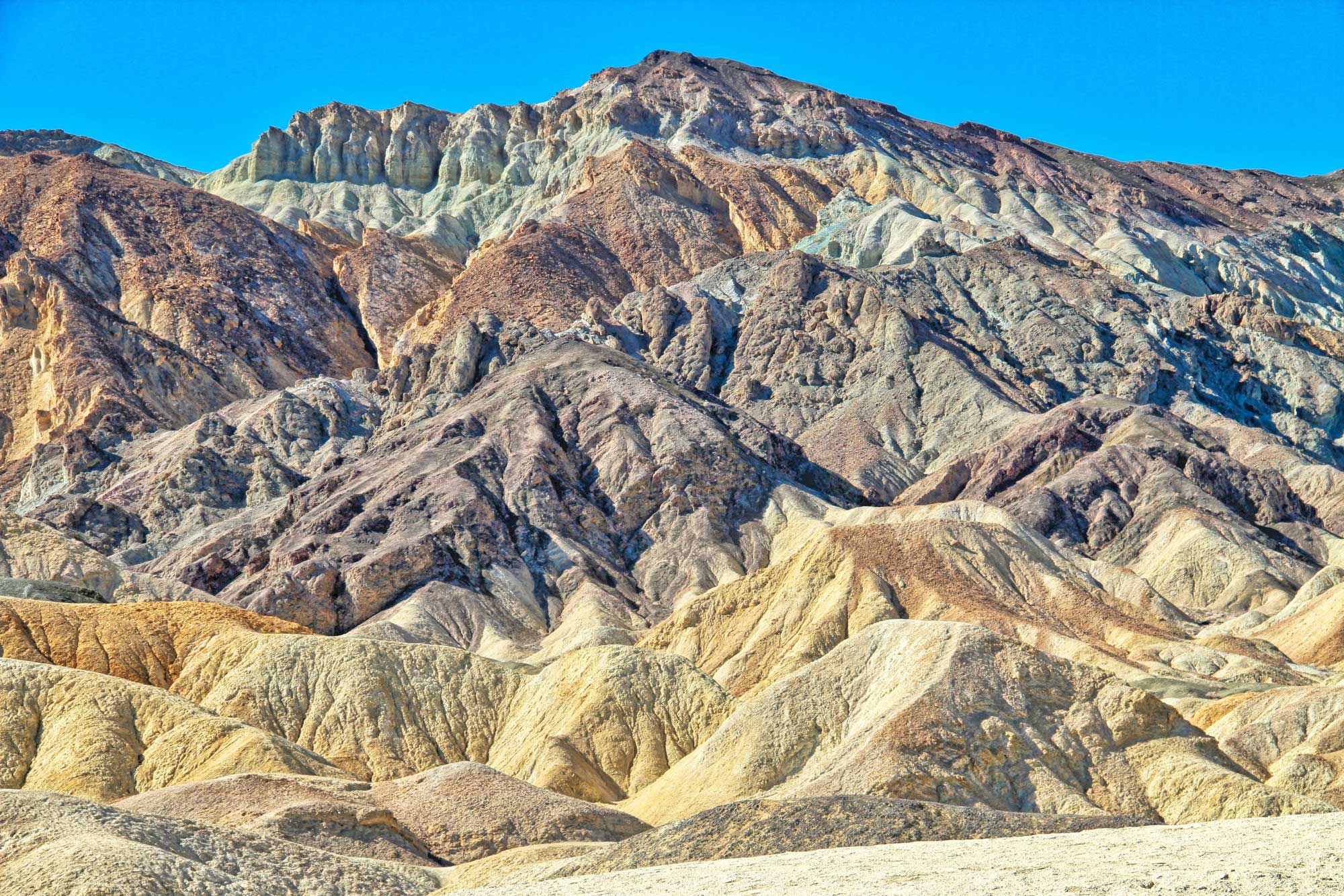
The "Artist's Palette" in Death Valley National Park, California. Photo by ThomasLendt (Wikimedia Commons, Creative Commons Attribution-ShareAlike 4.0 International license, image resized).
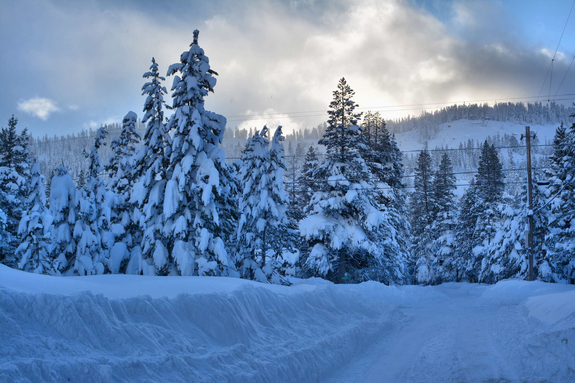
Snow near Lake Tahoe, a lake on the California-Nevada border, in February 2019. Photo by Jonathan Cook-Fisher (flickr, Creative Commons Attribution 2.0 Generic license, image resized).
Nevada
Almost all of Nevada is within the Basin and Range physiographic province, with north-south trending mountain ranges separated by basins. The Sierra Nevada mountains rise on the western side of the state along the California-Nevada border. The highest point is Boundary Peak near the western border; it reaches 4007 meters (13,147 feet); the lowest point is on the Colorado River at 147 meters (481 feet).
Unlike the other western states, Nevada does not border the ocean. Given its position east of the Sierra Nevada Mountains, the state is very dry. Much of Nevada is classified as semi-arid to desert; only the northeastern part of the state has a Mediterranean climate. In fact, Nevada is the most arid state in the U.S., receiving only about 24 centimeters (9.5 inches) of rainfall a year.
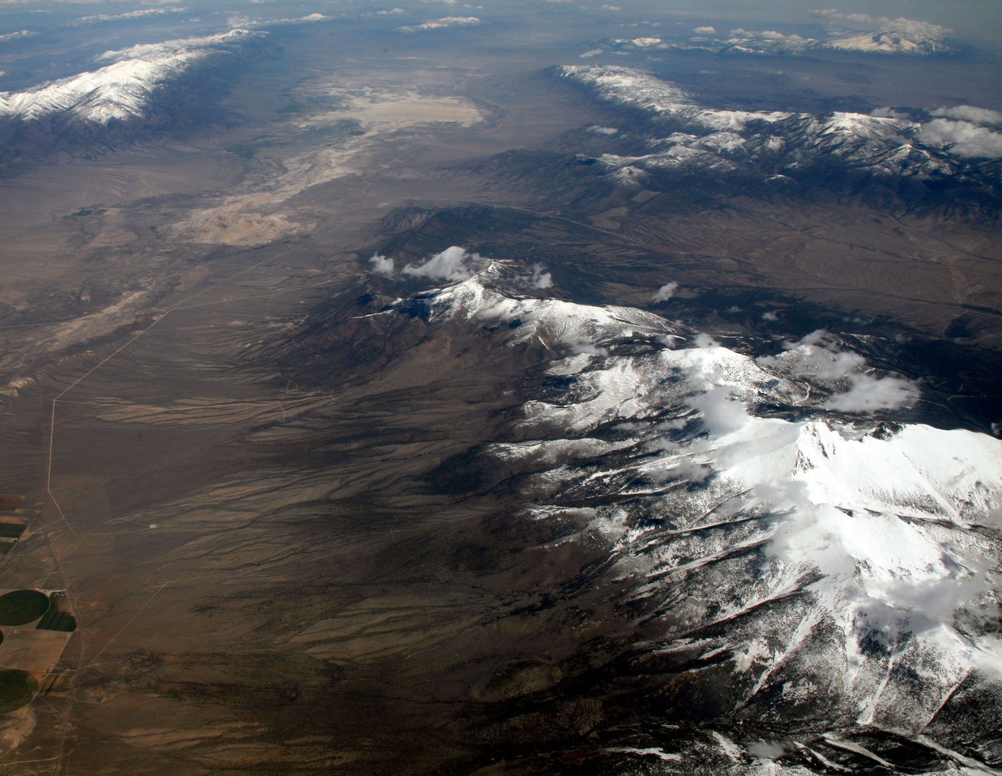
Aerial view of Great Basin National Park, Nevada, showing Wheeler Peak at the lower right. Photo by Doc Searls (Wikimedia Commons, Creative Commons Attribution 2.0 Generic license, image resized).
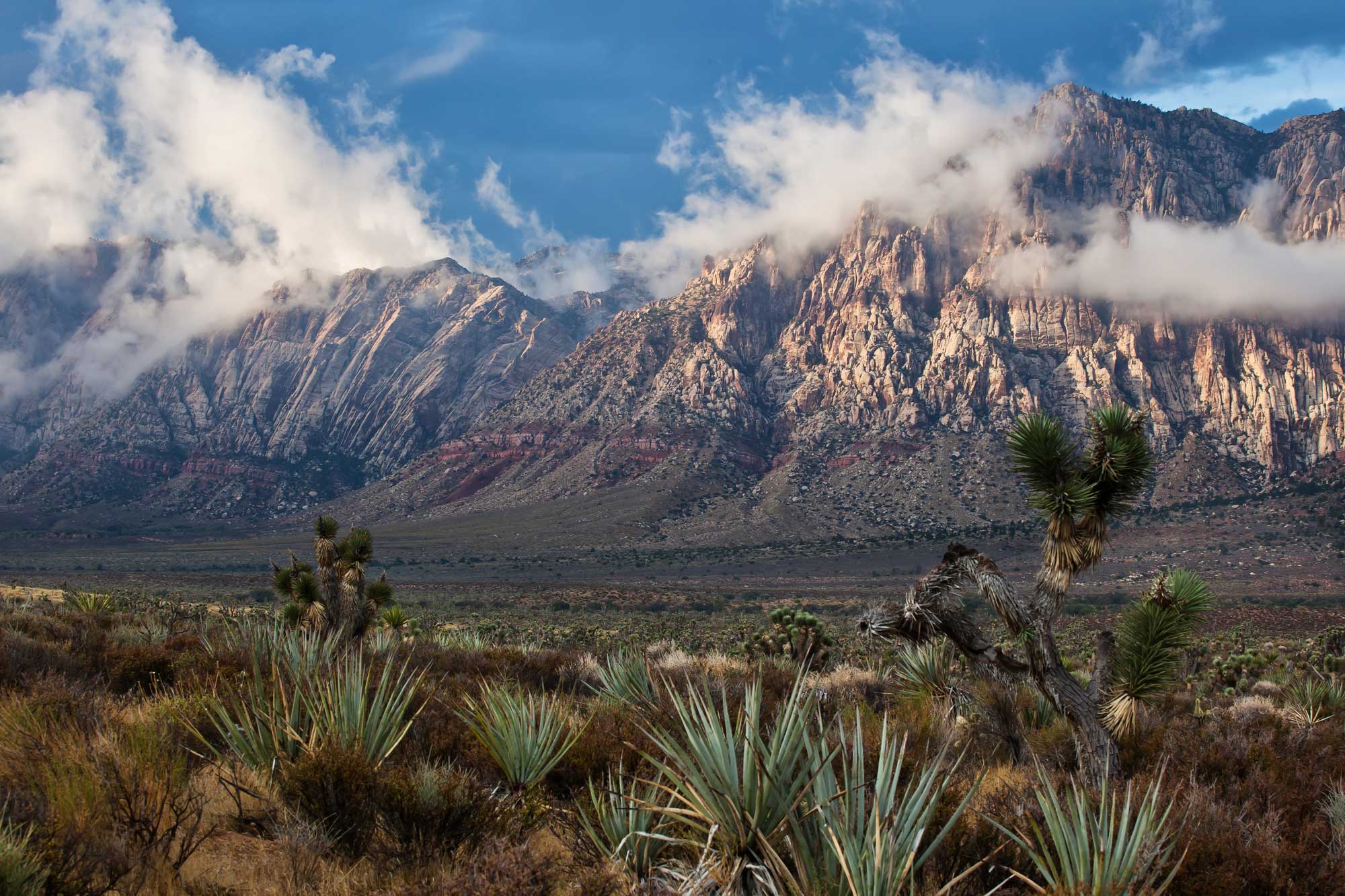
Red Rock Escarpment, Red Rock Canyon National Conservation Area, southern Nevada. Joshua trees (Yucca brevifolia) stand in the foreground. Photo by Bob Wick, BLM (Bureau of Land Management Nevada on flickr, Creative Commons Attribution 2.0 Generic license, image resized).
Oregon
Oregon's climate is influenced by its proximity to the Pacific Ocean and its mountain ranges, particularly the Oregon Coast Range and the Cascades that run north-south through western Oregon. Mt. Hood, a volcano in northwestern Oregon near Portland, is the highest peak at 3425 meters (11,239 feet). The lowest point is the coastline, which is at sea level.
Much of Oregon has a Mediterranean climate, although some areas, particularly in the southeastern part of the state, have a cold semi-arid climate. As in Washington, temperate rain forest occurs in western Oregon due to moist air carried in from the Pacific Ocean causing rainfall on the mountains near the coast. Eastern Oregon is much drier due to the rain shadow on the leeward side of the mountains.
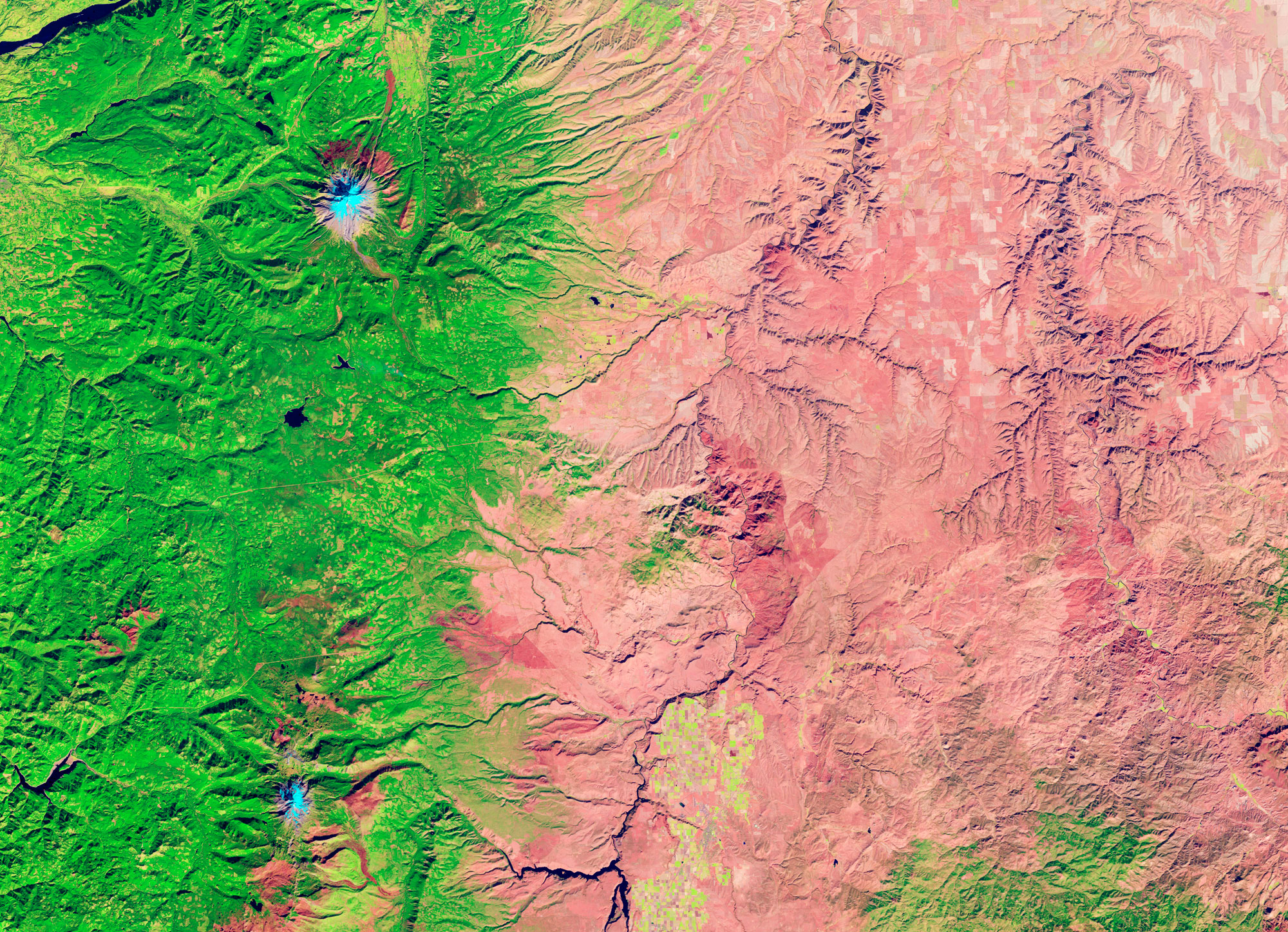
False-color image showing the difference in precipitation and vegetation cover in western and eastern Oregon. The two blue spots are volcanic peaks in the Cascades: Mt. Hood (upper) and Mt. Jefferson (lower). NASA Earth Observatory image by Jesse Allen and Robert Simmon (used following NASA's image use policy).
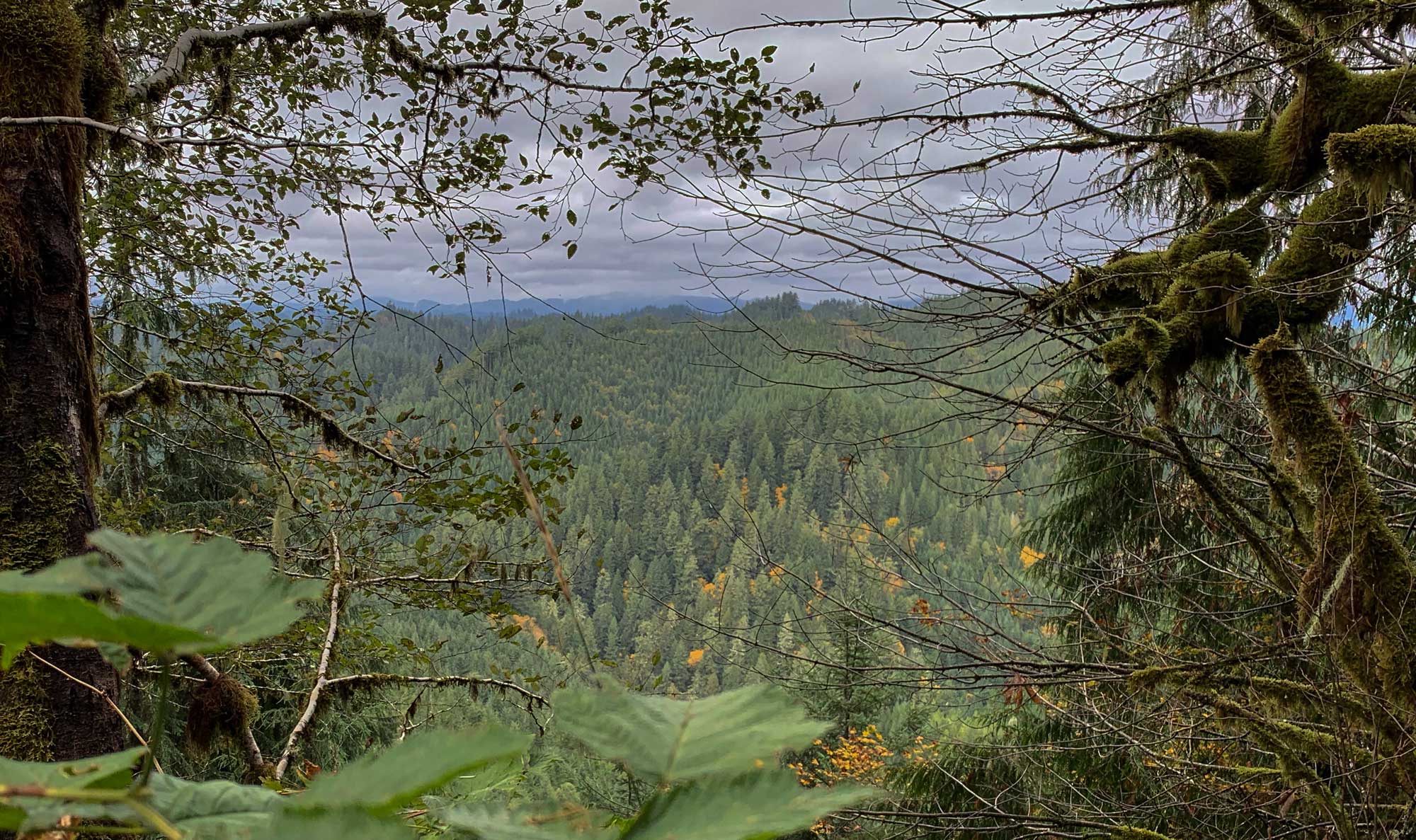
Devi's Staircase Wilderness, Oregon Coast Range, western Oregon. Photo by Michael Campbell, BLM (Bureau of Land Management Oregon and Washington on flickr, Creative Commons Attribution 2.0 Generic license, image resized).
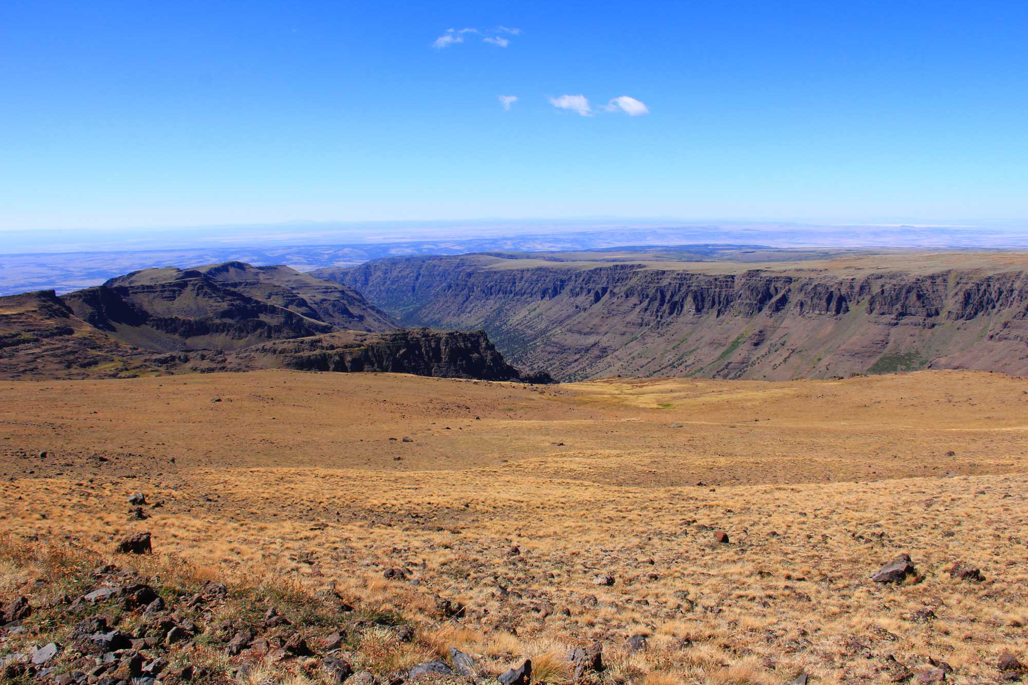
Steens Mountain Wilderness, southeastern Oregon. Photo by Bureau of Land Management Oregon and Washington on flickr (Creative Commons Attribution 2.0 Generic license, image resized).
Washington
Washington's climate is influenced by its proximity to the Pacific Ocean and its mountain ranges, including the Olympic Mountains on the Olympic Peninsula (located in west-central Washington), the Cascades that run north-south through western Washington, and the Rockies found in northeastern Washington. Mt. Rainier, a volcano in western Washington, is the highest peak at 4394 meters (14,417 feet). The lowest point is the coastline, which is at sea level. Much of Washington state has a Mediterranean climate, although the south-central part of the state has a cold semi-arid climate.
Due to its western mountain ranges, Washington experiences extreme differences in precipitation from west to east. For example, Olympic National Park in Washington receives over 190 centimeters (75 inches) of rain annually on average, whereas communities only 400 kilometers (250 miles) to the east in Washington receive 18 to 20 centimeters (7 to 8 inches) annually.
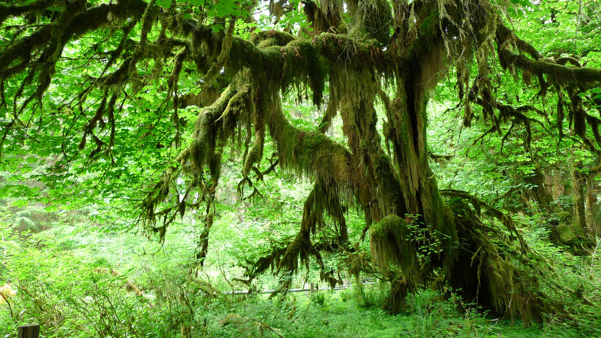
Moss hanging from a tree in Hoh Rain Forest, Olympic National Park, west-central Washington. Photo by John Walker (flickr, Creative Commons Attribution 2.0 generic license, image resized).
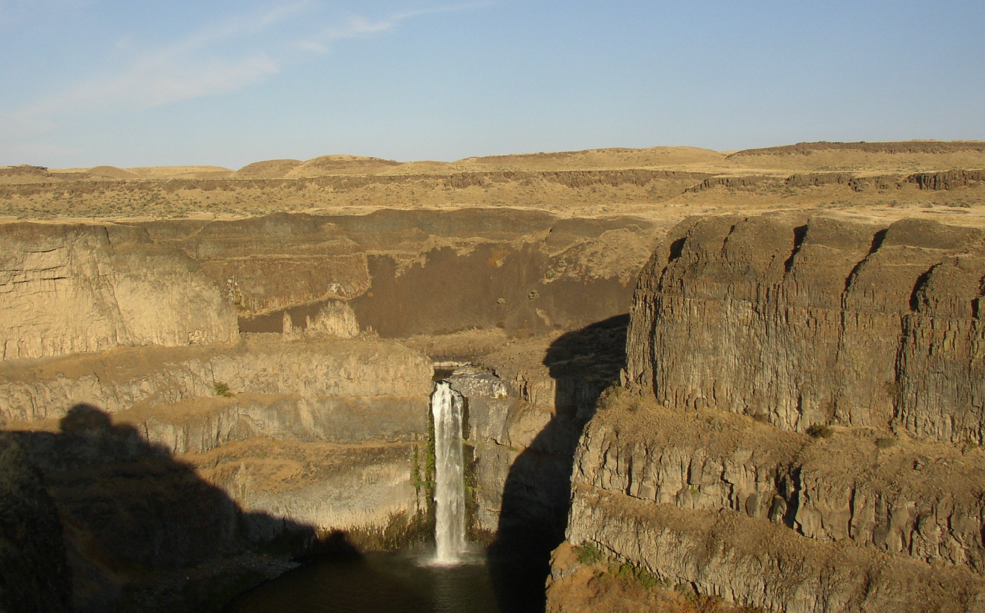
Dry landscape around Palouse Falls, Palouse Falls State Park, southeastern Washington. Photo by Williamborg (Wikimedia Commons, Creative Commons Attribution-Sharealike 3.0 Unported license).
Past climate of the western U.S.
This section covers the climate of the contiguous western U.S. through the Phanerozoic, from about 541 million years ago to the recent. For the climate on early Earth prior to 541 million years ago, see the Introduction to Climate section.
Paleozoic (541 to 252 million years ago)
Cambrian to Devonian (541 to 359 million years ago)
Throughout much of the Paleozoic, North America’s terrestrial western margin ran through Idaho, Arizona, and easternmost Utah, with the continental shelf extending out through California, Oregon, and Washington. Western Washington, all of Oregon, and most of northwestern California are almost entirely composed of ancient terranes and volcanic island arcs that drifted together at different times during Earth’s history and accreted onto the edge of the continent at its western subduction zone. Most of these terranes appear to have experienced warm, wet climates, and geologists have concluded that they all originated in tropical areas of what is now the Pacific Ocean.
In the Cambrian, the western states had a warm climate. Fossils such as trilobites, brachiopods, and archaeocyathids (extinct reef builders) found in eastern California and western Nevada provide evidence of warm, shallow seas.
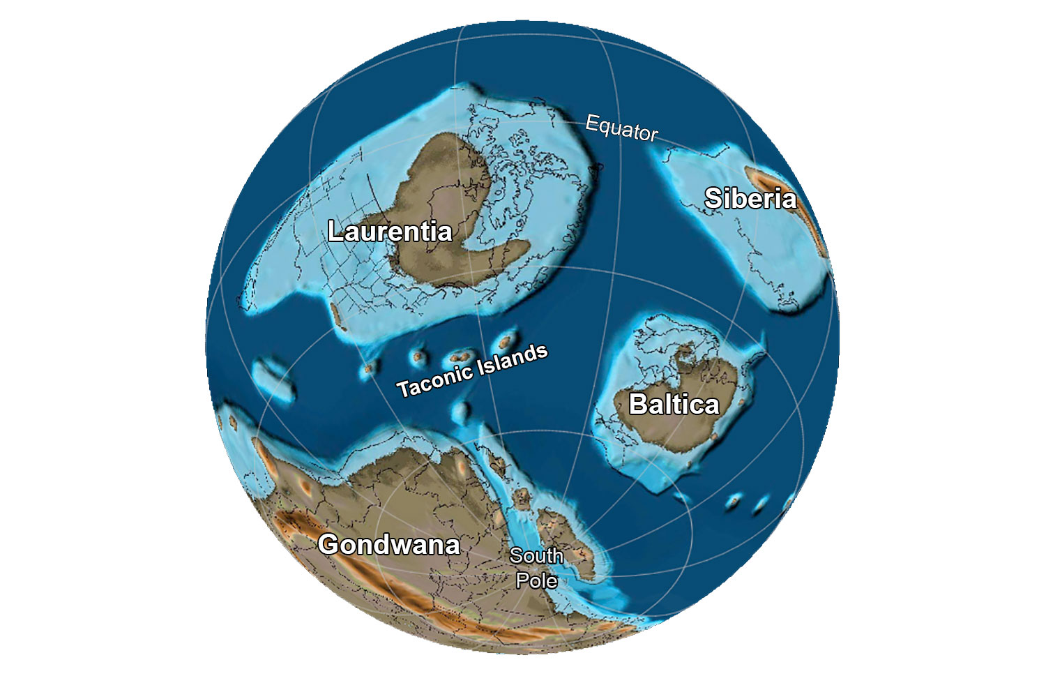
The globe about 485 million years ago, near the Cambrian-Ordovician boundary. Reconstruction created using basemap from the PALEOMAP PaleoAtlas for GPlates and the PaleoData Plotter Program, PALEOMAP Project by C. R. Scotese (2016); map annotations by Jonathan R. Hendricks for PRI's Earth@Home project (CC BY-NC-SA 4.0 license).
Archaeocyathids (the lighter-colored, tube-like structures), Early Cambrian Wood Canyon Formation, Inyo County, California. Photo by Bob Day (University of California Museum of Paleontology/UCMP (Creative Commons Attribution 3.0 Unported license, accessed via GBIF.org).
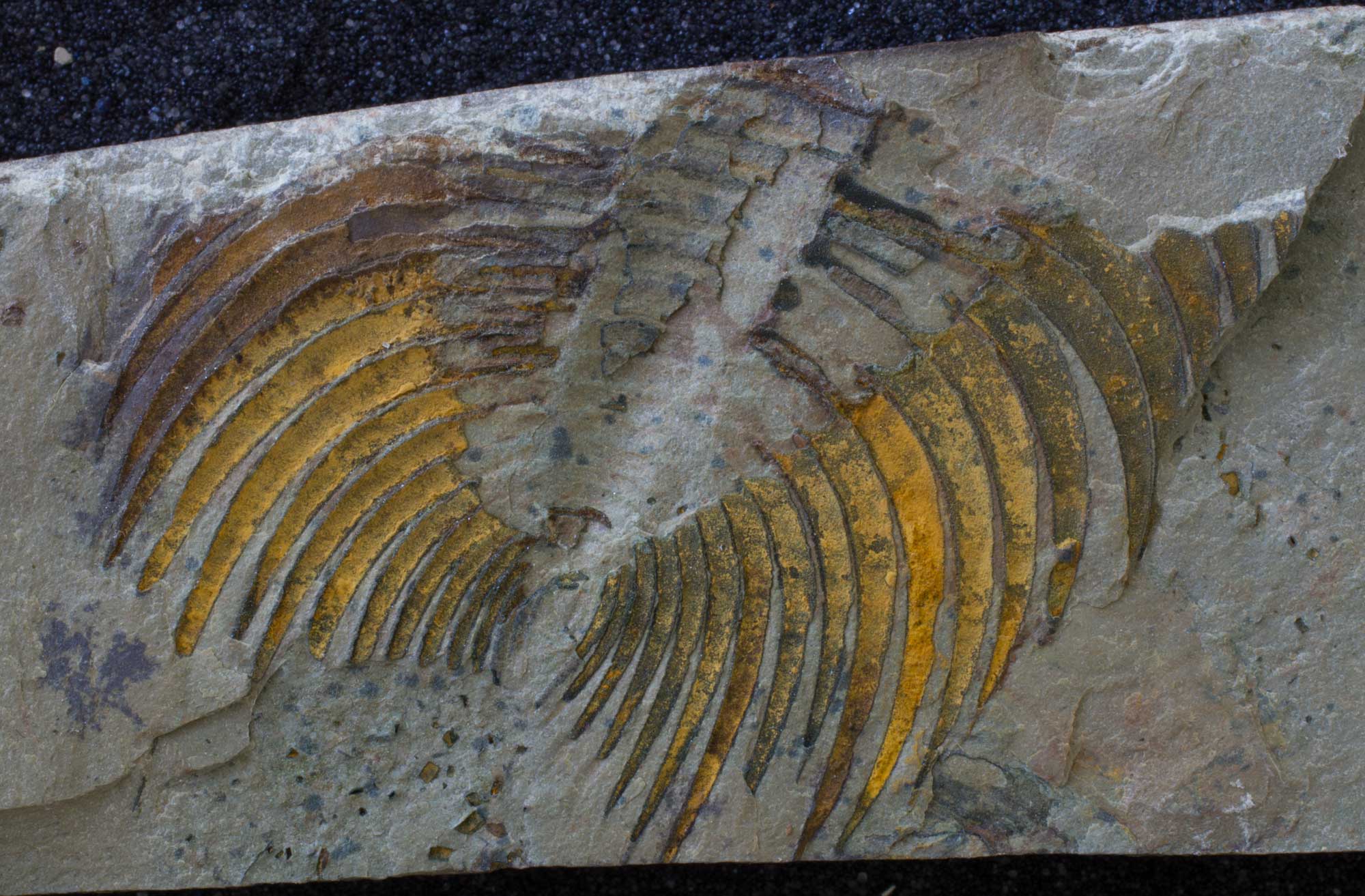
A trilobite (Nevadia parvoconica), Indian Springs Lagerstätte, Early Cambrian Poleta Formation, Esmeralda County, Nevada. Photo by Paleontological Research Institution (PRI) on GBIF.org (CC0 1.0 Universal/Public Domain Dedication).
Sea level rose in the Ordovician, and both deep- and shallow-water marine deposits are known from that time. Conodonts and graptolites are found in deep-water deposits from northeastern Washington and shallow-water marine rocks throughout Nevada and southeastern California, revealing that the climate remained warm during the Ordovician. At the end of the Ordovician, from 460 to 430 million years ago, the Earth fell into another ice age, but corals found in California indicate it remained warm enough for tropical seas to exist there. Silurian-age rocks tell us much the same story.
From 430 to 300 million years ago, North America moved north across the equator, and the cycle of warming and cooling was repeated yet again. In the Devonian, sea level was higher than it had been earlier. Devonian rocks are relatively scarce in the West, with small areas widely scattered across Nevada. The most extensive outcrops of Devonian rocks are located on accreted tropical terranes and include some very large reefs.
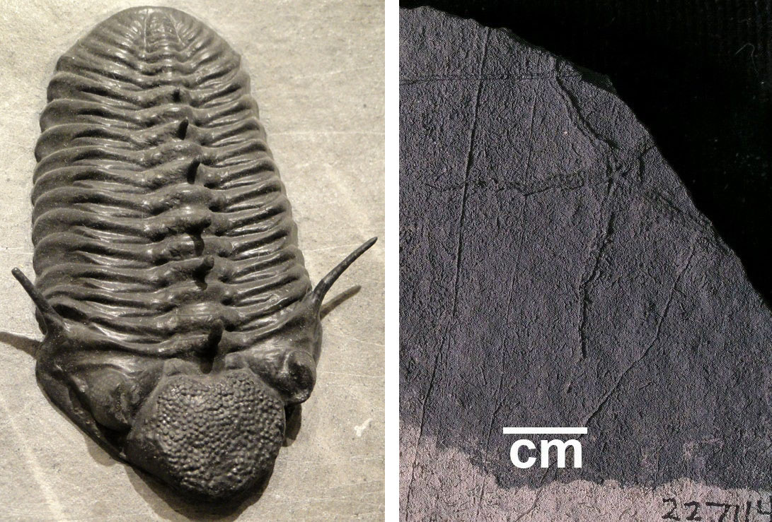
Devonian marine invertebrate fossils from Nevada. Left: A trilobite, Paciphacops claviger, Early Devonian Wenban Limestone, Cortez Range. Photo by Daderot (Wikimedia Commons, CC0 1.0 Universal/Public Domain Dedication). Left: An early starfish (Protasteridae), Late Devonian Devil's Gate Formation, Eureka County. Photo of YPM IP 227114 by Susan H. Butts (Yale Peabody Museum of Natural History/YPM, CC0 1.0 Universal/Public Domain Dedication, accessed via GBIF.org).
Carboniferous to Permian (359 to 252 million years ago)
By the Early Carboniferous, ice capped the South Pole and began to expand northward. Although the Earth’s temperature fell during this time and the frozen water far to the south caused sea levels to drop, the West still remained relatively warm because of North America’s low-latitude position. Mountain-building in Nevada raised the sea bottom, dividing the marine environment into shallow water to the east and deep water to the west. Nevada’s shallow-water deposits contain reefs, indicating that the climate there was still warm. By the late Carboniferous, North America had collided with Gondwana, leading to the formation of Pangaea, a supercontinent composed of nearly all the landmass on Earth.
Carboniferous and Permian rocks in Oregon, northern California, and western Washington originated on tropical terranes. Some contain lush, tropical floras that are completely dissimilar to those on the main part of the continent, a testament to their continued isolation in the ocean far from the western margin of North America.
Earth 300 million years ago, during the end of the Carboniferous Period (Pennsylvanian). Pangaea was completed when North America finally collided with Gondwana. Reconstruction created using basemap from the PALEOMAP PaleoAtlas for GPlates and the PaleoData Plotter Program, PALEOMAP Project by C. R. Scotese (2016); map annotations by Jonathan R. Hendricks & Elizabeth J. Hermsen for PRI's Earth@Home project (CC BY-NC-SA 4.0 license).
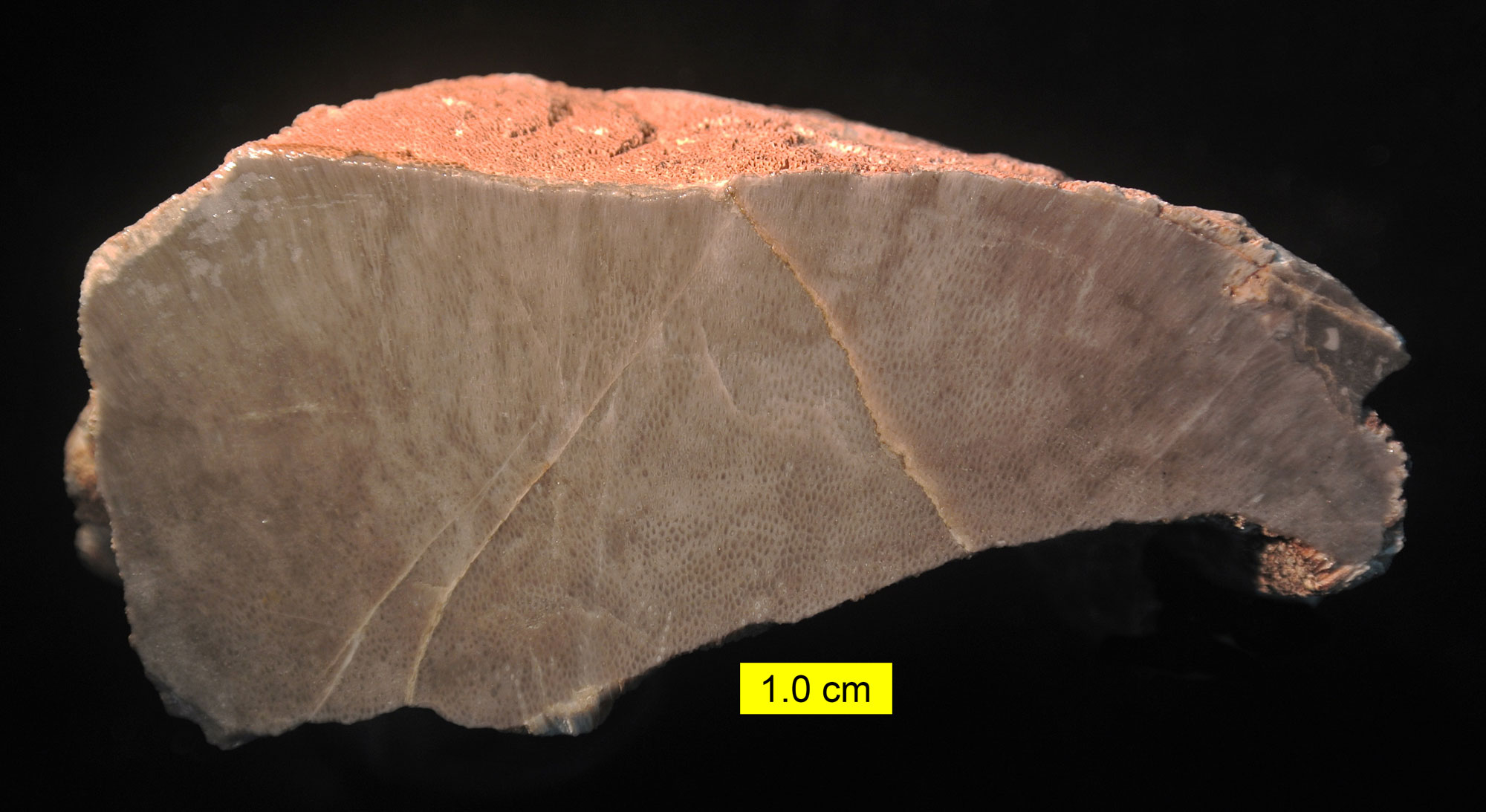
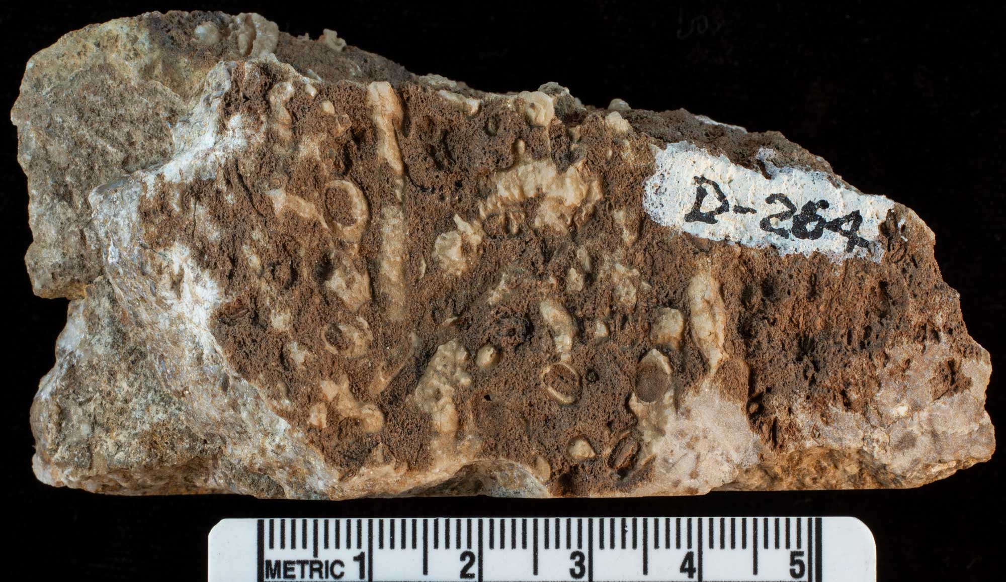
A chaetetid (enigmatic organisms now considered to be sponges) cut to show its internal structure. Carboniferous Bird Spring Formation, Spring Mountains, Nevada. Photo by Mark A. Wilson (Wikimedia Commons, CC0 1.0 Universal Public Domain Dedication).
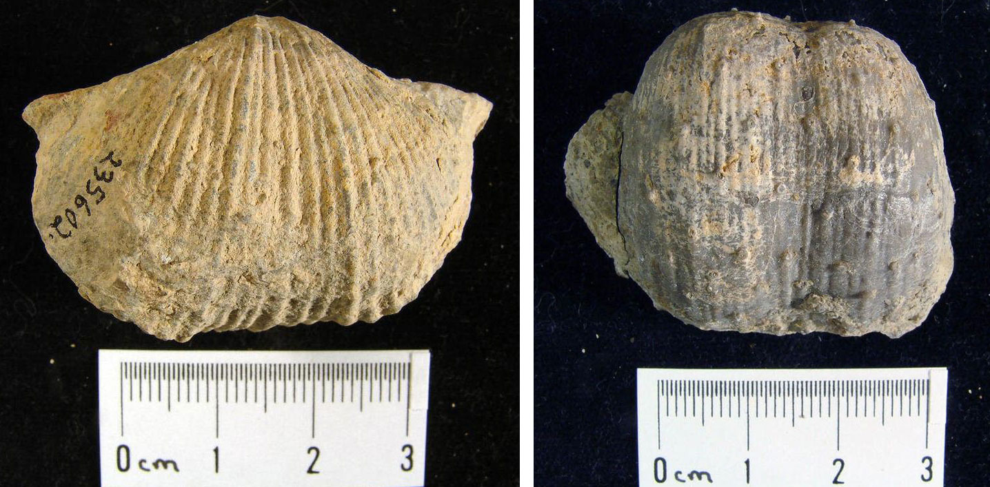
Brachiopods from the Permian of Clark County, Nevada. Left: Spirifer rockymontanus (YPM IP 235602). Right: Productus inflatus (YPM IP 235604). All photos by Jessica Utrup (Yale Peabody Museum of Natural History/YPM, CC0 1.0 Universal/Public Domain Dedication, accessed via GBIF.org).
Mesozoic (252 to 66 million years ago)
Triassic to Jurassic (252 to 145 million years ago)
Around 220 million years ago, the West moved north from the equator. Pangaea began breaking up into continents that would drift toward their modern-day positions. The Earth remained warm until worldwide temperatures began to dip again in the Late Jurassic, around 150 million years ago. At this time, the western states were still largely underwater, but the Sierra Nevada Mountains had begun to form as a volcanic island arc close to the edge of the continent.
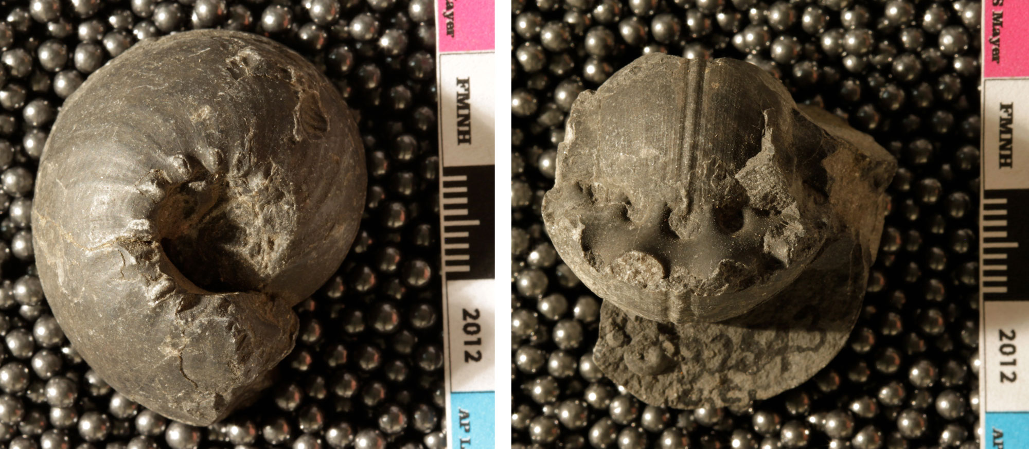
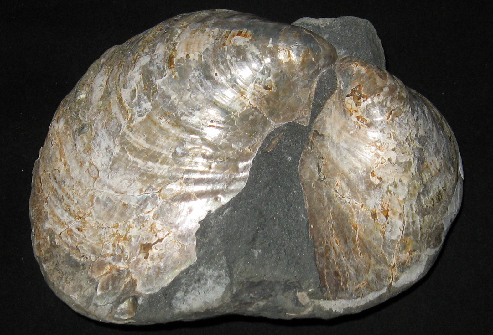
Nevada’s Triassic rocks contain both deep-water marine and terrestrial deposits. Its Triassic seas were rich with ichthyosaurs and other marine reptiles, while its terrestrial rocks reflect the aridity and seasonality of the climate farther inland. As mountain building continued into the Jurassic, the seas became shallower, while terrestrial deposits expanded. By this time, terranes were beginning to collide with the continent; some of these collisions included volcanic islands ringed with corals, indicating that the climate remained warm.
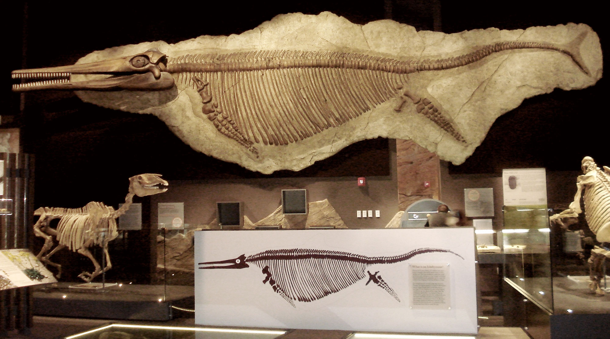
The large ichthyosaur Shonisaurus popularis from the Triassic of Nevada. Specimen on display in the Nevada State Museum, Las Vegas, Nevada. Photo by Kenneth Carpenter (Wikimedia Commons, Creative Commons Attribution-ShareAlike 4.0 International license, image cropped and resized).
Two views of the Triassic ammonoid Tropites sububullatus pacifica from Brock Mountain, California. Photos of UC 32543 by Alex P. Layng, Field Museum of Natural History (copyright Field Museum of Natural History, Creative Commons Attribution NonCommercial license, accessed via GBIF.org, images cropped and resized).
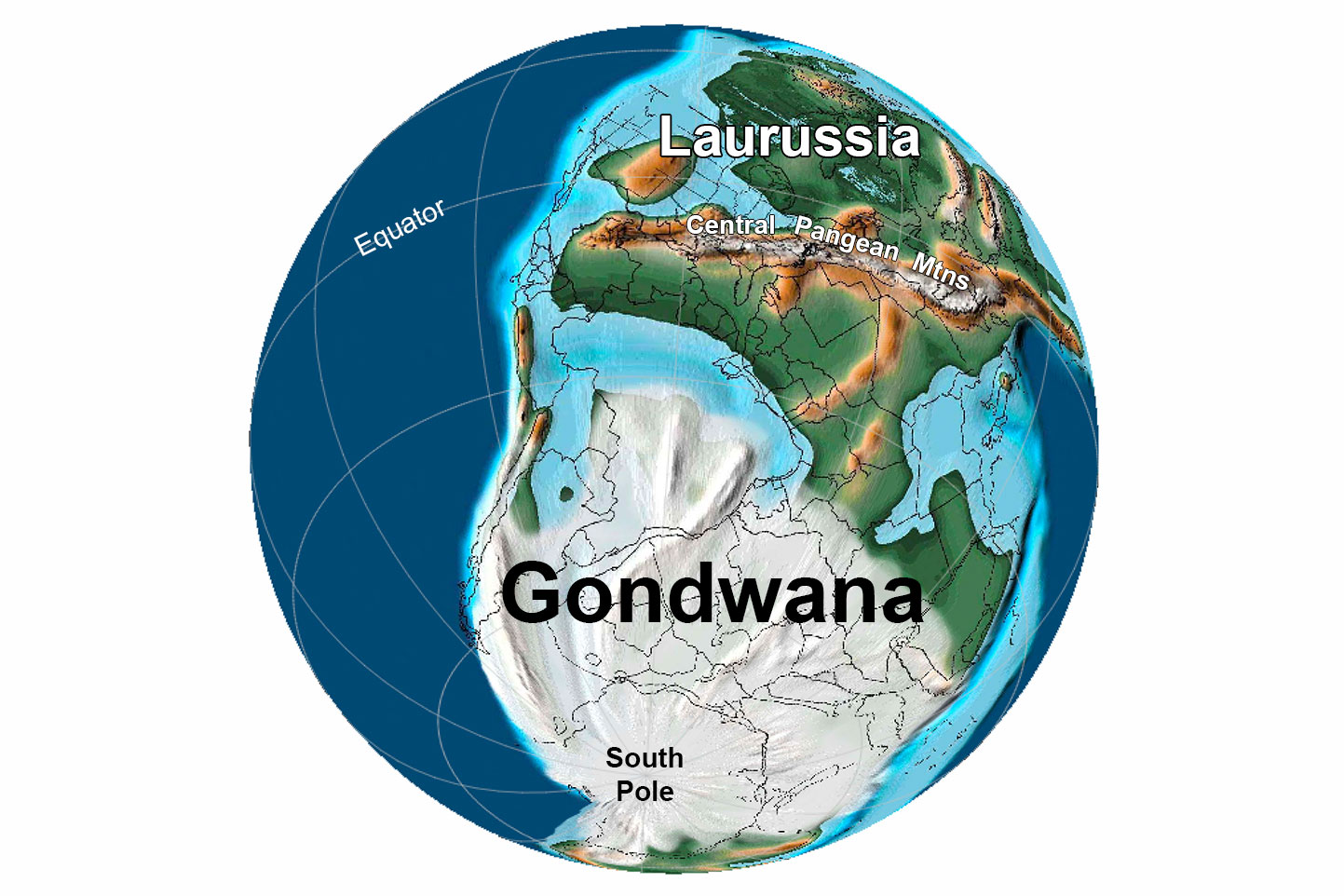
Pangaea began to break up during the Jurassic, rifting apart into continents that would drift toward their modern-day positions. The supercontinent was split by spreading along the mid-Atlantic ridge, initiating the formation of the Atlantic Ocean.
Jurassic rocks are widely scattered through Oregon and Washington, where they contain coral-ringed volcanic arcs with associated deeper marine sediments. Jurassic rocks in California reflect both shallow-water marine and terrestrial environments. A large area of shallow-water marine deposits was laid down just off of the rising Sierra Nevada, in what is now the eastern Central Valley. The terrestrial rocks of southeastern California contain ginkgoes and cycads that indicate a warm, moderately wet climate. Terrestrial Jurassic rocks in southern Nevada, however, show that the climate on land was still arid.
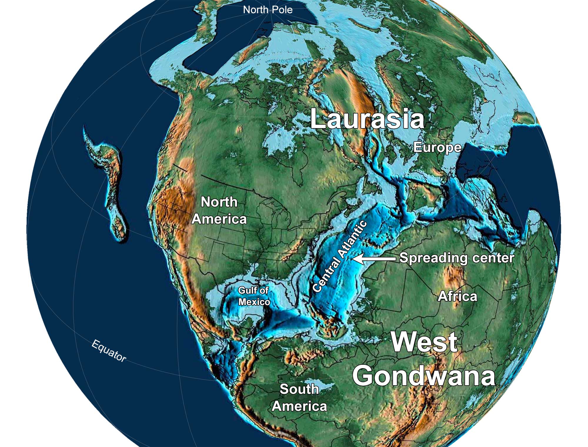
Earth 150 million years ago, near the end of the Jurassic Period. North America and Europe are part of Laurasia, and South America and Africa are part of Gondwana. Notice that North America has separated from Africa and there is a spreading center in the Central Atlantic Ocean. Reconstruction created using Paleomap (by C. Scotese) for GPlates. Reconstruction created using basemap from the PALEOMAP PaleoAtlas for GPlates and the PaleoData Plotter Program, PALEOMAP Project by C. R. Scotese (2016); map annotations by Jonathan R. Hendricks and Elizabeth J. Hermsen for PRI's Earth@Home project (CC BY-NC-SA 4.0 license).
Cretaceous (145 to 66 million years ago)
As a result of displacement due to continental rifting and seafloor spreading, sea level throughout the Cretaceous was much higher than it is today. Global temperatures during the Cretaceous were very warm, as much as 10°C (18°F) above those at present. There was likely little or no glacial ice anywhere on Earth, and temperatures were highest in lower latitudes. Shallow seaways spread over many of the continents, including South America, Africa, Eurasia, and North America.
Mountain-building continued throughout the West with the formation of volcanic mountains in the Sierra Nevada region as well as uplift of the Rocky Mountains further to the east. Erosion predominated, and Nevada and Oregon have a very sparse record of Cretaceous sedimentation and climate; the few outcrops from this time period show that Nevada was terrestrial and Oregon was still largely marine.
Washington and California have a slightly better record, showing that they, too, were still principally marine. Global climate was warm, but reefs did not form, probably due to the intense mountain building and erosion that shed a great amount of sediment into the interior embayments and the Pacific Ocean. The climate temporarily cooled again at the end of the Cretaceous, 66 million years ago.
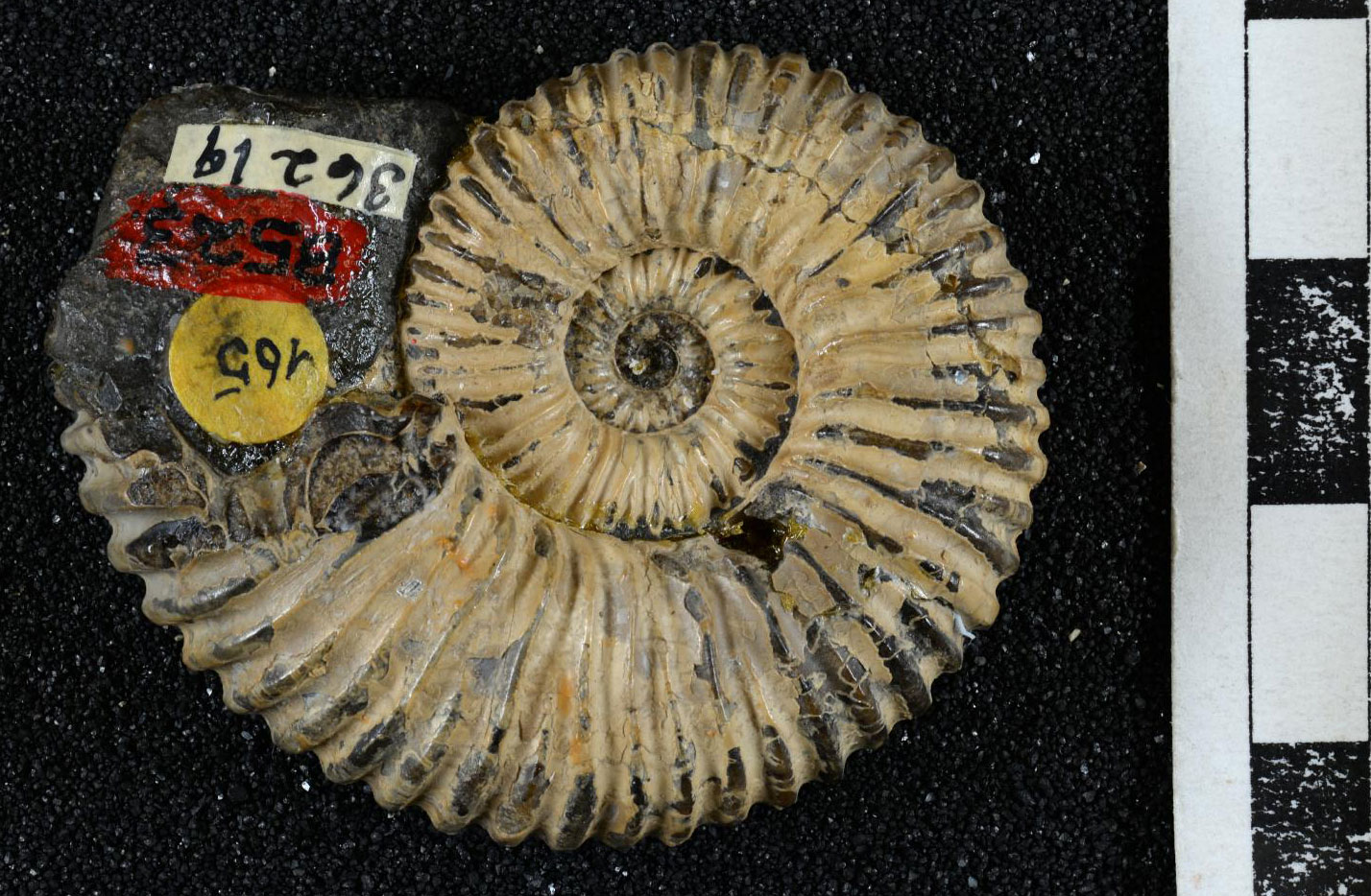
An ammonoid (Acanthoplites subbigoti) from the Early Cretaceous Budden Canyon Formation, Shasta County, California. Photo of LACMIP 9951.2 by Natural History Museum of Los Angeles County (Creative Commons Attribution 4.0 International license, image cropped).
The giant bivalve Inoceramus from the Cretaceous of Little Sucia Island, San Juan Islands, Washington. Photo by Kevmin (Wikimedia Commons, Creative Commons Attribution-ShareAlike 3.0 Unported license, image cropped).
Cenozoic (66 million years ago to present)
Paleogene to Neogene (66 to 2.6 million years ago)
In the early Paleogene, the climate warmed once more. By around 50 million years ago, the West’s climate was actually hot, with palm trees growing as far north as northwestern Washington, western Canada, and southern Alaska. The sea withdrew from most of Oregon and Washington, and plant fossils are found throughout these states.
Impressions of fossil palm leaves (Sabalites), Eocene Chuckanut Formation, Whatcom County, Washington. Source: From Figure 4 in Mustoe (2019) Geosciences 9(7): 321 (Creative Commons Attribution 4.0 International license, image cropped).
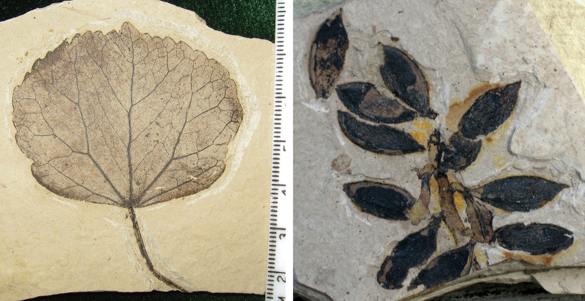
A leaf (left) and fruits (right) of an extinct relative of the katsura (Cercidiphyllum) from Republic, Ferry County, Washington. Leaf = 7.2 cm long (about 2.8 inches). Fruits = each up to 2 centimeters long (about 0.8 inches). Left photo and right photo by Kevmin (Wikimedia Commons, Creative Commons Attribution-ShareAlike 4.0 International license, images cropped and resized).
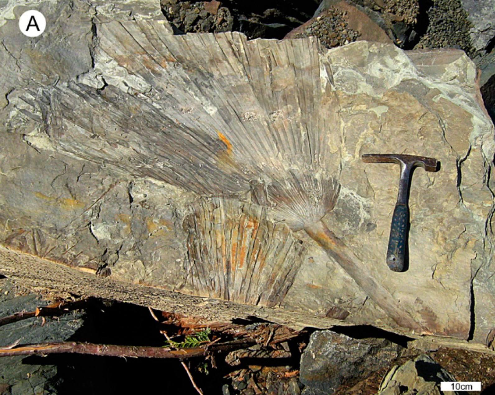
One of the best records of the contiguous western states’ Paleogene climate is found in Oregon’s John Day Fossil Beds. Here, plant and animal fossils indicate that from 50 to 35 million years ago this area was home to a subtropical rainforest with banana and citrus trees. Between 35 and 20 million years ago, however, the climate became cooler and drier, and prairies and deciduous trees such as oak, maple, and alder flourished. This change coincided with the initial uplift of the Cascade Range (37–7 million years ago), which began to create a rain shadow to the east.
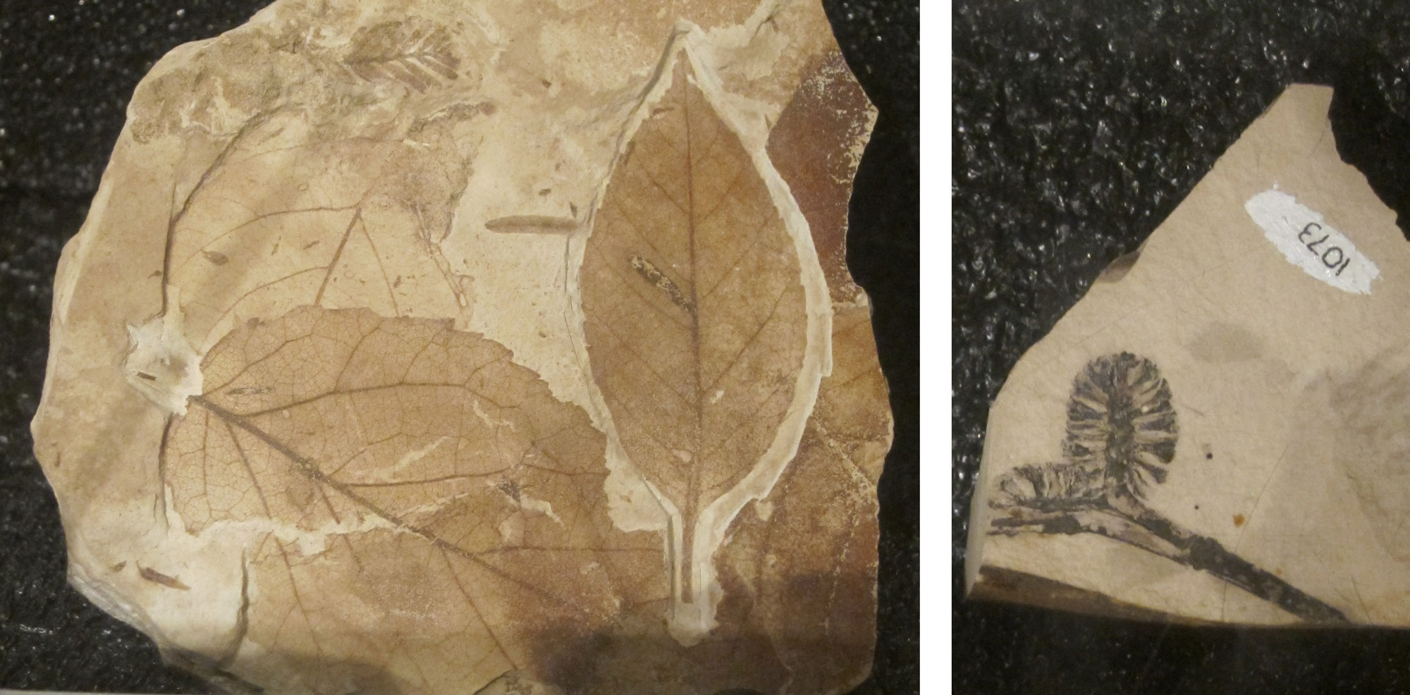
Alder (Alnus) leaves and "cones" (groups of female flowers or fruits, but not true cones) from the Oligocene John Day Formation, Oregon. Fossils on display at the Thomas Condon Paleontology Center, John Day Fossil Beds National Monument. Left photo and right photo by National Park Service/NPS (public domain).
The final uplift of the Cascades and Sierra Nevada created the intense rain shadow that is responsible for the aridity of eastern Washington, eastern Oregon, and Nevada today. Moist Pacific Ocean air moves eastward with the prevailing winds, and it is pushed upward and cools when it encounters a mountain chain. Water vapor condenses from this cool air and falls as rain or snow on the western side of the mountain. The air that continues to move east over the mountains is now much drier, and it warms as it moves down the eastern side of the mountain range, promoting evaporation.
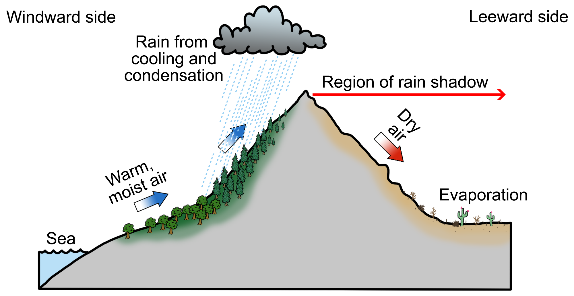
The rain shadow effect occurs when moisture-laden air rises up the windward side of a mountain, only to release this moisture as precipitation due to cooling and condensation. Once the air reaches the leeward side, it warms due to compression, promoting evaporation and a lack of precipitation. Diagram by Wade Greenberg-Brand, originally published in the Teacher Friendly Guide to Earth Science series, modified for Earth@Home.
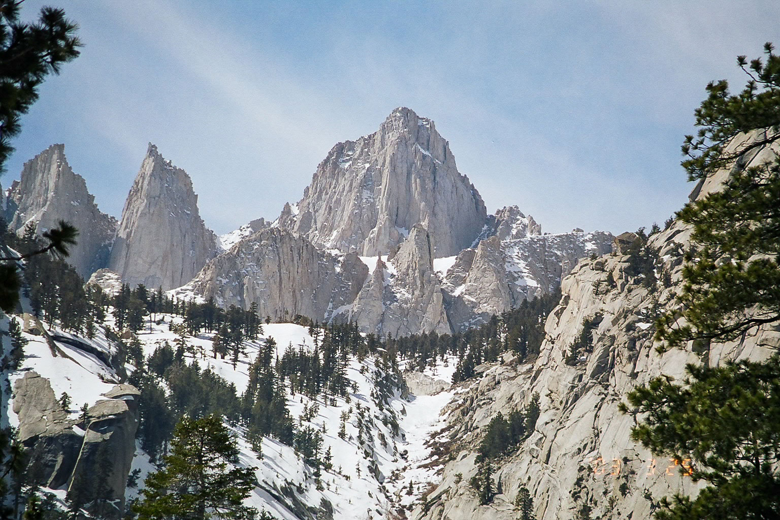
Mount Whitney, the highest peak in California and also in the Sierra Nevada mountains at 4421 meters (14,505 feet) above sea level. Photo by Geographer (Wikimedia Commons, Creative Commons Attribution 1.0 Generic license).
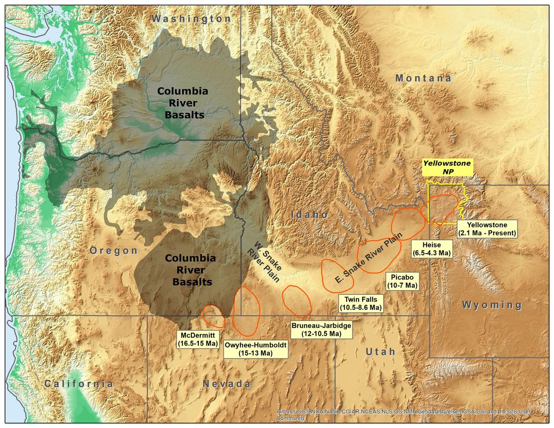
Original caption: "Map of the northwestern U.S., showing the approximate locations of Yellowstone hotspot volcanic fields (orange) and Columbia River Basalts (gray). Boundary of Yellowstone National Park is shown in yellow. Modified from Barry et al. (GSA Special Paper 497, p. 45-66, 2013), Smith and Siegel (Windows into the Earth: the geologic story of Yellowstone and Grand Teton National Parks: Oxford University Press, 2000), and Christiansen (USGS Professional Paper 729-G, 2001)." Source: USGS (public domain).
Quaternary (2.6 million years ago to present)
Eventually, a sheet of sea ice formed over the Arctic, and ice sheets spread over northern Asia, Europe, and North America, signaling the start of the most recent ice age. Since 800,000 years ago, an equilibrium has been reached between warming and cooling, with the ice caps growing and retreating primarily due to the influence of astronomical forces (i.e., the combined gravitational effects of the Earth, Sun, moon, and planets).
During the last glacial maximum, ice covered the northern part of Washington State. During periods of ice advance, the western states were colder than they are today, with extensive mountain glaciers occurring throughout the region; in fact, Yosemite Valley was carved out at this time. Microfossil evidence from the Rancho La Brea Tar Pits in Los Angeles tells us that southern California’s climate around 40,000 years ago was similar to San Francisco’s today.
Around 12,000 years ago, all of Washington east of the Cascades was inundated and scoured by numerous enormous, violent floods. These occurred when an ice sheet alternately blocked and retreated from what is now the Clark Fork River in northwestern Montana and northern Idaho. When the river was blocked, an enormous lake—Glacial Lake Missoula—built up behind the ice dam. When the ice dam later failed, the water was released catastrophically, shaping and scouring the landscape.
Today, many of the glaciers that remain in the West are in retreat and much of the area is becoming more arid. Only one true glacier, Maclure Glacier, still exists in Yosemite National Park.
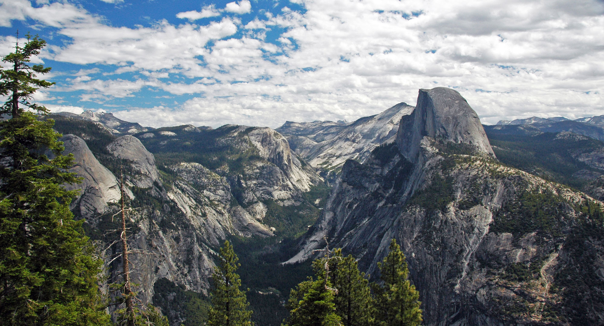
Yosemite Valley and Half Dome (the projecting rock formation on the right), Yosemite National Park, eastern California. Yosemite Valley was carved by glaciers in the Pleistocene. Photo by James St. John (flickr, Creative Commons Attribution 2.0 Generic license, image resized).
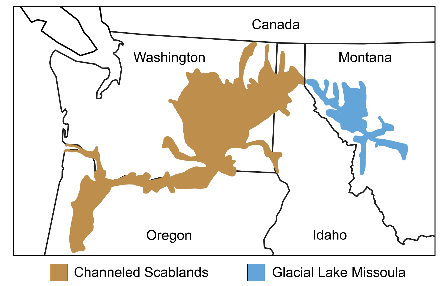
Map showing the extent of glacial Lake Missoula and the Channeled Scablands. Map modified from a map by Wade Greenberg-Brand, adapted from image by the Montana Natural History Center, originally published in The Teacher-Friendly Guide to the Earth Science of the Northwest Central US.
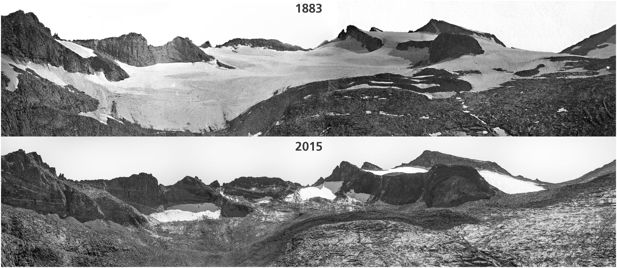
Lyell Glacier in 1883 compared to Lyell ice patch in 2015, Yosemite National Park, California. Photos by Israel Russell/USGS (1883) and Keenan Takahashi/NPS (2015). Source: NPS Climate Change Response on flickr (public domain).
Future climate of the western U.S.
The western states contribute significantly to climate change. The population of any industrialized and particularly wealthy country produces pollution. The more than 51 million residents of California, Nevada, Oregon, and Washington use electricity, transportation, and products that come from carbon-rich fossil fuels. Burning fossil fuels releases carbon into the atmosphere, which warms the Earth. Of the western states, California emits by far the most greenhouse gases. In 2019, California was the second highest carbon dioxide emitter in the nation, behind only Texas. The majority of California’s emissions came from transportation.
On the other hand, the contiguous western states are making changes to reduce human impact on the climate, including decarbonization of energy sources and electrification efforts such as adoption of electric vehicles. The city of Seattle was an early adopter of the 2030 Challenge, an effort by cities to reduce fossil fuel use in buildings so that both new and renovated buildings would qualify as carbon neutral by the year 2030. In 2021, California was the U.S.'s top producer of electricity from solar, geothermal, and biomass sources, and Nevada was 6th in the nation in solar power generation. Washington and Oregon are both large hydropower producers, and in 2020 wind power accounted for 14% of Oregon's utility-scale electricity generation.
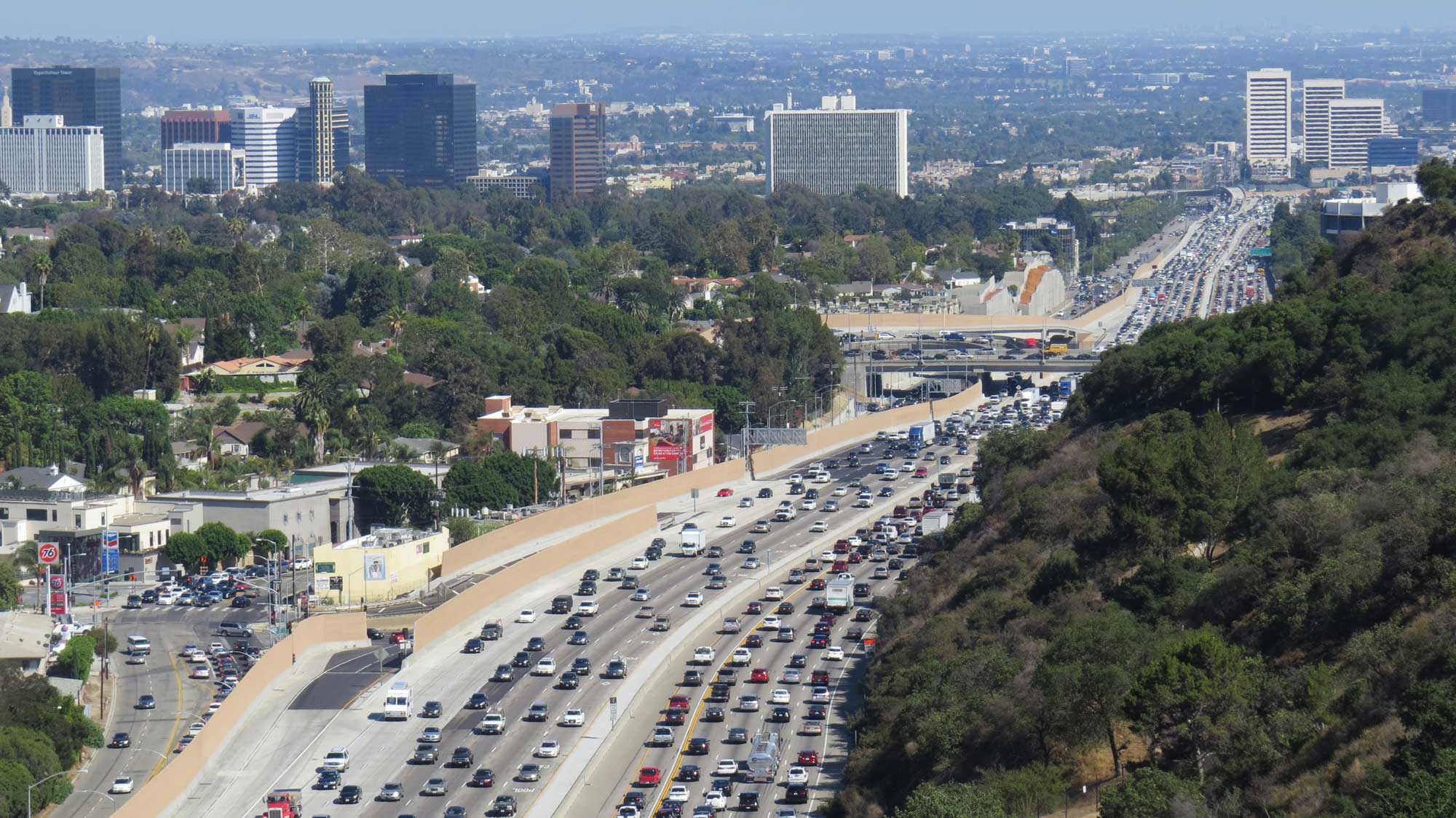
Traffic in Los Angeles, California, 2014. Photo by Luke Jones (flickr, Creative Commons Attribution 2.0 Generic license, image resized).
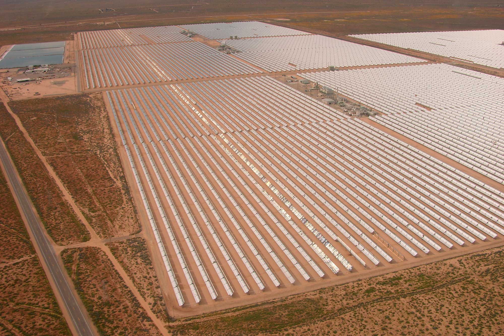
A large solar power plant in the Mojave Desert of California, 2005. Photo by Alan Radecki/Akradecki (Wikimedia Commons, Creative Commons Attribution-ShareAlike 3.0 Unported license, image resized).
Trends and predictions
Studies show that the climate of the contiguous western states is changing right now, and that change has accelerated in the latter part of the 20th century. These changes include the following:
- Temperatures have increased since the 1980s during all seasons.
- Nighttime temperatures have increased by almost 1.7°C (3°F) since 1900.
- The average annual number of wildfires of over 400 hectares (1000 acres) has doubled in California since the 1970s.
- The freeze-free season in the Pacific Northwest is on average 11 days longer for the period of 1991–2010, compared with that of 1961–1990.
- Heavy downpours have increased by 18% in the Pacific Northwest from 1948 to 2006.
Future temperature
Climate models predict that the climate of the western states will continue to warm, and that the average annual temperature will rise by 2° to 6°C (3° to 10°F) by the end of the 21st century. Summer heat waves will become hotter and longer. These increased temperatures lead to a whole host of other effects, including a decrease in snowpack, declines in river flow, drier soils from more evaporation, and the increased likelihood of drought and fires.
The West is already feeling the effects of increased temperature combined with decreasing precipitation. In 2021, the Northwest experienced an unprecedented "heat dome" that brought record-high temperatures, with Seattle reaching about 42°C (108°F) and Portland 46.7°C (116°F) in June.
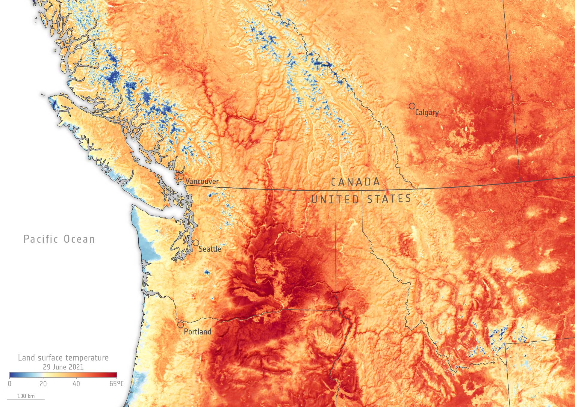
Heat map showing land surface temperature in the northwestern U.S. and adjacent Canada during the June 2021 heat dome event. Excerpt from original caption: "The extent of the heatwave can be seen in this map, which shows the land surface temperature of parts of Canada and the US on 29 June. The data show that surface temperatures in Vancouver reached 43°C [over 109°F], and Calgary and Portland recorded 43°C [over 109°F]. The hottest temperatures recorded are in the state of Washington (visible in deep red) with maximum land surface temperatures of around 69°C [over 156°F]." Image and caption by the European Space Agency on flickr (Creative Commons Attribution-ShareAlike 2.0 Generic license, image resized).
Future precipitation and water supply
California and Nevada
Water supply is a critical issue in the western states, and communities will need to adapt to changes in precipitation, snowmelt, and runoff as the climate changes. Models predict that winter and spring storms in Nevada will shift northward, dropping less rain and snow in already arid areas. California will likely be faced with less water flowing in its rivers and declining high-elevation forests, along with increased pressure on the water supply for agriculture and cities.
Drought conditions in the West are already severely affecting water supplies in California and Nevada. In early 2022, water levels as Lake Mead, a reservoir on the Arizona-Nevada border that supplies water to parts of Arizona, California, Nevada, and New Mexico, were critically low. As a result, stringent water conservation measures were instituted in some places, including limits on outdoor lawn watering. In order to conserve water, Las Vegas has begun efforts to replace much of the grass in the city with arid-adapted plants or other landscaping that does not require frequent watering. In 2021, the town of Mendocino Village, California, faced a severe water shortage and had to have water trucked in from Ukiah, a distance of almost 113 kilometers (70 miles).
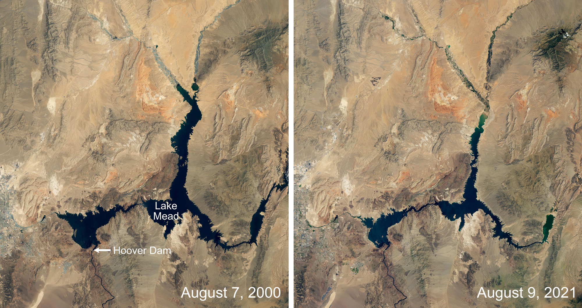
Lake Mead, the lake created by the Hoover Dam, at two points in time about 21 years apart. Images by Lauren Dauphin, NASA Earth Observatory (used following NASA's image use policy).
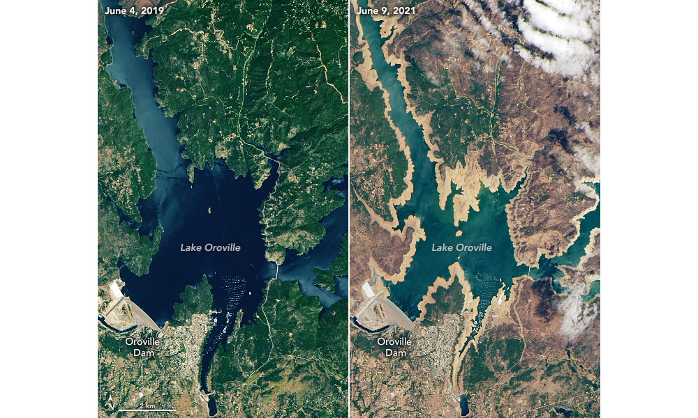
Satellite images of Lake Oroville, a reservoir in northern California. Left: At capacity (highest level), June 2019. Right: At a much lower water level due to drought, June 2021. In August 2021, the Edward Hyatt Power Plant, a hydroelectric plant on Lake Oroville, was shut down because water levels were too low for it to operate. Source: USGS (public domain).
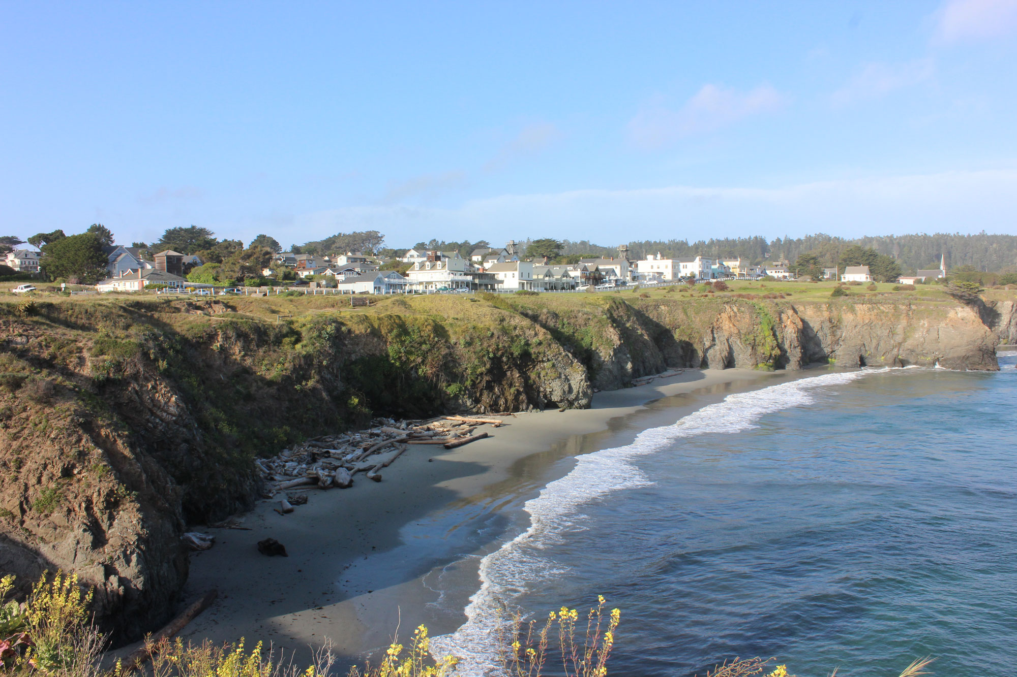
Mendocino Village, California, in 2015. In 2021, the village experienced a severe water shortage and water had to be delivered by truck from inland. Photo by btwashburn (flickr, Creative Commons Attribution 2.0 Generic license, image resized).
Oregon and Washington
The Northwest is expected to see less summer precipitation and more winter precipitation, and more of winter precipitation falling as rain rather than snow. Over the past 40 to 70 years, the Cascade Range has experienced a 25% decline in snowpack measured on April 1, a trend that is expected to continue. This means less water from snowmelt in the warm season. Spring runoff in streams is expected to occur nearly 20 to 40 days earlier during the 21st century. Sea level rise from melting glaciers and the thermal expansion of a warmer ocean will be a concern for cities such as Seattle, Tacoma, and Olympia.
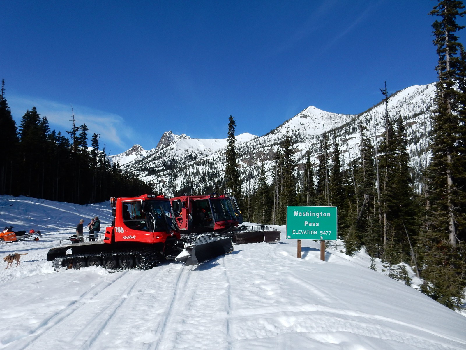
Washington Pass Summit (elevation 1669 meters or 5477 feet), Cascade Mountains, Washington. This photo was taken on March 10, 2015; the snow was about 1.5 meters (5 feet) deep. Photo by Washington State Department of Transportation on flickr (Creative Commons Attribution-NonCommercial-NoDerivs 2.0 Generic license).
Climate change and wildfire risk
The risk of dangerous wildfires is currently very high in parts of the West. The reasons for this are complex and involve a combination factors. Weather conditions, particularly hot, dry weather and wind that spreads flames, contribute significantly to the ignition and growth of wildfires. Other elements involved in the ignition and growth of fires and the risks they pose to people living in the West include (but are not limited to) forest management practices, development patterns, infrastructure maintenance, and human behavior (intentionally or unintentionally starting fires).
As average temperatures rise and the west becomes drier with a longer annual fire season (season conducive to the ignition and spread of wildfires), the number and intensity of wildfires is expected to increase. The result may be more deadly, fast-moving fires like the Camp Fire that devastated Paradise, California, in 2018. The Camp Fire killed 85 people, destroyed more than 18,000 buildings, and burned more than 62,000 hectares (more than 150,000 acres) of land. Investigators determined that the fire was started by Pacific Gas and Electric (PG&E) electrical transmission lines. Warm and dry conditions and high winds spread the fire rapidly, causing the catastrophe in Paradise.
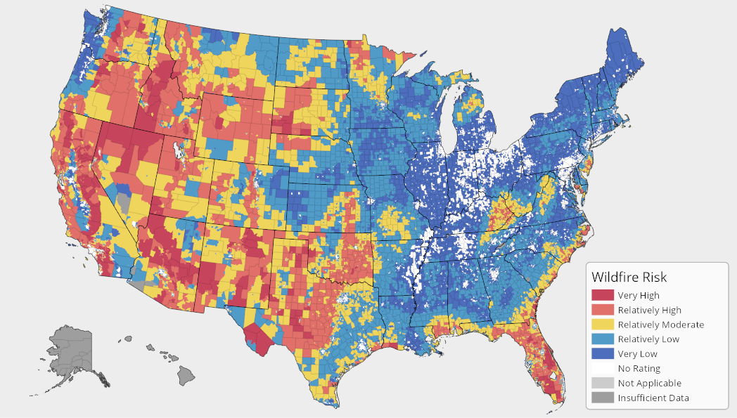
Wildfire risk map for the United States. Source: FEMA National Risk Index.
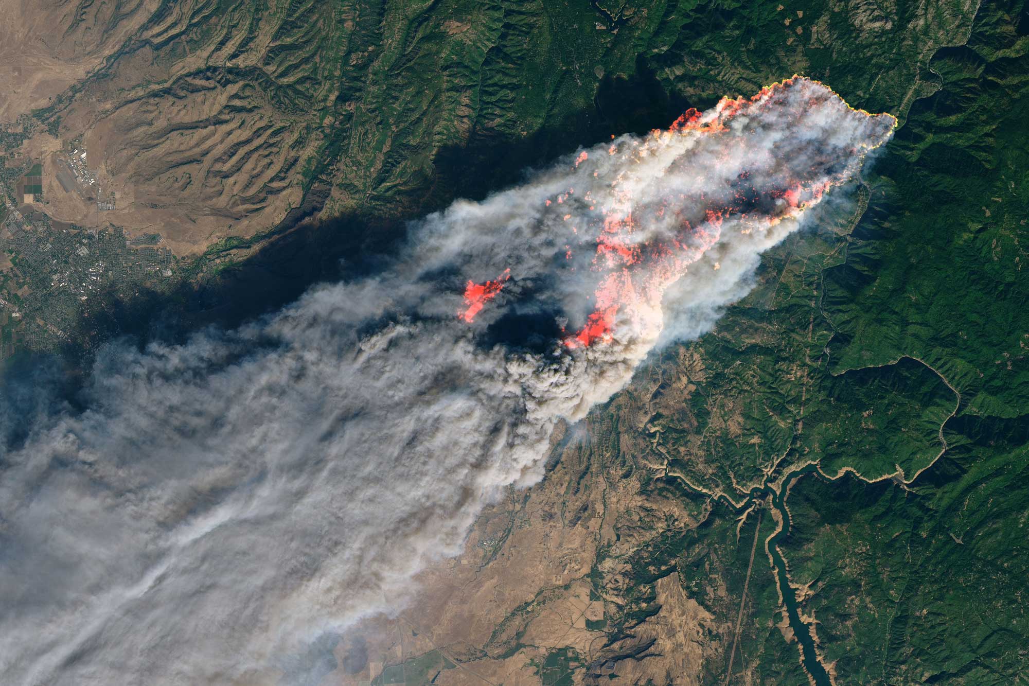
The Camp Fire as seen from a satellite, November 8, 2018. Infrared light provides the orange color that indicates where the fire is burning. Source: NASA Earth Observatory image by Joshua Stevens (NASA Earth Observatory, used following NASA's image use policy).
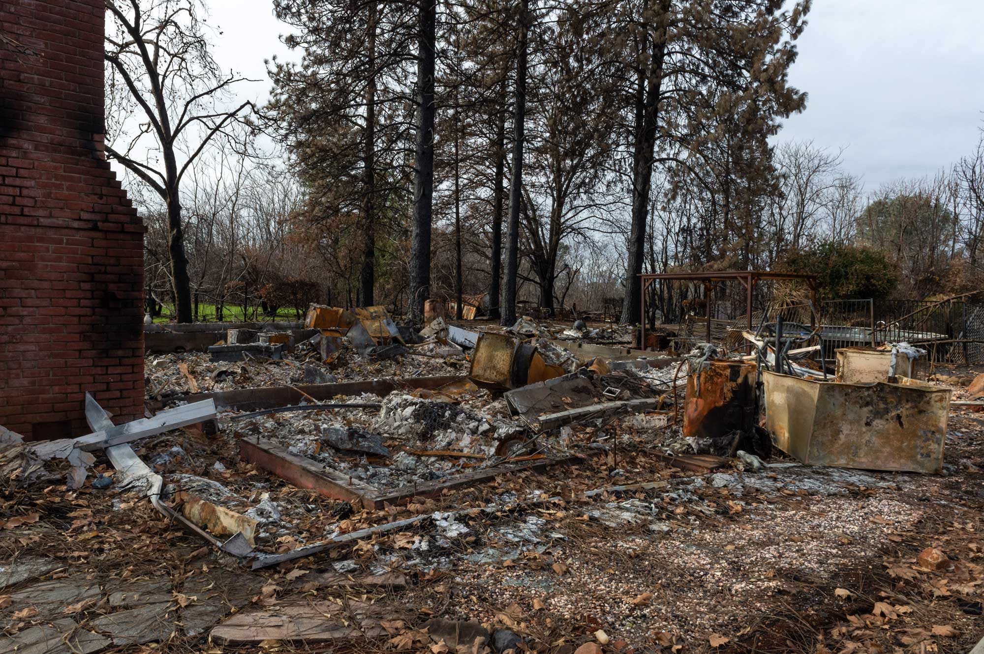
Paradise, California, in December 2018, following the Camp Fire. Photo by Cal OES on flickr (Creative Commons Attribution-NonCommercial 2.0 Generic license, image resized).
Resources
Resources from the Paleontological Research Institution
Books
Zabel, I.H.H., D. Haas, and R.M. Ross. 2017. The Teacher-Friendly Guide to Climate Change. Paleontological Research Institution Special Publication 53, Ithaca, NY, 294 pp. Find updated, digital versions of the chapters of this book on Earth@Home Climate.
Allmon, W. D., T. A. Smrecak, and R. M. Ross. 2010. Climate change—past, present & future: a very short guide. Paleontological Research Institution Special Publication 38, Ithaca, NY, 200 pp.
Websites
Earth@Home Climate: https://climate.earthathome.org/
Earth@Home: Quick guides & FAQ: Climate and Energy: https://earthathome.org/quick-faqs/#climate
Earth@Home: Here on Earth: Introduction to Climate: https://earthathome.org/hoe/climate/