

Spotlight: Overview of the rocks of Alaska.
Topics covered on this page: Overview; Yukon-Tanana Terrane; Seward and York Terrane; Stikinia, Taku, and Trace Arm Terranes; Wrangellia Terrane; Modern Subduction and Accretion; Resources.
Credits: Most of the text of this page is derived from "Rocks of the Western US" by Wendy E. Van Norden, Alexandra Moore, and Gary Lewis, chapter 2 in The Teacher-Friendly Guide to the Earth Science of the Western US (published in 2014 by The Paleontological Research Institution and edited by Mark D. Lucas, Robert M. Ross, and Andrielle Swaby). The book was adapted for Earth@Home web by Elizabeth J. Hermsen and Jonathan R. Hendricks in 2022. Changes include formatting and revisions to the text and images. Credits for individual images are given in figure captions.
Updates: Page last updated April 27, 2022.
Image above: XXXX.
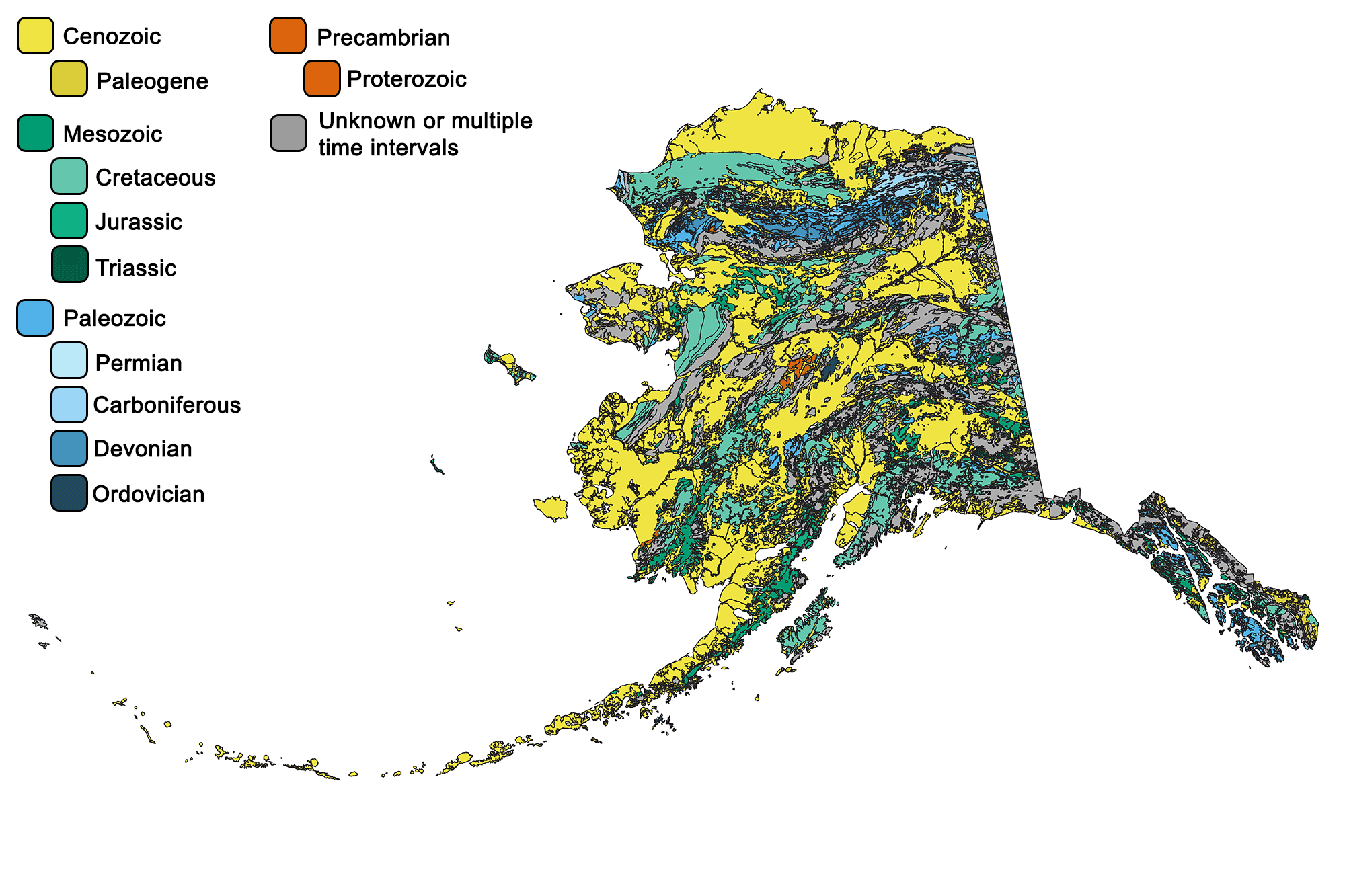
Geologic map of Alaska. Image by Jonathan R. Hendricks for the Earth@Home project developed using QGIS and USGS data (public domain) from Wilson et al. (2015).
Overview
Alaska is a mosaic of accreted terranes, each with its own history.
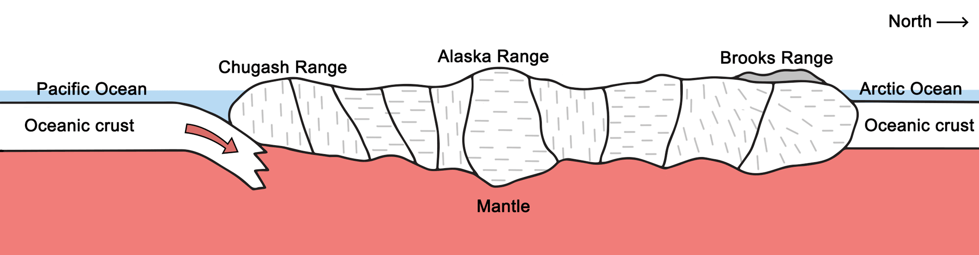
A cross-section of Central Alaska. Each section delineates a separate terrane. Image by Gary Lewis, modified for the Earth@Home project.
Due to the accretion of these terranes over time, Alaska today showcases a diverse array of mountain ranges and physiographical regions.
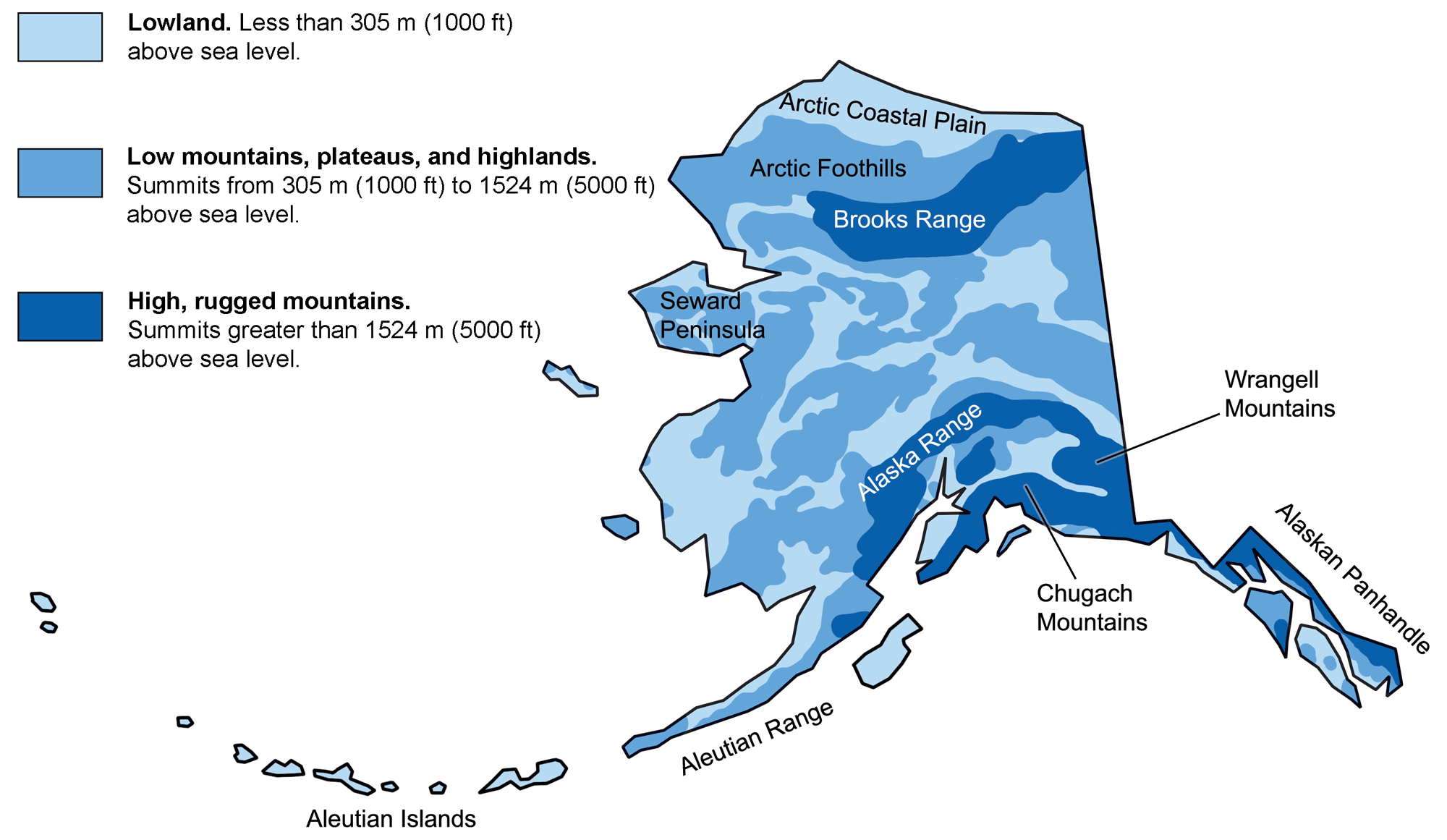
Physiographic features of Alaska. Image adapted from original by the USGS (public domain).
Yukon-Tanana Terrane
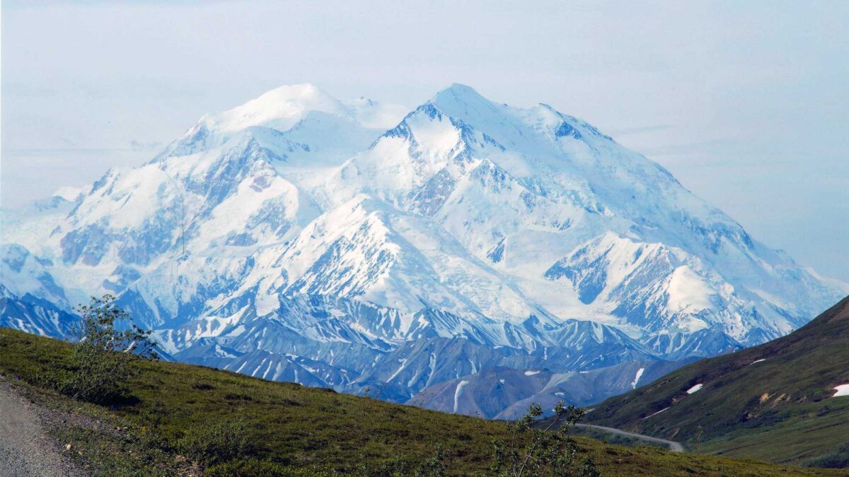
The first rocks of Alaska were put in place when the Yukon-Tanana terrane collided with the western edge of North America 200 million years ago. These rocks are late Precambrian in age and are mostly composed of schist. The greenschist and blueschist of the southwestern Brooks Range show clear signs of having been formed at this convergent plate margin, as they contain minerals that form at high pressure but low temperature. The Brooks Range, Alaska’s northernmost mountain range, is heavily composed of the Yukon-Tanana’s ancient seabed, and contains many ancient marine fossils.
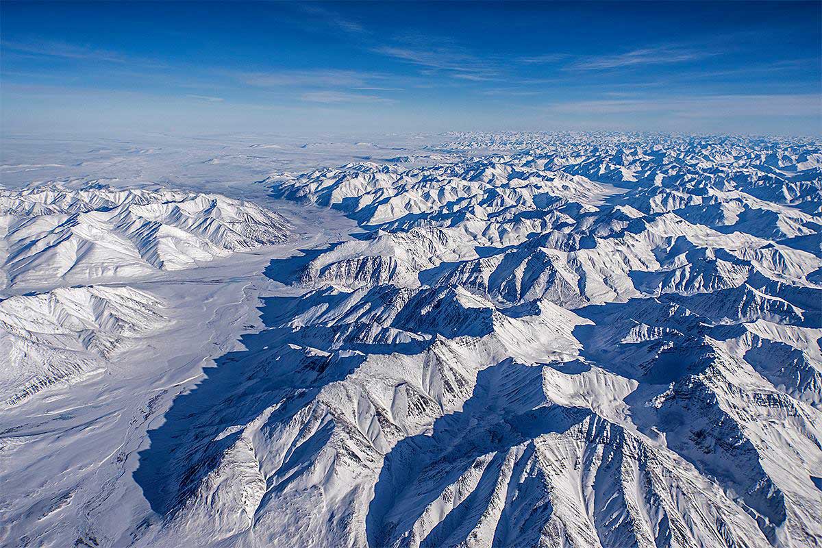
Alaska's Brooks Range. Photograph by Stuart Rankin (Flickr; Creative Commons Attribution-NonCommercial 2.0 Generic license; image resized).
Seward and York Terranes
Other late Precambrian and Paleozoic rocks of Alaska include gneisses of the Seward Peninsula, which extends from northwest Alaska and is a remnant of the Bering land bridge that connected Alaska to Siberia during the Pleistocene. The Seward Peninsula is actually composed of two terranes: the Seward terrane, which is made up of Precambrian schists, granites, and marbles, and the York terrane, which consists of Ordovician through Mississippian limestone, dolostone, and phyllite. The sedimentary rocks of the York terrane would have originally been deposited in a shallow marine environment before their accretion onto the North American plate. During the Cretaceous, thrust faulting deformed the York terrane, allowing the formation of intrusive granites.
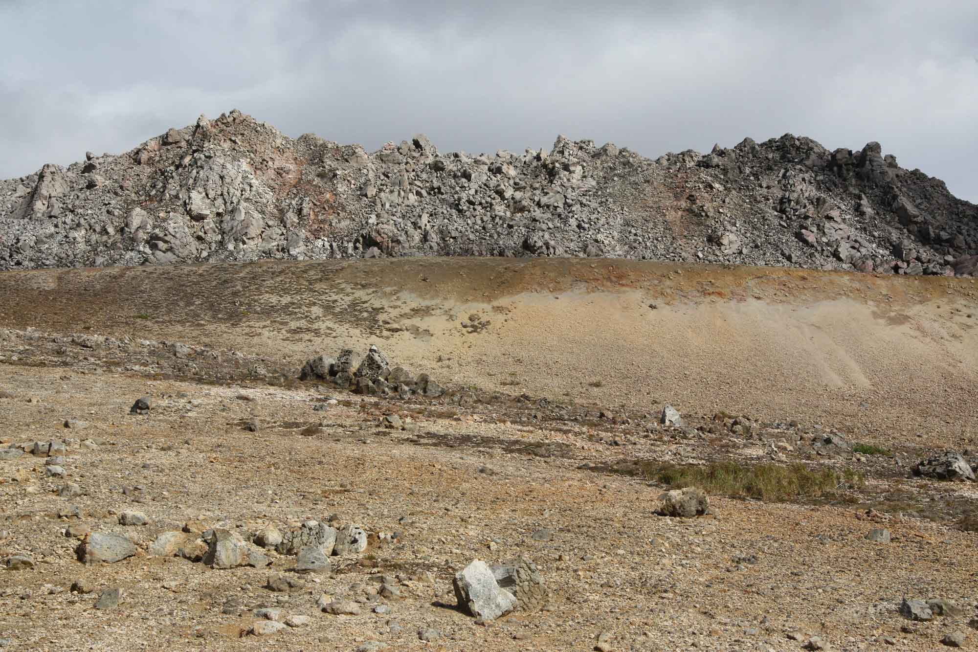
In the late Cambrian to early Devonian, undersea volcanism resulted in large quantities of igneous material being mixed with fossiliferous limestone. As these units were transported to finally dock against North America, they accreted as part of the northern Alaska Range, and metamorphism created large quantities of carbonaceous schist.
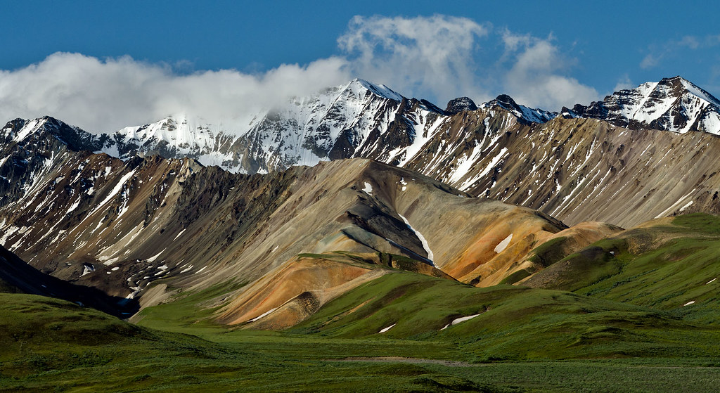
The Alaska Range. Photograph by Richard Droker (Flickr; Creative Commons Attribution-NonCommercial-NoDerivs 2.0 Generic license).
Stikinia, Taku, and Trace Arm Terranes
The next major terrane, Stikinia, began as a volcanic island arc that formed on the rifted margin fragments of the Yukon-Tanana. Its formation would have been similar to the volcanic arc that makes up the islands of Japan today. As this island arc traveled towards a collision with Alaska during the Cretaceous, it scooped up marine shales, sandstones, and limestones that became jumbled up with the volcanic rhyolites, andesites, and basalts that formed the islands. This collection of varied, jumbled rocks eventually became part of the Alaska Range.
The Taku and Tracy Arm terranes were the next to crash into Alaska, adding more metamorphic rocks such as gneiss, schist, and marble.
Wrangellia Terrane
The Wrangellia terrane, born near the equator about 300 million years ago, didn’t dock with Alaska until 120 million years ago, so it contains rocks that tell a complex story of many years of volcanism, erosion, deposition, sinking, and uplift. Wrangellia’s defining unit is a 2500-kilometer (1553-mile) Triassic flood basalt, which would have been extruded onto the terrane’s landmass about 230 million years ago. Shallow seas later inundated the region, covering these volcanic rocks with layers of limestone and other marine sediments. Today, these flood basalts and their overlying sediments extend across the southern portion of the Alaska Range and the Wrangell Mountains. As Wrangellia moved toward North America, it also collided with a variety of other smaller terranes, compressing seafloor rocks against it and forming a complex fault system. This fault is expressed today as the Border Ranges Fault, which occurs throughout the Chugach Mountains at the southern edge of Alaska.
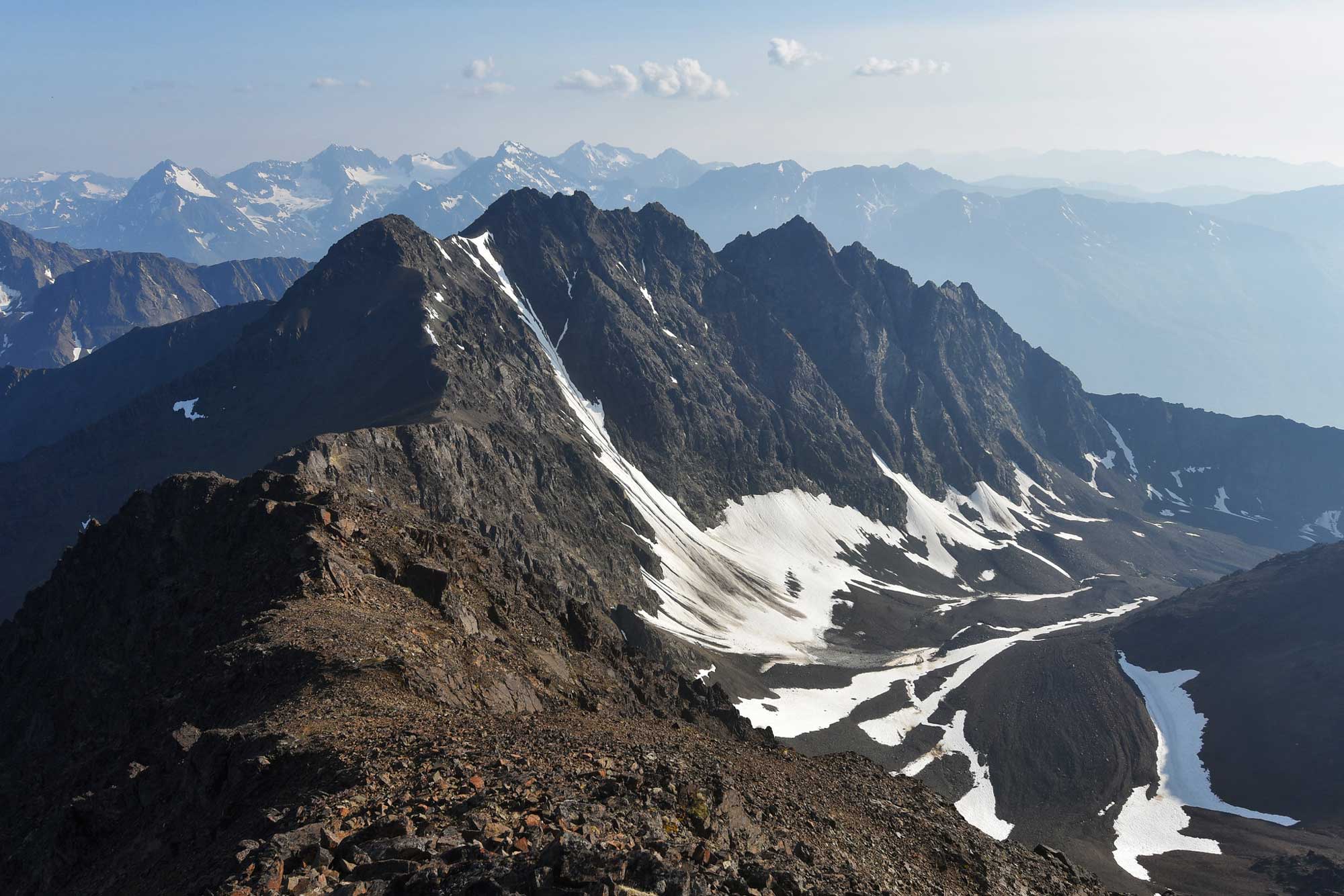
Raina Peak in Chugach State Park, Alaska. Photograph by Paxson Woelber (Flickr; Creative Commons Attribution 2.0 Generic license; image resized).
Modern subduction and accretion
Each terrane was brought to Alaska on a subducting plate, and subduction is still occurring along the Aleutian Trench, resulting in the formation of the Aleutian Islands. The subduction creates stratovolcanoes and plutonic igneous intrusions along the entire Aleutian Range.
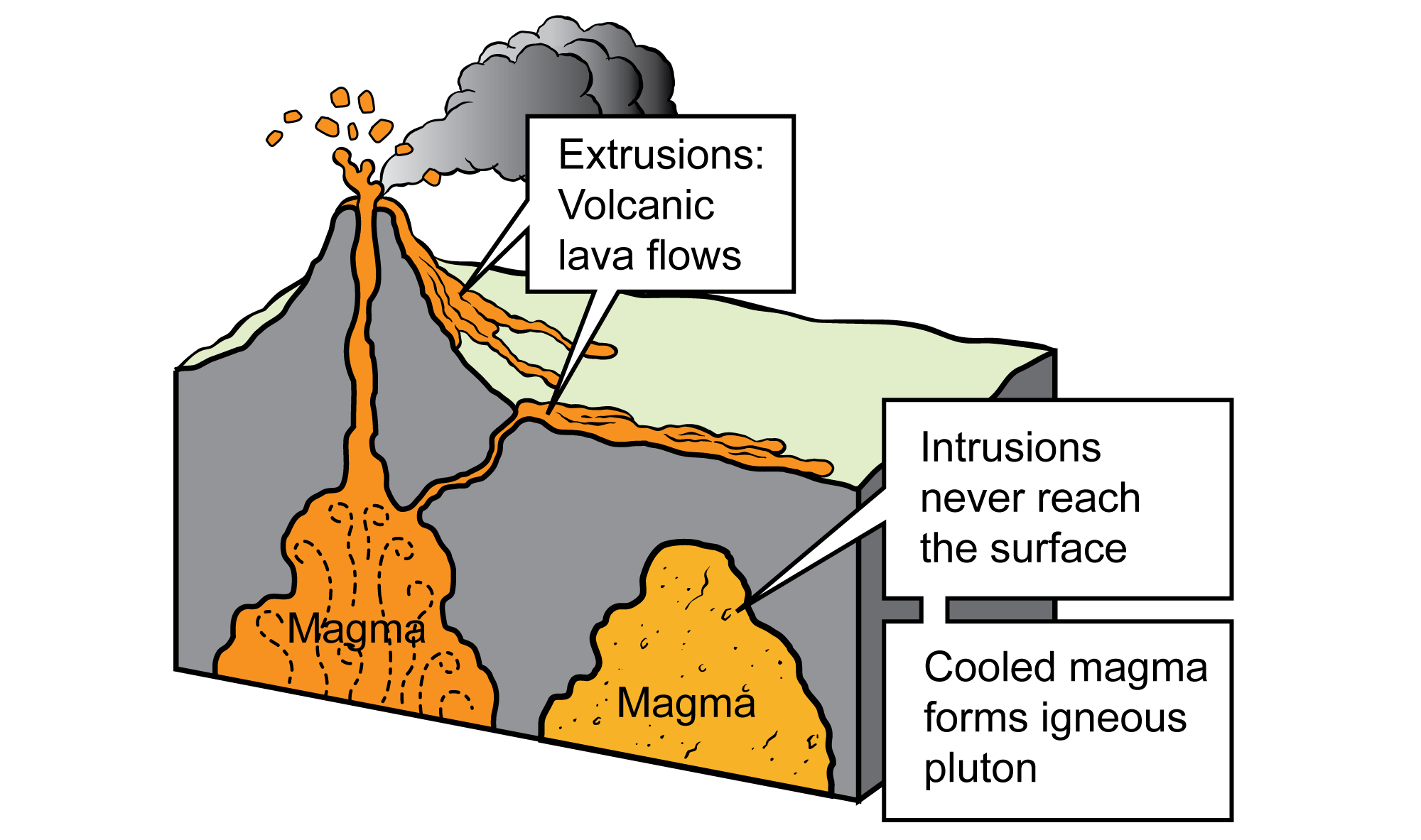
Intrusive and extrusive igneous features. Image by Jim Houghton, modified for the Earth@Home project.
The stratovolcanoes produce rocks that tend to be intermediate in silica content, so andesite and dacite are common. Pyroclastic rocks from explosive events are also quite common. One spectacular example is found at Novarupta in Katmai National Park, where a volcanic eruption thirty times as large as Mt. St. Helens occurred in 1912. Geologists who investigated the aftermath of the eruption were awestruck by the still-smoking tuff that covered the surrounding area, and named it the Valley of Ten Thousand Smokes.
Novarupta at the Valley of Ten Thousand Smokes, Katmai National Park and Preserve, Alaska. Photograph by Jim Flook/NPS CulturalLandscapes (Flickr; Creative Commons Attribution-NonCommercial 2.0 Generic license).
"A Volcano 10 Times More Forceful than Mount St. Helens" by Smithsonian Channel (YouTube).
Today, the Yakutat Block is the terrane currently accreting to Alaska, along the state’s south-central coast. Its convergence with Alaska is responsible for the volcanism evident in the Wrangell Mountains today. The largest volcano in the range, Mt. Wrangell, is unusual because it formed from massive andesitic lava flows that gave it a shield shape rather than the cone shape of a typical stratovolcano. The process that allowed andesite to form a shield volcano is poorly understood, but is likely related to the volume of ejected magma. Besides these andesitic lava flows, the rocks of the Wrangell Mountains include scattered cinder cones and rhyolite domes.
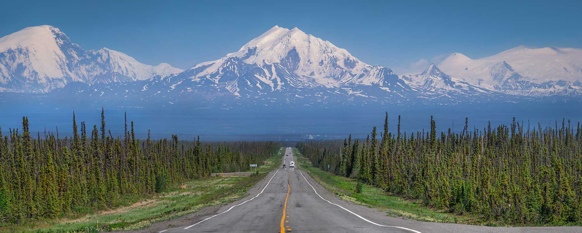
The Wrangell Mountains of Alaska. Photograph by Jeremy Taylor (Flickr; Creative Commons Attribution-NonCommercial 2.0 Generic license).
During the late Jurassic and early Cretaceous, rotation of the North American plate caused basins to open up in the Arctic, creating shallow seas that filled with sediments eroded from the Brooks Range. Today, these sediments form the upper source rocks of the Arctic Foothills and Arctic Coastal Plain, north of the Brooks Range. The shales here are rich with oil, formed as the sediments were deposited in a marine environment with high biological activity. Prudhoe Bay, at the edge of the Coastal Plain, is estimated to hold nearly 25 billion barrels of oil.
Southeastern Alaska, also known as the Alaskan Panhandle, expresses a slightly different geologic history than does the main body of the state. The core of the Coast Mountains is a granitic batholith, parts of which have been deformed by metamorphism to form schist, gneiss, and marble. The region contains a large fault system, which has increased uplift in many areas to expose more metamorphic rock. In addition, a jumble of marine sedimentary rock and conglomerates was accreted to the southeastern coastal area as terranes continued to dock and subduct.
Resources
Resources from the Paleontological Research Institution
Digital Encyclopedia of Earth Science: Minerals.
Earth@Home: Introduction to Rocks.
Earth@Home: Geologic time scale.
Earth@Home: Geologic maps.
Earth@Home Virtual Collection: Rocks (Virtual rock collection featuring 3D models of rock specimens sorted by type.)