

Page snapshot: Introduction to the fossils of the Central Lowland region of the northwest-central United States.
Topics covered on this page: Paleozoic fossils; Mesozoic fossils; Resources.
Credits: Most of the text on this page comes from "Fossils of the Northwest Central US" by Warren D. Allmon and Dana S. Friend, chapter 3 in the The Teacher-Friendly Guide to the Earth Science of the Northwest Central US, edited by Mark D. Lucas, Robert M. Ross, and Andrielle N. Swaby (published in 2015 by the Paleontological Research Institution; currently out of print). The book was adapted for the web by Elizabeth J. Hermsen and Jonathan R. Hendricks in 2022. Changes include formatting and revisions to the text and images. Credits for individual images are given in figure captions.
Updates: Page last updated October 25, 2023.
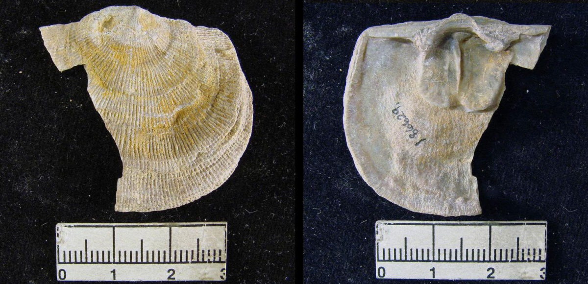
Image above: Upper valve of a brachiopod (Derbyoides nebraskensis), Pennsylvanian Stranger Formation, Cass County, Nebraska. Photo of YPM IP 186629 by Jessica Utrup, 2011 (Yale Peabody Museum of Natural History on GBIF.org, CC0 1.0/public domain dedication).
Paleozoic fossils
The Central Lowland region composes the middle part of the North American continent, centered on the Mississippi River Valley. This region as a whole includes abundant and extensive fossils from the early Paleozoic, especially in the midwestern states, demonstrating that the area was covered by a warm, shallow sea during much of this time. The portion of the Central Lowland region represented in the northwest-central states—eastern Nebraska, eastern South Dakota, and eastern North Dakota—has very few Paleozoic rocks at the surface.
Cores drilled in eastern parts of the Dakotas have yielded marine fossils of early and middle Paleozoic age from the subsurface similar to those found elsewhere in the Central Lowland region, revealing that these areas were also covered by the same warm, shallow sea. Fossils and other subsurface information indicate that coral reefs were well developed in what is now North Dakota during parts of the Silurian and Devonian.
Pennsylvanian rocks outcrop in easternmost Nebraska and contain a diversity of marine fossils, including foraminifera, brachiopods, bryozoans, cephalopods, crinoids, gastropods, bivalves, trilobites, corals, and the teeth of early sharks. The Beil Limestone, for example, is a rock layer containing abundant corals; it occurs in Cass County, Nebraska, and also extends into Mills and Montgomery counties in Iowa, Holt County in Missouri, and Doniphan, Atchison, Greenwood, and Douglas counties in Kansas.
A rugose coral or horn coral (Campophyllum torquium), Pennsylvanian Cullum Limestone, Cass County, Nebraska. Photo of YPM IP 212818 by Jessica Utrup, 2019 (Yale Peabody Museum of Natural History on GBIF.org, CC0 1.0/public domain dedication).
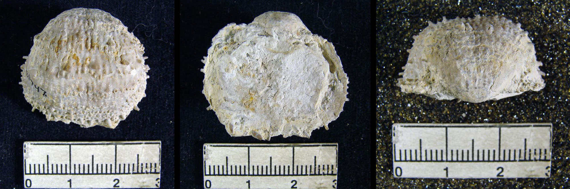
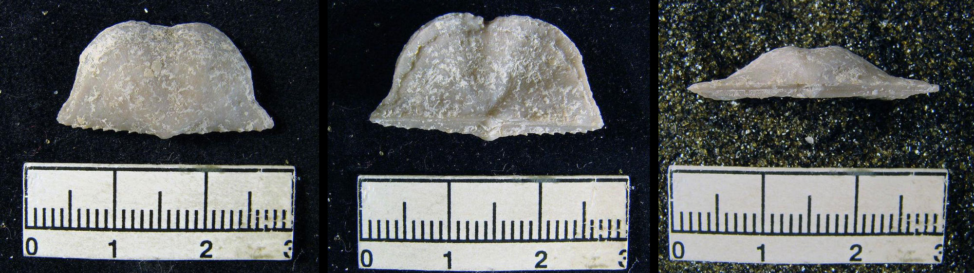
A productid brachiopod (Pustula nebraskensis), Pennsylvanian Tecumseh Shale, Cass County, Nebraska. Shell shown in three views: from above (left), form below (center), and from the hinge (right). Photo of YPM IP 231747 by Jessica Utrup, 2011 (Yale Peabody Museum of Natural History on GBIF.org, CC0 1.0/public domain dedication).
A brachiopod (Chonetes granulifer), Pennsylvanian Oread Limestone, Cass County, Nebraska. Shell shown in three views: from above (left), form below (center), and from the hinge (right). Photo of YPM IP 220336 by Jessica Utrup, 2011 (Yale Peabody Museum of Natural History on GBIF.org, CC0 1.0/public domain dedication).
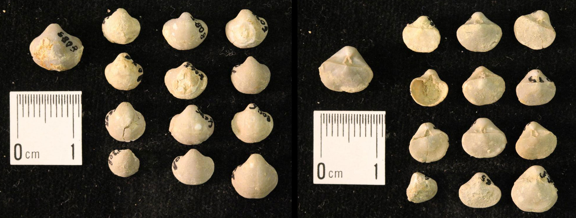
Brachiopods (Ambocolelia planoconvexa), Pennsylvanian Oread Limestone, Cass County, Nebraska. Shell shown in three views: from above (left), form below (center), and from the hinge (right). Photo of YPM IP 008085 by Jessica Utrup, 2015 (Yale Peabody Museum of Natural History on GBIF.org, CC0 1.0/public domain dedication).
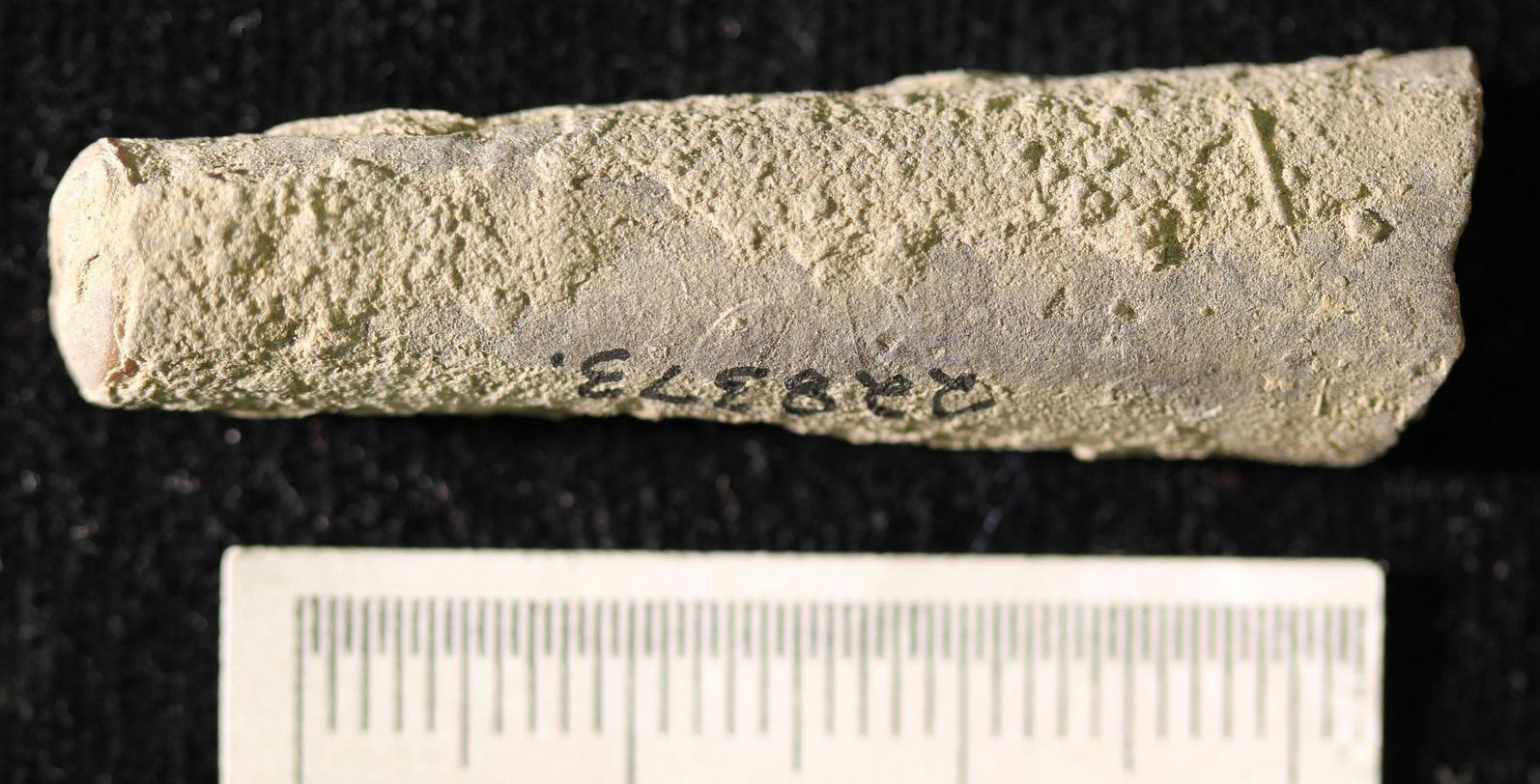
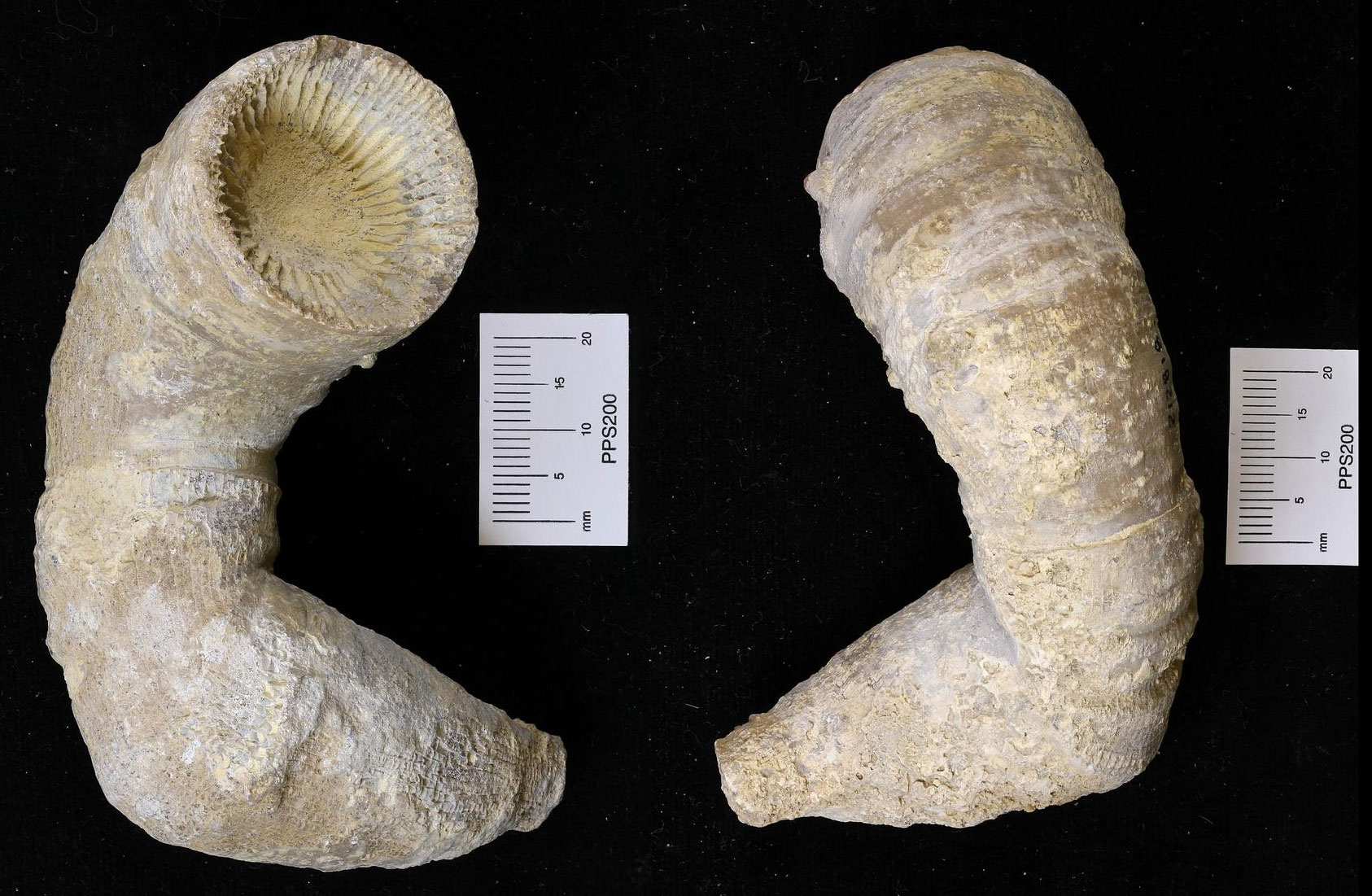
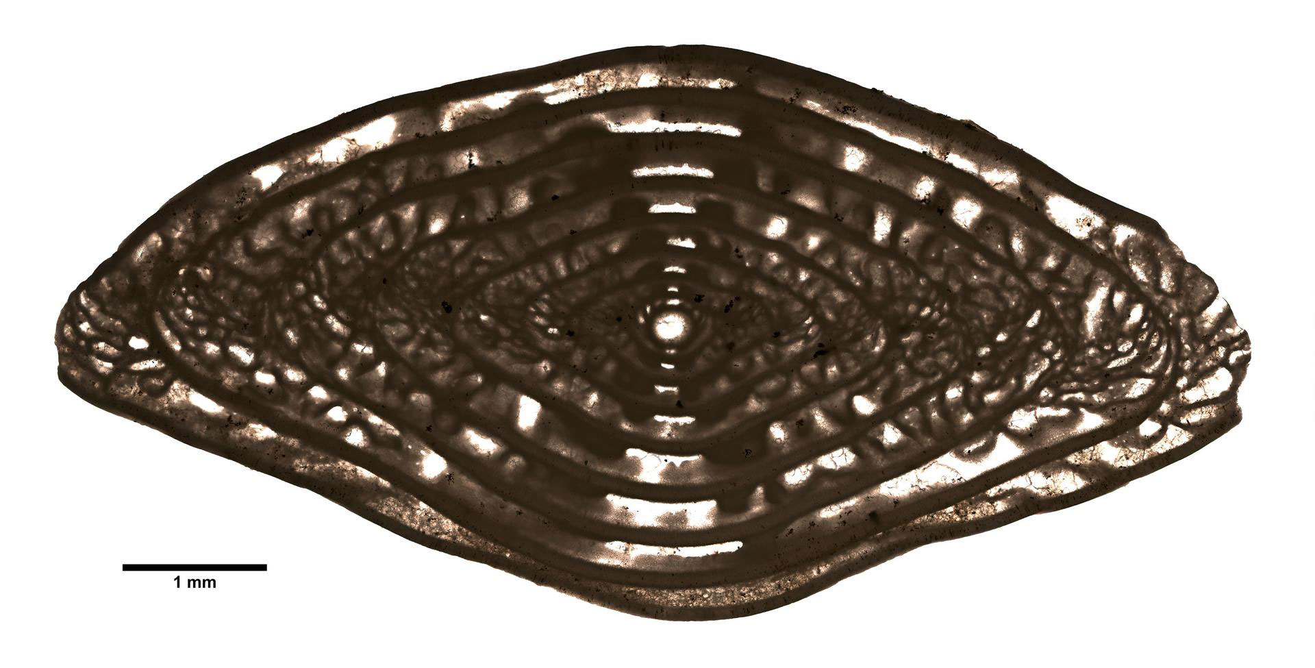
A straight-shelled cephalopod (Pseudorthoceras knoxense), Pennsylvanian French Creek Shale, Nemaha County, Nebraska. Photo of YPM IP 228373 by Jessica Utrup, 2015 (Yale Peabody Museum of Natural History on GBIF.org, CC0 1.0/public domain dedication).
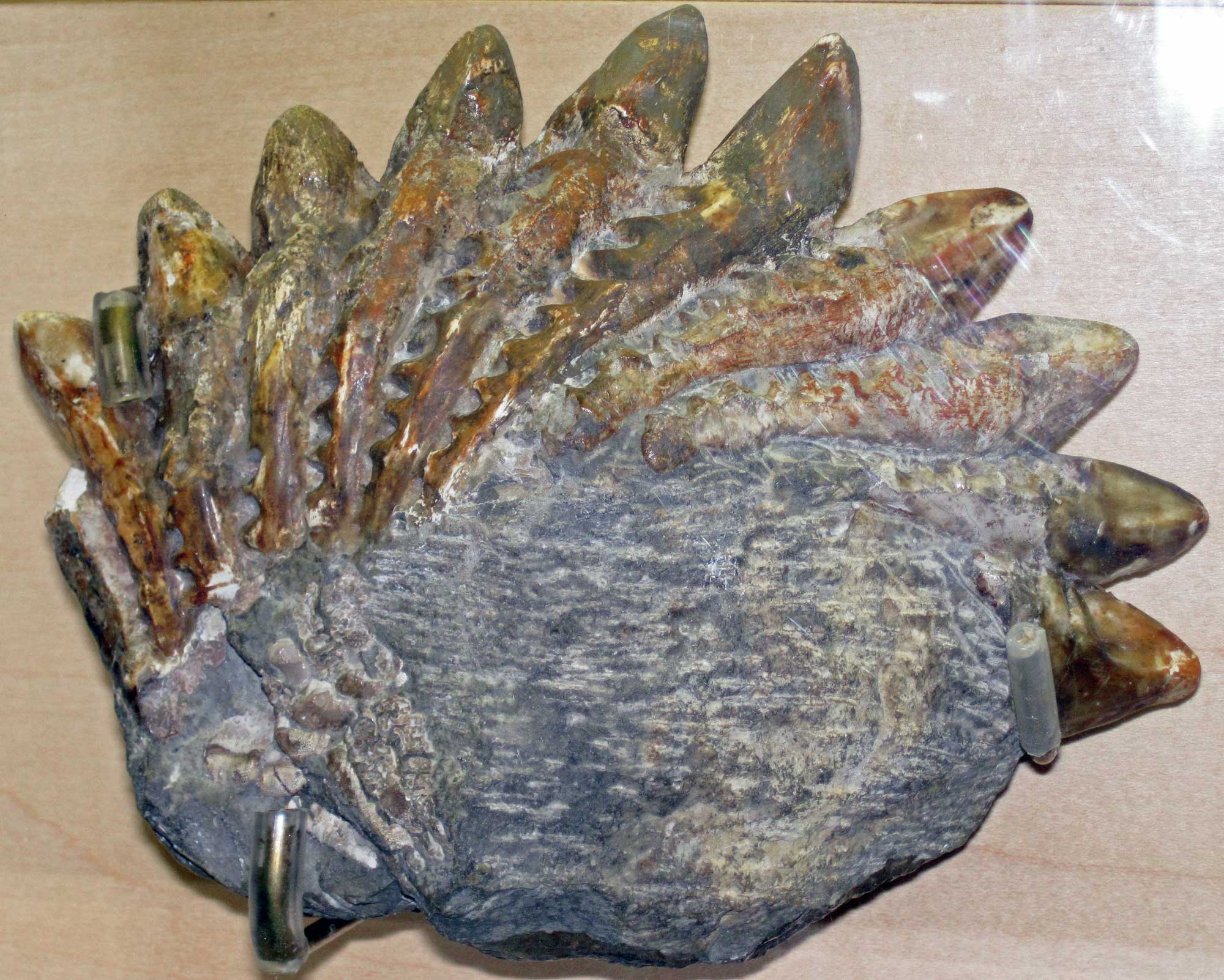
Teeth of a shark (Campodus variabilis), Pennsylvanian, Cass County, Nebraska. Specimen on display at the Nebraska State Museum of Natural History. Photo by James St. John (flickr, Creative Commons Attribution 2.0 Generic license, image resized).
A fusilinid, a type of large foram, from the Permian Janesville Shale, Nemaha County, Nebraska. Forams are single-celled organisms that make calcareous shells. Large forams like this one live on the seafloor, whereas some float in the water column. Photo of YPM IP 011311.A by Daniel J. Drew, 2018 (Yale Peabody Museum of Natural History on GBIF, CC0 1.0 Universal/public domain dedication).
Mesozoic fossils
The northeastern corner of North Dakota (Pembina County) contains the Central Lowland’s only Jurassic bedrock. By that time, a shallow sea had flooded the region again, and fossil marine gastropods, bivalves, and crinoids are found in the state’s Jurassic deposits.
Cretaceous rocks occurring in the Central Lowland, as well as the few Cenozoic deposits that extend into northeastern Nebraska, are identical to those found in the Great Plains region.
Resources
Resources from the Paleontological Research Institution & partners
Cretaceous Atlas of Ancient Life, Western Interior Seaway (Colorado, Iowa, Kansas, Montana, Nebraska, New Mexico, North Dakota, Oklahoma, South Dakota, Texas, Utah, Wyoming): https://www.cretaceousatlas.org/geology/
Digital Atlas of Ancient Life Virtual Collection: https://www.digitalatlasofancientlife.org/vc/ (Virtual fossil collection featuring 3D models of fossil specimens sorted by group)
Digital Encyclopedia of Ancient Life: https://www.digitalatlasofancientlife.org/learn/
Earth@Home: Earth Science of the Midwestern U.S.: Fossils of the Central Lowland (covers the Central Lowland in Illinois, Indiana, Illinois, Minnesota, Ohio, and Wisconsin): https://earthathome.org/hoe/mw/fossils-cl
Earth@Home: Earth Science of the Northeastern U.S.: Fossils of the Central Lowland and Inland Basin (covers the Central Lowland and Inland Basin in Maryland, New Jersey, New York, Pennsylvania, and Vermont): https://earthathome.org/hoe/ne/fossils-cl-ib/
Earth@Home: Earth Science of the South-central U.S.: Fossils of the Central Lowland and Interior Highland (covers the Central Lowland in Kansas, Missouri, Oklahoma, and Texas): https://earthathome.org/hoe/sc/fossils-cl-ih/
Earth@Home: Quick guide to common fossils: https://earthathome.org/quick-faqs/quick-guide-common-fossils/
Pennsylvanian Atlas of Ancient Life, Midcontinent United States (Iowa, Illinois, Indiana, Kansas, Missouri, Nebraska, Oklahoma, Texas): https://pennsylvanianatlas.org/