

Spotlight: Overview of the rocks of the Central Lowland and Great Plains regions of the northwest-central United States, including Montana, Wyoming, North Dakota, South Dakota, and Nebraska.
Topics covered on this page: Overview; Precambrian; Paleozoic; Mesozoic; Cenozoic; Resources.
Credits: Most of the text of this page is derived from "Rocks of the Northwest Central US" by Lisa R. Fisher and Bryan Isaacs, chapter 2 in The Teacher-Friendly Guide to the Earth Science of the Northwest Central US (published in 2015 by The Paleontological Research Institution and edited by Mark D. Lucas, Robert M. Ross, and Andrielle N. Swaby). The book was adapted for Earth@Home web by Elizabeth J. Hermsen and Jonathan R. Hendricks in 2022. Changes include formatting and revisions to the text and images. Credits for individual images are given in figure captions.
Updates: Page last updated September 6, 2022.
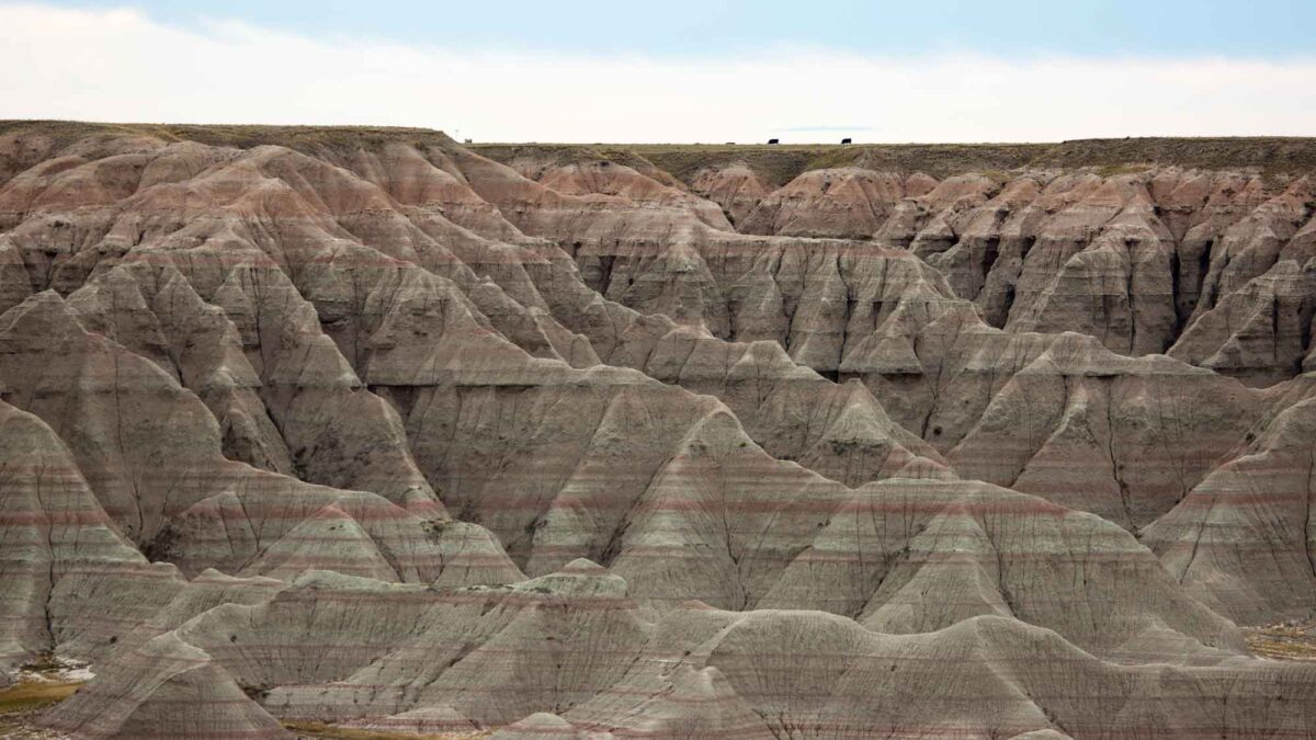
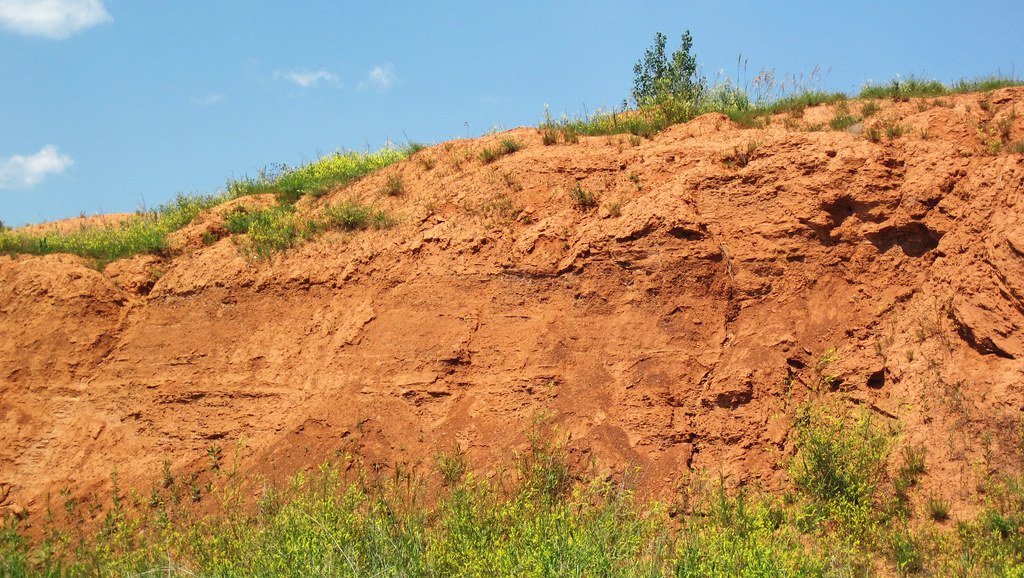
Image above: Sedimentary rock exposures in Badlands National Park, South Dakota. Photograph by NPS Natural Resources (Flickr; public domain).
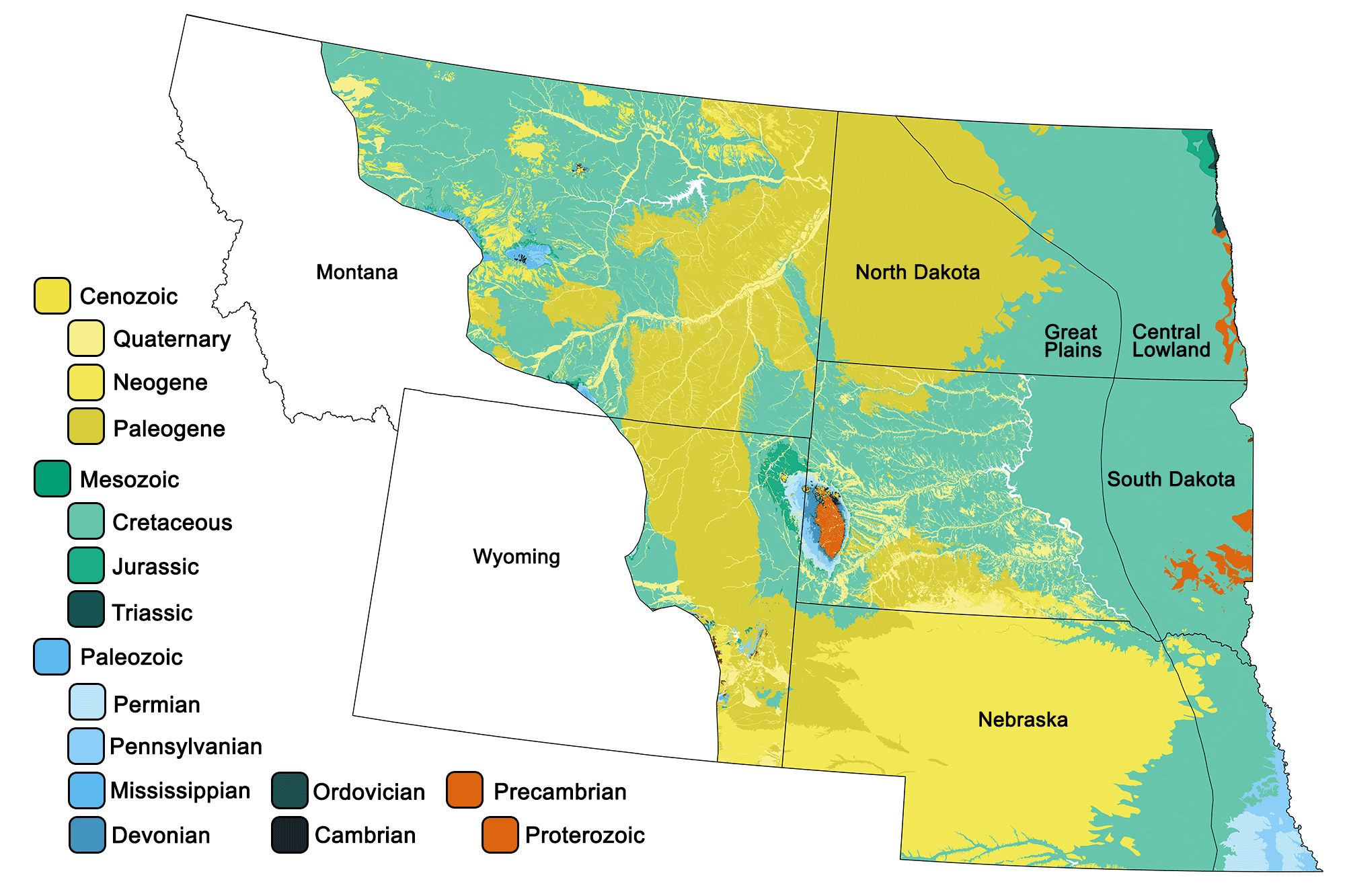
Geologic map of the Central Lowland and Great Plains regions of the northwest-central United States showing maximum ages of mappable units. Image by Jonathan R. Hendricks for the Earth@Home project developed using QGIS and USGS data (public domain) from Fenneman and Johnson (1946)and Horton et al. (2017).
Overview
The two physiographic regions of the Central Lowland and Great Plains are combined in this section due to their geological continuity. The Central Lowland, an area of low terrain that extends like a saucer with gently rising rims, stretches to meet the Great Plains on its western border in the eastern Dakotas and eastern Nebraska. In general, surface deposits in these two regions are composed of Quaternary glacial tills and outwash in the northernmost and easternmost plains, and Mesozoic-Cenozoic sediments in the western plains. Outcrops of older material are usually exposed by stream erosion, dissected terrain, or quarries. Erosional processes from the Missouri, Yellowstone, Little Missouri, Cheyenne, Niobrara, and Platte river systems dominate the area’s active geology.
Precambrian
The Great Plains and Central Lowland are underlain by a basement of igneous and metamorphic Precambrian rocks, some of which are up to 2.6 billion years old. These rocks are, for the most part, buried and inaccessible, with the exception of the Black Hills in southwestern South Dakota and the Sioux Arch in southeastern South Dakota. The Sioux Arch area contains Proterozoic Sioux Quartzite, a formation of pink and red orthoquartzite with cross-bedding, ripples, and mudcracks. It consists largely of conglomerates formed from stream deposits, sandstones from braided streams and alluvial plains, and red to purple mudstones from tidal and lagoonal deposits. These materials, eroded from Archean granites, sandstones, and iron formations, were deposited between 1.8 and 1.6 billion years ago before being subjected to mild metamorphism. Although the Sioux Quartzite is largely overlain by Cretaceous rocks and Pleistocene glacial materials, it appears in small outcrops in southeastern South Dakota and adjacent Minnesota, and is exposed in abundance at Sioux Falls Park along the Big Sioux River.
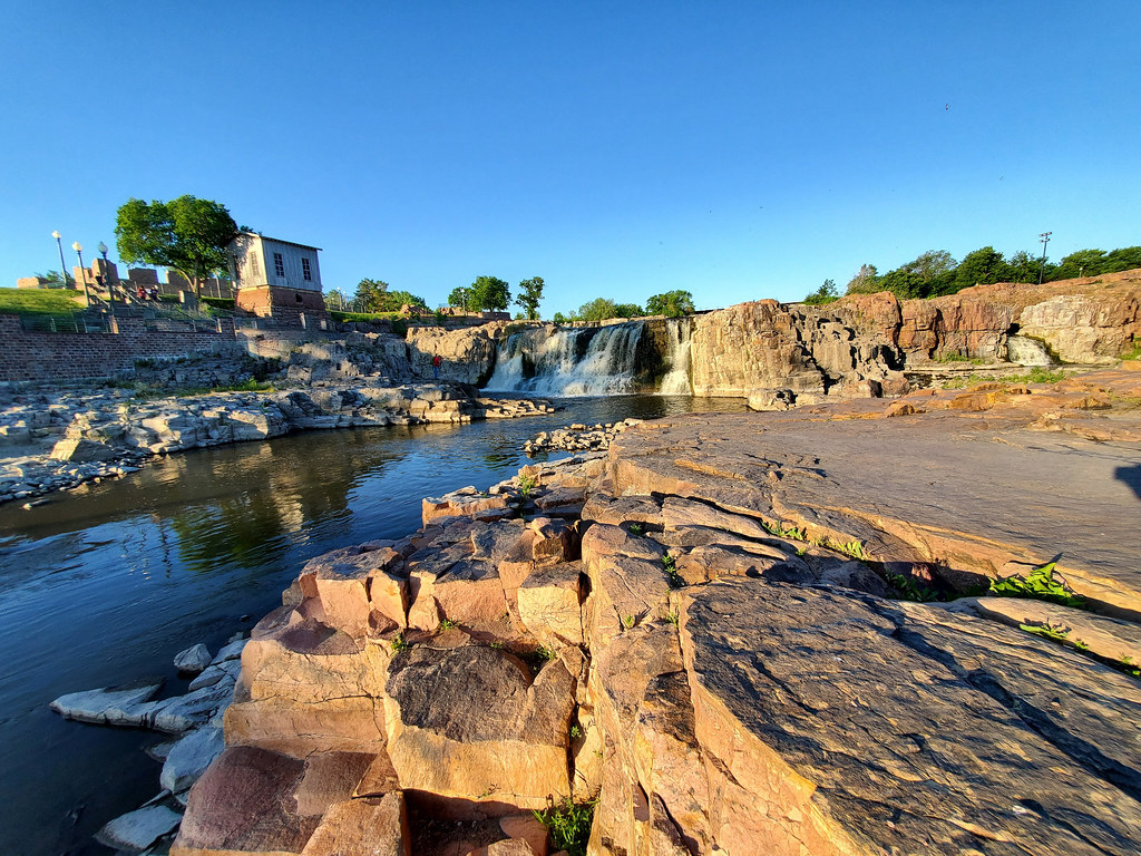
Sioux Falls Park, Sioux Falls, South Dakota. Photograph by "Photo Phiend" (Flickr; Creative Commons Attribution-NonCommercial-NoDerivs 2.0 Generic license).
The quartzite is quarried for building and decorative material, and the mudstones are also known as “pipestone” since Native Americans quarried them for pipes and carvings.
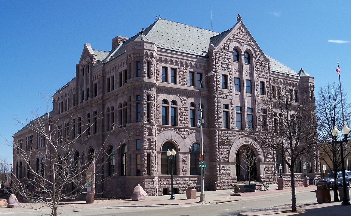
Sioux Quartzite was used to construct the Federal Building in Sioux Falls, South Dakota. Photograph by "AlexiusHoratius" (Wikimedia Commons; Creative Commons Attribution-ShareAlike 3.0 Unported license).
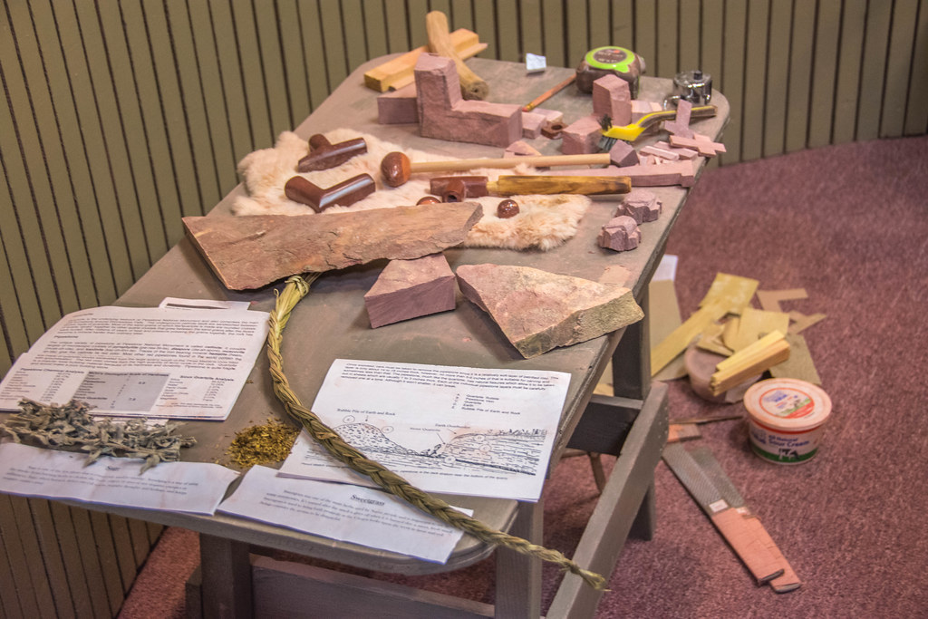
Raw samples of pipestone and the tools that are used to carve it into pipes at Pipestone National Monument in Pipestone, Minnesota. Photograph by Wayne Hsieh (Flickr; Creative Commons Attribution-NonCommercial 2.0 Generic license).
The most dramatic outcrops of Precambrian rocks within the Great Plains and Central Lowland are located in South Dakota’s Black Hills. The Black Hills are the easternmost outlier of the Cordilleran system, uplifted during the Laramide Orogeny between 68 and 65 million years ago. The range is cored by a complex set of 3.5- to 2.5-billion-year-old Archean rocks that were later deformed and metamorphosed into various schists and gneisses accompanied by the intrusion of granitic rocks. At the very center of the uplift is the notable 1.7-billion-year-old Harney Peak granite batholith from which Mt. Rushmore is carved.
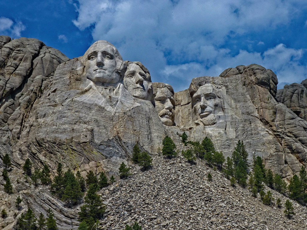
Mount Rushmore, carved from the Harney Peak granite. Photograph by "Jim & Robin" (Flickr; Creative Commons Attribution 2.0 Generic license).
Related pegmatites known for a great variety of spectacular minerals and crystals are also found here.
Large crystal of microcline in a pegmatite at Mount Rushmore, South Dakota. Photograph by Ron Schott (Flickr; Creative Commons Attribution-NonCommercial-ShareAlike 2.0 Generic license).
Paleozoic
Thick sequences of Paleozoic and Cenozoic sedimentary rocks cover the basement beneath the Great Plains. Layers of limestone and shale were deposited when shallow seas repeatedly flooded the area, while sandstones accumulated from sandy beaches were left behind as the seas retreated. These sedimentary layers are largely undeformed except where they have been pushed up and exposed by uplift in the Black Hills. Here, extensive cave systems formed in the Mississippian-aged Madison limestone (locally known as Pahasapa limestone) after the layers were uplifted and subjected to surface erosion.
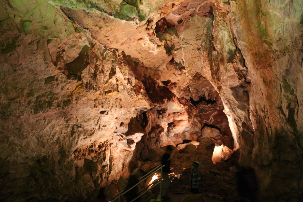
Jewel Cave in the Black Hills of South Dakota. The cave was formed as acid-rich water gradually dissolved layers of limestone that had been cracked by the uplift of the Black Hills around 60 million years ago. Photograph by Alfonso Sintjago (Flickr; Creative Commons Attribution 2.0 Generic license).
The delicate formations found in these caves today, called speleothems, are mineral deposits that formed in more recent times.
In easternmost Nebraska, a small area of Carboniferous strata is exposed at the surface thanks to erosion from the Mississippi River. The dark shales and coal beds in this area originate from a swampy shoreline and oxygen-poor continental shelf. Here, rivers flowing from the east deposited sediments eroded from the Appalachian Mountains. A band of Permian bedrock is also exposed in the southeastern portion of Nebraska, deposited there as sea levels moved back and forth across the state during the late Paleozoic.
Mesozoic and Cenozoic
Throughout the Mesozoic, shallow seas periodically covered much of North America’s interior. The sedimentary deposits resulting from the water’s advance and retreat became the limestones, shales, and sandstones that are now near the surface and actually outcrop in many areas of the Great Plains. For example, Triassic and Jurassic deposits of red silts and clays surround the Black Hills in a ring, providing evidence of an ancient arid coastal plain and intertidal mudflats. These red stones and interbedded layers of gypsum are part of a geological formation called the Spearfish Formation, which extends from the Dakotas into Montana, Wyoming, and Nebraska. The Belle Fourche River, which flows from Wyoming to South Dakota, cuts through and exposes these layers.
The Spearfish Formation near Sundance, Wyoming. Photograph by James St. John (Flickr; Creative Commons Attribution 2.0 Generic license).
During the Cretaceous Period, the interior of North America was downwarped by tectonic processes associated with the subduction of oceanic lithosphere along the western edge of North America. As the Laramide and Sevier orogenies occurred to the west, the North American interior was flooded by a particularly vast inland sea called the Western Interior Seaway.
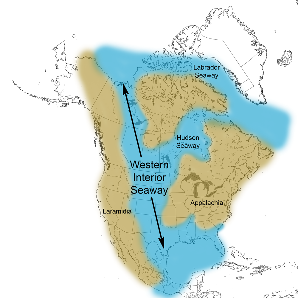
Extent of the Western Interior Seaway during the Cretaceous Period. Image from Cretaceous Atlas of Ancient Life: Western Interior Seaway (Creative Commons Attribution-NonCommercial-ShareAlike 4.0 International license).
Episodes of transgression and regression deposited thousands of feet of marine and terrestrial sedimentary rock across the Great Plains and Central Lowland. As the Cretaceous drew to a close, mountain building progressed eastward, and the vast inland sea receded for the final time. The pattern of sedimentation transitioned from marine, to near shore, and finally to on-land gravels, sands, and muds deposited by the action of streams and rivers flowing eastward from the elevated Rockies. These continental deposits covered the entire Great Plains progressively from north to south.
Tectonic activity associated with the Laramide Orogeny also generated volcanism and igneous intrusions near the area of mountain building. The famous Devils Tower, an exposed igneous intrusion that rises 386 meters (1267 feet) above the surrounding terrain, lies in Wyoming just west of the Black Hills.
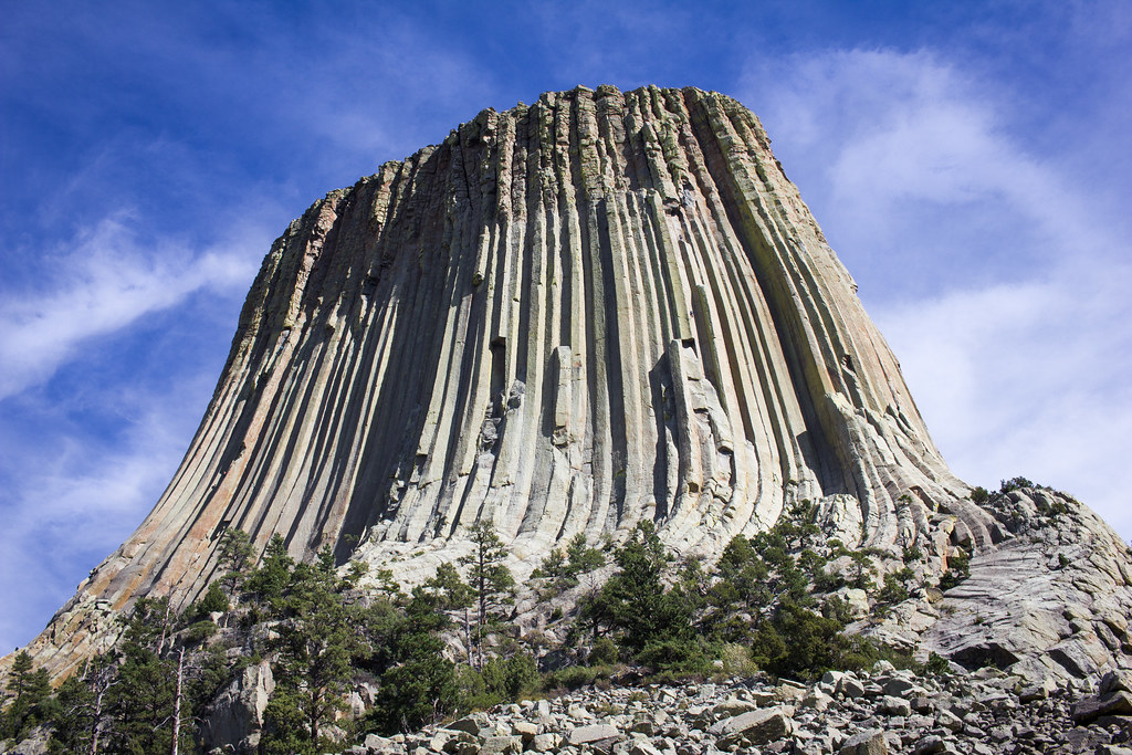
Devils Tower, a large intrusive igneous rock formation with well-developed columnar jointing, in Crook County, Wyoming. Photograph by Christian Collins (Flickr; Creative Commons Attribution-NonCommercial 2.0 Generic license).
Devils Tower is composed of phonolite, a gray or greenish gray igneous rock containing conspicuous crystals of white feldspar. This igneous rock exhibits spectacular columnar jointing, indicating that it cooled quickly at a shallow depth. A popular interpretation for the formation of this landmark classifies it as a solidified volcanic neck, but alternate interpretations peg it as a laccolith or other shallow intrusive body. Just 6 kilometers (3.5 miles) to the northwest of Devils Tower lies a set of four summits, the Missouri Buttes, which are also composed of jointed phonolite of the same age.

Devils Tower and the Missouri Buttes. Photograph by Craig Hemsath (Flickr; Creative Commons Attribution-NonCommercial-NoDerivs 2.0 Generic license).
A similar landform in Montana, Snake Butte, is also the result of an igneous intrusion; it is composed of a coarse-grained igneous rock called syenite, and it also exhibits columnar jointing. Syenite is particularly durable, and was an important source of material used to build the Ft. Peck Dam in the 1930s.
Volcanic eruptions in the Rockies during the Neogene and Paleogene generated ash that was carried eastward by the prevailing winds, and often fell across the Great Plains in thick layers. The Ashfall Fossil Beds in northeastern Nebraska are an example of one such location, formed after a dense volcanic ash fall that occurred in the late Miocene. Sentinel Butte in North Dakota also contains a widespread ash and bentonite deposit that is up to 8 meters (25 feet) thick in some areas.
The Sentinel Butte Formation, a Paleocene ash deposit in the Little Missouri Badlands of North Dakota. Photograph by James St. John (Flickr; Creative Commons Attribution 2.0 Generic license).
During the Cenozoic, many sediments were deposited in terrestrial environments such as lakes, rivers, and floodplains. These deposits cover the region’s Cretaceous rocks in two large areas. The first, comprising mostly Paleocene sediments, is located in the northern Great Plains of Montana, Wyoming, and the Dakotas. The other area includes a large tract of late Paleocene to Neogene strata that has escaped much erosional loss, and constitutes the High Plains subdivision of the Great Plains between Nebraska and Texas. The sandstones in the High Plains Ogallala Formation house the famous Ogallala or High Plains Aquifer. Water in the Ogallala Aquifer, stored since Quaternary times, is now being withdrawn by extensive agricultural development at rates exceeding recharge in the modern climate regime.
Rivers flowing eastward out of the Rocky Mountains since the early Cenozoic have eroded and carried sediment towards the plains. The process was intensified by the successive accumulation and melting of mountain glaciers and ice caps over many of the mountain ranges in the Rockies. These rivers, continually cutting into and removing earlier sedimentary cover, have thereby created much of the scenery and spectacular rock outcrops found in the Great Plains. Some examples include the Upper Missouri Breaks National Monument in central Montana, Badlands National Park in southwestern South Dakota, and the Scotts Bluff National Monument in western Nebraska.
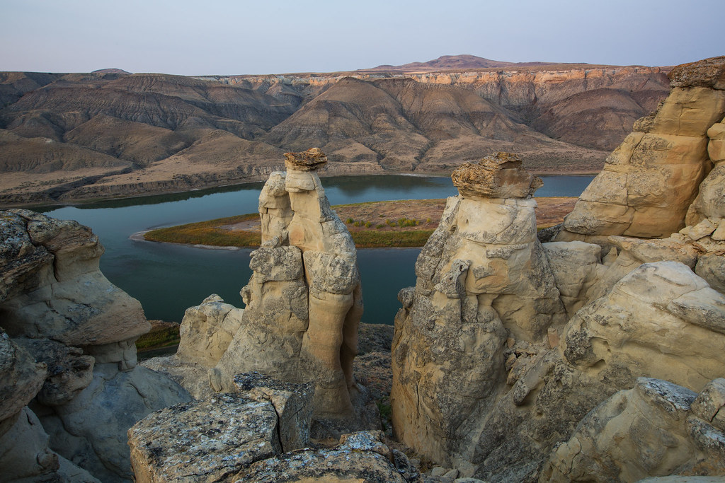
The Upper Missouri Breaks in central Montana are composed of Mesozoic and Cenozoic shales, sandstones, and volcanic materials. Photograph by the Bureau of Land Management (Flickr; Creative Commons Attribution 2.0 Generic license).
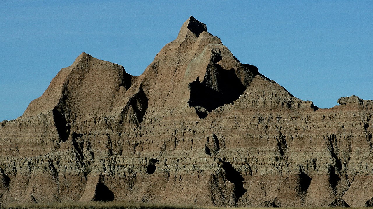
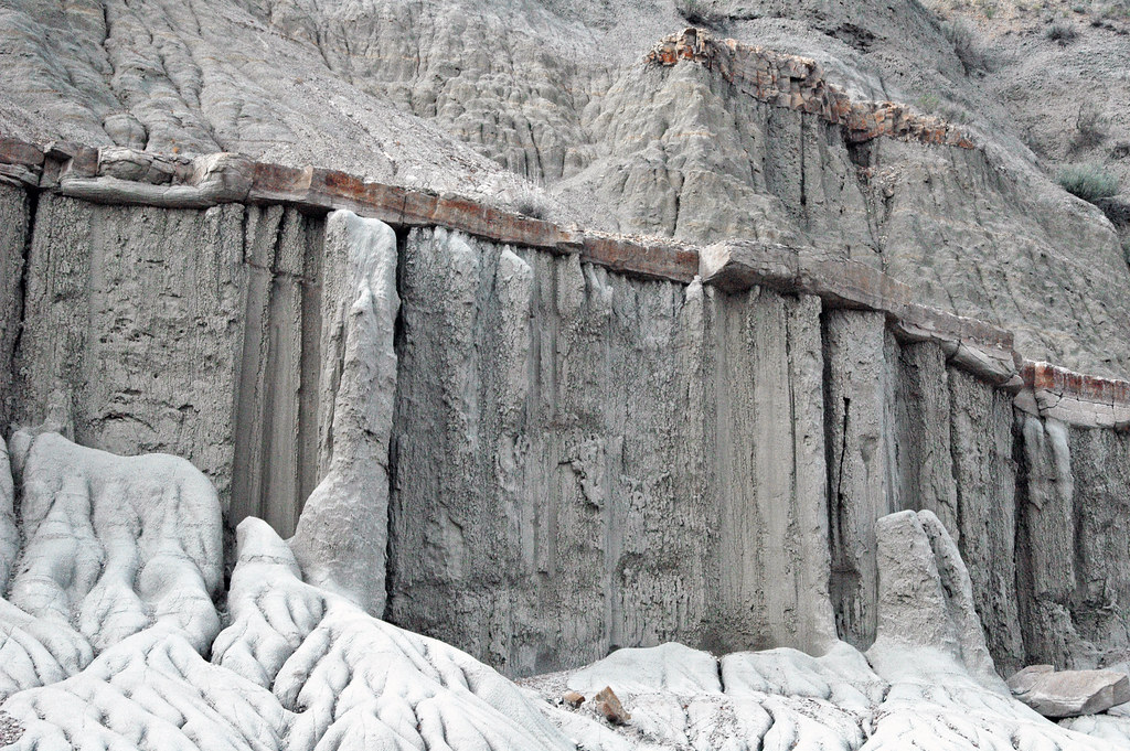
The Brule Formation, exposed in Badlands National Park, is a sequence of fine-grained mudstones, claystones, and siltstones interbedded with freshwater carbonate rock, volcanic ash, and sandstone. These sediments were deposited during the Oligocene, 34-30 million years ago. Photograph by Lee McDowell, National Park Service (Wikimedia Commons; public domain).
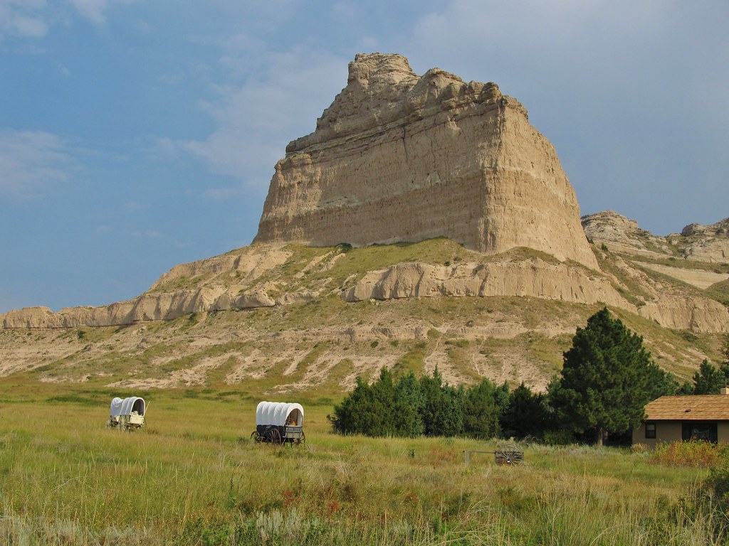
Scotts Bluff exposes 225 meters (740 feet) of Paleogene-Neogene terrestrial sediments, including sandstone, limestone, and volcanic material. Photograph by "Jasperdo" (Flickr; Creative Commons Attribution-NonCommercial-NoDerivs 2.0 Generic license).
Many of these sculpted badland areas also contain abundant concretions and nodules, hard rounded bodies of rock formed by the precipitation of dissolved minerals, and later exposed by erosion. For example, large spherical sandstone concretions called “cannonballs” are common in the Sentinel Butte Formation of western North Dakota.
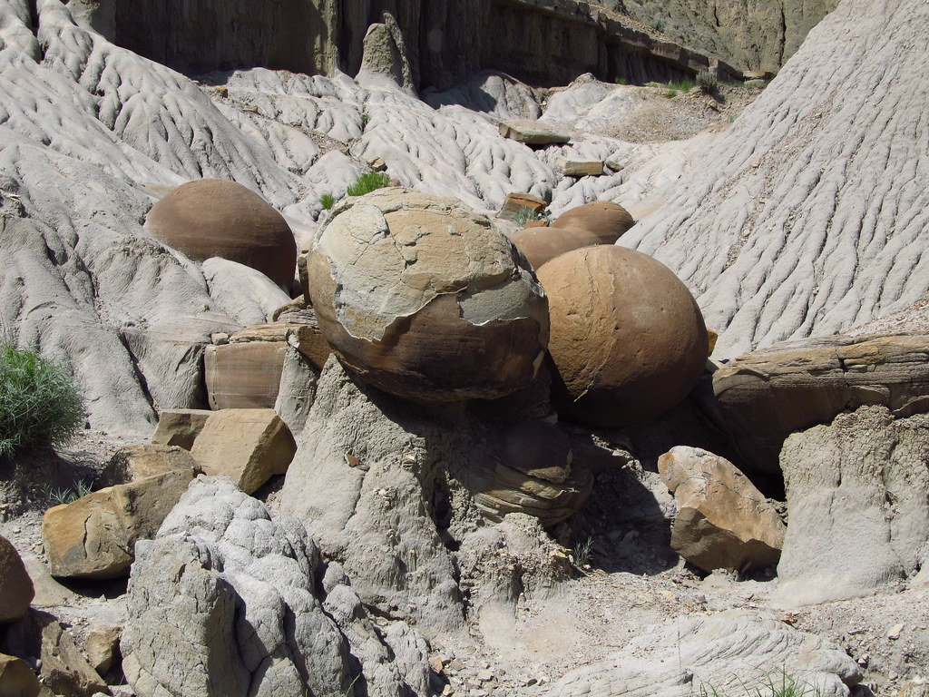
Cannonball concretions in the Sentinel Butte Formation, Theodore Roosevelt National Park, North Dakota. Photograph by "Jasperdo" (Flickr; Creative Commons Attribution-NonCommercial-NoDerivs 2.0 Generic license).
The Quaternary deposits of the Great Plains and Central Lowland are primarily related to glacial processes. During the ice age, the Laurentide Ice Sheet advanced several times in four main pulses and covered northern Montana and most of the Dakotas, and also penetrated into Nebraska and Kansas. The advancing ice sheet scoured and abraded the bedrock beneath it, breaking it down from huge boulders into fine dust, called rock flour. When the glaciers retreated, till and outwash were carried in meltwater and deposited in lakes or by streams. Rock flour and sand was picked up by the wind and blown for many kilometers (miles) until it settled into thick layers of loess.
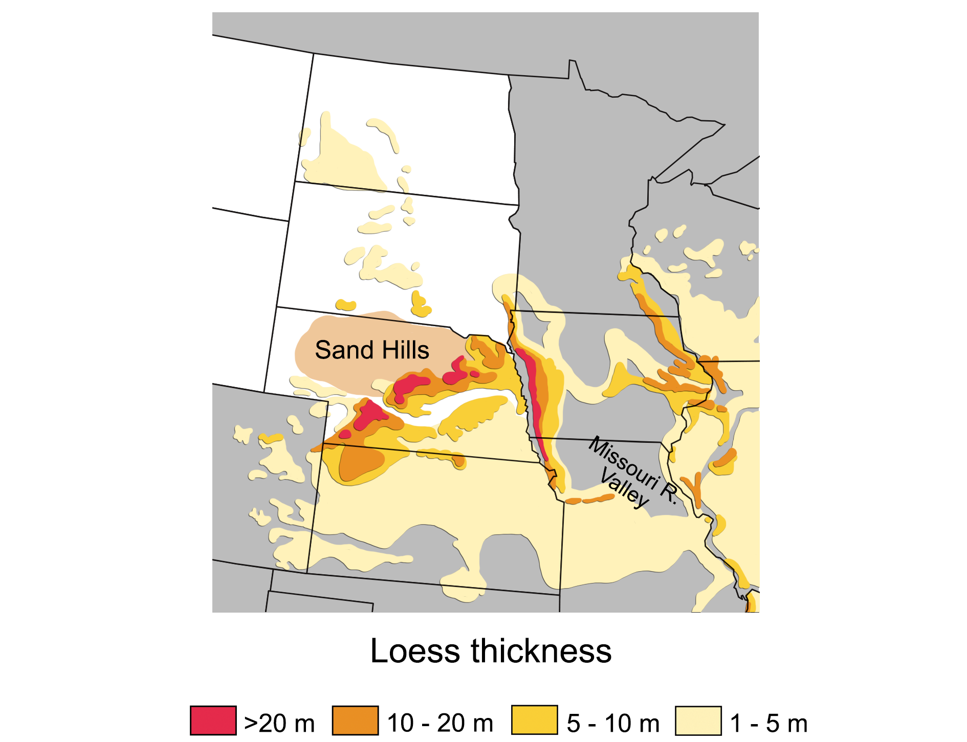
Loess deposits in the central US. Image by Wade Greenberg-Brand, adapted from image in Mason, J. A., Bettis, A. E., Roberts, H. M., Muhs, D. R., and Joeckel, R. M. (2006), Last glacial loess sedimentary system of eastern Nebraska and western Iowa, AMQUA post-meeting field trip no. 1; in, Guidebook of the 18th Biennial Meeting of the American Quaternary Association, R. Mandel, ed.: Kansas Geological Survey, Technical Series 21; modified for the Earth@Home project.
The Sandhills of Nebraska are perhaps the best-known example of wind-transported glacial sediments in the Great Plains.
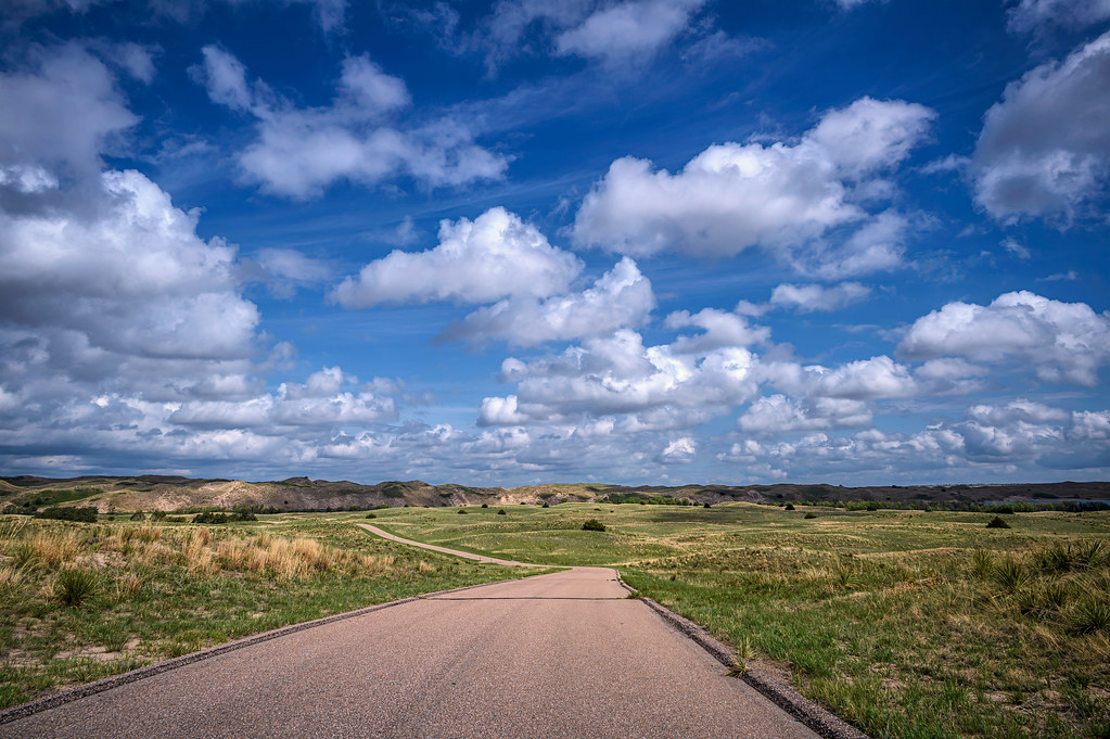
The Nebraska Sandhills near Valentine, Nebraska. Photograph by Diana Robinson (Flickr; Creative Commons Attribution-NonCommercial-NoDerivs 2.0 Generic license).
Resources
Resources from the Paleontological Research Institution
Digital Encyclopedia of Earth Science: Minerals.
Earth@Home: Introduction to Rocks.
Earth@Home: Geologic time scale.
Earth@Home: Geologic maps.
Earth@Home Virtual Collection: Rocks (Virtual rock collection featuring 3D models of rock specimens sorted by type.)