

Spotlight: Overview of the rocks of the Rocky Mountains region of the northwest-central United States, including Idaho, Montana, and Wyoming. Special focus is given to Yellowstone National Park.
Topics covered on this page: Overview; Precambrian; Paleozoic, Mesozoic, and Cenozoic; Resources.
Credits: Most of the text of this page is derived from "Rocks of the Northwest Central US" by Lisa R. Fisher and Bryan Isaacs, chapter 2 in The Teacher-Friendly Guide to the Earth Science of the Northwest Central US (published in 2015 by The Paleontological Research Institution and edited by Mark D. Lucas, Robert M. Ross, and Andrielle N. Swaby). The book was adapted for Earth@Home web by Elizabeth J. Hermsen and Jonathan R. Hendricks in 2022. Changes include formatting and revisions to the text and images. Credits for individual images are given in figure captions.
Updates: Page last updated September 15, 2022.
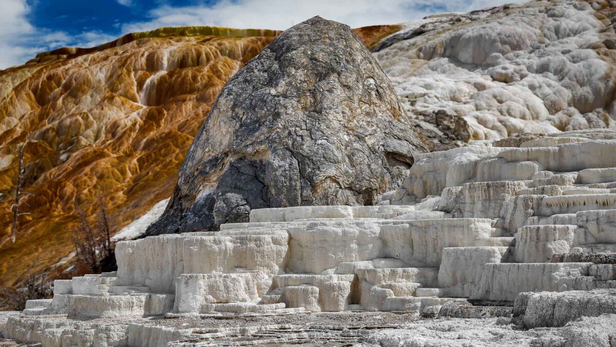
Image above: Travertine deposits at Mammoth Hot Springs in Yellowstone National Park. Photograph by Ken Lane (Flickr; Creative Commons Attribution-NonCommercial-ShareAlike 2.0 Generic license; image cropped and resized).
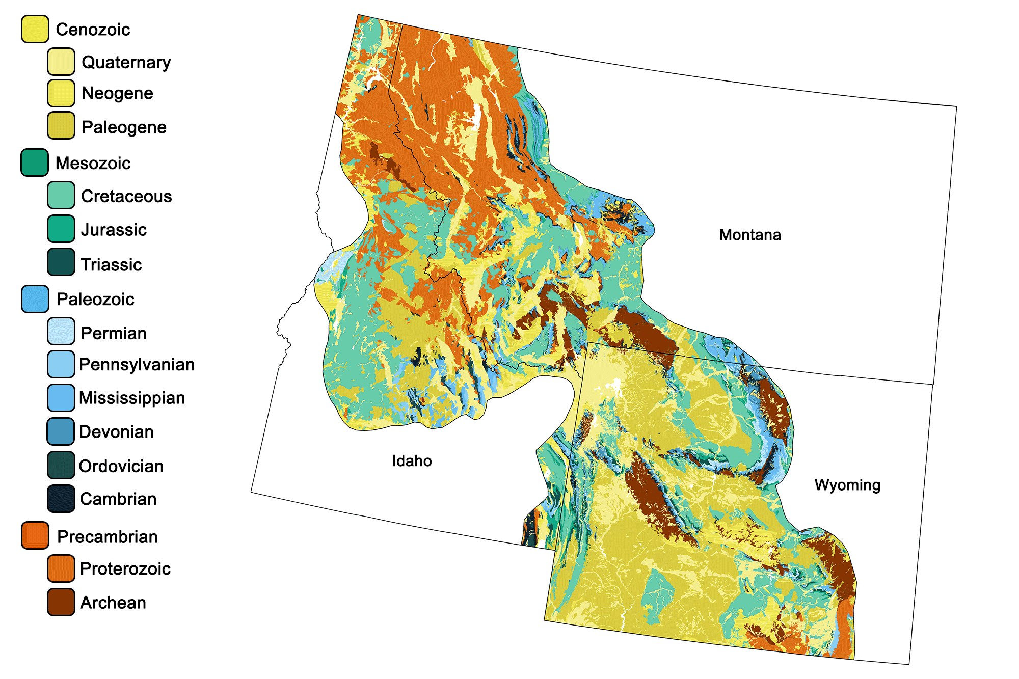
Geologic map of the Rocky Mountains region of the northwest-central United States showing maximum ages of mappable units. Image by Jonathan R. Hendricks for the Earth@Home project developed using QGIS and USGS data (public domain) from Fenneman and Johnson (1946)and Horton et al. (2017).
Overview
The rocks of the Rocky Mountain region are the most varied in the Northwest Central, ranging from Archean gneisses—some of the oldest rocks found in the US—to Paleozoic reefs, oil shales, volcanic fi elds, and glacial till. This great variety of rock types is mainly a result of the Laramide and Sevier orogenies, which uplifted numerous discrete blocks of terrain along thrust faults that accommodated compressional shortening and thickening of the crust. The overlying sediments were subsequently eroded to expose deeper Precambrian rock as well as Mesozoic and Paleozoic sedimentary formations. The thrust-faulted uplift also produced adjacent basins, which subsequently accumulated sediments eroded from the surrounding mountains.
Precambrian
The oldest rock found so far in the Rocky Mountain region is a 3.65- to 3.8-billion-year-old granitic gneiss found in the Wind River Range. Other Archean-aged rocks, including gneisses, amphibolites, schists, and iron formations, are found throughout the uplifted ranges of Wyoming, Montana, and Idaho, including the Teton, Bighorn, Beartooth, and Wind River mountains.
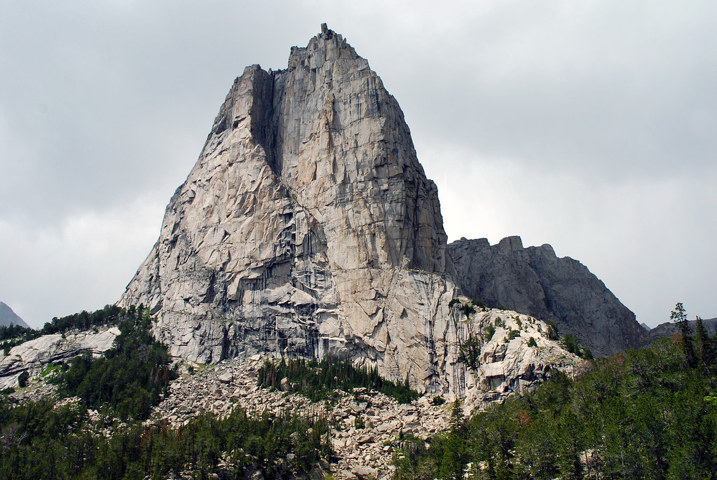
Cathedral Peak in the Wind River Range, Wyoming, is composed of Archean-aged granitic gneiss. Photograph by Kylir Horton (Flickr; Creative Commons Attribution 2.0 Generic license).
These rocks were formed when cratons collided between 3.6 and 3 billion years ago, producing belts of metamorphosed and deformed rock. In southwest Montana, the mountains contain excellent examples of metamorphosed sedimentary rocks with interesting occurrences of minerals (blue calcite, rubies, and more), schists, marble, quartzite, iron formations, and greenstone. At the southern end of the Wind River Mountains, a greenstone belt hosts gold deposits, and the Granite Mountains host a thick iron formation with metamorphosed sediments, greenstone, gold deposits, and good examples of komatiites.
A greenstone belt is a term used to describe a series of interlayered volcanic and sedimentary rocks that have been metamorphosed into meta-sedimentary rocks and amphibolite. The rocks are called “greenstones” due to the presence of metamorphic minerals that give the rock a greenish-grey color. Many geologists believe these belts are the result of deposition in volcanic arc environments. An unusual volcanic rock type—komatiite—is often found in Archean greenstone belts. Komatiites are mafic volcanic rocks richer in magnesium and erupted at a higher temperature than basalts. They are restricted to the Archean, when the mantle temperatures were higher at the depths where magma is generated. Komatiites often exhibit “spinifex texture,” which is an unusual crystallization-cooling texture that produces large, long crystals.
Two main groups of Proterozoic rocks record the early formation of the North American continent: the Snowy Pass Supergroup and the Belt Supergroup. The Snowy Pass Supergroup, 2.4–2.5 billion years old, is located in the Medicine Bow Range in southern Wyoming. These strata—thick sequences of sandstone, conglomerate, and limestone—were deposited in a continental shelf environment on the passive margin of proto-North America. The sediments were later metamorphosed by an orogenic episode accompanied by volcanic activity. Today, the Medicine Peak quartzite forms high cliffs along the ridge of the Medicine Bow Range.
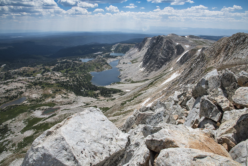
Summit of Medicine Bow Peak, a ridge of 2.4-billion-year-old quartzite (metamorphosed sandstone) in the Medicine Bow Range, Wyoming. Photograph by Brendan Bombaci (Flickr; Creative Commons Attribution-NonCommercial-NoDerivs 2.0 Generic license).
Metamorphosed limestones in the Snowy Range also host 2.3-billion-year-old stromatolites, or mats of colonial cyanobacteria.
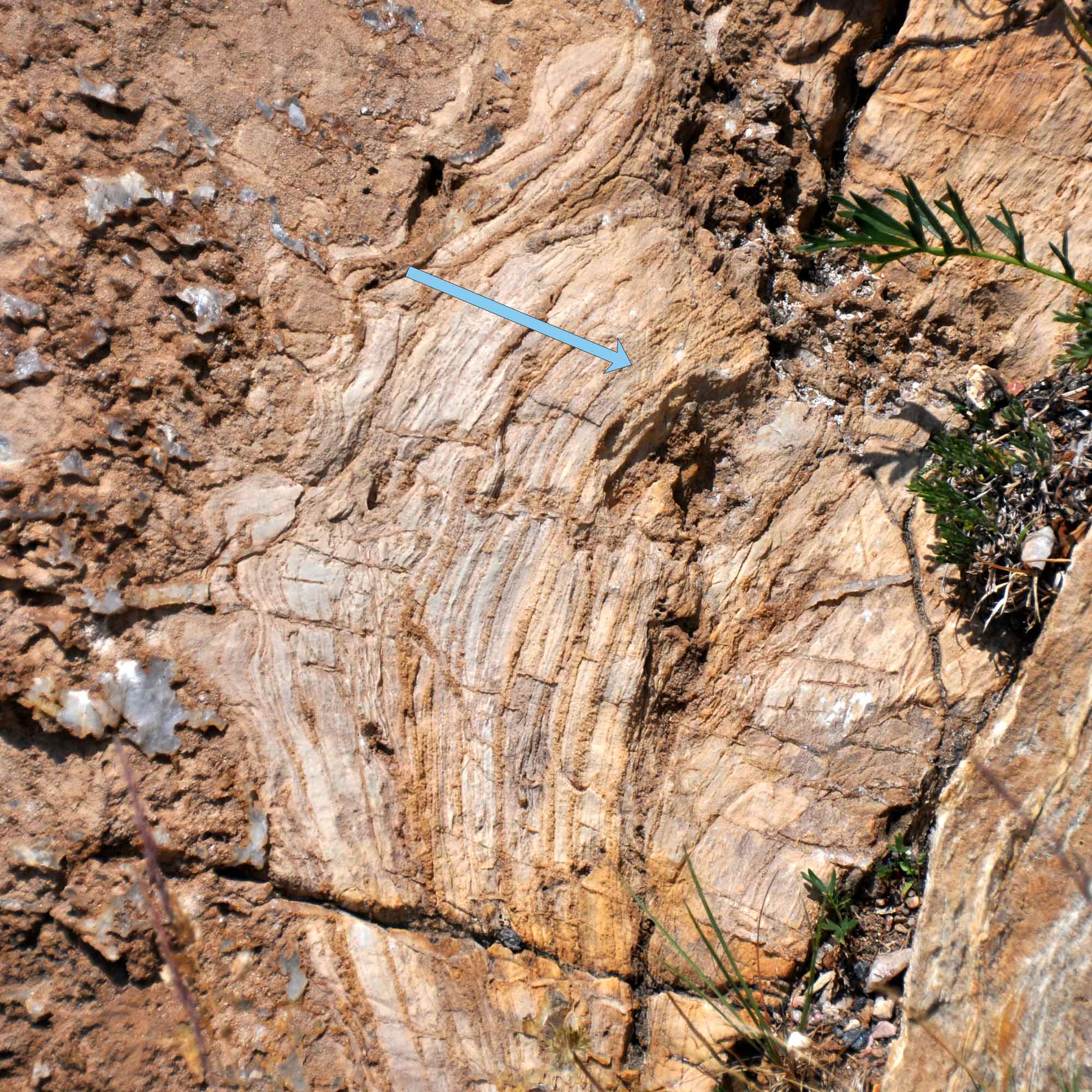
Stromatolite in metamorphosed and tilted Proterozoic dolostone from the Nash Formation, Medicine Bow Range, Wyoming. Arrow indicates direction of original growth. Photograph by James St. John (Flickr; Creative Commons Attribution 2.0 Generic license).
The Belt Supergroup is located in northwestern Montana and adjacent Idaho, and is composed of a sequence of low-grade metamorphic sandstones, siltstones, mudstones, shales, and limestones over 10 kilometers (6 miles) thick. These rocks come in many colors—orange, yellow, rusty, red, purple, and green with white quartzite. They were deposited in a large sedimentary basin between 1.4 and 1.1 billion years ago, and they preserve many fossils as well as sedimentary structures including ripple marks, mudcracks, and raindrops.
Rocks from the Belt Supergroup are best seen in Glacier National Park, Montana, where they have been exposed by an extensive system of thrust faults and folds related to the subduction of the Farallon plate beneath western North America in the late Cretaceous. The Belt Supergroup is of particular note due to its age and excellent preservation. It is extremely rare for sedimentary rocks of over a billion years in age to not have been warped, tilted, metamorphosed, or otherwise altered. The Belt Supergroup is also famous for its abundant and well-preserved stromatolites. In addition, ancient tillites (glacial deposits) found in Idaho represent major glaciation events that occurred during the Proterozoic.
Diamictite, a type of tillite from the Pocatello Formation near Pocatello, Idaho. This rock is thought to have been deposited during the “Snowball Earth” Proterozoic glacial period. Photograph by "Qfl247" (Wikimedia Commons; Creative Commons Attribution-ShareAlike 3.0 Unported license).
Paleozoic, Mesozoic, and Cenozoic
While most of the ranges and uplifts in the Rocky Mountains are cored by Archean rocks, two major areas are not. The Snake and Salt River Ranges of western Wyoming and adjacent Idaho, and the range just west of Choteau, Montana, consist of Paleozoic and Mesozoic units faulted and uplifted during the Sevier Orogeny. The ranges of central Idaho are primarily made up of the three major lobes of the Idaho Batholith, a set of late Cretaceous granitic intrusions.
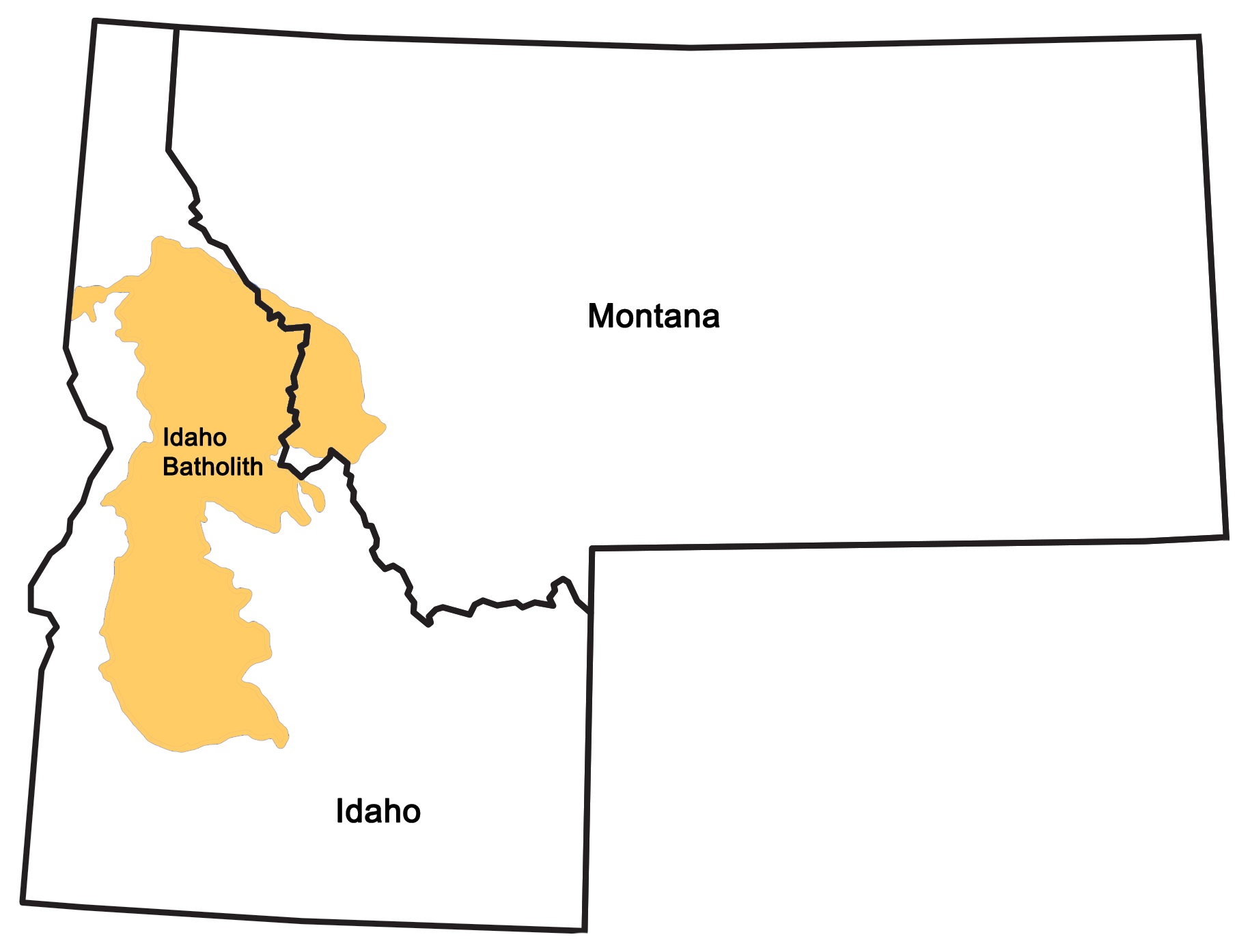
Extent of the Idaho Batholith. Map by Wade Greenberg-Brand, modified for the Earth@Home project.
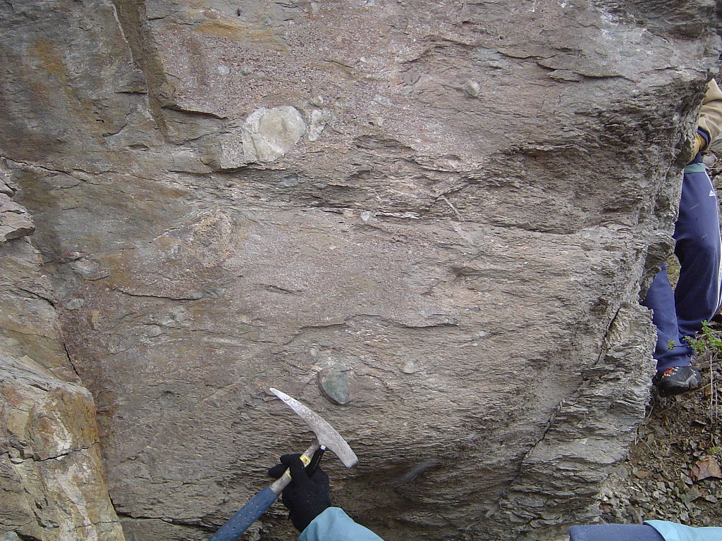
The Cambrian to Mississippian rocks of the Rocky Mountain region are a succession of sandstones, limestones, and shales that were deposited on the continental shelf of what was then the western shore of North America.
Ridges of the Mississippian-aged Madison Limestone, exposed by thrust faulting along the Rocky Mountain Front in Montana. Photograph by Ron Clausen (Wikimedia Commons; Creative Commons Attribution 3.0 Unported license).
From the Pennsylvanian through the Permian, a transition to shallow and evaporating seas deposited sandstones, mudstones, limestones, and phosphate-rich rocks. During the Triassic, a hot and arid landscape stretched across the region, as the shallow seas of the previous era retreated. This led to the deposition of continental rocks on nearshore marine environments and vast floodplains: red beds, sandstones, mudstones, and limestones.
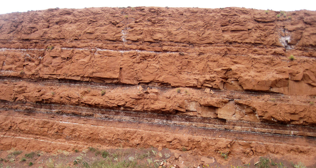
An outcrop of Triassic sandstone (Chugwater Formation) near Thermopolis, Wyoming. Photograph by James St. John (Flickr; Creative Commons Attribution 2.0 Generic license).
Others were deposited by aeolian processes; the Nugget Sandstone, found in parts of southwest Wyoming, exhibits cross-bedding and was deposited by wind on a Jurassic shoreline or desert. The bright red and orange colors of many Mesozoic siltstones and sandstones are caused by the presence of iron oxides.
During the Cretaceous, shales, sandstones, and coals formed when the epicontinental Western Interior Seaway covered the area.
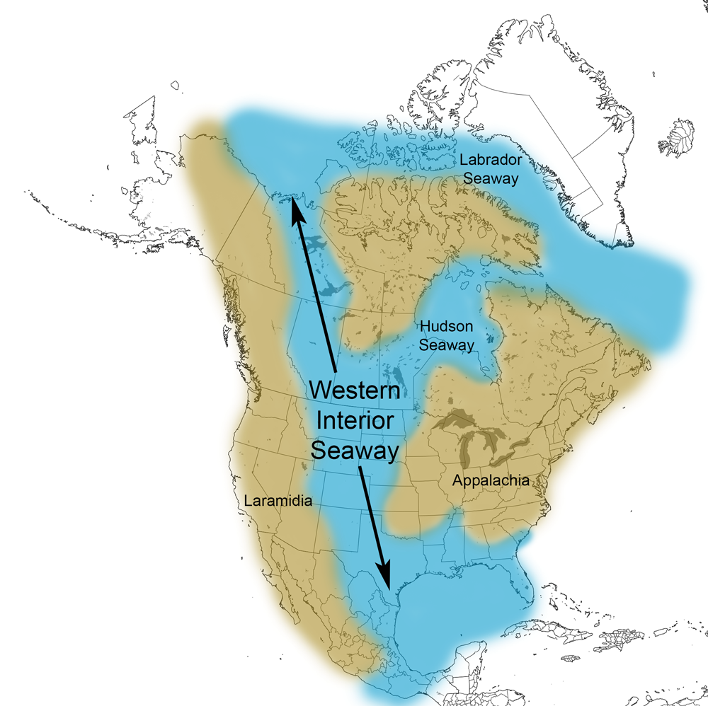
Extent of the Western Interior Seaway during the Cretaceous Period. Image from Cretaceous Atlas of Ancient Life: Western Interior Seaway (Creative Commons Attribution-NonCommercial-ShareAlike 4.0 International license).
Between the main ranges of the Rockies, there are a series of intermontane basins and mesas; surface rocks here are predominantly of Cretaceous and early Cenozoic age.
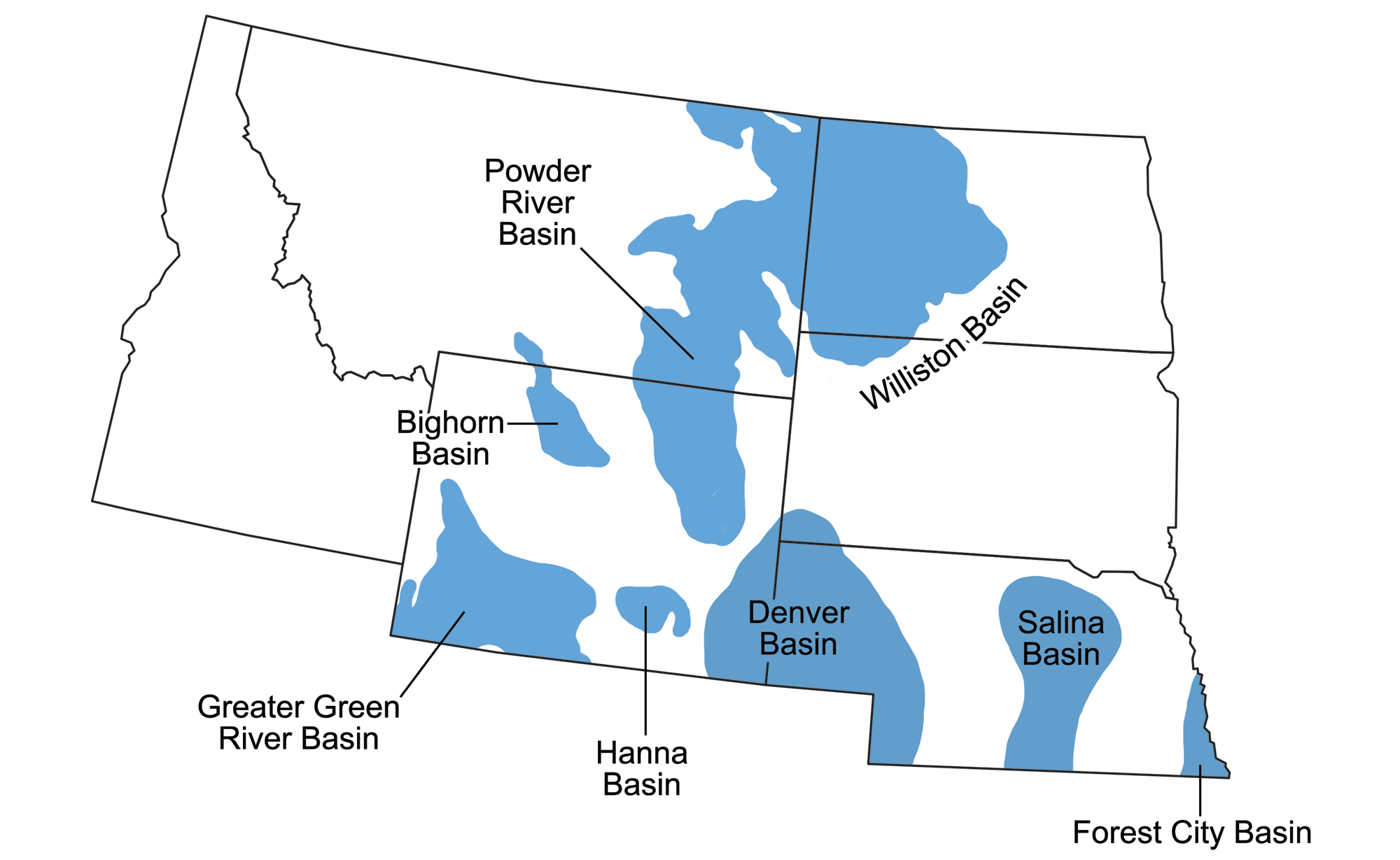
Sedimentary basins of the Northwest Central. Map by Wade Greenberg-Brand, originally published in The Teacher-Friendly Guide to the Earth Science of the Northwest Central US, modified for the Earth@Home project.
Most of the rocks were formed when eroded sediment from the uplifted mountains was deposited by rivers into alluvial fans in lakes, basins, and swamps. These deposits eventually formed conglomerates, sandstones, mudstones, shales, evaporites, coal, and limestone. Thick blankets or wedges of Paleogene and Neogene sediments were deposited on the flanks of uplifted mountains. Paleozoic, Triassic, and Jurassic rocks crop out where they are uplifted at the margins of uplifts and ranges, but are typically buried within the basins.
The most important intermontane basins in the Rocky Mountain region are the Green River, Bighorn, Wind River, and Red Desert basins. These areas were centers for the deposition of thick layers of shale and mudstone into lakes, later forming evaporite beds as the lakes dried. The best known of these basin deposits are the sediments of the Green River Basin, which include well known fossil beds, oil shales, and large coal deposits. It is also the world’s largest source of trona, a non-marine evaporate mineral, along with related minerals including sodium bicarbonate (baking soda). Because of the basins’ isolated nature, early Cenozoic deposits are mainly basin-specific, with individual units often restricted to a particular basin or set of related basins. Some basins also contain igneous outcroppings—for example, Boars Tusk, an isolated butte within the Green River Basin, is the heavily eroded lamproite core of a 2.5-million-year-old volcano.
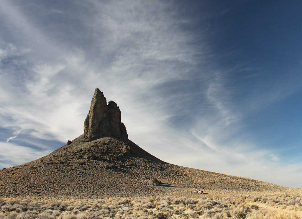
Boars Tusk, located within Sweetwater County, Wyoming, is the core of an extinct volcano. Photograph by "carfull...from Wyoming (Flickr; Creative Commons Attribution-NonCommercial-NoDerivs 2.0 Generic license).
During the Neogene, large volcanic eruptions related to the Yellowstone hot spot periodically buried parts of the region in thick layers of ash, forming tuff.
Volcanic ashfall tuff from the Eocene, Green River Formation, Wyoming. Photograph by James St. John (Flickr; Creative Commons Attribution 2.0 Generic license).
Active Eocene volcanism and plutonism produced the Absaroka Volcanic Field in northwestern Wyoming, as well as smaller fi elds and intrusive bodies in Montana and Idaho. The Absaroka volcanics are up to 1500 meters (5000 feet) thick, and are composed of andesites, dacites, basalts, tuffs, and mudflows with minor related igneous intrusions.
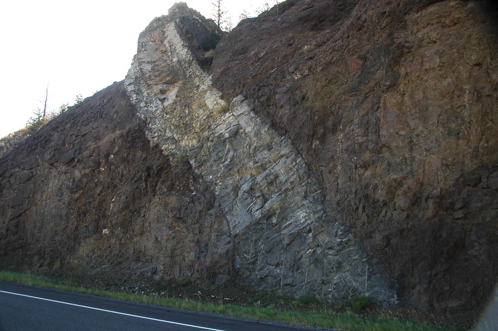
An andesite dike intrudes through a volcanic debris flow conglomerate exposed by a roadcut in the Absaroka Range, Wyoming. Photograph by James St. John (Flickr; Creative Commons Attribution 2.0 Generic license).
Pleistocene glaciation produced glacial till and outwash materials in the region’s mountains and basins. Alpine glaciers, rather than continental ice sheets, carved cirques and deposited moraines in mountain valleys.
Rocks of Yellowstone National Park
Yellowstone National Park and its surrounding area are the latest and current manifestation of the Yellowstone hot spot, whose trail from Oregon to Wyoming produced the Snake River Plain in Idaho. The most recent caldera eruption associated with this hot spot occurred 640,000 years ago, and more recent minor eruptive activity produced rhyolitic domes and basalt flows. The Yellowstone area is rich with volcanic features, such as calderas, resurgent domes, lava flows, and hydrothermal explosion craters. Yellowstone also has the world’s greatest number of geysers, along with hot springs, fumaroles, and mudpots. Earthquakes are common here, and many are related to faults connected with the movement of magma, groundwater, thermal expansion, or contraction of the ground.
Due to the Yellowstone area’s history of volcanism, rocks in the park are primarily volcanic. Major explosive caldera eruptions in the Yellowstone area occurred 2.1, 1.3, and 0.63 million years ago, with multiple minor eruptions occurring between the major caldera-forming eruptions. The volume of material ejected during these major eruptions has led to Yellowstone’s classification as a supervolcano.
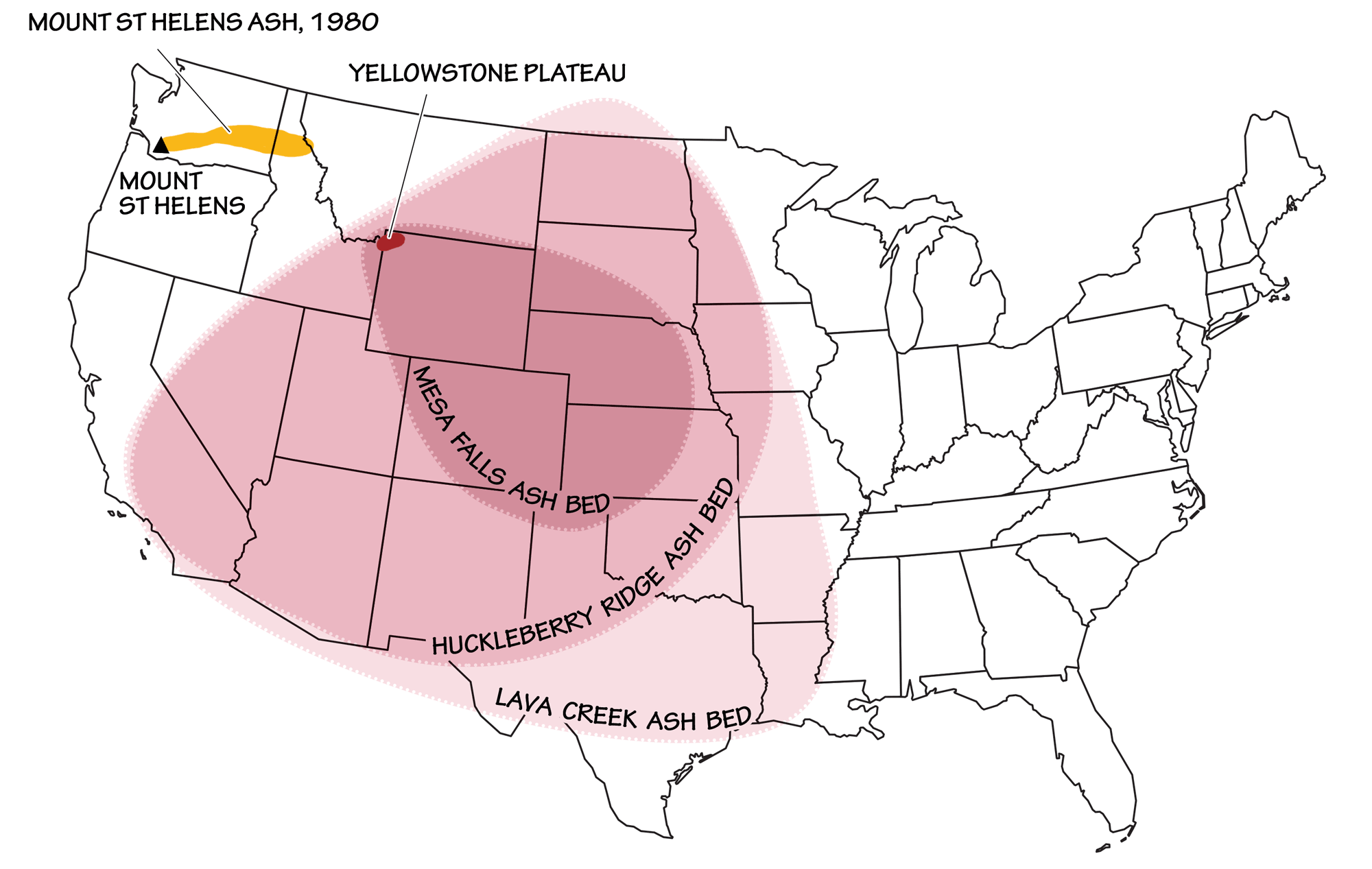
The extent of the three most recent ashfalls from Yellowstone supervolcano eruptions, as compared to the eruption of Mt. St. Helens in 1980. Image by Wade Greenberg-Brand, adapted from image by USGS (public domain).
A wide range of volcanic rock types and textures are present in the park, including basalts, rhyolites, obsidian (volcanic glass), agglomerates (volcanic flows that picked up cobbles or fragments of other volcanic rocks), and ashflows. In some areas, volcanic ashflows are mixed with sedimentary conglomerates, sandstones, and mudstones from stream and mudflow deposits.
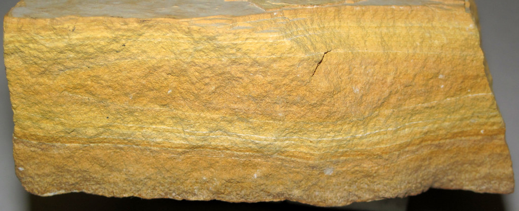
The rocks formed during Yellowstone’s past eruptive events can be seen in exposures throughout the park. The Huckleberry Ridge ash bed, laid down during the caldera explosion of 2.1 million years ago, is exposed in the walls of Golden Gate Canyon.
The pink- and yellow-hued rocks exposed in Golden Gate Canyon are composed of Huckleberry Ridge Tuff, formed from an ashfall after a Yellowstone supervolcano eruption 2.1 million years ago. Photograph by Tim Jones (Flickr; Creative Commons Attribution-NonCommercial-NoDerivs 2.0 Generic license).
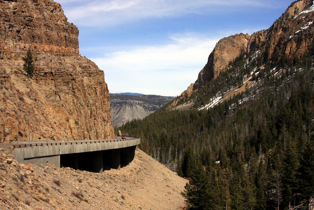
An eruption around 590,000 years ago produced the Canyon Rhyolite flow, which can be seen in the Grand Canyon of the Yellowstone River on the eastern side of the park.
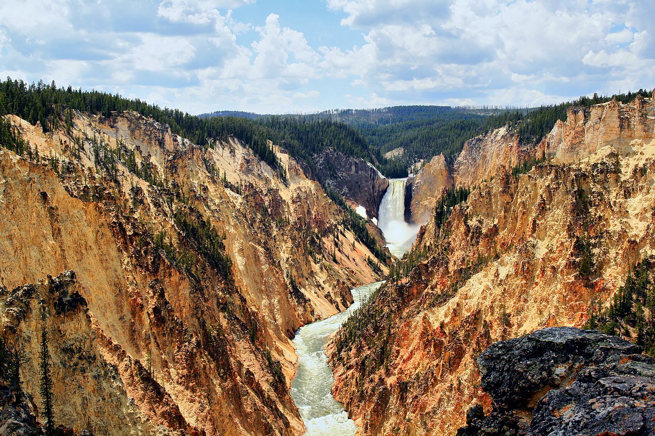
Brightly colored rhyolites are exposed in the Grand Canyon of the Yellowstone. Photograph by Brocken Inaglory (Wikimedia Commons; Creative Commons Attribution-ShareAlike 3.0 Unported license).
Here, the rhyolites in the canyon walls have been altered by oxidation and acidic groundwater, resulting in striking yellows, pinks, and lavenders. Obsidian Cliff formed from a rhyolite lava flow that occurred 180,000 years ago; it contains abundant obsidian and was an important source of tool-making material for prehistoric peoples in the area.
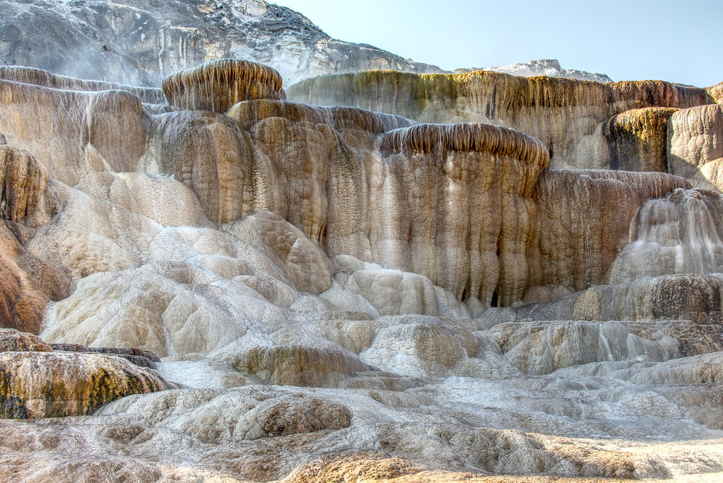
The travertine terraces of Mammoth Hot Springs in Yellowstone National Park precipitated over thousands of years as hot water from the spring cooled and deposited calcium carbonate. Over two tons of carbonate minerals in solution flow through the hot springs every day. Photograph by "paweesit" (Flickr; Creative Commons Attribution-NoDervis 2.0 Generic license).
Both rhyolite and basalt are lavas, but they behave differently due to their different densities and melt structures. Rhyolite is composed of felsic minerals including quartz, orthoclase, and biotite, and is high in silica and aluminum. This composition results in a very viscous magma. The lavas in volcanoes with felsic (rhyolitic) compositions are too viscous to flow easily; pressure builds up beneath them until they erupt explosively. The most explosive volcanoes form calderas, and the ash from such an explosion can travel many miles. The eruptions that occurred at the Yellowstone hot spot were rhyolitic in nature.
Basalt is composed of the mafic minerals plagioclase and pyroxene, and may contain olivine. These minerals are high in iron and magnesium, and produce a very fluid magma. Volcanoes with mafic or basaltic compositions tend to produce fluid lava flows comparable to those associated with the eruptions presently seen in Hawai‘i. The voluminous Columbia Flood Basalts (see the Columbia Plateau) are the result of a basaltic eruption.
The thermal features of Yellowstone are driven by heat from the cooling magma body beneath the caldera. Groundwater circulates through the hot rock, rises in hot springs, or erupts as geysers if there is a pressure buildup within the water. Fumaroles are openings that emit gaseous steam. Mudpots occur where hot water mixes with clay that has weathered from volcanic rock; the thick mud bubbles and spatters as it boils or releases gas. The hydrothermal solutions that circulate within Yellowstone’s geysers and hot springs dissolve minerals from the bedrock, precipitating them out at the surface to form intricate structures made of silica or travertine.
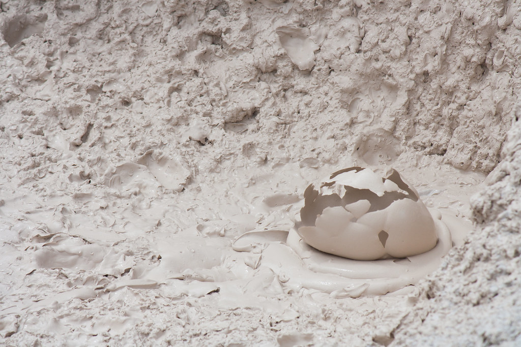
Mudpots in the Pocket Basin, Yellowstone National Park. The mud is composed of hot water mixed with volcanic clay. Photograph by Derek Bruff (Flickr; Creative Commons Attribution-NonCommercial 2.0 Generic license).
During the Quaternary, the Cordilleran Ice Sheet covered part of the Rocky Mountains, and a small ice sheet covered Yellowstone. This glaciation event left behind glacial till, creating moraines and outwash deposits from sediments deposited by meltwater. Geyser and hot spring activity continued beneath the ice cover. The combination of ice, meltwater ponds and lakes, and underground heat sources caused hydrothermal explosions—these are not volcanic eruptions, but rather occur when water contained in near-surface rock at superheated temperatures flashes to steam and violently disrupts the confining rock. In the case of the Pocket Basin, located in the western part of the park, an ice-dammed lake existed over a heat source, and a hydrothermal explosion was triggered by an abrupt decrease in confining pressure when the dam failed and the lake drained. This event created a crater-like basin, in which steam works its way through silica-bearing volcanic silt to create mudpots.
"Yellowstone Geothermal Wonders - Geysers, hot springs, mud pots!" by "Joe Spins the Globe" (YouTube).
Resources
Resources from the Paleontological Research Institution
Digital Encyclopedia of Earth Science: Minerals.
Earth@Home: Introduction to Rocks.
Earth@Home: Geologic time scale.
Earth@Home: Geologic maps.
Earth@Home Virtual Collection: Rocks (Virtual rock collection featuring 3D models of rock specimens sorted by type.)