

Page snapshot: Introduction to energy in the Coastal Plain region of the south-central United States, including fossil fuels, renewable energy, and nuclear power.
Topics covered on this page: Overview; Oil and gas; Salt domes; Conventional oil and gas; Offshore oil and gas; Shale gas (hydraulic fracturing); Oil and gas refining, storage, and distribution; Coal; Renewable energy; Nuclear power; Resources.
Credits:Most of the text of this page is derived from "Energy in the South-central US" by Carlyn S. Buckler and Robert M. Ross, chapter 7 in The Teacher-Friendly Guide to the Earth Science of the South Central US, edited by Mark D. Lucas, Robert M. Ross, and Andrielle N. Swaby (published in 2015 by the Paleontological Research Institution; currently out of print). The book was adapted for the web by Elizabeth J. Hermsen and Jonathan R. Hendricks in 2022. Changes include formatting and revisions to the text and images. Credits for individual images are given in figure captions.
Updates: Page last updated October 12, 2022.
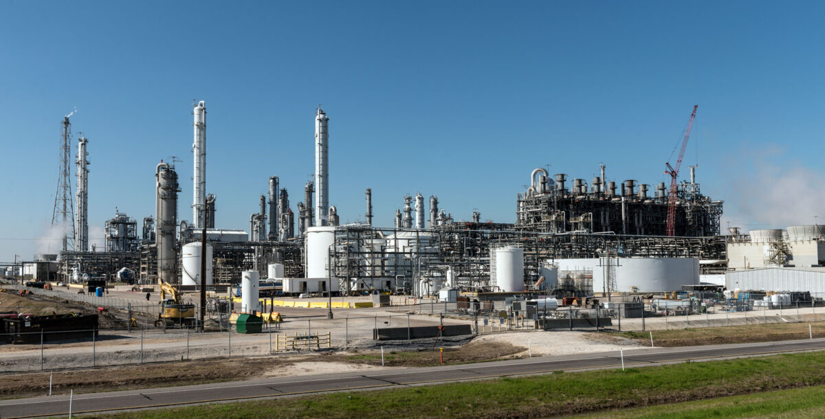
Image above: Oil refinery, Groves, Texas, 2014. Photo by Carol M. Highsmith (Library of Congress reproduction number LC-DIG-highsm-26614, Library of Congress Prints and Photographs Division, no known restrictions on publication).
Overview
Oil and natural gas resources are abundant in the Coastal Plain and are produced from reservoir rocks on- and offshore in Texas and Louisiana, as well as from Pennsylvanian sandstone in southwestern Arkansas and southeastern Oklahoma. Other fossil fuel resources include lignite and bituminous coal from Texas and Louisiana. The Coastal Plain also supports a variety of alternative energy sources, including wind, hydroelectricity, biomass, and nuclear power generation.
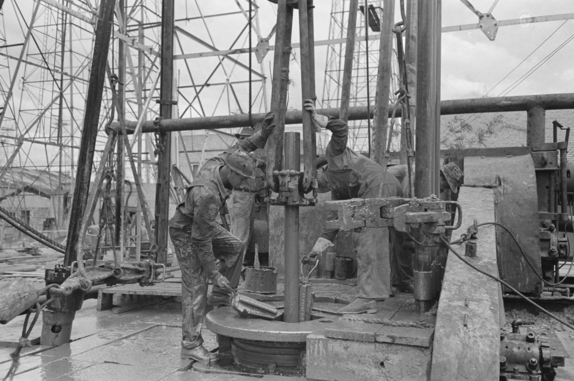
Original caption: "Removing length of pipe from oil well, Kilgore, Texas." Photo by Russell Lee, 1939 (Library of Congress reproduction number LC-DIG-fsa-8a26038, U.S. Farm Security Administration/Office of War Information, Library of Congress Prints and Photographs Division, no known restrictions).
Oil and gas
Salt domes
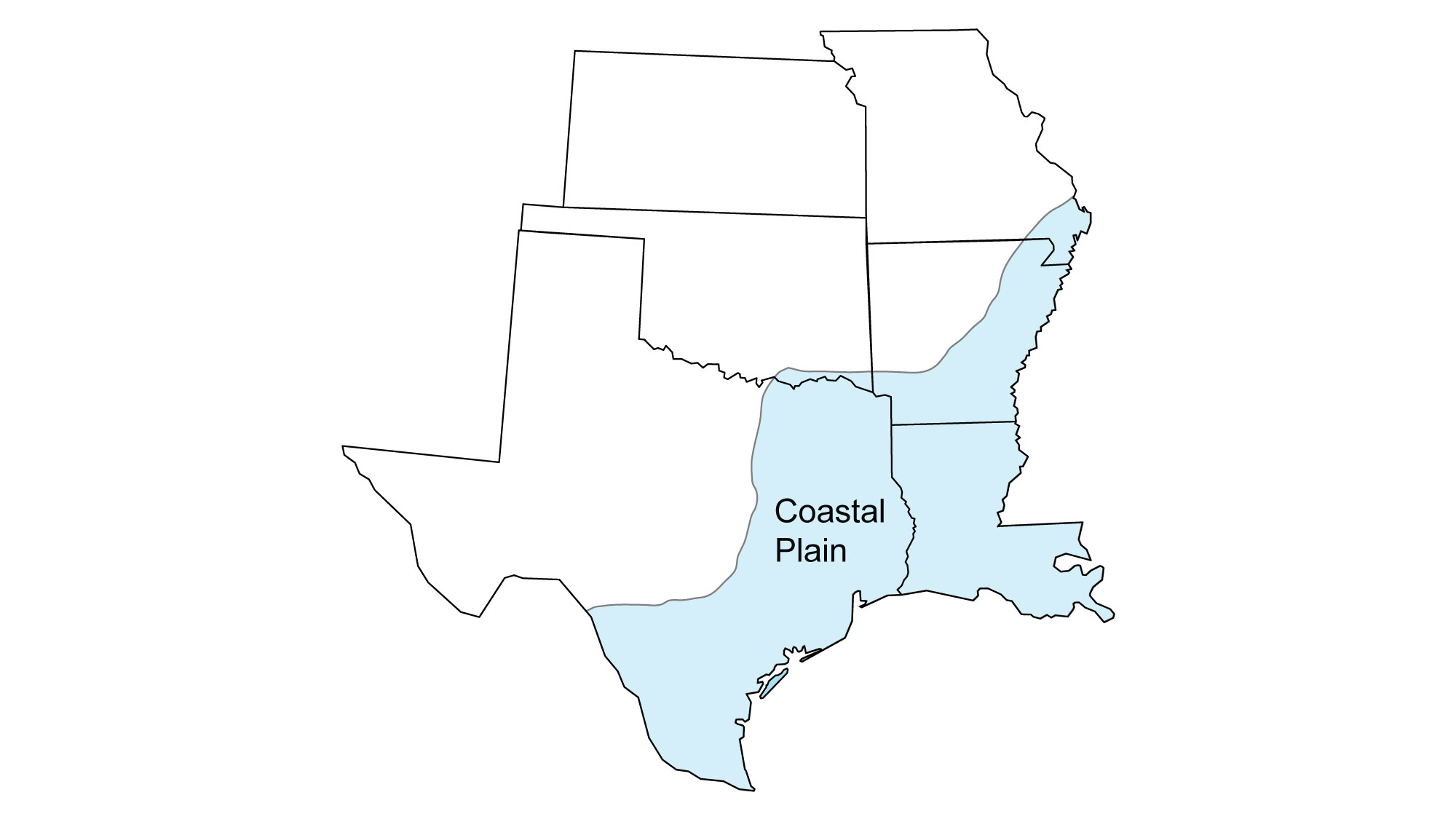
As Pangaea broke apart during the Jurassic, the Gulf of Mexico opened and began to take shape. In its early stages, the Gulf experienced periods of restricted marine circulation. During these periods, salt was deposited through evaporation of seawater. This Jurassic salt occurs in flat layers now known as the Louann Salt Formation.
Today, the Louann Salt is covered by over 6000 meters (20,000 feet) of sedimentary rock. Salt has moved upward through the overlying rock layers through time, forming hundreds of salt domes. As these salt domes push through the overlying rock, they can form oil traps, or gaps in the rock where oil and gas can accumulate. Oil and gas can also accumulate under and along salt structures. Salt domes have created prolific oil reservoirs both on- and offshore in the Gulf Coast region.
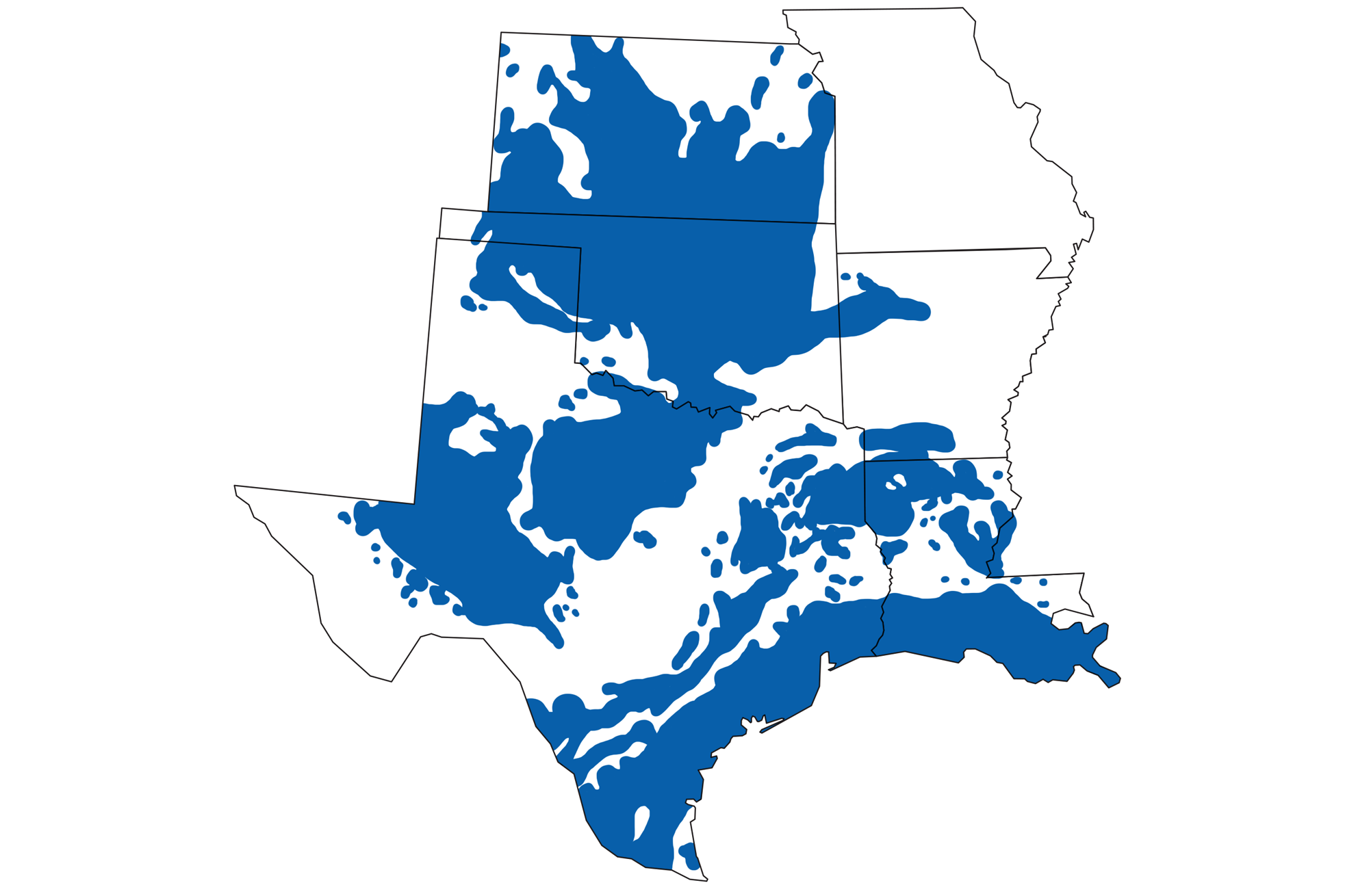
The Louann Salt Formation extends under the surface of the Coastal Plain to the blue line. The black "blobs" are known salt structures where the salt layer has been deformed. Image modified from original by Peter Nester for the Earth@Home project.
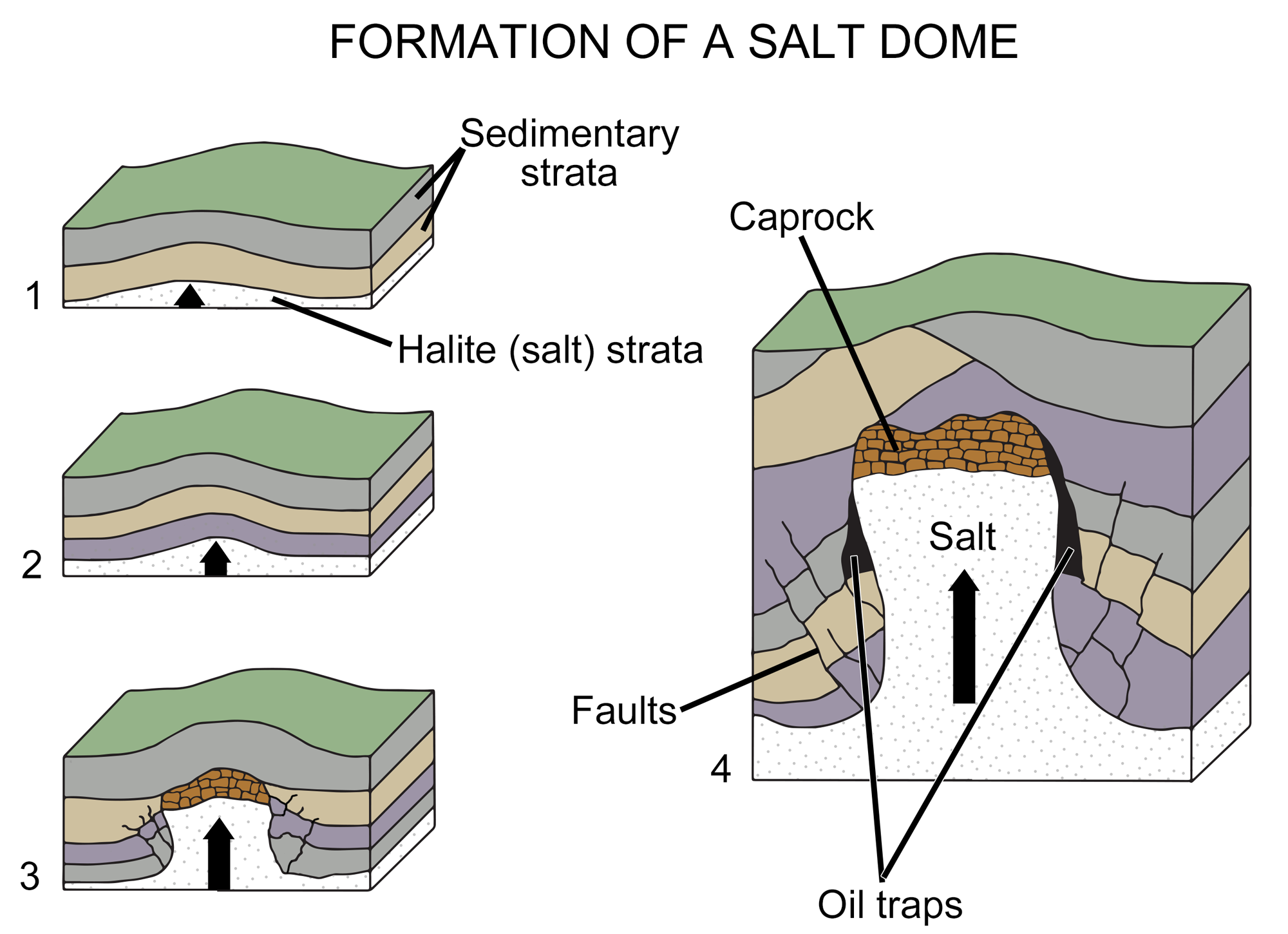
Diagram of the formation of a salt dome. In images1 to 3, a salt layer deforms, pushing upward through the rock layers above it until it is impeded by a caprock (a hard or dense rock layer). In image 4, the deformation of overlying layers by the salt has formed gaps where oil or gas has accumulated. Image modified from original by Wade Greenberg-Brand (after an image by Britannica online for kids) for the Earth@Home project.
Conventional oil and gas
Since the late Jurassic, the Gulf of Mexico has been accumulating thick sediment deposits, which have been supplemented since that time by sediments eroded from the Mississippi River watershed in central North America. The Coastal Plain along southern Louisiana and Texas was submerged under high sea levels for much of the Late Cretaceous and Paleogene periods. Because of this, thick layers of limestones, shales, and sandstones occur there. Many Late Cretaceous and early Paleogene shales became source rocks for oil, significant quantities of which have migrated into more porous sandstone and limestone, ultimately pooling in reservoirs. Impermeable sedimentary deposits such as gypsum, anhydrite, limestone, and dolomite serve as cap rock that trap the oil and gas.
The underlying Jurassic salt structures that occur in abundance along the Gulf of Mexico explain the geographic distribution of many oil and gas reservoirs from eastern Texas to western Alabama. Impermeable rocks pushed up by salt domes became caprock where oil could be trapped.
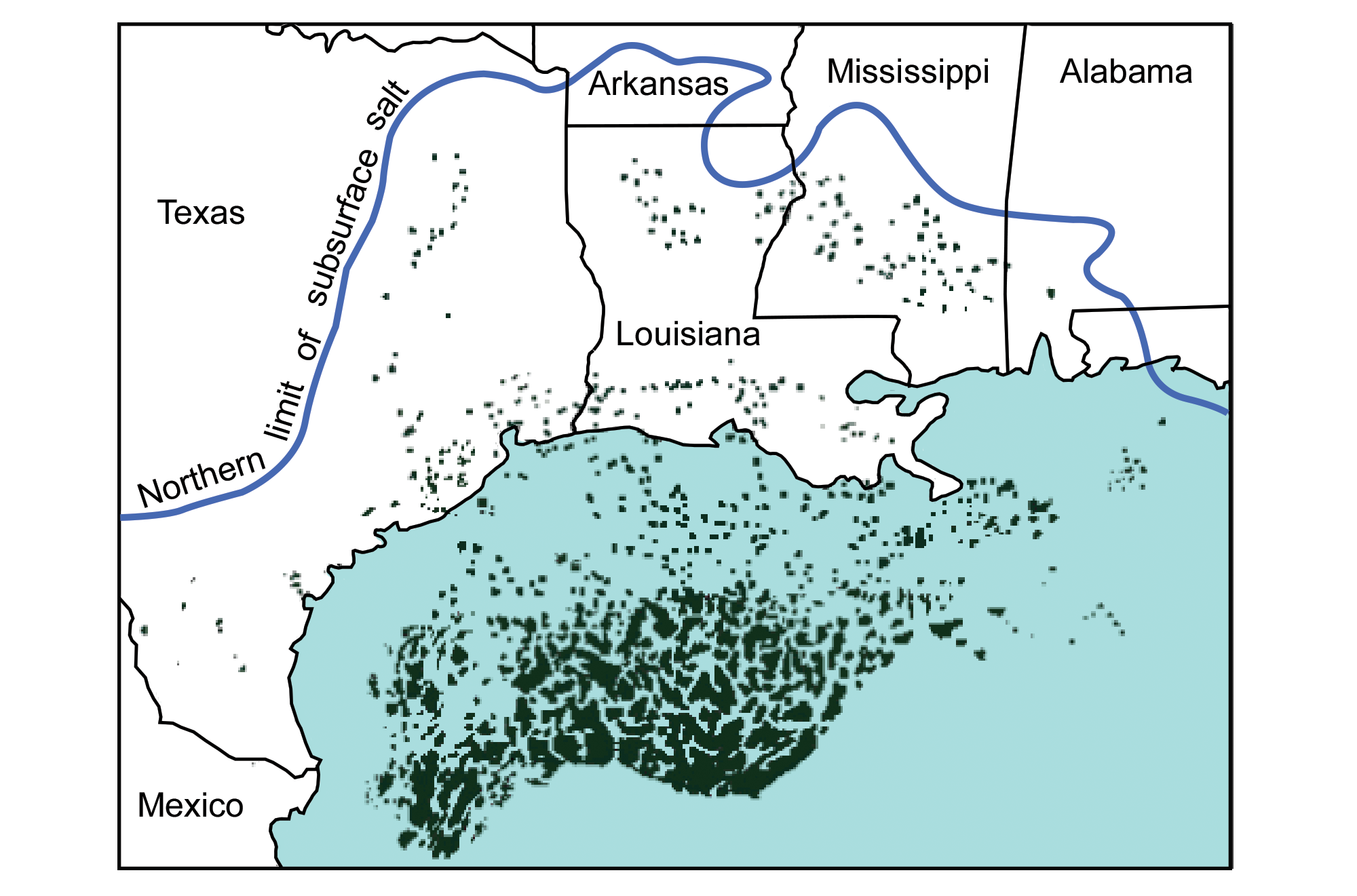
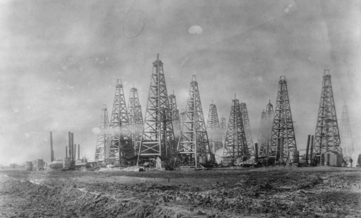
Gushers, an icon of oil exploration during the late 19th and early 20th centuries, occurred when highly pressurized reservoirs were breached by simple drilling techniques. Oil or gas would travel up the borehole at a tremendous speed, pushing the drill bit out and spewing out into the air. One of the most famous oil gushers, Lucas Gusher at Spindletop oil field in Beaumont, Texas, is credited with starting the Texas Oil Boom in 1901 that stimulated the growth of the oil industry. At its peak, Lucas Gusher ejected 100,000 barrels of oil per day before it slowed enough to be capped off. Today, southeastern Texas and southern Louisiana are together known as the East Texas Oil Field, which is the second largest oil field in the US outside of Alaska.
Areas of oil and gas production in the south-central states of the U.S. Map by Wade Greenberg-Brand (adapted from image by Peter Nester), originally published in The Teacher-Friendly Guide to the Earth Science of the South Central US, modified for Earth@Home.
Spindletop oil field, Beaumont, Porter Arthur, Texas, early 1900s. Photo by Bernier Publ. Co., NY (Library of Congress reproduction number LC-USZ62-4722, Library of Congress Prints and Photographs Division, no known restrictions on publication).
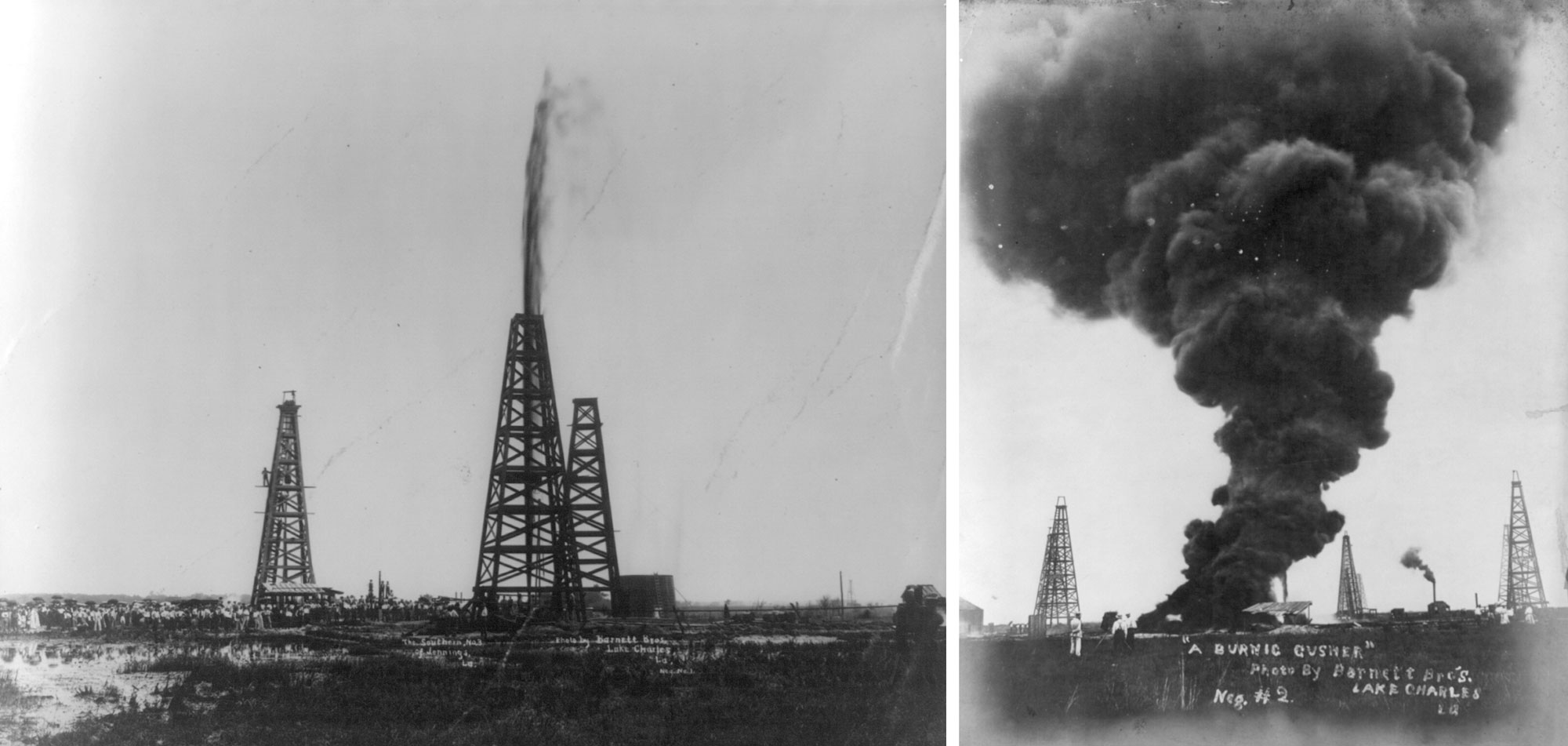
Gushers in Louisiana, ca. 1902. Left: A crowd gathered at a gusher. Right: A burning gusher. Photo by Barnett Bros., (Library of Congress reproduction numbers LC-USZ62-20452 and LC-USZ62-78478, Library of Congress Prints and Photographs Division, no known restrictions).
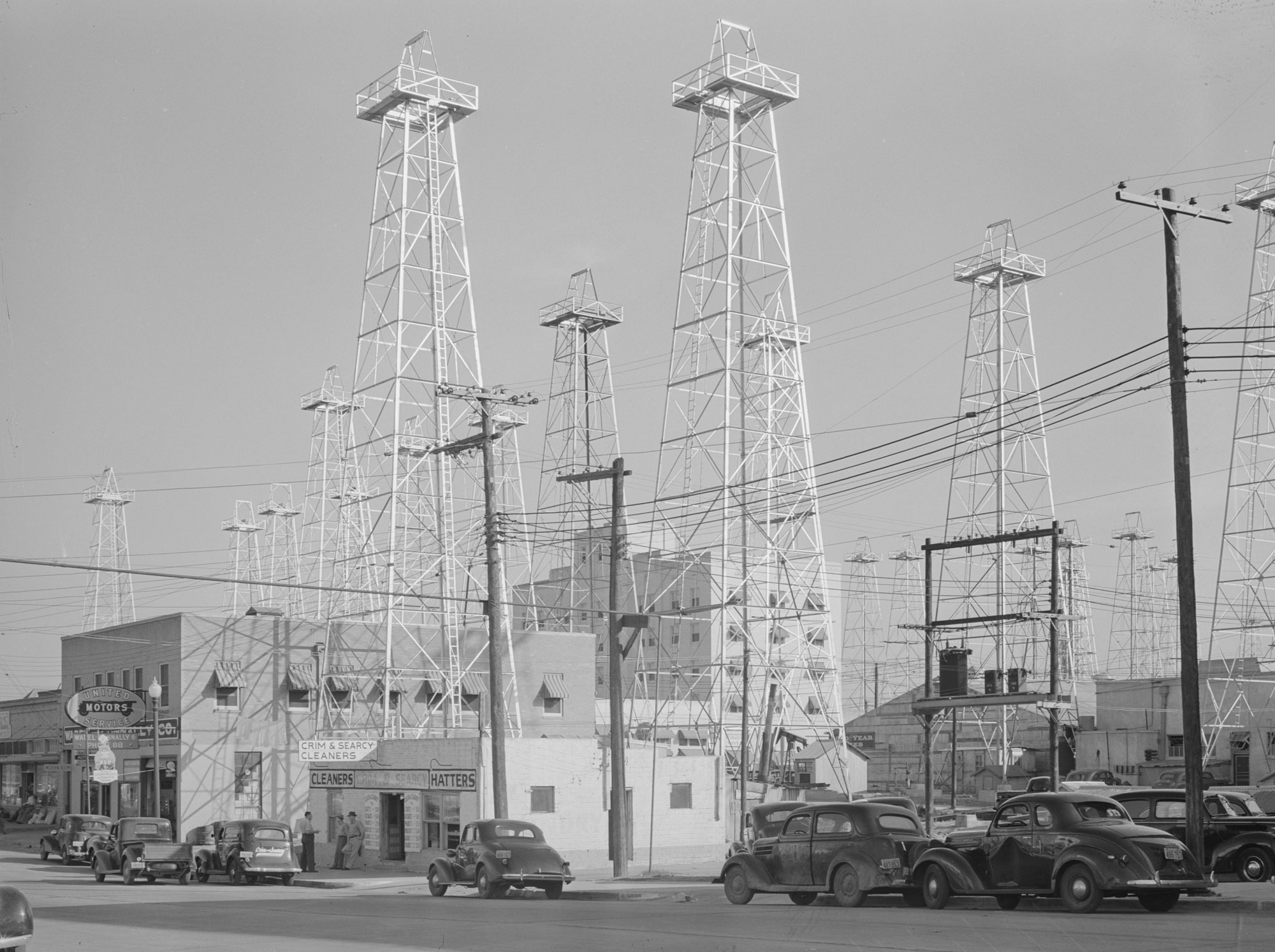
Oil derricks in Kilgore, Texas, East Texas Oil Field, 1939. Part of Kilgore was once called the "World's Richest Acre." Photo by Russell Lee (Library of Congress reproduction number LC-USF34-033148-D, U.S. Farm Security Administration/Office of War Information, Library of Congress Prints and Photographs Division, no known restrictions).
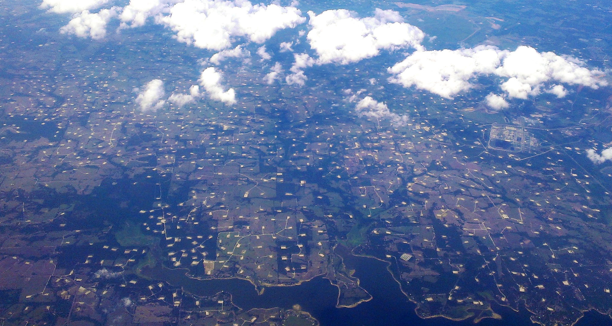
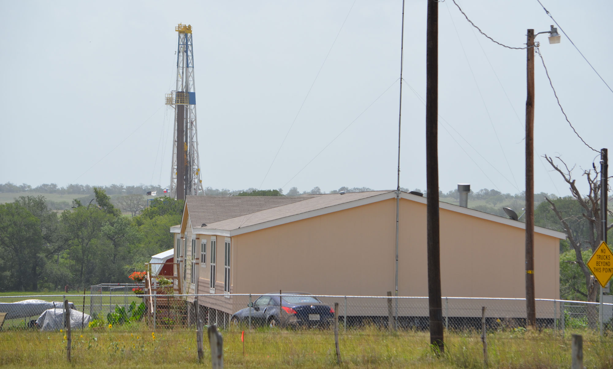
Aerial photo of development for fossil fuel extraction (oil and/or gas) near Limestone, Texas, 2013. Photo Amy Youngs (flickr, Creative Commons Attribution-NonCommercial-ShareAlike 2.0 Generic license, image resized).
Offshore oil and gas
Today, oil and gas production associated with Coastal Plain sediments has moved mostly offshore, into the Gulf of Mexico. Offshore reservoirs exist where sandy sediments accumulated. Substantial quantities of sediment were eroded from the midcontinent into the Gulf of Mexico through the ancestral Red, Mississippi, and Sabine river systems. These sediments accumulated on the continental shelf and also along deeper submarine fans on the continental slope and even the abyssal plain. Much of this offshore oil and gas formed and trapped in similar ways to that onshore. Many of the offshore reservoirs are thick Paleogene and especially Miocene deposits, with Cretaceous- and Eocene-aged source rocks.
Drilling in the deepest parts of the Gulf is extremely challenging due to weather, the harsh environment, and water pressure at depth. This became publicly apparent during the Deepwater Horizon oil spill in 2010, when a seafloor gusher discharged 4.9 million barrels of oil over a period of 87 days before it was capped.
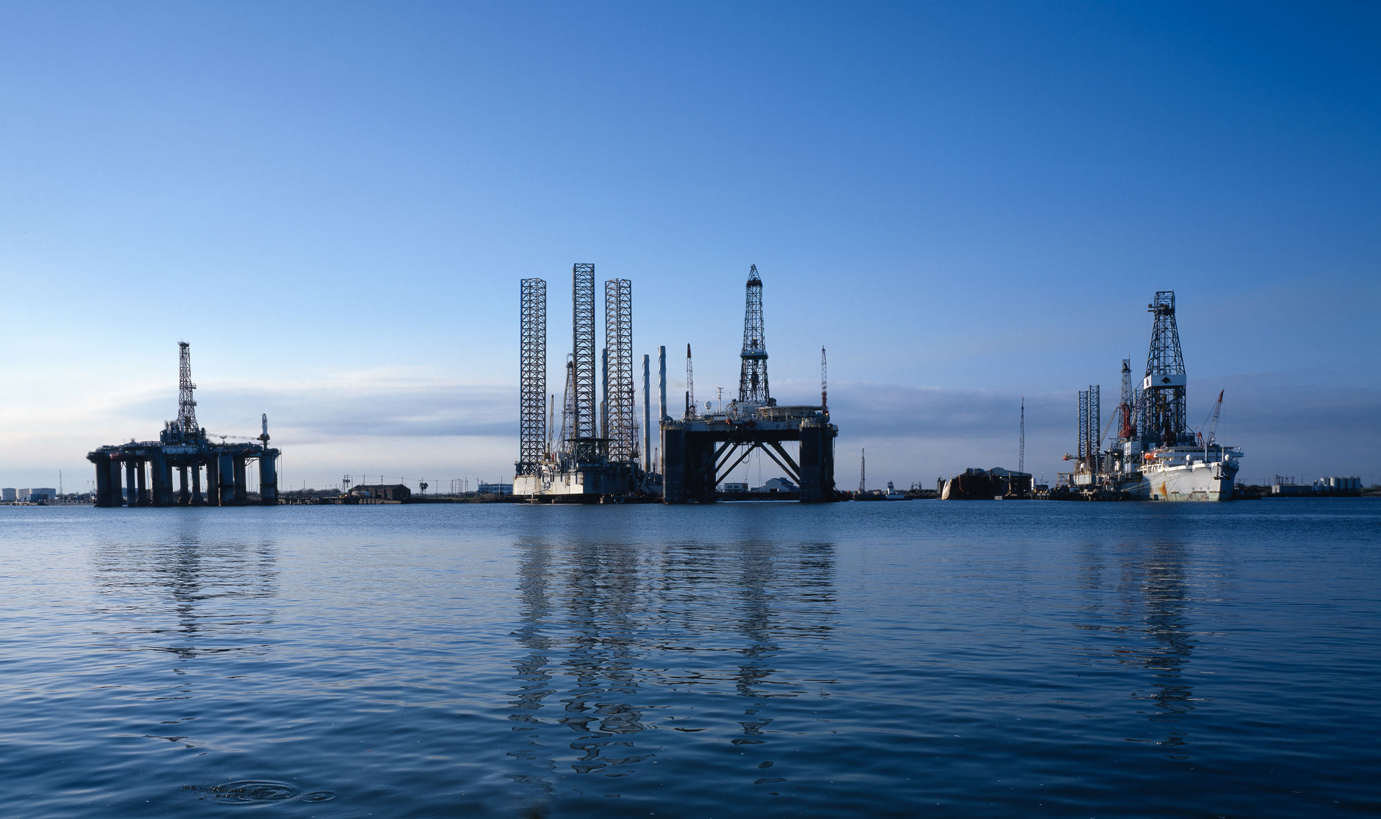
Oil rigs, Galveston, Texas. Photo by Carol M. Highsmith (Library of Congress reproduction number LC-DIG-highsm-12858, Library of Congress Prints and Photographs Division, no known restrictions on publication).
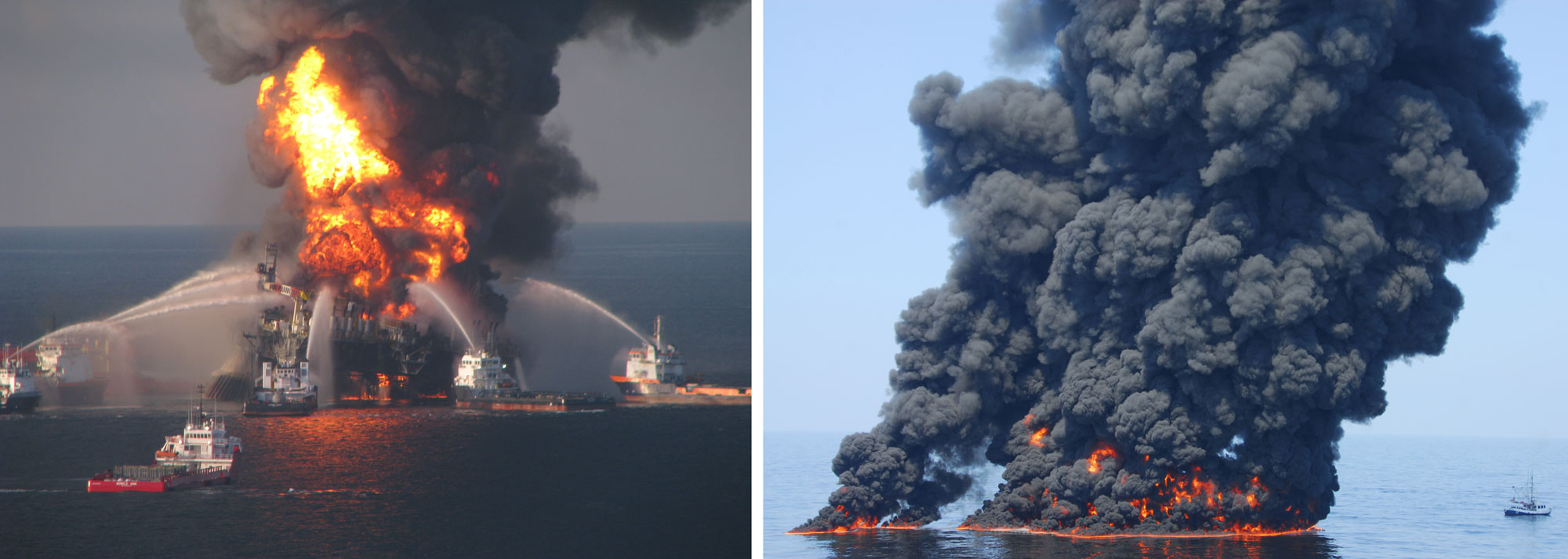
Deepwater Horizon oil spill, 2010. Left: Deepwater Horizon oil rig burning in the Gulf of Mexico off the coast of Louisiana. Photo by U.S. Coast Guard (via USGS, public domain). Right: An oil slick in the Gulf of Mexico from the Deepwater Horizon spill that was intentionally set on fire. Photo by the U.S. Coast Guard (via USGS, public domain).
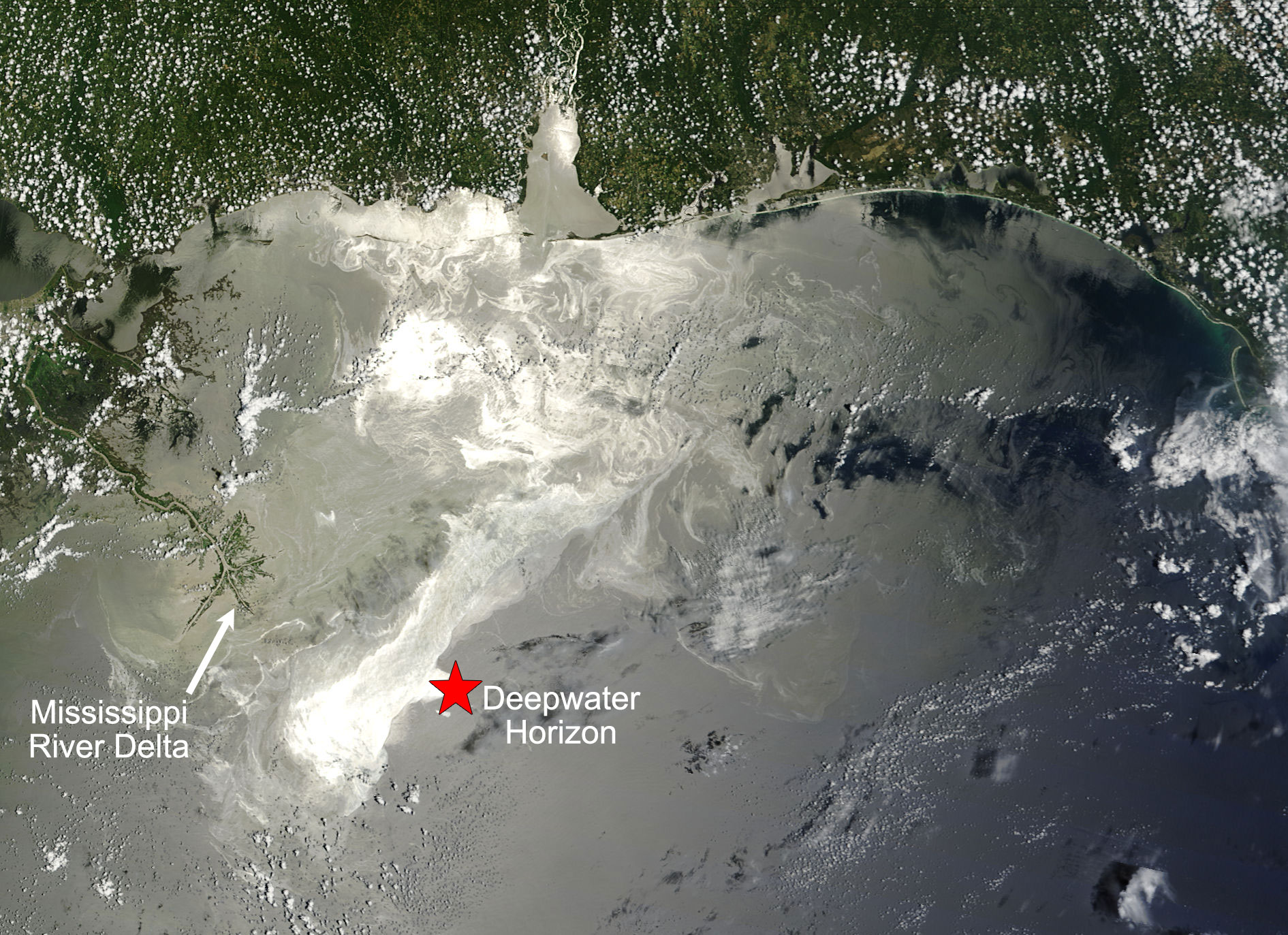
Oil slick on the Gulf of Mexico June 25, 2010. The Deepwater Horizon spill started on April 20, 2010. The approximate location of the Deepwater Horizon is shown at the red star, the Mississippi River Delta (Louisiana) is on the left. Source: NASA image by Jeff Schmaltz, MODIS Rapid Response Team (NASA Earth Observatory, used after NASA's image use policy, image cropped, resized, labeled).
Shale gas (hydraulic fracturing)
The late Jurassic Haynesville Shale is a source rock that became a major target for hydraulic fracturing in the mid-2000s. The Haynesville Shale is stratigraphically above and slightly younger than the Louann Salt Formation. It was deposited later in the Jurassic as the Gulf of Mexico continued to expand. At this time, the continental shelf was an oxygen-poor environment with restricted circulation. Black, organic-rich shales are commonly laid down in such low-oxygen environments.
The unit lies greater than 3000 meters (9800 feet) under the surface in large parts of southwestern Arkansas, northwest Louisiana, and east Texas, and is about 70–100 meters (230–330 feet) thick. The formation varies geographically and includes shale, sandstone, and limestone. The shale has large amounts of natural gas trapped in its pores.
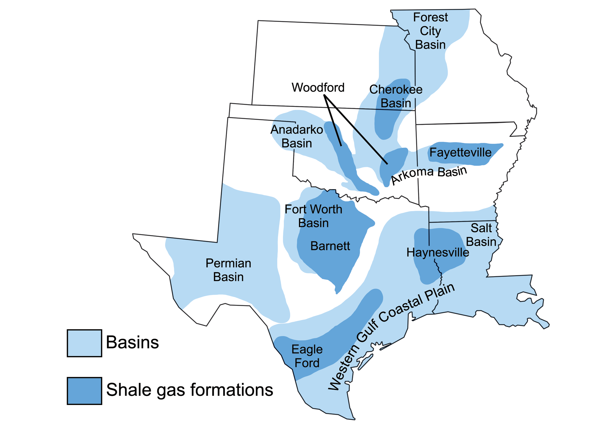
Sedimentary basins containing significant fossil fuel accumulations, and the area of these basins covered by shale formations in which horizontal drilling and hydraulic fracturing are used. Map by Wade Greenberg-Brand (adapted from image by U.S. Energy Information Administration), originally published in The Teacher-Friendly Guide to the Earth Science of the South Central US, modified for Earth@Home.
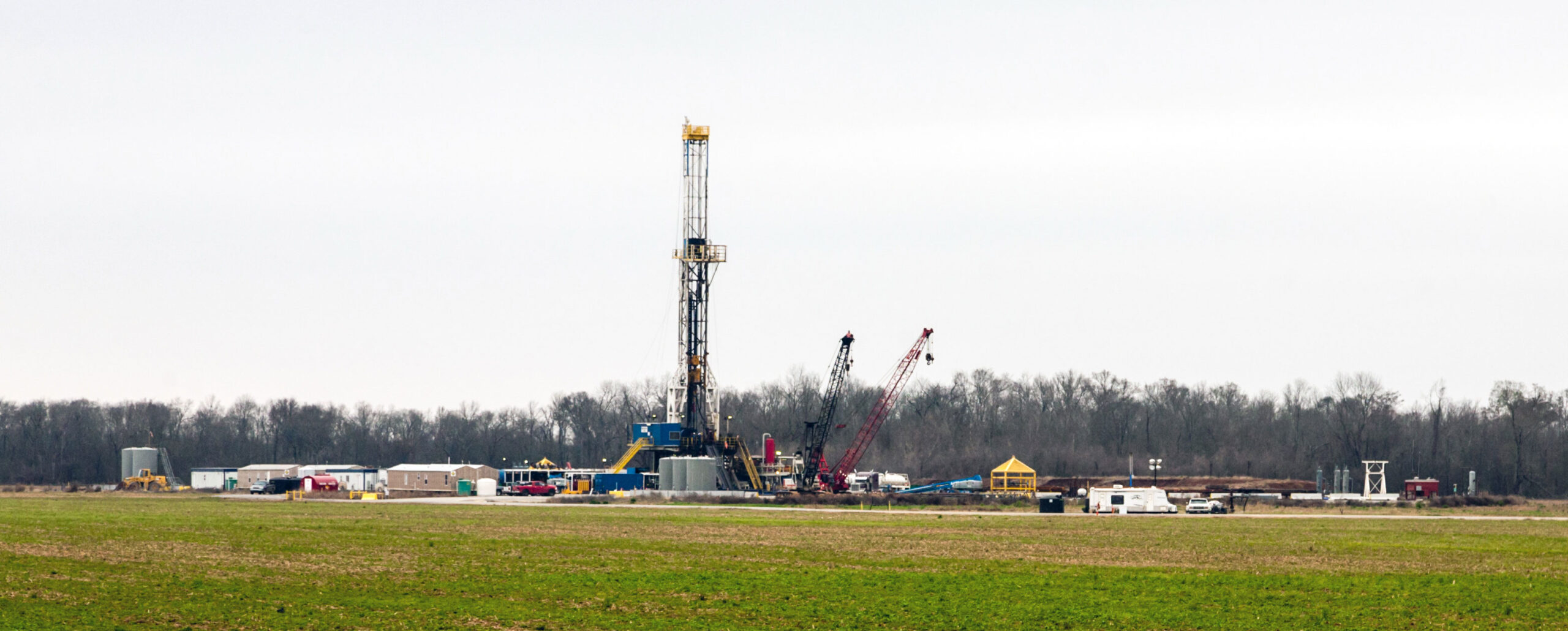
Fracking for natural gas in the Haynesville Shale, Louisiana, 2013. Photo by Daniel Foster (Wikimedia Commons, Creative Commons Attribution-ShareAlike 2.0 Generic license, image cropped and resized).
The Late Cretaceous Eagle Ford Shale in south Texas is another extremely productive onshore area for the extraction of both gas and oil through hydraulic fracturing. The Eagle Ford Shale was deposited along the edge of the continental shelf in quiet, slightly oxygen-poor conditions. Drilling began in 2008, and within a few years the area was one of the largest oil and gas producers in the U.S. The Eagle Ford Shale is about 20–100 meters (70–230 feet) thick. It is drilled across a wide spectrum of depths, from about 1300 to over 4000 meters (4300–13,100+ feet) deep, accounting for the variety of hydrocarbons extracted.
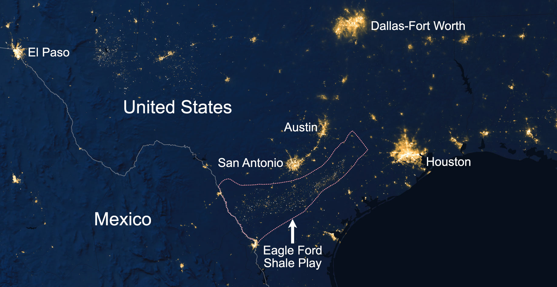
Nighttime satellite image of Texas from February 2016 showing the extent of development in the region of the Eagle Ford Shale. The lights are from gas flares, drilling rigs, camps, and other development) associated with extraction of oil and gas. NASA Earth Observatory image by Joshua Stevens, information from caption by Adam Voiland (image used after NASA's image use policy, image cropped and labeled).
Drill rig near a home in the Eagle Ford Shale. Photo by Earthworks (flickr, Creative Commons Attribution 2.0 Generic license, CC BY 2.0, image cropped and resized).
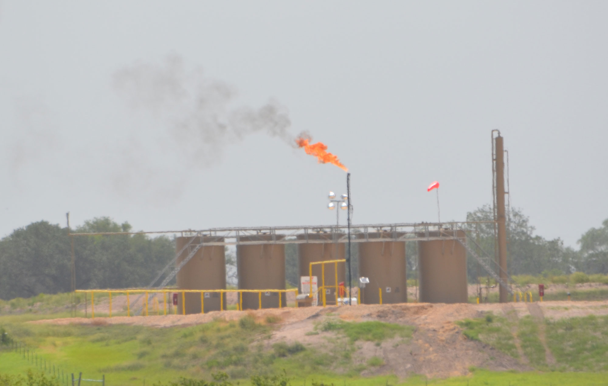
Gas flaring in the Eagle Ford Shale with an oilfield tank battery (group of oil storage tanks) in the background. When fossil fuels are extracted and processed, some natural gas may be flared (burned) for practical, safety, or economic reasons. Carbon dioxide and some methane, both greenhouse gases, are released during flaring. Photo by Earthworks (flickr, Creative Commons Attribution 2.0 Generic license, CC BY 2.0, image cropped and resized).
Oil and gas refining, storage, and distribution
Refining and distribution
In the southern part of the coastal plain, refineries are king. Texas and Louisiana are the two largest producers and refiners of crude oil in the nation, and Louisiana has one of the largest shipping ports for oil in the U.S. Natural gas also drives the Coastal Plain. Harvesting of natural gas and the infrastructure to move this energy resource throughout the region are extensive, and natural gas is one of the most consumed energies in the Coastal Plain region. Louisiana has six deep-draft ports—including the Louisiana Offshore Oil Port (LOOP)—that transfer large quantities of oil and other commercial goods for shipping around the country and the world.
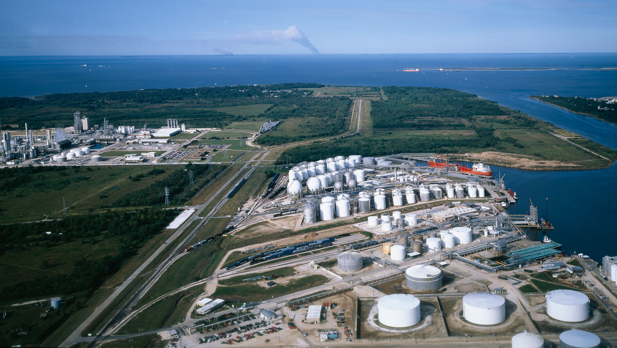
Aerial view of an oil refinery near Houston, Texas. Photo by Carol M. Highsmith (Library of Congress reproduction number LC-DIG-highsm-12335, Library of Congress Prints and Photographs Division, no known restrictions on publication).
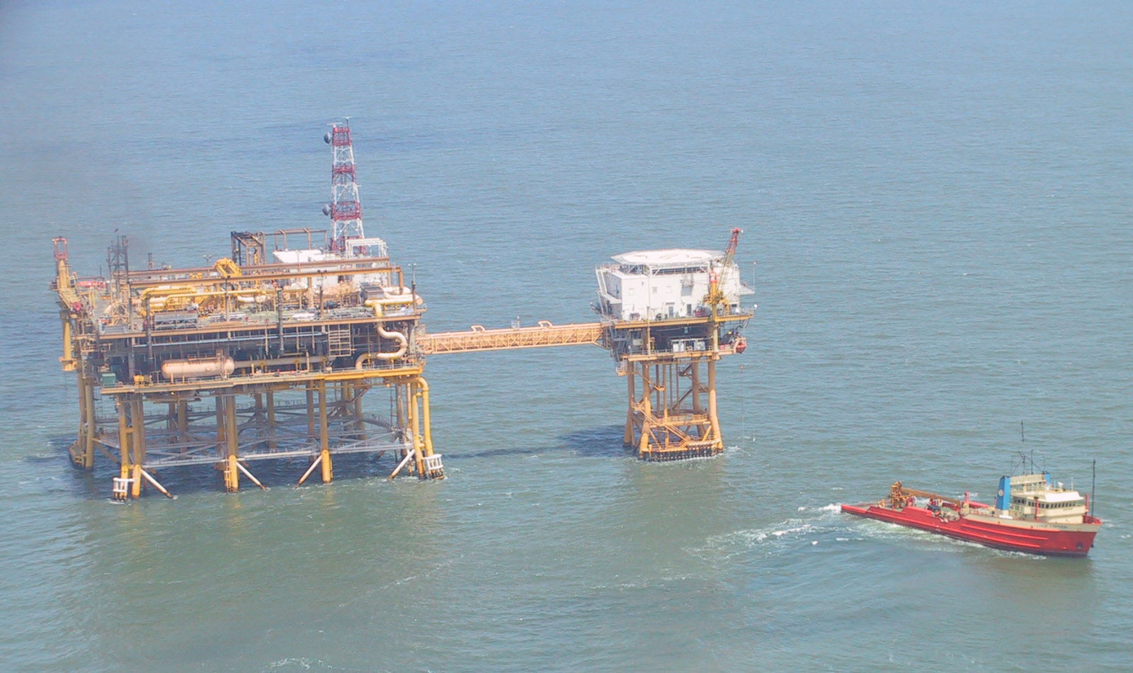
Louisiana Offshore Oil Port (LOOP) offshore pumping platform. Photo by Edibobb (Wikimedia Commons, Creative Commons Attribution 3.0 Unported license, image cropped and resized).
Storage
Due to their inherent impermeability, salt domes are often solution-mined to create caverns that have been used to store petroleum, gas, and even chemical waste. In solution mining, water is pumped underground to dissolve the salt, creating a cavity.
Salt domes in the Coastal Plain are also used to store large quantities of oil and gas. The United States Strategic Petroleum Reserve is one such storage operation, currently holding 619 million barrels of oil in caverns across four salt domes in Texas and Louisiana. Other salt dome storage facilities include Clovelly Dome, which is used to store crude petroleum before it is shipped to refi neries, and the Regas Terminal, which stores 127 million cubic meters (4.5 billion cubic feet) of natural gas in a cavern larger than the Eiffel Tower.
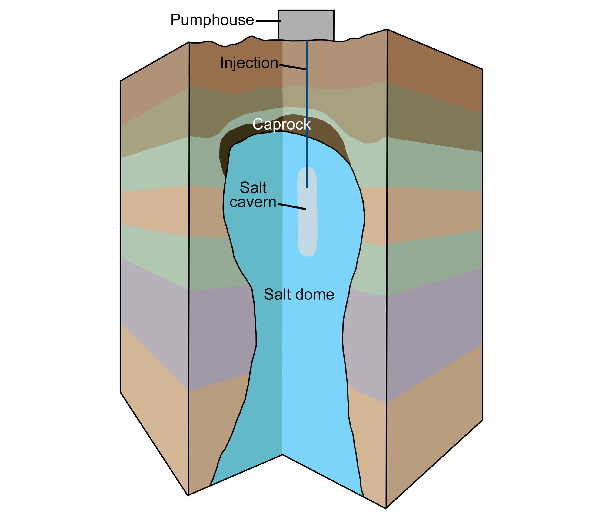
Diagram of solution mining to create a salt cavern. A pumphouse pumps water into an underground salt dome. The water dissolves the salt, and the brine (salty water) is pumped back out, creating a salt cavern (a large cavity) in the salt dome. Modified from original by Wade Greenberg-Brand for the Earth@Home project.
Coal
Texas produces more lignite than any other state due to the presence of extensive Eocene-age deposits along the Gulf Coastal Plain. These deposits were formed by flowering plants and conifers living in marshy environments, brackish lagoons, and between streams near the Eocene coastline.
Lignite deposits also extend across northern Louisiana and eastern Arkansas, east into Mississippi and Alabama, and north into the Mississippi Embayment. The coal deposits are relatively young and have not been deeply buried, thus the coal has not been subjected to the sort of pressures and temperatures that yield higher-grade coal.
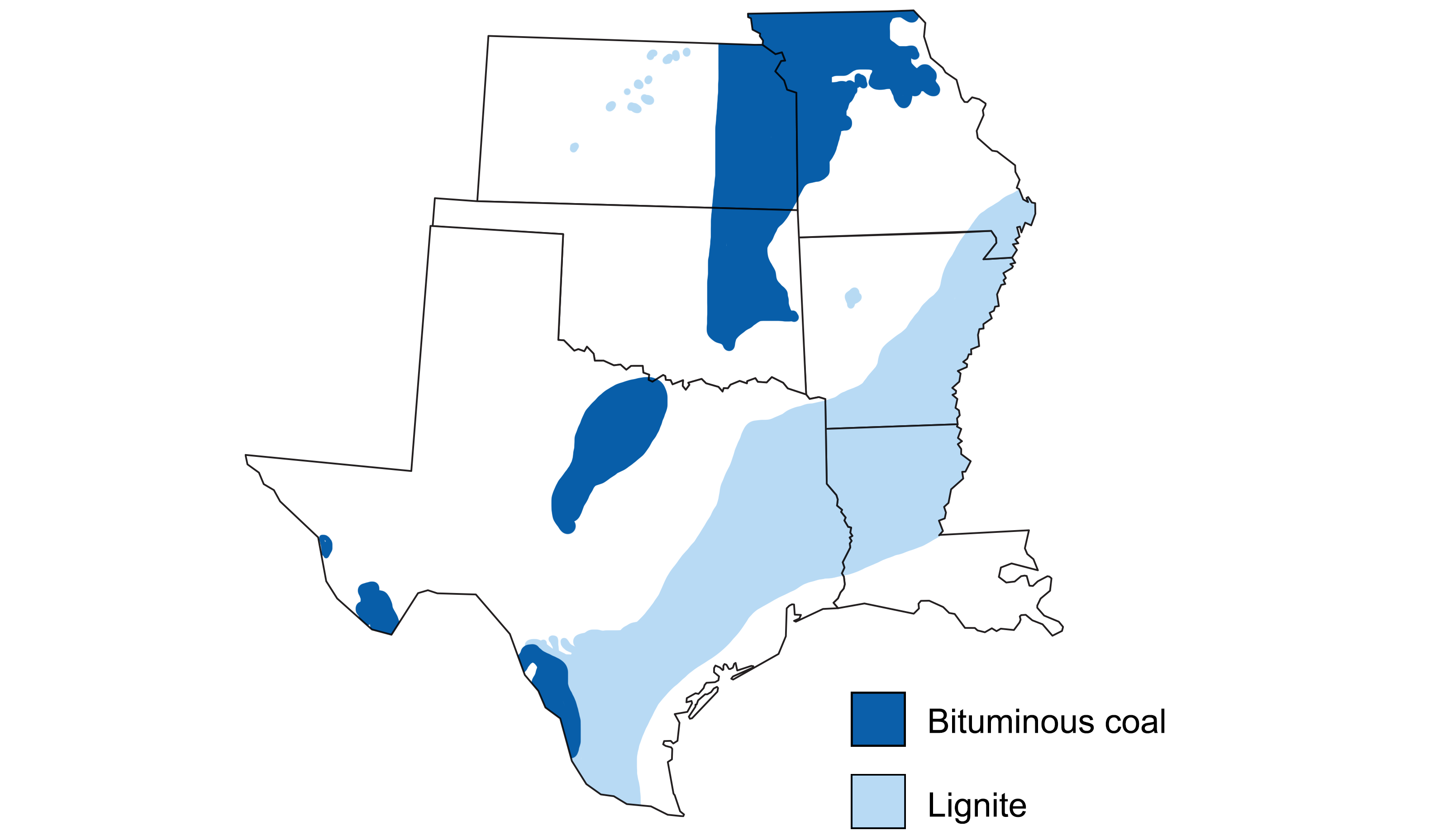
Areas with significant coal resources in the south-central U.S. Modified from a map by Wade Greenberg-Brand (adapted from an image by USGS, originally published in The Teacher-Friendly Guide to the Earth Science of the South Central US).
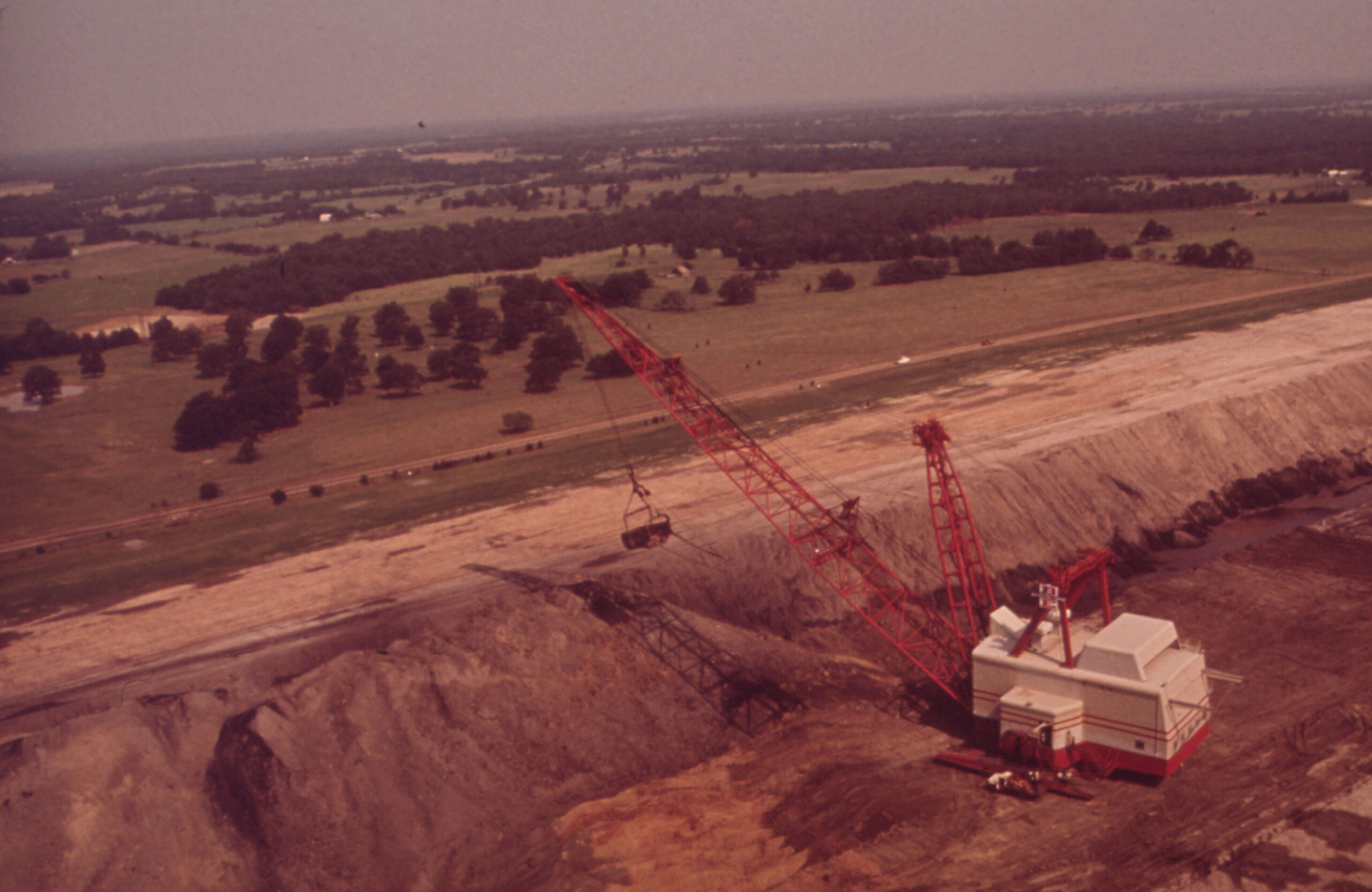
Large stripping shovel at a brown coal mine in Texas, 1972. Photo by Blair Pittman, Environmental Protection Agency DOCUMERICA series (National Archives identifier 545888, use unrestricted).
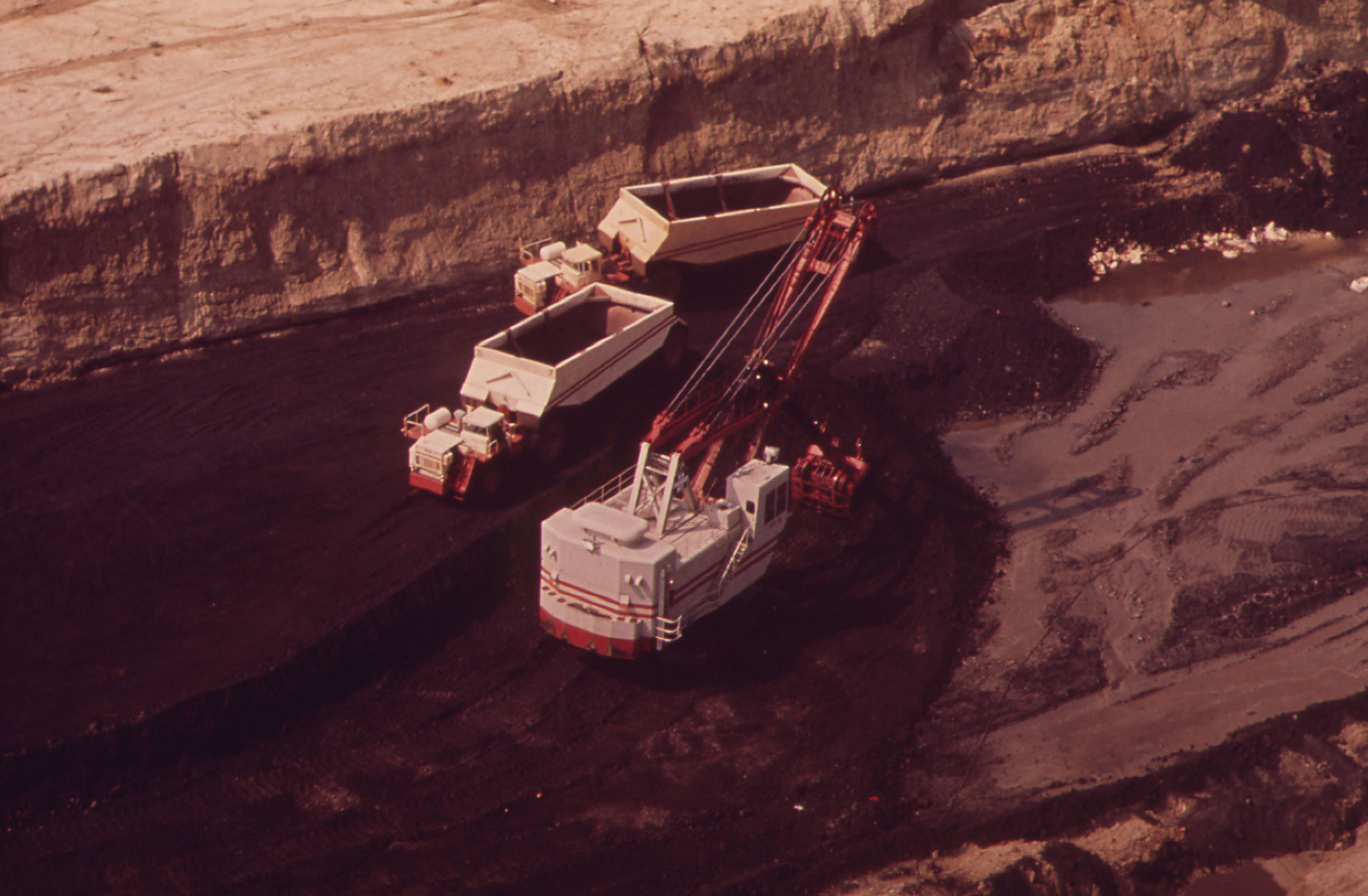
Large stripping shovel and trucks at a brown coal mine in Texas, 1972. Photo by Blair Pittman, Environmental Protection Agency DOCUMERICA series (National Archives identifier 545831, use unrestricted).
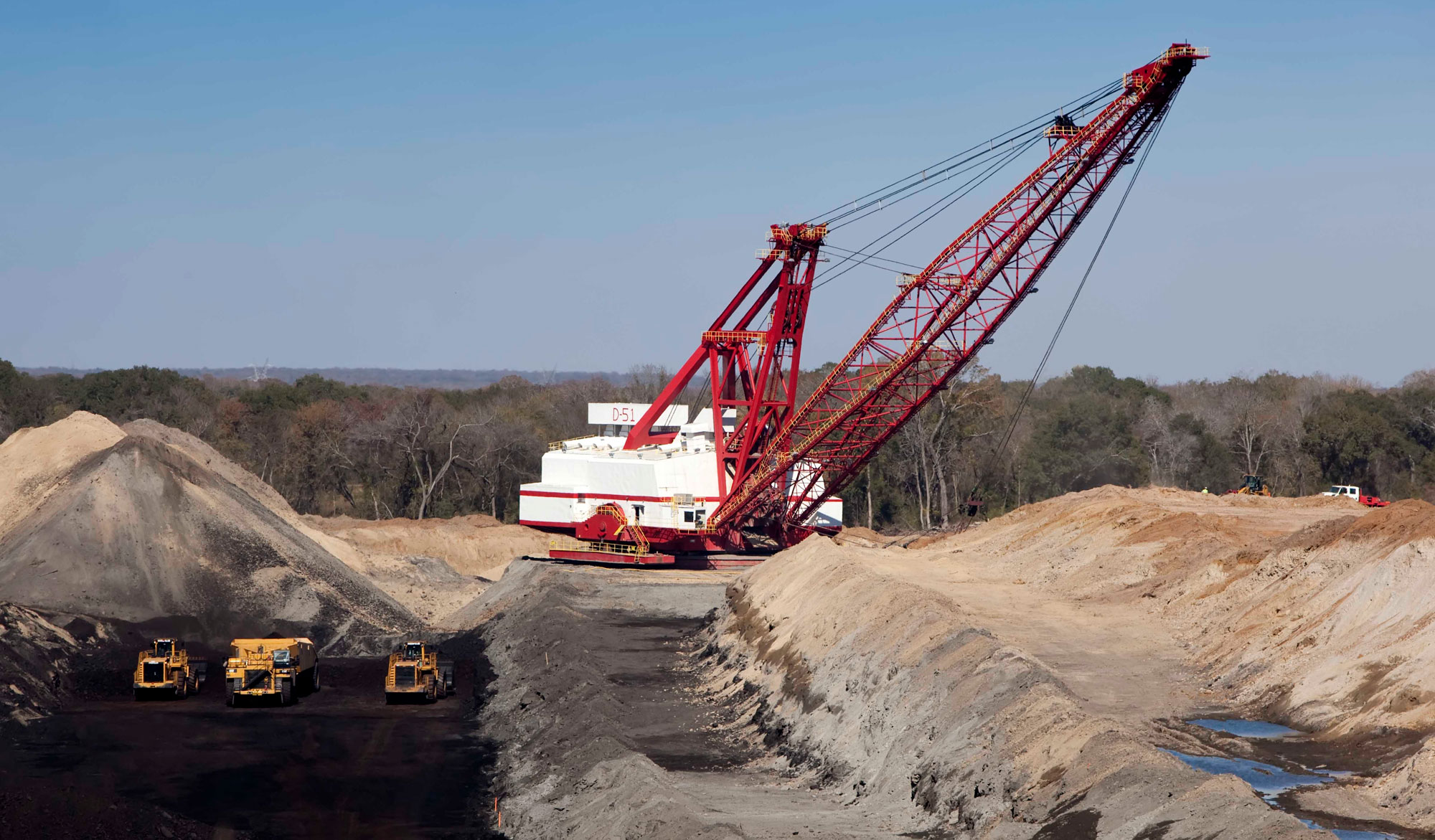
Large stripping shovel and trucks at Kosse brown coal mine, Limestone and Richardson counties, Texas, 2010. Photo by David Ingram (flickr, Creative Commons Attribution-NonCommercial 2.0 Generic license, image cropped and resized).
Renewable energy
Although the vast majority of energy in the Coastal Plain is derived from fossil fuels, there is also a variety of alternative and renewable energy production in the region. The Guadalupe River supports a handful of small hydropower plants, and a few wind farms are scattered along the southern Gulf Coast, in areas of favorable wind conditions. The largest of these, Gulf Wind, is a 283 MW project located in Kenedy County, Texas.
The Coastal Plain is also rich in biomass resources―organic materials burned to generate energy―with many areas generating up to 200,000 tons of biomass material every year from forestry, urban waste, and agriculture. A cluster of biomass power plants can be found near the city of Houston, producing 29 MW of power, enough to provide around 10% of Houston’s annual electricity demand.
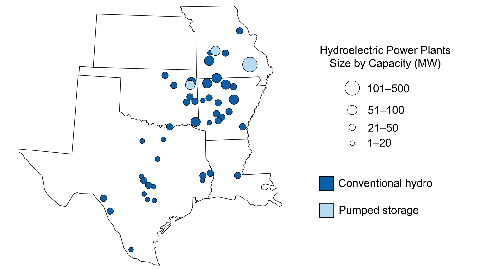
Hydroelectric plants in the south-central U.S. Map modified for Earth@Home from a map by Wade Greenburg-Brand (adapted from an image by the U.S. Energy Information Administration, originally published in The Teacher-Friendly Guide to the Earth Science of the South Central US).
Nuclear power
The Coastal Plain also supports a few nuclear power plants. The South Texas Nuclear Project Electric Generating Station is a 2560 MW nuclear power station, located along the Colorado River about 140 kilometers (90 miles) from Houston. There are two nuclear facilities in Louisiana, the Waterford and River Bend reactors, both located along the Mississippi River.
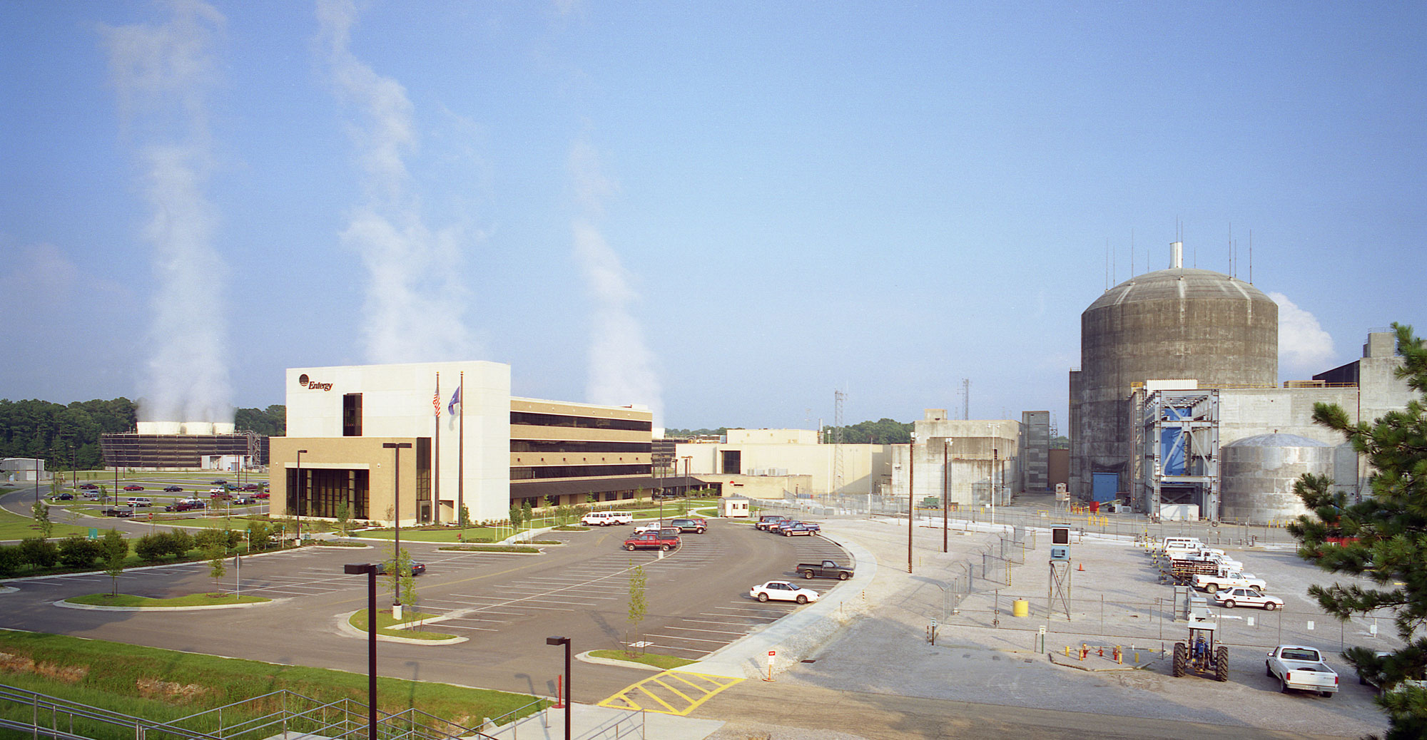
River Bend Nuclear Station unit 1, near St. Francisville, Louisiana. Photo source: Entergy Nuclear via Nuclear Energy Regulatory Commission (flickr, Creative Commons Attribution 2.0 Generic license, image cropped and resized).
Resources
Resources from the Paleontological Research Institution
2013. Under siege: Marine life vs. the Gulf Oil Spill. Paleontological Research Institution. PDF: https://www.priweb.org/science-education-programs-and-resources/under-siege-marine-life-vs-the-gulf-oil-spill
Here on Earth: Introduction to Energy: https://earthathome.org/hoe/energy
Earth@Home: Earth Science of the Northeastern U.S. (energy in the Coastal Plain region of Delaware, Maryland, New Jersey, Long Island, and southern New England): https://earthathome.org/hoe/ne/energy/
Here on Earth: Southeastern U.S.: Energy in the Coastal Plain (continues coverage of energy in the Coastal Plain from western Kentucky, western Tennessee, and Mississippi east to Florida and north to Virginia): https://earthathome.org/hoe/se/energy-cp