

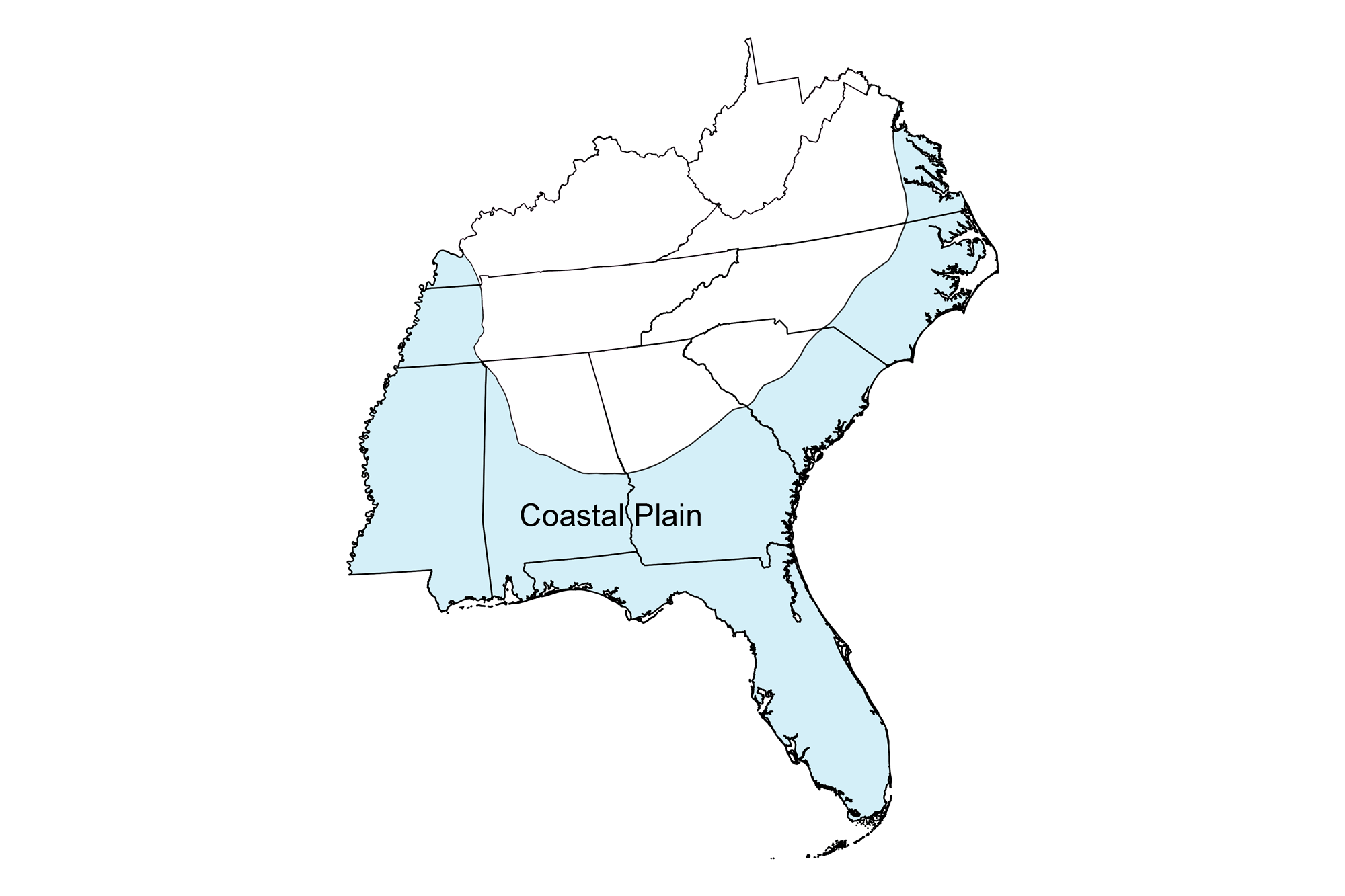
Page snapshot: Introduction to energy in the Coastal Plain region of the southeastern United States, including fossil fuels, renewable energy, and nuclear power.
Topics covered on this page: Oil and gas; Salt domes; Conventional oil and gas; Offshore oil and gas; Oil and gas storage; Coal; Bioethanol and biomass plants; Solar energy; Nuclear power; Resources.
Credits: Most of the text of this page is derived from "Energy in the Southeastern US" by Carlyn S. Buckler, Peter L. Nester, Stephen F Greb, and Robert J. Moye, chapter 6 in The Teacher-Friendly Guide to the Earth Science of the Southeastern US, 2nd ed., edited by Andrielle N. Swaby, Mark D. Lucas, and Robert M. Ross (published in 2016 by the Paleontological Research Institution; currently out of print). The book was adapted for the web by Elizabeth J. Hermsen and Jonathan R. Hendricks in 2021–2022. Changes include formatting and revisions to the text and images. Credits for individual images are given in figure captions.
Updates: Page last updated October 12, 2022.
Image above: Lamberts Point Coal Terminal, Norfolk, Virginia. Photo source: chesapeakeclimate (uncredited, flickr, Creative Commons Attribution-ShareAlike 2.0 Generic license, image resized and cropped).
Overview
The Southeastern Coastal Plain is best known for its oil and gas deposits in and offshore of Mississippi and Alabama. While the Gulf Coast in the Southeast has not been nearly as productive as the Gulf Coast of Louisiana and Texas to the west, it has similar characteristics as a petroleum producer. Natural gas also drives the Coastal Plain. The harvest of natural gas and the infrastructure to move this energy resource throughout the region are extensive, making natural gas to be one of the most consumed types of energy. The Coastal Plain also supports a variety of alternative energy sources, including solar, biomass, and nuclear power generation.
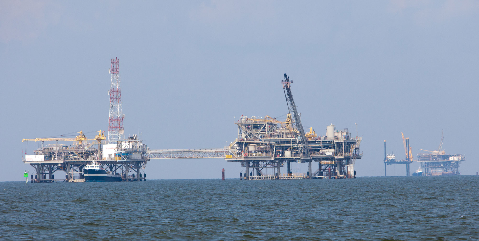
Oil platforms near Dauphin Island, Alabama. Photo by Kris Krüg (flickr, Creative Commons Attribution-NonCommercial-ShareAlike 2.0 Generic license, image cropped).
Oil and gas
Salt domes
As Pangaea broke apart during the Jurassic, the Gulf of Mexico opened and began to take shape. In its early stages, the Gulf experienced periods of restricted marine circulation. During these periods, salt was deposited through evaporation of seawater. This Jurassic salt occurs in flat layers now known as the Louann Salt Formation.
Today, the Louann Salt is covered by over 6000 meters (20,000 feet) of sedimentary rock. Salt has moved upward through the overlying rock layers through time, forming hundreds of salt domes. As these salt domes push through the overlying rock, they can form oil traps, or gaps in the rock where oil and gas can accumulate. Oil and gas can also accumulate under and along salt structures. Salt domes have created prolific oil reservoirs both on- and offshore in the Gulf Coast region.
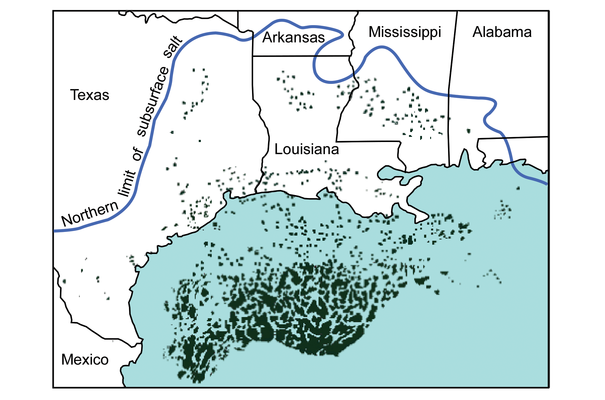
The Louann Salt Formation extends under the surface of the Coastal Plain to the blue line. The black "blobs" are known salt structures where the salt layer has been deformed. Image modified from original by Peter Nester for the Earth@Home project.
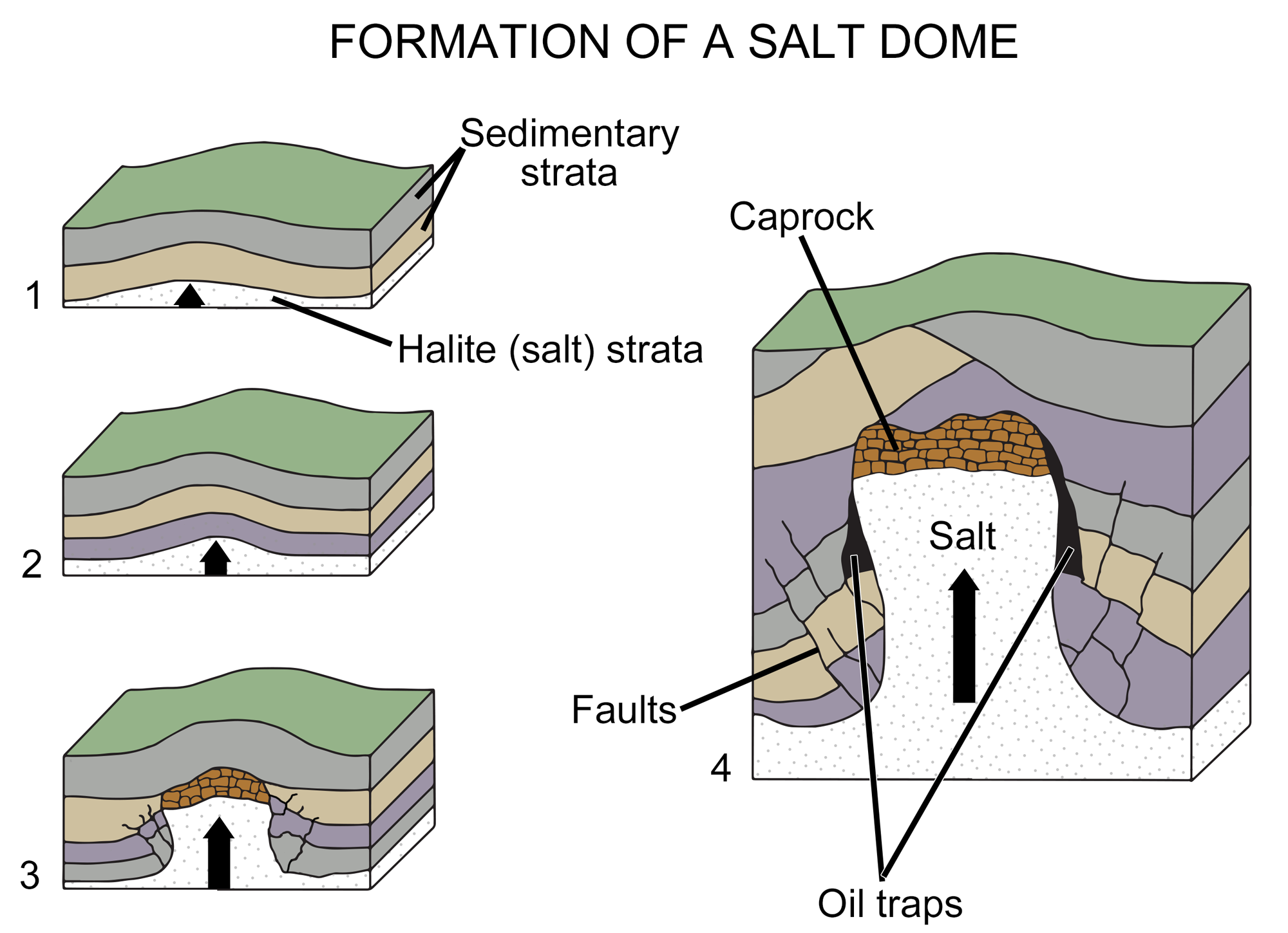
Diagram of the formation of a salt dome. In images1 to 3, a salt layer deforms, pushing upward through the rock layers above it until it is impeded by a caprock (a hard or dense rock layer). In image 4, the deformation of overlying layers by the salt has formed gaps where oil or gas has accumulated. Image modified from original by Wade Greenberg-Brand (after an image by Britannica online for kids) for the Earth@Home project.
Conventional oil and gas
The Coastal Plain along southern Mississippi and southwest Alabama was submerged under high sea levels for much of the Late Cretaceous and Paleogene periods. Because of this, thick layers of limestones, shales, and sandstones occur there. Many Late Cretaceous and early Paleogene shales became source rocks for oil, significant quantities of which have migrated into more porous sandstone and limestone, ultimately pooling in reservoirs. Impermeable sedimentary deposits such as gypsum, anhydrite, limestone, and dolomite serve as cap rock that trap the oil and gas.
The underlying Jurassic salt structures that occur in abundance along the Gulf of Mexico explain the geographic distribution of many oil and gas reservoirs from eastern Texas to western Alabama. Locally thick occurrences of salt are found in the Mississippi Interior Salt Basin, which extends from central Louisiana through central Mississippi and southwestern Alabama. Impermeable rocks pushed up by salt domes became caprock where oil could be trapped. This is the case in the South Carlton field in southwestern Alabama, the Norphlet Formation in central and southern Mississippi and Alabama, and dozens of fields in central Mississippi. Oil and gas production takes place mostly in Cretaceous sandstones.
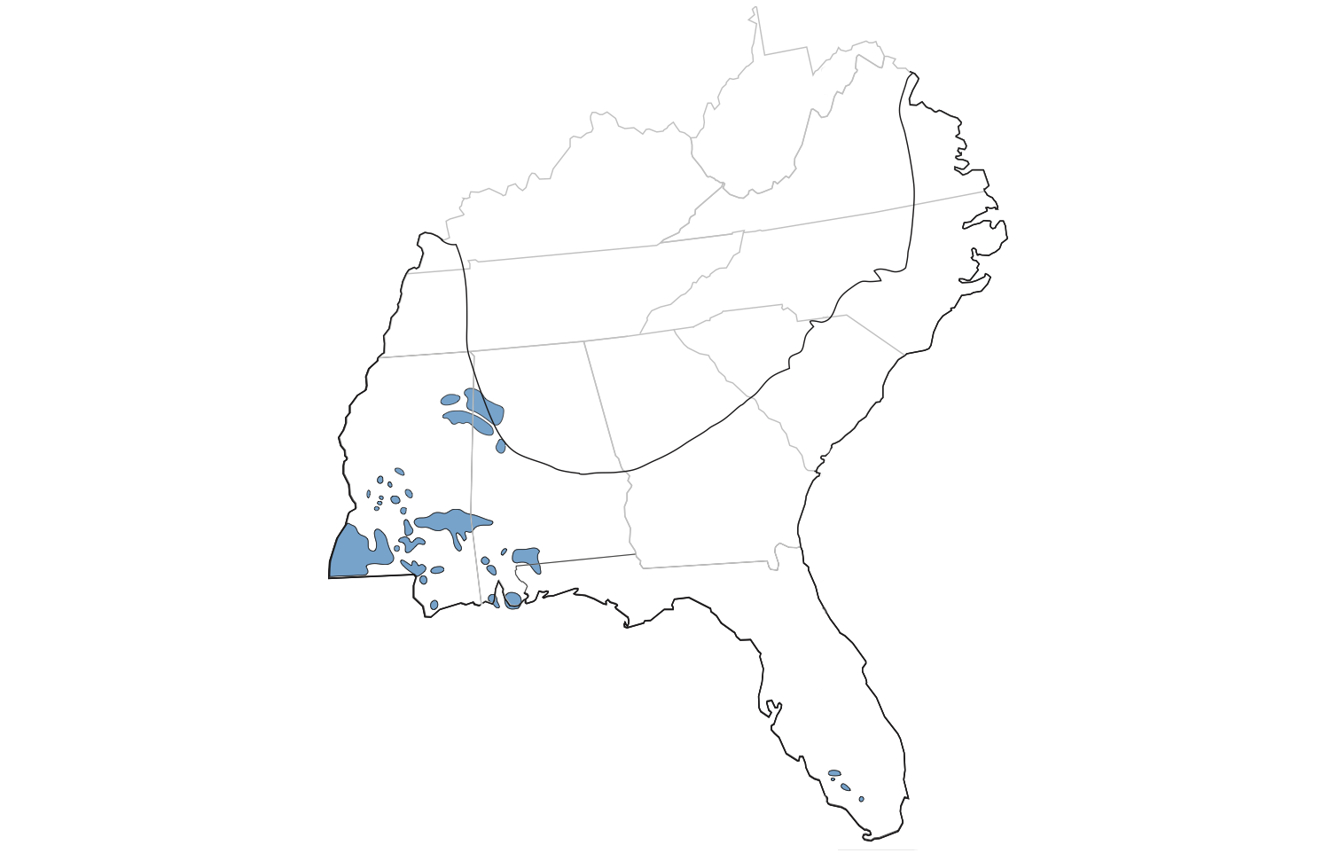
Clusters of known oil and gas fields in the Coastal Plain region. Modified from original by Jim Houghton for the Earth@Home project.
Offshore oil and gas
Today, oil and gas production associated with Coastal Plain sediments has moved mostly offshore, into the Gulf of Mexico. Offshore reservoirs exist where sandy sediments accumulated. Substantial quantities of sediment were eroded from the midcontinent into the Gulf of Mexico through the ancestral Red, Mississippi, and Sabine river systems. These sediments accumulated on the continental shelf and also along deeper submarine fans on the continental slope and even the abyssal plain. Much of this offshore oil and gas formed and trapped in similar ways to that onshore. Many of the offshore reservoirs are thick Paleogene and especially Miocene deposits, with Cretaceous- and Eocene-aged source rocks.
The largest Gulf of Mexico oil field to date was found in 1999, 250 kilometers (155 miles) due south of the Mississippi coastline. Drilling in the deepest parts of the Gulf is extremely challenging due to weather, the harsh environment, and water pressure at depth. This became publicly apparent during the Deepwater Horizon oil spill in 2010, when a seafloor gusher discharged 4.9 million barrels of oil over a period of 87 days before it was capped.
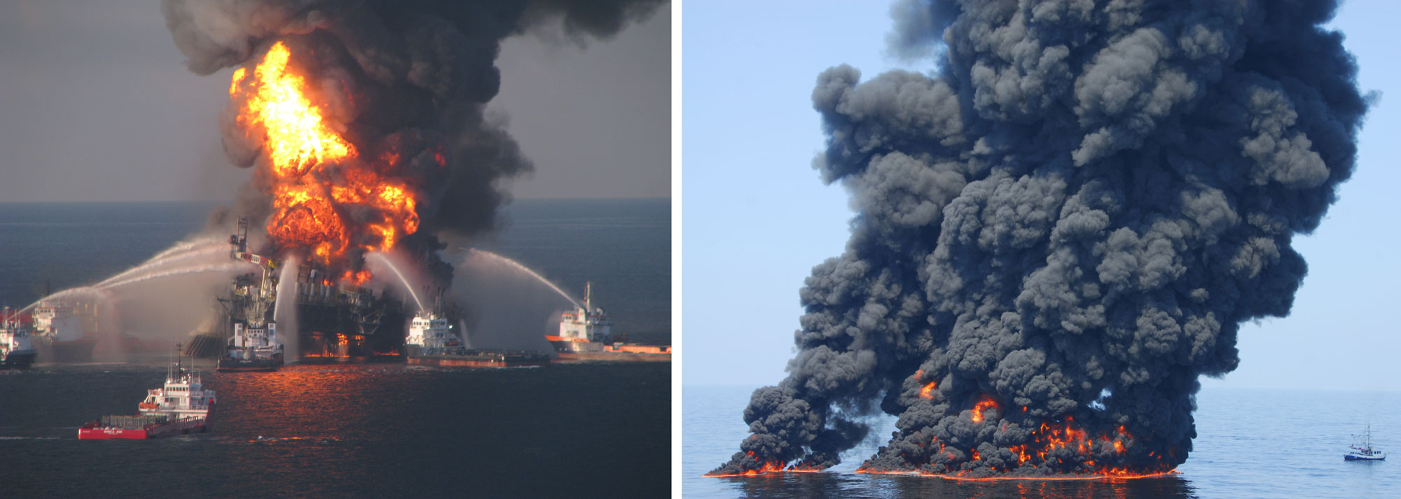
Deepwater Horizon oil spill, 2010. Left: Deepwater Horizon oil rig burning in the Gulf of Mexico off the coast of Louisiana. Photo by U.S. Coast Guard (via USGS, public domain). Right: An oil slick in the Gulf of Mexico from the Deepwater Horizon spill that was intentionally set on fire. Photo by the U.S. Coast Guard (via USGS, public domain).
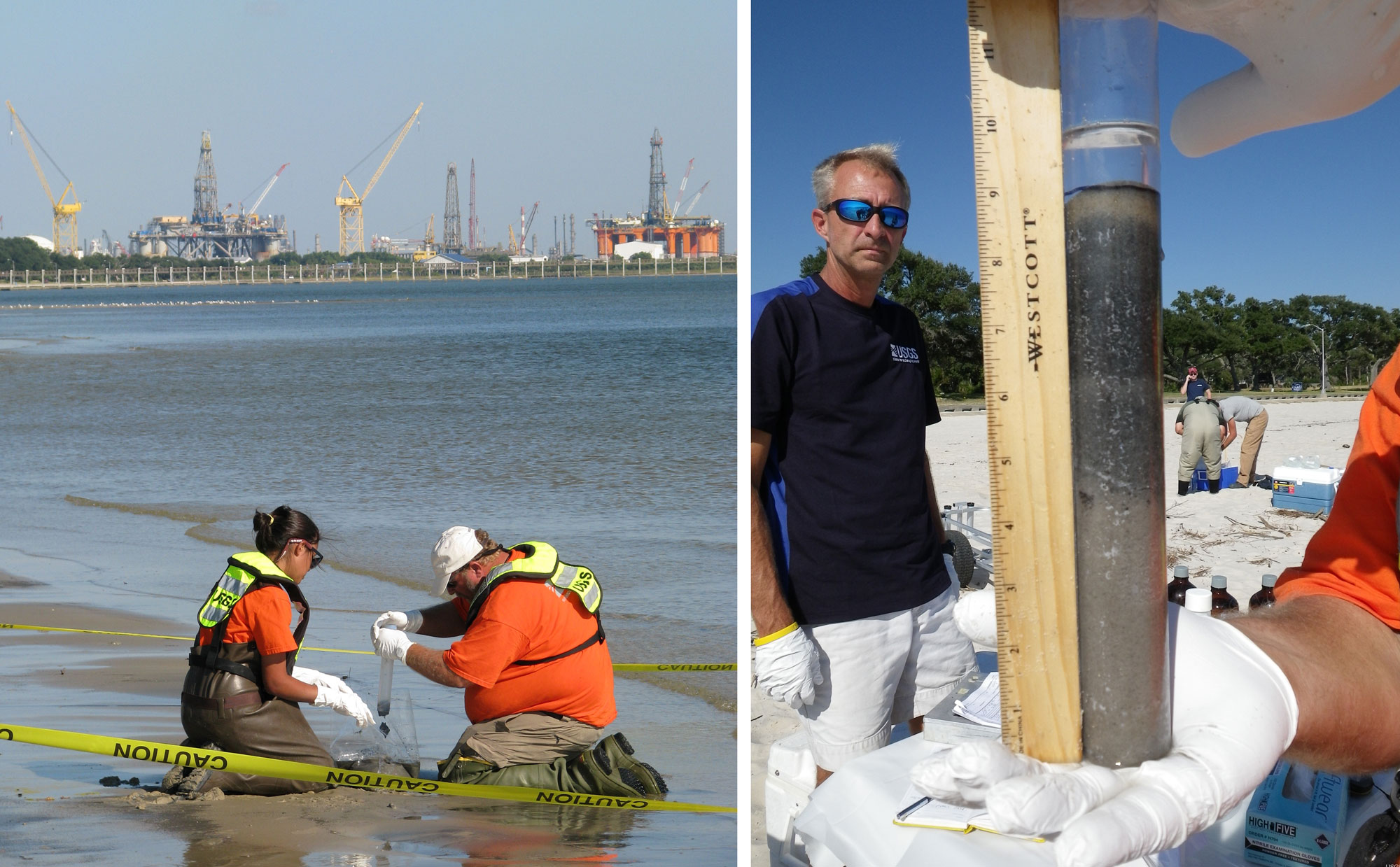
USGS scientists collecting sediment samples on Pascagoula Beach in Mississippi following the Deepwater Horizon oil spill in 2010. Left: Scientists collecting sediment samples with drilling platforms in the background. Photo source: USGS (uncredited, public domain). Right: A sediment core. According to the USGS photo description, "the blackened areas may indicate oil-impacted zones." Photo source: USGS (uncredited, public domain).
Oil and gas storage
Due to their inherent impermeability, salt domes themselves are often solution-mined to create caverns that have been used to store petroleum, gas, and even chemical waste. In solution mining, water is pumped underground to dissolve the salt. Salt domes in the Coastal Plain are also used to store large quantities of oil and gas. Sempra US Gas & Power's Mississippi Hub Storage is one storage operation, currently holding up to 850 million cubic meters (30 billion cubic feet) of natural gas in four storage caverns below Simpson County, Mississippi. Other salt dome storage facilities include the Bond Salt Dome Storage Field in Jackson County, Mississippi, and the McIntosh storage cavern in Alabama.
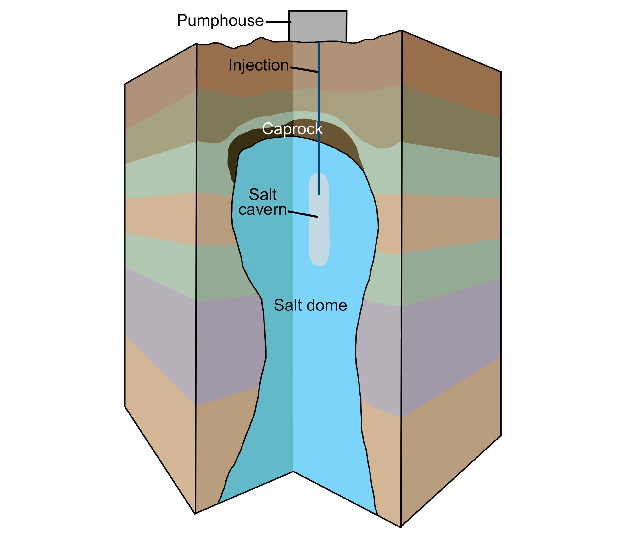
Diagram of solution mining to create a salt cavern. A pumphouse pumps water into an underground salt dome. The water dissolves the salt, and the brine (salty water) is pumped back out, creating a salt cavern (a large cavity) in the salt dome. Modified from original by Wade Greenberg-Brand for the Earth@Home project.
Florida peninsula
The Florida peninsula has produced small quantities of oil since the mid-1900s from deep—3000–4000 meter (9800–13,100 feet)—Cretaceous-aged rocks. Although the thick sequence of carbonate rocks in Florida is permeable and can act as a reservoir, very few source rocks exist. Therefore, little oil or gas is present to fill the potential reservoirs. Small amounts of oil are still being produced today in a belt of porous Cretaceous limestones from west of Miami to near Fort Myers.
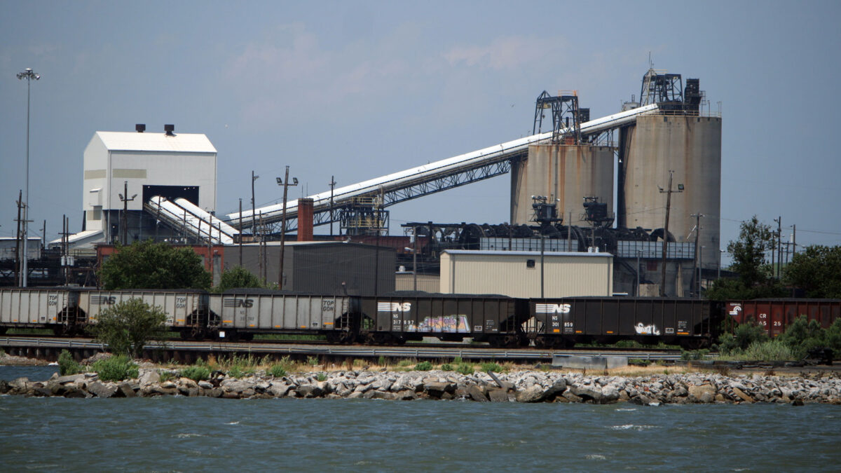
Coal
During the last 100 million years, the seas have advanced and retreated several times, shifting the position of the Coastal Plain's shoreline back and forth. At different times, peat swamps accumulated along the old coastlines and far up the Mississippi River Valley. The largest deposits of coal are Eocene-aged deposits, which are present from Texas east across northern Louisiana and eastern Arkansas, into Mississippi and Alabama, and also north into the Mississippi Embayment. These thinly bedded coals are formed from plants that lived in marshy environments, brackish lagoons, and between streams near the Eocene coastline.
In contrast to the Carboniferous peats of the Inland Basin, which became anthracite and higher-grade bituminous coal, The Coastal Plain's peats were not as deeply buried and were not exposed to the same pressures and temperatures as the Carboniferous peats of the Inland Basin. Therefore, while the Carboniferous peats became anthracite and higher-grade bituminous coal, only lignite and "high volatile" (lower-grade) bituminous coals formed in the Gulf Coastal Plain.
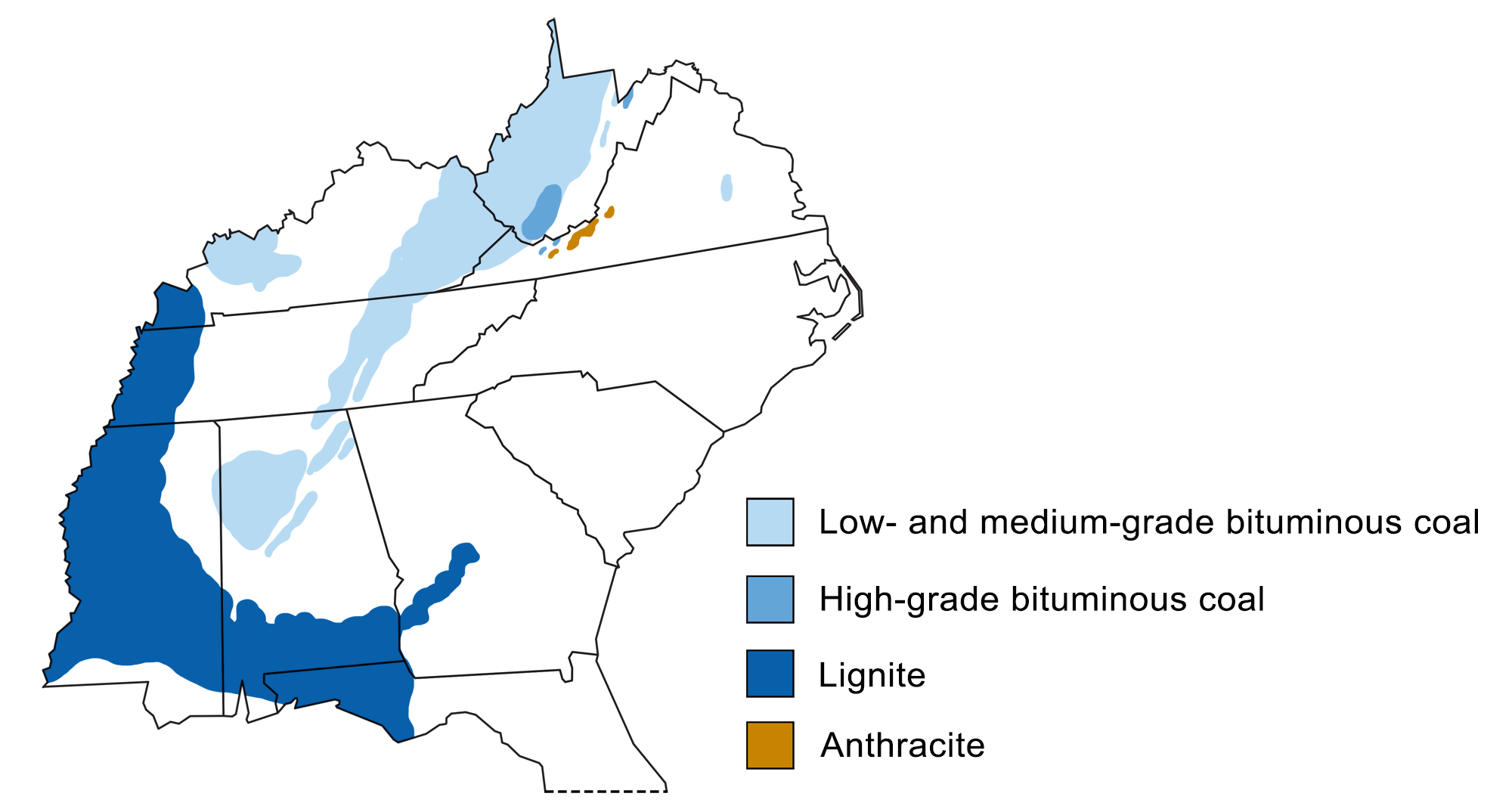
Coal-producing regions of the Southeastern US. Coal (lignite) in the Coastal Plain is younger than coal (bituminous coal and anthracite) in the Inland Basin. Modified from original by Wade Greenberg-Brand (adapted from image by USGS) for the Earth@Home project.
While the Coastal Plain region does not produce much coal, the Lamberts Point coal export facility in coastal Norfolk, Virginia, is the largest and fastest coal transload facility (that is, transferring from one form of transportation to another) in the Northern Hemisphere. It has serviced approximately one-third to one-half of US coal exports since 2000.
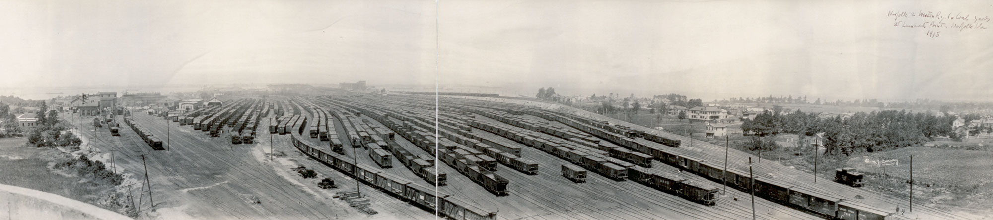
Coal yard of the Norfolk and Western Railway, Lamberts Point, Norfolk, Virginia, ca. 1915. Photo by Frank J. Conway (Library of Congress, non known restrictions on publication).
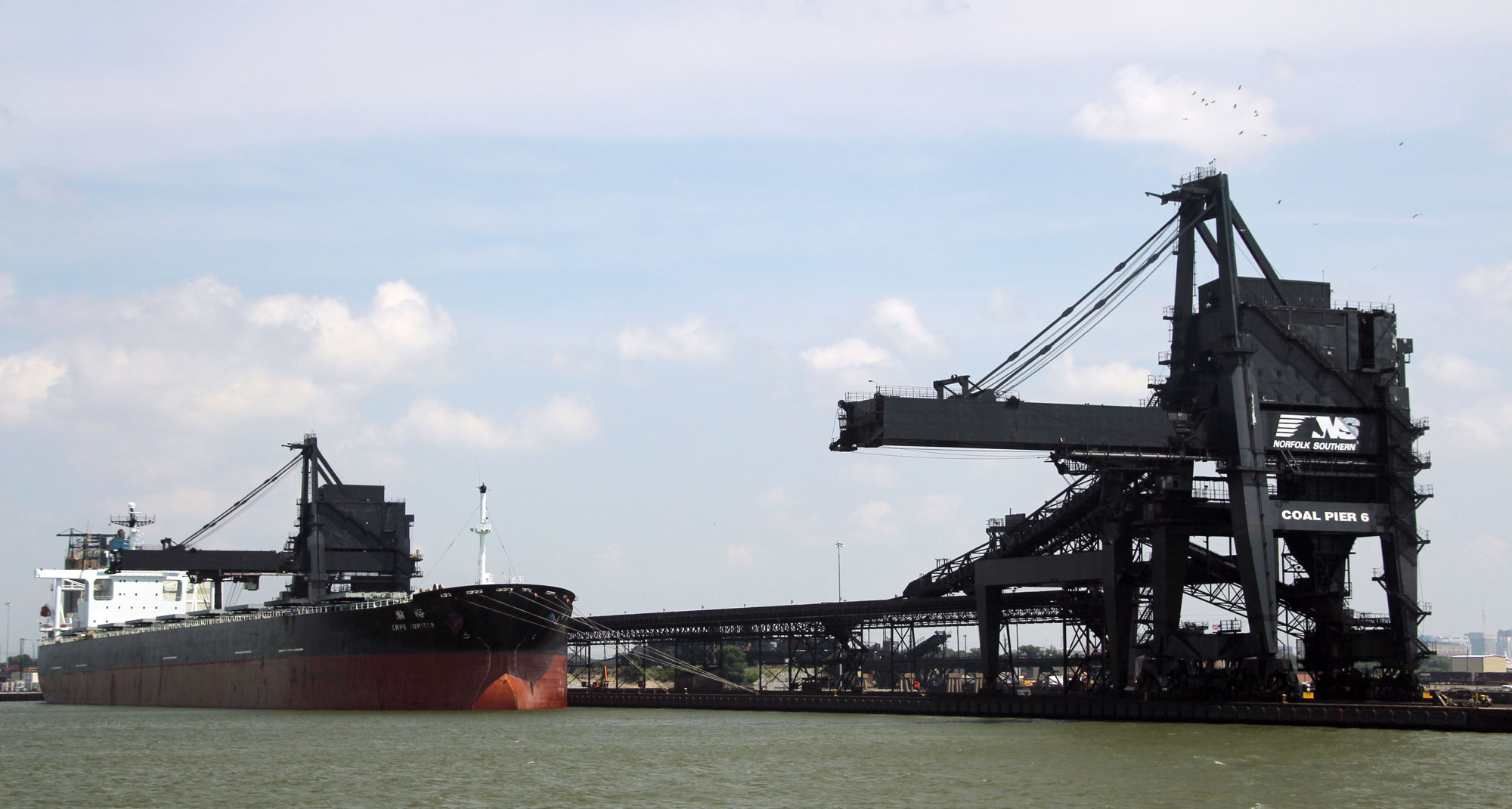
Ship docked at the Lamberts Point Coal Terminal, Norfolk, Virginia, in 2013. Photo source: chesapeakeclimate (uncredited, flickr, Creative Commons Attribution-ShareAlike 2.0 Generic license, image cropped and resized).
Some large deposits of peat that have not yet been compacted occur along the Atlantic Coastal Plain, including Holocene deposits in coastal North Carolina. Here, the peat ranges from 0.3–4.6 meters (1–15 feet) thick and averages 1.4 meters (4.5 feet) thick. The largest deposits are found in the Albemarle-Pamlico peninsula of North Carolina and the Great Dismal Swamp of North Carolina and Virginia.
Great Dismal Swamp, Virginia. Photo by Debra A. Willard, USGS (public domain).
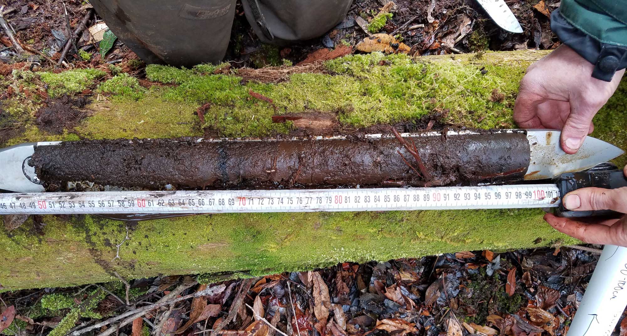
A peat core taken from the Great Dismal Swamp in Virginia, 2017. Photo by Kristen Hoefke, USGS (public domain).
Renewable energy
Bioethanol and biomass plants
The Coastal Plain is rich in biomass resources. Biomass resources are organic materials that are burned to generate energy. These include oils that come from plants (soybeans and canola), as well as biomass from sugar production (sugarcane, sugar beets, and sorghum), starchy crops (grains like rice and corn), wood and wood products, and certain types of municipal waste. Across the Southeastern states, biomass accounts for 6.3% of energy use. States within the Coastal Plain generate a slightly higher percentage of their energy from biomass. Alabama has the largest share―10.1% in 2013―of the states in the region. Of the 737 public and private-access biodiesel fueling stations nationwide, more than 18% are in North Carolina.
A bioethanol and electric power plant that produces energy from wood, vegetable, and municipal wastes was recently built in Vero Beach, Florida. The fermentation and gasification process in this plant uses municipal and other non-food biomass waste, thus avoiding issues associated with using farm crops for biofuel production. The power plant produces commercial-level amounts of biofuel―300 million liters (80 million gallons) of ethanol―as well as electricity to run the plant and from six to eight MW of energy for area homes and businesses. Many people see this type of plant as one possible solution to reducing municipal waste and the use of fossil fuels.
Solar energy
Between August of 2014 and August of 2015, North Carolina's production of electricity from solar power increased 127%, more than in any other state in the country during that time period. The state’s solar electric power production in 2015 accounted for more than twice the total production for all the other states in the Southeast combined. Nevertheless, California accounts for more than half of the country’s solar electric production, and the total US output of solar power is also dwarfed by other sources.
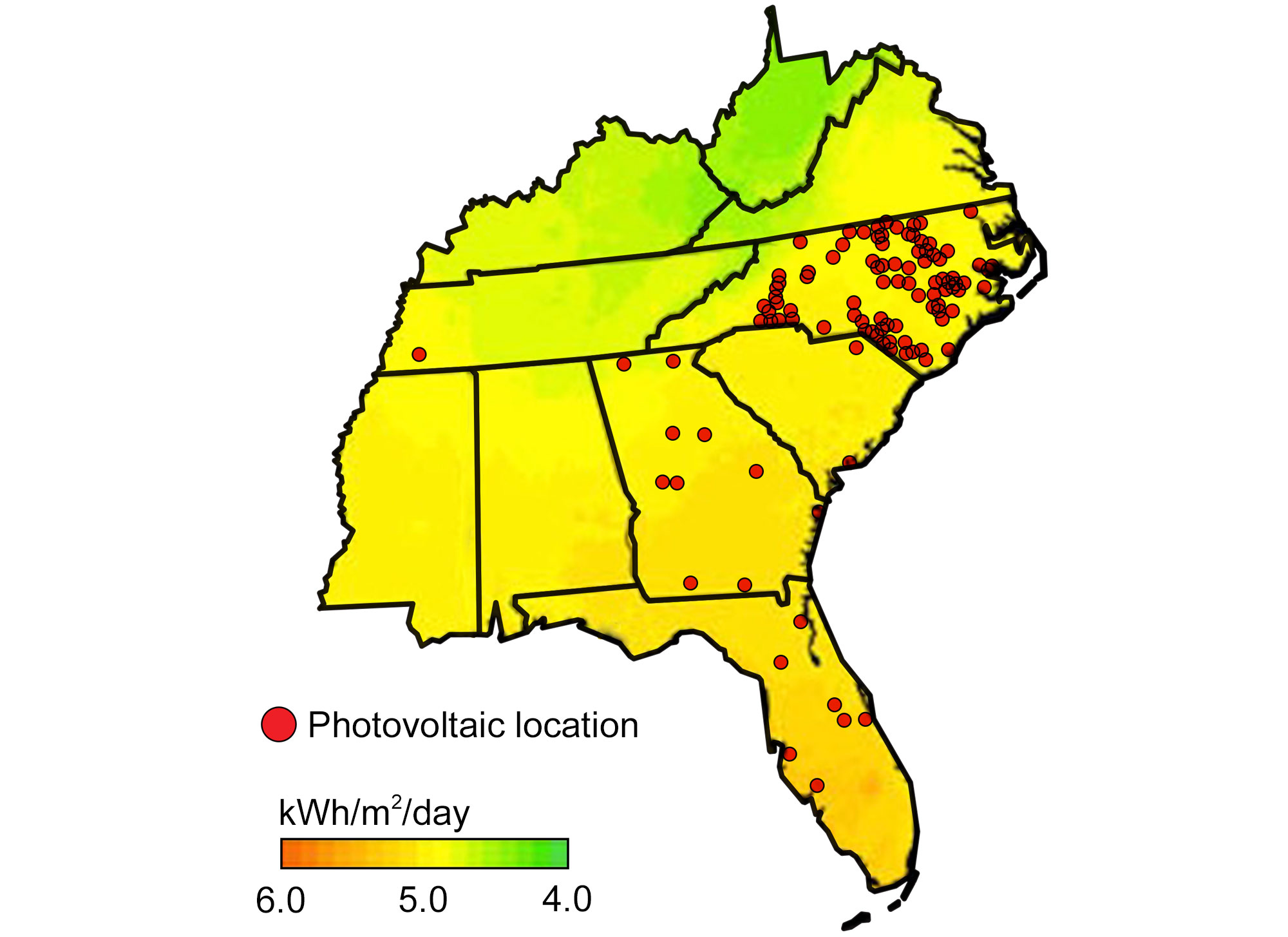
Locations of existing photovoltaic power plants overlaid on a map of the annual average solar resource for the Southeastern US. Modified from original by Wade Greenberg-Brand (adapted from an image by Britannica Online for Kids) for Earth@Home project.
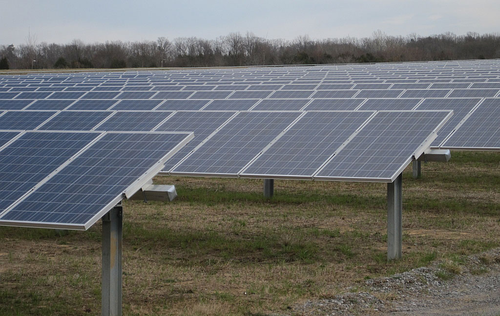
Agricenter International solar farm in Shelby Farms Park, Memphis, Tennessee. Memphis is in the Mississippi Embayment region of the Coastal Plain. Photo by Thomas R. Machnitzki (Wikimedia Commons, Creative Commons Attribution 3.0 Unported license, image cropped).
Nuclear power
Every Southeastern state in the Coastal Plain has at least one nuclear power plant. Of the 18 plants in the Southeastern US, 9 are located in the Coastal Plain region, producing a combined total of 17,029 MW of power. The largest nuclear facility is the Turkey Point Nuclear Generating Station near Miami, Florida, which has a capacity of 3552 MW. There are also several nuclear reactor fuel processing facilities in the Coastal Plain, notably in North and South Carolina.
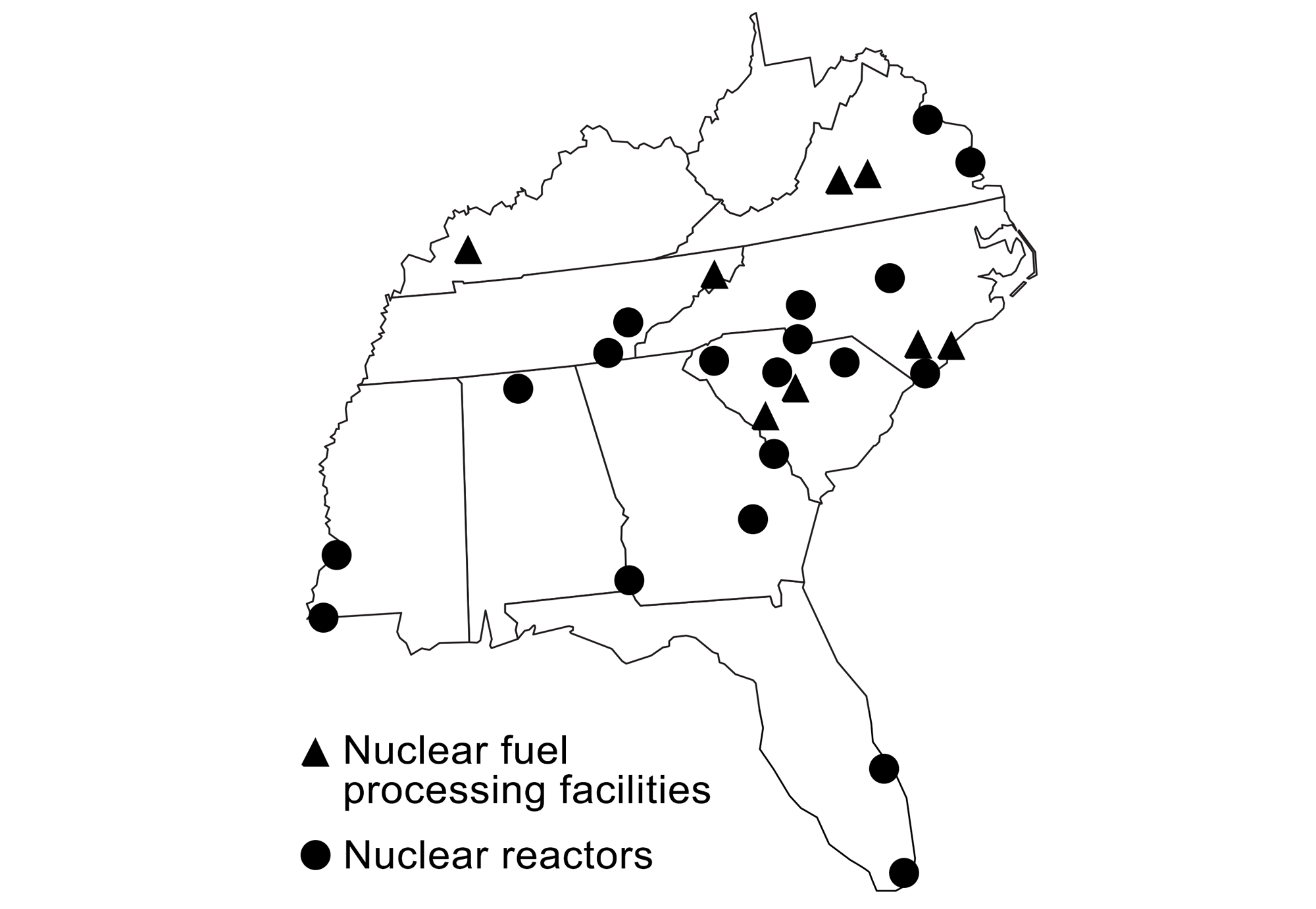
Production of nuclear power and locations of nuclear fuel processing facilities in the southeastern states. Modified from original by Wade Greenberg-Brand (adapted from images by the US Energy Information Administration and Kenny Moore via Wikimedia Commons) for the Earth@Home project.
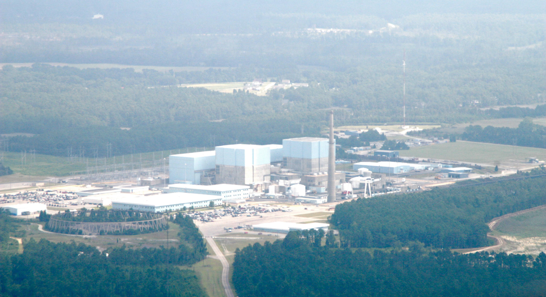
Brunswick Nuclear Power Plant near Southport, North Carolina. Photo by Doc Searls (Wikimedia Commons, Creative Commons Attribution-ShareAlike 2.0 Generic license, image cropped).
Resources
Resources from the Paleontological Research Institution
2013. Under siege: Marine life vs. the Gulf Oil Spill. Paleontological Research Institution. PDF: https://www.priweb.org/science-education-programs-and-resources/under-siege-marine-life-vs-the-gulf-oil-spill
Here on Earth: Introduction to Energy: https://earthathome.org/hoe/energy
Earth@Home: Earth Science of the Northeastern U.S. (energy in the Coastal Plain region of Delaware, Maryland, New Jersey, Long Island, and southern New England): https://earthathome.org/hoe/ne/energy/
Here on Earth: Earth Science of the South-central U.S.: Energy in the Coastal Plain (continues coverage of energy in the Gulf Coastal Plain in Louisiana and Texas): https://earthathome.org/hoe/sc/energy-cp