

Snapshot: Metallic and non-metallic mineral resources in the Coastal Plain region of the southeastern U.S. Coverage also includes selected non-mineral resources the are commercially mined or quarried (for example, building stone).
Topics covered on this page: Introduction; Metallic mineral resources; Non-metallic mineral resources; Resources (references and further reading about minerals).
Credits: Most of the text of this page is derived from "Mineral resources of the Southeastern US" by Robert J. Moye, Stephen F. Greb, and Jane A. Picconi, chapter 5 in The Teacher-Friendly Guide to the Earth Science of the Southeastern U.S., 2nd ed., edited by Andrielle N. Swaby, Mark D. Lucas, and Robert M. Ross (published in 2016 by the Paleontological Research Institution; currently out of print). The book was adapted for the web by Elizabeth J. Hermsen and Jonathan R. Hendricks in 2021–2022. Changes include formatting and revisions to the text and images. Credits for individual images are given in figure captions.
Updates: Page last updated March 28, 2022.
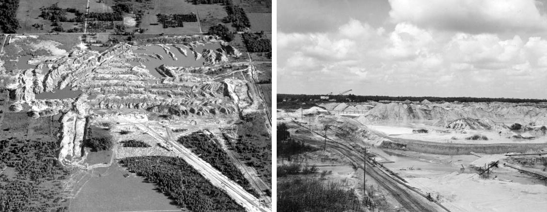
Image above: Phosphate mining in Florida, 20th century. Left: Aerial view of American Cyanamid Company phosphate mine, Donner, Florida, 1959. Photo uncredited (Image number RC17492, Florida Memory, public domain). Right: Phosphate mounds, International Minerals and Chemical Corporation, Mulberry, Florida, 1947. Photo uncredited (Image number C005883, Florida Memory, public domain).
Introduction
The Southeast has been largely tectonically inactive for about 150 million years; weathering and erosion are the dominant geologic processes that have operated during this time. Most of the Coastal Plain has eroded to a gently tilted plain, where erosion and deposition around rivers and coastlines has formed numerous placer concentrations of heavy minerals. Fluctuating sea levels during the Cretaceous, Paleogene, Neogene, and Quaternary left thick, extensive sedimentary deposits throughout the region.
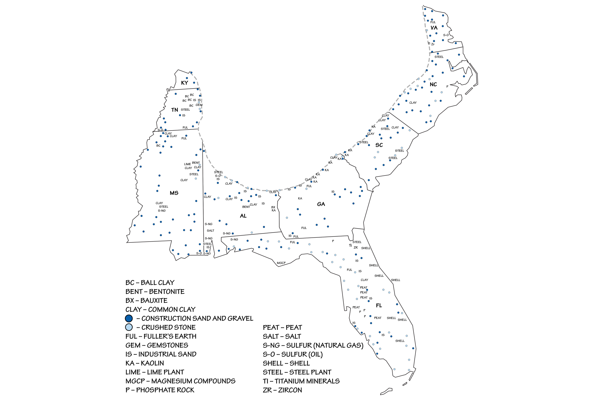
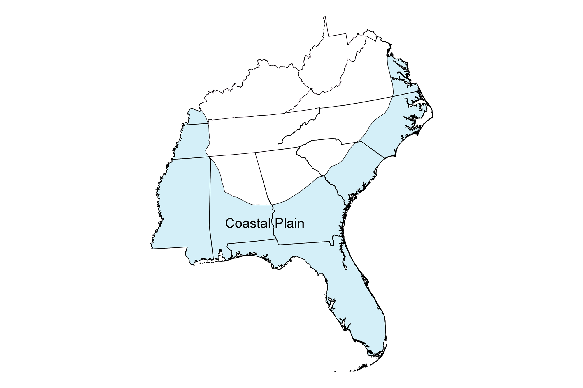
Locations of principal mineral resources of the Coastal Plain region of the southeastern United States. Image by Wade Greenberg-Brand, adapted from image in USGS 2010-11 State Minerals Yearbook (public domain).
Metallic mineral resources
Although not mined commercially, numerous concentrations of heavy mineral sands have been identified in ancient river and beach deposits along the western margin of the Coastal Plain and offshore on the continental shelf. Deposits of rutile, ilmenite, monazite, zircon, and gold have been investigated in North and South Carolina. Although minor production has occurred in the past, these deposits are currently not economically viable to mine; some of them occur in environmentally sensitive or urban areas.
Bauxite
Bauxite is a residual product of weathering in the Coastal Plain's Cretaceous carbonate rocks, and bauxite deposits can be found in Georgia, Alabama, Tennessee, and Virginia. This clay-like mixture of several minerals is mined primarily as an ore of aluminum; most bauxite ore contains 45–55% aluminum oxide.
A sample of bauxite (locality unknown). Model by Department of Earth Sciences, University of Newcastle (Sketchfab; Creative Commons Attribution-NonCommercial 4.0 International license).
The Southeast's bauxite deposits are generally small and of limited potential. Small-scale production has continued in Alabama to the present.
Iron ore
From the 17th to 19th centuries, iron foundries and steel mills in the Coastal Plain were fueled by "bog" iron ore mined from coastal swamps and Triassic basin coal. Steel mills of the late 19th and 20th centuries were more dependent on imported iron and coal, and tended to be near the ocean on navigable rivers, as their operation was heavily reliant on a considerable supply of freshwater.
Non-metallic mineral resources
The Coastal Plain is blanketed by sand and gravel that were eroded from the Appalachian Mountains and redistributed by rivers and the ocean. These materials (along with clay) are the dominant natural resource mined on the Southeast Coastal Plain because they are abundant along the coast, in rivers, and along river terraces.
Sand, gravel, and building stone
Sand and gravel are primarily used in construction, concrete, and road fill; the region also produces industrial sand. Sedimentary rock is not commonly exposed at the surface, but sedimentary bedrock is mined in many quarries where sediment and soil cover are thin.
Limestone is quarried as a building stone, to make crushed stone used as construction aggregate, and in the manufacture of cement and lime. In some areas, Cretaceous and Cenozoic sediments at the surface have been sufficiently hardened for use as a dimension stone. For example, Alabama's Marianna Limestone, though soft enough to be cut with a saw, hardens upon exposure and was commonly used as a dimension stone.
Because much of Florida was deposited as a carbonate platform, there are extensive carbonate (limestone and dolomite) resources near the surface. Florida is one of the top producers of crushed stone in the U.S., and annually leads the nation in the manufacture of masonry cement.
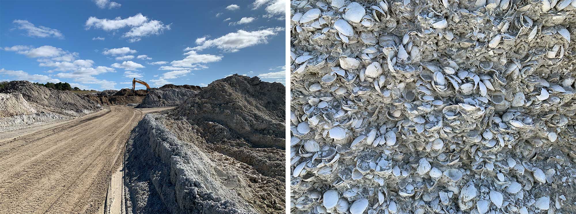
Left: An active aggregate quarry in Florida. Right: Fossil-rich Plio-Pleistocene deposits are being quarried at this location for aggregate and sand. Photograph by Jonathan R. Hendricks.
Shell limestone (coquina) can also be easily cut into dimension stone, and was used as a building material in many of the historic buildings in St. Augustine, Florida, including the Castillo de San Marcos—the first permanent European settlement in the United States.
Limestone coquina of broken mollusk shells. Specimen is from the teaching collection at the Paleontological Research Institution, Ithaca, New York. Length is approximately 10 cm (Sketchfab; public domain).
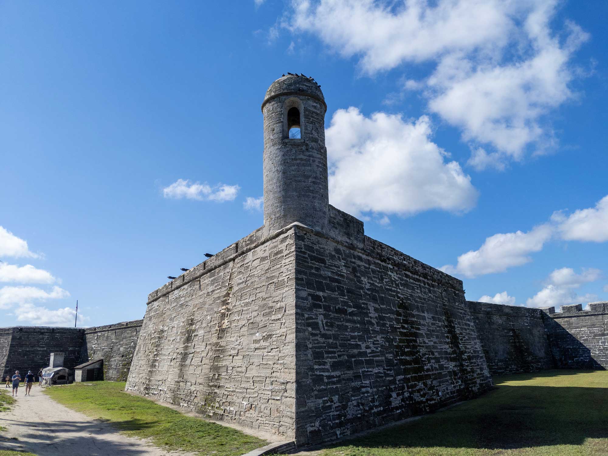
Castillo de San Marco National Monument in St. Augustine, Florida. The bricks are made of coquina. Photograph by Matthew Dillon (Flickr; Creative Commons Attribution 2.0 generic license).
Clay
Six of the top ten clay producers in the U.S. occur in the Southeast's Coastal Plain, with Georgia and South Carolina in the lead. Several types of clay are found in the region, each used for different purposes. Common clay is used in the manufacture of bricks, lightweight aggregate, cement, and other structural clay products—North Carolina is annually the U.S. leader in brick production because of its common clay resources. Ball clay is a plastic clay, so named because it was rolled into balls during the days of hand mining. Ball clay is used as a bonding agent in the manufacture of ceramics and is common in the upper Mississippi River Embayment.
Kaolinite is an earthy white clay, also known as "china clay," which is used in the manufacture of ceramics (including fine porcelain), as a paper coating, in refractories, and as an additive in rubber products, fertilizers, cosmetics, and detergents. Before the Revolutionary War, kaolinite from South Carolina was exported to England for the production of Wedgwood pottery and china. Deposits of kaolin clay occur along the western margin of the Coastal Plain along a 480-kilometer-long (300-mile-long) trend from Aiken, South Carolina, through Macon, Georgia, to Eufaula, Alabama.
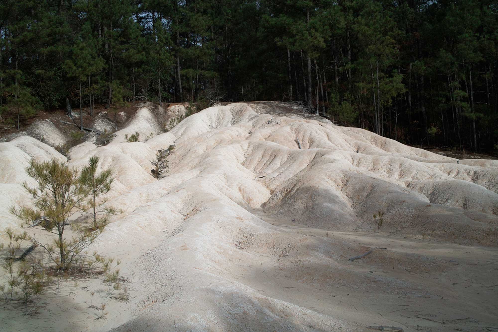
Kaolin tailings at an old open-pit mine in Aiken, South Carolina. Photograph by "carlbagge" (Flickr; Creative Commons Attribution 2.0 Generic license).
These clays are formed from the weathering of the Piedmont's crystalline rocks, and occur as lenses in late Cretaceous- to Neogene-aged sediments. Mining of these deposits accounts for around 90% of total United States kaolinite production and 40% of global production. Fuller's earth is another type of earthy clay with a higher moisture content than other clays. Because it naturally absorbs water, it is used in the manufacture of kitty litter, as an adsorbent in refining oils, and as an additive to various types of pastes and putties.
Bentonite
Bentonite is currently mined in Mississippi and Alabama; it is altered volcanic ash that originated from Cretaceous volcanoes in the central and western U.S. and was subsequently blown into the Southeastern U.S. by prevailing winds. Bentonite is used in drilling muds and can be used as a sealant in instances where it is important to provide a barrier for water flow through rock or sediment.
Phosphate
Phosphate is present in Coastal Plain sediment along the Atlantic coast from the Chesapeake Bay to Florida. These deposits developed in deep ocean waters during the Neogene, where current and wave action concentrated phosphate-rich sediment that eventually hardened to become phosphate rock. Phosphates are used primarily to make fertilizers, but are also used in the manufacture of phosphoric acid, detergents, food additives, pesticides, soft drinks, and other products.
The highest grade and most extensive phosphates deposits occur in the Miocene formations of North Carolina and Florida, which together account for about 95% of domestic production of phosphate and about half of global production. The Aurora phosphate operation at Lee Creek in Beaufort County, North Carolina is the largest integrated phosphate mining and chemical plant in the world. In fact, it is the world's largest potash producer and is capable of producing over six million tons of phosphate ore per year. Florida, however, contains the largest known deposits of phosphates in the US; the state provides two-thirds of the country's phosphate needs and nearly one quarter of the world’s phosphates. Fertilizer is one of Florida's leading exports, with an annual value of over $2 billion.
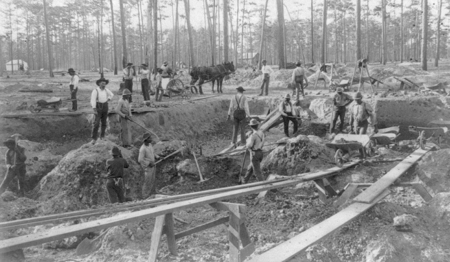
Workers in a phosphate mine, Dunnellon, Florida, ca. 1890. Photo by C. H. Colby (Library of Congress, no known restrictions on publication).
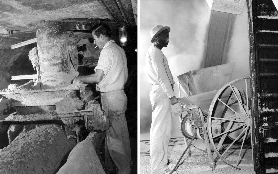
Phosphate mining and milling. Left: Phosphate miner, Noralyn Mine, Bartow, Florida, 1957. Photo by Charles Lee Baron (Image number C026238, Florida Memory, public domain). Right: Powder phosphate being loaded, International Minerals and Chemical Corporation, Mulberry, Florida, 1947. Photo uncredited (Image number C005913, Florida Memory, public domain).
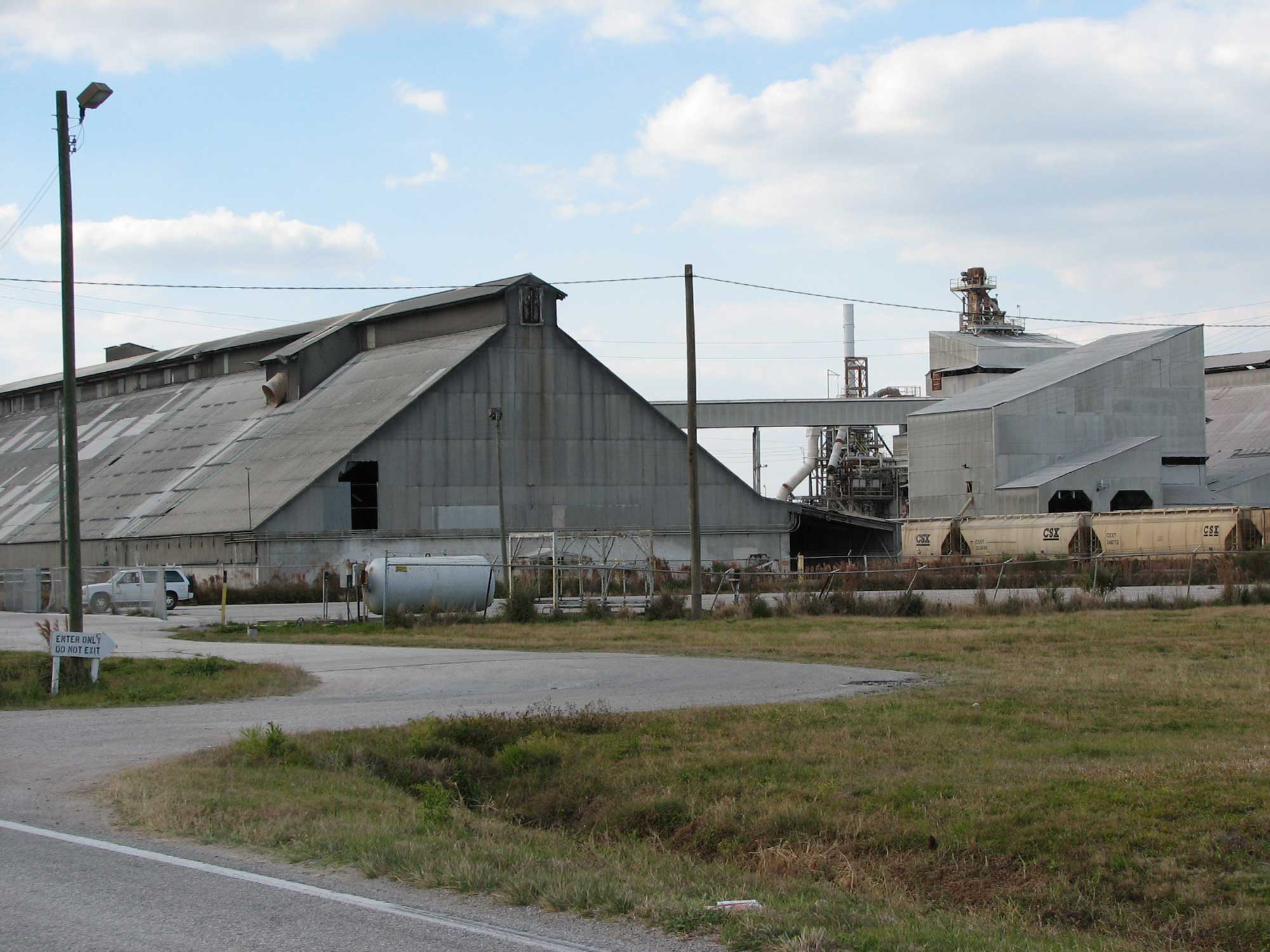
Phosphate fertilizer processing plant in Nichols, Florida. Photograph by Harvey Henkelmann (Wikimedia Commons).
Peat
Some of the largest swamps in the U.S. are found in the Coastal Plain, including the Everglades of Florida, the Okefenokee Swamp of Georgia, and the Great Dismal Swamp of Virginia and North Carolina. Swamps, bogs, and marshes support abundant vegetation. Thick piles of plant material accumulate as plants in these habitats die and are buried by successive layers of dead plants, creating a low-oxygen environment in which the plant material is not being decomposed. As the layers of plant material are buried deeper, they are compressed into peat. With further compression and much longer spans of time, the organic material becomes coal.
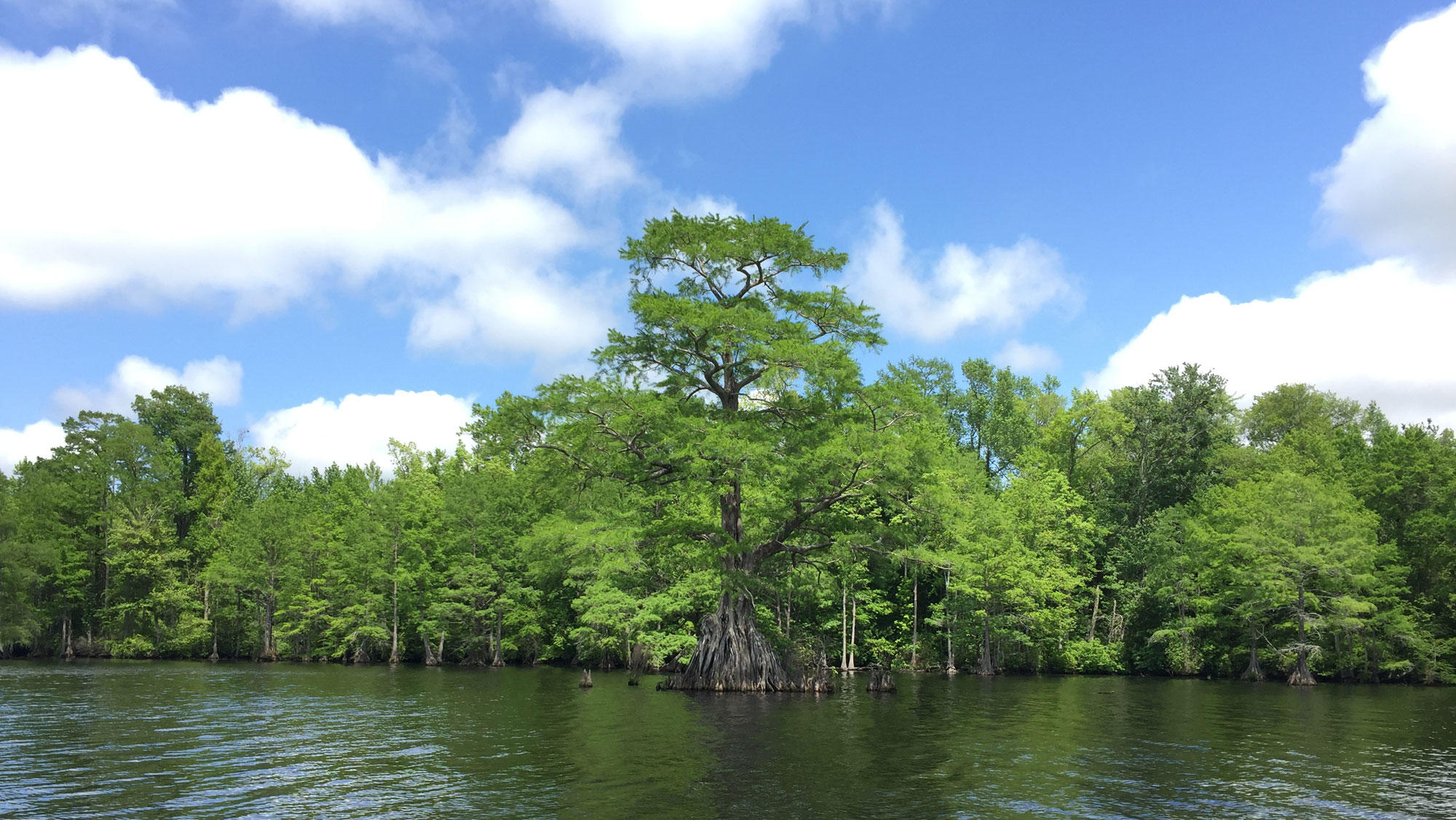
Great Dismal Swamp, Virginia. Photo by Debra A. Willard, USGS (public domain).
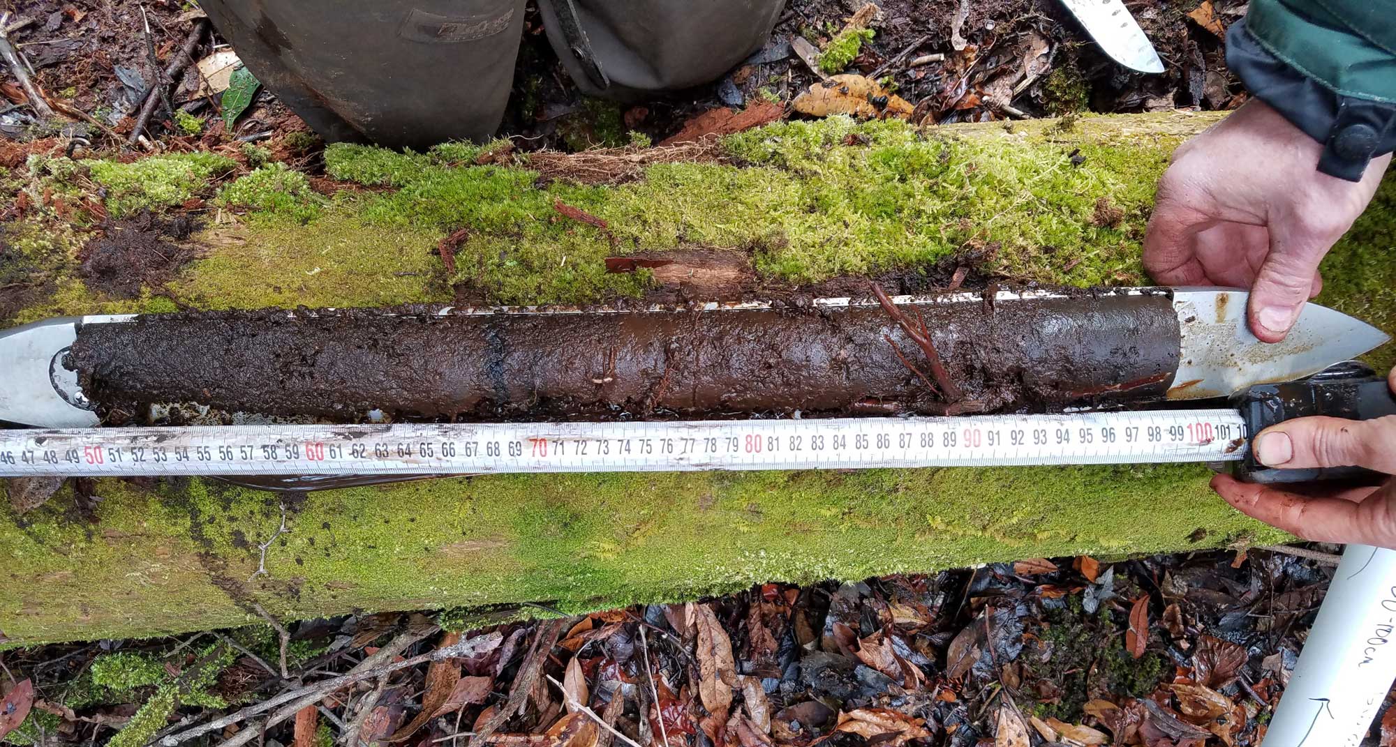
A peat core taken from the Great Dismal Swamp in Virginia, 2017. Photo by Kristen Hoefke, USGS (public domain).
Peats produced in these swampy environments are a valuable resource, and Florida is the top peat producer in the country. Peats are used in potting soil, as a soil conditioner, as insulation for packing fruits and vegetables, and as a protein additive in cattle food.
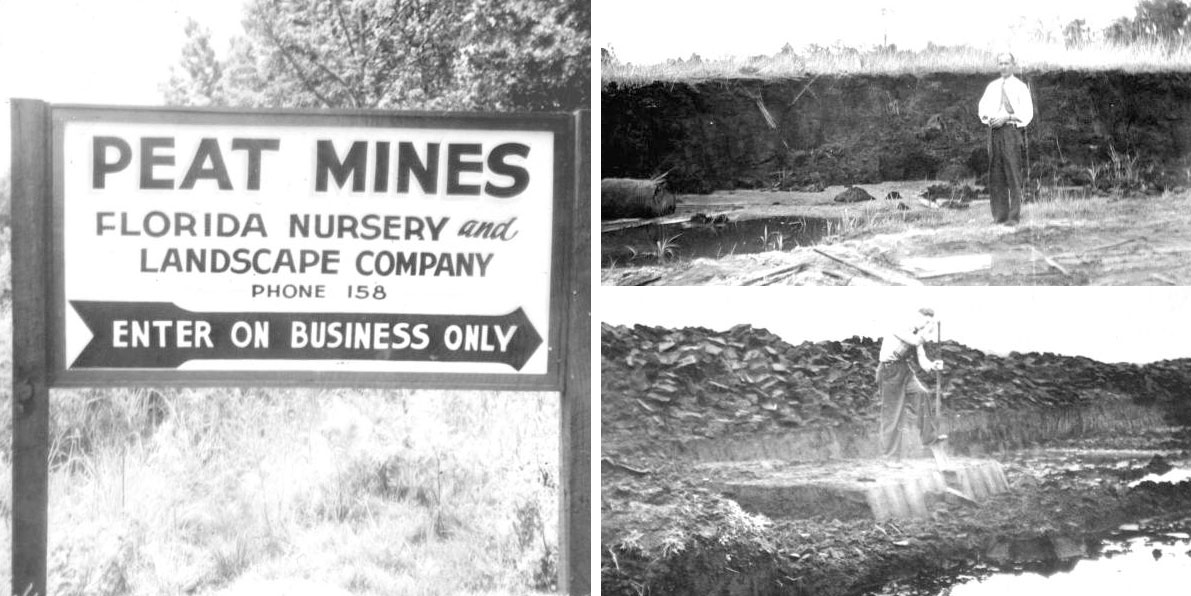
Historical photographs of peat mining in the 1940s, Florida. Left: Sign for the peat mines of the Florida Nursery and Landscape Company, Lake County, Florida. Photo by John Henry Davis, 1945 (Image GE1708, via Florida Memory, public domain). Top right: Pond-prairie peat deposit, Florida Nursery and Landscape Company, Lake County, Florida. Photo by John Henry Davis, 1944 (Image GE1704, via Florida Memory, public domain). Bottom right: Man digging peat using a spade, Florahome, Putnam County, Florida. Photo by John Henry Davis, 1944 (Image GE1700, via Florida Memory, public domain).
Video of peat mining in Florida, 2012. ("Mining Florida Peat," video by HarrellsLLC, via YouTube).
Salt
Thick salt sequences, related to the early rifting of Pangaea and the formation of the Gulf of Mexico during the Triassic and Jurassic periods, underlie much of the Gulf Coast. However, salt is currently only mined in Alabama. Sulfur is produced from sources associated with salt domes along the Gulf Coastal Plain, and as a byproduct from the processing of oil and gas.
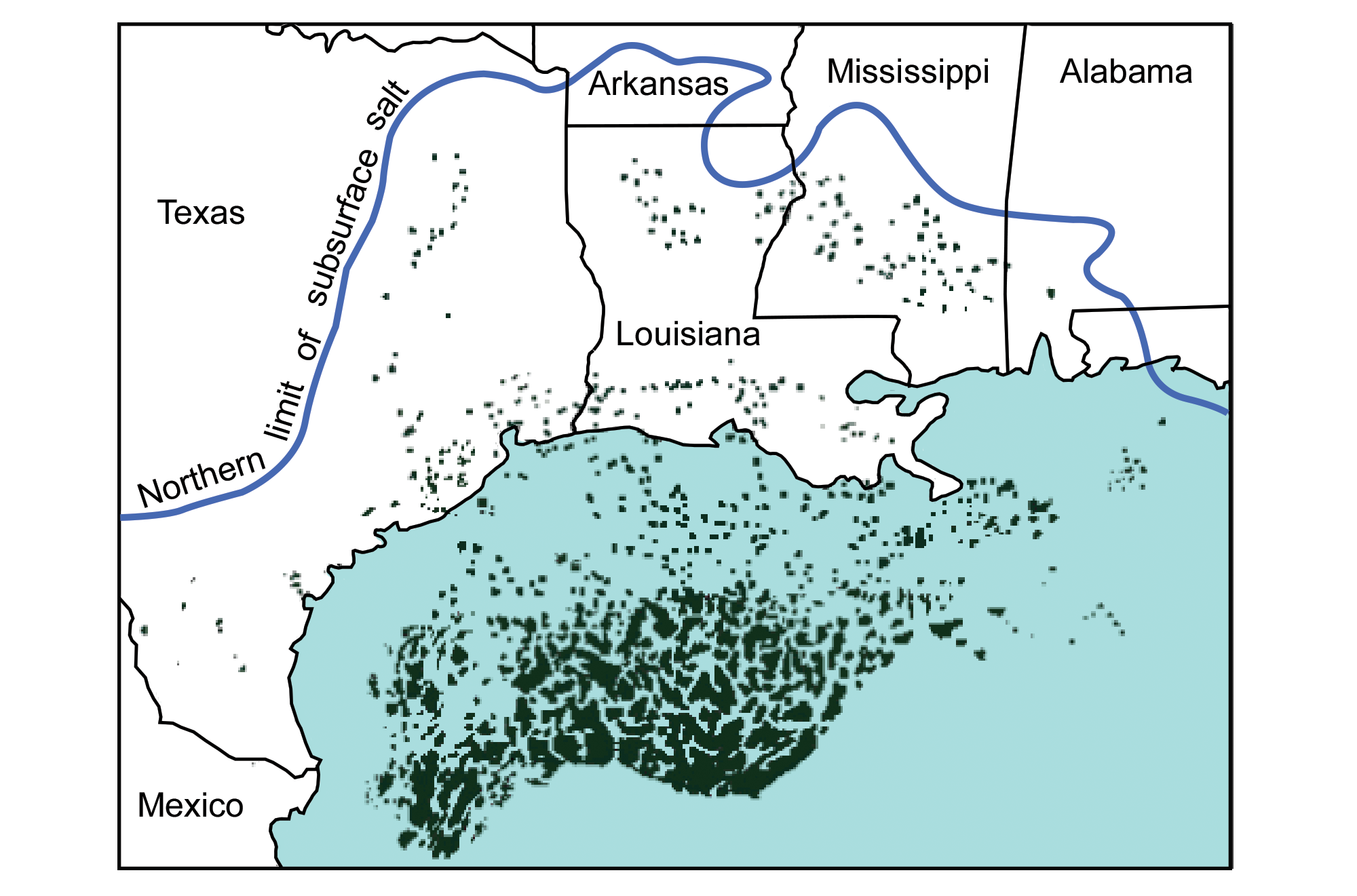
The Jurassic-age Louann Salt Formation extends under the surface of the Coastal Plain to the blue line. The black "blobs" are known salt structures where the salt layer has been deformed. Salt domes are important in trapping oil and gas in reservoirs underground. Image modified from original by Peter Nester for the Earth@Home project.
Resources
Resources from the Paleontological Research Institution
Digital Atlas of Ancient Life: Minerals (collection of 3D models on Sketchfab): https://skfb.ly/6WxTo
Digital Encyclopedia of Earth Science: Minerals: https://earthathome.org/de/minerals/
Earth@Home: Earth Science of the South-central U.S.: Mineral Resources of the Coastal Plain (continues coverage of the Gulf Coastal Plain in Arkansas, Louisiana, Missouri, Oklahoma, and Texas): https://earthathome.org/hoe/sc/minerals-cp/