

Page snapshot: Introduction to energy in the Rocky Mountains region of the southwestern United States, including fossil fuels and renewable energy.
Topics covered on this page: Overview; Oil and gas; Hydroelectricity; Wind energy; Resources.
Credits: Most of the text of this page is derived from "Energy in the Southwestern US" by Carlyn S. Buckler and Robert M. Ross, chapter 6 in The Teacher-Friendly Guide to the Earth Science of the Southwestern US, edited by Andrielle N. Swaby, Mark D. Lucas, and Robert M. Ross (published in 2016 by the Paleontological Research Institution; currently out of print). The book was adapted for the web by Elizabeth J. Hermsen and Jonathan R. Hendricks in 2022. Changes include formatting and revisions to the text and images. Credits for individual images are given in figure captions.
Updates: Page last updated September 8, 2022.
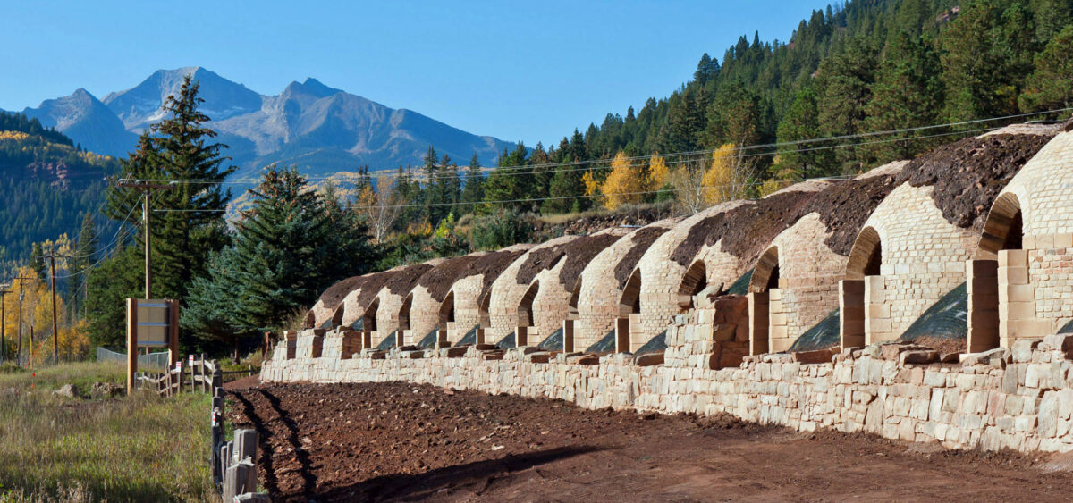
Image above: Restored coke ovens in the Redstone Coke Oven Historic District, Pitkin County, Colorado, 2011. Coke ovens are used to cook coal, transforming it into coke, which has a higher carbon content. Photo by Jesse Varner (Wikimedia Commons, Creative Commons Attribution-ShareAlike 2.0 Generic license, image cropped).
Overview
The high topography of the Rocky Mountains provides context both for hydroelectric power and wind energy. The same rugged peaks and valleys that contribute to localized high winds also make large-scale wind energy development difficult. The Rocky Mountains region is also known for coal, oil, and gas, in this case from large marine and freshwater sedimentary deposits in the Greater Green River Basin.
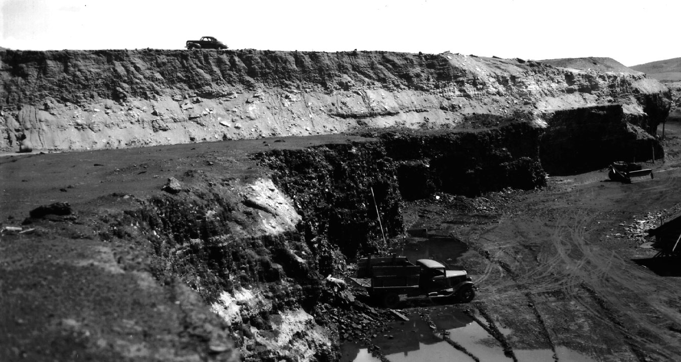
Open-pit coal mine, Coalmont district, Jackson County, Colorado, 1940. Photo by C.E. Erdmann (USGS).
Oil and gas
Petroleum resources are extracted in the Sand Wash Basin, a southern lobe of the Greater Green River Basin (the bulk of which is located in Wyoming). The Greater Green River Basin is itself made up of several smaller basins and arches between them, formed during the Laramide Orogeny from the end of the Cretaceous period into the Eocene. The basin is known for its Eocene-aged surface rocks that contain both mineral and fossil fuel resources, along with its unusually well-preserved terrestrial fossils in the Green River Formation.
Fossil fuels, thought to be derived from blue-green algae living in ancient lakes, are found in particularly thick sequences of Eocene oil shale. The Green River Formation hosts the world's largest known oil shale deposits. The North Park Basin contains Paleozoic and Mesozoic strata, especially deposits laid down by the Western Interior Seaway. Oil and natural gas have long been extracted conventionally at the North and South McCallum oil fields, from the basin's Cretaceous-aged deltaic sandstones. In recent years, unconventional drilling of the late Cretaceous Niobrara Shale has drawn attention to the organic-rich calcareous shale and marl in the North Park and Sand Wash basins.
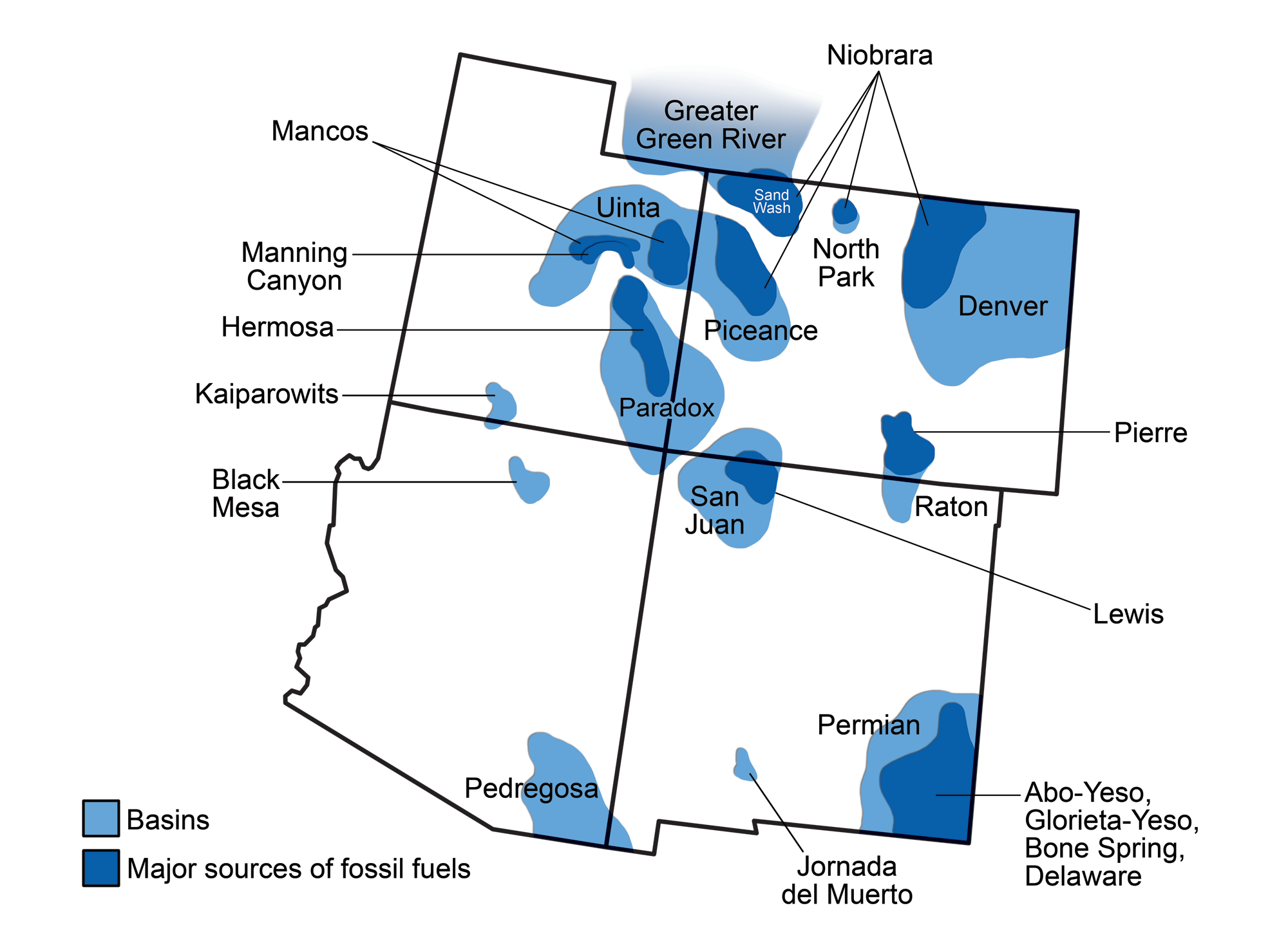
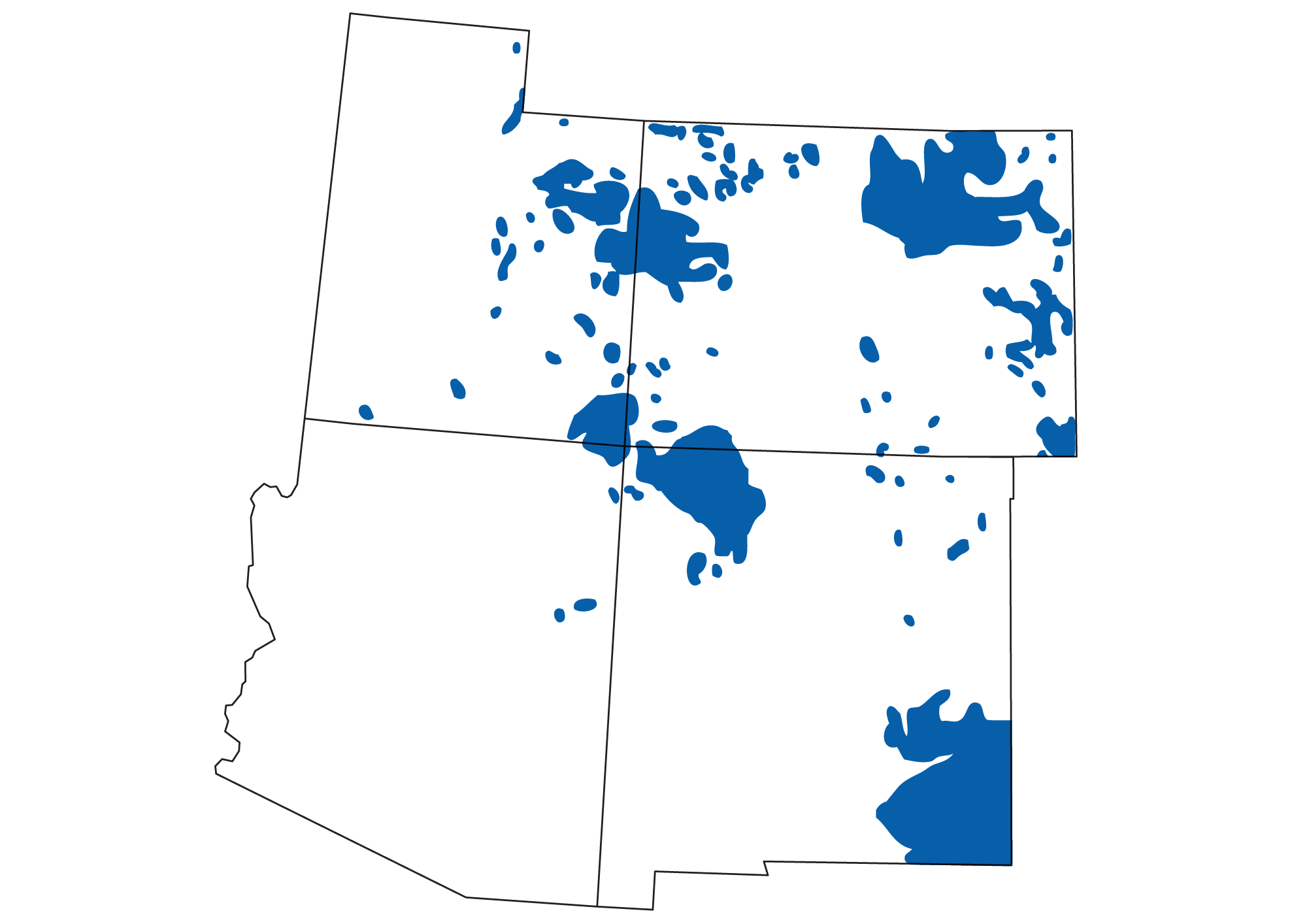
Areas of oil and gas production in the southwestern United States. The Great Plains and the Colorado Plateau are both major fuel-producing regions. Map by Andrielle swamby, originally published in The Teacher-Friendly Guide to the Earth Science of the Southwestern US.
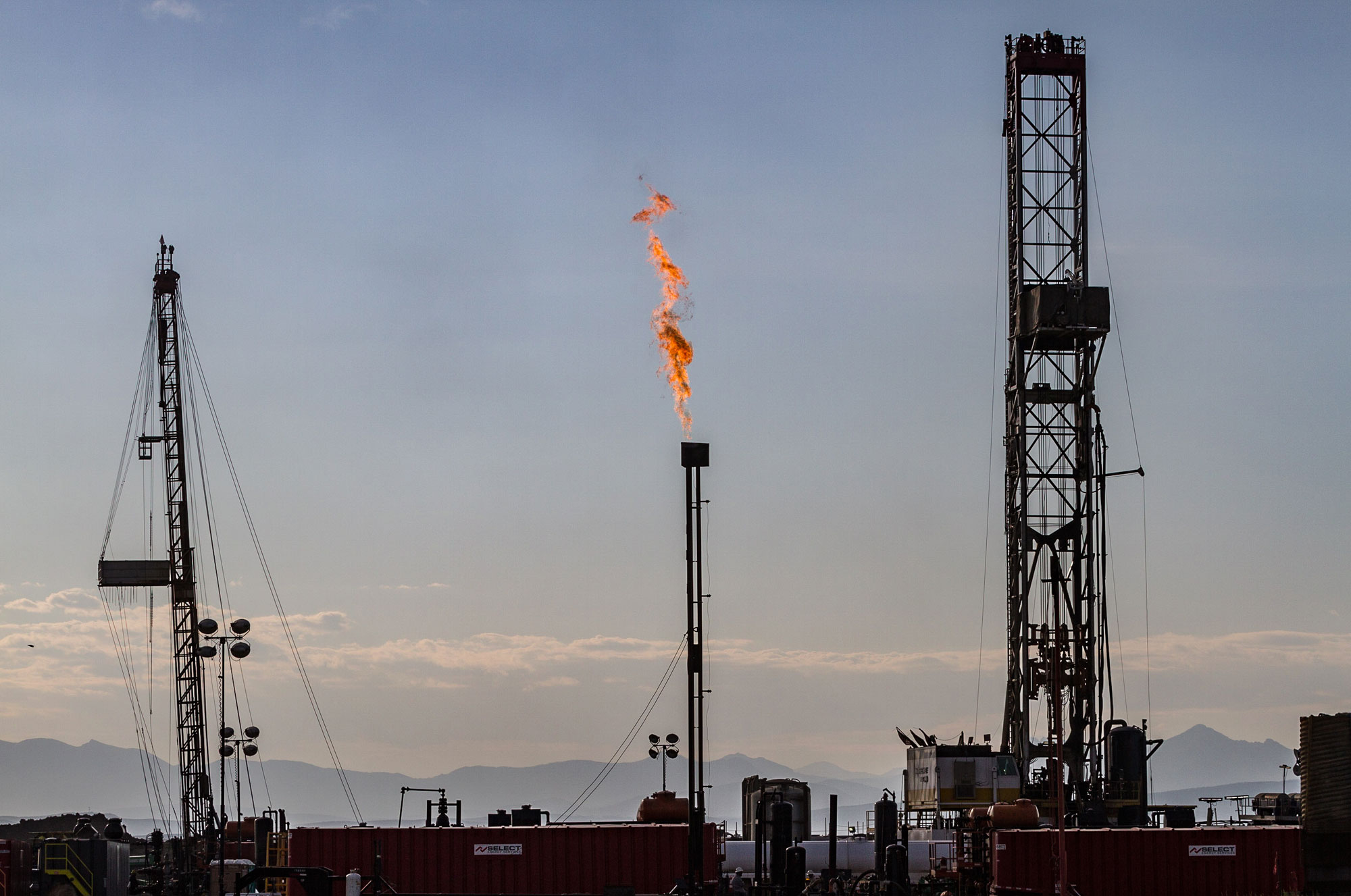
Drill rig and associated equipment near Coalmont, Colorado. The fire is a methane flare, or waste methane being burned, which may be done for safety, logistical, or economic reasons. Photo by Tony Webster (flickr, Creative Commons Attribution-ShareAlike 2.0 Generic license, image resized).
Hydroelectricity
Since the Rocky Mountains provide an abundance of water to lower areas in the east and west, hydroelectric power is substantial in this area. The Colorado River and its tributaries, including the Gunnison River and the Uncompahgre River, provide the potential for much of the Rocky Mountains' hydropower. Over 20 plants produce more than 300 MW of energy for the region. Two large pumped storage stations, Cabin Creek (324 MW) and Mount Elbert (230 MW), are also located in the Colorado Rockies.
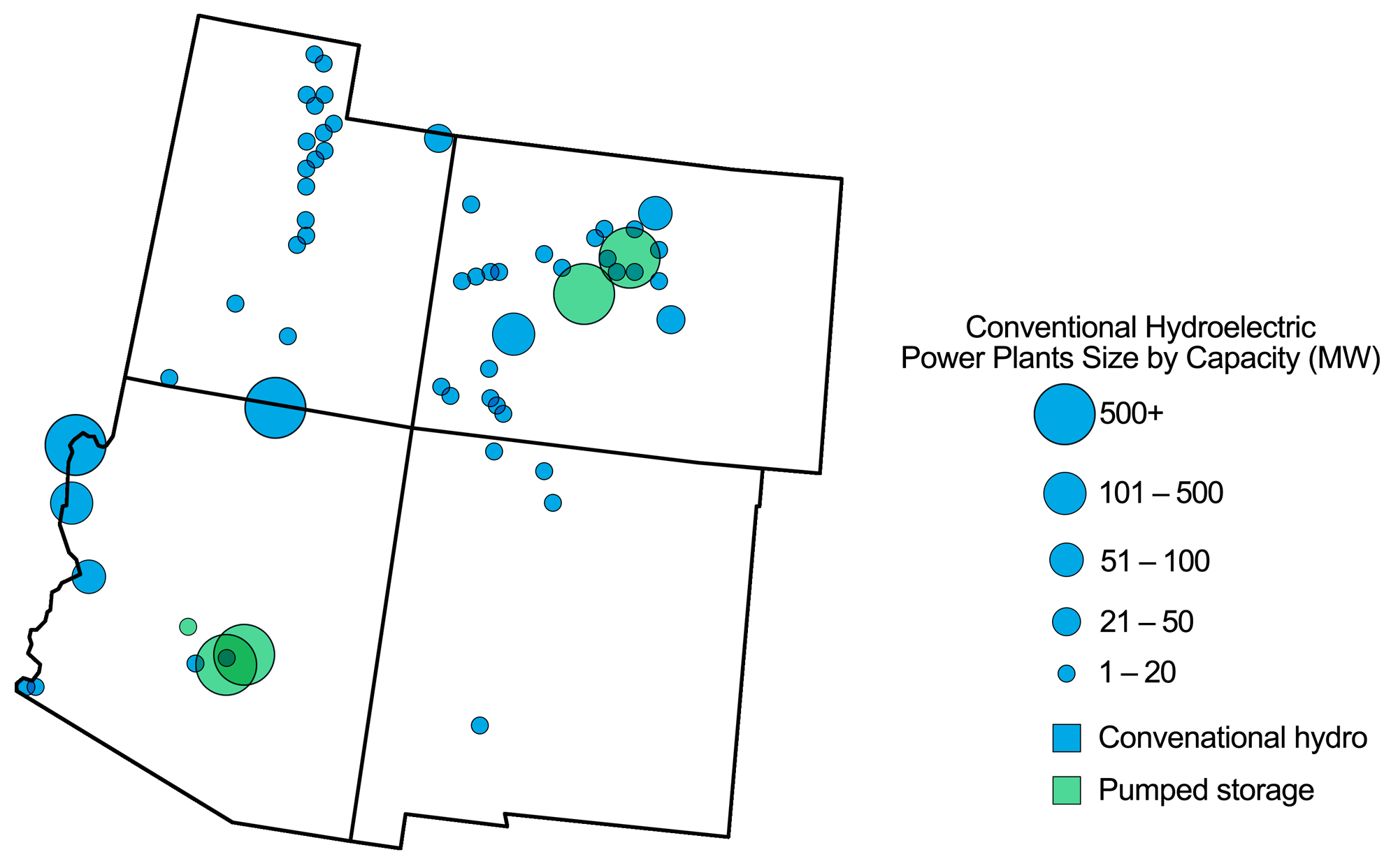
Hydroelectric power plants in the southwestern U.S. Map modified from a map by Andrielle Swaby (adapted from images by the U.S. Energy Information Administration), originally published in The Teacher-Friendly Guide to the Earth Science of the Southwestern US.
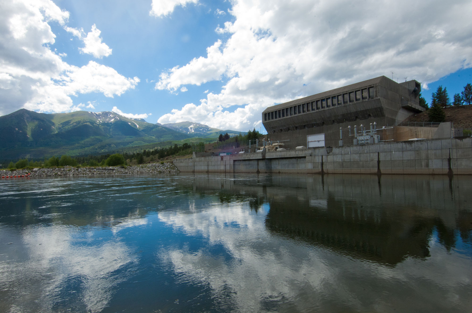
Mt. Elbert pumped storage facility near Leadville, Colorado. Photo by Andy Pernick, Bureau of Reclamation (public domain).
Wind energy
The Rocky Mountains region has some of the highest potential for wind energy in the US, although the area's terrain and lack of infrastructure has made tapping into this resource challenging. There are currently no large-scale wind power projects in the Rocky Mountains region of the Southwest.
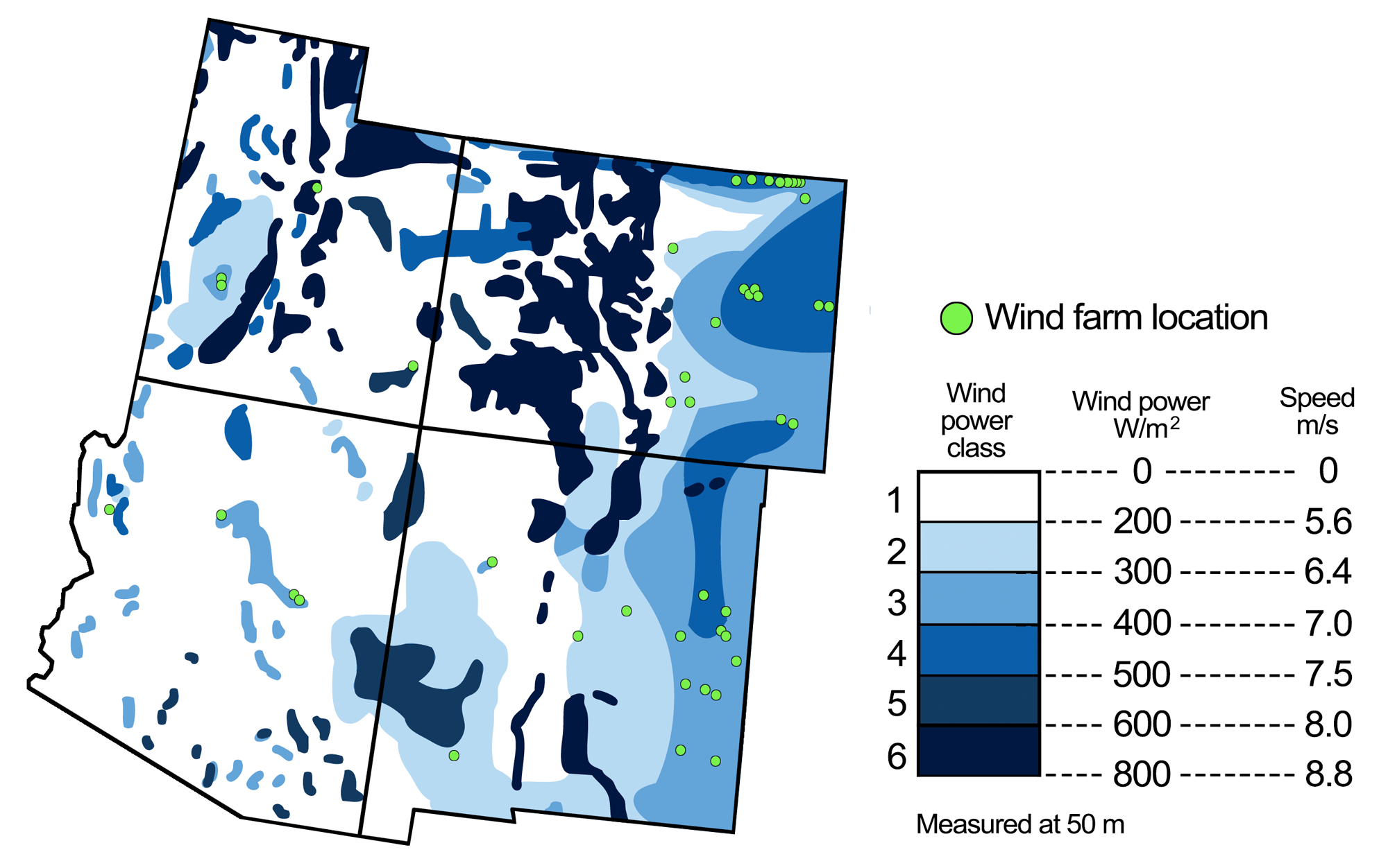
Wind energy potential in the southwest United States, with the locations of wind farms. Figure modified from a figure by Andrielle Swaby (adapted from an image by the National Renewable Energy Laboratory), originally published in The Teacher-Friendly Guide to the Earth Science of the Southwestern US.
Resources
Resources from the Paleontological Research Institution
Earth@Home: Earth Science of the Northwest-central U.S.: Energy in the Rocky Mountains (covers energy in the Rocky Mountain region of Idaho, Montana, and Wyoming): https://earthathome.org/hoe/nwc/energy-rm/
Earth@Home: Earth Science of the Western U.S.: Energy in the Columbia Plateau and Rocky Mountains (covers energy in the Rocky Mountain region of Washington): https://earthathome.org/hoe/w/energy-cp-rm/
Earth@Home: Introduction to Energy: https://earthathome.org/hoe/energy