Page snapshot: Hawaii State Geologic Map; Fossil; Rock; Mineral; Gem; Highest and Lowest Elevations; Places to Visit; and Additional Resources.
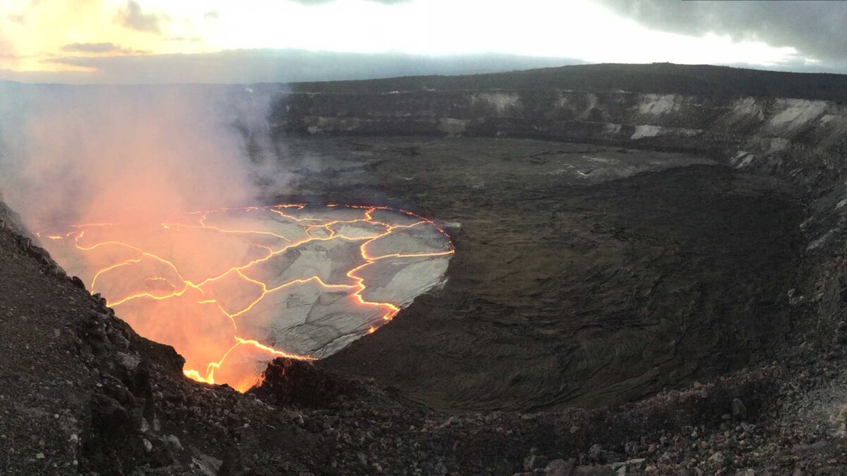
Image above: Eruption of lava lake at the summit of Kīlauea on September 7, 2016. Image by the USGS (public domain). Original caption: "On Wednesday evening (September 7), the lava lake at Kīlauea's summit reached a high level, about 8 m (26 feet) below the floor of Halema‘uma‘u Crater. This panorama shows the former Halema‘uma‘u Overlook (closed since 2008 due to volcanic hazards) at the far left. Jaggar Museum, visible on the skyline in the upper right part of the photo, is a popular destination in Hawai‘i Volcanoes National Park for viewing the lava lake activity and spattering lake surface."
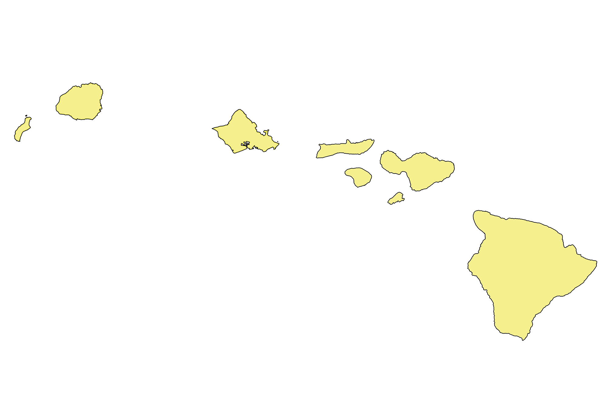
Geologic Map of Hawai‘i
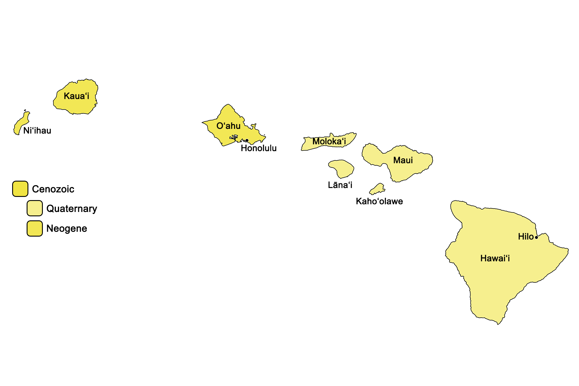
Geologic map of Hawai‘i showing maximum ages of mappable units. Image by Jonathan R. Hendricks for the Earth@Home project developed using QGIS and USGS data (public domain) from Fenneman and Johnson (1946) and Horton et al. (2017).
Hawai‘i State Fossil: None
Hawai‘i does not have an official state fossil. What do you think it should be? Answer in the comments.
Hawai‘i State Rock: None
Hawai‘i does not have an official state rock. What do you think it should be? Answer in the comments below.
Hawai‘i State Mineral: None
Hawai‘i does not have an official state mineral. What do you think it should be? Answer in the comments below.
Hawai‘i State Gem: Black Coral
Hawai‘i's official state "gem" is actually a type of living coral. Learn more here.
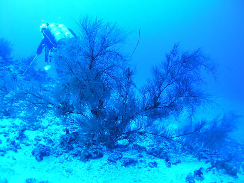
Colony of living black coral in Hawaii. Original caption: "Black coral at 210 ft in the Au'au Channel, off Maui, Hawaii. Image courtesy of Anthony Montgomery, Hawaii Department of Land and Natural Resources, Division of Aquatic Resources." Image from the NOAA Ocean Explorer Gallery.
Hawai‘i's Highest and Lowest Elevations
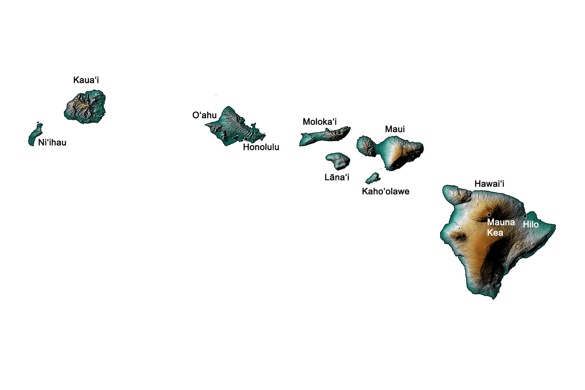
Topographic map of Hawaii. Data from: Farr, T. G. et al., 2007, The Shuttle Radar Topography Mission, Rev. Geophys., 45, RG2004, doi:10.1029/2005RG000183. (Also available online at http://www2.jpl.nasa.gov/srtm/SRTM_paper.pdf). Image by Jonathan R. Hendricks for the Earth@Home project.
Highest Elevation: Mauna Kea
Mauna Kea, a dormant shield volcano on the island of Hawai‘i, is the state’s highest point at 4207 meters (13,803 feet) above sea level. A product of hot spot volcanism, much of this volcano’s bulk is below sea level—when measured from the ocean floor, its total height is actually 10,100 meters (33,100 feet).
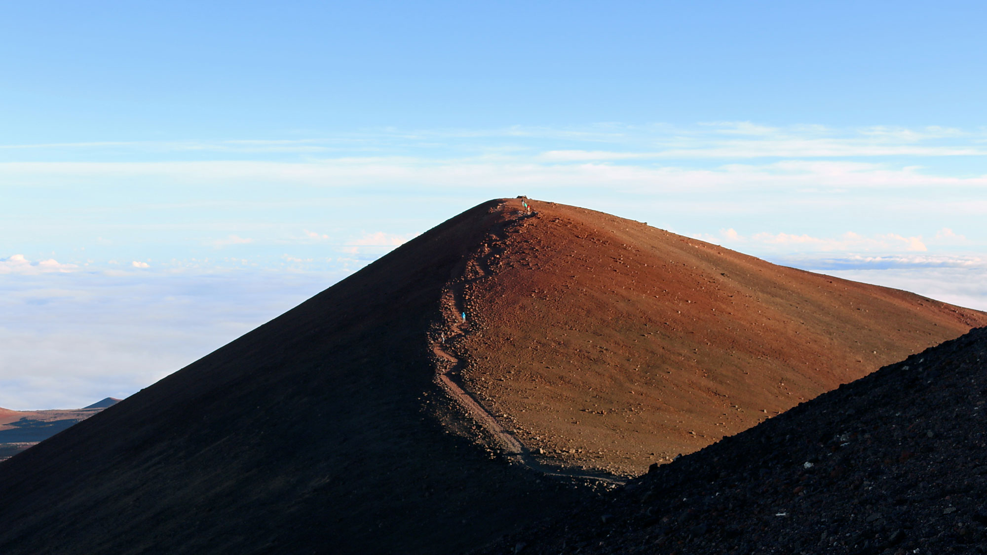
The summit trail on Mauna Kea, Hawai'i Island. Photo by Robert Linsdell (Wikimedia Commons, Creative Commons Attribution 2.0 Generic license, image resized).
Lowest Elevation: Coastline
The lowest points in Hawai‘i are found at sea level along its coastlines, where the shoreline meets the Pacific Ocean.
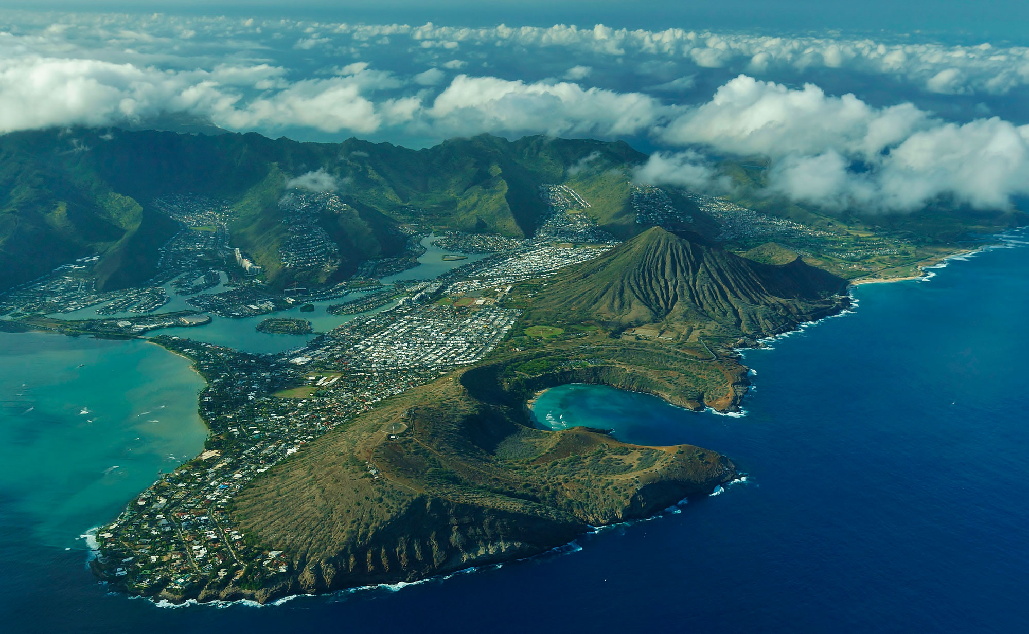
Volcanic craters formed by rejuvenated volcanism on O'ahu, including Hanauma Bay (foreground) and Koko Crater (immediately behind Hanauma Bay). Photo "Hanuama Bay and Koko Crater Hawaii Kai" by Eric Tessmer (flickr, Creative Commons Attribution 2.0 Generic license, image cropped and resized).
Places to Visit
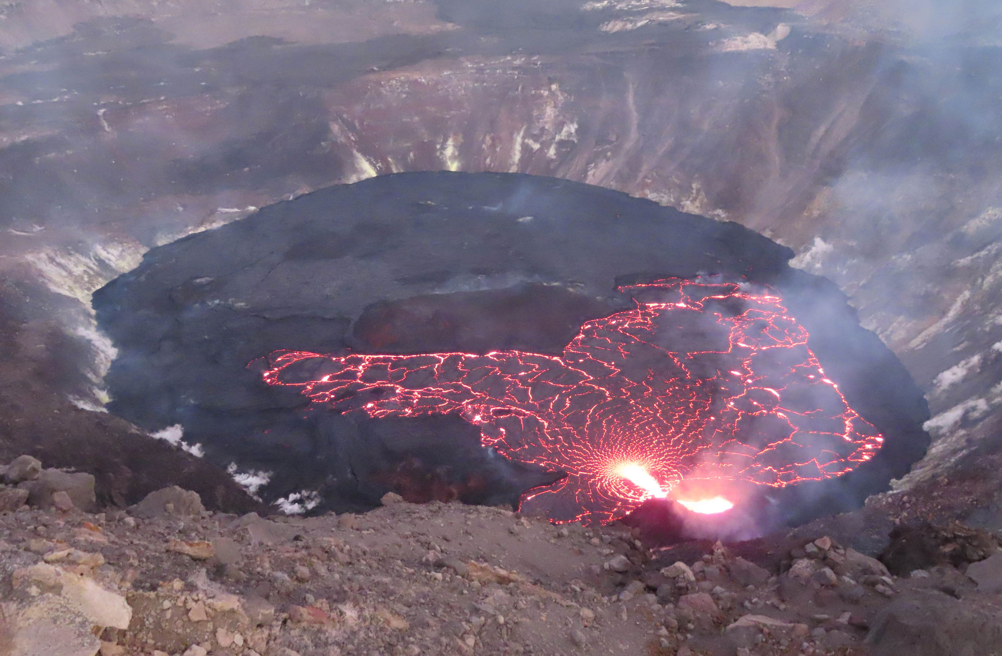
Lava lake, Halema'uma'u crater, Kīlauea volcano summit caldera, Hawai'i Island, November 2, 2021. Source: Julie M. Chang, USGS (public domain).
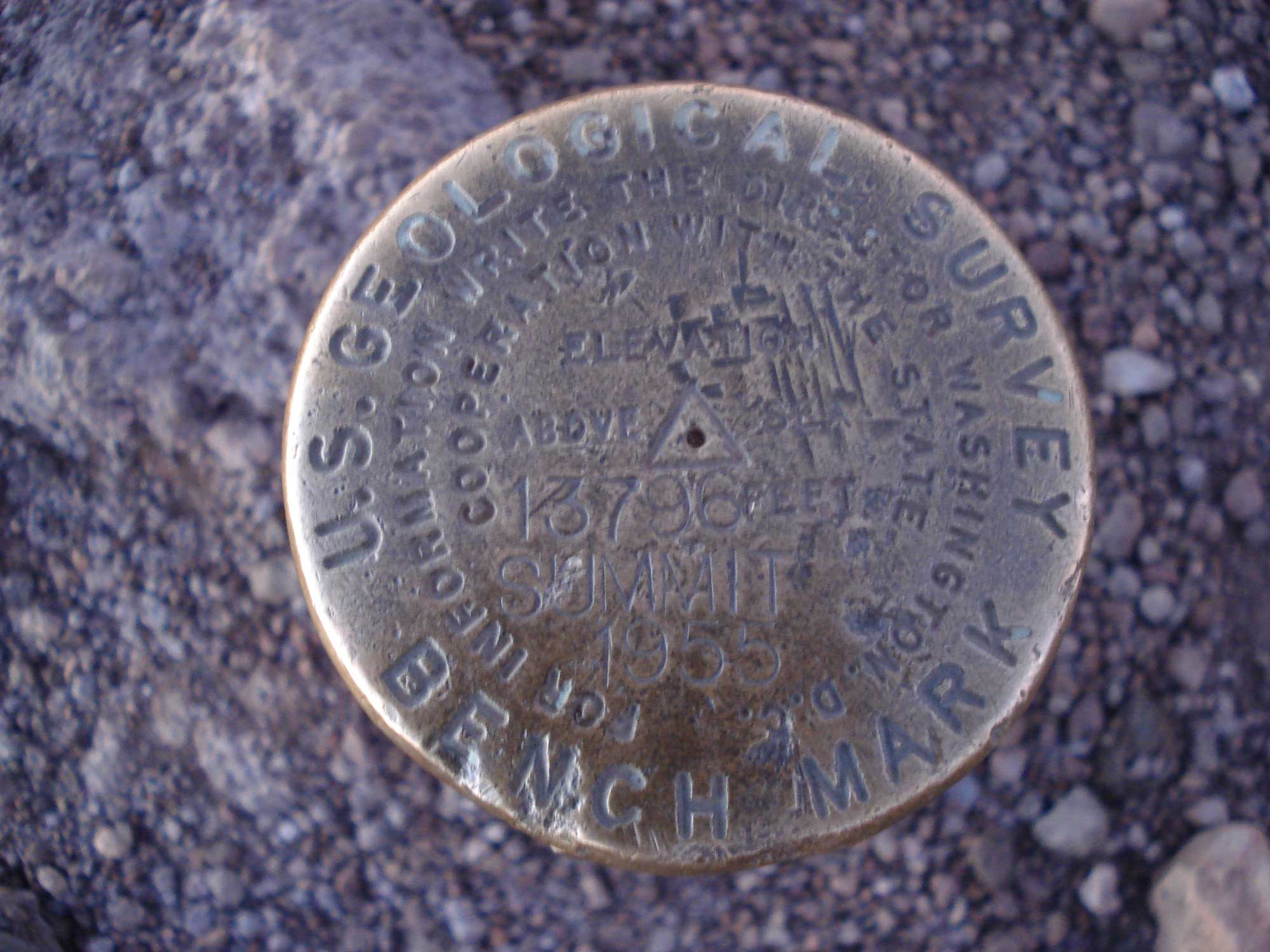
United States Geological Survey (USGS) marker that indicates the summit point of Mauna Kea.