

Spotlight: Overview of the rocks of the Columbia Plateau region of the western United States, including Washington, Oregon, and Nevada.
Topics covered on this page: Overview; Resources.
Credits: Most of the text of this page is derived from "Rocks of the Western US" by Wendy E. Van Norden, Alexandra Moore, and Gary Lewis, chapter 2 in The Teacher-Friendly Guide to the Earth Science of the Western US (published in 2014 by The Paleontological Research Institution and edited by Mark D. Lucas, Robert M. Ross, and Andrielle Swaby). The book was adapted for Earth@Home web by Elizabeth J. Hermsen and Jonathan R. Hendricks in 2022. Changes include formatting and revisions to the text and images. Credits for individual images are given in figure captions.
Updates: Page last updated April 21, 2022.
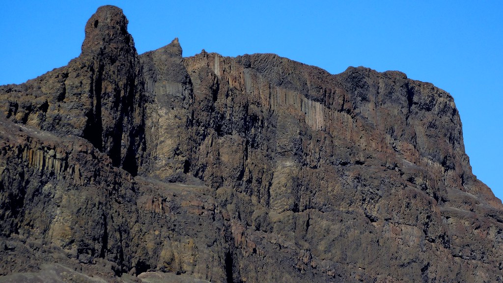
Image above: Basalts of the Moses Coulee, Washington. Photograph by the Washington State Department of Agriculture (Flickr; Creative Commons Attribution-NonCommercial 2.0 Generic license; image cropped and resized).
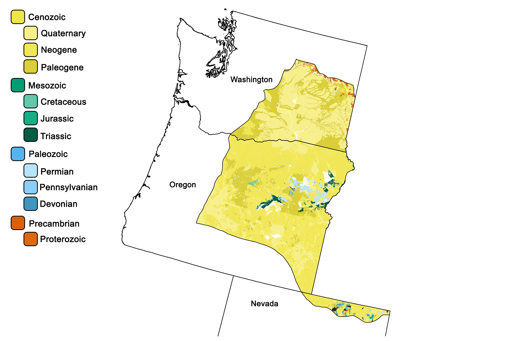
Geologic map of the Columbia Plateau region of the western United States showing maximum ages of mappable units. Image by Jonathan R. Hendricks for the Earth@Home project developed using QGIS and USGS data (public domain) from Fenneman and Johnson (1946)and Horton et al. (2017).
Overview
The Columbia Plateau, also known as the Columbia Basin, is the site of one of the largest outpourings of lava that the world has ever seen. Between 15 and 6 million years ago, basaltic lava flooded approximately 163,000 square kilometers (63,000 square miles), covering large parts of Washington, Oregon, and Idaho.
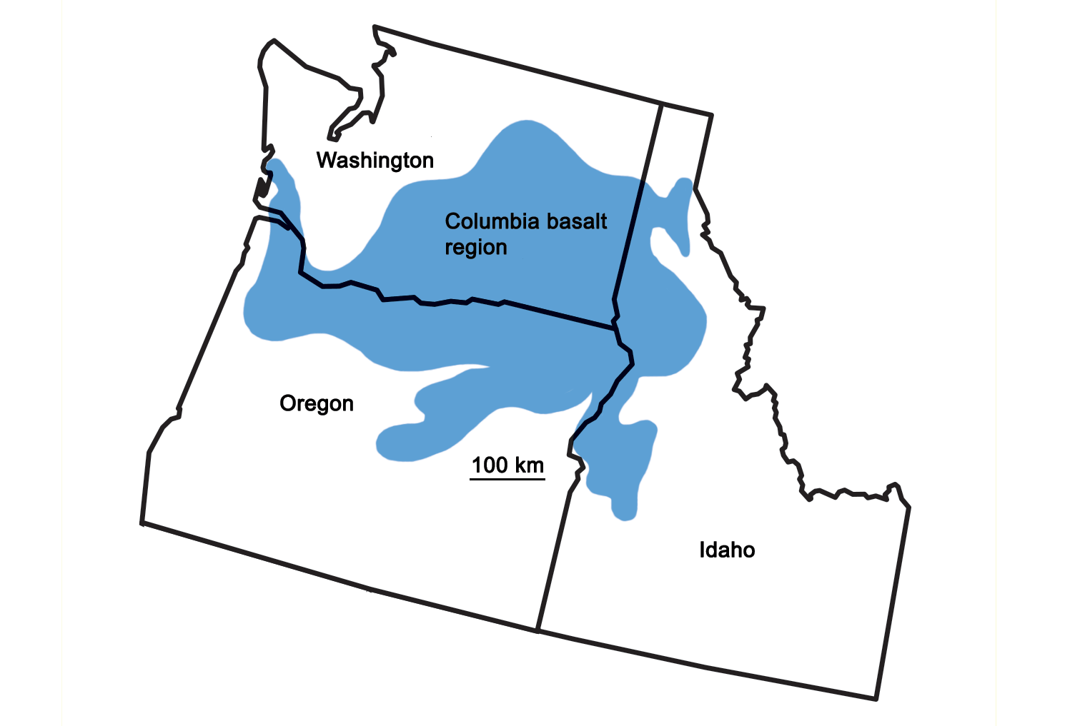
Extent of the Columbia Basin Flood Basalt. Map by Wade Greenberg-Brand for the Earth@Home project.
The thickness of the lava flows reached 1800 meters (6000 feet), burying almost all of the older rock in the area.
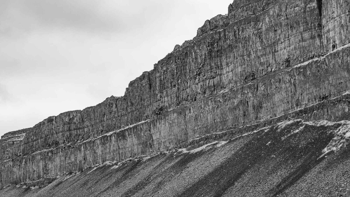
The Columbia River has eroded deep into the lava flows of the Columbia Plateau, revealing layers of columnar jointed basalt. Layers of these jointed lava flows have been exposed at the Moses Coulee in Douglas County, Washington.
Moses Coulee exposure of lava fl ows in Douglas County, Washington. Photograph by "Pictoscribe" (Flickr; Creative Commons Attribution-NonCommercial-NoDerivs 2.0 Generic license).
Basaltic magmas are produced by partial melting of the upper mantle. Materials melt when we increase their temperature, but a second way to melt a solid is to decrease the pressure. In the interior of the Earth this second mechanism—decompression—is far more important. When pressure on the mantle is released as it is forced up through the crust due to subduction, it becomes basaltic magma.
Resources
Resources from the Paleontological Research Institution
Digital Encyclopedia of Earth Science: Minerals.
Earth@Home: Introduction to Rocks.
Earth@Home: Geologic time scale.
Earth@Home: Geologic maps.
Earth@Home Virtual Collection: Rocks (Virtual rock collection featuring 3D models of rock specimens sorted by type.)